Hamble-le-Rice

Civil Parish in Hampshire Eastleigh

England

Hamble-le-Rice

Fawley : Fawley Oil Refinery From The Solent looking across to the oil refinery.
Fawley : Fawley Oil Refinery Credit: Lewis Clarke

Hamble-le-Rice is a civil parish located on the eastern bank of the River Hamble in Hampshire, England. Situated approximately ten miles southeast of Southampton, it covers an area of approximately 5.7 square miles. The parish is bordered by the River Hamble to the west, Netley to the east, and Botley to the north.

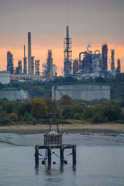
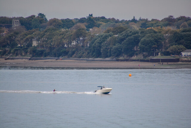
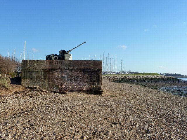
Hamble-le-Rice has a rich maritime history and is well-known for its sailing and boating activities. The village has a picturesque waterfront that features a marina and a variety of yacht clubs, attracting sailing enthusiasts from all over the country. It is also home to one of the oldest surviving airfields in the UK, Hamble Airfield, which played a significant role during World War II.

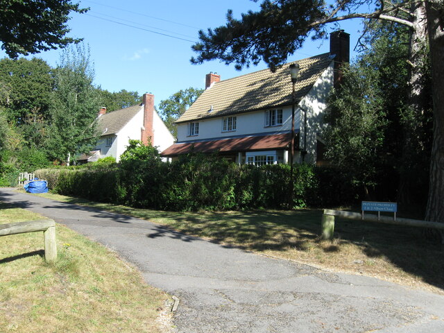
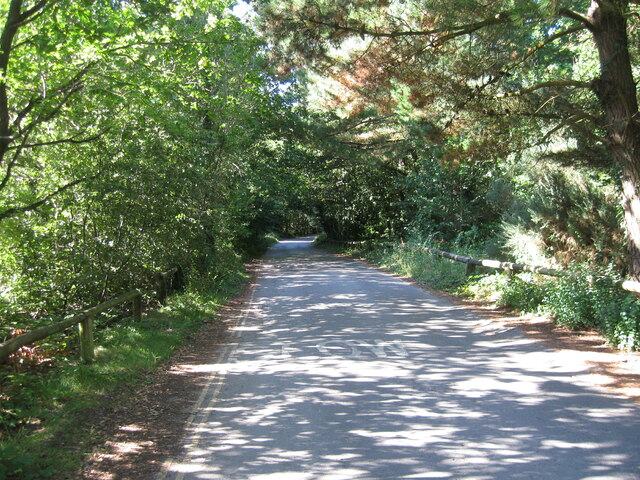
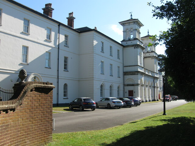
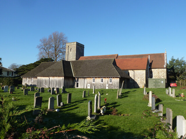
The village itself has a charming and traditional feel, with narrow streets lined with cottages and historic buildings. It offers a range of amenities, including shops, pubs, restaurants, and a community center. The nearby Hamble Common provides recreational space for locals and visitors, offering opportunities for walking, cycling, and birdwatching.

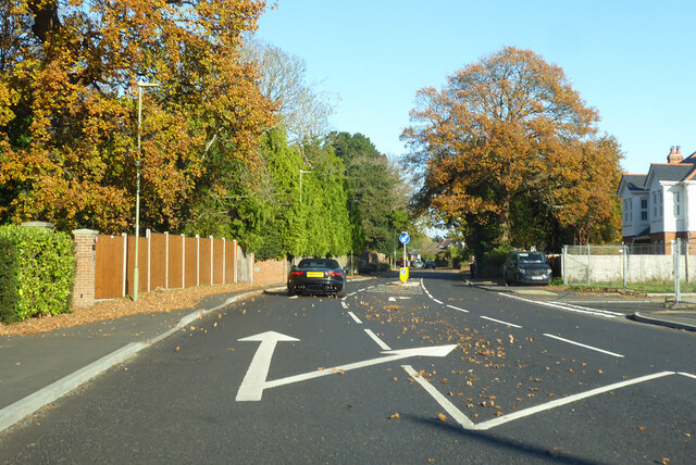
Hamble-le-Rice is well-connected by road and has good transport links to Southampton and other nearby towns. The M27 motorway is easily accessible, providing convenient access to the rest of Hampshire and beyond. The village is also served by regular bus services, and Hamble railway station offers direct train connections to Southampton and Portsmouth.

Overall, Hamble-le-Rice is a delightful civil parish that combines its maritime heritage with a tranquil and scenic environment, making it a popular destination for both residents and visitors alike.

If you have any feedback on the listing, please let us know in the comments section below.

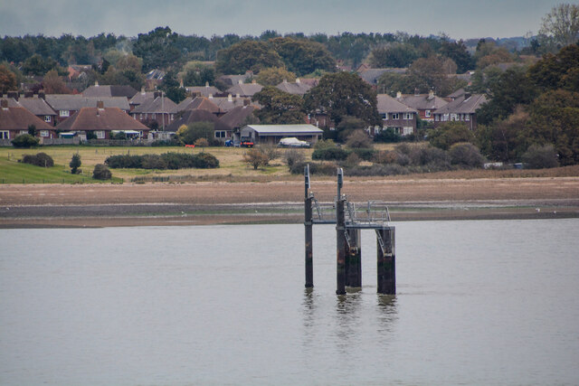
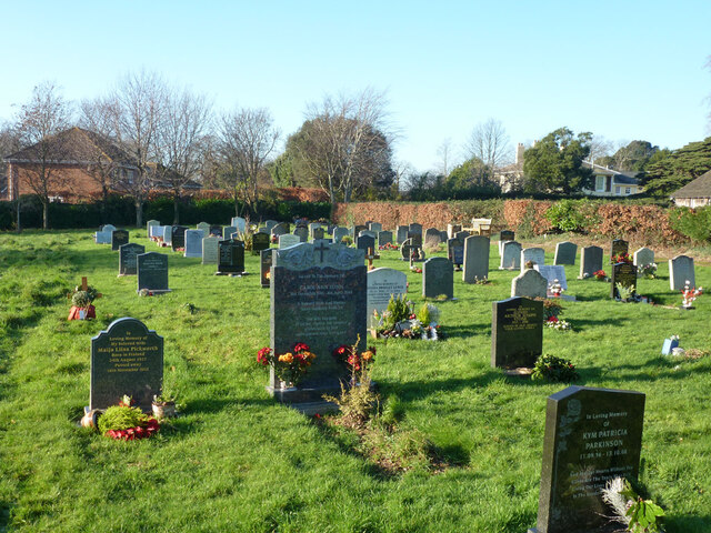
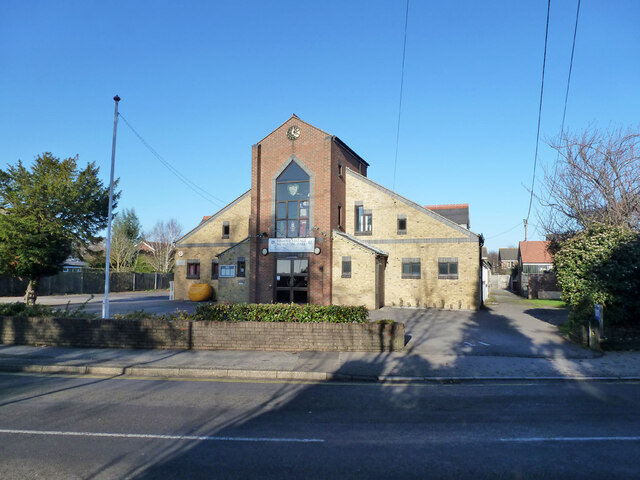
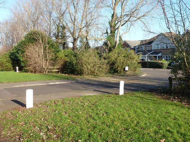
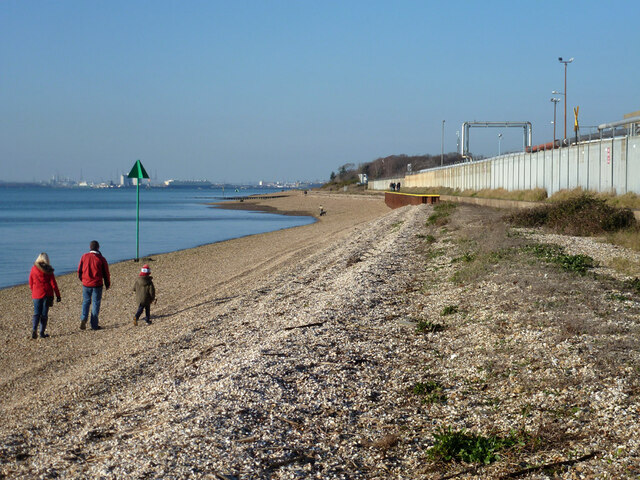
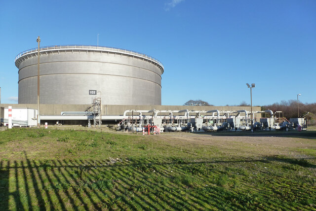
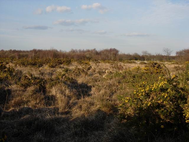
Hamble-le-Rice Images

Images are sourced within 2km of 50.859383/-1.324211 or Grid Reference SU4706. Thanks to Geograph Open Source API. All images are credited.

Fawley : Fawley Oil Refinery From The Solent looking across to the oil refinery.
Fawley : Fawley Oil Refinery
From The Solent looking across to the oil refinery.
Fawley : Southampton Water Looking across the water towards Halble-le-Rice.
Fawley : Southampton Water
Looking across the water towards Halble-le-Rice.
Fawley : Southampton Water Looking towards a boat heading out across the water.
Fawley : Southampton Water
Looking towards a boat heading out across the water.
Albert Close
Albert Close
Unnamed road
Unnamed road
Nightingale Walk
Nightingale Walk
Brook Lane, Warsash
Brook Lane, Warsash
The Priory Church of St Andrew the Apostle, Hamble A grade II*(star) listed building.
The Priory Church of St Andrew the Apostle, Hamble
A grade II*(star) listed building.
Graveyard, Hamble
Graveyard, Hamble
Hamble Village Memorial Hall Built 1933, refurbished 2003. The 'Memorial' was transferred from an earlier hall of 1920 that was remembering war dead.
Hamble Village Memorial Hall
Built 1933, refurbished 2003. The 'Memorial' was transferred from an earlier hall of 1920 that was remembering war dead.
Disused railway to oil installation The private branch from near Hamble station to an oil installation of BP (formerly Shell Mex and BP) is no longer used. Away from the installation the route is heavily overgrown, but the track appears to be still in place. Here there is a strange provision of double check rails.
Disused railway to oil installation
The private branch from near Hamble station to an oil installation of BP (formerly Shell Mex and BP) is no longer used. Away from the installation the route is heavily overgrown, but the track appears to be still in place. Here there is a strange provision of double check rails.
Disused level crossing, Barton Drive The disused private branch from near Hamble station to an oil installation (currently BP Oil) on Southampton Water crosses here. The track still seems mostly in place but it is heavily overgrown. Double tracks here, a loop on the single line. The white pipeline markers explain why the railway fell out of use.
Disused level crossing, Barton Drive
The disused private branch from near Hamble station to an oil installation (currently BP Oil) on Southampton Water crosses here. The track still seems mostly in place but it is heavily overgrown. Double tracks here, a loop on the single line. The white pipeline markers explain why the railway fell out of use.
Anti-aircraft gun, Hamble Defence of Britain reference e27098, the original emplacement, probably not the original gun.
Anti-aircraft gun, Hamble
Defence of Britain reference e27098, the original emplacement, probably not the original gun.
Low cliff, Hamble Common This seems to have been cut back about 25 m over the last century.
Low cliff, Hamble Common
This seems to have been cut back about 25 m over the last century.
Water frontage, Hamble oil terminal Currently BP, earlier a Shell Mex and BP depot before that liaison dissolved. The red sign says 'Private Property. No fires on the beach', which seems sensible.
Water frontage, Hamble oil terminal
Currently BP, earlier a Shell Mex and BP depot before that liaison dissolved. The red sign says 'Private Property. No fires on the beach', which seems sensible.
Beach by Hamble oil terminal
Tank 1102, Hamble Oil Terminal Also pumps P1112 to P1116.
Tank 1102, Hamble Oil Terminal
Also pumps P1112 to P1116.
Show me another place!

Hamble-le-Rice is located at Grid Ref: SU4706 (Lat: 50.859383, Lng: -1.324211)

Administrative County: Hampshire

District: Eastleigh

Police Authority: Hampshire

What 3 Words

///tortoises.tops.soils. Near Hamble-le-Rice, Hampshire

Related Wikis

Hamble-le-Rice

Hamble-le-Rice, commonly known as Hamble, is a village and civil parish in the Borough of Eastleigh in Hampshire, England. It is best known for being an...
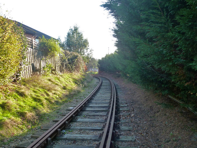
Hamble Rail Trail

The Hamble Rail Trail is a 4.5-mile-long (7.2 km) circular footpath in Hampshire, southern England, comprising a path which runs alongside a disused railway...

Folland Sports F.C.

Folland Sports Football Club is a football club based in Hamble-le-Rice, near Southampton, in Hampshire, England. They are currently members of the Wessex...

St Andrew's Castle, Hamble

St Andrew's Castle was an artillery fort constructed by Henry VIII near Hamble-le-Rice, Hampshire, between 1542 and 1543. It formed part of the King's...

Hamble Common Camp

Hamble Common Camp is the site of an Iron Age promontory hillfort located in Hampshire. The fort is located on Hamble common on a peninsula of land formed...

Hamble Club F.C.

Hamble Club Football Club is a football club based in Hamble-le-Rice, Hampshire. They are currently members of the Wessex League Premier Division and play...

Royal Southern Yacht Club

The Royal Southern Yacht Club is a yacht club in Hamble-le-Rice, Hampshire, England. == History == It was established in 1837...

Mercury Marshes

Mercury Marshes is a 6.4-hectare (16-acre) Local Nature Reserve in Hamble-le-Rice in Hampshire. It is owned by Hampshire County Council and managed by...

Nearby Amenities

Located within 500m of 50.859383,-1.324211
Bus Stop
Beaulieu Road
Bus: yes
Naptan AtcoCode: 1900HA030506
Naptan Bearing: NW
Naptan CommonName: Beaulieu Road
Naptan Crossing: Coach Road
Naptan NaptanCode: hamdgmja
Naptan Street: Hamble Lane
Naptan Verified: no
Public Transport: platform
Shelter: yes
Source: naptan_import
Lat/Long: 50.8615066/-1.3274608
Bus Stop
Beaulieu Road
Bench: no
Bus: yes
Naptan AtcoCode: 1900HA030507
Naptan Bearing: SE
Naptan CommonName: Beaulieu Road
Naptan Crossing: Beaulieu Road
Naptan NaptanCode: hamdgmjm
Naptan Street: Hamble Lane
Naptan Verified: no
Public Transport: platform
Shelter: yes
Source: naptan_import
Lat/Long: 50.8612876/-1.3268955
Bus Stop
Hamble Fire Station
Bus: yes
Naptan AtcoCode: 1900HA030508
Naptan Bearing: W
Naptan CommonName: Hamble Fire Station
Naptan Crossing: Aquila Way
Naptan NaptanCode: hamdgpdt
Naptan Street: Hamble Lane
Naptan Verified: no
Public Transport: platform
Source: naptan_import
Lat/Long: 50.8594298/-1.3236874
Bus Stop
Hamble Fire Station
Bus: yes
Naptan AtcoCode: 1900HA030509
Naptan Bearing: E
Naptan CommonName: Hamble Fire Station
Naptan Crossing: Spitfire Way
Naptan NaptanCode: hamdgpmt
Naptan Street: Hamble Lane
Naptan Verified: no
Public Transport: platform
Source: naptan_import
Lat/Long: 50.8591192/-1.3220391
Bus Stop
Copse Lane
Bus: yes
Naptan AtcoCode: 1900HA030510
Naptan Bearing: W
Naptan CommonName: Copse Lane
Naptan Crossing: Hamble Lane
Naptan NaptanCode: hamdgpwm
Naptan Street: Hambleside Court
Naptan Verified: no
Public Transport: platform
Source: naptan_import
Lat/Long: 50.8588418/-1.3207359
Bus Stop
Copse Lane
Bus: yes
Naptan AtcoCode: 1900HA030511
Naptan Bearing: E
Naptan CommonName: Copse Lane
Naptan Crossing: Copse Lane
Naptan NaptanCode: hamdgtgj
Naptan Street: High Street
Naptan Verified: no
Public Transport: platform
Source: naptan_import
Lat/Long: 50.8588714/-1.3196415
Restaurant
The Cinnamon Bay
Addr City: Southampton
Addr Housename: St Andrews Buildings
Addr Postcode: SO31 4JE
Addr Street: High Street
Addr Unit: 4-7
Addr Village: Hamble-Le-Rice
Fhrs Id: 140025
Lat/Long: 50.8591273/-1.319018
Railway: switch
Lat/Long: 50.8572381/-1.320874
Railway: level_crossing
Lat/Long: 50.860718/-1.3211889
Post Box
Collection Plate: CP1D
Collection Times: Mo-Fr 09:00; Sa 07:00
Post Box Type: lamp
Ref: SO31 257D
Royal Cypher: EIIR
Royal Cypher Wikidata: Q33102113
Lat/Long: 50.8596616/-1.3226365
Post Box
Brand: Royal Mail
Brand Wikidata: Q638098
Brand Wikipedia: en:Royal Mail
Collection Plate: CP7D
Collection Times: Mo-Fr 09:00; Sa 07:00
Operator: Royal Mail
Operator Wikidata: Q638098
Post Box Type: lamp
Ref: SO31 671
Royal Cypher: EIIR
Royal Cypher Wikidata: Q33102113
Lat/Long: 50.8624842/-1.325178
Post Box
Brand: Royal Mail
Brand Wikidata: Q638098
Brand Wikipedia: en:Royal Mail
Collection Plate: CP1D
Collection Times: Mo-Fr 09:00; Sa 07:00
Operator: Royal Mail
Operator Wikidata: Q638098
Post Box Type: wall
Ref: SO31 222D
Royal Cypher: EIIR
Royal Cypher Wikidata: Q33102113
Lat/Long: 50.8601664/-1.3307007
Post Box
Brand: Royal Mail
Brand Wikidata: Q638098
Brand Wikipedia: en:Royal Mail
Collection Plate: CP1
Collection Times: Mo-Fr 17:15; Sa 09:00
Operator: Royal Mail
Operator Wikidata: Q638098
Post Box Type: pillar
Ref: SO31 784
Royal Cypher: EIIR
Royal Cypher Wikidata: Q33102113
Lat/Long: 50.8583772/-1.3262562
Post Box
Brand: Royal Mail
Brand Wikidata: Q638098
Brand Wikipedia: en:Royal Mail
Collection Plate: CP1
Collection Times: Mo-Fr 17:30; Sa 10:30
Operator: Royal Mail
Operator Wikidata: Q638098
Post Box Type: pillar
Ref: SO31 240
Royal Cypher: GVIR
Royal Cypher Wikidata: Q33102169
Source: local_knowledge
Lat/Long: 50.8621059/-1.3290763
Fast Food
Kingfisher
Addr City: Southampton
Addr Country: GB
Addr Housenumber: 4
Addr Place: Hamble-le-Rice
Addr Postcode: SO31 4JT
Addr Street: Coronation Parade
Cuisine: fish_and_chips
Source: local_knowledge
Lat/Long: 50.8620196/-1.329079
Fast Food
Ming Wah
Addr City: Southampton
Addr Country: GB
Addr Housenumber: 3
Addr Postcode: SO31 4JT
Addr Street: Coronation Parade
Addr Village: Hamble-Le-Rice
Cuisine: chinese
Fhrs Id: 842835
Source: local_knowledge
Lat/Long: 50.8619882/-1.3290401
Restaurant
Royal Spice
Addr City: Hamble le-Rice, Southampton
Addr Country: GB
Addr Housenumber: 2
Addr Postcode: SO31 4JT
Addr Street: Coronation Parade
Cuisine: indian
Internet Access: wlan
Opening Hours: We-Mo 17:00-23:00
Source: local_knowledge
Lat/Long: 50.8619527/-1.3289905
The Co-operative Food
Addr City: Southampton
Addr Country: GB
Addr Housenumber: 8
Addr Postcode: SO31 4JT
Addr Street: Coronation Parade
Brand: The Co-operative Food
Brand Wikidata: Q107617274
Operator: The Co-operative Group
Operator Wikidata: Q117202
Shop: convenience
Source: local_knowledge
Website: https://www.coop.co.uk/store-finder/SO31-4JT/8-9-coronation-parade
Lat/Long: 50.8622439/-1.3292558
Clippers
Addr City: Southampton
Addr Country: GB
Addr Housenumber: 10
Addr Postcode: SO31 4JT
Addr Street: Coronation Parade
Shop: hairdresser
Source: local_knowledge
Lat/Long: 50.8623124/-1.329307
Booth: K6
Old Phone: +44 23 8045 2365
Removed Amenity: telephone
Source: local_knowledge
Lat/Long: 50.8625029/-1.3293258
Crossing
Kerb: lowered
Lat/Long: 50.8624236/-1.3290811
Railway: switch
Lat/Long: 50.8619161/-1.3210459
Railway: buffer_stop
Lat/Long: 50.8569847/-1.3209912
Best-in Local Shop
Shop: convenience
Lat/Long: 50.8619222/-1.3289489
Bicycle Parking
Bicycle Parking: stands
Capacity: 4
Lat/Long: 50.8623473/-1.3292587
Air Transport Auxillary Memorial
Historic: memorial
Lat/Long: 50.8592655/-1.3225713
Information: board
Tourism: information
Lat/Long: 50.8593502/-1.3225391
Railway: switch
Lat/Long: 50.8590889/-1.3214803
Veterinary
Harrier Veterinary Surgery
Lat/Long: 50.8619191/-1.3278054
Townhall
Hamble Village Memorial Hall
Lat/Long: 50.8590765/-1.3198596
Post Office
Coronation Parade Post Office
Addr City: Southampton
Addr Country: GB
Addr Housenumber: 5
Addr Postcode: SO31 4JT
Addr Street: Coronation Parade
Addr Village: Hamble
Brand: Post Office
Brand Wikidata: Q1783168
Opening Hours: Mo-Fr 09:00-17:30; Sa 09:00-14:00
Ref Pol Id: 5636
Source: local_knowledge
Website: https://www.postoffice.co.uk/branch-finder/1845462/coronation-parade
Lat/Long: 50.86205/-1.3291179
Atm
Opening Hours: 24/7
Operator: Bank of Ireland
Lat/Long: 50.862089/-1.3290575
Hamble Pharmacy
Addr City: Hamble, Southampton
Addr Housename: Hamble Pharmacy
Addr Housenumber: 7
Addr Postcode: SO31 4JT
Addr Street: Coronation Parade
Lat/Long: 50.8621795/-1.3292198
River Sales & Lettings
Addr City: Hamble, Southampton
Addr Housename: River Sales & Lettings Ltd
Addr Housenumber: 6
Addr Postcode: SO31 4JT
Addr Street: Coronation Parade
Lat/Long: 50.8621381/-1.3291889
Turning Circle
Lat/Long: 50.8613598/-1.3200674
Turning Circle
Lat/Long: 50.8613885/-1.3204947
Railway: abandoned
Lat/Long: 50.858994/-1.3214895
Railway: switch
Lat/Long: 50.8550905/-1.3224225
Direction: 170
Generator Method: photovoltaic
Generator Output Electricity: yes
Generator Solar Modules: 13
Generator Source: solar
Generator Type: solar_photovoltaic_panel
Location: roof
Power: generator
Lat/Long: 50.8572747/-1.3184308
Direction: 185
Generator Method: photovoltaic
Generator Output Electricity: yes
Generator Solar Modules: 9
Generator Source: solar
Generator Type: solar_photovoltaic_panel
Location: roof
Power: generator
Lat/Long: 50.8570873/-1.3191992
Direction: 275
Generator Method: photovoltaic
Generator Output Electricity: yes
Generator Solar Modules: 6
Generator Source: solar
Generator Type: solar_photovoltaic_panel
Location: roof
Power: generator
Lat/Long: 50.8570138/-1.3191355
Direction: 185
Generator Method: photovoltaic
Generator Output Electricity: yes
Generator Solar Modules: 16
Generator Source: solar
Generator Type: solar_photovoltaic_panel
Location: roof
Power: generator
Lat/Long: 50.8581962/-1.3199353
Direction: 175
Generator Method: photovoltaic
Generator Output Electricity: yes
Generator Solar Modules: 16
Generator Source: solar
Generator Type: solar_photovoltaic_panel
Location: roof
Power: generator
Lat/Long: 50.858685/-1.3193425
Direction: SSE
Generator Method: photovoltaic
Generator Output Electricity: yes
Generator Solar Modules: 16
Generator Source: solar
Generator Type: solar_photovoltaic_panel
Location: roof
Power: generator
Lat/Long: 50.8586376/-1.3188362
Direction: S
Generator Method: photovoltaic
Generator Output Electricity: yes
Generator Solar Modules: 14
Generator Source: solar
Generator Type: solar_photovoltaic_panel
Location: roof
Power: generator
Lat/Long: 50.8594653/-1.3201512
Direction: E
Generator Method: photovoltaic
Generator Output Electricity: yes
Generator Solar Modules: 6
Generator Source: solar
Generator Type: solar_photovoltaic_panel
Location: roof
Power: generator
Lat/Long: 50.8595127/-1.3204281
Direction: E
Generator Method: photovoltaic
Generator Output Electricity: yes
Generator Solar Modules: 8
Generator Source: solar
Generator Type: solar_photovoltaic_panel
Location: roof
Power: generator
Lat/Long: 50.859547/-1.3204268
Direction: W
Generator Method: photovoltaic
Generator Output Electricity: yes
Generator Solar Modules: 4
Generator Source: solar
Generator Type: solar_photovoltaic_panel
Location: roof
Power: generator
Lat/Long: 50.8599755/-1.3197898
Direction: W
Generator Method: photovoltaic
Generator Output Electricity: yes
Generator Solar Modules: 6
Generator Source: solar
Generator Type: solar_photovoltaic_panel
Location: roof
Power: generator
Lat/Long: 50.8600238/-1.3197837
Direction: E
Generator Method: photovoltaic
Generator Output Electricity: yes
Generator Solar Modules: 5
Generator Source: solar
Generator Type: solar_photovoltaic_panel
Location: roof
Power: generator
Lat/Long: 50.8600221/-1.319722
Direction: E
Generator Method: photovoltaic
Generator Output Electricity: yes
Generator Solar Modules: 2
Generator Source: solar
Generator Type: solar_photovoltaic_panel
Location: roof
Power: generator
Lat/Long: 50.8599755/-1.3197354
Direction: 265
Generator Method: photovoltaic
Generator Output Electricity: yes
Generator Solar Modules: 8
Generator Source: solar
Generator Type: solar_photovoltaic_panel
Location: roof
Power: generator
Lat/Long: 50.8595969/-1.3178646
Direction: 85
Generator Method: photovoltaic
Generator Output Electricity: yes
Generator Solar Modules: 8
Generator Source: solar
Generator Type: solar_photovoltaic_panel
Location: roof
Power: generator
Lat/Long: 50.8595948/-1.3177707
Direction: 190
Generator Method: photovoltaic
Generator Output Electricity: yes
Generator Solar Modules: 17
Generator Source: solar
Generator Type: solar_photovoltaic_panel
Location: roof
Power: generator
Lat/Long: 50.8587993/-1.3176131
Direction: S
Generator Method: photovoltaic
Generator Output Electricity: yes
Generator Solar Modules: 16
Generator Source: solar
Generator Type: solar_photovoltaic_panel
Location: roof
Power: generator
Lat/Long: 50.861301/-1.3187159
Direction: E
Generator Method: photovoltaic
Generator Output Electricity: yes
Generator Solar Modules: 14
Generator Source: solar
Generator Type: solar_photovoltaic_panel
Location: roof
Power: generator
Lat/Long: 50.8613891/-1.3189909
Direction: S
Generator Method: photovoltaic
Generator Output Electricity: yes
Generator Solar Modules: 12
Generator Source: solar
Generator Type: solar_photovoltaic_panel
Location: roof
Power: generator
Lat/Long: 50.8612125/-1.3202394
Direction: S
Generator Method: photovoltaic
Generator Output Electricity: yes
Generator Solar Modules: 17
Generator Source: solar
Generator Type: solar_photovoltaic_panel
Location: roof
Power: generator
Lat/Long: 50.8612007/-1.3199886
Railway: level_crossing
Lat/Long: 50.861859/-1.3210368
Railway: level_crossing
Lat/Long: 50.8618624/-1.3210252
Railway: level_crossing
Lat/Long: 50.8607146/-1.3211401
Railway: switch
Lat/Long: 50.8550161/-1.3225133
Railway: abandoned
Lat/Long: 50.8564687/-1.3213051
Railway: abandoned
Lat/Long: 50.8564576/-1.3212471
Bicycle Parking
Bicycle Parking: stands
Capacity: 6
Covered: no
Lat/Long: 50.8574265/-1.3284604
Bicycle Parking
Bicycle Parking: stands
Capacity: 6
Covered: no
Lat/Long: 50.857469/-1.3283986
Bicycle Parking
Capacity: 8
Covered: no
Lat/Long: 50.8561225/-1.3279786
Bicycle Parking
Bicycle Parking: stands
Capacity: 4
Lat/Long: 50.8590121/-1.3266672
Bicycle Parking
Bicycle Parking: stands
Capacity: 2
Lat/Long: 50.8589381/-1.3268295
Railway: crossing
Lat/Long: 50.8606929/-1.3211443
Railway: crossing
Lat/Long: 50.8606936/-1.3211934
The data included in this document is from www.openstreetmap.org. The data is made available under ODbL.

Have you been to Hamble-le-Rice?

Leave your review of Hamble-le-Rice below (or comments, questions and feedback).