Bromley Common

Settlement in Kent

England

Bromley Common

St. George's Road, Bickley St. George's Road is a private road in Bickley, in the outer suburbs of south east London.

This image was taken on a dull and gloomy January afternoon.  Deciduous trees were bare for the winter season, but evergreens had kept their leaves.
St. George's Road, Bickley Credit: Malc McDonald

Bromley Common is a suburban area located in the London Borough of Bromley, in the county of Kent, England. Situated approximately 11 miles southeast of central London, it is a popular residential district known for its peaceful atmosphere and convenient amenities.

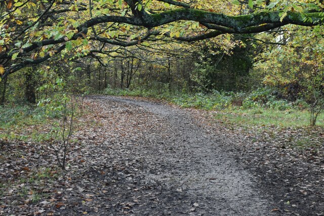
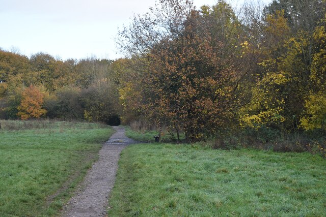
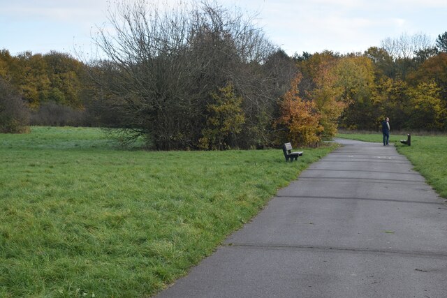
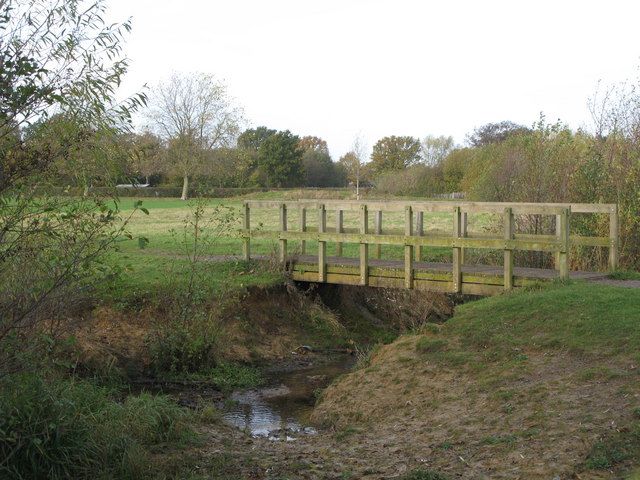
The area takes its name from the vast common land that once dominated the landscape, providing a natural grazing area for livestock. Over the years, the common has been gradually developed, and today it serves as a recreational space for residents and visitors alike. The common is adorned with beautiful green spaces, including Jubilee Country Park, which offers picturesque walking trails, woodlands, and ponds.

Bromley Common benefits from excellent transport links, with several bus routes serving the area and providing easy access to nearby towns and villages. Bromley South railway station is also within close proximity, offering regular services to London Victoria, Bromley North, and Orpington.

The area boasts a range of amenities, including local shops, supermarkets, and restaurants, ensuring residents have easy access to everyday necessities. The nearby Bromley town center provides additional shopping opportunities, with a variety of high street brands, independent shops, and a vibrant market.

Families are attracted to Bromley Common due to its excellent schools, such as Farnborough Primary School and Darrick Wood School, which are both highly regarded educational institutions in the area.

Overall, Bromley Common offers a peaceful and well-connected suburban lifestyle, making it an attractive place to live for individuals and families seeking a balance between urban convenience and natural beauty.

If you have any feedback on the listing, please let us know in the comments section below.

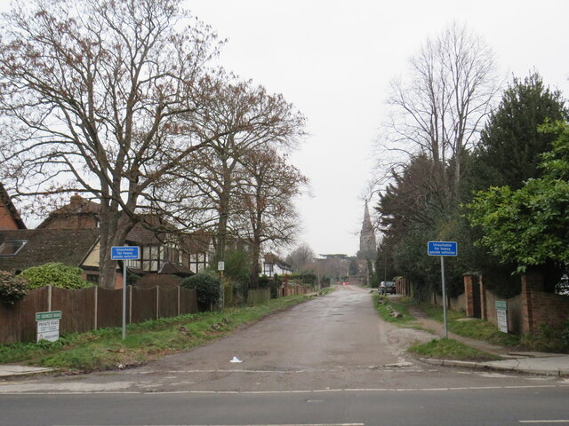
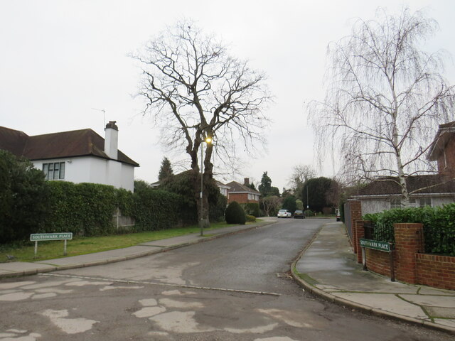
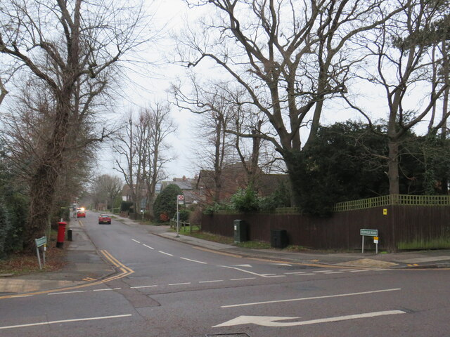
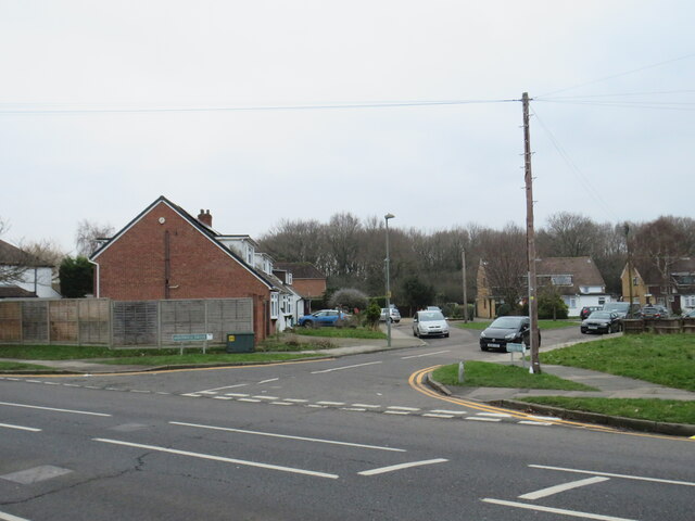
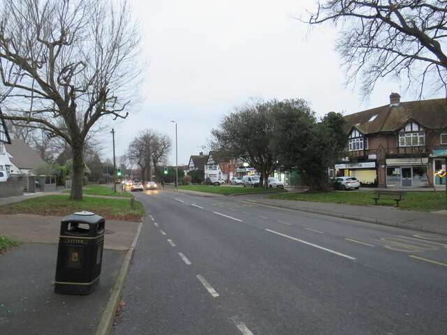
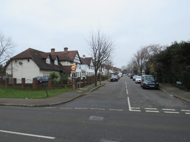
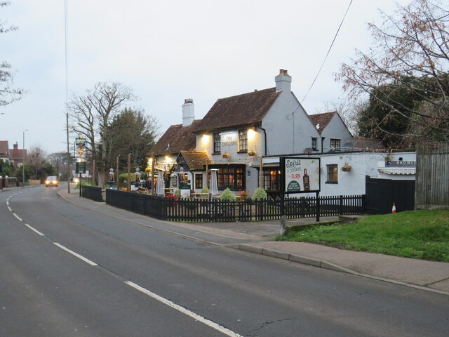
Bromley Common Images

Images are sourced within 2km of 51.382311/0.04634 or Grid Reference TQ4266. Thanks to Geograph Open Source API. All images are credited.

St. George's Road, Bickley St. George's Road is a private road in Bickley, in the outer suburbs of south east London.

This image was taken on a dull and gloomy January afternoon.  Deciduous trees were bare for the winter season, but evergreens had kept their leaves.
St. George's Road, Bickley
St. George's Road is a private road in Bickley, in the outer suburbs of south east London. This image was taken on a dull and gloomy January afternoon. Deciduous trees were bare for the winter season, but evergreens had kept their leaves.
Southwark Place, Bickley Southwark Place is a residential cul-de-sac in Bickley, in the outer suburbs of south east London.

This image was taken on a dull and gloomy January afternoon.  Deciduous trees were bare for the winter season, but evergreens had kept their leaves.
Southwark Place, Bickley
Southwark Place is a residential cul-de-sac in Bickley, in the outer suburbs of south east London. This image was taken on a dull and gloomy January afternoon. Deciduous trees were bare for the winter season, but evergreens had kept their leaves.
Oldfield Road, Bickley Oldfield Road is a residential road in Bickley, in the outer suburbs of south east London.

This image was taken on a dull and gloomy January afternoon.  Deciduous trees were bare for the winter season, but evergreens had kept their leaves.
Oldfield Road, Bickley
Oldfield Road is a residential road in Bickley, in the outer suburbs of south east London. This image was taken on a dull and gloomy January afternoon. Deciduous trees were bare for the winter season, but evergreens had kept their leaves.
Fontwell Drive, Southborough, near Bromley Fontwell Drive is a residential cul-de-sac in Southborough, in the outer suburbs of south east London.

This image was taken on a dull and gloomy January afternoon.
Fontwell Drive, Southborough, near Bromley
Fontwell Drive is a residential cul-de-sac in Southborough, in the outer suburbs of south east London. This image was taken on a dull and gloomy January afternoon.
Southborough Lane, Southborough, near Bromley Southborough Lane is a suburban road near Bromley in outer south east London.

This image was taken on a dull and gloomy January afternoon.  Deciduous trees were bare for the winter season, but evergreens had kept their leaves.
Southborough Lane, Southborough, near Bromley
Southborough Lane is a suburban road near Bromley in outer south east London. This image was taken on a dull and gloomy January afternoon. Deciduous trees were bare for the winter season, but evergreens had kept their leaves.
Cloisters Avenue, Southborough, near Bromley Cloisters Avenue is a residential road in Southborough, in the outer suburbs of south east London.

This image was taken on a dull and gloomy January afternoon.  Deciduous trees were bare for the winter season, but evergreens had kept their leaves.
Cloisters Avenue, Southborough, near Bromley
Cloisters Avenue is a residential road in Southborough, in the outer suburbs of south east London. This image was taken on a dull and gloomy January afternoon. Deciduous trees were bare for the winter season, but evergreens had kept their leaves.
The Chequers, Southborough, near Bromley The Chequers pub in Southborough, in the outer suburbs of south east London.

This image was taken on a dull and gloomy January afternoon, as it was beginning to get dark.  Deciduous trees were bare for the winter season, but evergreens had kept their leaves.
The Chequers, Southborough, near Bromley
The Chequers pub in Southborough, in the outer suburbs of south east London. This image was taken on a dull and gloomy January afternoon, as it was beginning to get dark. Deciduous trees were bare for the winter season, but evergreens had kept their leaves.
Pope Road, Bromley Pope Road is a residential road in Bromley, in the outer suburbs of south east London.

This image was taken on a dull and gloomy January afternoon, as darkness was falling.
Pope Road, Bromley
Pope Road is a residential road in Bromley, in the outer suburbs of south east London. This image was taken on a dull and gloomy January afternoon, as darkness was falling.
Norman Park, Bromley An entrance to Norman Park in Bromley, in the outer suburbs of south east London.

This image was taken on a dull and gloomy January afternoon.  Deciduous trees were bare for the winter season.
Norman Park, Bromley
An entrance to Norman Park in Bromley, in the outer suburbs of south east London. This image was taken on a dull and gloomy January afternoon. Deciduous trees were bare for the winter season.
London Loop path in Jubilee Country Park
Path in Jubilee Country Park A nearby sign explains that this path was a former military road, part of a Second World War anti-aircraft gun emplacement.
Path in Jubilee Country Park
A nearby sign explains that this path was a former military road, part of a Second World War anti-aircraft gun emplacement.
Old Milestone by A21, Farnborough Common, Locks Bottom, 130m West of Fantail junction The Milestone is located on edge of shrubbery, behind path on the North of the road.  Parish of Bromley (Bromley District). Metal plate attached to stone post, Bromley marker design, erected by the Sevenoaks turnpike trust in the 19th Century. An earlier photograph can be found here: <a title="https://www.geograph.org.uk/photo/6061421" href="https://www.geograph.org.uk/photo/6061421">Link</a>  

Inscription reads:-   
(1 / MILE / TO / FARNBORO)  : : (13 / MILES / TO / LONDON /BRIDGE)

Grade II listed. List Entry Number: 1299025 <span class="nowrap"><a title="https://historicengland.org.uk/listing/the-list/list-entry/1299025" rel="nofollow ugc noopener" href="https://historicengland.org.uk/listing/the-list/list-entry/1299025">Link</a><img style="margin-left:2px;" alt="External link" title="External link - shift click to open in new window" src="https://s1.geograph.org.uk/img/external.png" width="10" height="10"/></span> 

Milestone Society National ID: KE_LBFA13
Old Milestone by A21, Farnborough Common, Locks Bottom, 130m West of Fantail junction
The Milestone is located on edge of shrubbery, behind path on the North of the road.  Parish of Bromley (Bromley District). Metal plate attached to stone post, Bromley marker design, erected by the Sevenoaks turnpike trust in the 19th Century. An earlier photograph can be found here: Link   Inscription reads:- (1 / MILE / TO / FARNBORO) : : (13 / MILES / TO / LONDON /BRIDGE) Grade II listed. List Entry Number: 1299025 LinkExternal link Milestone Society National ID: KE_LBFA13
Parade of shops, Petts Wood
Queensway
Queensway
Queensway
Queensway
Nightingale Rd, Lakeswood Rd
Lakeswood Rd
Lakeswood Rd
Show me another place!

Bromley Common is located at Grid Ref: TQ4266 (Lat: 51.382311, Lng: 0.04634)

Unitary Authority: Bromley

Police Authority: Metropolitan

What 3 Words

///rally.units.path. Near Farnborough, London

Related Wikis

Bishop Justus Church of England School

Bishop Justus Church of England School is a mixed secondary school and sixth form in the Bromley area of the London Borough of Bromley, England. The school...

Bromley Common

Bromley Common is an unincorporated village in Greater London, within the London Borough of Bromley. Prior to 1965 it was within the historic county of...

Southborough, Bromley

Southborough is an area of South East London, within the London Borough of Bromley, Greater London. Prior to 1965 it was within the historic county of...

London South East Colleges

Bromley College of Further and Higher Education, trading as London South East Colleges (LSEC), is a large college of further education and higher education...

Holmesdale F.C.

Holmesdale Football Club is a football club originally based in South Norwood, London, England. Affiliated to the Kent County Football Association, they...

Crofton Wood

Crofton Wood or Crofton Woods is a Site of Special Scientific Interest and Site of Metropolitan Importance for Nature Conservation in Crofton in the London...

Norman Park, Bromley

Norman Park is a recreation ground in Bromley, England.It has a playground and athletics track, and hosts events such as a music festivals, weekly organised...

Jubilee Country Park

Jubilee Country Park is a 62-acre (25 ha) public park in Petts Wood in the London Borough of Bromley. It is a Local Nature Reserve and a Site of Metropolitan...

Related Videos

Hayes Circular walk | Hiking in London | Drone 4K | Saturday Walk | 🇬🇧 Hiking UK | England

A short walk across three commons in South East London Length 9.5 km (6 m) Toughness 1 out of 10 his short walk crosses three ...

Hayes to Knockholt walk | 🇬🇧 Close to London UK | 🇬🇧 Hiking UK | England

Join us on a delightful journey as we hike from Otford to Eynsford, immersing ourselves in the scenic beauty of the Kent ...

Ivan Strelets - High Elms Driving And Walking (Original Music Video)

Jump into the driver's seat for a scenic sunny autumn day drive and walk through the lush High Elms countryside in Orpington, ...

Walking On My Own

A hauntingly sad instrumental in classical style......at first.

Nearby Amenities

Located within 500m of 51.382311,0.04634
Turning Circle
Lat/Long: 51.3863333/0.0462529
Bus Stop
Turpington Lane Community Centre
Bus: yes
Local Ref: U
Naptan AdministrativeAreaRef: 082
Naptan AtcoCode: 490004336N
Naptan Bearing: N
Naptan CommonName: Turpington Lane Community Centre
Naptan Indicator: Stop U
Naptan Locality: E0034147
Naptan LocalityName: Southborough
Naptan NaptanCode: 59266
Naptan ParentLocalityName: London
Naptan Status: active
Naptan Street: TURPINGTON LANE
Naptan Verified: no
Network: London Buses
Network Wikidata: Q1192411
Operator: Transport For London
Operator Wikidata: Q682520
Public Transport: platform
Ref: 59266
Lat/Long: 51.3858755/0.0427351
Bus Stop
Turpington Lane Community Centre
Bus: yes
Local Ref: T
Naptan AdministrativeAreaRef: 082
Naptan AtcoCode: 490004336S
Naptan Bearing: N
Naptan CommonName: Bridgeways Day Unit
Naptan Indicator: Stop T
Naptan Locality: E0034147
Naptan LocalityName: Southborough
Naptan NaptanCode: 55804
Naptan ParentLocalityName: London
Naptan Status: active
Naptan Street: TURPINGTON LANE
Naptan Verified: no
Network: London Buses
Network Wikidata: Q1192411
Operator: Transport For London
Operator Wikidata: Q682520
Public Transport: platform
Ref: 55804
Lat/Long: 51.3858399/0.0428919
Bus Stop
Link Way
Bus: yes
Local Ref: BJ
Naptan AdministrativeAreaRef: 082
Naptan AtcoCode: 490009193E
Naptan Bearing: NE
Naptan CommonName: Link Way
Naptan Indicator: Stop BJ
Naptan Locality: E0034076
Naptan LocalityName: Bromley Common
Naptan NaptanCode: 49494
Naptan ParentLocality: N0060488
Naptan ParentLocalityName: Bromley
Naptan Status: active
Naptan Street: TURPINGTON LANE
Naptan Verified: yes
Network: London Buses
Network Wikidata: Q1192411
Operator: Transport For London
Operator Wikidata: Q682520
Public Transport: platform
Ref: 49494
Lat/Long: 51.3843073/0.0425876
Bus Stop
Link Way
Bus: yes
Local Ref: BK
Naptan AdministrativeAreaRef: 082
Naptan AtcoCode: 490009193W
Naptan Bearing: SW
Naptan CommonName: Link Way
Naptan Indicator: Stop BK
Naptan Locality: E0034076
Naptan LocalityName: Bromley Common
Naptan NaptanCode: 57364
Naptan ParentLocality: N0060488
Naptan ParentLocalityName: Bromley
Naptan Status: active
Naptan Street: TURPINGTON LANE
Naptan Verified: yes
Network: London Buses
Network Wikidata: Q1192411
Operator: Transport For London
Operator Wikidata: Q682520
Public Transport: platform
Ref: 57364
Lat/Long: 51.3839588/0.0425245
Bus Stop
Bromley Common / Holy Trinity Church
Bus: yes
Local Ref: BS
Naptan AdministrativeAreaRef: 082
Naptan AtcoCode: 490010498N
Naptan Bearing: N
Naptan CommonName: Bromley Common Holy Trinity Church
Naptan Indicator: Stop BS
Naptan Locality: E0034076
Naptan LocalityName: Bromley Common
Naptan NaptanCode: 76253
Naptan ParentLocality: N0060488
Naptan ParentLocalityName: Bromley
Naptan Status: active
Naptan Street: BROMLEY COMMON
Naptan Verified: yes
Network: London Buses
Network Wikidata: Q1192411
Operator: Transport For London
Operator Wikidata: Q682520
Public Transport: platform
Ref: 76253
Lat/Long: 51.3803863/0.0416374
Bus Stop
Oakley Road / Holy Trinity Church
Bus: yes
Local Ref: BM
Naptan AdministrativeAreaRef: 082
Naptan AtcoCode: 490010498S
Naptan Bearing: S
Naptan CommonName: Bromley Common Holy Trinity Ch
Naptan Indicator: Stop BM
Naptan Locality: E0034076
Naptan LocalityName: Bromley Common
Naptan NaptanCode: 76434
Naptan ParentLocality: N0060488
Naptan ParentLocalityName: Bromley
Naptan Status: active
Naptan Street: HASTINGS ROAD
Naptan Verified: yes
Network: London Buses
Network Wikidata: Q1192411
Operator: Transport For London
Operator Wikidata: Q682520
Public Transport: platform
Ref: 76434
Lat/Long: 51.3790452/0.0427817
Bus Stop
Turpington Lane / Bromley Common
Departures Board: no
Local Ref: BH
Naptan AdministrativeAreaRef: 082
Naptan AtcoCode: 490013856E
Naptan Bearing: E
Naptan CommonName: Turpington Lane Bromley Common
Naptan Indicator: Stop BH
Naptan Locality: E0034076
Naptan LocalityName: Bromley Common
Naptan NaptanCode: 74810
Naptan ParentLocality: N0060488
Naptan ParentLocalityName: Bromley
Naptan Status: active
Naptan Street: TURPINGTON LANE
Naptan Verified: yes
Network: London Buses
Network Wikidata: Q1192411
Operator: Transport For London
Operator Wikidata: Q682520
Public Transport: platform
Ref: 74810
Tactile Paving: no
Wheelchair: yes
Lat/Long: 51.3832694/0.0405116
Bus Stop
Bromley Common / Turpington Lane
Local Ref: BT
Naptan AdministrativeAreaRef: 082
Naptan AtcoCode: 490013856N
Naptan Bearing: N
Naptan CommonName: Bromley Common Turpington Lane
Naptan Indicator: Stop BT
Naptan Locality: E0034076
Naptan LocalityName: Bromley Common
Naptan NaptanCode: 50036
Naptan ParentLocality: N0060488
Naptan ParentLocalityName: Bromley
Naptan Status: active
Naptan Street: BROMLEY COMMON
Naptan Verified: no
Network: London Buses
Network Wikidata: Q1192411
Operator: Transport For London
Operator Wikidata: Q682520
Public Transport: platform
Ref: 50036
Lat/Long: 51.3834889/0.0394595
Bus Stop
Bromley Common / Turpington Lane
Local Ref: BL
Naptan AdministrativeAreaRef: 082
Naptan AtcoCode: 490013856S
Naptan Bearing: S
Naptan CommonName: Bromley Common Turpington Lane
Naptan Indicator: Stop BL
Naptan Locality: E0034076
Naptan LocalityName: Bromley Common
Naptan NaptanCode: 74433
Naptan ParentLocality: N0060488
Naptan ParentLocalityName: Bromley
Naptan Status: active
Naptan Street: BROMLEY COMMON
Naptan Verified: yes
Network: London Buses
Network Wikidata: Q1192411
Operator: Transport For London
Operator Wikidata: Q682520
Public Transport: platform
Ref: 74433
Lat/Long: 51.3825824/0.0403447
Noexit: yes
Lat/Long: 51.378415/0.0433997
Give Way
Direction: forward
Lat/Long: 51.3822353/0.0405944
Give Way
Direction: forward
Lat/Long: 51.3792159/0.0424821
Give Way
Direction: forward
Lat/Long: 51.3830545/0.0399853
Source: Bing
Lat/Long: 51.3791734/0.0427333
Bromley Common
Place: suburb
Source: OS_OpenData_StreetView
Wikidata: Q123380
Wikipedia: en:Bromley Common
Lat/Long: 51.382016/0.0403387
Telephone
Booth: KX420
Covered: booth
Lat/Long: 51.3839437/0.0425726
Post Box
Post Box Type: pillar
Royal Cypher: EIIR
Royal Cypher Wikidata: Q33102113
Lat/Long: 51.3839571/0.0426129
Bench
Lat/Long: 51.3799251/0.0511023
Bromley Bouncy Castles
Addr City: Bromley
Addr Housename: Barham Court
Addr Housenumber: 1
Addr Postcode: BR2 8LB
Addr Street: Church Lane
Operator: Bromley Bouncy Castles
Phone: +44 7956 838687
Shop: party
Website: https://www.bromleybouncycastles.com
Lat/Long: 51.3791519/0.0433526
Bench
Lat/Long: 51.3801629/0.0510054
Crossing
Lat/Long: 51.3835352/0.041297
Give Way
Direction: forward
Lat/Long: 51.384688/0.0462169
Give Way
Direction: forward
Lat/Long: 51.3833784/0.0437583
Give Way
Direction: backward
Lat/Long: 51.3832899/0.040598
Give Way
Direction: backward
Lat/Long: 51.3835128/0.0413157
Give Way
Direction: backward
Lat/Long: 51.3836007/0.0417633
Give Way
Direction: backward
Lat/Long: 51.3840913/0.0425998
Give Way
Direction: forward
Lat/Long: 51.3845949/0.0429187
Give Way
Direction: backward
Lat/Long: 51.3850842/0.0427913
Give Way
Lat/Long: 51.3792791/0.0430259
Give Way
Direction: forward
Lat/Long: 51.3785186/0.0431656
Traffic Calming: island
Lat/Long: 51.3783821/0.0431454
Give Way
Direction: backward
Lat/Long: 51.385349/0.0455912
Give Way
Direction: backward
Lat/Long: 51.386534/0.0456532
Noexit: yes
Lat/Long: 51.386192/0.0497544
Noexit: yes
Lat/Long: 51.3856536/0.048518
Addr City: Bromley
Addr Country: GB
Addr Housenumber: 10-18
Addr Postcode: BR2 8JP
Addr Street: Turpington Close
Lat/Long: 51.3839885/0.0404102
Addr City: Bromley
Addr Country: GB
Addr Housenumber: 1-9
Addr Postcode: BR2 8JP
Addr Street: Turpington Close
Lat/Long: 51.3838111/0.0405604
Entrance: main
Lat/Long: 51.3837934/0.0405125
Entrance: main
Lat/Long: 51.3839727/0.0403623
Entrance: yes
Lat/Long: 51.3838573/0.0406264
Entrance: yes
Lat/Long: 51.3839922/0.0405133
The data included in this document is from www.openstreetmap.org. The data is made available under ODbL.

Have you been to Bromley Common?

Leave your review of Bromley Common below (or comments, questions and feedback).