Brome Street

Settlement in Suffolk Mid Suffolk

England

Brome Street

Sign at the Devil's Hand-basin Garage, Brome The area just to the east of the A140 at the Stuston turn-off is known as the Devil's Hand-basin, and gives that name to the petrol station at the junction.  This sign stands at the exit to the forecourt.  There are various stories that seek to explain the name, which tend to centre on a blacksmith at the time of the Black Death asking his customers to put their payment in a basin full of vinegar as a primitive disinfectant but do not explain the Devil's role in the story.  See <span class="nowrap"><a title="https://www.hiddenea.com/suffolks.htm#stuston" rel="nofollow ugc noopener" href="https://www.hiddenea.com/suffolks.htm#stuston">Link</a><img style="margin-left:2px;" alt="External link" title="External link - shift click to open in new window" src="https://s1.geograph.org.uk/img/external.png" width="10" height="10"/></span> for a collation of the various possible explanations.
Sign at the Devil's Hand-basin Garage, Brome Credit: Christopher Hilton

Brome Street is a small village located in the county of Suffolk, England. Situated in the East Anglia region, it lies approximately 20 miles east of the historic city of Bury St Edmunds. The village is part of the Mid Suffolk district and has a population of around 200 residents.

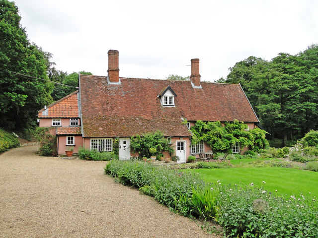
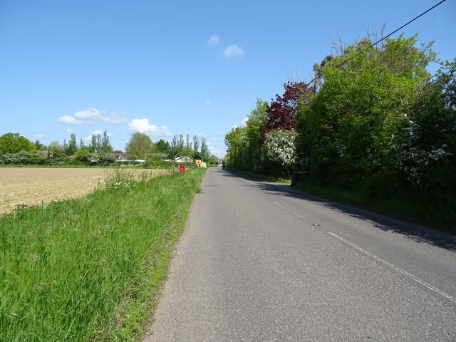
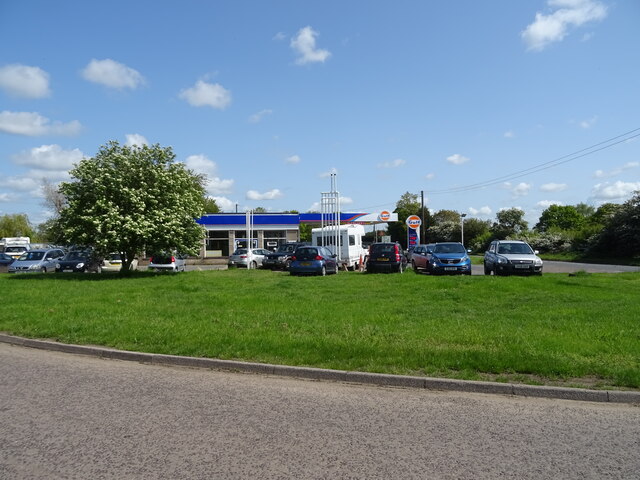
Brome Street is characterized by its rural setting, surrounded by picturesque countryside and farmland. The village itself is small, with a quaint and peaceful atmosphere. It is primarily a residential area, with a few local amenities such as a village hall and a small convenience store.

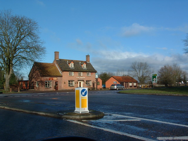
The architecture in Brome Street is predominantly traditional and reflects the village's history, with charming cottages and farmhouses scattered throughout. The area has a rich agricultural heritage, with farming playing a significant role in the local economy.

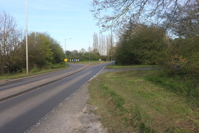
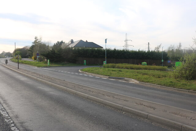
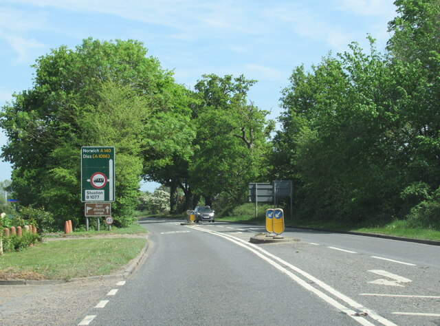
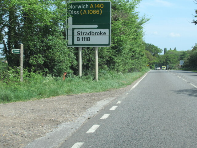
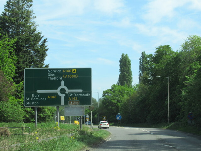
The village is well-connected to surrounding towns and cities, with several major roads passing nearby, including the A140 and A143. This provides easy access to nearby amenities, employment opportunities, and recreational facilities.

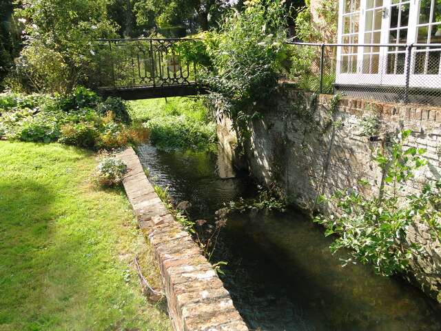
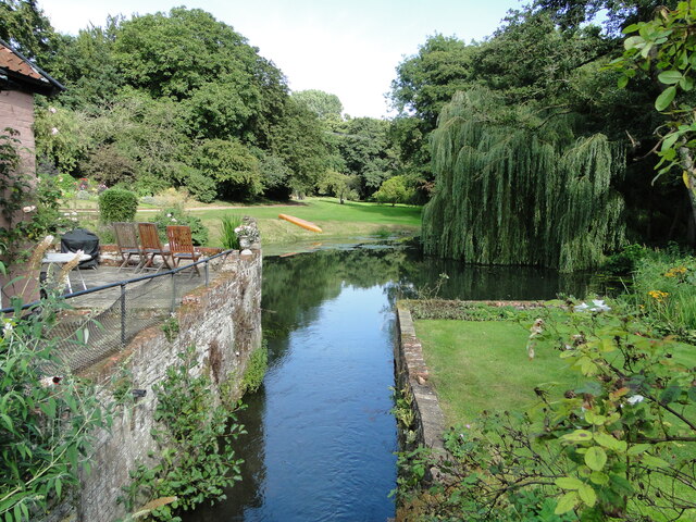
For those seeking outdoor activities, Brome Street offers beautiful countryside walks and cycling routes. The village is also within close proximity to the Waveney Valley, providing opportunities for boating and fishing along the River Waveney.

In summary, Brome Street is a small, rural village in Suffolk, known for its picturesque surroundings and peaceful atmosphere. It offers a close-knit community and a tranquil countryside lifestyle for its residents.

If you have any feedback on the listing, please let us know in the comments section below.
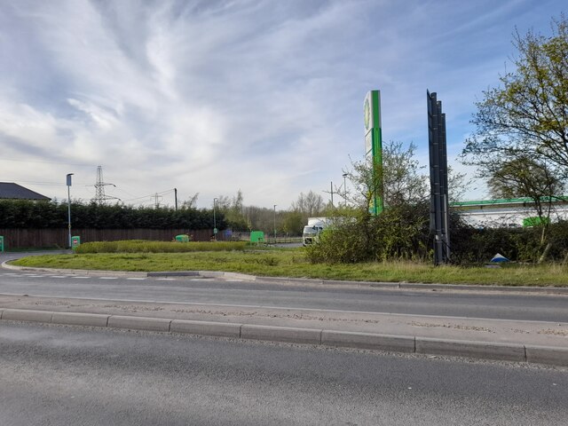
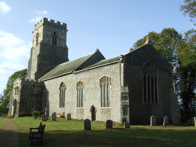
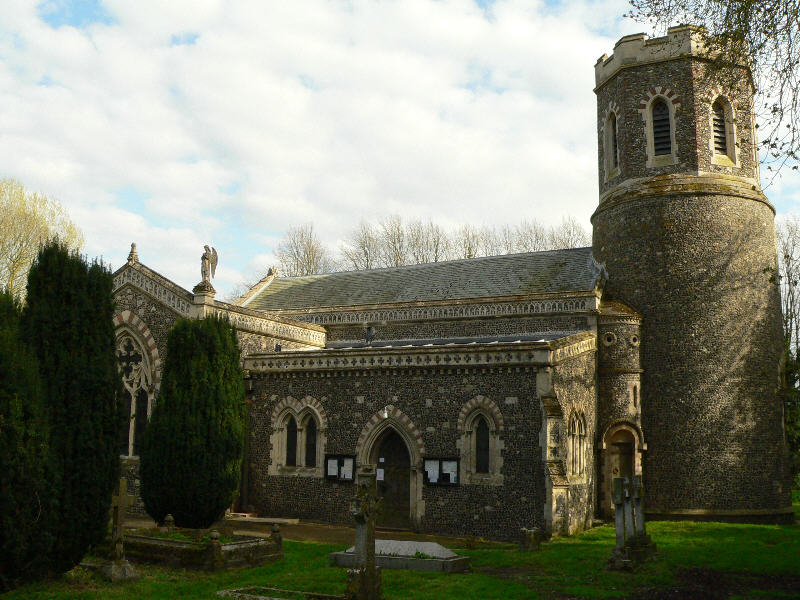
Brome Street Images

Images are sourced within 2km of 52.347003/1.16064 or Grid Reference TM1576. Thanks to Geograph Open Source API. All images are credited.

Sign at the Devil's Hand-basin Garage, Brome The area just to the east of the A140 at the Stuston turn-off is known as the Devil's Hand-basin, and gives that name to the petrol station at the junction.  This sign stands at the exit to the forecourt.  There are various stories that seek to explain the name, which tend to centre on a blacksmith at the time of the Black Death asking his customers to put their payment in a basin full of vinegar as a primitive disinfectant but do not explain the Devil's role in the story.  See <span class="nowrap"><a title="https://www.hiddenea.com/suffolks.htm#stuston" rel="nofollow ugc noopener" href="https://www.hiddenea.com/suffolks.htm#stuston">Link</a><img style="margin-left:2px;" alt="External link" title="External link - shift click to open in new window" src="https://s1.geograph.org.uk/img/external.png" width="10" height="10"/></span> for a collation of the various possible explanations.
Sign at the Devil's Hand-basin Garage, Brome
The area just to the east of the A140 at the Stuston turn-off is known as the Devil's Hand-basin, and gives that name to the petrol station at the junction. This sign stands at the exit to the forecourt. There are various stories that seek to explain the name, which tend to centre on a blacksmith at the time of the Black Death asking his customers to put their payment in a basin full of vinegar as a primitive disinfectant but do not explain the Devil's role in the story. See LinkExternal link for a collation of the various possible explanations.
The old watermill at Oakley The mill which stands on the River Dove, a tributary of the Waveney, had an undershot wheel roughly six feet wide and probably ceased to operate in the early 1800s. In the early 1830s the wheel was removed and part of the building was converted into a laundry. The river which is to the right of the building, is not fast flowing and has much vegetation in places upstream. The tail-race and millpond are however relatively clear with a small weir a short distance downstream. Access was granted by the kind permission of the owner.
<a href="https://www.geograph.org.uk/photo/6942267">TM1776 : The mill-race at Oakley old mill</a>
<a href="https://www.geograph.org.uk/photo/6942273">TM1776 : Oakley old watermill tail-race and millpond</a>
The old watermill at Oakley
The mill which stands on the River Dove, a tributary of the Waveney, had an undershot wheel roughly six feet wide and probably ceased to operate in the early 1800s. In the early 1830s the wheel was removed and part of the building was converted into a laundry. The river which is to the right of the building, is not fast flowing and has much vegetation in places upstream. The tail-race and millpond are however relatively clear with a small weir a short distance downstream. Access was granted by the kind permission of the owner. TM1776 : The mill-race at Oakley old mill TM1776 : Oakley old watermill tail-race and millpond
The mill-race at Oakley old mill The mill which stands on the River Dove, a tributary of the Waveney, had an undershot wheel roughly six feet wide and probably ceased to operate in the early 1800s. In the early 1830s the wheel was removed and part of the building was converted into a laundry. The river which is to the right of the building, is not fast flowing and has much vegetation in places upstream. The tail-race and millpond are however relatively clear with a small weir a short distance downstream. Access was granted by the kind permission of the owner.
<a href="https://www.geograph.org.uk/photo/6942263">TM1776 : The old watermill at Oakley</a>
The mill-race at Oakley old mill
The mill which stands on the River Dove, a tributary of the Waveney, had an undershot wheel roughly six feet wide and probably ceased to operate in the early 1800s. In the early 1830s the wheel was removed and part of the building was converted into a laundry. The river which is to the right of the building, is not fast flowing and has much vegetation in places upstream. The tail-race and millpond are however relatively clear with a small weir a short distance downstream. Access was granted by the kind permission of the owner. TM1776 : The old watermill at Oakley
Oakley old watermill tail-race and millpond Taken from the bridge over the former location of the undershot water-wheel showing the tail-race and millpond.
The mill which stands on the River Dove, a tributary of the Waveney, had an undershot wheel roughly six feet wide and probably ceased to operate in the early 1800s. In the early 1830s the wheel was removed and part of the building was converted into a laundry. The river which is to the right of the building, is not fast flowing and has much vegetation in places upstream. The tail-race and millpond are however relatively clear with a small weir a short distance downstream. Access was granted by the kind permission of the owner.
<a href="https://www.geograph.org.uk/photo/6942263">TM1776 : The old watermill at Oakley</a>
Oakley old watermill tail-race and millpond
Taken from the bridge over the former location of the undershot water-wheel showing the tail-race and millpond. The mill which stands on the River Dove, a tributary of the Waveney, had an undershot wheel roughly six feet wide and probably ceased to operate in the early 1800s. In the early 1830s the wheel was removed and part of the building was converted into a laundry. The river which is to the right of the building, is not fast flowing and has much vegetation in places upstream. The tail-race and millpond are however relatively clear with a small weir a short distance downstream. Access was granted by the kind permission of the owner. TM1776 : The old watermill at Oakley
Old Bury Road, Scole
Petrol station by Old Bury Road, Scole
A140 north approaching junction for B1077 to Stuston
A140 north approaching Gulf petrol station at junction with B1077
A140 north approaching junction with B1118, footpath to the left
A140 north approaching junction with A143
A143 east at Norfolk County sign
Caravans near Chestnut Farm
Eye Road, Brome
Eye Road, Brome
Field off Eye Road, Brome Towards the A140.
Field off Eye Road, Brome
Towards the A140.
Service station, The Devil's Handbasin On the A140.
Service station, The Devil's Handbasin
On the A140.
River Waveney and meadows between Brome and Scole – forming the Suffolk-Norfolk county boundary.
River Waveney and meadows between Brome and Scole
– forming the Suffolk-Norfolk county boundary.
Brome Church (Suffolk)
Show me another place!

Brome Street is located at Grid Ref: TM1576 (Lat: 52.347003, Lng: 1.16064)

Administrative County: Suffolk

District: Mid Suffolk

Police Authority: Suffolk

What 3 Words

///statue.unsightly.hikes. Near Scole, Norfolk

Related Wikis

Brome and Oakley

Brome and Oakley is a civil parish in the Mid Suffolk district of the English county of Suffolk. The parish is in the north of the county, immediately...

Oakley, Suffolk

Oakley is a village and former civil parish in the Mid Suffolk district, in the north of the English county of Suffolk. It lies immediately to the south...

Brome, Suffolk

Brome is a village and former civil parish in the Mid Suffolk district, in the north of the English county of Suffolk. It lies on the A140 Norwich to Ipswich...

Hoxne Hoard

The Hoxne Hoard ( HOK-sən) is the largest hoard of late Roman silver and gold discovered in Britain, and the largest collection of gold and silver coins...

Nearby Amenities

Located within 500m of 52.347003,1.16064
The Street
Naptan AtcoCode: 390040940
Naptan Bearing: N
Naptan BusStopType: CUS
Naptan CommonName: The Street
Naptan Indicator: adj
Naptan Landmark: The Street
Naptan NaptanCode: sufjgmag
Naptan Street: Buck Lane
Naptan Verified: no
Source: naptan_import
Lat/Long: 52.3465511/1.1568102
The Street
Naptan AtcoCode: 390040941
Naptan Bearing: S
Naptan BusStopType: CUS
Naptan CommonName: The Street
Naptan Indicator: opp
Naptan Landmark: The Street
Naptan NaptanCode: sufjgmaj
Naptan Street: Buck Lane
Naptan Verified: no
Source: naptan_import
Lat/Long: 52.3464945/1.156909
Brome with Oakley
Board Type: history
Information: board
Man Made: village_sign
Tourism: information
Lat/Long: 52.3453482/1.1609638
Bus Stop
Village Hall
Naptan AtcoCode: 390040125
Naptan Bearing: E
Naptan CommonName: Village Hall
Naptan Indicator: o/s
Naptan Landmark: Village Hall
Naptan NaptanCode: sufawatw
Naptan Street: The Street
Naptan Verified: no
Note: position verified
Seats: 6
Shelter: yes
Source: naptan_import
Lat/Long: 52.3455628/1.1599721
Board Type: history
Information: board
Inscription: 490 B.G. (H) USAAF 848 - 849 - 850 - 851 B24 Squadrons B17 and the Supporting Units Who Kept Us Flying 1944 1945
Memorial: plaque
Tourism: information
Lat/Long: 52.3455572/1.1599392
Post Box
Collection Times: Mo-Fr 16:00; Sa 10:00
Operator: Royal Mail
Post Box Mounting: wooden_post
Post Box Type: lamp
Ref: IP23 7121
Royal Cypher: EIIR
Royal Cypher Wikidata: Q33102113
Source: survey
Lat/Long: 52.3456312/1.1597224
Bench
Backrest: yes
Material: wood
Lat/Long: 52.346251/1.1571291
Recycling
Recycling Glass Bottles: yes
Recycling Paper: yes
Recycling Type: container
Lat/Long: 52.3457951/1.1600836
Description: Mid Suffolk Footpath
Information: route_marker
Tourism: information
Lat/Long: 52.3453215/1.1654118
Booth: K6
Covered: booth
Disused Amenity: telephone
Man Made: telephone_box
Operator: Brome & Oakley Parish Council
Lat/Long: 52.3452207/1.1607168
Defibrillator
Defibrillator Location: Close to the entrance to the village hall.
Emergency: defibrillator
Indoor: no
Operator: Community Heartbeat
Ref: CHR-RT-1748
Ref GB The Circuit: 59A6CD7D-59D1-411E-BA13-ADF201090CFE
Lat/Long: 52.3456727/1.1598793
The data included in this document is from www.openstreetmap.org. The data is made available under ODbL.

Have you been to Brome Street?

Leave your review of Brome Street below (or comments, questions and feedback).