Great Hucklow

Civil Parish in Derbyshire Derbyshire Dales

England

Great Hucklow

Pastures at Wardlow Mires, Derbyshire Powerlines running towards the village of Foolow.  Viewed from the public footpath between Wardlow Mires and Stanley House Farm.
Pastures at Wardlow Mires, Derbyshire Credit: Andrew Tryon

Great Hucklow is a civil parish located in the county of Derbyshire, England. It is situated in the Peak District National Park, approximately 14 miles southwest of the city of Sheffield. The parish covers an area of around 7 square miles and has a population of approximately 300 residents.

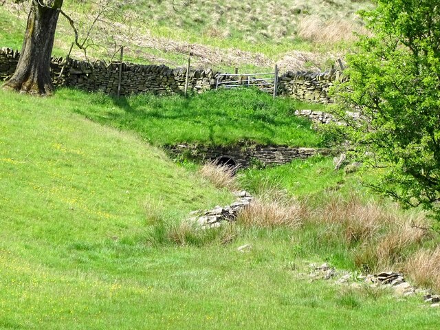
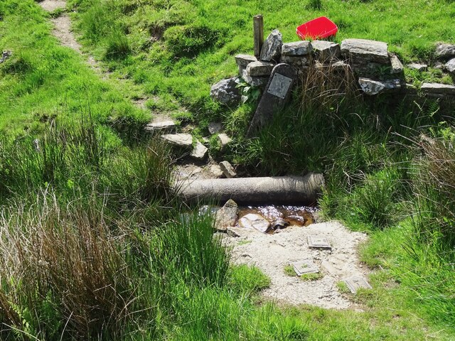
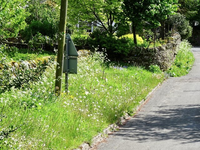
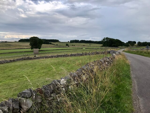
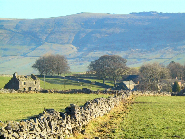
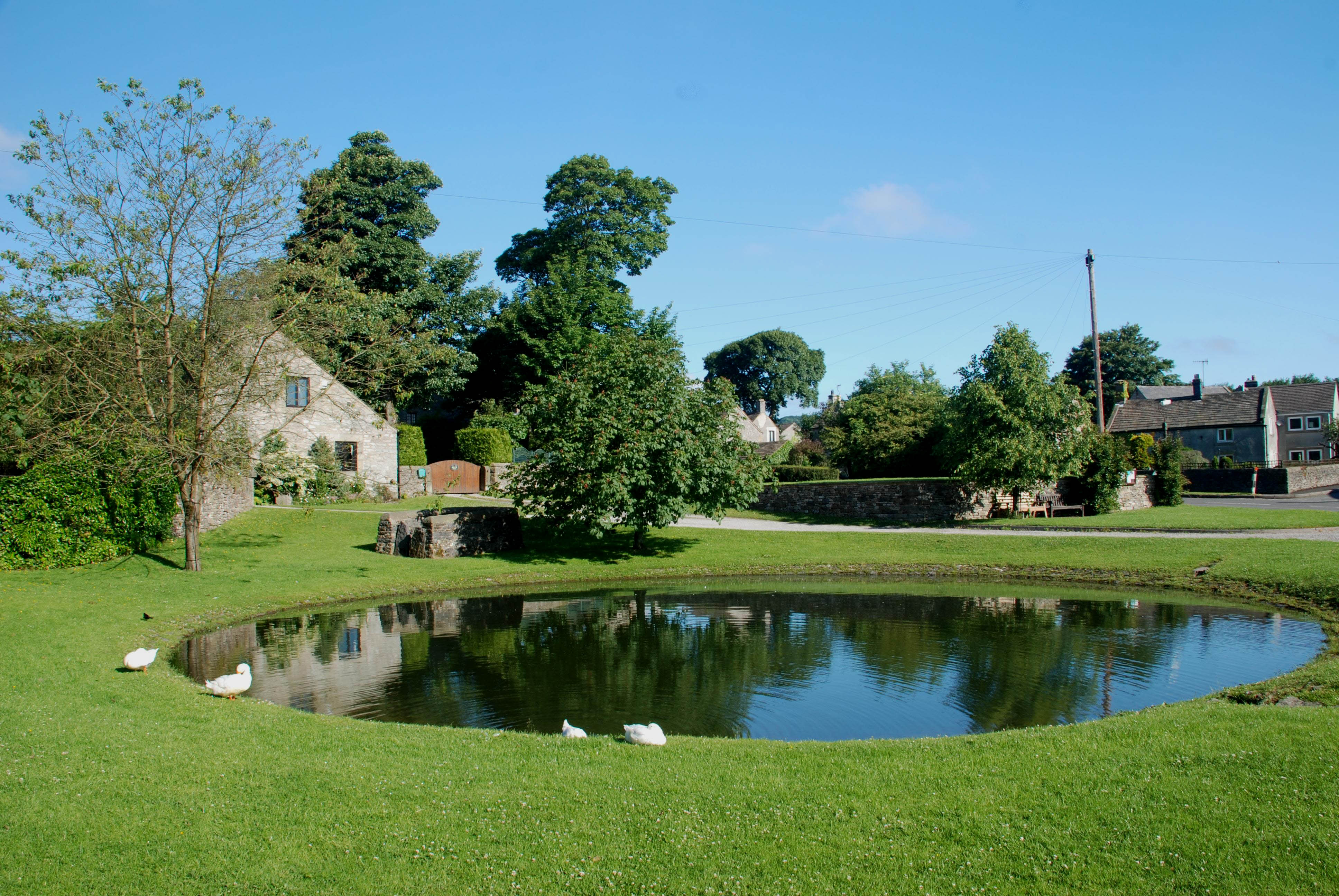
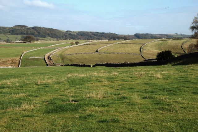
The village of Great Hucklow is nestled in a picturesque rural setting, surrounded by rolling hills and scenic landscapes. It is known for its charming stone-built houses and historic buildings, which add to its traditional English village appeal.

Great Hucklow is famous for its limestone quarrying industry, which has been a significant part of the local economy for many years. The quarry provided limestone for various construction projects, including the building of local houses and roads. Although the quarry is no longer operational, its legacy can still be seen in the village's architecture.

The village is also home to St. Mary's Church, a Grade II listed building dating back to the 13th century. The church features a beautiful medieval tower and stained glass windows, attracting visitors interested in its historical and architectural significance.

The surrounding countryside offers ample opportunities for outdoor activities such as walking, hiking, and cycling. The nearby Peak District National Park provides stunning scenery and a range of recreational activities for nature enthusiasts.

Overall, Great Hucklow is a charming village with a rich history and natural beauty, making it an attractive destination for tourists and a tranquil place to live for its residents.

If you have any feedback on the listing, please let us know in the comments section below.

Great Hucklow Images

Images are sourced within 2km of 53.294863/-1.739543 or Grid Reference SK1777. Thanks to Geograph Open Source API. All images are credited.

Pastures at Wardlow Mires, Derbyshire Powerlines running towards the village of Foolow.  Viewed from the public footpath between Wardlow Mires and Stanley House Farm.
Pastures at Wardlow Mires, Derbyshire
Powerlines running towards the village of Foolow. Viewed from the public footpath between Wardlow Mires and Stanley House Farm.
Public Footpath by Stanley House Farm, Wardlow, Derbyshire Towards Housley.
Public Footpath by Stanley House Farm, Wardlow, Derbyshire
Towards Housley.
Bretton Brook emerging from a culvert under Camphill Lane
Footpath crossing Bretton Brook
Site of a pinfold Now an extra-wide piece of roadside verge given over to wild flowers, this was once the site of a pinfold, where stray animals were held until claimed by their owners, on payment of a fee.
Site of a pinfold
Now an extra-wide piece of roadside verge given over to wild flowers, this was once the site of a pinfold, where stray animals were held until claimed by their owners, on payment of a fee.
Footpath through buttercups at Stanley Lodge
Old Unitarian chapel at Great Hucklow Closely associated with Dr Lawrence du Garde Peach who set up the celebrated Hucklow Players to bring drama to Derbyshire villages in the 1930s - he was also a noted playwright, editor and  author of a string of early Ladybird guides
Old Unitarian chapel at Great Hucklow
Closely associated with Dr Lawrence du Garde Peach who set up the celebrated Hucklow Players to bring drama to Derbyshire villages in the 1930s - he was also a noted playwright, editor and author of a string of early Ladybird guides
Lower Anchor Farm
Lower Anchor Farm
The Anchor Inn
The Anchor Inn
A623 near Lane Head The A623 is one of the main east-west roads across the Peak District. It runs for approximately 14 miles between the roundabout junction with the A6 near Chapel en le Frith (<a href="https://www.geograph.org.uk/photo/4202133">SK0779 : A6/A623 Junction near Dove Holes</a>) and Baslow where it meets the A619.
A623 near Lane Head
The A623 is one of the main east-west roads across the Peak District. It runs for approximately 14 miles between the roundabout junction with the A6 near Chapel en le Frith (SK0779 : A6/A623 Junction near Dove Holes) and Baslow where it meets the A619.
Farmland near Little Hucklow
Stone Barn next to the B6049 near Windmill
B6049 near Windmill
B6049 near Windmill
Farmland near Little Hucklow
Farm Building near Little Hucklow
Washhouse Bottom near Little Hucklow
Washhouse Bottom, south of Little Hucklow
Washhouse Bottom
Washhouse Bottom
Show me another place!

Great Hucklow is located at Grid Ref: SK1777 (Lat: 53.294863, Lng: -1.739543)

Administrative County: Derbyshire

District: Derbyshire Dales

Police Authority: Derbyshire

What 3 Words

///crabmeat.surprises.yelled. Near Tideswell, Derbyshire

Related Wikis

Little Hucklow

Little Hucklow is a village and civil parish in Derbyshire. Whilst it is a separate civil parish in the Derbyshire Dales District, the Parish Council...

Great Hucklow

Great Hucklow (Old English Hucca's burial mound) is a village and civil parish in the Derbyshire Peak District which is under Hucklow Edge between the...

Grindlow

Grindlow is a farming hamlet of a dozen or so houses that nestles under Hucklow Edge in the Derbyshire Peak District. Although it is a separate civil parish...

Coplow Dale

Coplow Dale (or Coplowdale) is a small settlement in the civil parish of Little Hucklow, Derbyshire, England. == External links == Coplow Dale at Streetmap...

Foolow

Foolow (Old English possibly for "bird hill" or "colourful hill") is a village in the Derbyshire Peak District. == Village centre == The village green...

St Hugh's Church, Foolow

St Hugh's Church, Foolow is a Grade II listed parish church in the Church of England in Foolow, Derbyshire. == History == The church was opened on 17 November...

The Three Stags' Heads

The Three Stags' Heads is a Grade II listed public house in Wardlow Mires, Derbyshire, England.On the Campaign for Real Ale's National Inventory of Historic...

Brosterfield

Brosterfield is a hamlet in Derbyshire, England. It is located close to Foolow, where the road to that village joins the A623 road.

Nearby Amenities

Located within 500m of 53.294863,-1.739543
Great Hucklow
Is In Country: UK
Is In County: Derbyshire
Place: village
Source: npe
Wikidata: Q2314796
Wikipedia: en:Great Hucklow
Lat/Long: 53.2975547/-1.7343784
Bench
Ele: 304.1405029
Lat/Long: 53.2972271/-1.7343171
Telephone
Defibrillator
Access: yes
Booth: K6
Check Date: 2023-03-09
Covered: booth
Defibrillator Location: inside red phone box, Great Hucklow
Ele: 303.4195557
Emergency: defibrillator
Indoor: no
Man Made: telephone_box
Lat/Long: 53.2972165/-1.7343474
Post Box
Ele: 303.6599121
Post Box Type: wall
Royal Cypher: GR
Royal Cypher Wikidata: Q33102273
Lat/Long: 53.2972123/-1.7342932
Bus Stop
Great Hucklow (Old Chapel)
Bus: yes
Departures Board: timetable
Ele: 303.4195557
Public Transport: platform
Shelter: no
Lat/Long: 53.2972094/-1.7342482
Pub
The Queen Anne
Ele: 305
Food: yes
Parking: yes
Real Ale: Tetley Bitter, Clarks Classic Blonde
Toilets Wheelchair: no
Wheelchair: limited
Lat/Long: 53.297934/-1.7362846
Great Hucklow Butter Cross
Ele: 304.3808594
Historic: monument
Source Name: Sign
Lat/Long: 53.2974035/-1.7351274
Bus Stop
Windmill Great Hucklow Road
Bus: yes
Ele: 295.9693604
Naptan AtcoCode: 1000DGHW3077
Naptan NaptanCode: dbsgajwp
Public Transport: platform
Lat/Long: 53.2973247/-1.7449851
Bus Stop
Windmill Great Hucklow Road
Bus: yes
Naptan AtcoCode: 1000DWCN3860
Naptan NaptanCode: dbsdgdap
Public Transport: platform
Lat/Long: 53.2972854/-1.7450828
Post Box
Ele: 298.6129150
Post Box Design: hovis
Post Box Mounting: wall
Post Box Type: lamp
Ref: SK17 18
Royal Cypher: EVIIR
Royal Cypher Wikidata: Q33102324
Lat/Long: 53.2972511/-1.7459183
Bench
Lat/Long: 53.2973457/-1.7343062
Bench
Lat/Long: 53.2974419/-1.7348641
Description: Mill Dam Lead Mine, Great Hucklow
Information: board
Tourism: information
Lat/Long: 53.2983826/-1.7365835
Barrier: stile
Material: stone
Source: survey;gps
Stile: stepover
Lat/Long: 53.2958301/-1.7330743
Barrier: stile
Material: stone
Source: survey;gps
Stile: stepover
Lat/Long: 53.2960284/-1.7339698
The Great Hucklow Cross
Information: board
Tourism: information
Lat/Long: 53.2973859/-1.7351275
Barrier: entrance
Source: survey;gps
Lat/Long: 53.2971996/-1.734023
Barrier: entrance
Source: survey;gps
Lat/Long: 53.2972091/-1.7344356
Barrier: stile
Material: stone
Source: survey;gps
Stile: stepover
Lat/Long: 53.2957117/-1.7325733
Bus Stop
Great Hucklow Lane End
Bus: yes
Naptan AtcoCode: 1000DGHG3065
Naptan NaptanCode: dbsgtgtp
Public Transport: platform
Lat/Long: 53.2933814/-1.7353128
Bus Stop
Great Hucklow Lane End
Bus: yes
Naptan AtcoCode: 1000DGHG3227
Naptan NaptanCode: dbsgtgtw
Public Transport: platform
Lat/Long: 53.293348/-1.7354449
Great Hucklow Lane End
Bus: yes
Public Transport: stop_position
Lat/Long: 53.2933815/-1.7354194
Great Hucklow Lane End
Bus: yes
Public Transport: stop_position
Lat/Long: 53.2933523/-1.7353334
Bus Stop
Great Hucklow (Old Chapel)
Bus: yes
Departures Board: timetable
Public Transport: platform
Shelter: no
Lat/Long: 53.2972945/-1.7339299
Great Hucklow (Old Chapel)
Bus: yes
Public Transport: stop_position
Lat/Long: 53.2972657/-1.7342406
Great Hucklow (Old Chapel)
Bus: yes
Public Transport: stop_position
Lat/Long: 53.2972433/-1.7339307
Windmill Great Hucklow Road
Bus: yes
Public Transport: stop_position
Lat/Long: 53.2973175/-1.7450571
Windmill Great Hucklow Road
Bus: yes
Public Transport: stop_position
Lat/Long: 53.2972997/-1.7450102
Advertising: board
Lat/Long: 53.2972072/-1.7342768
Give Way
Direction: backward
Lat/Long: 53.2935223/-1.7356589
Give Way
Direction: forward
Lat/Long: 53.2934467/-1.7357459
Stop
Direction: forward
Lat/Long: 53.2972018/-1.7337619
The data included in this document is from www.openstreetmap.org. The data is made available under ODbL.

Have you been to Great Hucklow?

Leave your review of Great Hucklow below (or comments, questions and feedback).