Gilcrux

Civil Parish in Cumberland Allerdale

England

Gilcrux

Bulgill railway station (site), Cumbria Opened in 1845 by the Maryport & Carlisle Railway on what is today the line from Barrow-in-Furness to Carlisle, this station closed to passengers in 1960 and completely in 1964. 
View north east towards Aspatria and Carlisle. The Carlisle-bound platform and main building were to the left of the line on this side of the bridge. The Maryport-bound platform was on the other side of the bridge, behind the camera position.
Bulgill railway station (site), Cumbria Credit: Nigel Thompson

Gilcrux is a civil parish located in the county of Cumberland, in the northwestern region of England. Situated about 7 miles southwest of the town of Cockermouth, it covers an area of approximately 13 square kilometers and has a population of around 400 residents.

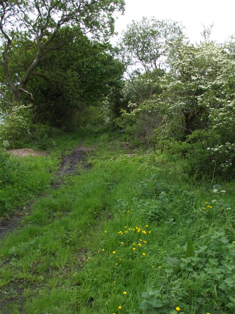
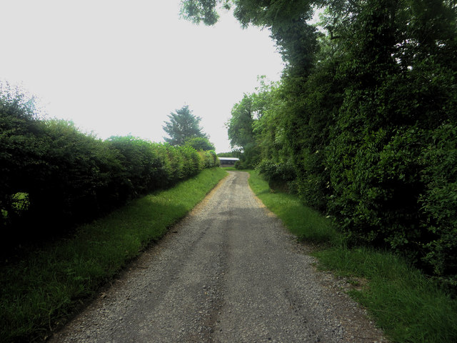
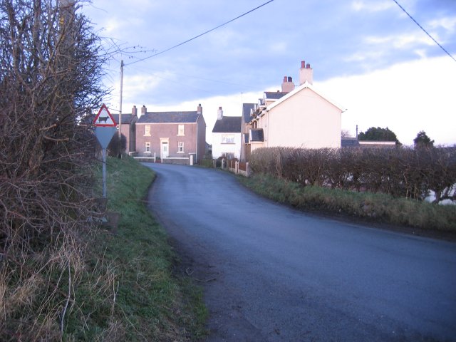
The parish is characterized by its rural landscape, with rolling hills, farmland, and scattered residential properties. It is surrounded by several other parishes, including Plumbland to the northeast, Blindcrake to the southeast, and Tallentire to the southwest.

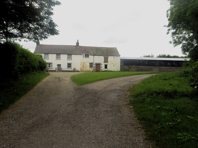
The village of Gilcrux itself serves as the main settlement within the parish. It features a small number of houses, a village hall, and a primary school, providing essential services for the local community. The village hall serves as a hub for various community activities and events throughout the year.

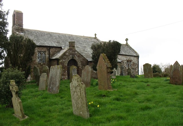
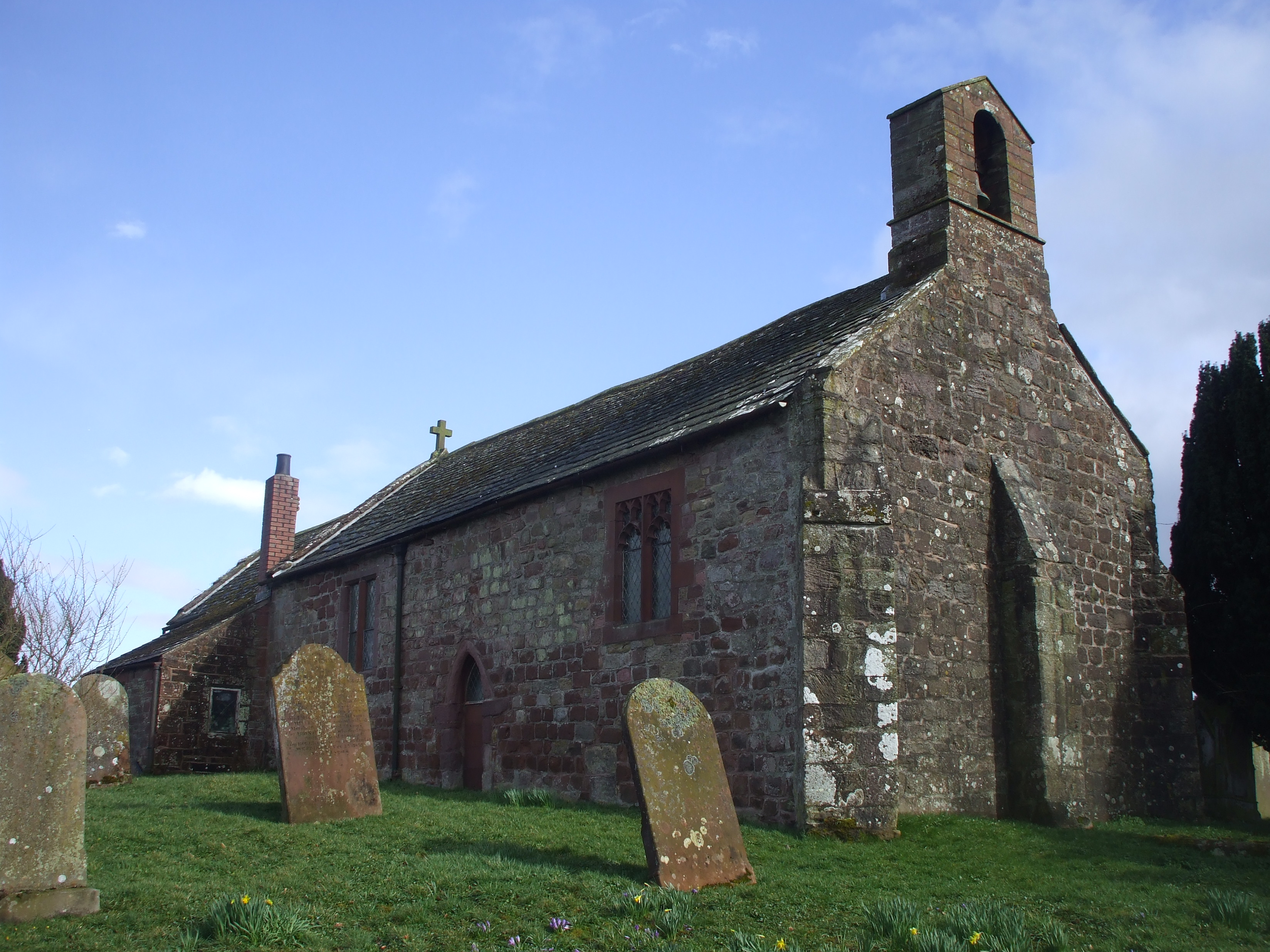
A notable feature of Gilcrux is the St. Mary's Church, which dates back to the 12th century. This historic church is known for its picturesque location and architectural beauty, attracting visitors and locals alike.

The parish enjoys a peaceful and tranquil atmosphere, making it an ideal place for those seeking a quiet countryside lifestyle. The surrounding natural beauty also offers opportunities for outdoor activities, such as hiking, cycling, and exploring the nearby Lake District National Park.

Overall, Gilcrux offers a charming rural setting, a close-knit community, and easy access to both countryside and cultural attractions, making it an attractive place to live or visit.

If you have any feedback on the listing, please let us know in the comments section below.

Gilcrux Images

Images are sourced within 2km of 54.729226/-3.380183 or Grid Reference NY1138. Thanks to Geograph Open Source API. All images are credited.

Bulgill railway station (site), Cumbria Opened in 1845 by the Maryport & Carlisle Railway on what is today the line from Barrow-in-Furness to Carlisle, this station closed to passengers in 1960 and completely in 1964. 
View north east towards Aspatria and Carlisle. The Carlisle-bound platform and main building were to the left of the line on this side of the bridge. The Maryport-bound platform was on the other side of the bridge, behind the camera position.
Bulgill railway station (site), Cumbria
Opened in 1845 by the Maryport & Carlisle Railway on what is today the line from Barrow-in-Furness to Carlisle, this station closed to passengers in 1960 and completely in 1964. View north east towards Aspatria and Carlisle. The Carlisle-bound platform and main building were to the left of the line on this side of the bridge. The Maryport-bound platform was on the other side of the bridge, behind the camera position.
Bulgill railway station (site), Cumbria Opened in 1845 by the Maryport & Carlisle Railway on what is today the line from Barrow-in-Furness to Carlisle, this station closed to passengers in 1960 and completely in 1964. 
View south west towards Dearham Bridge, Maryport and Barrow. The Maryport-bound platform was to the left of the line on this side of the bridge. The Carlisle-bound platform and main building were on the other side of the bridge, behind the camera position. The steps down to platform level can still be seen on the left.
Bulgill railway station (site), Cumbria
Opened in 1845 by the Maryport & Carlisle Railway on what is today the line from Barrow-in-Furness to Carlisle, this station closed to passengers in 1960 and completely in 1964. View south west towards Dearham Bridge, Maryport and Barrow. The Maryport-bound platform was to the left of the line on this side of the bridge. The Carlisle-bound platform and main building were on the other side of the bridge, behind the camera position. The steps down to platform level can still be seen on the left.
Farm track to Homerigg Tarmacked and classed as a minor C road for the first half a mile, this is a very narrow road, and was seriously difficult to turn around on, despite having a field gate entrance to utilise, I think I managed a 22 point turn!
Farm track to Homerigg
Tarmacked and classed as a minor C road for the first half a mile, this is a very narrow road, and was seriously difficult to turn around on, despite having a field gate entrance to utilise, I think I managed a 22 point turn!
Overgrown Bridleway to Crosby Take a machette if you're contemplating on riding or cycling down here.
Overgrown Bridleway to Crosby
Take a machette if you're contemplating on riding or cycling down here.
Farmland, Gilcrux Oil-seed rape to the west of Greengill with Criffel in the distance.
Farmland, Gilcrux
Oil-seed rape to the west of Greengill with Criffel in the distance.
Direction Sign – Signpost in Gilcrux Located on the west side of a junction in the village in Gilcrux parish. 2 arms and annulus finial. See also <a title="https://www.geograph.org.uk/photo/5005441" href="https://www.geograph.org.uk/photo/5005441">Link</a>.

Milestone Society National ID: CU_NY1137
Direction Sign – Signpost in Gilcrux
Located on the west side of a junction in the village in Gilcrux parish. 2 arms and annulus finial. See also Link. Milestone Society National ID: CU_NY1137
Direction Sign – Signpost at Greengill, near Gilcrux Located on the west side of a junction at Greengill. Gilcrux parish. 3 arms and annulus finial.

Milestone Society National ID: CU_NY1037
Direction Sign – Signpost at Greengill, near Gilcrux
Located on the west side of a junction at Greengill. Gilcrux parish. 3 arms and annulus finial. Milestone Society National ID: CU_NY1037
Fields at Grange Farm
St Mary's church, Gilcrux
Grass fields at Eweclose farm Grass fields at Eweclose farm between the farm steading and the country road to the north.
Grass fields at Eweclose farm
Grass fields at Eweclose farm between the farm steading and the country road to the north.
Track north of Eweclose farm The track which connects Eweclose farm with the outside world.
Track north of Eweclose farm
The track which connects Eweclose farm with the outside world.
Wardhall Cottages Wardhall Cottages, a couple of short rows of houses either side of the road between Gilcrux and Parsonby.
Wardhall Cottages
Wardhall Cottages, a couple of short rows of houses either side of the road between Gilcrux and Parsonby.
Postbox and signs at Wardhall Cottages A Queen Elizabeth II postbox beside a pair of signposts and a bin at Wardhall Cottages.
Postbox and signs at Wardhall Cottages
A Queen Elizabeth II postbox beside a pair of signposts and a bin at Wardhall Cottages.
Grassfield west of Grange Farm A field of grass to the west of Grange Farm.
Grassfield west of Grange Farm
A field of grass to the west of Grange Farm.
Lane to High Flatt Farm Looking along the narrow lane which leads to the farm steading at High Flatt.
Lane to High Flatt Farm
Looking along the narrow lane which leads to the farm steading at High Flatt.
House at High Flatt Farm An old stone house at High Flatt farm.
House at High Flatt Farm
An old stone house at High Flatt farm.
Country road east of Gilcrux Looking along the hedge lined country road to the east of Gilcrux.
Country road east of Gilcrux
Looking along the hedge lined country road to the east of Gilcrux.
Entrance to East House farmyard The entrance off the main road through Gilcrux into the farmyard of East House farm.
Entrance to East House farmyard
The entrance off the main road through Gilcrux into the farmyard of East House farm.
Show me another place!

Gilcrux is located at Grid Ref: NY1138 (Lat: 54.729226, Lng: -3.380183)

Administrative County: Cumbria

District: Allerdale

Police Authority: Cumbria

What 3 Words

///diamonds.dried.brave. Near Dearham, Cumbria

Nearby Locations

Gilcrux

Related Wikis

Gilcrux

Gilcrux is a small village and civil parish in the ceremonial county of Cumbria, England, and historically part of Cumberland. It is situated just outside...

Bullgill

Bullgill is a hamlet in Cumbria, England. == Geography == It is located to the northeast of Dearham, 4.3 miles (6.9 km) by road northeast of Maryport and...

Bullgill railway station

Bullgill or Bull Gill was a railway station on the Maryport and Carlisle Railway (M&CR) serving Bullgill in Cumbria. The station was opened by the M&CR...

Crosby Villa

Crosby Villa is a hamlet in the civil parish of Crosscanonby in Cumbria, United Kingdom. It is located on the A596 road, 3.75 miles (6.04 km) north-east...

Nearby Amenities

Located within 500m of 54.729226,-3.380183
Gilcrux
Place: village
Source: npe
Wikidata: Q3242661
Wikipedia: en:Gilcrux
Lat/Long: 54.7301538/-3.3744317
Bus Stop
Sea View (W bound)
Bench: no
Covered: yes
Naptan AtcoCode: 090002282768
Naptan Bearing: W
Naptan CommonName: Sea View (W bound)
Naptan Indicator: o/s
Naptan Landmark: Sea View near phone box
Naptan NaptanCode: cumadtma
Naptan Street: Village Green
Naptan Verified: no
Shelter: yes
Source: naptan_import
Lat/Long: 54.729682/-3.3756425
Sea View (N bound)
Naptan AtcoCode: 090002283794
Naptan Bearing: NE
Naptan BusStopType: CUS
Naptan CommonName: Sea View (N bound)
Naptan Indicator: near
Naptan Landmark: Nearwell House
Naptan NaptanCode: cumadtmd
Naptan Street: No name
Naptan Verified: no
Source: naptan_import
Lat/Long: 54.7296998/-3.37581
Post Box
Post Box Type: lamp
Ref: CA7 299
Royal Cypher: EIIR
Royal Cypher Wikidata: Q33102113
Lat/Long: 54.7297148/-3.3754695
Holly Cottage
Addr City: Gilcrux
Addr Postcode: CA7 2QX
Tourism: guest_house
Lat/Long: 54.7294094/-3.3769548
Defibrillator
Defibrillator Location: outside Village Hall
Emergency: defibrillator
Indoor: no
Lat/Long: 54.7304224/-3.3732982
Generator Method: photovoltaic
Generator Output Electricity: yes
Generator Source: solar
Generator Type: solar_photovoltaic_panel
Location: roof
Power: generator
Lat/Long: 54.7305352/-3.3733796
Yarling Well
Man Made: water_well
Lat/Long: 54.7297582/-3.3759741
Bench
Lat/Long: 54.7296463/-3.3756815
Historic: memorial
Memorial: plaque
Lat/Long: 54.7297484/-3.3761415
West Garth Well
Man Made: water_well
Lat/Long: 54.7284267/-3.3789197
Power: pole
Lat/Long: 54.7321427/-3.3762505
Power: pole
Lat/Long: 54.7316451/-3.3774286
Power: pole
Lat/Long: 54.7310099/-3.3789539
Power: pole
Lat/Long: 54.7303979/-3.3804236
Power: pole
Lat/Long: 54.7303836/-3.381672
Power: pole
Lat/Long: 54.7313682/-3.3825752
Power: pole
Lat/Long: 54.7305173/-3.3780673
Power: pole
Lat/Long: 54.7299885/-3.3770173
Power: pole
Lat/Long: 54.7297833/-3.3801941
Power: pole
Lat/Long: 54.7259126/-3.381767
Power: pole
Lat/Long: 54.7250365/-3.38161
The data included in this document is from www.openstreetmap.org. The data is made available under ODbL.

Have you been to Gilcrux?

Leave your review of Gilcrux below (or comments, questions and feedback).