Geldeston

Civil Parish in Norfolk South Norfolk

England

Geldeston

Serpentine wall at the White House, Barsham The wall, in conjunction with other more conventional plain walls form an enclosed garden
Serpentine wall at the White House, Barsham Credit: Adrian S Pye

Geldeston is a civil parish located in the county of Norfolk, England. It is situated on the southern bank of the River Waveney, near the border with Suffolk. The village is approximately 4 miles south of the market town of Beccles and 12 miles southwest of the city of Norwich.

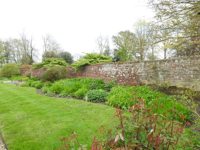
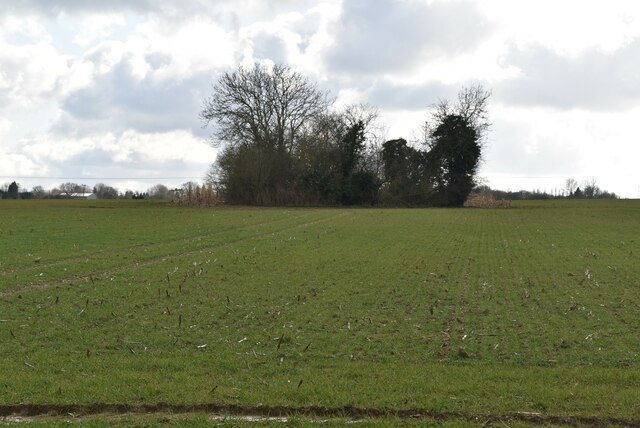
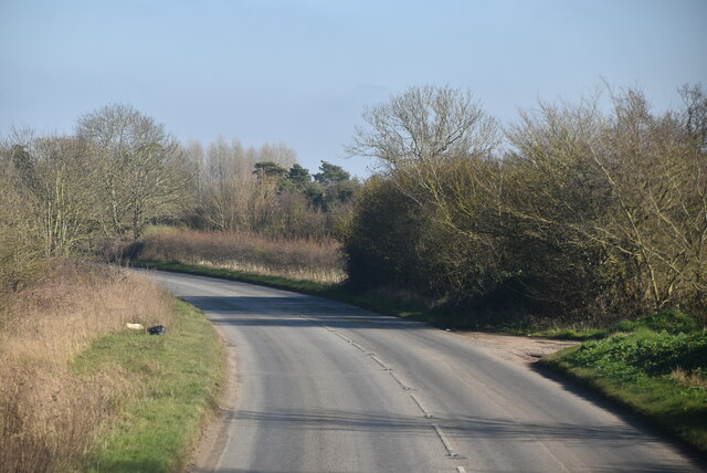
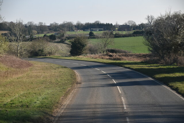
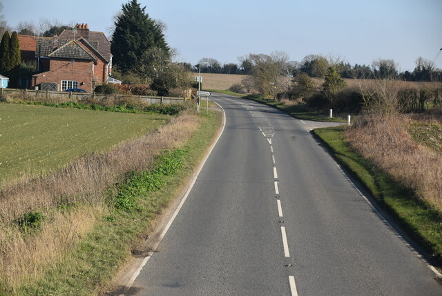
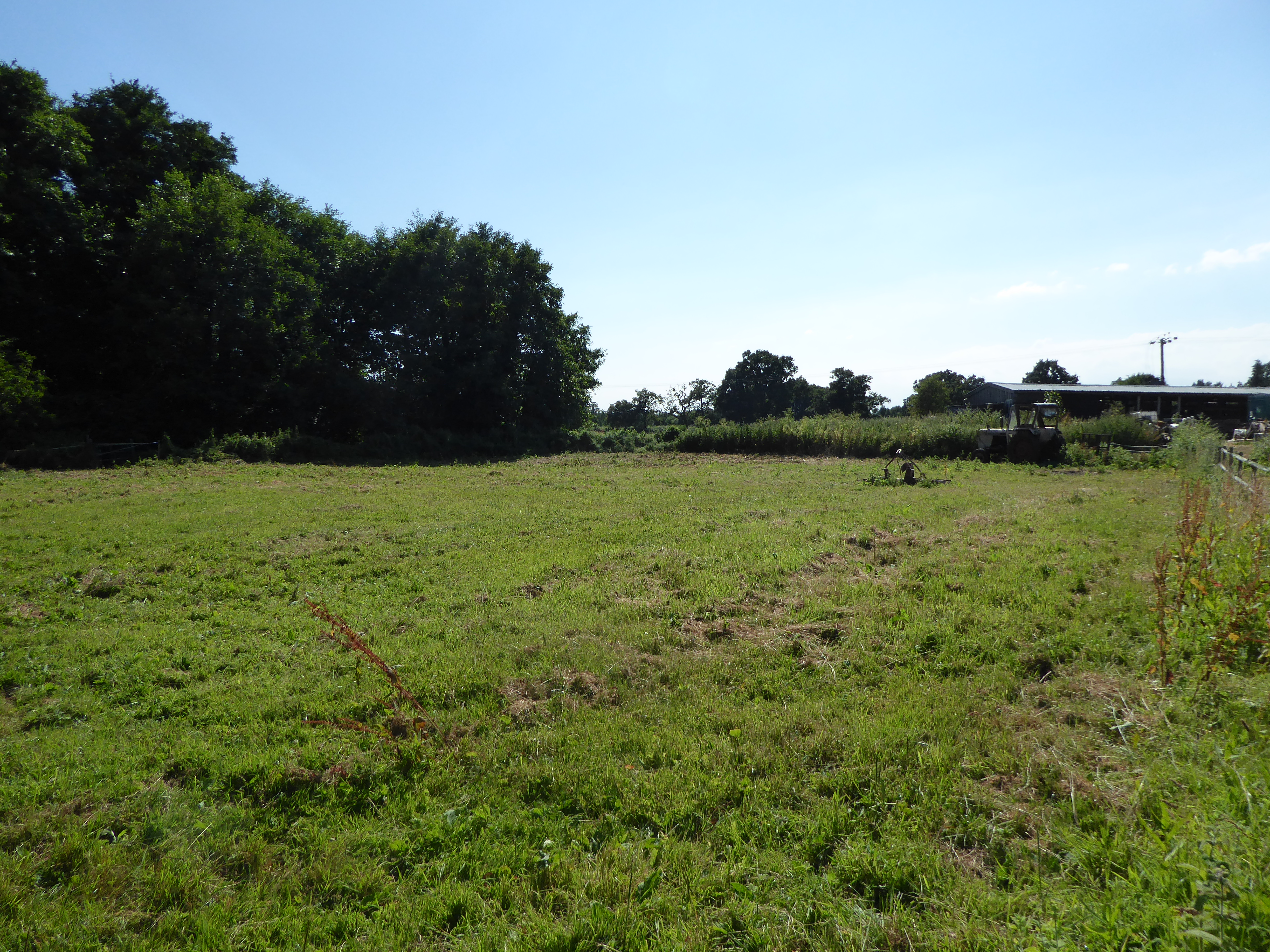
The parish covers an area of around 10 square kilometers and has a population of approximately 400 residents. Geldeston is known for its picturesque countryside, with rolling hills, lush green fields, and charming rural landscapes. The village is surrounded by farmland and has a peaceful and tranquil atmosphere.

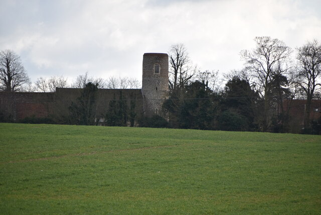
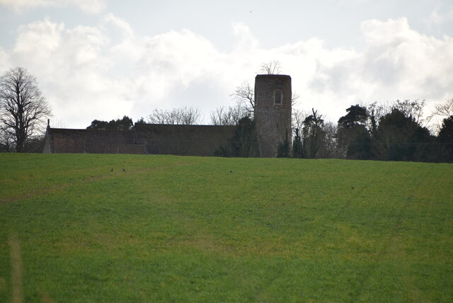
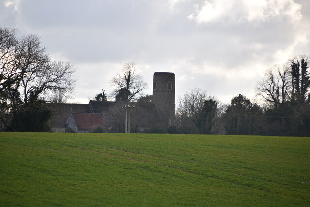
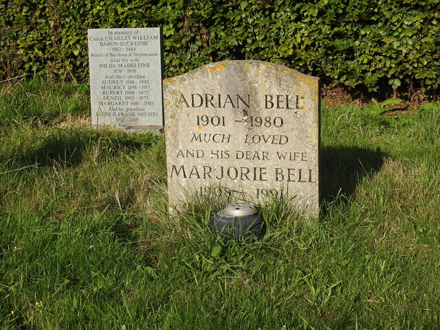
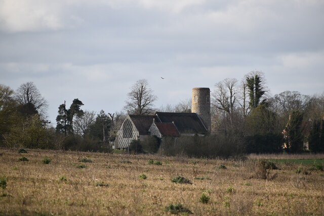
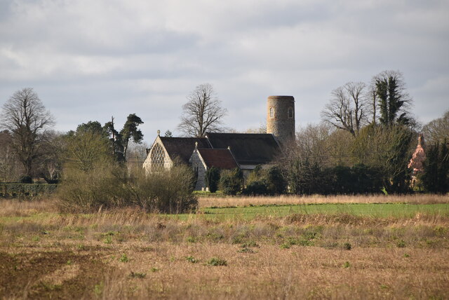
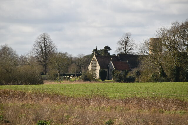
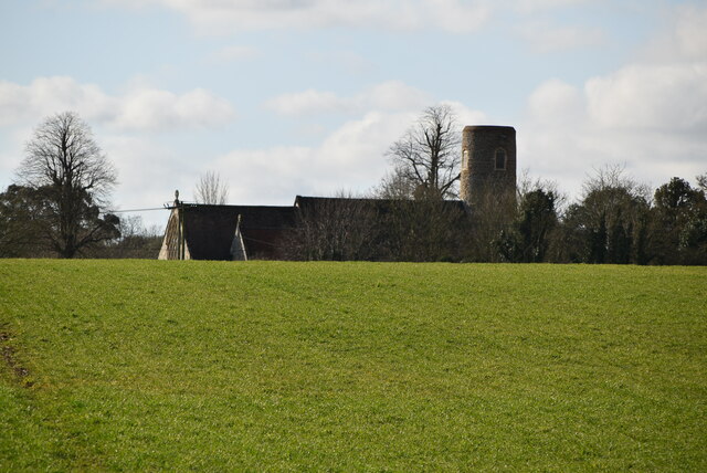
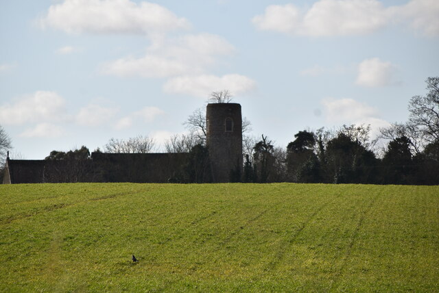
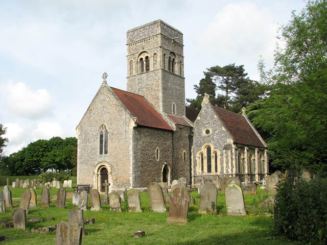
Geldeston has a rich history, dating back to medieval times. The village is mentioned in the Domesday Book of 1086, where it is recorded as "Gellestuna." The historic St. Michael's Church, built in the 13th century, is a prominent landmark in the area.

The village is home to a friendly and close-knit community. It has a village hall which hosts various events and activities throughout the year, providing a hub for social gatherings and community engagement. Geldeston also has a traditional village pub, The Locks Inn, which is popular among locals and visitors alike.

Geldeston's location on the River Waveney makes it a popular destination for boating and fishing enthusiasts. The river provides opportunities for leisurely walks and wildlife spotting. The nearby Geldeston Locks, a series of three locks on the river, are a popular spot for visitors to watch boats navigate through the waterway. Overall, Geldeston offers a charming and idyllic rural retreat in the heart of Norfolk.

If you have any feedback on the listing, please let us know in the comments section below.

Geldeston Images

Images are sourced within 2km of 52.467928/1.516429 or Grid Reference TM3891. Thanks to Geograph Open Source API. All images are credited.

Serpentine wall at the White House, Barsham The wall, in conjunction with other more conventional plain walls form an enclosed garden
Serpentine wall at the White House, Barsham
The wall, in conjunction with other more conventional plain walls form an enclosed garden
Wooded pond
Wooded pond
Church of Holy Trinity Grade I listed. <span class="nowrap"><a title="https://historicengland.org.uk/listing/the-list/list-entry/1032028" rel="nofollow ugc noopener" href="https://historicengland.org.uk/listing/the-list/list-entry/1032028">Link</a><img style="margin-left:2px;" alt="External link" title="External link - shift click to open in new window" src="https://s1.geograph.org.uk/img/external.png" width="10" height="10"/></span> 
<span class="nowrap"><a title="http://www.suffolkchurches.co.uk/barsham.html" rel="nofollow ugc noopener" href="http://www.suffolkchurches.co.uk/barsham.html">Link</a><img style="margin-left:2px;" alt="External link" title="External link - shift click to open in new window" src="https://s1.geograph.org.uk/img/external.png" width="10" height="10"/></span>
Church of Holy Trinity
Grade I listed. LinkExternal link LinkExternal link
Holy Trinity Church Grade I listed. <span class="nowrap"><a title="https://historicengland.org.uk/listing/the-list/list-entry/1032028" rel="nofollow ugc noopener" href="https://historicengland.org.uk/listing/the-list/list-entry/1032028">Link</a><img style="margin-left:2px;" alt="External link" title="External link - shift click to open in new window" src="https://s1.geograph.org.uk/img/external.png" width="10" height="10"/></span> 
<span class="nowrap"><a title="http://www.suffolkchurches.co.uk/barsham.html" rel="nofollow ugc noopener" href="http://www.suffolkchurches.co.uk/barsham.html">Link</a><img style="margin-left:2px;" alt="External link" title="External link - shift click to open in new window" src="https://s1.geograph.org.uk/img/external.png" width="10" height="10"/></span>
Holy Trinity Church
Grade I listed. LinkExternal link LinkExternal link
Grave of Adrian and Marjorie Bell Barsham Holy Trinity churchyard.

At the age of 19 he explored the countryside in Hundon, Suffolk, to learn about agriculture, and he farmed in various locations over the next sixty years, ending up at Crake Hall at Barsham <a title="https://www.geograph.org.uk/photo/2157926" href="https://www.geograph.org.uk/photo/2157926">Link</a> , until his death. His first book, Corduroy was an immediate best-seller and was followed by two more books on the countryside, Silver Ley in 1931 and The Cherry Tree in 1932, the three books forming a ruralist farm trilogy. He wrote the "Countryman’s Notebook" column in the Eastern Daily Press from 1950, and produced over twenty other books on the countryside, including Apple Acre (1942), Sunrise to Sunset (1944), The Budding Morrow (1946), The Flower and the Wheel (1949), Music in the Morning, (1954), A Suffolk Harvest (1956), the autobiographical My Own Master (1961) and The Green Bond (1976). Between 1930 and 1978, he set around 5,000 puzzles for The Times, and is credited with helping to establish its distinctive cryptic clue style.
Grave of Adrian and Marjorie Bell
Barsham Holy Trinity churchyard. At the age of 19 he explored the countryside in Hundon, Suffolk, to learn about agriculture, and he farmed in various locations over the next sixty years, ending up at Crake Hall at Barsham Link , until his death. His first book, Corduroy was an immediate best-seller and was followed by two more books on the countryside, Silver Ley in 1931 and The Cherry Tree in 1932, the three books forming a ruralist farm trilogy. He wrote the "Countryman’s Notebook" column in the Eastern Daily Press from 1950, and produced over twenty other books on the countryside, including Apple Acre (1942), Sunrise to Sunset (1944), The Budding Morrow (1946), The Flower and the Wheel (1949), Music in the Morning, (1954), A Suffolk Harvest (1956), the autobiographical My Own Master (1961) and The Green Bond (1976). Between 1930 and 1978, he set around 5,000 puzzles for The Times, and is credited with helping to establish its distinctive cryptic clue style.
Holy Trinity Church Grade I listed. <span class="nowrap"><a title="https://historicengland.org.uk/listing/the-list/list-entry/1032028" rel="nofollow ugc noopener" href="https://historicengland.org.uk/listing/the-list/list-entry/1032028">Link</a><img style="margin-left:2px;" alt="External link" title="External link - shift click to open in new window" src="https://s1.geograph.org.uk/img/external.png" width="10" height="10"/></span> 
<span class="nowrap"><a title="http://www.suffolkchurches.co.uk/barsham.html" rel="nofollow ugc noopener" href="http://www.suffolkchurches.co.uk/barsham.html">Link</a><img style="margin-left:2px;" alt="External link" title="External link - shift click to open in new window" src="https://s1.geograph.org.uk/img/external.png" width="10" height="10"/></span>
Holy Trinity Church
Grade I listed. LinkExternal link LinkExternal link
Holy Trinity Church <span class="nowrap"><a title="https://en.wikipedia.org/wiki/Barsham,_Suffolk" rel="nofollow ugc noopener" href="https://en.wikipedia.org/wiki/Barsham,_Suffolk">Link</a><img style="margin-left:2px;" alt="External link" title="External link - shift click to open in new window" src="https://s1.geograph.org.uk/img/external.png" width="10" height="10"/></span>
Holy Trinity Church
Entering Shipmeadow, B1062 <span class="nowrap"><a title="https://www.sabre-roads.org.uk/wiki/index.php?title=B1062" rel="nofollow ugc noopener" href="https://www.sabre-roads.org.uk/wiki/index.php?title=B1062">Link</a><img style="margin-left:2px;" alt="External link" title="External link - shift click to open in new window" src="https://s1.geograph.org.uk/img/external.png" width="10" height="10"/></span>
Entering Shipmeadow, B1062
Entering Barsham, B1062 <span class="nowrap"><a title="https://www.sabre-roads.org.uk/wiki/index.php?title=B1062" rel="nofollow ugc noopener" href="https://www.sabre-roads.org.uk/wiki/index.php?title=B1062">Link</a><img style="margin-left:2px;" alt="External link" title="External link - shift click to open in new window" src="https://s1.geograph.org.uk/img/external.png" width="10" height="10"/></span>
Entering Barsham, B1062
Show me another place!

Geldeston is located at Grid Ref: TM3891 (Lat: 52.467928, Lng: 1.516429)

Administrative County: Norfolk

District: South Norfolk

Police Authority: Norfolk

What 3 Words

///liquid.dress.retract. Near Beccles, Suffolk

Nearby Locations

Dockeney Geldeston

Related Wikis

Geldeston

Geldeston is a village and civil parish in the English county of Norfolk. The village is located 2.5 miles (4.0 km) north-west of Beccles and 14 miles...

Geldeston railway station

Geldeston (also Geldeston Halt) was a station on the Waveney Valley Line serving the village of Geldeston, Norfolk. It was operational for passenger services...

Geldeston Meadows

Geldeston Meadows is a 14-hectare (35-acre) biological Site of Special Scientific Interest near Geldeston in Norfolk. It is part of the Broadland Ramsar...
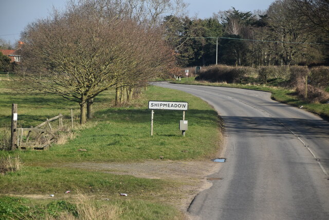
Shipmeadow

Shipmeadow is a village and civil parish located in the north of the English county of Suffolk. It is in the East Suffolk district, 2.5 miles (4.0 km)...

Leet Hill, Kirby Cane

Leet Hill, Kirby Cane is a 6.5-hectare (16-acre) geological Site of Special Scientific Interest in Kirby Cane in Norfolk. It is a Geological Conservation...
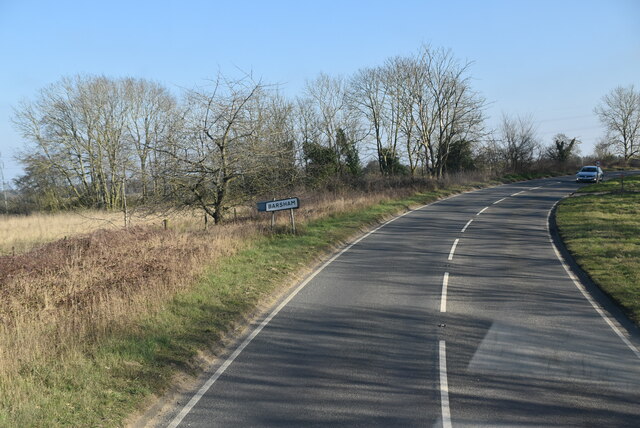
Barsham, Suffolk

Barsham is a village and civil parish in the East Suffolk district of the English county of Suffolk. It is about 2 miles (3.2 km) west of Beccles, south...

Haughey Air AgustaWestland AW139 crash

On 13 March 2014, an AgustaWestland AW139 helicopter of Haughey Air crashed shortly after taking off at night in fog from Gillingham, Norfolk, United Kingdom...

Gillingham, Norfolk

Gillingham ( GHIL-ing-əm) is a small village and civil parish in the English county of Norfolk. The villages is located 1.5 miles (2.4 km) north-west...

Nearby Amenities

Located within 500m of 52.467928,1.516429
Post Box
Collection Times: Mo-Fr 09:00; Sa 07:00
Operator: Royal Mail
Post Box Mounting: pier
Post Box Type: lamp
Ref: NR34 3412D
Royal Cypher: EIIR
Royal Cypher Wikidata: Q33102113
Lat/Long: 52.4703914/1.5133723
Post Box
Collection Times: Mo-Fr 16:30; Sa 10:15
Operator: Royal Mail
Post Box Mounting: wall
Post Box Type: lamp
Ref: NR34 3425
Royal Cypher: EIIR
Royal Cypher Wikidata: Q33102113
Lat/Long: 52.4723975/1.5165811
Entrance: yes
Lat/Long: 52.4636076/1.5168995
Access: yes
Barrier: lift_gate
Lift Gate Type: single
Material: metal
Lat/Long: 52.4652791/1.5165904
Geldeston
Historic Railway: station
Railway: site
Source: OS 1:25k
Wikidata: Q5530399
Wikipedia: en:Geldeston railway station
Lat/Long: 52.4707417/1.513016
Entrance: main
Lat/Long: 52.4636267/1.5170524
FIXME: Incomplete
Lat/Long: 52.4639327/1.516365
Note: Just to help tension the end of the line
Power: pole
Lat/Long: 52.4713102/1.5137435
Location Transition: yes
Power: pole
Lat/Long: 52.4713379/1.5135625
Power: pole
Lat/Long: 52.4706403/1.5181142
Power: pole
Lat/Long: 52.4704409/1.5198818
Power: pole
Lat/Long: 52.4702563/1.521644
Information: guidepost
Tourism: information
Lat/Long: 52.4638251/1.5167537
Parking
Access: yes
Fee: no
Note: No overnight parking
Parking: surface
Smoothness: good
Supervised: no
Surface: ground
Lat/Long: 52.4654041/1.5164526
Waste Basket
Colour: blue
Inscription: Dog waste only
Waste: dog_excrement
Lat/Long: 52.4697406/1.5128608
Geldeston Village Hall
Board Type: notice
Information: board
Tourism: information
Lat/Long: 52.4697457/1.5127826
Waste Basket
Colour: red
Inscription: Dog waste only
Waste: dog_excrement
Lat/Long: 52.4724028/1.5164519
Waste Basket
Waste: trash
Lat/Long: 52.4724102/1.5164405
The data included in this document is from www.openstreetmap.org. The data is made available under ODbL.

Have you been to Geldeston?

Leave your review of Geldeston below (or comments, questions and feedback).