Foulness

Civil Parish in Essex Rochford

England

Foulness

Houses near Courtsend The houses and other buildings in this area east of Courtsend was known by the rather fanciful name of White City!
Houses near Courtsend Credit: Trevor Harris

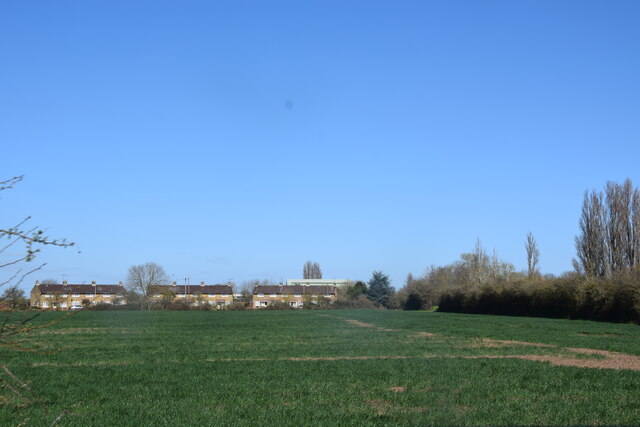
Foulness is a civil parish located on the island of Foulness in Essex, England. It is situated in the Thames Estuary, approximately 10 miles east of Southend-on-Sea. The island is accessible via a single road, known as the Broomway, which is submerged during high tide, making it a unique and isolated location.

The civil parish covers an area of approximately 12 square miles and has a population of around 200 people. It is predominantly used for military purposes and is home to the Foulness Island Range, a military testing site owned by the Ministry of Defence. The range has been in operation since the late 19th century and is used for testing explosives and weapons systems.

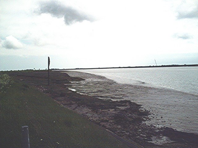
Foulness Island is known for its vast and diverse wildlife. The island is a designated Site of Special Scientific Interest (SSSI) due to its importance for breeding and overwintering birds. It is also home to rare plant species and provides a habitat for various mammals and insects.

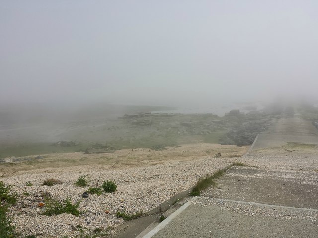
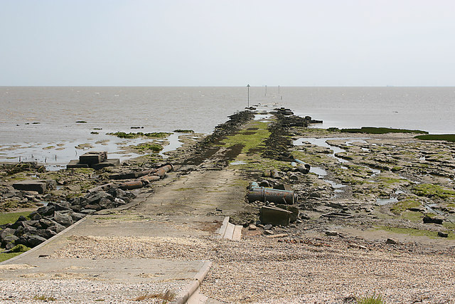
The island has a rich history dating back thousands of years. It was mentioned in the Domesday Book of 1086 and has been inhabited since the Neolithic period. Throughout its history, Foulness has been affected by coastal erosion and flooding, leading to the construction of sea defenses.

Due to its military nature and limited access, Foulness remains a remote and tranquil location. The island offers a unique opportunity for those seeking solitude and a connection with nature in a truly unspoiled environment.

If you have any feedback on the listing, please let us know in the comments section below.

Foulness Images

Images are sourced within 2km of 51.590653/0.936757 or Grid Reference TR0392. Thanks to Geograph Open Source API. All images are credited.

Houses near Courtsend The houses and other buildings in this area east of Courtsend was known by the rather fanciful name of White City!
Houses near Courtsend
The houses and other buildings in this area east of Courtsend was known by the rather fanciful name of White City!
The northern end of The Broomway Until the 1920's the only way onto Foulness - apart from by boat - was on this byway known as The Broomway (from the way it was marked in the past)- obviously at low tide only! From here at Fisherman's Head, it goes across the mud until it reaches an area of firm sand over half a kilometre from the shore. There it turns southwest and runs parallel to the shore for about six miles until it reaches land at Wakering Stairs. There are (or were) paths to the west to other spots on Foulness - Eastwick Head, Rugwood Head, Asplins Head and Shelford Head.
The northern end of The Broomway
Until the 1920's the only way onto Foulness - apart from by boat - was on this byway known as The Broomway (from the way it was marked in the past)- obviously at low tide only! From here at Fisherman's Head, it goes across the mud until it reaches an area of firm sand over half a kilometre from the shore. There it turns southwest and runs parallel to the shore for about six miles until it reaches land at Wakering Stairs. There are (or were) paths to the west to other spots on Foulness - Eastwick Head, Rugwood Head, Asplins Head and Shelford Head.
Looking north from Fisherman's Head Towards Northern Corner. Behind the seawall and outside of the fenced MoD area, Foulness locals including have created a wildlife area.
Looking north from Fisherman's Head
Towards Northern Corner. Behind the seawall and outside of the fenced MoD area, Foulness locals including have created a wildlife area.
Seawall and borrowdyke north of Fisherman's Head View north to Northern Corner.
Seawall and borrowdyke north of Fisherman's Head
View north to Northern Corner.
Fisherman's Head A fret rolls in on a light easterly breeze and a flooding tide over the northernmost causeway linking the Broomway to Foulness Island. The very poor visibility here when the rest of the island is bathed in warm sunshine is a stark reminder of the danger presented to the foolhardy by this unforgiving shore
Fisherman's Head
A fret rolls in on a light easterly breeze and a flooding tide over the northernmost causeway linking the Broomway to Foulness Island. The very poor visibility here when the rest of the island is bathed in warm sunshine is a stark reminder of the danger presented to the foolhardy by this unforgiving shore
Fisherman's Head, Foulness Contrast this with the view obtained just a month before. See <a href="https://www.geograph.org.uk/photo/5809124">TR0392 : Fisherman's Head</a>
Fisherman's Head, Foulness
Contrast this with the view obtained just a month before. See TR0392 : Fisherman's Head
View of seawall south-west from Fisherman's Head, Foulness
Sea shore north-east of Fisherman's Head, Foulness
View north from Fisherman's Head, Foulness The watery area seen here is a man-made 'scrape' constructed to attract nesting birds.
View north from Fisherman's Head, Foulness
The watery area seen here is a man-made 'scrape' constructed to attract nesting birds.
The Broomway The Broomway is a track (a Public Right of Way) over Maplin Sands which provides access between Foulness Island and Great Wakering via Wakering Stairs. It was the only means of access, other than by boat, between the island and the mainland until the 20th century. 

It is accessible only at low tides, and is bordered by dangerous soft muddy sands, some of which act as quicksand. Over the years many people have died on The Broomway, either due to the incoming tide or by being caught by quicksand. The Broomway is connected to Foulness and the mainland by a series of constructed hards or headways over the soft sand.

In older times the track was marked by a series of stakes, which resembled upturned brooms, hence the name "The Broomway". 

Although the track is a Public Right of Way - parts are classified as Byway Open to All Traffic, others as Public Footpath - access is controlled by the Ministry of Defence which has a large installation on Foulness. Access can be suspended at any time.

Guided tours of The Broomway are available from Nature Break Wildlife Cruises <span class="nowrap"><a title="http://www.wildlifetrips.org.uk/" rel="nofollow ugc noopener" href="http://www.wildlifetrips.org.uk/">Link</a><img style="margin-left:2px;" alt="External link" title="External link - shift click to open in new window" src="https://s1.geograph.org.uk/img/external.png" width="10" height="10"/></span>
The Broomway
The Broomway is a track (a Public Right of Way) over Maplin Sands which provides access between Foulness Island and Great Wakering via Wakering Stairs. It was the only means of access, other than by boat, between the island and the mainland until the 20th century. It is accessible only at low tides, and is bordered by dangerous soft muddy sands, some of which act as quicksand. Over the years many people have died on The Broomway, either due to the incoming tide or by being caught by quicksand. The Broomway is connected to Foulness and the mainland by a series of constructed hards or headways over the soft sand. In older times the track was marked by a series of stakes, which resembled upturned brooms, hence the name "The Broomway". Although the track is a Public Right of Way - parts are classified as Byway Open to All Traffic, others as Public Footpath - access is controlled by the Ministry of Defence which has a large installation on Foulness. Access can be suspended at any time. Guided tours of The Broomway are available from Nature Break Wildlife Cruises LinkExternal link
The Broomway - Fishermans Head This headway leads from Foulness Island to the Broomway.
The Broomway - Fishermans Head
This headway leads from Foulness Island to the Broomway.
Track along the sea wall Track, and public footpath, running just inside the sea wall on Foulness Island. Note also the borrow dyke to the left.
Track along the sea wall
Track, and public footpath, running just inside the sea wall on Foulness Island. Note also the borrow dyke to the left.
Foulness Island seawall Taken in the pouring rain
Foulness Island seawall
Taken in the pouring rain
Foulness Lookout Tower Five of these along the coastline, beginning at Great Wakering.
Foulness Lookout Tower
Five of these along the coastline, beginning at Great Wakering.
The former Kings Head, Courtsend, Foulness Courtsend was the second largest settlement on the island (after Churchend). Into the 1990's it had its own pub - this building now a private house, then called the Kings Head. Following the death of the last landlord at the end of the 90's, it closed.
The former Kings Head, Courtsend, Foulness
Courtsend was the second largest settlement on the island (after Churchend). Into the 1990's it had its own pub - this building now a private house, then called the Kings Head. Following the death of the last landlord at the end of the 90's, it closed.
Show me another place!

Foulness is located at Grid Ref: TR0392 (Lat: 51.590653, Lng: 0.936757)

Administrative County: Essex

District: Rochford

Police Authority: Essex

What 3 Words

///chew.enough.heightens. Near Burnham-on-Crouch, Essex

Nearby Locations

Foulness Fisherman's Head

Related Wikis

Foulness SSSI

Foulness SSSI is a 10,702 hectare biological Site of Special Scientific Interest covering the shoreline between Southend-on-Sea and the Crouch estuary...

Foulness Island

Foulness Island () is a closed island on the east coast of Essex in England, which is separated from the mainland by narrow creeks. In the 2001 census...

Saint Mary the Virgin, Foulness Island

Saint Mary the Virgin is a parish of the Church of England on Foulness Island, in Essex, England. Before the 15th century, the island of Foulness was divided...

River Crouch

The River Crouch is a small river that flows entirely through the English county of Essex. The distance of the Navigation between Holliwell Point which...

Have you been to Foulness?

Leave your review of Foulness below (or comments, questions and feedback).