Fishlake

Civil Parish in Yorkshire Doncaster

England

Fishlake

Canal north of Kirkhouse Green Road National Cycle Network route 62 runs along the towpath beside New Junction Canal.
Canal north of Kirkhouse Green Road Credit: DS Pugh

Fishlake is a civil parish located in the East Riding of Yorkshire, England. Situated approximately 12 miles northeast of Doncaster, it covers an area of about 11 square miles. The small village is nestled between the River Don to the north and the A614 road to the south.

Fishlake has a rich historical background, with evidence of human settlement dating back to the Bronze Age. The village is mentioned in the Domesday Book of 1086, highlighting its long-standing presence in the region. The local landscape is characterized by flat, fertile land, making it an ideal location for agriculture.

With a population of around 700 residents, Fishlake is a close-knit community that has managed to preserve its rural charm. The village is home to a 12th-century church, St. Cuthbert's, which is a notable architectural landmark. The church features a unique octagonal spire and is surrounded by a picturesque churchyard.

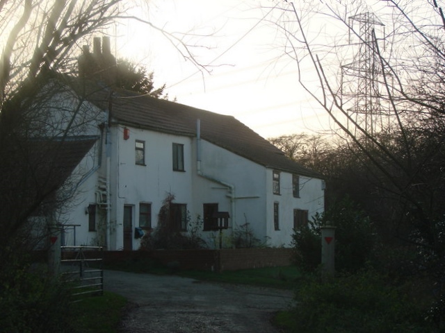
The parish also boasts several historic buildings, including traditional cottages and farmhouses that showcase the area's traditional architectural style. The local economy relies primarily on agriculture, with farming being the main occupation for many residents. In recent years, Fishlake has also seen an increase in tourism, as visitors are drawn to its scenic beauty and historical attractions.

Fishlake offers a peaceful and tranquil environment, perfect for those seeking a quiet escape from the bustling city life. The village provides basic amenities such as a primary school, a village hall, and a post office, ensuring that residents have access to essential services. Overall, Fishlake is a charming and idyllic countryside retreat that encapsulates the beauty and heritage of Yorkshire.

If you have any feedback on the listing, please let us know in the comments section below.

Fishlake Images

Images are sourced within 2km of 53.620356/-1.023554 or Grid Reference SE6414. Thanks to Geograph Open Source API. All images are credited.

Canal north of Kirkhouse Green Road National Cycle Network route 62 runs along the towpath beside New Junction Canal.
Canal north of Kirkhouse Green Road
National Cycle Network route 62 runs along the towpath beside New Junction Canal.
Westfield Bridge House National Cycle Network route 62 runs along the towpath beside New Junction Canal.
Westfield Bridge House
National Cycle Network route 62 runs along the towpath beside New Junction Canal.
Canal near Westfield Bridge House National Cycle Network route 62 runs along the towpath beside New Junction Canal.
Canal near Westfield Bridge House
National Cycle Network route 62 runs along the towpath beside New Junction Canal.
Across New Junction Canal National Cycle Network route 62 runs along the towpath beside New Junction Canal.
Across New Junction Canal
National Cycle Network route 62 runs along the towpath beside New Junction Canal.
Towpath north of Westfield Bridge House National Cycle Network route 62 runs along the towpath beside New Junction Canal.
Towpath north of Westfield Bridge House
National Cycle Network route 62 runs along the towpath beside New Junction Canal.
Towpath beside New Junction Canal National Cycle Network route 62 runs along the towpath beside New Junction Canal.
Towpath beside New Junction Canal
National Cycle Network route 62 runs along the towpath beside New Junction Canal.
Canal near Smallhedge Farm National Cycle Network route 62 runs along the towpath beside New Junction Canal.
Canal near Smallhedge Farm
National Cycle Network route 62 runs along the towpath beside New Junction Canal.
Towpath near Smallhedge Farm National Cycle Network route 62 runs along the towpath beside New Junction Canal.
Towpath near Smallhedge Farm
National Cycle Network route 62 runs along the towpath beside New Junction Canal.
Powerlines crossing New Junction Canal National Cycle Network route 62 runs along the towpath beside New Junction Canal.
Powerlines crossing New Junction Canal
National Cycle Network route 62 runs along the towpath beside New Junction Canal.
Moored boat south of Sykehouse Lock Bridge National Cycle Network route 62 runs along the towpath beside New Junction Canal.
Moored boat south of Sykehouse Lock Bridge
National Cycle Network route 62 runs along the towpath beside New Junction Canal.
Sheffield and South Yorkshire Navigation at Stainforth
New Inn, Stainforth The New Inn at Stainforth is situated on the bank of the Stainforth and Keadby Canal.
New Inn, Stainforth
The New Inn at Stainforth is situated on the bank of the Stainforth and Keadby Canal.
St.Cuthbert's church, Fishlake Largely a Perpendicular church indicating how prosperous Fishlake was in the late medieval period. Enter through an extravagantly carved Norman south doorway and you're immediately drawn to a sumptuous 14th century font. A wonderful church !
St.Cuthbert's church, Fishlake
Largely a Perpendicular church indicating how prosperous Fishlake was in the late medieval period. Enter through an extravagantly carved Norman south doorway and you're immediately drawn to a sumptuous 14th century font. A wonderful church !
South Doorway, St.Cuthbert's church The richly carved south door at St.Cuthbert's church in Fishlake. It is late Norman c1200 with depictions of virtues fighting vices, pairs of seated figures, animals and an assortment of grotesques.
South Doorway, St.Cuthbert's church
The richly carved south door at St.Cuthbert's church in Fishlake. It is late Norman c1200 with depictions of virtues fighting vices, pairs of seated figures, animals and an assortment of grotesques.
Tomb of Richard Marshall Richard Marshall was vicar of Fishlake 1496 - 1505, his tomb is in the chancel built during his ministry.
Tomb of Richard Marshall
Richard Marshall was vicar of Fishlake 1496 - 1505, his tomb is in the chancel built during his ministry.
Decorated Gothic East window The splendid chancel east window of St.Cuthbert's church, Fishlake. Late Decorated in style c1360 with seven tall lights and flowing tracery.
Decorated Gothic East window
The splendid chancel east window of St.Cuthbert's church, Fishlake. Late Decorated in style c1360 with seven tall lights and flowing tracery.
Green Track Although not signed as such this green track appears to be a byway.
Green Track
Although not signed as such this green track appears to be a byway.
Severe Pruning These mature trees by the side of the road just east of Fishlake have received a good pruning.
Severe Pruning
These mature trees by the side of the road just east of Fishlake have received a good pruning.
Show me another place!

Fishlake is located at Grid Ref: SE6414 (Lat: 53.620356, Lng: -1.023554)

Division: West Riding

Administrative County: South Yorkshire

District: Doncaster

Police Authority: South Yorkshire

What 3 Words

///lasted.pastime.sinkhole. Near Stainforth, South Yorkshire

Nearby Locations

Mill Field Fishlake

Related Wikis

Fishlake

Fishlake is a village and civil parish in the Metropolitan Borough of Doncaster. It was historically part of the West Riding of Yorkshire until 1974....

Stainforth railway station

Stainforth railway station was a station on the South Yorkshire Railway's line between Doncaster and Thorne, serving the town of Stainforth, South Yorkshire...

Stainforth, South Yorkshire

Stainforth () is a town and civil parish in the City of Doncaster, in South Yorkshire, England. It is around 7 miles (11 km) north-east of Doncaster, close...

Topham, South Yorkshire

Topham is a small rural hamlet upon the River Went in rural Yorkshire within the Metropolitan Borough of Doncaster in northern England. The hamlet runs...
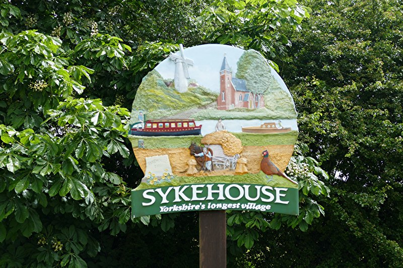
Sykehouse

Sykehouse is a village and civil parish in the City of Doncaster, South Yorkshire, England, on the border with the East Riding of Yorkshire. It was part...

Hatfield Colliery

Hatfield Colliery, also known as Hatfield Main Colliery, was a colliery in the South Yorkshire Coalfield, mining the High Hazel coal seam. The colliery...

Snaith and Pollington railway station

Snaith and Pollington railway station was a station on the Hull and Barnsley and Great Central Joint Railway between Sykehouse and Carlton. It was built...

Sykehouse railway station

Sykehouse railway station was a station on the Hull and Barnsley and Great Central Joint Railway between Thorpe-in-Balne and Snaith and Pollington. It...

Nearby Amenities

Located within 500m of 53.620356,-1.023554
Fishlake Mill
Addr City: Doncaster
Addr Country: GB
Addr Postcode: DN7 5LH
Addr Street: East Field Road
Fhrs Id: 366711
Tourism: guest_house
Lat/Long: 53.6184441/-1.0212191
The data included in this document is from www.openstreetmap.org. The data is made available under ODbL.

Have you been to Fishlake?

Leave your review of Fishlake below (or comments, questions and feedback).