Fenton

Civil Parish in Lincolnshire South Kesteven

England

Fenton

Stubble field and Stanger's Plantation
Stubble field and Stanger's Plantation Credit: Jonathan Thacker

Fenton is a civil parish located in the county of Lincolnshire, in the eastern part of England. It is situated approximately 5 miles west of the market town of Spilsby and covers an area of around 3 square miles. The parish is predominantly rural, with a small population of around 200 residents.

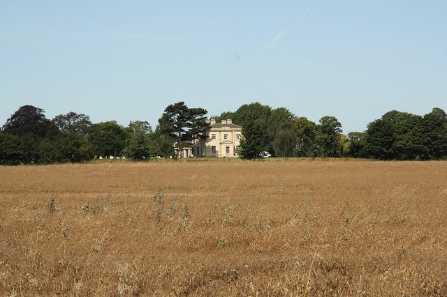
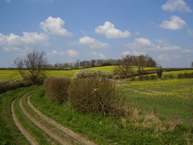
Fenton is characterized by its picturesque countryside, featuring rolling hills, meadows, and farmland. The landscape is dotted with traditional cottages and farmhouses, giving the area a charming and idyllic feel. The parish is surrounded by several other small villages, creating a close-knit rural community.

The village of Fenton itself is small but has a rich history. It is home to a historic church, St. Peter's Church, which dates back to the 12th century. The church is known for its beautiful Norman architecture and is a popular spot for visitors interested in history and architecture.

In terms of amenities, Fenton is fairly limited. There is no school or shop within the parish boundaries, but residents have easy access to nearby villages for their daily needs. The community is served by regular bus services that connect Fenton to neighboring towns and villages.

Overall, Fenton offers a peaceful and picturesque setting, ideal for those seeking a quiet and rural lifestyle. Its proximity to larger towns provides access to additional amenities, while its rich history and beautiful landscapes make it an attractive destination for nature lovers and history enthusiasts.

If you have any feedback on the listing, please let us know in the comments section below.

Fenton Images

Images are sourced within 2km of 53.04926/-0.682122 or Grid Reference SK8851. Thanks to Geograph Open Source API. All images are credited.

Stubble field and Stanger's Plantation
Footpath to Stubton Gorse
Public footpath near Stubton This farm road goes to a private airstrip running left to right on the horizon. The footpath goes to Fenton.
Public footpath near Stubton
This farm road goes to a private airstrip running left to right on the horizon. The footpath goes to Fenton.
Lake at Gorse Lodge, near Stubton Gorse Lodge is actually in <a href="https://www.geograph.org.uk/gridref/SK8849">SK8849</a> but the majority of this lake, the field beyond and the woodland, Stubton Gorse are in the featured square. There is a clay pigeon shooting ground here.
Lake at Gorse Lodge, near Stubton
Gorse Lodge is actually in SK8849 but the majority of this lake, the field beyond and the woodland, Stubton Gorse are in the featured square. There is a clay pigeon shooting ground here.
Ploughed field at Gorse Lodge
Fulbeck Kart Circuit This is a shot of the last corner of the Fulbeck Kart Circuit, which is operated by Lincolnshire Kart Racing Club. An excellent and challenging circuit. <span class="nowrap"><a title="http://www.motorsport-central.co.uk/fulbeckcircuit_61.html" rel="nofollow ugc noopener" href="http://www.motorsport-central.co.uk/fulbeckcircuit_61.html">Link</a><img style="margin-left:2px;" alt="External link" title="External link - shift click to open in new window" src="https://s1.geograph.org.uk/img/external.png" width="10" height="10"/></span>
Fulbeck Kart Circuit
This is a shot of the last corner of the Fulbeck Kart Circuit, which is operated by Lincolnshire Kart Racing Club. An excellent and challenging circuit. LinkExternal link
Entrance to Stubton Hill Farm
Footpath to Stubton Gorse
Track to Stubton Gorse
View towards Stubton Gorse
Farm track near Stubton
Moor Farm Cottages
Moor Farm Cottages
Fenton Road Leaving Stubton towards Fenton, with curious different coloured spheres on the power lines
Fenton Road
Leaving Stubton towards Fenton, with curious different coloured spheres on the power lines
Stubble field and Stanger's Plantation
Sown field near Stubton Fenton Boundary Plantation on the right.
Sown field near Stubton
Fenton Boundary Plantation on the right.
Bridleway to Stubton Gorse
Bridleway to Stubton Gorse The maize on the left grown for game food/cover. Pheasants and partridges are abundant here.
Bridleway to Stubton Gorse
The maize on the left grown for game food/cover. Pheasants and partridges are abundant here.
Bridleway near Stubton
Show me another place!

Fenton is located at Grid Ref: SK8851 (Lat: 53.04926, Lng: -0.682122)

Administrative County: Lincolnshire

District: South Kesteven

Police Authority: Lincolnshire

What 3 Words

///blush.gearbox.bumps. Near Claypole, Lincolnshire

Nearby Locations

Fenton

Related Wikis

Fenton, South Kesteven

Fenton is a village in the South Kesteven district of Lincolnshire, England. It is situated 14 miles (23 km) south-west from the city and county town of...
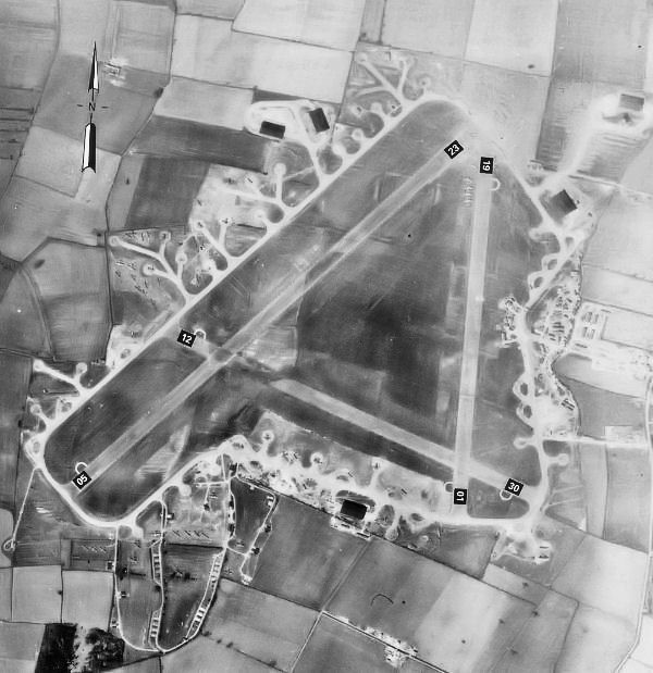
RAF Fulbeck

Royal Air Force Fulbeck or more simply RAF Fulbeck is a former Royal Air Force station located 6.3 miles (10.1 km) east of Newark-on-Trent, Nottinghamshire...

Stubton

Stubton is a small village and civil parish in the South Kesteven district of Lincolnshire, England. The population of the civil parish (including Fenton...

All Saints' Church, Barnby in the Willows

All Saints' Church, Barnby in the Willows, is a Grade I listed parish church in the Church of England in Barnby in the Willows. == History == The church...

Barnby in the Willows

Barnby in the Willows is a village and civil parish in the Newark and Sherwood district of Nottinghamshire, England, just east of Newark-on-Trent. According...

Beckingham, Lincolnshire

Beckingham is a village and civil parish in the North Kesteven district of Lincolnshire, England. The population of the civil parish (including Stapleford...

Stragglethorpe

Stragglethorpe is a village in the civil parish of Brant Broughton with Stragglethorpe, in the North Kesteven district of Lincolnshire, England. The village...

Loveden

Loveden is a deanery of the Diocese of Lincoln, England, and a former wapentake.Loveden is located broadly to the North of Grantham and includes the villages...

Nearby Amenities

Located within 500m of 53.04926,-0.682122
Ele: 14.3052979
Lat/Long: 53.0521853/-0.6777701
Ele: 14.0649414
Lat/Long: 53.0513085/-0.6785506
Generator Method: photovoltaic
Generator Output Electricity: yes
Generator Source: solar
Generator Type: solar_photovoltaic_panel
Location: roof
Power: generator
Lat/Long: 53.0485028/-0.687347
Generator Method: photovoltaic
Generator Output Electricity: yes
Generator Source: solar
Generator Type: solar_photovoltaic_panel
Location: roof
Power: generator
Lat/Long: 53.0489465/-0.6889872
Generator Method: photovoltaic
Generator Output Electricity: yes
Generator Source: solar
Generator Type: solar_photovoltaic_panel
Location: roof
Power: generator
Lat/Long: 53.0474163/-0.6876246
Generator Method: photovoltaic
Generator Output Electricity: yes
Generator Source: solar
Generator Type: solar_photovoltaic_panel
Location: roof
Power: generator
Lat/Long: 53.047476/-0.6868012
Generator Method: photovoltaic
Generator Output Electricity: yes
Generator Source: solar
Generator Type: solar_photovoltaic_panel
Location: roof
Power: generator
Lat/Long: 53.0477275/-0.6866939
The data included in this document is from www.openstreetmap.org. The data is made available under ODbL.

Have you been to Fenton?

Leave your review of Fenton below (or comments, questions and feedback).