Eyam

Civil Parish in Derbyshire Derbyshire Dales

England

Eyam

Sir William Hill trig
Sir William Hill trig Credit: Alex McGregor

Eyam is a civil parish located in the Derbyshire Dales district of Derbyshire, England. Situated in the Peak District National Park, it lies approximately 15 miles southwest of Sheffield and 24 miles northwest of Derby. Eyam is a small village with a population of around 900 residents.

The village is known for its rich history, particularly the significant role it played during the outbreak of the bubonic plague in 1665. Eyam voluntarily chose to isolate itself from the neighboring communities in order to prevent the spread of the disease. This self-imposed quarantine lasted for over a year, resulting in the deaths of around 260 villagers, nearly three-quarters of the population at the time. The village is now known as the "Plague Village" and attracts visitors interested in its unique history.

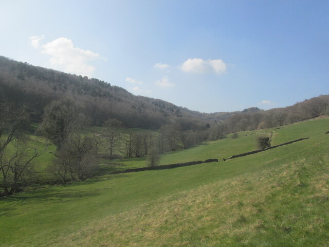
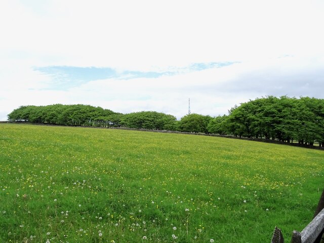
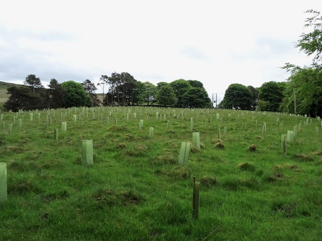
Eyam is surrounded by picturesque countryside and offers stunning views of the surrounding hills and valleys. The village is characterized by its traditional stone-built houses and historic buildings, such as Eyam Hall, a Jacobean manor house that is open to the public. The village also boasts a medieval church, St. Lawrence's Church, which dates back to the 12th century and features a number of interesting architectural features.

In terms of amenities, Eyam has a primary school, a post office, a village shop, and a few pubs and cafes. It also has a strong community spirit and hosts various events and festivals throughout the year. The village is popular with tourists who come to explore its history, enjoy the scenic beauty of the Peak District, and experience the tranquil atmosphere of this unique village.

If you have any feedback on the listing, please let us know in the comments section below.

Eyam Images

Images are sourced within 2km of 53.292374/-1.677254 or Grid Reference SK2177. Thanks to Geograph Open Source API. All images are credited.

Sir William Hill trig
Black Harry Lane A steep climb out of Middleton Dale.
Black Harry Lane
A steep climb out of Middleton Dale.
Darlton Quarry One of several disused quarries in Middleton Dale. The quarry is shaded from the low winter sun but White Edge above Froggatt Edge is glowing in the distance.
Darlton Quarry
One of several disused quarries in Middleton Dale. The quarry is shaded from the low winter sun but White Edge above Froggatt Edge is glowing in the distance.
Out  of  Stoney  Middleton  on  the  A623  through  Middleton  Dale
Out of Stoney Middleton on the A623 through Middleton Dale
Turn  right  for  Eyam.  Junction  on  A623
Turn right for Eyam. Junction on A623
Eyam  Post  Office
Eyam Post Office
St  Lawrence  Parish  Church  and  War  Memorial
St Lawrence Parish Church and War Memorial
Saxon  Cross  in  Eyam  Churchyard. Early  9th Century Pevsner states that it is notable for the survival of the cross head, unfortunately the top two feet or so of the shaft are missing
Saxon Cross in Eyam Churchyard. Early 9th Century
Pevsner states that it is notable for the survival of the cross head, unfortunately the top two feet or so of the shaft are missing
Church of St Lawrence Grade II* listed parish church dating from the 13th century. 
The church contains several items relating to the plague of 1665-6 for which the village of Eyam is famous, notably the Plague Register listing the 260 people who died during the 14 months of the plague.
Church of St Lawrence
Grade II* listed parish church dating from the 13th century. The church contains several items relating to the plague of 1665-6 for which the village of Eyam is famous, notably the Plague Register listing the 260 people who died during the 14 months of the plague.
Celtic Cross in Eyam churchyard The cross is believed to date from the 8th century
Celtic Cross in Eyam churchyard
The cross is believed to date from the 8th century
Mag  Clough Quiet, secluded side valley.
Mag Clough
Quiet, secluded side valley.
Highfield Belt Highfield Belt is a narrow belt of woodland which has been here since at least 1842, when the Ordnance Survey First Series map was surveyed. It partially encircles the remains of Broadlow Lead Mine.
Highfield Belt
Highfield Belt is a narrow belt of woodland which has been here since at least 1842, when the Ordnance Survey First Series map was surveyed. It partially encircles the remains of Broadlow Lead Mine.
Top Twelve Meers' Mine The remains of one of many former lead mines in the area. Marked on some maps as "Twelve Meers' Mine" but known as "Top" to distinguish it from "Old Twelve Meers' Mine", which was nearby. A meer was a unit of length of 29, 31 or 32 yards, depending on the time and place, used in the Derbyshire lead mining industry.
Top Twelve Meers' Mine
The remains of one of many former lead mines in the area. Marked on some maps as "Twelve Meers' Mine" but known as "Top" to distinguish it from "Old Twelve Meers' Mine", which was nearby. A meer was a unit of length of 29, 31 or 32 yards, depending on the time and place, used in the Derbyshire lead mining industry.
Replanting Big Moor Plantation Until recently, "Big Moor Plantation" was a meaningless label for a largely empty field. This has now been rectified with the planting of new saplings.
Replanting Big Moor Plantation
Until recently, "Big Moor Plantation" was a meaningless label for a largely empty field. This has now been rectified with the planting of new saplings.
Eyam Mechanics Institute and Village Hall Built as the Mechanics Institute to provide a range of adult education opportunities and now as the Village Hall caters for a wide range of community events
Eyam Mechanics Institute and Village Hall
Built as the Mechanics Institute to provide a range of adult education opportunities and now as the Village Hall caters for a wide range of community events
The Riley Graves Eyam the famous Plague village in Derbyshire has on its outskirts this walled area that contains a number of graves of the Riley family who died during the time of the plague.
The Riley Graves
Eyam the famous Plague village in Derbyshire has on its outskirts this walled area that contains a number of graves of the Riley family who died during the time of the plague.
Eyam, St Lawrence
Eyam, St Lawrence
Aspen trees and suckers This valley has a surprising concentration of aspen trees in a few places. There are very many suckers (clone shoots on tree roots) in the foreground which possibly owe their survival to a reduction in sheep grazing in recent years. The three tall trees are all aspens and perhaps grew up from suckers of a much older tree.
Aspen trees and suckers
This valley has a surprising concentration of aspen trees in a few places. There are very many suckers (clone shoots on tree roots) in the foreground which possibly owe their survival to a reduction in sheep grazing in recent years. The three tall trees are all aspens and perhaps grew up from suckers of a much older tree.
Show me another place!

Eyam is located at Grid Ref: SK2177 (Lat: 53.292374, Lng: -1.677254)

Administrative County: Derbyshire

District: Derbyshire Dales

Police Authority: Derbyshire

What 3 Words

///bulk.harmlessly.myth. Near Hathersage, Derbyshire

Related Wikis

Jumber Brook

Jumber Brook is a stream in Eyam in the Derbyshire Peak District. The stream originates to the north of the village at Highcliffe. The brook flows south...

Eyam Museum

Eyam Museum or as it is locally known Eyam Plague museum is a local museum in the village of Eyam, located in the Peak District, Derbyshire, England....

Mompesson's Well

Mompesson's Well is a 17th-century grade II listed water well in Eyam, Derbyshire. == History == The well is named for Church of England priest William...

St Lawrence's Church, Eyam

St Lawrence’s Church, Eyam is a Grade II* listed parish church in the Church of England in Eyam, Derbyshire. == History == The church is medieval with...
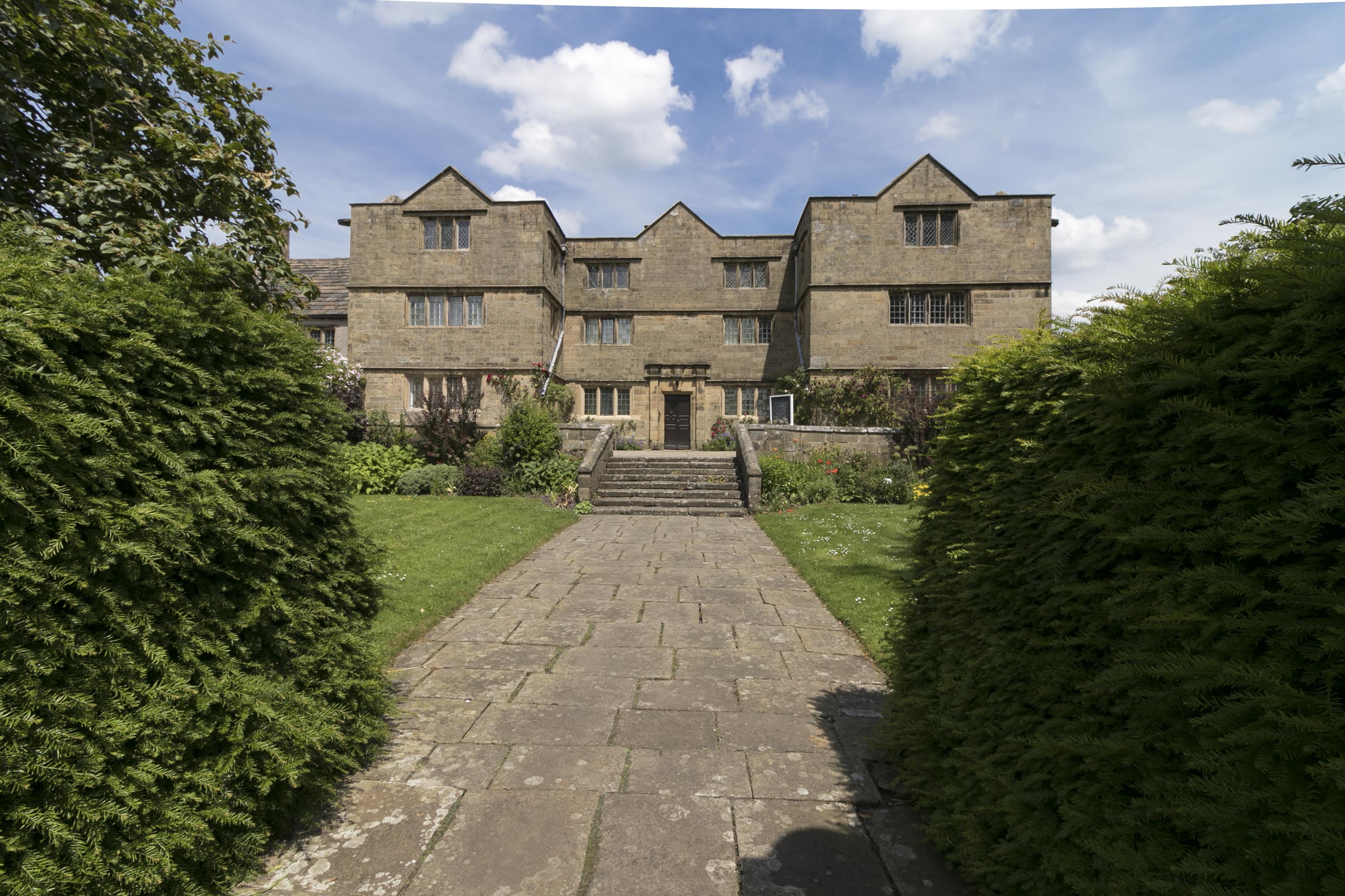
Eyam Hall

Eyam Hall is a country house within the civil parish of Eyam, Derbyshire, located to the west of St Lawrence's Church, Eyam. It is recorded in the National...

Eyam

Eyam ( ) is an English village and civil parish in the Derbyshire Dales that lies within the Peak District National Park. There is evidence of early occupation...
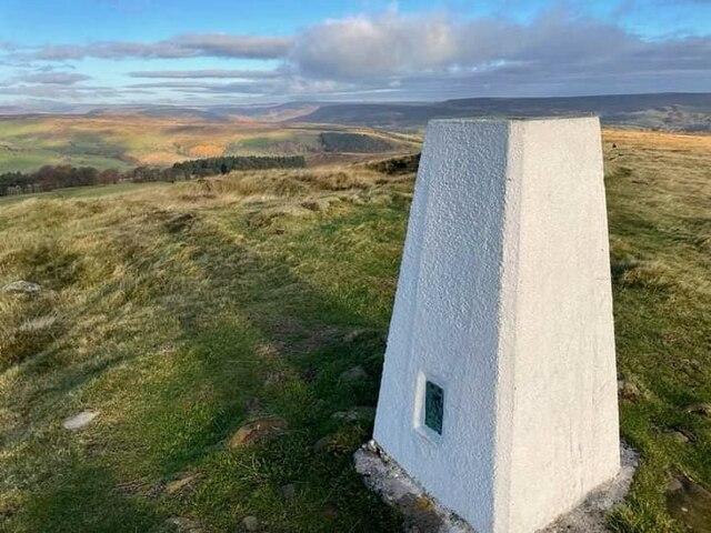
Eyam Moor

Eyam Moor is a plateau-topped hill between the villages of Eyam and Hathersage in Derbyshire, in the Peak District of England. The summit of Sir William...

Riley Graveyard

Riley Graveyard is a 17th-century grade II listed cemetery in Eyam, Derbyshire. == History == The cemetery, on the outskirts of Eyam, contains the graves...

Nearby Amenities

Located within 500m of 53.292374,-1.677254
Barrier: stile
Foot: yes
Material: stone
Stile: stepover
Lat/Long: 53.2917809/-1.6754727
Ford: yes
Lat/Long: 53.2927109/-1.6798779
Barrier: stile
Foot: yes
Lat/Long: 53.292658/-1.6796344
Waterway: waterfall
Lat/Long: 53.292687/-1.679869
Man Made: tower
Lat/Long: 53.2962865/-1.6778498
Bench
Source: survey;gps
Lat/Long: 53.2885734/-1.6773645
Watering Place
Lat/Long: 53.2936408/-1.6805922
Bench
Backrest: no
Lat/Long: 53.2931121/-1.6844939
Direction: 157
Tourism: viewpoint
Lat/Long: 53.2931099/-1.6844533
The data included in this document is from www.openstreetmap.org. The data is made available under ODbL.

Have you been to Eyam?

Leave your review of Eyam below (or comments, questions and feedback).