Erringden

Civil Parish in Yorkshire Calderdale

England

Erringden

Bridgegate
Bridgegate Credit: Alex McGregor

Erringden is a civil parish located in the county of Yorkshire, England. It is situated within the metropolitan borough of Calderdale and covers an area of approximately 9.7 square kilometers. The parish is located in the hilly southern part of the borough, bordering the districts of Hebden Bridge and Mytholmroyd.

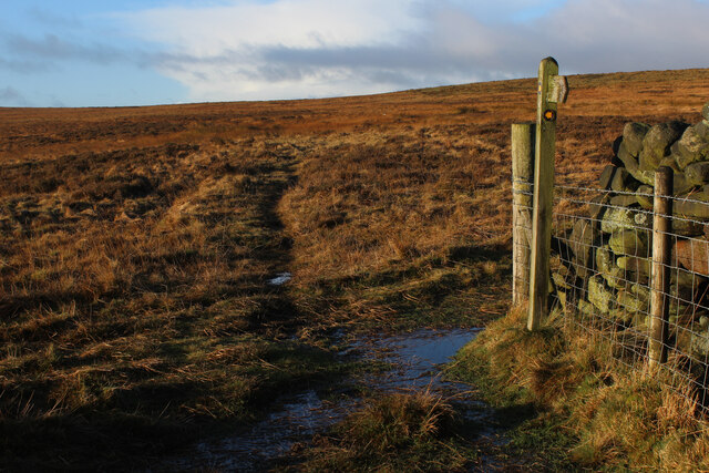
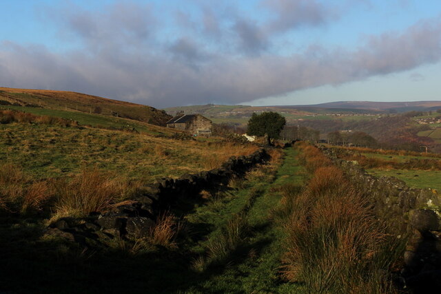
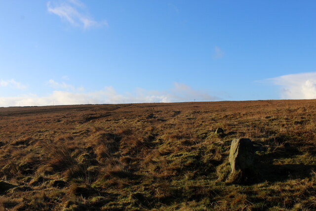
Erringden is known for its picturesque landscapes, characterized by rolling hills, moorland, and dense woodland. The parish is part of the South Pennines, an area renowned for its natural beauty and has been designated as an Area of Outstanding Natural Beauty (AONB). The hilly terrain provides ample opportunities for outdoor activities such as hiking, cycling, and birdwatching.

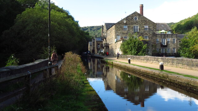
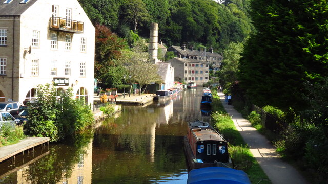
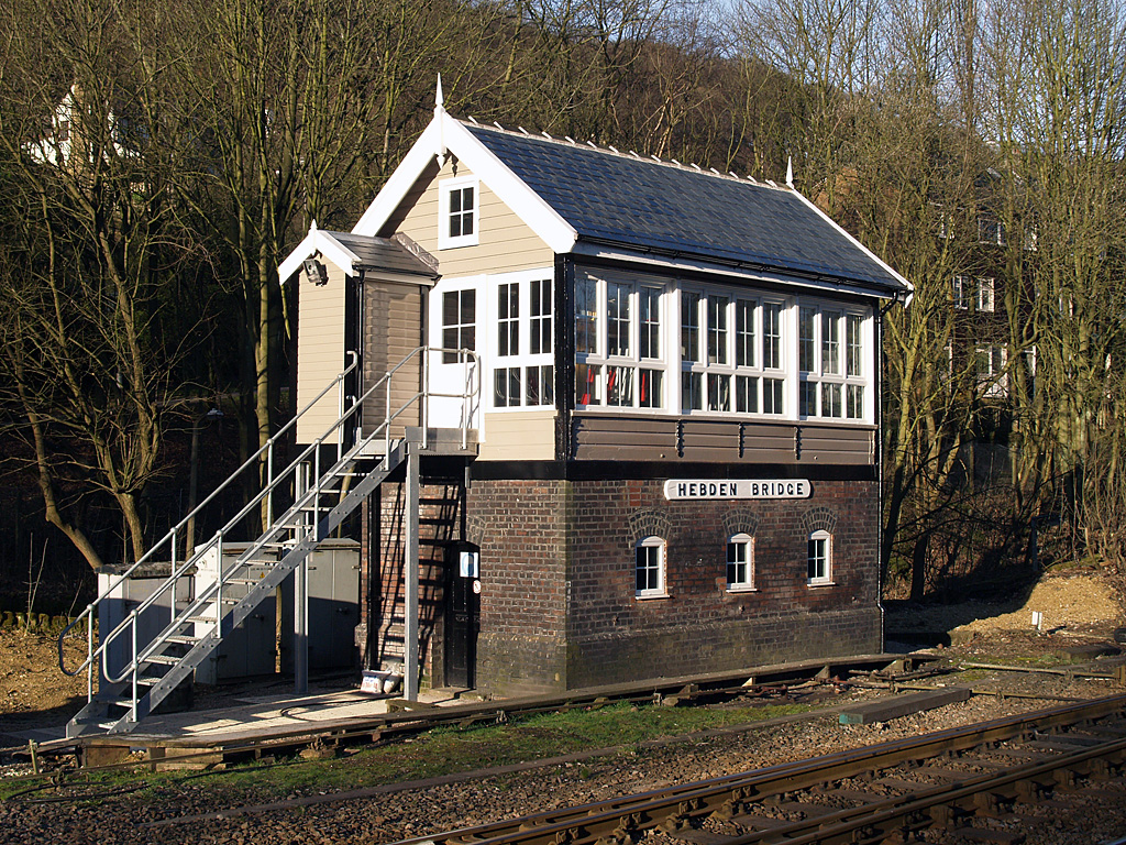
The parish is sparsely populated, with a small number of villages and hamlets scattered throughout the area. The largest settlement within Erringden is the village of Hebden Bridge, which lies on the banks of the River Calder. Hebden Bridge is a vibrant and bustling town, known for its independent shops, art galleries, and cultural events. The town attracts visitors from far and wide, drawn to its bohemian atmosphere and picturesque setting.

Erringden has a rich history, with evidence of human habitation dating back to prehistoric times. The area was heavily influenced by the textile industry during the Industrial Revolution, and remnants of mills and industrial buildings can still be seen today. The parish is also home to a number of historic landmarks, including ancient stone circles, burial mounds, and traditional Yorkshire stone houses.

In summary, Erringden is a rural civil parish in Yorkshire, characterized by its stunning landscapes, charming villages, and rich history. It is a haven for outdoor enthusiasts and offers a unique blend of natural beauty and cultural heritage.

If you have any feedback on the listing, please let us know in the comments section below.

Erringden Images

Images are sourced within 2km of 53.728474/-2.029826 or Grid Reference SD9825. Thanks to Geograph Open Source API. All images are credited.

Bridgegate
Bridgegate
The White Swan
The White Swan
Shoulder Of Mutton
Shoulder Of Mutton
Canal lock
Canal lock
Canal view
Canal view
The Flying Saucer at Hebden Bridge Cafe and studio in old canal warehouse
The Flying Saucer at Hebden Bridge
Cafe and studio in old canal warehouse
Halifax Road at Calderside View from rail line on Whiteley Arches
Halifax Road at Calderside
View from rail line on Whiteley Arches
Oakville Road at Calderside View from Rochdale to Leeds railway
Oakville Road at Calderside
View from Rochdale to Leeds railway
The aqueduct carrying the Rochdale Canal over the Calder at Hebden Bridge The Rochdale Canal runs for 33 miles between Manchester and Sowerby Bridge in West Yorkshire, UK. In Sowerby Bridge it connects with the Calder and Hebble Navigation. In Manchester it connects with the Ashton and Bridgewater Canals. 

The canal was opened between Sowerby Bridge and Todmorden and from Manchester to Rochdale in 1799 and between Todmorden and Rochdale in 1805. Most of the canal was closed in 1952. Restoration work began in late 1980s and by  1996 the canal was opened to navigation once again between Sowerby Bridge and the summit level. The canal was re-opened to navigation along its entire length in July 2002 and forms part of the South Pennine Ring. 

<span class="nowrap"><a title="http://www.penninewaterways.co.uk/rochdale/index.htm" rel="nofollow ugc noopener" href="http://www.penninewaterways.co.uk/rochdale/index.htm">Link</a><img style="margin-left:2px;" alt="External link" title="External link - shift click to open in new window" src="https://s1.geograph.org.uk/img/external.png" width="10" height="10"/></span>
The aqueduct carrying the Rochdale Canal over the Calder at Hebden Bridge
The Rochdale Canal runs for 33 miles between Manchester and Sowerby Bridge in West Yorkshire, UK. In Sowerby Bridge it connects with the Calder and Hebble Navigation. In Manchester it connects with the Ashton and Bridgewater Canals. The canal was opened between Sowerby Bridge and Todmorden and from Manchester to Rochdale in 1799 and between Todmorden and Rochdale in 1805. Most of the canal was closed in 1952. Restoration work began in late 1980s and by 1996 the canal was opened to navigation once again between Sowerby Bridge and the summit level. The canal was re-opened to navigation along its entire length in July 2002 and forms part of the South Pennine Ring. LinkExternal link
Chinook Helicopter passing close to Stoodley Pike Monument A close encounter!
Chinook Helicopter passing close to Stoodley Pike Monument
A close encounter!
Pennine Way at Doe Stones & view towards Edge End Moor
Seat at eastern end of Horsehold Wood & view over Calderside A seat with a view.
Seat at eastern end of Horsehold Wood & view over Calderside
A seat with a view.
View towards Hebden Bridge from eastern end of Horsehold Wood
Rochdale Canal at Hebden Bridge
Striding onto Erringden Moor Plenty of footpaths to choose from, when walking on this stretch of moorland
Striding onto Erringden Moor
Plenty of footpaths to choose from, when walking on this stretch of moorland
Haven Lane Muddy green lane on the edge of Cock Hill Moor
Haven Lane
Muddy green lane on the edge of Cock Hill Moor
Old Boundary Stone on Erringden Moor There are plenty of these stones forming a line across the moor
Old Boundary Stone on Erringden Moor
There are plenty of these stones forming a line across the moor
Show me another place!

Erringden is located at Grid Ref: SD9825 (Lat: 53.728474, Lng: -2.029826)

Division: West Riding

Administrative County: West Yorkshire

District: Calderdale

Police Authority: West Yorkshire

What 3 Words

///casino.custom.following. Near Hebden Bridge, West Yorkshire

Related Wikis

Related Videos

Beautiful Places in Yorkshire | Visit Hebden Bridge & Heptonstall In One Day

Discover two of the most beautiful places in Yorkshire: the popular market town of Hebden Bridge and the ancient village of ...

Hiking John O’ Groats to Land’s End | Daily Vlog | Day 38

Me and Di (my girlfriend) are hiking from John O' Groats to Land's End and wild camping all the way. This is a daily vlog of our ...

Hebden Dale Edge, Hardcastle Crag & the Pennine Way, West Yorkshire

The Hebden Dale walk from Heptonstall, proved to be a little more challenging than anticipated. Battling against a fierce wind for ...

Hebden Bridge In England - 5K HDR Walking Tour of the 4th Funkiest Town in the World

Open to Collab with Travel Companies, please send an email. Support my work; https://www.buymeacoffee.com/wasimahmed ...

Nearby Amenities

Located within 500m of 53.728474,-2.029826
Barrier: stile
Steps: 1
Stile: stepover
Lat/Long: 53.724431/-2.0320155
Barrier: stile
Lat/Long: 53.7264954/-2.0273611
Barrier: stile
Foot: yes
Stile: squeezer
Lat/Long: 53.7266524/-2.0277205
Barrier: stile
Foot: yes
Material: stone
Stile: stepover
Lat/Long: 53.7272522/-2.0303058
Barrier: entrance
Lat/Long: 53.7276534/-2.0288
Power: pole
Lat/Long: 53.7321982/-2.0291206
Power: pole
Lat/Long: 53.730859/-2.0293084
Power: pole
Lat/Long: 53.7295579/-2.0295069
Power: pole
Lat/Long: 53.728317/-2.0296919
Power: pole
Lat/Long: 53.727111/-2.0298663
Power: pole
Lat/Long: 53.7259589/-2.0300111
Power: pole
Lat/Long: 53.7248115/-2.0302042
Power: pole
Lat/Long: 53.724145/-2.0315641
The data included in this document is from www.openstreetmap.org. The data is made available under ODbL.

Have you been to Erringden?

Leave your review of Erringden below (or comments, questions and feedback).