Elveden

Civil Parish in Suffolk West Suffolk

England

Elveden

Crossroads, Elveden The crossroads with the A11 has now been bypassed <a href="https://www.geograph.org.uk/photo/1142978">TL8179 : Elveden Crossroads</a>
Crossroads, Elveden Credit: Hugh Venables

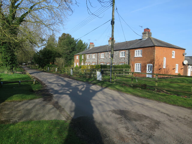
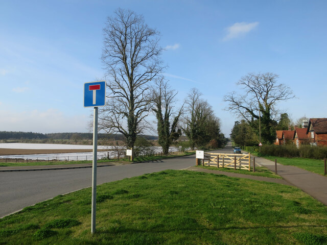
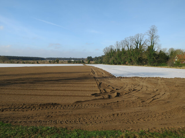
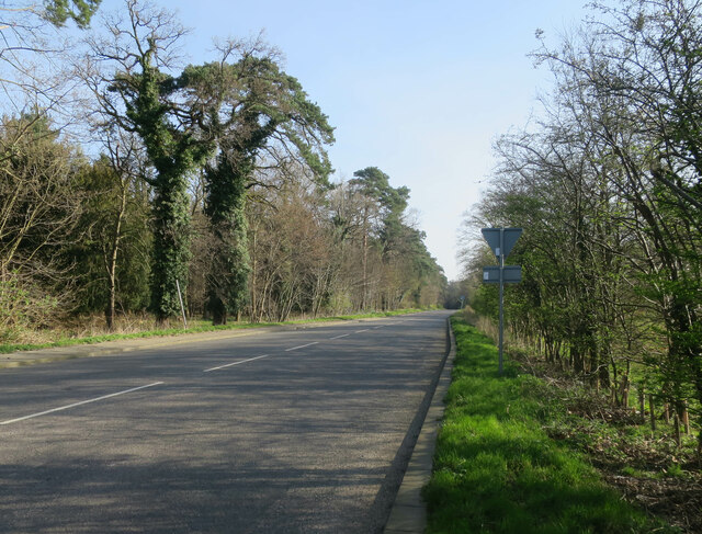
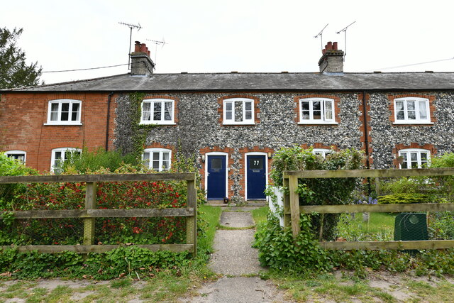
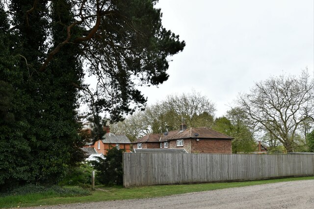
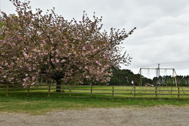
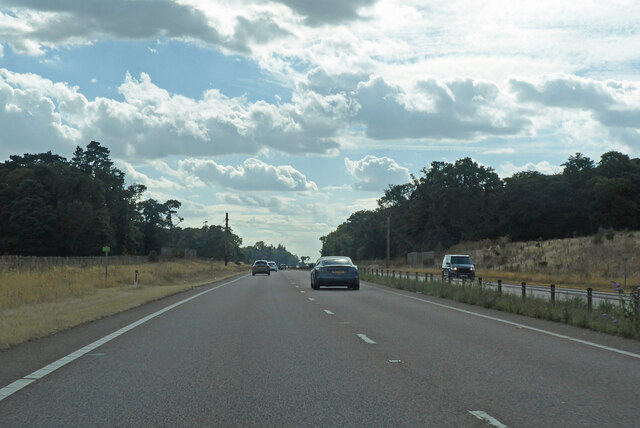
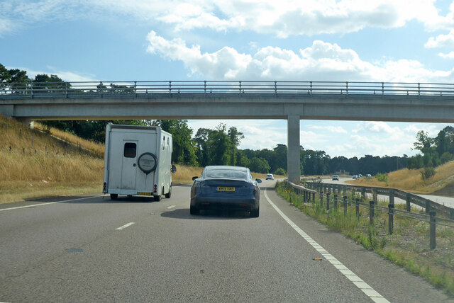
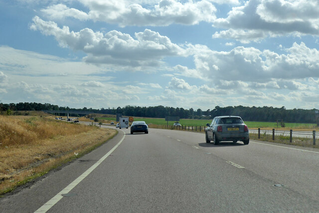
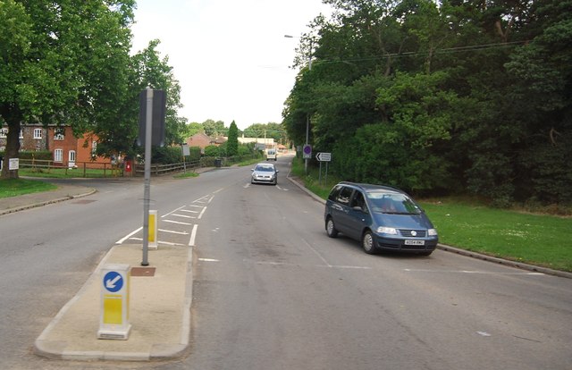
Elveden is a civil parish located in the county of Suffolk, England. Situated approximately 15 miles northwest of the town of Bury St Edmunds, it covers an area of approximately 6.46 square miles. The parish is predominantly rural, characterized by farmland, forests, and heathland.

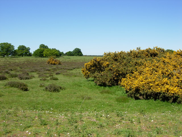
One of the notable features of Elveden is Elveden Forest, an ancient woodland that covers a significant portion of the parish. The forest is home to a diverse range of plant and animal species, making it a popular destination for nature enthusiasts and hikers. Additionally, the forest is known for its stunning scenery and tranquil atmosphere, attracting visitors who seek a peaceful retreat.

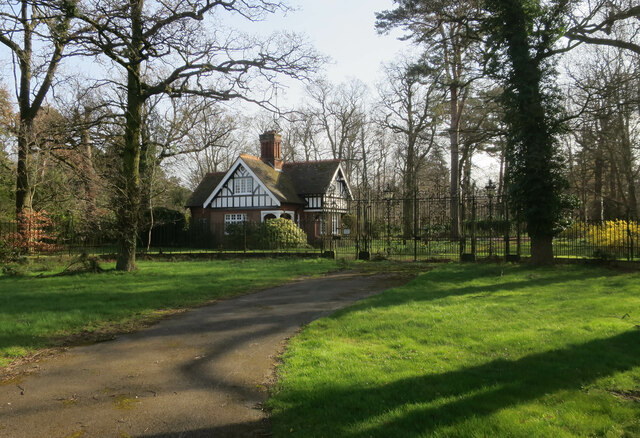
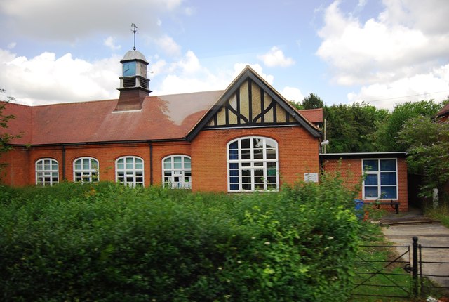
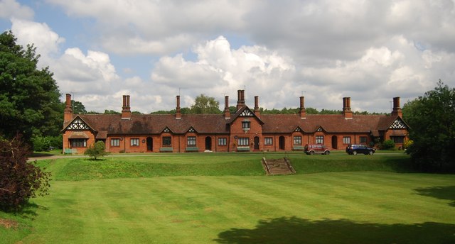
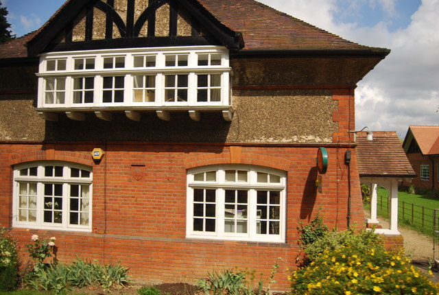
Elveden Hall, a stately home, is another prominent landmark in the parish. The hall, which dates back to the 19th century, is set amidst vast parkland and gardens. It is renowned for its impressive architecture and has been used as a filming location for various movies and television shows.

The neighboring Elveden Estate is a large agricultural estate that dominates the landscape. It is known for its vast arable fields and commercial forestry operations. The estate also includes a farm shop, café, and restaurant, offering visitors a chance to sample local produce and indulge in traditional Suffolk cuisine.

Overall, Elveden, Suffolk is an idyllic rural parish that offers a blend of natural beauty, historic landmarks, and agricultural heritage. Its picturesque landscapes and charming attractions make it an appealing destination for both locals and tourists seeking a peaceful escape.

If you have any feedback on the listing, please let us know in the comments section below.

Elveden Images

Images are sourced within 2km of 52.384864/0.663628 or Grid Reference TL8179. Thanks to Geograph Open Source API. All images are credited.

Crossroads, Elveden The crossroads with the A11 has now been bypassed <a href="https://www.geograph.org.uk/photo/1142978">TL8179 : Elveden Crossroads</a>
Crossroads, Elveden
The crossroads with the A11 has now been bypassed TL8179 : Elveden Crossroads
London Road, Elveden The former A11, from before the dualling and bypass.
London Road, Elveden
The former A11, from before the dualling and bypass.
Field by Elveden
Field by Elveden
House in Elveden Now considerably more peaceful after the A11 bypass around the village as part of the dualling of the road.
House in Elveden
Now considerably more peaceful after the A11 bypass around the village as part of the dualling of the road.
London Road, Elveden The former A11.
London Road, Elveden
The former A11.
Elveden: Row of cottages
Elveden: Houses
Elveden: Houses
Elveden: Play area within a playing field
A11 towards London But no longer a continuous route with that number. Taking the A14 around Newmarket is the first interruption.
A11 towards London
But no longer a continuous route with that number. Taking the A14 around Newmarket is the first interruption.
Bridge over A11 A farm access road crosses.
Bridge over A11
A farm access road crosses.
A11 towards London On the Elveden Bypass.
A11 towards London
On the Elveden Bypass.
Tesla Model 3 at Supercharger A lovely location near the Elveden Inn.
Tesla Model 3 at Supercharger
A lovely location near the Elveden Inn.
Chalk Hall Farm Taken from the A11.
Chalk Hall Farm
Taken from the A11.
The entrance to Chalk Hall Farm
Elveden School
Elveden School
B1106, Elveden
B1106, Elveden
Cottage Homes, Elveden Grade II listed almshouses built in 1900. <span class="nowrap"><a title="http://www.britishlistedbuildings.co.uk/en-275761-cottage-homes-1-7-elveden" rel="nofollow ugc noopener" href="http://www.britishlistedbuildings.co.uk/en-275761-cottage-homes-1-7-elveden">Link</a><img style="margin-left:2px;" alt="External link" title="External link - shift click to open in new window" src="https://s1.geograph.org.uk/img/external.png" width="10" height="10"/></span>
Cottage Homes, Elveden
Grade II listed almshouses built in 1900. LinkExternal link
Elveden Post Office
Elveden Post Office
Show me another place!

Elveden is located at Grid Ref: TL8179 (Lat: 52.384864, Lng: 0.663628)

Administrative County: Suffolk

District: West Suffolk

Police Authority: Suffolk

What 3 Words

///boasted.seriously.crucially. Near Thetford, Norfolk

Related Wikis

Elveden

Elveden is a village and civil parish in the West Suffolk district of Suffolk in eastern England. In 2005 it had a population of 270. The village is bypassed...

Elveden Hall

Elveden Hall is a large stately home on the Elveden Estate in Elveden, Suffolk, England. The seat of the Earls of Iveagh, it is a Grade II* listed building...

Breckland Forest

Breckland Forest is an 18,126 hectare biological and geological Site of Special Scientific Interest in many separate areas between Swaffham in Norfolk...

Berner's Heath

Berner's Heath is a 236.9-hectare (585-acre) biological Site of Special Scientific Interest north-east of Icklingham in Suffolk. It is a Nature Conservation...

Weather and Horn Heaths, Eriswell

Weather and Horn Heaths, Eriswell is a 133.3-hectare (329-acre) biological Site of Special Scientific Interest east of Eriswell in Suffolk. It is a Nature...

Thetford Heaths

Thetford Heaths is a 270.6-hectare (669-acre) biological and geological Site of Special Scientific Interest in Suffolk. It is a Nature Conservation Review...

Little Heath, Barnham

Little Heath, Barnham lies south-west of Barnham, Suffolk. Much of the area is now a Site of Special Scientific Interest, which almost surrounds the former...

Breckland Farmland

Breckland Farmland is a 13,392.4 hectare biological Site of Special Scientific Interest (SSSI) in many separate areas between Swaffham in Norfolk and Bury...

Nearby Amenities

Located within 500m of 52.384864,0.663628
Bus Stop
A11 Crossroads
Check Date Shelter: 2023-01-29
Naptan AtcoCode: 390020123
Naptan Bearing: S
Naptan CommonName: A11 Crossroads
Naptan Indicator: S-bound
Naptan Landmark: Shelter
Naptan NaptanCode: sufajdtp
Naptan Street: Brandon Road
Shelter: yes
Source: naptan_import;survey
Lat/Long: 52.384226/0.6670011
A11 Crossroads
Naptan AtcoCode: 390020124
Naptan Bearing: N
Naptan BusStopType: CUS
Naptan CommonName: A11 Crossroads
Naptan Indicator: N-bound
Naptan Landmark: A11 Crossroads
Naptan NaptanCode: sufajdtw
Naptan Street: Brandon Road
Naptan Verified: no
Source: naptan_import
Lat/Long: 52.3842278/0.6668547
Bus Stop
Shelter
Naptan AtcoCode: 390020363
Naptan Bearing: W
Naptan CommonName: Shelter
Naptan Indicator: o/s
Naptan Landmark: Shelter
Naptan NaptanCode: sufjdtaw
Naptan Street: Estate Road
Naptan Verified: no
Source: naptan_import
Lat/Long: 52.3837229/0.6669597
Collection Times: Mo-Fr 16:30; Sa 09:00
Former Amenity: post_box
Note: Brick pillar missing and postbox absent, 2014-12-05. Still missing as of 2020-08.
Post Box Mounting: brick_pillar
Post Box Type: wall
Ref: IP24 3019
Royal Cypher: EIIR
Lat/Long: 52.3838801/0.6670434
Motorway Junction
Lat/Long: 52.3890743/0.6646514
Power: pole
Lat/Long: 52.3863076/0.6668865
Power: pole
Lat/Long: 52.3849644/0.6646567
Power: pole
Lat/Long: 52.3844053/0.6638761
Power: pole
Lat/Long: 52.3871196/0.6684722
Power: pole
Lat/Long: 52.3874684/0.6691966
Material: wood
Power: pole
Lat/Long: 52.3859435/0.6662599
Power: pole
Lat/Long: 52.3846927/0.6642563
Material: wood
Power: pole
Lat/Long: 52.38531/0.6651883
Material: wood
Power: pole
Lat/Long: 52.3856899/0.6657322
Power: pole
Lat/Long: 52.3867676/0.6677965
Power: pole
Lat/Long: 52.3833536/0.6631257
Power: pole
Lat/Long: 52.3840681/0.6634256
Speed Camera
Lat/Long: 52.3832453/0.6667085
Speed Camera
Lat/Long: 52.3836022/0.6679906
Pipeline: marker
Substance: oil
Lat/Long: 52.3883351/0.6640998
Pipeline: marker
Substance: oil
Lat/Long: 52.3883632/0.6642933
Fixme: incomplete
Lat/Long: 52.3878242/0.6597959
Bicycle Parking
Bicycle Parking: wall_loops
Capacity: 24
Covered: no
Lat/Long: 52.3859521/0.6646739
Material: wood
Note: end of line
Power: pole
Source: Bing;observation
Lat/Long: 52.3889861/0.6657082
Fixme: incomplete
Lat/Long: 52.3883879/0.66159
Pipeline: marker
Substance: oil
Lat/Long: 52.3888717/0.6657322
Pipeline: marker
Substance: oil
Lat/Long: 52.3890086/0.6660377
Fixme: position approx
Pipeline: marker
Substance: oil
Lat/Long: 52.388051/0.6622691
Charging Station
Alan-Tess
Amperage: 32
Authentication None: yes
Capacity: 2
Fee: no
Opening Hours: 24/7
Operator: Pod Point
Operator Wikidata: Q42888154
Phone: +44 333 006 3503
Ref: PG-80432
Socket Type2: 2
Voltage: 230
Website: https://www.pod-point.com/
Lat/Long: 52.3864463/0.6649679
Charging Station
Thetford Supercharger
Addr City: Thetford
Addr Country: GB
Addr Housename: Elveden Inn
Addr Postcode: IP24 3TP
Addr Street: Brandon Road
Addr Village: Elveden
Amperage: 610
Brand: Tesla, Inc.
Brand Wikidata: Q478214
Capacity: 16
End Date: 2024 Mar 1
Fee: yes
Motorcar: yes
Opening Date: 2024-05-14
Opening Hours: 24/7
Operator: Tesla, Inc.
Operator Wikidata: Q478214
Power: 250 kW
Short Name: Tesla
Socket Tesla Supercharger Ccs: 16
Start Date: 2016-07-05
Voltage: 1000
Website: https://www.tesla.com/findus/location/supercharger/thetfordsupercharger
Lat/Long: 52.3865046/0.6645459
Elveden
Traffic Sign: city_limit
Lat/Long: 52.3870205/0.6652093
Give Way
Direction: backward
Lat/Long: 52.3878972/0.6650886
Defibrillator
Defibrillator Location: In Elvden Inn main car park, on the opposite side to the pub.
Emergency: defibrillator
Ref GB The Circuit: A56BE6A7-5B6D-4020-AE9A-AD1900D93AD7
Lat/Long: 52.3864623/0.6650028
The data included in this document is from www.openstreetmap.org. The data is made available under ODbL.

Have you been to Elveden?

Leave your review of Elveden below (or comments, questions and feedback).