Elstree and Borehamwood

Civil Parish in Hertfordshire Hertsmere

England

Elstree and Borehamwood

Derelict restaurant on Watling Street, Elstree
Derelict restaurant on Watling Street, Elstree Credit: David Howard

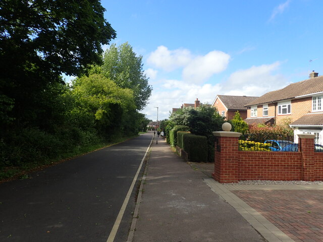
Elstree and Borehamwood is a civil parish located in Hertfordshire, England. It is situated just 12 miles northwest of central London, making it a popular residential area for commuters. The parish covers an area of approximately 2.8 square miles and has a population of around 33,000.

The area is well-known for its connection to the film and television industry, with several major studios and production companies based here. Elstree Studios, for example, has been a prominent location for film and television production since the 1920s, hosting numerous famous productions, including the Star Wars and Indiana Jones series. This has led to the growth of a vibrant media community in the area, with many professionals working in the industry residing in the parish.

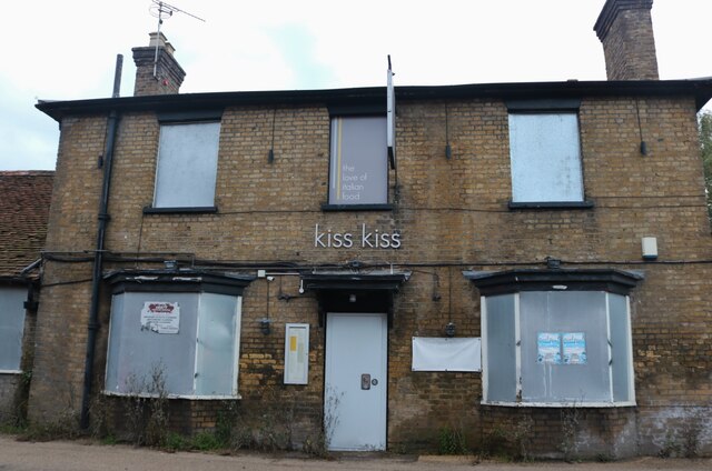
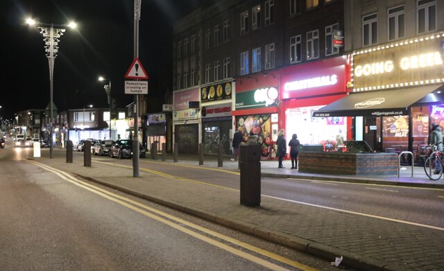
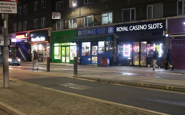
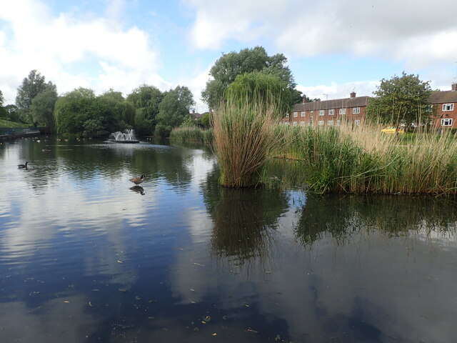
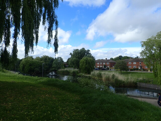
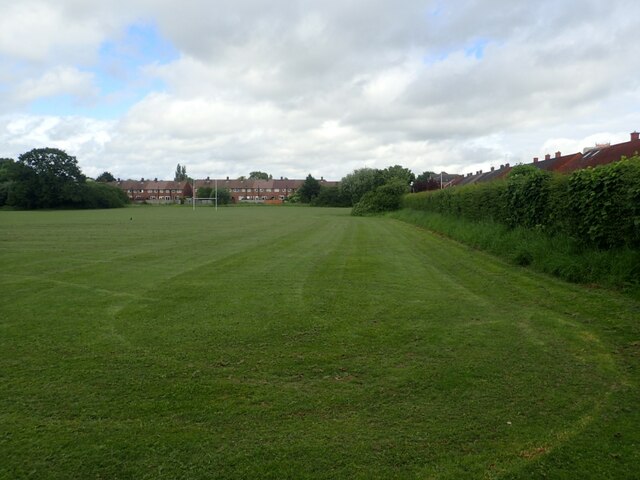
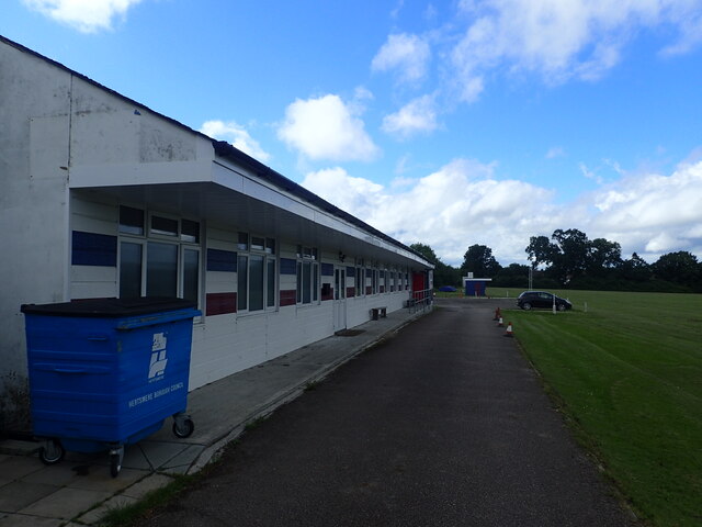
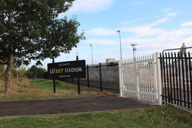
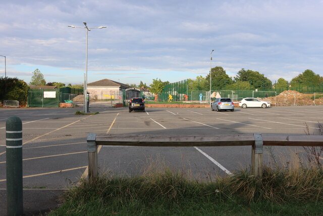
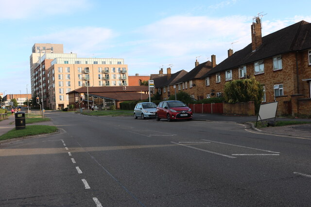
Aside from its association with the entertainment industry, Elstree and Borehamwood offer a range of amenities and attractions for residents and visitors. The town centre provides a variety of shops, restaurants, and leisure facilities, including a cinema and a leisure centre. There are also several parks and open spaces, such as Aberford Park and Meadow Park, providing opportunities for outdoor recreation.

Transport links in Elstree and Borehamwood are excellent, with the town being served by two railway stations, Elstree & Borehamwood and Elstree Studios, providing regular services to London and other destinations. The area is also well-connected by road, with the A1(M) and M25 motorways nearby.

Overall, Elstree and Borehamwood is a thriving civil parish that combines a rich heritage in the film and television industry with a range of amenities and excellent transport links, making it an attractive place to live and work.

If you have any feedback on the listing, please let us know in the comments section below.

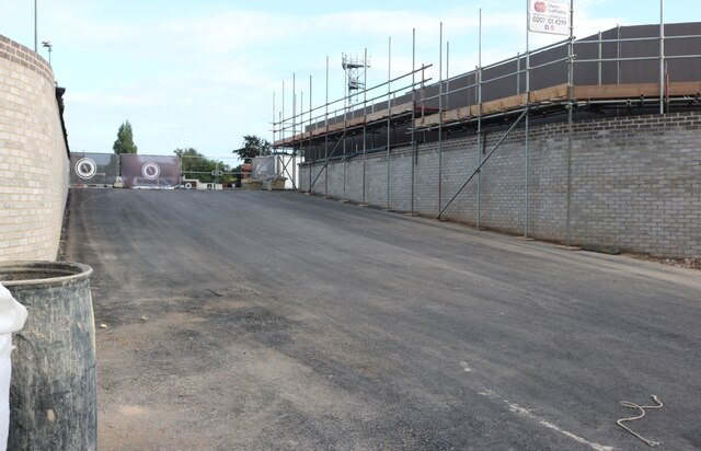
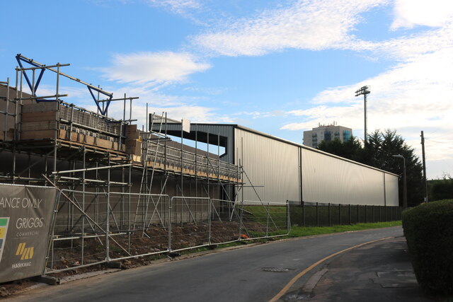
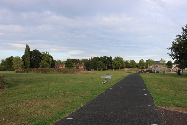
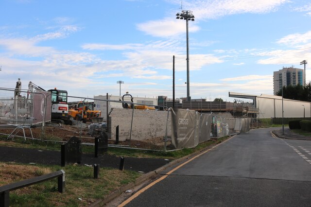
Elstree and Borehamwood Images

Images are sourced within 2km of 51.654791/-0.280185 or Grid Reference TQ1996. Thanks to Geograph Open Source API. All images are credited.

Derelict restaurant on Watling Street, Elstree
Shenley Road, Borehamwood Heading south the A5 (as was) was closed in Radlett and all traffic was diverted through Borehamwood. I was tempted to pick up a Wimpy as there are very few left now.
Shenley Road, Borehamwood
Heading south the A5 (as was) was closed in Radlett and all traffic was diverted through Borehamwood. I was tempted to pick up a Wimpy as there are very few left now.
Shenley Road, Borehamwood
Lake in Aberford Park Aberford Park was purchased in stages starting in 1888. The lake was formed by the damming of the Borehamwood Brook. On some maps this is known as Tykes Water.

More information can be found at <span class="nowrap"><a title="https://www.greenflagaward.org//park-summary/?park=576" rel="nofollow ugc noopener" href="https://www.greenflagaward.org//park-summary/?park=576">Link</a><img style="margin-left:2px;" alt="External link" title="External link - shift click to open in new window" src="https://s1.geograph.org.uk/img/external.png" width="10" height="10"/></span>  and <span class="nowrap"><a title="https://www.parksherts.co.uk/parks/view/aberford-park" rel="nofollow ugc noopener" href="https://www.parksherts.co.uk/parks/view/aberford-park">Link</a><img style="margin-left:2px;" alt="External link" title="External link - shift click to open in new window" src="https://s1.geograph.org.uk/img/external.png" width="10" height="10"/></span>
Lake in Aberford Park
Aberford Park was purchased in stages starting in 1888. The lake was formed by the damming of the Borehamwood Brook. On some maps this is known as Tykes Water. More information can be found at LinkExternal link and LinkExternal link
Aberford Park Aberford Park was purchased in stages starting in 1888. The lake was formed by the damming of the Borehamwood Brook. On some maps this is known as Tykes Water.

More information can be found at <span class="nowrap"><a title="https://www.greenflagaward.org//park-summary/?park=576" rel="nofollow ugc noopener" href="https://www.greenflagaward.org//park-summary/?park=576">Link</a><img style="margin-left:2px;" alt="External link" title="External link - shift click to open in new window" src="https://s1.geograph.org.uk/img/external.png" width="10" height="10"/></span>  and <span class="nowrap"><a title="https://www.parksherts.co.uk/parks/view/aberford-park" rel="nofollow ugc noopener" href="https://www.parksherts.co.uk/parks/view/aberford-park">Link</a><img style="margin-left:2px;" alt="External link" title="External link - shift click to open in new window" src="https://s1.geograph.org.uk/img/external.png" width="10" height="10"/></span>

See also <a title="https://www.geograph.org.uk/photo/7182331" href="https://www.geograph.org.uk/photo/7182331">Link</a>
Aberford Park
Aberford Park was purchased in stages starting in 1888. The lake was formed by the damming of the Borehamwood Brook. On some maps this is known as Tykes Water. More information can be found at LinkExternal link and LinkExternal link See also Link
Rugby and cricket ground alongside Croxdale Road This is the Old Haberdashers Sports Ground.
Rugby and cricket ground alongside Croxdale Road
This is the Old Haberdashers Sports Ground.
Rugby and cricket ground alongside Croxdale Road This is the Old Haberdashers Sports Ground - see also <a title="https://www.geograph.org.uk/photo/7182342" href="https://www.geograph.org.uk/photo/7182342">Link</a>
Rugby and cricket ground alongside Croxdale Road
This is the Old Haberdashers Sports Ground - see also Link
Theobald Street, Borehamwood The main part of Theobald Street runs parallel to this service road on the other side of the trees on the left
Theobald Street, Borehamwood
The main part of Theobald Street runs parallel to this service road on the other side of the trees on the left
The entrance to Borehamwood FC The ground is currently being rebuilt and this is the road entrance which is not yet in use, the pedestrian entrance runs parallel to the left.
The entrance to Borehamwood FC
The ground is currently being rebuilt and this is the road entrance which is not yet in use, the pedestrian entrance runs parallel to the left.
Meadow Park Stadium, Borehamwood Currently being rebuilt, this is the home of Borehamwood FC.
Meadow Park Stadium, Borehamwood
Currently being rebuilt, this is the home of Borehamwood FC.
Meadow Park, Borehamwood
Construction work at Borehamwood FC The whole stadium is being rebuilt.
Construction work at Borehamwood FC
The whole stadium is being rebuilt.
The pedestrian entrance to Borehamwood FC This is all in the process of construction.
The pedestrian entrance to Borehamwood FC
This is all in the process of construction.
Meadow Park, Borehamwood Looking towards Broughinge Road.
Meadow Park, Borehamwood
Looking towards Broughinge Road.
Liberty Court, Borehamwood
Fairbrook Medical Centre, Borehamwood
Meadow Park car park, Borehamwood
Brook Road, Borehamwood
Show me another place!

Elstree and Borehamwood is located at Grid Ref: TQ1996 (Lat: 51.654791, Lng: -0.280185)

Administrative County: Hertfordshire

District: Hertsmere

Police Authority: Hertfordshire

What 3 Words

///having.kind.calm. Near Borehamwood, Hertfordshire

Nearby Locations

Elstree and Borehamwood

Related Wikis

Gate Studios

Gate Studios was one of the many studios known collectively as Elstree Studios in the town of Borehamwood, England. Opened in 1928, the studios were in...

Elstree & Borehamwood railway station

Elstree & Borehamwood railway station is a railway station in the town of Borehamwood, Hertfordshire, England. It primarily serves Borehamwood as well...

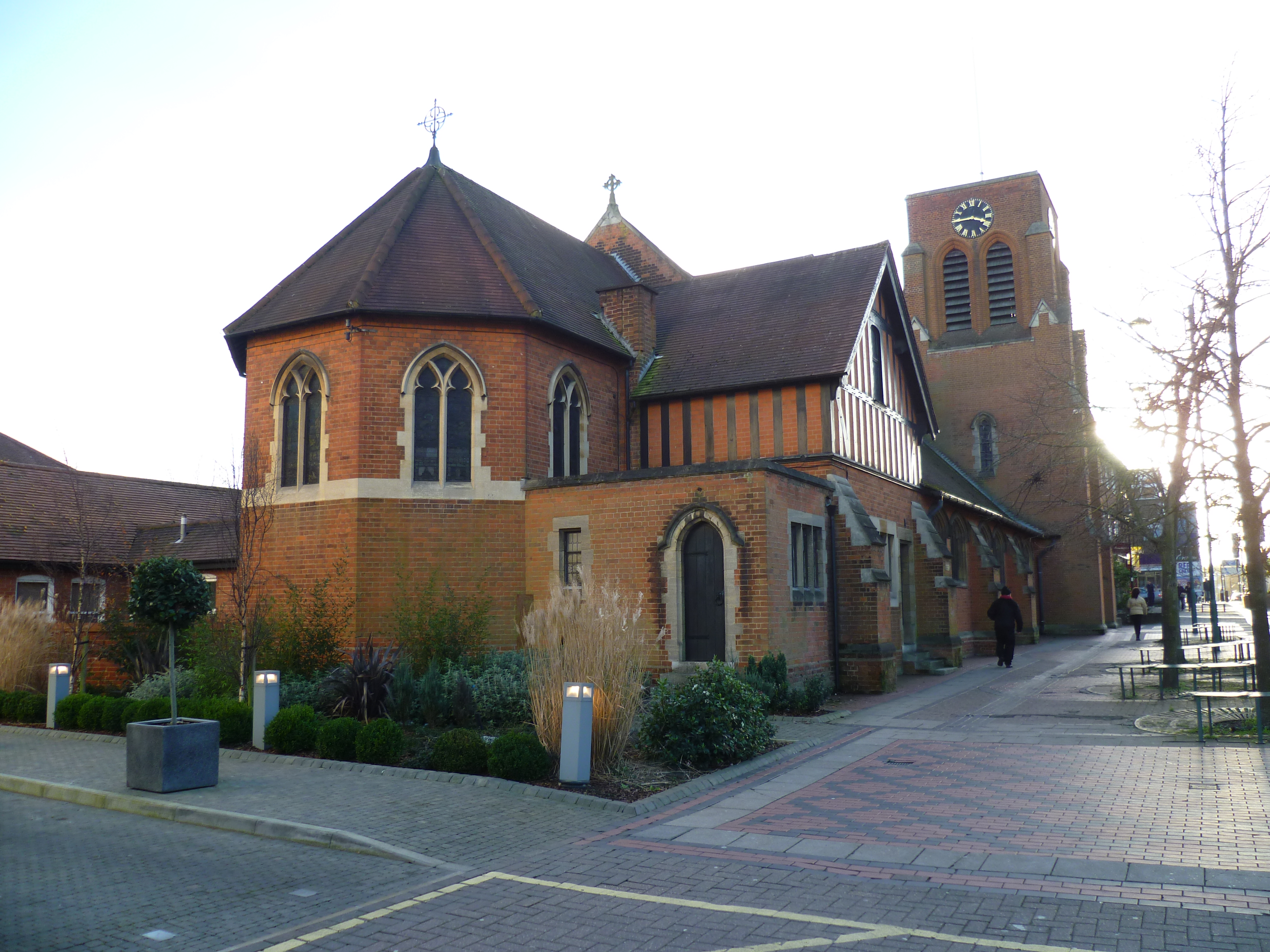
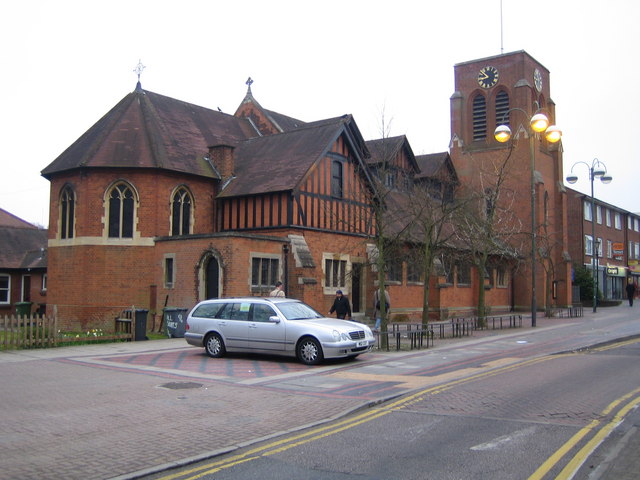
All Saints church, Borehamwood

All Saints church is a Church of England church in Shenley Road, Borehamwood. It is in the parish of Elstree and Borehamwood. The church is built in the...
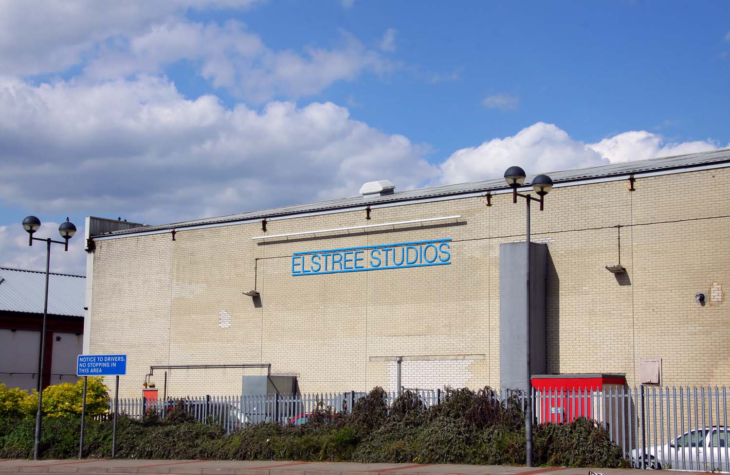
Elstree Studios

Elstree Studios is a generic term which can refer to several current and demolished British film studios and television studios based in or around the...

Elstree and Borehamwood

Elstree and Borehamwood is a civil parish in the Hertsmere district, in Hertfordshire, England. Located approximately 12 miles (19 km) northwest of central...

Borehamwood

Borehamwood (, historically also Boreham Wood) is a town in southern Hertfordshire, England, 12 miles (19 km) from Charing Cross. Borehamwood has a population...

BBC Elstree Centre

The BBC Elstree Centre, sometimes referred to as the BBC Elstree Studios, is a television production facility, currently owned by the BBC. The complex...

Yavneh College, Borehamwood

Yavneh College is a co-educational, Jewish, secondary and sixth form school. A comprehensive with five-form entry for ages 11–18 yrs, it is part of the...

Nearby Amenities

Located within 500m of 51.654791,-0.280185
Mini Roundabout
Lat/Long: 51.653943/-0.2795745
Mini Roundabout
Direction: clockwise
Lat/Long: 51.6561837/-0.2808497
Mini Roundabout
Direction: clockwise
Lat/Long: 51.6563608/-0.2801029
Mini Roundabout
Direction: clockwise
Lat/Long: 51.6532209/-0.2745295
Traffic Calming: bump
Lat/Long: 51.6566819/-0.2797865
Traffic Calming: island
Lat/Long: 51.6538428/-0.2794319
Noexit: yes
Lat/Long: 51.6544378/-0.2733314
Noexit: yes
Lat/Long: 51.6544111/-0.2733962
Turning Circle
Lat/Long: 51.6511124/-0.2802566
Turning Circle
Lat/Long: 51.6515947/-0.2773842
Crossing
Button Operated: yes
Crossing: traffic_signals
Crossing Island: no
Tactile Paving: yes
Lat/Long: 51.6535478/-0.2798327
Give Way
Direction: forward
Lat/Long: 51.6527985/-0.2820568
Crossing
Crossing: unmarked
Crossing Island: yes
Tactile Paving: no
Lat/Long: 51.6529587/-0.2817197
Mini Roundabout
Direction: clockwise
Lat/Long: 51.6528269/-0.28195
Mini Roundabout
Direction: clockwise
Source: Bing
Lat/Long: 51.6552877/-0.2768464
Mini Roundabout
Direction: clockwise
Lat/Long: 51.6563699/-0.2746431
Mini Roundabout
Direction: clockwise
Lat/Long: 51.6527416/-0.2738533
Crossing
Crossing: unmarked
Lat/Long: 51.6520954/-0.2749318
Direction: backward
Traffic Calming: table
Lat/Long: 51.6511325/-0.2764866
Bus Stop
Furzehill Road
Bench: yes
Bin: yes
Bus: yes
Lit: yes
Local Ref: F
Naptan AtcoCode: 210021002680
Naptan Bearing: SW
Naptan CommonName: Furzehill Road
Naptan Indicator: nr
Naptan Landmark: Unknown
Naptan NaptanCode: hrtgpgwp
Naptan PlusbusZoneRef: ELTR
Naptan ShortCommonName: NA
Naptan Street: Shenley Road
Naptan Verified: no
Public Transport: platform
Shelter: yes
Source: naptan_import
Tactile Paving: no
Lat/Long: 51.6554863/-0.2763289
Bus Stop
Glenhaven Avenue
Bench: yes
Bin: yes
Bus: yes
Lit: yes
Local Ref: E
Naptan AtcoCode: 210021002690
Naptan Bearing: SW
Naptan CommonName: Glenhaven Avenue
Naptan Indicator: opp
Naptan Landmark: Unknown
Naptan NaptanCode: hrtgpgwt
Naptan PlusbusZoneRef: ELTR
Naptan ShortCommonName: NA
Naptan Street: Shenley Road
Naptan Verified: no
Public Transport: platform
Shelter: yes
Source: naptan_import
Tactile Paving: no
Lat/Long: 51.654333/-0.2785882
Bus Stop
Deacon's Hill Road
Bench: yes
Bin: yes
Bus: yes
Lit: yes
Naptan AtcoCode: 210021002700
Naptan Bearing: SW
Naptan CommonName: Deacon's Hill Road
Naptan Indicator: nr
Naptan Landmark: Unknown
Naptan NaptanCode: hrtgpjag
Naptan ShortCommonName: NA
Naptan Street: Allum Lane
Public Transport: platform
Shelter: yes
Source: naptan_import
Tactile Paving: no
Lat/Long: 51.6525039/-0.2823871
Bus Stop
Baptist Church
Naptan AtcoCode: 210021003000
Naptan Bearing: NW
Naptan CommonName: Baptist Church
Naptan Indicator: o/s
Naptan Landmark: Unknown
Naptan NaptanCode: hrtgpgjw
Naptan PlusbusZoneRef: ELTR
Naptan ShortCommonName: NA
Naptan Street: Furzehill Road
Naptan Verified: no
Public Transport: platform
Shelter: no
Source: naptan_import
Lat/Long: 51.6544846/-0.2759956
Bus Stop
Audley Close
Bus: yes
Naptan AtcoCode: 210021003240
Naptan Bearing: NE
Naptan BusStopType: CUS
Naptan CommonName: Audley Close
Naptan Crossing: opp Audley Close
Naptan Indicator: opp
Naptan Landmark: opp Audley Close
Naptan NaptanCode: hrtgpgam
Naptan PlusbusZoneRef: ELTR
Naptan ShortCommonName: NA
Naptan Street: Stratfield Road
Naptan Verified: no
Public Transport: platform
Shelter: no
Source: naptan_import
Lat/Long: 51.6586118/-0.2796831
Bus Stop
Stratfield Road
Bench: yes
Bin: yes
Bus: yes
Lit: yes
Naptan AtcoCode: 210021003390
Naptan Bearing: S
Naptan CommonName: Stratfield Road
Naptan Indicator: nr
Naptan Landmark: Unknown
Naptan NaptanCode: hrtgpdtg
Naptan PlusbusZoneRef: ELTR
Naptan ShortCommonName: NA
Naptan Street: Theobald Street
Naptan Verified: no
Public Transport: platform
Shelter: no
Source: naptan_import
Tactile Paving: yes
Lat/Long: 51.6572184/-0.2814573
Bus Stop
Stratfield Road
Bench: yes
Bin: yes
Bus: yes
Lit: yes
Naptan AtcoCode: 210021003430
Naptan Bearing: NW
Naptan CommonName: Stratfield Road
Naptan Crossing: Red Road
Naptan Indicator: opp
Naptan Landmark: Red Road
Naptan NaptanCode: hrtgpdtm
Naptan PlusbusZoneRef: ELTR
Naptan ShortCommonName: NA
Naptan Street: Theobald Street
Naptan Verified: no
Public Transport: platform
Shelter: no
Source: naptan_import
Tactile Paving: no
Lat/Long: 51.6576919/-0.2823406
Bus Stop
Audley Close
Bus: yes
Naptan AtcoCode: 210021003560
Naptan Bearing: SW
Naptan BusStopType: CUS
Naptan CommonName: Audley Close
Naptan Crossing: Audley Close
Naptan Indicator: adj
Naptan Landmark: Audley Close
Naptan NaptanCode: hrtgtdag
Naptan PlusbusZoneRef: ELTR
Naptan ShortCommonName: NA
Naptan Street: Stratfield Road
Naptan Verified: no
Public Transport: platform
Shelter: no
Source: naptan_import
Lat/Long: 51.6582302/-0.2800301
Bus Stop
Glenhaven Avenue
Bench: yes
Bin: yes
Bus: yes
Local Ref: D
Naptan AtcoCode: 210021004100
Naptan Bearing: NE
Naptan CommonName: Glenhaven Avenue
Naptan Indicator: nr
Naptan Landmark: Unknown
Naptan NaptanCode: hrtgpawt
Naptan PlusbusZoneRef: ELTR
Naptan ShortCommonName: NA
Naptan Street: Shenley Road
Naptan Verified: no
Public Transport: platform
Shelter: yes
Source: naptan_import
Tactile Paving: no
Lat/Long: 51.6545444/-0.2785329
Bus Stop
Furzehill Road
Bench: yes
Bin: no
Bus: yes
Lit: yes
Local Ref: G
Naptan AtcoCode: 210021004120
Naptan Bearing: NE
Naptan CommonName: Furzehill Road
Naptan Indicator: opp
Naptan Landmark: Unknown
Naptan NaptanCode: hrtgpdaj
Naptan PlusbusZoneRef: ELTR
Naptan ShortCommonName: NA
Naptan Street: Shenley Road
Naptan Verified: no
Public Transport: platform
Shelter: yes
Source: naptan_import
Tactile Paving: no
Lat/Long: 51.6560792/-0.2754321
Bus Stop
Barham Avenue
Bench: yes
Bin: no
Check Date Shelter: 2023-08-12
Naptan AtcoCode: 210021004230
Naptan Bearing: E
Naptan CommonName: Barham Avenue
Naptan Crossing: opp Nash Close
Naptan Indicator: nr
Naptan Landmark: opp Nash Close
Naptan NaptanCode: hrtgpatj
Naptan PlusbusZoneRef: ELTR
Naptan ShortCommonName: NA
Naptan Street: Allum Lane
Public Transport: platform
Shelter: yes
Source: naptan_import
Tactile Paving: yes
Lat/Long: 51.652145/-0.2849299
Elstree & Borehamwood Railway Station
Naptan AtcoCode: 210021004235
Naptan Bearing: SW
Naptan BusStopType: CUS
Naptan CommonName: Elstree & Borehamwood Railway Station
Naptan Indicator: o/s
Naptan Landmark: Unknown
Naptan NaptanCode: hrtgpatm
Naptan PlusbusZoneRef: ELTR
Naptan ShortCommonName: NA
Naptan Street: Station Road
Naptan Verified: no
Source: naptan_import
Lat/Long: 51.6530444/-0.2789976
Bus Stop
Deacon's Hill Road
Bench: yes
Bin: no
Lit: yes
Naptan AtcoCode: 210021004240
Naptan Bearing: NE
Naptan CommonName: Deacon's Hill Road
Naptan Indicator: opp
Naptan Landmark: Unknown
Naptan NaptanCode: hrtgpatp
Naptan ShortCommonName: NA
Naptan Street: Allum Lane
Naptan Verified: no
Public Transport: platform
Shelter: no
Source: naptan_import
Tactile Paving: no
Lat/Long: 51.6530733/-0.2816131
Bus Stop
Elstree & Borehamwood Station
Bench: yes
Bin: yes
Bus: yes
Local Ref: A
Naptan AtcoCode: 210021004245
Naptan Bearing: SW
Naptan CommonName: Elstree & Borehamwood Railway Station
Naptan Indicator: Stop A
Naptan Landmark: Unknown
Naptan NaptanCode: hrtadatw
Naptan PlusbusZoneRef: ELTR
Naptan ShortCommonName: NA
Naptan Street: Station Road
Naptan Verified: no
Public Transport: platform
Shelter: yes
Source: naptan_import
Tactile Paving: no
Wheelchair: yes
Lat/Long: 51.6531494/-0.2793942
Bus Stop
Elstree & Borehamwood Station
Bench: yes
Bin: yes
Bus: yes
Local Ref: B
Naptan AtcoCode: 210021004250
Naptan Bearing: SW
Naptan CommonName: Elstree & Borehamwood Railway Station
Naptan Indicator: Stop B
Naptan Landmark: Unknown
Naptan NaptanCode: hrtadawa
Naptan PlusbusZoneRef: ELTR
Naptan ShortCommonName: NA
Naptan Street: Station Road
Naptan Verified: no
Public Transport: platform
Shelter: yes
Source: naptan_import
Tactile Paving: no
Lat/Long: 51.6533419/-0.2796869
Bus Stop
Elstree & Borehamwood Station
Bench: yes
Bin: yes
Bus: yes
Local Ref: C
Naptan AtcoCode: 210021004255
Naptan Bearing: SW
Naptan CommonName: Elstree & Borehamwood Railway Station
Naptan Indicator: Stop C
Naptan Landmark: Unknown
Naptan NaptanCode: hrtadawd
Naptan PlusbusZoneRef: ELTR
Naptan ShortCommonName: NA
Naptan Street: Station Road
Naptan Verified: no
Public Transport: platform
Shelter: yes
Source: naptan_import
Tactile Paving: no
Lat/Long: 51.65361/-0.279543
Mini Roundabout
Lat/Long: 51.6532485/-0.2776993
Turning Circle
Lat/Long: 51.6583841/-0.2785618
Turning Circle
Lat/Long: 51.6582089/-0.2818022
Booth: K6
Covered: booth
Fictional Amenity: telephone
Man Made: telephone_box
Note: no calls - film set
Lat/Long: 51.6587938/-0.2773626
Fictional Leisure: playground
Note: no playing - film set
Lat/Long: 51.6587571/-0.2772418
Fictional Amenity: telephone
Note: no phoning - film set
Lat/Long: 51.6584708/-0.2772172
Fictional Amenity: telephone
Note: no phoning - film set
Lat/Long: 51.6585373/-0.2768202
Walford East
Fake Railway: subway_entrance
Note: just an entrance - no trains - film set
Lat/Long: 51.6586255/-0.27689
Fictional Highway: bus_stop
Note: no buses: film set
Ref: 34
Shelter: yes
Lat/Long: 51.658436/-0.2768019
Elstree & Borehamwood
Public Transport: stop_position
Railway: stop
Ref: 1
Train: yes
Lat/Long: 51.6516407/-0.2789186
Post Box
Check Date: 2021-03-18
Collection Times: Mo-Fr 17:30, Sa 11:30
Ref: WD6 200
Royal Cypher: EIIR
Royal Cypher Wikidata: Q33102113
Source: survey;Bing
Lat/Long: 51.6533371/-0.2797854
Atm
Note: Was out of order when I visited.
Operator: HSBC
Lat/Long: 51.6526528/-0.2815908
Post Box
Collection Times: Mo-Fr 17:30, Sa 11:45
Operator: Royal Mail
Operator Wikidata: Q638098
Post Box Design: type_k
Post Box Type: pillar
Ref: WD6 143
Royal Cypher: EIIR
Royal Cypher Wikidata: Q33102113
Lat/Long: 51.6546237/-0.2783757
Post Box
Collection Times: Mo-Fr 18:00, Sa 11:45
Drive Through: no
Post Box Design: type_k
Post Box Type: pillar
Ref: WD6 142
Royal Cypher: EIIR
Royal Cypher Wikidata: Q33102113
Lat/Long: 51.6550971/-0.2774005
Crossing
Crossing: unmarked
Lat/Long: 51.6532964/-0.2815336
Entrance: yes
Lat/Long: 51.653117/-0.2798162
Post Box
Check Date: 2022-08-25
Collection Times: Mo-Fr 17:30; Sa 11:30
Ref: WD6 97
Royal Cypher: EIIR
Lat/Long: 51.6523166/-0.2841769
Elstree & Borehamwood
Public Transport: stop_position
Railway: stop
Ref: 2
Train: yes
Lat/Long: 51.6531383/-0.2800467
Bicycle Parking
Bicycle Parking: stands
Capacity: 4
Covered: no
Lat/Long: 51.6544831/-0.278253
Bicycle Parking
Bicycle Parking: stands
Capacity: 4
Covered: no
Lat/Long: 51.6553063/-0.2766548
Bicycle Parking
Lat/Long: 51.6549138/-0.2795465
Fictional Amenity: post_box
Post Box Type: pillar
Lat/Long: 51.6589187/-0.2776498
Fictional Amenity: post_box
Lat/Long: 51.6584295/-0.2768558
Entrance: main
Lat/Long: 51.6531923/-0.2796065
Crossing
Crossing: marked
Tactile Paving: yes
Lat/Long: 51.6532526/-0.2795331
Crossing
Crossing: unmarked
Crossing Island: yes
Tactile Paving: yes
Lat/Long: 51.6538171/-0.2794078
Crossing
Crossing: unmarked
Crossing Island: no
Tactile Paving: no
Lat/Long: 51.6521284/-0.2839082
Crossing
Crossing: marked
Tactile Paving: yes
Lat/Long: 51.6560604/-0.2796767
Crossing
Crossing: marked
Lat/Long: 51.6553998/-0.2787303
Mini Roundabout
Direction: clockwise
Lat/Long: 51.6561317/-0.279708
Bank
HSBC UK
Brand: HSBC UK
Brand Wikidata: Q64767453
Brand Wikipedia: en:HSBC
Opening Hours: Mo-Fr 09:30-15:30
Source: Recollection from visit
Wheelchair: yes
Lat/Long: 51.6565482/-0.277364
Give Way
Direction: forward
Lat/Long: 51.6556142/-0.2789108
Crossing
Crossing: unmarked
Lat/Long: 51.6526479/-0.273998
Give Way
Direction: forward
Lat/Long: 51.6546686/-0.2761997
Bench
Arthur's Bench
Backrest: yes
Lat/Long: 51.6587629/-0.2777957
Historic: memorial
Lat/Long: 51.6584996/-0.2772874
Barrier: lift_gate
Lat/Long: 51.6564653/-0.2801264
Pharmacy
Boots
Addr City: Borehamwood
Addr Housename: Borehamwood Shopping Park
Addr Postcode: WD6 4PR
Addr Unit: Unit 3B
Branch: Borehamwood Retail Park
Brand: Boots
Brand Wikidata: Q6123139
Brand Wikipedia: en:Boots (company)
Contact Phone: +44 20 8953 1401
Contact Website: http://www.boots.com/stores/6537-borehamwood-retail-park-wd6-4pr
Dispensing: yes
Fhrs Id: 1064996
Healthcare: pharmacy
Operator: Boots UK Limited
Ref: 6537
Source: gps; photograph; local knowledge
Lat/Long: 51.6558833/-0.2780565
Location Transition: yes
Power: pole
Lat/Long: 51.6574665/-0.2857532
Location Transition: yes
Power: pole
Lat/Long: 51.6573975/-0.2859409
Crossing
Crossing: marked
Tactile Paving: yes
Lat/Long: 51.6533411/-0.2794339
Give Way
Lat/Long: 51.6535557/-0.2793883
Traffic Calming: island
Lat/Long: 51.6558306/-0.2807702
Surface: paving_stones
Traffic Calming: hump
Lat/Long: 51.6582012/-0.2801768
Surface: paving_stones
Traffic Calming: hump
Lat/Long: 51.6578864/-0.2809328
Give Way
Direction: backward
Lat/Long: 51.6584275/-0.2796873
Turning Circle
Lat/Long: 51.6571214/-0.281874
Mini Roundabout
Direction: clockwise
Lat/Long: 51.6543408/-0.2757178
Direction: 155
Generator Method: photovoltaic
Generator Output Electricity: yes
Generator Solar Modules: 22
Generator Source: solar
Generator Type: solar_photovoltaic_panel
Location: roof
Power: generator
Lat/Long: 51.6529175/-0.2811142
Direction: 155
Generator Method: photovoltaic
Generator Output Electricity: yes
Generator Solar Modules: 24
Generator Source: solar
Generator Type: solar_photovoltaic_panel
Location: roof
Power: generator
Lat/Long: 51.6530672/-0.2805488
Generator Method: photovoltaic
Generator Output Electricity: yes
Generator Solar Modules: 42
Generator Source: solar
Generator Type: solar_photovoltaic_panel
Location: roof
Power: generator
Tilted: no
Lat/Long: 51.6526051/-0.2801082
Direction: 155
Generator Method: photovoltaic
Generator Output Electricity: yes
Generator Solar Modules: 29
Generator Source: solar
Generator Type: solar_photovoltaic_panel
Location: roof
Power: generator
Lat/Long: 51.6521558/-0.2797407
Direction: 155
Generator Method: photovoltaic
Generator Output Electricity: yes
Generator Solar Modules: 13
Generator Source: solar
Generator Type: solar_photovoltaic_panel
Location: roof
Power: generator
Lat/Long: 51.6518656/-0.2795584
Elstree and Borehamwood Museum
Addr City: Borehamwood
Addr Housenumber: 96
Addr Postcode: WD6 1EB
Addr Street: Shenley Road
Fee: no
Opening Hours: Tu-Th 12:00-18:00; Fr off; Sa 10:00-15:00; Su-Mo off
Phone: +44 1442 454 888
Tourism: museum
Website: https://www.elstree-museum.org.uk/
Wheelchair: yes
Lat/Long: 51.6559577/-0.2741476
Defibrillator
Emergency: defibrillator
Indoor: no
Lat/Long: 51.6556984/-0.2758048
Barrier: bollard
Bicycle: yes
Foot: yes
Lat/Long: 51.651138/-0.2776423
Elevator
Lat/Long: 51.6525221/-0.2798708
Elevator
Lat/Long: 51.6526172/-0.2795136
Barrier: bollard
Bicycle: yes
Foot: yes
Lat/Long: 51.6514633/-0.2779164
Elevator
Lat/Long: 51.6526722/-0.2797669
Noexit: yes
Lat/Long: 51.6531815/-0.2767429
Barrier: bollard
Bicycle: yes
Bollard: removable
Foot: yes
Lat/Long: 51.6559322/-0.2768374
Telephone
Booth: KX100
Covered: booth
Operator: BT
Operator Wikidata: Q593786
Lat/Long: 51.6546508/-0.2783181
Atm
Cash In: no
Check Date: 2024-04-05
Fee: 0.95
Operator: Cashzone
Lat/Long: 51.6549788/-0.2772909
Crossing
Crossing: unmarked
Crossing Island: yes
Lat/Long: 51.6546854/-0.2761036
Crossing
Crossing: marked
Crossing Markings: surface
Tactile Paving: yes
Lat/Long: 51.6552102/-0.2766753
Elstree & Borehamwood
Naptan AtcoCode: 9100ELTR
Network: National Rail
Network Website: https://www.nationalrail.co.uk/stations/els/
Network Wikidata: Q26334
Operator: Thameslink
Public Transport: station
Railway: station
Ref Crs: ELS
Source: Bing
Source Ref: http://en.wikipedia.org/wiki/List_of_London_railway_stations
Start Date: 1868-07-13
Wheelchair: yes
Wheelchair Description: Access from platform to train by manual boarding ramp
Wikidata: Q5367763
Wikipedia: en:Elstree & Borehamwood railway station
Lat/Long: 51.652819/-0.2798815
Barrier: height_restrictor
Maxheight: 2.3
Lat/Long: 51.6566501/-0.2751629
Barrier: height_restrictor
Maxheight: 2.3
Lat/Long: 51.6565836/-0.2750885
Give Way
Direction: backward
Lat/Long: 51.6528895/-0.2818772
Barrier: kerb
Kerb: lowered
Tactile Paving: no
Lat/Long: 51.6521262/-0.2840318
Give Way
Direction: backward
Lat/Long: 51.6527741/-0.2818837
Crossing
Crossing: unmarked
Crossing Island: no
Tactile Paving: no
Lat/Long: 51.6527327/-0.2818482
Crossing
Crossing: unmarked
Crossing Island: no
Tactile Paving: yes
Lat/Long: 51.6530027/-0.2814123
Traffic Calming: cushion
Lat/Long: 51.6524687/-0.2816633
Crossing
Crossing: unmarked
Tactile Paving: no
Lat/Long: 51.652963/-0.28153
Crossing
Lat/Long: 51.6519952/-0.2813041
Crossing
Lat/Long: 51.6523592/-0.2815368
Crossing
Crossing: unmarked
Tactile Paving: no
Lat/Long: 51.6525525/-0.2816676
Crossing
Crossing: unmarked
Tactile Paving: no
Lat/Long: 51.6526951/-0.2817552
Traffic Calming: cushion
Lat/Long: 51.6519121/-0.281319
Crossing
Crossing: unmarked
Crossing Island: no
Tactile Paving: no
Lat/Long: 51.6517253/-0.2812644
Restaurant
Nando's
Addr City: Borehamwood
Addr Housenumber: 75-77
Addr Postcode: WD6 1AG
Addr Street: Shenley Road
Brand: Nando's
Brand Wikidata: Q3472954
Brand Wikipedia: en:Nando's
Cuisine: chicken;portuguese
Diet Vegetarian: yes
Fhrs Id: 429439
Indoor Seating: yes
Outdoor Seating: yes
Source Addr: FHRS Open Data
Website: https://www.nandos.co.uk/restaurants/borehamwood
Lat/Long: 51.6557308/-0.2764172
Cafe
Starbucks
Addr City: Borehamwood
Addr Housenumber: Unit 1
Addr Parentstreet: Shenley Road
Addr Postcode: WD6 1AE
Addr Street: Keystone Passage
Brand: Starbucks
Brand Wikidata: Q37158
Brand Wikipedia: en:Starbucks
Cuisine: coffee_shop
Diet Vegan: yes
Diet Vegetarian: yes
Fhrs Id: 445886
Indoor Seating: yes
Official Name: Starbucks Coffee
Opening Hours: Mo-Fr 06:30-19:00; Sa,Su 07:00-19:00
Outdoor Seating: yes
Takeaway: yes
Website: https://www.starbucks.com/store-locator/store/1015173/borehamwood-shopping-park-unit-12-tiger-borehamwood-shopping-park-london-eng
Wheelchair: yes
Lat/Long: 51.655599/-0.2765909
Elstree & Borehamwood
Public Transport: stop_position
Railway: stop
Ref: 4
Train: yes
Lat/Long: 51.6530791/-0.2802307
Elstree & Borehamwood
Public Transport: stop_position
Railway: stop
Ref: 3
Train: yes
Lat/Long: 51.6520246/-0.279382
Give Way
Direction: forward
Lat/Long: 51.6521509/-0.2839083
Noexit: yes
Lat/Long: 51.6570179/-0.2797964
Direction: 160
Generator Method: photovoltaic
Generator Output Electricity: yes
Generator Solar Modules: 18
Generator Source: solar
Generator Type: solar_photovoltaic_panel
Location: roof
Power: generator
Lat/Long: 51.6535985/-0.286336
Direction: 165
Generator Method: photovoltaic
Generator Output Electricity: yes
Generator Solar Modules: 16
Generator Source: solar
Generator Type: solar_photovoltaic_panel
Location: roof
Power: generator
Lat/Long: 51.654187/-0.2866265
Direction: 150
Generator Method: photovoltaic
Generator Output Electricity: yes
Generator Solar Modules: 9
Generator Source: solar
Generator Type: solar_photovoltaic_panel
Location: roof
Power: generator
Lat/Long: 51.6557484/-0.2872127
Fixme: solar panels?
Lat/Long: 51.655607/-0.2864689
Direction: 185
Generator Method: photovoltaic
Generator Output Electricity: yes
Generator Solar Modules: 42
Generator Source: solar
Generator Type: solar_photovoltaic_panel
Location: roof
Power: generator
Lat/Long: 51.6542051/-0.2849246
Traffic Calming: island
Lat/Long: 51.6522846/-0.2830529
Traffic Calming: island
Lat/Long: 51.6528819/-0.2818861
Direction: 240
Generator Method: photovoltaic
Generator Output Electricity: yes
Generator Solar Modules: 18
Generator Source: solar
Generator Type: solar_photovoltaic_panel
Location: roof
Power: generator
Lat/Long: 51.6585047/-0.2828659
Crossing
Crossing: unmarked
Crossing Island: yes
Kerb: lowered
Tactile Paving: no
Traffic Calming: island
Lat/Long: 51.6575168/-0.2817562
Surface: paving_stones
Traffic Calming: table
Lat/Long: 51.6576224/-0.2815466
Crossing
Crossing: unmarked
Crossing Island: yes
Kerb: lowered
Tactile Paving: no
Traffic Calming: island
Lat/Long: 51.6565919/-0.2810724
Traffic Calming: island
Lat/Long: 51.6540652/-0.2797784
Traffic Calming: island
Lat/Long: 51.6527895/-0.2739467
Direction: 150
Generator Method: photovoltaic
Generator Output Electricity: yes
Generator Solar Modules: 16
Generator Source: solar
Generator Type: solar_photovoltaic_panel
Location: roof
Power: generator
Lat/Long: 51.6589785/-0.2826966
Direction: 145
Generator Method: photovoltaic
Generator Output Electricity: yes
Generator Solar Modules: 8
Generator Source: solar
Generator Type: solar_photovoltaic_panel
Location: roof
Power: generator
Lat/Long: 51.6592236/-0.2814135
Traffic Calming: table
Lat/Long: 51.6586813/-0.2794808
Turning Circle
Lat/Long: 51.6587429/-0.2811158
Surface: paving_stones
Traffic Calming: table
Lat/Long: 51.6591093/-0.2787546
Crossing
Crossing: marked
Lat/Long: 51.6561189/-0.2795619
Crossing
Crossing: unmarked
Tactile Paving: yes
Traffic Calming: table
Lat/Long: 51.6562093/-0.2748817
Crossing
Crossing: marked
Crossing Markings: surface
Tactile Paving: yes
Lat/Long: 51.6551648/-0.2767662
Traffic Calming: island
Lat/Long: 51.6531046/-0.2743875
Direction: 175
Generator Method: photovoltaic
Generator Output Electricity: yes
Generator Solar Modules: 4
Generator Source: solar
Generator Type: solar_photovoltaic_panel
Location: roof
Power: generator
Lat/Long: 51.6557469/-0.2819234
Barrier: kerb
Kerb: lowered
Tactile Paving: yes
Lat/Long: 51.6562728/-0.2806701
Crossing
Crossing: marked
Tactile Paving: yes
Lat/Long: 51.6562261/-0.2806399
Direction: 160
Generator Method: photovoltaic
Generator Output Electricity: yes
Generator Solar Modules: 14
Generator Source: solar
Generator Type: solar_photovoltaic_panel
Location: roof
Power: generator
Lat/Long: 51.6568512/-0.2823364
Traffic Calming: bump
Lat/Long: 51.6576743/-0.2759292
Direction: 155
Generator Method: photovoltaic
Generator Output Electricity: yes
Generator Solar Modules: 16
Generator Source: solar
Generator Type: solar_photovoltaic_panel
Location: roof
Power: generator
Lat/Long: 51.651199/-0.2779667
Direction: 245
Generator Method: photovoltaic
Generator Output Electricity: yes
Generator Solar Modules: 8
Generator Source: solar
Generator Type: solar_photovoltaic_panel
Location: roof
Power: generator
Lat/Long: 51.6511737/-0.2781122
Noexit: yes
Lat/Long: 51.653824/-0.2787063
Direction: forward
Traffic Calming: table
Lat/Long: 51.6511059/-0.2762668
Traffic Calming: table
Lat/Long: 51.6514918/-0.2766274
Crossing
Crossing: unmarked
Tactile Paving: yes
Traffic Calming: table
Lat/Long: 51.6565095/-0.2743844
Crossing
Crossing: unmarked
Tactile Paving: yes
Traffic Calming: table
Lat/Long: 51.6564592/-0.2743308
Crossing
Crossing: unmarked
Tactile Paving: yes
Lat/Long: 51.6564172/-0.2742843
Addr City: Borehamwood
Addr Housenumber: 63
Addr Postcode: WD6 1AE
Addr Street: Shenley Road
Disused Shop: yes
Lat/Long: 51.6555402/-0.2767013
Cafe
Brick Lane Bagel Co.
Addr City: Borehamwood
Addr Housenumber: 3
Addr Parentstreet: Shenley Road
Addr Postcode: WD6 1AE
Addr Street: Keystone Passage
Fhrs Id: 1439100
Opening Hours: Mo-Sa 08:00-17:00; Su 09:00-16:00
Source Addr: FHRS Open Data
Lat/Long: 51.6558884/-0.2769087
Prep School
Explore Learning
Check Date: 2024-02-13
Lat/Long: 51.6558238/-0.2768282
Vodafone
Addr City: Borehamwood
Addr Parentstreet: Shenley Road
Addr Street: Keystone Passage
Brand: Vodafone
Brand Wikidata: Q122141
Opening Hours: Mo-Sa 09:00-17:30; Su 10:00-17:00
Shop: mobile_phone
Wheelchair: yes
Lat/Long: 51.6557654/-0.2767604
Crossing
Crossing: marked
Crossing Markings: surface
Kerb: flush
Tactile Paving: yes
Traffic Calming: table
Lat/Long: 51.6547824/-0.2775792
Fast Food
Wimpy
Addr City: Borehamwood
Addr Housename: Furzehill Parade
Addr Postcode: WD6 1DX
Addr Street: Shenley Road
Addr Unit: 9
Brand: Wimpy
Brand Wikidata: Q2811992
Brand Wikipedia: en:Wimpy (restaurant)
Cuisine: burger
Drive Through: no
Fhrs Id: 434659
Opening Hours: Mo-Th 09:00-21:00; Fr,Sa 09:00-22:00; Su 10:00-21:00
Phone: +44 20 8953 8824
Source Addr: FHRS Open Data
Survey Date: 2024-03-15
Takeaway: yes
Website: https://locations.wimpy.uk.com/england/hertfordshire/borehamwood/9-furzehill-parade.html
Lat/Long: 51.6554984/-0.2761239
Lidl
Addr City: Borehamwood
Addr Housename: Borehamwood Shopping Park
Addr Postcode: WD6 4PR
Addr Unit: 3A
Brand: Lidl
Brand Wikidata: Q151954
Brand Wikipedia: en:Lidl
Fhrs Id: 940585
Shop: supermarket
Survey Date: 2016-07-01
Website: https://www.lidl.co.uk/s/en-GB/store-finder/borehamwood/theobald-street/
Lat/Long: 51.6566984/-0.2786824
Traffic Calming: cushion
Lat/Long: 51.6513056/-0.2818935
Crossing
Crossing: unmarked
Crossing Island: no
Tactile Paving: no
Lat/Long: 51.6549854/-0.2850173
Barrier: kerb
Kerb: lowered
Tactile Paving: no
Lat/Long: 51.6535794/-0.2830075
Barrier: kerb
Kerb: lowered
Tactile Paving: no
Lat/Long: 51.6534745/-0.2829519
Crossing
Crossing: unmarked
Crossing Island: no
Tactile Paving: no
Lat/Long: 51.6535344/-0.2829836
Barrier: kerb
Kerb: lowered
Tactile Paving: no
Lat/Long: 51.6528663/-0.2826427
Crossing
Crossing: unmarked
Tactile Paving: no
Lat/Long: 51.6528283/-0.2826262
Barrier: kerb
Kerb: lowered
Tactile Paving: no
Lat/Long: 51.6519494/-0.2856796
Barrier: kerb
Kerb: lowered
Tactile Paving: no
Lat/Long: 51.6519838/-0.2855848
Crossing
Crossing: unmarked
Tactile Paving: no
Lat/Long: 51.6519643/-0.2856384
Barrier: kerb
Kerb: lowered
Tactile Paving: no
Lat/Long: 51.6522544/-0.2836321
Crossing
Crossing: unmarked
Crossing Island: no
Tactile Paving: no
Lat/Long: 51.6522526/-0.2837085
Crossing
Crossing: unmarked
Tactile Paving: no
Lat/Long: 51.6524432/-0.2832439
Barrier: kerb
Kerb: lowered
Tactile Paving: no
Lat/Long: 51.6559775/-0.2857428
Crossing
Crossing: unmarked
Crossing Island: no
Tactile Paving: no
Lat/Long: 51.6559971/-0.2856871
Noexit: yes
Lat/Long: 51.6524837/-0.2841822
Give Way
Direction: backward
Lat/Long: 51.6558143/-0.2793385
Barrier: kerb
Tactile Paving: yes
Lat/Long: 51.6561639/-0.2799234
Crossing
Crossing: marked
Tactile Paving: yes
Lat/Long: 51.6561495/-0.2799754
Crossing
Crossing: marked
Lat/Long: 51.6560601/-0.2792857
Crossing
Crossing: marked
Lat/Long: 51.656045/-0.2790615
Crossing
Crossing: marked
Lat/Long: 51.6560301/-0.2788349
Barrier: kerb
Kerb: lowered
Tactile Paving: yes
Lat/Long: 51.6559061/-0.277594
Crossing
Crossing: marked
Tactile Paving: yes
Lat/Long: 51.6564817/-0.2781731
Crossing
Crossing: unmarked
Lat/Long: 51.6564366/-0.2801199
Noexit: yes
Lat/Long: 51.656529/-0.2800089
Crossing
Crossing: unmarked
Lat/Long: 51.6564704/-0.2799746
Crossing
Crossing: marked
Lat/Long: 51.6565309/-0.2797367
Barrier: kerb
Kerb: lowered
Tactile Paving: yes
Lat/Long: 51.6559034/-0.2774714
Crossing
Crossing: unmarked
Tactile Paving: yes
Lat/Long: 51.6559048/-0.277536
Cafe
Costa
Addr City: Borehamwood
Addr Housename: Borehamwood Shopping Park
Addr Postcode: WD6 4PR
Addr Street: Theobald Street
Addr Unit: Unit 6E
Brand: Costa
Brand Wikidata: Q608845
Brand Wikipedia: en:Costa Coffee
Cuisine: coffee_shop
Fhrs Id: 429442
Opening Hours: Mo-Fr 07:30-17:30; Sa,Su 08:30-17:00
Takeaway: yes
Lat/Long: 51.6565423/-0.2772128
JD Sports
Brand: JD Sports
Brand Wikidata: Q6108019
Brand Wikipedia: en:JD Sports
Shop: sports
Lat/Long: 51.6565576/-0.277509
Hobbycraft
Brand: Hobbycraft
Brand Wikidata: Q16984508
Brand Wikipedia: en:Hobbycraft
Opening Hours: Mo-Fr 09:00-20:00; Sa 09:00-18:00; Su 10:30-16:30
Shop: craft
Wheelchair: yes
Lat/Long: 51.6566721/-0.2784342
Pets at Home
Brand: Pets at Home
Brand Wikidata: Q7179258
Brand Wikipedia: en:Pets at Home
Opening Hours: Mo-Sa 09:00-18:00; Su 09:00-16:00
Shop: pet
Website: https://community.petsathome.com/store/borehamwood/
Wheelchair: yes
Lat/Long: 51.655894/-0.2782626
Poundland
Addr City: Borehamwood
Addr Housenumber: 3D
Addr Postcode: WD6 4PR
Addr Street: Boulevard 25 Retail Park
Brand: Poundland
Brand Wikidata: Q1434528
Brand Wikipedia: en:Poundland
Fhrs Id: 903199
Opening Hours: Mo-Sa 08:30-20:00; Su 10:30-16:30
Shop: variety_store
Source Addr: FHRS Open Data
Wheelchair: yes
Lat/Long: 51.655909/-0.2784933
Bank
Metro Bank
Brand: Metro Bank
Brand Wikidata: Q6824499
Brand Wikipedia: en:Metro Bank (United Kingdom)
Opening Hours: Mo-Sa 08:30-18:00; Su 11:00-17:00
Wheelchair: yes
Lat/Long: 51.6559365/-0.2786905
Give Way
Direction: forward
Lat/Long: 51.6563862/-0.2798214
Give Way
Direction: forward
Lat/Long: 51.6561927/-0.2797533
Give Way
Direction: backward
Lat/Long: 51.6560747/-0.279683
Give Way
Direction: backward
Lat/Long: 51.656123/-0.2796093
Give Way
Direction: forward
Lat/Long: 51.6560438/-0.2792892
Give Way
Direction: backward
Lat/Long: 51.6560303/-0.2790646
Give Way
Direction: forward
Lat/Long: 51.6562238/-0.2793147
Give Way
Direction: forward
Lat/Long: 51.656362/-0.2792918
Give Way
Direction: forward
Lat/Long: 51.6565179/-0.2789822
Give Way
Direction: forward
Lat/Long: 51.6564864/-0.2785372
Give Way
Direction: forward
Lat/Long: 51.6564553/-0.2780419
Give Way
Direction: forward
Lat/Long: 51.6564282/-0.277595
Give Way
Direction: forward
Lat/Long: 51.6560975/-0.2771975
Give Way
Direction: forward
Lat/Long: 51.6560372/-0.2774284
Give Way
Direction: backward
Lat/Long: 51.6559618/-0.2775234
Give Way
Direction: forward
Lat/Long: 51.6560405/-0.2778982
Give Way
Direction: forward
Lat/Long: 51.6560758/-0.2783747
Give Way
Direction: forward
Lat/Long: 51.6561039/-0.2788223
Give Way
Direction: forward
Lat/Long: 51.6557359/-0.2791281
Crossing
Crossing: marked
Tactile Paving: yes
Lat/Long: 51.6560345/-0.278252
Barrier: bollard
Lat/Long: 51.6523186/-0.2748783
Barrier: bollard
Lat/Long: 51.6528013/-0.2742022
Crossing
Crossing: unmarked
Lat/Long: 51.6540415/-0.2753957
Give Way
Direction: backward
Lat/Long: 51.6579569/-0.2806629
Give Way
Direction: forward
Lat/Long: 51.658135/-0.2804427
Give Way
Direction: backward
Lat/Long: 51.6588699/-0.2793259
Crossing
Button Operated: yes
Crossing: traffic_signals
Crossing Island: no
Tactile Paving: yes
Lat/Long: 51.6541821/-0.2799365
Give Way
Lat/Long: 51.6538595/-0.2803286
Car Wash
Automated: no
Lat/Long: 51.6544087/-0.2802663
Advertising: totem
Lat/Long: 51.6561488/-0.2805127
Bicycle Parking
Bicycle Parking: stands
Lat/Long: 51.6561737/-0.2805274
Crossing
Crossing: unmarked
Tactile Paving: yes
Traffic Calming: table
Lat/Long: 51.6540697/-0.2792265
Crossing
Crossing: unmarked
Tactile Paving: yes
Traffic Calming: table
Lat/Long: 51.6541092/-0.2792748
Crossing
Crossing: marked
Lat/Long: 51.6550458/-0.2790428
Crossing
Crossing: marked
Lat/Long: 51.6552038/-0.2786392
Crossing
Crossing: marked
Lat/Long: 51.655252/-0.2786939
Bicycle Parking
Bicycle Parking: stands
Capacity: 1
Covered: no
Lat/Long: 51.6541126/-0.2793481
Traffic Calming: bump
Lat/Long: 51.6568886/-0.2798567
Traffic Calming: bump
Lat/Long: 51.6574039/-0.2778296
Traffic Calming: bump
Lat/Long: 51.6567775/-0.2767512
Crossing
Crossing: unmarked
Tactile Paving: yes
Traffic Calming: table
Lat/Long: 51.6545565/-0.2782181
Crossing
Crossing: unmarked
Tactile Paving: yes
Traffic Calming: table
Lat/Long: 51.6545969/-0.2782743
Crossing
Crossing: unmarked
Tactile Paving: yes
Traffic Calming: table
Lat/Long: 51.6550686/-0.2772395
Crossing
Crossing: unmarked
Tactile Paving: yes
Traffic Calming: table
Lat/Long: 51.6551041/-0.2772887
Crossing
Crossing: unmarked
Tactile Paving: yes
Traffic Calming: table
Lat/Long: 51.65537/-0.2766051
Crossing
Crossing: unmarked
Tactile Paving: yes
Traffic Calming: table
Lat/Long: 51.6554149/-0.276668
Barrier: kerb
Kerb: lowered
Tactile Paving: yes
Lat/Long: 51.6552305/-0.2766345
Crossing
Crossing: unmarked
Tactile Paving: yes
Traffic Calming: table
Lat/Long: 51.6558151/-0.275743
Crossing
Crossing: unmarked
Tactile Paving: yes
Traffic Calming: table
Lat/Long: 51.6558544/-0.2757911
Crossing
Crossing: unmarked
Tactile Paving: yes
Traffic Calming: table
Lat/Long: 51.6562536/-0.2749391
Noexit: yes
Lat/Long: 51.6535716/-0.2785168
Crossing
Crossing: unmarked
Crossing Island: no
Tactile Paving: yes
Lat/Long: 51.6531119/-0.2788284
Albert Square
Place: square
Lat/Long: 51.6579369/-0.2751023
Cards Direct
Brand: Cards Direct
Brand Wikidata: Q114826765
Shop: gift
Lat/Long: 51.6563211/-0.2767844
Longdan
Brand: Longdan
Brand Wikidata: Q111462402
Origin: asian
Shop: supermarket
Lat/Long: 51.6558748/-0.2778315
Bench
Backrest: yes
Lat/Long: 51.6573939/-0.2818197
Give Way
Direction: backward
Lat/Long: 51.6574943/-0.2817962
Post Box
Brand: Royal Mail
Brand Wikidata: Q638098
Collection Times: Mo-Fr 09:00; Sa 07:00
Operator: Royal Mail
Operator Wikidata: Q638098
Post Box Design: type_b
Post Box Type: pillar
Ref: WD6 283D
Royal Cypher: EIIR
Lat/Long: 51.6587876/-0.279244
Bus Stop
Note: Bus stand
Lat/Long: 51.6532824/-0.2792595
Noexit: yes
Lat/Long: 51.6531563/-0.2768918
Noexit: yes
Lat/Long: 51.6528959/-0.2779962
Crossing
Crossing: unmarked
Crossing Island: no
Lat/Long: 51.652039/-0.283826
Turning Circle
Lat/Long: 51.6520405/-0.2836798
Noexit: yes
Lat/Long: 51.6507953/-0.2828537
Noexit: yes
Lat/Long: 51.6508349/-0.2828094
Turning Circle
Lat/Long: 51.65102/-0.2799173
Turning Circle
Lat/Long: 51.6506719/-0.2810896
Noexit: yes
Lat/Long: 51.6532009/-0.2767369
Noexit: yes
Lat/Long: 51.6544888/-0.2768341
Turning Circle
Lat/Long: 51.6589699/-0.2817305
Parcel Locker
Brand: InPost
Lat/Long: 51.6533284/-0.2798959
Parcel Locker
Brand: Amazon Hub
Ref: cienna
Lat/Long: 51.6533173/-0.2798878
iFix
Addr City: Borehamwood
Addr Housenumber: 38
Addr Postcode: WD6 1DR
Addr Street: Shenley Road
Old Name: The Ink Lab
Shop: computer
Source Addr Postcode: code-point_open
Survey Date: 2024-03-15
Lat/Long: 51.6545428/-0.2779405
Red Spot Dry Cleaners
Addr City: Borehamwood
Addr Housenumber: 36
Addr Postcode: WD6 1DR
Addr Street: Shenley Road
Shop: dry_cleaning
Source Addr Postcode: code-point_open
Survey Date: 2024-03-15
Lat/Long: 51.654516/-0.2779951
Maciuś Food Plus
Addr City: Borehamwood
Addr Housenumber: 34
Addr Postcode: WD6 1DR
Addr Street: Shenley Road
Brand: Food Plus
Brand Wikidata: Q122829106
Check Date: 2024-02-13
Cuisine: polish
Shop: convenience
Source Addr Postcode: code-point_open
Survey Date: 2024-03-16
Website: https://www.foodplus.eu/en/map/food-plus-maciu-wd6-1dr-borehamwood
Lat/Long: 51.6544869/-0.278058
Fast Food
CheatMeals
Addr City: Borehamwood
Addr Housenumber: 32
Addr Postcode: WD6 1DR
Addr Street: Shenley Road
Fhrs Id: 1332027
Indoor Seating: yes
Old Name: Peri Peri Original
Outdoor Seating: no
Source Addr: FHRS Open Data
Survey Date: 2024-03-16
Website: https://www.cheatmeals.co.uk/location/borehamwood
Lat/Long: 51.6544547/-0.2781245
Restaurant
Going Greek
Addr City: Borehamwood
Addr Housenumber: 30
Addr Postcode: WD6 1DR
Addr Street: Shenley Road
Cuisine: greek
Fhrs Id: 1415706
Old Name: J2 Sushi
Source Addr: FHRS Open Data
Survey Date: 2024-03-16
Lat/Long: 51.6544263/-0.2781831
Addr City: Borehamwood
Addr Housenumber: 28
Addr Postcode: WD6 1DR
Addr Street: Shenley Road
Disused Shop: convenience
Old Name: Devi Food & Wine;JK Mini Market
Source Addr Postcode: code-point_open
Survey Date: 2024-03-16
Lat/Long: 51.6543957/-0.2782463
Fast Food
Pizza Hut Delivery
Addr City: Borehamwood
Addr Housenumber: 26
Addr Postcode: WD6 1DR
Addr Street: Shenley Road
Brand: Pizza Hut Delivery
Brand Wikidata: Q107293079
Cuisine: pizza
Delivery: yes
Fhrs Id: 429381
Source Addr: FHRS Open Data
Survey Date: 2024-03-16
Takeaway: only
Website: https://www.pizzahut.co.uk/huts/uk-1/542-borehamwood/
Lat/Long: 51.6543667/-0.2783062
Restaurant
Paolo's
Addr City: Borehamwood
Addr Housenumber: 24
Addr Postcode: WD6 1DR
Addr Street: Shenley Road
Cuisine: italian
Fhrs Id: 1424493
Old Name: Noah's Ark Children's Hospice
Source Addr: FHRS Open Data
Survey Date: 2024-03-16
Lat/Long: 51.6543368/-0.2783678
Pub
The Alfred Arms
Addr City: Borehamwood
Addr Housenumber: 22
Addr Postcode: WD6 1AE
Addr Street: Shenley Road
Check Date: 2024-02-13
Fhrs Id: 977871
Source Addr: FHRS Open Data
Lat/Long: 51.6542856/-0.2784736
Addr City: Borehamwood
Addr Housenumber: 61
Addr Postcode: WD6 1AE
Addr Street: Shenley Road
Disused Shop: yes
Lat/Long: 51.6555078/-0.2767622
Cafe
Sababa
Addr City: Borehamwood
Addr Housenumber: 33-35
Addr Postcode: WD6 1AE
Addr Street: Shenley Road
Fhrs Id: 1064917
Indoor Seating: yes
Old Name: Bonjour
Outdoor Seating: yes
Survey Date: 2024-03-16
Website: https://www.sababaa.uk/
Lat/Long: 51.6549206/-0.2778775
B.Kosher
Addr City: Borehamwood
Addr Housenumber: 55
Addr Postcode: WD6 1AE
Addr Street: Shenley Road
Fhrs Id: 940588
Shop: convenience
Lat/Long: 51.6552815/-0.2771944
Fast Food
Borehamwood Kosher Deli
Addr City: Borehamwood
Addr Housenumber: 51
Addr Postcode: WD6 1AE
Addr Street: Shenley Road
Fhrs Id: 583985
Lat/Long: 51.6552128/-0.27732
Restaurant
Likya
Addr City: Borehamwood
Addr Housenumber: 49
Addr Postcode: WD6 1AE
Addr Street: Shenley Road
Fhrs Id: 846252
Indoor Seating: yes
Outdoor Seating: yes
Lat/Long: 51.6551684/-0.2773992
Cafe
Balagan
Addr City: Borehamwood
Addr Housenumber: 47
Addr Postcode: WD6 1AE
Addr Street: Shenley Road
Fhrs Id: 1332017
Lat/Long: 51.6551148/-0.2774997
Addr City: Borehamwood
Addr Housenumber: 45
Addr Postcode: WD6 1AE
Addr Street: Shenley Road
Shop: yes
Lat/Long: 51.6550904/-0.2775455
Addr City: Borehamwood
Addr Housenumber: 43
Addr Postcode: WD6 1AE
Addr Street: Shenley Road
Disused Amenity: fast_food
Old Name: Sam's Chicken
Lat/Long: 51.6550561/-0.2776099
Restaurant
Ananas
Addr City: Borehamwood
Addr Housenumber: 41
Addr Postcode: WD6 1AE
Addr Street: Shenley Road
Fhrs Id: 1670517
Indoor Seating: yes
Old Name: Hanedan
Outdoor Seating: yes
Lat/Long: 51.6550258/-0.2776668
Fast Food
Eli's Pizza
Addr City: Borehamwood
Addr Housenumber: 39
Addr Postcode: WD6 1AE
Addr Street: Shenley Road
Check Date: 2023-08-18
Cuisine: pizza
Diet Kosher: yes
Fhrs Id: 894154
Indoor Seating: yes
Outdoor Seating: yes
Survey Date: 2024-03-16
Lat/Long: 51.6549959/-0.2777228
Local Supermarket
Addr City: Borehamwood
Addr Housenumber: 37
Addr Postcode: WD6 1AE
Addr Street: Shenley Road
Fhrs Id: 868640
Shop: convenience
Survey Date: 2024-03-16
Lat/Long: 51.6549638/-0.2777831
Fast Food
Kiyoto Sushi
Addr City: Borehamwood
Addr Housenumber: 31
Addr Postcode: WD6 1AE
Addr Street: Shenley Road
Cuisine: sushi
Fhrs Id: 802564
Survey Date: 2024-03-16
Lat/Long: 51.654868/-0.2779629
Pumpernicks Bagel Bakery
Addr City: Borehamwood
Addr Housenumber: 53
Addr Postcode: WD6 1AE
Addr Street: Shenley Road
Fhrs Id: 434669
Indoor Seating: yes
Outdoor Seating: yes
Shop: bakery
Lat/Long: 51.6552431/-0.2772557
Post Office
Borehamwood Post Office
Addr City: Borehamwood
Addr Housenumber: 57
Addr Postcode: WD6 1AE
Addr Street: Shenley Road
Brand: Post Office
Brand Wikidata: Q1783168
Ref Pol Id: 147710
Website: https://www.postoffice.co.uk/branch-finder/1910337/borehamwood
Lat/Long: 51.6553097/-0.2771373
Cafe
The Pink Cafe
Addr City: Borehamwood
Addr Housenumber: 59
Addr Postcode: WD6 1AE
Addr Street: Shenley Road
Fhrs Id: 1562572
Indoor Seating: yes
Outdoor Seating: yes
Lat/Long: 51.6553394/-0.2770859
Fast Food
Sushi Haven Chikchak Noodles
Addr City: Borehamwood
Addr Housenumber: 29
Addr Postcode: WD6 1AE
Addr Street: Shenley Road
Fhrs Id: 1205405
Lat/Long: 51.6548365/-0.278022
Iceland
Addr City: Borehamwood
Addr Housenumber: 137-141
Addr Postcode: WD6 1AH
Addr Street: Shenley Road
Brand: Iceland
Brand Wikidata: Q721810
Shop: frozen_food
Survey Date: 2024-03-15
Website: https://www.iceland.co.uk/store-finder/store?StoreID=1209&StoreName=BOREHAMWOOD%202
Lat/Long: 51.6567785/-0.2743525
Barrier: kerb
Kerb: regular
Tactile Paving: no
Lat/Long: 51.6529233/-0.2816909
Barrier: kerb
Kerb: regular
Tactile Paving: no
Lat/Long: 51.6530101/-0.2817615
Crossing
Crossing: unmarked
Crossing Island: yes
Tactile Paving: no
Lat/Long: 51.6527791/-0.2820903
Traffic Signals
Direction: backward
Lat/Long: 51.6542187/-0.2799646
Traffic Signals
Direction: forward
Lat/Long: 51.6541482/-0.2798907
Traffic Signals
Direction: backward
Lat/Long: 51.6535819/-0.2797973
Traffic Signals
Direction: forward
Lat/Long: 51.653515/-0.2798758
Bench
Lat/Long: 51.6549344/-0.2767275
Bench
Lat/Long: 51.6549648/-0.2766658
Noexit: yes
Lat/Long: 51.6576754/-0.2754495
Crossing
Crossing: marked
Kerb: flush
Tactile Paving: yes
Lat/Long: 51.656508/-0.2786046
Noexit: yes
Lat/Long: 51.6536577/-0.2799757
Noexit: yes
Lat/Long: 51.6532778/-0.2791134
Noexit: yes
Lat/Long: 51.6535349/-0.2794238
Crossing
Crossing: unmarked
Tactile Paving: no
Lat/Long: 51.6526954/-0.278611
Crossing
Crossing: unmarked
Tactile Paving: yes
Lat/Long: 51.6531479/-0.2789365
Give Way
Direction: backward
Lat/Long: 51.6531542/-0.2789151
Give Way
Lat/Long: 51.6536437/-0.2793231
Crossing
Crossing: marked
Crossing Island: no
Crossing Markings: surface
Tactile Paving: yes
Lat/Long: 51.6543248/-0.2789223
Crossing
Crossing: marked
Crossing Island: no
Crossing Markings: surface
Tactile Paving: yes
Lat/Long: 51.6564669/-0.2747775
Crossing
Crossing: unmarked
Tactile Paving: no
Lat/Long: 51.6556/-0.2764359
Crossing
Crossing: unmarked
Tactile Paving: no
Lat/Long: 51.6553994/-0.2768056
Crossing
Crossing: unmarked
Tactile Paving: no
Lat/Long: 51.6553249/-0.2769793
Crossing
Crossing: marked
Crossing Markings: surface
Tactile Paving: no
Lat/Long: 51.6547576/-0.2780611
Crossing
Crossing: unmarked
Crossing Island: no
Tactile Paving: yes
Lat/Long: 51.6566121/-0.2737169
Crossing
Crossing: unmarked
Tactile Paving: no
Lat/Long: 51.6558068/-0.2756186
Cafe
Costa
Brand: Costa
Brand Wikidata: Q608845
Cuisine: coffee_shop
Takeaway: yes
Lat/Long: 51.653235/-0.2798181
Nisa Local
Brand: Nisa Local
Brand Wikidata: Q16999069
Shop: convenience
Lat/Long: 51.6530583/-0.2796659
Savers
Addr City: Borehamwood
Addr Housenumber: 127-129
Addr Postcode: WD6 1AH
Addr Street: Shenley Road
Brand: Savers
Brand Wikidata: Q7428189
Fhrs Id: 996080
Official Name: Savers Health & Beauty
Shop: chemist
Source Addr: FHRS Open Data
Survey Date: 2024-03-15
Lat/Long: 51.6565972/-0.2747051
Holland & Barrett
Addr City: Borehamwood
Addr Housenumber: 123
Addr Postcode: WD6 1AG
Addr Street: Shenley Road
Brand: Holland & Barrett
Brand Wikidata: Q5880870
Fhrs Id: 1065021
Shop: health_food
Source Addr: FHRS Open Data
Survey Date: 2024-03-15
Website: https://www.hollandandbarrett.com/stores/borehamwood-3821/
Lat/Long: 51.6564191/-0.274901
Bank
Santander
Addr City: Borehamwood
Addr Postcode: WD6 1AX
Addr Street: Shenley Road
Brand: Santander
Brand Wikidata: Q7420065
Source Addr Postcode: code-point_open
Website: https://branchlocator.santander.com/detail/Santander_UK_UK_B460
Lat/Long: 51.656172/-0.2754306
Peacocks
Addr City: Borehamwood
Addr Postcode: WD6 1AG
Addr Street: Shenley Road
Brand: Peacocks
Brand Wikidata: Q7157762
Shop: clothes
Source Addr Postcode: code-point_open
Lat/Long: 51.6559873/-0.2758827
Pharmacy
Care Chemist
Addr City: Borehamwood
Addr Postcode: WD6 1AG
Addr Street: Shenley Road
Source Addr Postcode: code-point_open
Survey Date: 2024-03-16
Lat/Long: 51.655905/-0.2760516
CeX
Addr City: Borehamwood
Addr Postcode: WD6 1AG
Addr Street: Shenley Road
Brand: CeX
Brand Wikidata: Q5055676
Shop: electronics
Source Addr Postcode: code-point_open
Survey Date: 2024-03-16
Website: https://uk.webuy.com/site/storeDetail/?branchId=3079
Lat/Long: 51.6558625/-0.2761388
Bank
Nationwide
Addr City: Borehamwood
Addr Postcode: WD6 1BU
Addr Street: Shenley Road
Brand: Nationwide
Brand Wikidata: Q846735
Source Addr Postcode: code-point_open
Website: https://www.nationwide.co.uk/branches/borehamwood/81-shenley-road
Lat/Long: 51.6557843/-0.2762501
Bank
Yorkshire Building Society
Addr City: Borehamwood
Addr Housenumber: 15
Addr Postcode: WD6 1AD
Addr Street: Shenley Road
Brand: Yorkshire Building Society
Brand Wikidata: Q12073381
Source Addr Postcode: code-point_open
Website: https://www.ybs.co.uk/contact-us/branch-finder/details?location=borehamwood
Lat/Long: 51.6544772/-0.2787539
Alan Cook Travel
Addr City: Borehamwood
Addr Housenumber: 11
Addr Postcode: WD6 1AD
Addr Street: Shenley Road
Shop: travel_agency
Website: https://www.alancooktravel.com/
Lat/Long: 51.6544148/-0.2788773
Addr City: Borehamwood
Addr Street: Shenley Road
Disused Amenity: bank
Old Name: Natwest
Lat/Long: 51.6556986/-0.275715
Fast Food
Kings Kebabs
Addr City: Borehamwood
Addr Housenumber: 112
Addr Postcode: WD6 1EB
Addr Street: Shenley Road
Cuisine: kebab
Fhrs Id: 1501664
Indoor Seating: yes
Outdoor Seating: yes
Source Addr: FHRS Open Data
Survey Date: 2024-03-16
Lat/Long: 51.6565181/-0.2738267
Phonehouse
Addr City: Borehamwood
Addr Housenumber: 110
Addr Postcode: WD6 1EB
Addr Street: Shenley Road
Shop: mobile_phone
Survey Date: 2024-03-16
Website: https://www.phonehouseborehamwood.co.uk/
Lat/Long: 51.6564898/-0.2739032
Fast Food
German Doner Kebab
Addr City: Borehamwood
Addr Housenumber: 108
Addr Postcode: WD6 1EB
Addr Street: Shenley Road
Brand: German Doner Kebab
Brand Wikidata: Q112913418
Cuisine: kebab
Fhrs Id: 1400058
Source Addr: FHRS Open Data
Survey Date: 2024-03-16
Takeaway: yes
Lat/Long: 51.6564524/-0.2739877
Diamond Nails
Addr City: Borehamwood
Addr Housenumber: 106
Addr Street: Shenley Road
Beauty: nails
Shop: beauty
Survey Date: 2024-03-16
Lat/Long: 51.6564216/-0.2740601
Shenley Food & Wine
Addr City: Borehamwood
Addr Housenumber: 104
Addr Postcode: WD6 1EB
Addr Street: Shenley Road
Fhrs Id: 841563
Shop: convenience
Source Addr: FHRS Open Data
Survey Date: 2024-03-16
Lat/Long: 51.6563941/-0.2741231
Royal Casino Slots
Addr City: Borehamwood
Addr Housenumber: 102
Addr Street: Shenley Road
Leisure: adult_gaming_centre
Survey Date: 2024-03-16
Lat/Long: 51.6563667/-0.2741942
Eggfree Cake Box
Addr City: Borehamwood
Addr Housenumber: 100
Addr Postcode: WD6 1EB
Addr Street: Shenley Road
Fhrs Id: 1340444
Shop: bakery
Source Addr: FHRS Open Data
Survey Date: 2024-03-16
Lat/Long: 51.6563342/-0.2742559
Siam Thara
Addr City: Borehamwood
Addr Housenumber: 98
Addr Postcode: WD6 1EB
Addr Street: Shenley Road
Beauty: massage
Shop: beauty
Survey Date: 2024-03-16
Website: https://www.siam-thara.com/
Lat/Long: 51.6563076/-0.2743256
Atm
Brand: Santander
Brand Wikidata: Q5835668
Indoor: no
Operator: Santander
Operator Wikidata: Q5835668
Lat/Long: 51.6561458/-0.2753756
Bench
Backrest: yes
Lat/Long: 51.6556711/-0.2762729
Telephone
Booth: ST6
Lat/Long: 51.6557036/-0.2761978
Telephone
Booth: ST6
Lat/Long: 51.6556853/-0.27623
Addr City: Borehamwood
Addr Postcode: WD6 1AG
Addr Street: Shenley Road
Fixme: What is here?
Shop: yes
Source Addr Postcode: code-point_open
Survey Date: 2024-03-16
Lat/Long: 51.6558267/-0.2761991
Elect Tronex
Addr City: Borehamwood
Addr Postcode: WD6 1AG
Addr Street: Shenley Road
Shop: mobile_phone
Source Addr Postcode: code-point_open
Survey Date: 2024-03-16
Lat/Long: 51.6557652/-0.2763078
Shenley News & Convenience
Addr City: Borehamwood
Addr Housenumber: 3
Addr Postcode: WD6 1AA
Addr Street: Shenley Road
Check Date: 2024-02-13
Fhrs Id: 429376
Shop: newsagent
Source Addr: FHRS Open Data
Lat/Long: 51.654228/-0.2792709
Fast Food
Bricky's
Addr City: Borehamwood
Addr Housenumber: 5
Addr Postcode: WD6 1AA
Addr Street: Shenley Road
Fhrs Id: 1151435
Source Addr: FHRS Open Data
Survey Date: 2024-03-16
Lat/Long: 51.6542671/-0.2791918
Simmons Estates
Addr City: Borehamwood
Addr Housenumber: 7
Addr Postcode: WD6 1AA
Addr Street: Shenley Road
Office: estate_agent
Survey Date: 2024-03-16
Website: https://www.simmonsestates.co.uk/
Lat/Long: 51.6542921/-0.2791335
Fast Food
Ariya Grills
Addr City: Borehamwood
Addr Housenumber: 9
Addr Postcode: WD6 1AA
Addr Street: Shenley Road
Cuisine: kebab;pizza;burger
Fhrs Id: 1064931
Source Addr: FHRS Open Data
Survey Date: 2024-03-16
Lat/Long: 51.6543175/-0.2790745
Prahova
Addr City: Borehamwood
Addr Postcode: WD6 1AG
Addr Street: Shenley Road
Shop: deli
Source Addr Postcode: code-point_open
Survey Date: 2024-03-16
Lat/Long: 51.6560514/-0.2757056
Addr City: Borehamwood
Addr Housenumber: 103
Addr Postcode: WD6 1AG
Addr Street: Shenley Road
Disused Shop: yes
Source Addr: FHRS Open Data
Lat/Long: 51.6561146/-0.2755541
Atm
Brand: Santander
Brand Wikidata: Q5835668
Indoor: no
Operator: Santander
Operator Wikidata: Q5835668
Lat/Long: 51.6561201/-0.2754323
Wenzel's
Addr City: Borehamwood
Addr Housenumber: 111
Addr Postcode: WD6 1AG
Addr Street: Shenley Road
Brand: Wenzel's
Brand Wikidata: Q99357750
Fhrs Id: 1151433
Indoor Seating: no
Outdoor Seating: no
Shop: bakery
Source Addr: FHRS Open Data
Survey Date: 2024-03-16
Takeaway: only
Website: https://www.wenzels.co.uk/our-stores/borehamwood/
Lat/Long: 51.6562228/-0.2753489
Salt Cave
Addr City: Borehamwood
Addr Housenumber: 113
Addr Postcode: WD6 1AG
Addr Street: Shenley Road
Beauty: spa
Shop: beauty
Survey Date: 2024-03-16
Website: https://www.saltcavehalotherapy.co.uk/
Lat/Long: 51.656256/-0.2752818
TUI
Addr City: Borehamwood
Addr Postcode: WD6 1AH
Addr Street: Shenley Road
Brand: TUI
Brand Wikidata: Q7795876
Shop: travel_agency
Source Addr Postcode: code-point_open
Survey Date: 2024-03-15
Website: https://www.tui.co.uk/shop-finder/tui-holiday-store-153-shenley-road-borehamwood
Lat/Long: 51.6569283/-0.2739112
Fast Food
Greggs
Addr City: Borehamwood
Addr Housenumber: 149
Addr Postcode: WD6 1AH
Addr Street: Shenley Road
Brand: Greggs
Brand Wikidata: Q3403981
Cuisine: sandwich;bakery
Fhrs Id: 429383
Source Addr: FHRS Open Data
Survey Date: 2024-03-15
Takeaway: yes
Website: https://www.greggs.co.uk/shop-finder?shop-code=1201
Lat/Long: 51.6568908/-0.2740051
Wow
Addr City: Borehamwood
Addr Housenumber: 147
Addr Postcode: WD6 1AH
Addr Street: Shenley Road
Beauty: eyebrow
Shop: beauty
Survey Date: 2024-03-15
Website: https://www.wowbrowandlashbar.com/
Lat/Long: 51.6568617/-0.2740829
Ice Cream
Creams
Addr City: Borehamwood
Addr Housenumber: 143-145
Addr Postcode: WD6 1AH
Addr Street: Shenley Road
Branch: Borehamwood
Brand: Creams
Brand Wikidata: Q111811895
Cuisine: ice_cream
Fhrs Id: 1080306
Source Addr: FHRS Open Data
Survey Date: 2024-03-15
Website: https://www.creamscafe.com/our-stores/borehamwood/
Lat/Long: 51.6568234/-0.2741767
Pub
Good Companion
Addr City: Borehamwood
Addr Postcode: WD6 1AH
Addr Street: Shenley Road
Brand: Craft Union
Brand Wikidata: Q124956771
Indoor Seating: yes
Outdoor Seating: yes
Source Addr Postcode: code-point_open
Survey Date: 2024-03-15
Website: https://www.craftunionpubs.com/good-companion-borehamwood
Lat/Long: 51.6566812/-0.2745026
Paddy Power
Addr City: Borehamwood
Addr Postcode: WD6 1AH
Addr Street: Shenley Road
Brand: Paddy Power
Brand Wikidata: Q3888718
Shop: bookmaker
Source Addr Postcode: code-point_open
Survey Date: 2024-03-15
Website: https://locator.pponside.com/store/198/Borehamwood
Lat/Long: 51.6566354/-0.2745952
Specsavers
Addr City: Borehamwood
Addr Housenumber: 115
Addr Postcode: WD6 1AG
Addr Street: Shenley Road
Brand: Specsavers
Brand Wikidata: Q2000610
Shop: optician
Source Addr Postcode: code-point_open
Survey Date: 2024-03-15
Website: https://www.specsavers.co.uk/stores/borehamwood
Lat/Long: 51.6562885/-0.275204
Card Factory
Addr City: Borehamwood
Addr Housenumber: 117
Addr Postcode: WD6 1AG
Addr Street: Shenley Road
Brand: Card Factory
Brand Wikidata: Q5038192
Fhrs Id: 841562
Shop: gift
Source Addr: FHRS Open Data
Survey Date: 2024-03-15
Lat/Long: 51.6563226/-0.2751316
British Heart Foundation
Addr City: Borehamwood
Addr Housenumber: 119
Addr Postcode: WD6 1AG
Addr Street: Shenley Road
Brand: British Heart Foundation
Brand Wikidata: Q4970039
Shop: charity
Source Addr Postcode: code-point_open
Survey Date: 2024-03-15
Website: https://www.bhf.org.uk/what-we-do/find-bhf-near-you/borehamwood-bhf-shop
Lat/Long: 51.6563559/-0.2750592
Toni & Guy
Addr City: Borehamwood
Addr Housenumber: 121
Addr Postcode: WD6 1AG
Addr Street: Shenley Road
Brand: Toni & Guy
Brand Wikidata: Q324784
Shop: hairdresser
Source Addr Postcode: code-point_open
Survey Date: 2024-03-15
Website: https://toniandguy.com/salon/borehamwood
Lat/Long: 51.6563883/-0.2749868
Addr City: Borehamwood
Addr Housename: Furzehill Parade
Addr Postcode: WD6 1DX
Addr Street: Shenley Road
Addr Unit: 6
Disused Shop: yes
Survey Date: 2024-03-15
Lat/Long: 51.6554032/-0.2762903
Peace Hospice Care
Addr City: Borehamwood
Addr Housename: Furzehill Parade
Addr Postcode: WD6 1DX
Addr Street: Shenley Road
Addr Unit: 7-8
Shop: charity
Survey Date: 2024-03-15
Lat/Long: 51.6554548/-0.2762005
Dentist
Elstree Dental
Addr City: Borehamwood
Addr Housename: Furzehill Parade
Addr Postcode: WD6 1DX
Addr Street: Shenley Road
Addr Unit: 10
Survey Date: 2024-03-15
Website: https://elstreedental.com/
Lat/Long: 51.6555264/-0.276061
Hair Inc
Addr City: Borehamwood
Addr Housename: Furzehill Parade
Addr Postcode: WD6 1DX
Addr Street: Shenley Road
Addr Unit: 11
Shop: hairdresser
Survey Date: 2024-03-16
Lat/Long: 51.6555505/-0.2760141
Ladbrokes
Addr City: Borehamwood
Addr Housename: Furzehill Parade
Addr Postcode: WD6 1DX
Addr Street: Shenley Road
Addr Unit: 12
Brand: Ladbrokes
Brand Wikidata: Q1799875
Shop: bookmaker
Survey Date: 2024-03-15
Lat/Long: 51.6555821/-0.2759483
Fast Food
HK Central
Addr City: Borehamwood
Addr Housename: Furzehill Parade
Addr Postcode: WD6 1DX
Addr Street: Shenley Road
Addr Unit: 5
Cuisine: malaysian;chinese
Fhrs Id: 429412
Indoor Seating: no
Outdoor Seating: no
Survey Date: 2024-03-16
Takeaway: only
Lat/Long: 51.6553774/-0.2763453
Addr City: Borehamwood
Addr Housename: Furzehill Parade
Addr Postcode: WD6 1DX
Addr Street: Shenley Road
Addr Unit: 4
Fixme: Name?
Shop: locksmith;shoe_repair
Survey Date: 2024-03-16
Lat/Long: 51.655345/-0.276403
E-Cliniq
Addr City: Borehamwood
Addr Housename: Furzehill Parade
Addr Postcode: WD6 1DX
Addr Street: Shenley Road
Addr Unit: 3
Healthcare: clinic
Survey Date: 2024-03-16
Lat/Long: 51.655315/-0.2764606
Sew & Sew
Addr City: Borehamwood
Addr Housename: Furzehill Parade
Addr Postcode: WD6 1DX
Addr Street: Shenley Road
Addr Unit: 2
Shop: sewing
Survey Date: 2024-03-15
Website: https://www.sewmore.co.uk/
Lat/Long: 51.6552884/-0.2765237
Restaurant
Smokin Buns - Saucy Chicks
Addr City: Borehamwood
Addr Street: Shenley Road
Contact Facebook: https://www.facebook.com/Smokinbunsuk/
Survey Date: 2024-03-15
Lat/Long: 51.6554265/-0.2769555
H&T Pawnbrokers
Addr City: Borehamwood
Addr Housename: Furzehill Parade
Addr Postcode: WD6 1DX
Addr Street: Shenley Road
Addr Unit: 1
Brand: H&T Pawnbrokers
Brand Wikidata: Q105672451
Shop: pawnbroker
Survey Date: 2024-03-16
Website: https://handt.co.uk/pages/borehamwood
Lat/Long: 51.6552626/-0.27658
The Co-operative Funeralcare
Addr City: Borehamwood
Addr Housenumber: 60
Addr Postcode: WD6 1DS
Addr Street: Shenley Road
Brand: The Co-operative Funeralcare
Brand Wikidata: Q7726521
Shop: funeral_directors
Source Addr Postcode: code-point_open
Survey Date: 2024-03-15
Website: https://www.coop.co.uk/funeralcare/funeral-directors/borehamwood/WD6-1DS/60-62-shenley-road
Lat/Long: 51.655018/-0.277044
Addr City: Borehamwood
Addr Housenumber: 58
Addr Postcode: WD6 1DS
Addr Street: Shenley Road
Disused Shop: yes
Old Name: SJ Nail Salon
Source Addr Postcode: code-point_open
Survey Date: 2024-03-15
Lat/Long: 51.6549698/-0.2771473
Winkworth
Addr City: Borehamwood
Addr Housenumber: 56
Addr Street: Shenley Road
Brand: Winkworth
Brand Wikidata: Q8025502
Office: estate_agent
Survey Date: 2024-03-15
Website: https://www.winkworth.co.uk/estate-agents/borehamwood
Lat/Long: 51.6549365/-0.2772076
Hot off the Press
Addr City: Borehamwood
Addr Housenumber: 54
Addr Postcode: WD6 1DS
Addr Street: Shenley Road
Shop: dry_cleaning
Survey Date: 2024-03-15
Website: http://www.theorganicdrycleaner.com/
Lat/Long: 51.6549065/-0.277272
Addr City: Borehamwood
Addr Postcode: WD6 1DS
Addr Street: Shenley Road
Disused Shop: yes
Source Addr Postcode: code-point_open
Survey Date: 2024-03-15
Lat/Long: 51.6548757/-0.277331
Hair Cut for Him
Addr City: Borehamwood
Addr Postcode: WD6 1DS
Addr Street: Shenley Road
Shop: hairdresser
Source Addr Postcode: code-point_open
Survey Date: 2024-03-15
Lat/Long: 51.6548591/-0.2773686
SJ Nail
Addr City: Borehamwood
Addr Postcode: WD6 1DS
Addr Street: Shenley Road
Beauty: nails
Shop: beauty
Source Addr Postcode: code-point_open
Survey Date: 2024-03-15
Lat/Long: 51.6548067/-0.2774222
Clippers 'N' Snippers
Addr City: Borehamwood
Addr Housenumber: 46
Addr Postcode: WD6 1DR
Addr Street: Shenley Road
Shop: hairdresser
Source Addr Postcode: code-point_open
Survey Date: 2024-03-15
Lat/Long: 51.6546686/-0.2776368
VSP Wines
Addr City: Borehamwood
Addr Housenumber: 44
Addr Postcode: WD6 1DR
Addr Street: Shenley Road
Fhrs Id: 699267
Shop: alcohol
Source Addr Postcode: FHRS Open Data
Survey Date: 2024-03-15
Lat/Long: 51.6546436/-0.2777132
Restaurant
Tay Tar Thai
Addr City: Borehamwood
Addr Housenumber: 42
Addr Postcode: WD6 1DR
Addr Street: Shenley Road
Cuisine: thai
Fhrs Id: 894153
Survey Date: 2024-03-15
Website: https://www.taytarthai.co.uk/restaurants/borehamwood
Lat/Long: 51.6546195/-0.2777883
Fast Food
Mooboo
Addr City: Borehamwood
Addr Housenumber: 40
Addr Postcode: WD6 1DR
Addr Street: Shenley Road
Cuisine: bubble_tea
Fhrs Id: 1386952
Source Addr: FHRS Open Data
Survey Date: 2024-03-15
Lat/Long: 51.6545912/-0.2778755
Nail Avenue
Addr City: Borehamwood
Addr Housenumber: 14
Addr Postcode: WD6 1DL
Addr Street: Shenley Road
Beauty: nails
Shop: beauty
Source Addr Postcode: code-point_open
Survey Date: 2024-03-15
Website: https://www.nailavenue.co.uk/
Lat/Long: 51.6541336/-0.278817
L&H Residential
Addr City: Borehamwood
Addr Housenumber: 12
Addr Postcode: WD6 1DL
Addr Street: Shenley Road
Office: estate_agent
Survey Date: 2024-03-15
Website: https://laminghope.com/
Lat/Long: 51.6541053/-0.2788746
Mary Beauty & Bubbles
Addr City: Borehamwood
Addr Housenumber: 10
Addr Postcode: WD6 1DL
Addr Street: Shenley Road
Shop: beauty
Source Addr Postcode: code-point_open
Survey Date: 2024-03-15
Lat/Long: 51.6540753/-0.2789363
Best 'in' Kitchens Limited
Addr City: Borehamwood
Addr Housenumber: 8
Addr Postcode: WD6 1DL
Addr Street: Shenley Road
Shop: appliance
Source Addr Postcode: code-point_open
Survey Date: 2024-03-15
Lat/Long: 51.6540387/-0.2790155
Mobile Vape House
Addr City: Borehamwood
Addr Postcode: WD6 1DL
Addr Street: Shenley Road
Shop: e-cigarette;computer;mobile_phone
Source Addr Postcode: code-point_open
Survey Date: 2024-03-15
Lat/Long: 51.6540088/-0.2790798
Post Office
Mail Boxes Etc.
Addr City: Borehamwood
Addr Postcode: WD6 1DL
Addr Street: Shenley Road
Brand: Mail Boxes Etc.
Brand Wikidata: Q1139182
Shop: copyshop
Source Addr Postcode: code-point_open
Survey Date: 2024-03-15
Website: https://www.mbe.co.uk/borehamwood
Lat/Long: 51.6539738/-0.2791469
ABA Cars
Addr City: Borehamwood
Addr Housenumber: 4
Addr Postcode: WD6 1DL
Addr Street: Shenley Road
Office: taxi
Survey Date: 2024-03-15
Website: https://www.abacarsandcouriers.co.uk/
Lat/Long: 51.6539539/-0.2792059
Restaurant
Divan
Addr City: Borehamwood
Addr Housenumber: 2
Addr Postcode: WD6 1DL
Addr Street: Shenley Road
Cuisine: turkish
Fhrs Id: 429384
Source Addr: FHRS Open Data
Survey Date: 2024-03-15
Lat/Long: 51.6539147/-0.2792877
Cafe
Shenley Sandwich Bar & Bakery
Addr City: Borehamwood
Addr Housenumber: 13
Addr Postcode: WD6 1AD
Addr Street: Shenley Road
Check Date: 2024-04-05
Fhrs Id: 434658
Fixme: Check on ground
Shop: bakery
Source Addr: FHRS Open Data
Lat/Long: 51.6544514/-0.2788116
Restaurant
La Mariuca
Addr City: Borehamwood
Addr Housenumber: 17-21
Addr Postcode: WD6 1AD
Addr Street: Shenley Road
Contact Facebook: https://www.facebook.com/restaurantmariuca/
Cuisine: romanian
Fhrs Id: 1293870
Old Name: Kalamata
Source Addr: FHRS Open Data
Source Name: FHRS Open Data
Survey Date: 2021-04-15
Website: https://mariuca.co.uk/
Lat/Long: 51.6545646/-0.2786051
PureGym
Addr City: Borehamwood
Addr Housename: The Point
Addr Housenumber: 84
Addr Postcode: WD6 1EH
Addr Street: Shenley Road
Brand: PureGym
Brand Wikidata: Q18345898
Fixme: Check location in building and if still here.
Leisure: fitness_centre
Survey Date: 2021-04-15
Lat/Long: 51.6552826/-0.2754387
Gambling
Buzz Bingo
Addr City: Borehamwood
Addr Housename: The Point
Addr Housenumber: 84
Addr Postcode: WD6 1EH
Addr Street: Shenley Road
Brand: Buzz Bingo
Brand Wikidata: Q60746117
Fhrs Id: 1227329
Fixme: Check location in building.
Gambling: bingo;slot_machines
Survey Date: 2021-04-15
Lat/Long: 51.6553933/-0.2750337
Cinema
Reel Cinema
Addr City: Borehamwood
Addr Housenumber: 84
Addr Postcode: WD6 1EH
Addr Street: Shenley Road
Fhrs Id: 429380
Source Addr: FHRS Open Data
Wikidata: Q39055492
Lat/Long: 51.6549265/-0.2747628
Cash Converters
Addr City: Borehamwood
Addr Street: Shenley Road
Brand: Cash Converters
Brand Wikidata: Q5048645
Check Date: 2024-04-05
Fixme: Check on ground
Shop: pawnbroker
Lat/Long: 51.6558018/-0.2754495
Renaissance
Addr City: Borehamwood
Addr Housenumber: 90
Addr Postcode: WD6 1EB
Addr Street: Shenley Road
Check Date: 2024-04-05
Fixme: Check on ground
Shop: beauty
Website: https://www.rsbeautysalon.co.uk/
Lat/Long: 51.6558342/-0.2753663
A&V's Cutting Room
Addr City: Borehamwood
Addr Street: Shenley Road
Check Date: 2024-04-05
Fixme: Check on ground
Shop: hairdresser
Lat/Long: 51.6558692/-0.2752872
Phone & Vape
Addr City: Borehamwood
Addr Street: Shenley Road
Check Date: 2024-04-05
Fixme: Check on ground
Shop: e-cigarette;mobile_phone
Lat/Long: 51.6556146/-0.27588
Barkers
Addr City: Borehamwood
Addr Street: Shenley Road
Check Date: 2024-04-05
Fixme: Check on ground
Office: estate_agent
Lat/Long: 51.6556404/-0.2758223
The data included in this document is from www.openstreetmap.org. The data is made available under ODbL.

Have you been to Elstree and Borehamwood?

Leave your review of Elstree and Borehamwood below (or comments, questions and feedback).