Ellesborough

Civil Parish in Buckinghamshire

England

Ellesborough

Church and cottages, Ellesborough Beacon Hill rises steeply to the south of the village and affords good views across the Vale of Aylesbury.  The church of Ss. Peter and Paul is itself prominently located on a small hill towards the west of the village.
Church and cottages, Ellesborough Credit: Andrew Smith

Ellesborough is a civil parish located in Buckinghamshire, England. It is situated approximately 5 miles south of Aylesbury, the county town of Buckinghamshire. The parish covers an area of around 4 square miles and has a population of around 700 residents.

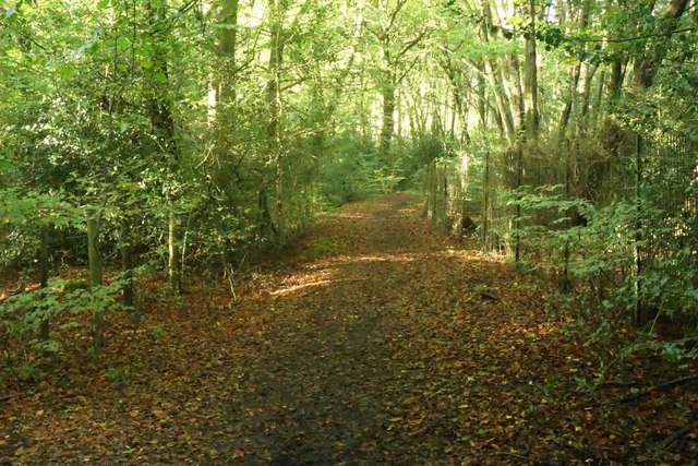
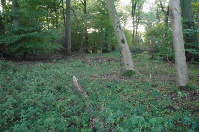
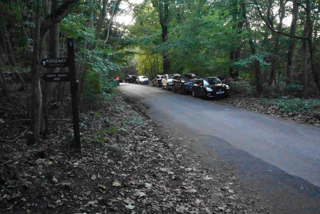
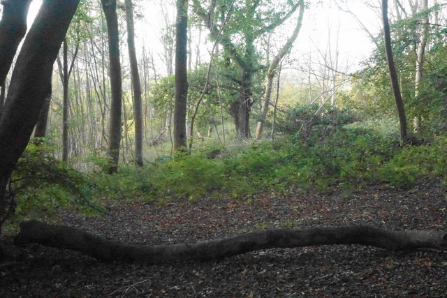
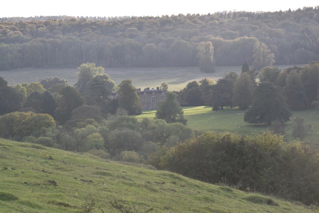
The village of Ellesborough is nestled in the Chiltern Hills, an Area of Outstanding Natural Beauty. This picturesque location offers stunning views of the surrounding countryside, making it a popular destination for walkers and nature enthusiasts. The parish is home to several footpaths and bridleways, providing ample opportunities for outdoor activities.

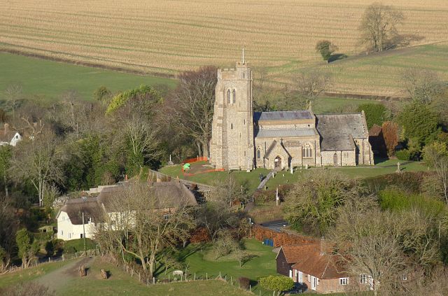
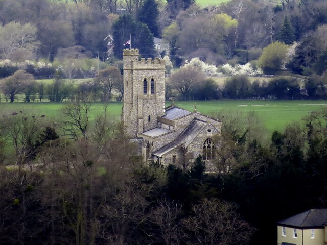
Ellesborough has a rich history dating back to the medieval period. The village is known for its Grade II* listed church, St. Peter and St. Paul, which was built in the 14th century and features beautiful stained glass windows and intricate stone carvings. The church is a prominent landmark in the village and adds to its historical charm.

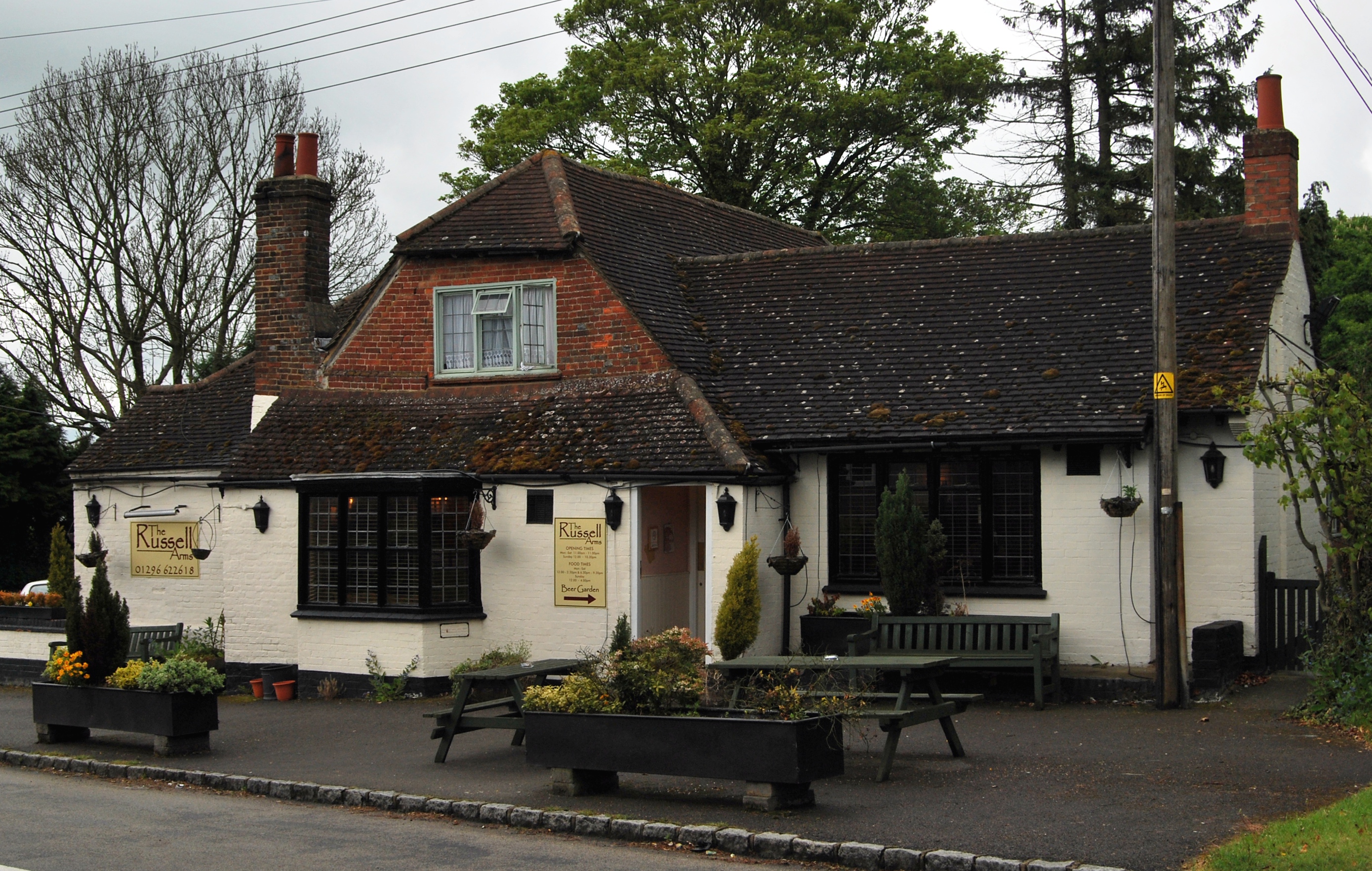
In terms of amenities, Ellesborough has a village hall that hosts various community events and activities. The parish also has a primary school, providing education for local children.

While Ellesborough is a small village, it benefits from its proximity to larger towns such as Aylesbury and High Wycombe, where residents can access a wider range of services and amenities. Overall, Ellesborough offers a peaceful and picturesque setting in the heart of the Buckinghamshire countryside, making it an attractive place to live or visit.

If you have any feedback on the listing, please let us know in the comments section below.

Ellesborough Images

Images are sourced within 2km of 51.753173/-0.781298 or Grid Reference SP8406. Thanks to Geograph Open Source API. All images are credited.

Church and cottages, Ellesborough Beacon Hill rises steeply to the south of the village and affords good views across the Vale of Aylesbury.  The church of Ss. Peter and Paul is itself prominently located on a small hill towards the west of the village.
Church and cottages, Ellesborough
Beacon Hill rises steeply to the south of the village and affords good views across the Vale of Aylesbury. The church of Ss. Peter and Paul is itself prominently located on a small hill towards the west of the village.
A bridleway crossing a field in Ellesborough Beacon Hill is in the background,
A bridleway crossing a field in Ellesborough
Beacon Hill is in the background,
Chequers near Ellesborough Chequers is the country house of the Prime Minister of the United Kingdom.
Chequers near Ellesborough
Chequers is the country house of the Prime Minister of the United Kingdom.
St Peter and St Paul Church in Ellesborough
Ellesborough Road, Wendover An unclassified but busy road to the west of Wendover.
Ellesborough Road, Wendover
An unclassified but busy road to the west of Wendover.
Houses on Ellesborough Road
Farmland, Ellesborough A few trees in a former field boundary to the north of the village.
Farmland, Ellesborough
A few trees in a former field boundary to the north of the village.
Farmland, Ellesborough A footpath alongside the western edge of Whorley Wood.
Farmland, Ellesborough
A footpath alongside the western edge of Whorley Wood.
Woodland, Ellesborough The bridleway at the western edge of Goodmerhill Wood.
Woodland, Ellesborough
The bridleway at the western edge of Goodmerhill Wood.
Footpath in Low Scrubs Whether by past management or not, the trees have developed some contorted shapes.
Footpath in Low Scrubs
Whether by past management or not, the trees have developed some contorted shapes.
Footpath in Low Scrubs I think these are mainly beech trees.
Footpath in Low Scrubs
I think these are mainly beech trees.
Footpath in High Scrubs You can go quite a long way without seeing out of the woodland.
Footpath in High Scrubs
You can go quite a long way without seeing out of the woodland.
Paths crossing in Linton's Wood This is looking south down the Ridgeway, which is approximately following the Chiltern escarpment. There are no views out because of the beech wood.
Paths crossing in Linton's Wood
This is looking south down the Ridgeway, which is approximately following the Chiltern escarpment. There are no views out because of the beech wood.
Woodland below Coombe Hill Looking down from the Ridgeway. Chequers is off view up to the left. Beacon Hill provides a background and beyond that is the Vale of Aylesbury.
Woodland below Coombe Hill
Looking down from the Ridgeway. Chequers is off view up to the left. Beacon Hill provides a background and beyond that is the Vale of Aylesbury.
Beech woodland in Linton's Wood This is at the top of the Chilterns escarpment though you cannot easily tell from the view. It is seen here from the Ridgeway long distance path.
Beech woodland in Linton's Wood
This is at the top of the Chilterns escarpment though you cannot easily tell from the view. It is seen here from the Ridgeway long distance path.
Road on Lodge Hill The Ridgeway crosses the road here on the Chilterns escarpment. It is a popular place to park away from the formal car park.
Road on Lodge Hill
The Ridgeway crosses the road here on the Chilterns escarpment. It is a popular place to park away from the formal car park.
Beech wood on Lodge Hill Coming northwards along the Ridgeway, we are nearly at a point where there is a view from the top of the ridge.
Beech wood on Lodge Hill
Coming northwards along the Ridgeway, we are nearly at a point where there is a view from the top of the ridge.
Chequers from the Ridgeway An open part of the hillside between Lodge Hill and Coombe Hill gives a view over the Prime Minister's retreat.
Chequers from the Ridgeway
An open part of the hillside between Lodge Hill and Coombe Hill gives a view over the Prime Minister's retreat.
Show me another place!

Ellesborough is located at Grid Ref: SP8406 (Lat: 51.753173, Lng: -0.781298)

Unitary Authority: Buckinghamshire

Police Authority: Thames Valley

What 3 Words

///cycle.hairspray.fishnet. Near Wendover, Buckinghamshire

Related Wikis

Butlers Cross

Butlers Cross is a hamlet within the parish of Ellesborough (where the 2011 Census population was included), in Buckinghamshire, England. It is in the...

Ellesborough

Ellesborough is a village and civil parish in Buckinghamshire, England. The village is at the foot of the Chiltern Hills just to the south of the Vale...

Coombe, Buckinghamshire

Coombe is a hamlet in the parish of Ellesborough in the English county of Buckinghamshire, situated between Coombe Hill and Chequers, the official country...

Coombe Hill, Buckinghamshire

Coombe Hill is a hill in The Chilterns, located next to the hamlet of Dunsmore, Buckinghamshire, England, near the small town of Wendover, and overlooking...

Nearby Amenities

Located within 500m of 51.753173,-0.781298
Butler's Cross
Place: hamlet
Wikidata: Q5002699
Lat/Long: 51.7570645/-0.7800391
Barrier: kissing_gate
Lat/Long: 51.7570328/-0.7844335
Ellesborough
Place: village
Lat/Long: 51.7541098/-0.7878489
Turning Circle
Lat/Long: 51.7566548/-0.7799287
Post Box
Collection Times: Mo-Fr 09:00; Sa 07:00
Operator: Royal Mail
Post Box Type: lamp
Ref: HP17 289D
Royal Cypher: EIIR
Royal Cypher Wikidata: Q33102113
Source: survey
Survey Date: 2016-06-11
Lat/Long: 51.7546168/-0.7879649
Post Box
Collection Times: Mo-Fr 16:00; Sa 09:15
Operator: Royal Mail
Post Box Type: wall
Ref: HP17 291
Royal Cypher: EIIR
Royal Cypher Wikidata: Q33102113
Source: survey
Survey Date: 2016-06-11
Lat/Long: 51.7564754/-0.780668
Historic: memorial
Memorial: war_memorial
Lat/Long: 51.7555418/-0.7806449
Waste Basket
Waste: trash
Lat/Long: 51.755763/-0.7807704
Bench
Backrest: yes
Lat/Long: 51.7557701/-0.7807629
Waste Basket
Waste: trash
Lat/Long: 51.7557103/-0.7804291
Defibrillator
Booth: K6
Colour: red
Defibrillator Location: inside red phone box, at junction of Chalkshire Road and Ellesborough Road (near Russells Arms pub), Butler's Cross
Disused Amenity: telephone
Emergency: defibrillator
Indoor: no
Man Made: telephone_box
Note: there was a KX300 kiosk here which was replaced with a K6
Lat/Long: 51.7557477/-0.7805242
Waste Basket
Waste: trash
Lat/Long: 51.7555302/-0.7804786
Barrier: kissing_gate
Lat/Long: 51.7575435/-0.7827187
Barrier: kissing_gate
Lat/Long: 51.757535/-0.7827477
Material: wood
Power: pole
Source: bing
Lat/Long: 51.7490776/-0.7802533
Material: wood
Power: pole
Source: bing
Lat/Long: 51.7498905/-0.7806529
Power: pole
Source: bing
Lat/Long: 51.7506128/-0.7810043
Power: pole
Source: bing
Transformer: distribution
Lat/Long: 51.7515651/-0.7814616
Power: pole
Source: bing
Lat/Long: 51.7524377/-0.7819068
Power: pole
Source: bing
Lat/Long: 51.7533426/-0.7823615
Power: pole
Source: bing
Lat/Long: 51.7542758/-0.7828201
Power: pole
Source: bing
Lat/Long: 51.7551956/-0.7832935
Power: pole
Source: bing
Lat/Long: 51.7558963/-0.7835832
Power: pole
Source: bing
Lat/Long: 51.7567048/-0.7842337
Golf: pin
Lat/Long: 51.7548775/-0.7784776
Golf: pin
Lat/Long: 51.7504979/-0.7769747
Golf: pin
Lat/Long: 51.7543868/-0.7787982
Golf: pin
Lat/Long: 51.7514988/-0.7783668
Golf: pin
Lat/Long: 51.7502991/-0.778
Golf: pin
Lat/Long: 51.7511686/-0.7758146
Golf: pin
Lat/Long: 51.752988/-0.7758716
Golf: pin
Lat/Long: 51.756316/-0.7763752
Direction: 150
Generator Method: photovoltaic
Generator Output Electricity: yes
Generator Solar Modules: 5
Generator Source: solar
Generator Type: solar_photovoltaic_panel
Location: roof
Power: generator
Lat/Long: 51.7544467/-0.78756
The data included in this document is from www.openstreetmap.org. The data is made available under ODbL.

Have you been to Ellesborough?

Leave your review of Ellesborough below (or comments, questions and feedback).