Coombe Hill

Hill, Mountain in Buckinghamshire

England

Coombe Hill

Church and cottages, Ellesborough Beacon Hill rises steeply to the south of the village and affords good views across the Vale of Aylesbury.  The church of Ss. Peter and Paul is itself prominently located on a small hill towards the west of the village.
Church and cottages, Ellesborough Credit: Andrew Smith

Coombe Hill is a prominent hill located in Buckinghamshire, England. Situated approximately 4 miles southwest of Wendover, it forms part of the Chiltern Hills, a designated Area of Outstanding Natural Beauty. Rising to an elevation of 260 meters (850 feet), Coombe Hill offers breathtaking panoramic views of the surrounding countryside.

The hill is renowned for its distinctive monument, the Coombe Hill Monument, which was erected in 1904 to commemorate the 148 Buckinghamshire men who lost their lives during the Second Boer War. The monument stands at the highest point of the hill and consists of a granite column topped with a bronze statue of a mounted soldier. It serves as a poignant reminder of the sacrifices made by local residents during the conflict.

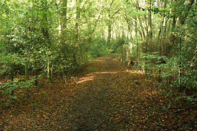
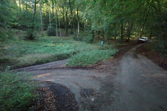
Surrounded by lush green fields and woodlands, Coombe Hill is a haven for nature enthusiasts and walkers. It is crisscrossed by a network of well-maintained footpaths and bridleways, providing ample opportunities for outdoor exploration. The hill is particularly popular among hikers and dog walkers who enjoy the stunning vistas and peaceful ambience.

In addition to its natural beauty, Coombe Hill boasts a rich historical past. The surrounding area is home to several ancient burial mounds, dating back to the Bronze Age. These archaeological sites offer valuable insights into the region's early inhabitants and are of great interest to researchers and history enthusiasts.

Overall, Coombe Hill is a cherished natural landmark in Buckinghamshire, attracting visitors with its breathtaking views, historical significance, and opportunities for outdoor recreation. Whether one seeks tranquility, historical knowledge, or simply a picturesque walk, Coombe Hill offers an unforgettable experience.

If you have any feedback on the listing, please let us know in the comments section below.
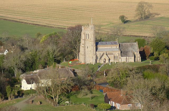
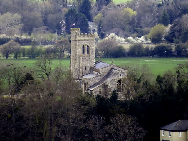
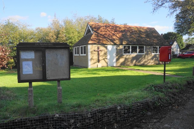
Coombe Hill Images

Images are sourced within 2km of 51.752164/-0.77146884 or Grid Reference SP8406. Thanks to Geograph Open Source API. All images are credited.

Church and cottages, Ellesborough Beacon Hill rises steeply to the south of the village and affords good views across the Vale of Aylesbury.  The church of Ss. Peter and Paul is itself prominently located on a small hill towards the west of the village.
Church and cottages, Ellesborough
Beacon Hill rises steeply to the south of the village and affords good views across the Vale of Aylesbury. The church of Ss. Peter and Paul is itself prominently located on a small hill towards the west of the village.
A bridleway crossing a field in Ellesborough Beacon Hill is in the background,
A bridleway crossing a field in Ellesborough
Beacon Hill is in the background,
Chequers near Ellesborough Chequers is the country house of the Prime Minister of the United Kingdom.
Chequers near Ellesborough
Chequers is the country house of the Prime Minister of the United Kingdom.
St Peter and St Paul Church in Ellesborough
Ellesborough Road, Wendover An unclassified but busy road to the west of Wendover.
Ellesborough Road, Wendover
An unclassified but busy road to the west of Wendover.
Houses on Ellesborough Road
HS2 works at Wendover A view north from Ellesborough Road of the HS2 works alongside the A413 at Wendover.  The line is due to tunnel beneath Ellesborough Road, and to facilitate this four houses have been demolished on the north side of the road.
HS2 works at Wendover
A view north from Ellesborough Road of the HS2 works alongside the A413 at Wendover. The line is due to tunnel beneath Ellesborough Road, and to facilitate this four houses have been demolished on the north side of the road.
Building site by the Wendover bypass Another field has been covered with concrete. This is the most frequent change I see on the edge of so many towns and villages.
Building site by the Wendover bypass
Another field has been covered with concrete. This is the most frequent change I see on the edge of so many towns and villages.
Farmland, Ellesborough A few trees in a former field boundary to the north of the village.
Farmland, Ellesborough
A few trees in a former field boundary to the north of the village.
Farmland, Ellesborough A footpath alongside the western edge of Whorley Wood.
Farmland, Ellesborough
A footpath alongside the western edge of Whorley Wood.
Woodland, Ellesborough The bridleway at the western edge of Goodmerhill Wood.
Woodland, Ellesborough
The bridleway at the western edge of Goodmerhill Wood.
Footpath in Low Scrubs Whether by past management or not, the trees have developed some contorted shapes.
Footpath in Low Scrubs
Whether by past management or not, the trees have developed some contorted shapes.
Footpath in Low Scrubs I think these are mainly beech trees.
Footpath in Low Scrubs
I think these are mainly beech trees.
Footpath in High Scrubs You can go quite a long way without seeing out of the woodland.
Footpath in High Scrubs
You can go quite a long way without seeing out of the woodland.
High Scrubs Longstanding beech woodland.
High Scrubs
Longstanding beech woodland.
Church of the Resurrection, Dunsmore This was built in 1897 as a chapel of ease to the parish church of St Peter & Paul, Ellesborough. The Church of England wanted to close it down in the 1980s, but the villagers came together to take it over, and it continues as an independent ecumenical church strongly linked to the community.
Church of the Resurrection, Dunsmore
This was built in 1897 as a chapel of ease to the parish church of St Peter & Paul, Ellesborough. The Church of England wanted to close it down in the 1980s, but the villagers came together to take it over, and it continues as an independent ecumenical church strongly linked to the community.
Footpath near Dunsmore Crossing undulating Chiltern countryside. The bright sunlight has intruded a bit.
Footpath near Dunsmore
Crossing undulating Chiltern countryside. The bright sunlight has intruded a bit.
Road through Fugsdon Wood Near the head of a dry valley.
Road through Fugsdon Wood
Near the head of a dry valley.
Show me another place!

Coombe Hill is located at Grid Ref: SP8406 (Lat: 51.752164, Lng: -0.77146884)

Unitary Authority: Buckinghamshire

Police Authority: Thames Valley

What 3 Words

///depended.vocally.expecting. Near Wendover, Buckinghamshire

Related Wikis

Coombe Hill, Buckinghamshire

Coombe Hill is a hill in The Chilterns, located next to the hamlet of Dunsmore, Buckinghamshire, England, near the small town of Wendover, and overlooking...

Bacombe and Coombe Hills

Bacombe and Coombe Hills is a 76.4-hectare (189-acre) biological Site of Special Scientific Interest in Upper Bacombe in Buckinghamshire. Bacombe Hill...

Butlers Cross

Butlers Cross is a hamlet within the parish of Ellesborough (where the 2011 Census population was included), in Buckinghamshire, England. It is in the...

Coombe, Buckinghamshire

Coombe is a hamlet in the parish of Ellesborough in the English county of Buckinghamshire, situated between Coombe Hill and Chequers, the official country...

Nearby Amenities

Located within 500m of 51.752164,-0.77146884
Coombe Hill
Ele: 257
Information: map
Man Made: survey_point
Map Type: toposcope
Natural: peak
Ref: S6207
Source: survey
Tourism: viewpoint
Wikidata: Q5167602
Lat/Long: 51.7531301/-0.7716141
Bench
Backrest: no
Lat/Long: 51.7531681/-0.7681925
Barrier: kissing_gate
Lat/Long: 51.7514225/-0.768219
Chilterns Countryside
Addr City: Aylesbury
Addr Housename: Lodge Hill
Addr Postcode: HP17 0UR
Addr Street: Butlers Cross
Alt Name: Chiltern Hills
Email: chilternscountryside@nationaltrust.org.uk
Phone: +44 1494 755596
Website: https://www.nationaltrust.org.uk/chilterns-countryside/
Lat/Long: 51.7513075/-0.7725077
Barrier: kissing_gate
Lat/Long: 51.748018/-0.7717473
Barrier: kissing_gate
Lat/Long: 51.7479885/-0.7727243
Bench
Backrest: no
Check Date: 2021-04-18
Lat/Long: 51.7530205/-0.7710868
Bench
Backrest: no
Check Date: 2021-05-01
Lat/Long: 51.7532555/-0.7689357
Coombe Hill
Check Date: 2021-04-18
Hiking: yes
Horse: yes
Information: map
Map Size: site
Map Type: scheme
Tourism: information
Lat/Long: 51.7485703/-0.7678889
Check Date: 2021-04-18
Covered: no
Leisure: picnic_table
Lat/Long: 51.7486031/-0.768182
Check Date: 2021-04-18
Covered: no
Leisure: picnic_table
Lat/Long: 51.7485903/-0.7680237
Check Date: 2021-04-18
Covered: no
Leisure: picnic_table
Lat/Long: 51.7484836/-0.7681444
Check Date: 2021-04-18
Covered: no
Leisure: picnic_table
Lat/Long: 51.7485039/-0.7680197
Waste Basket
Waste: dog_excrement
Lat/Long: 51.7487374/-0.7683166
Waste Basket
Waste: trash
Lat/Long: 51.7482887/-0.7681223
Playground: stepping_wall
Lat/Long: 51.7493255/-0.7679439
Playground: stepping_posts
Lat/Long: 51.7489344/-0.7678943
Playground: see_saw_walking_log
Lat/Long: 51.7490884/-0.7682223
Playground: stepping_posts
Lat/Long: 51.7493075/-0.7682526
Barrier: kissing_gate
Lat/Long: 51.7558346/-0.7694912
Bench
Backrest: no
Check Date: 2021-04-18
Lat/Long: 51.7506904/-0.7719902
Bench
Backrest: no
Check Date: 2021-04-18
Lat/Long: 51.7513498/-0.7720279
Bench
Backrest: no
Check Date: 2021-04-18
Lat/Long: 51.7497449/-0.7720559
Barrier: bollard
Lat/Long: 51.7529912/-0.7715466
Barrier: bollard
Lat/Long: 51.7529887/-0.771665
Barrier: bollard
Lat/Long: 51.7530648/-0.7715508
Barrier: bollard
Lat/Long: 51.7530622/-0.7716696
Barrier: kissing_gate
Lat/Long: 51.7549378/-0.7728517
Golf: pin
Lat/Long: 51.7504979/-0.7769747
Golf: pin
Lat/Long: 51.7514988/-0.7783668
Golf: pin
Lat/Long: 51.7502991/-0.778
Golf: pin
Lat/Long: 51.7511686/-0.7758146
Golf: pin
Lat/Long: 51.752988/-0.7758716
Golf: pin
Lat/Long: 51.7556966/-0.7746744
Coombe Hill
Ele: 260
Natural: peak
Source: https://www.hill-bagging.co.uk/mountaindetails.php?qu=S&rf=5385
Lat/Long: 51.7520448/-0.7709366
The data included in this document is from www.openstreetmap.org. The data is made available under ODbL.

Have you been to Coombe Hill?

Leave your review of Coombe Hill below (or comments, questions and feedback).