Eldersfield

Civil Parish in Worcestershire Malvern Hills

England

Eldersfield

St. John the Baptist's church, Eldersfield Viewed from the laburnum-clad lychgate.
The gridline intersects the east wall of the chancel.
St. John the Baptist's church, Eldersfield Credit: Jonathan Billinger

Eldersfield is a civil parish located in the county of Worcestershire, England. Situated in the Malvern Hills District, it covers an area of approximately 10 square kilometers, nestled in the picturesque countryside of the West Midlands. The parish is made up of the two main villages of Eldersfield and Pendock, along with several smaller hamlets.

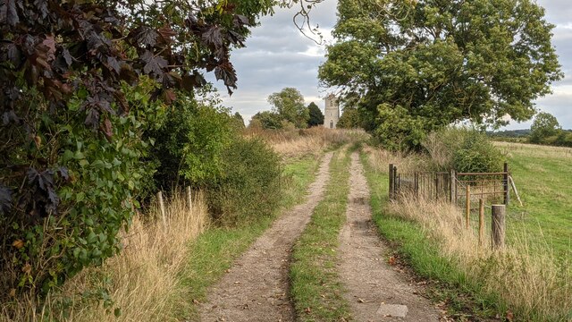
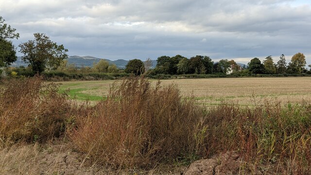
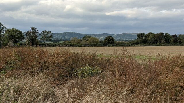
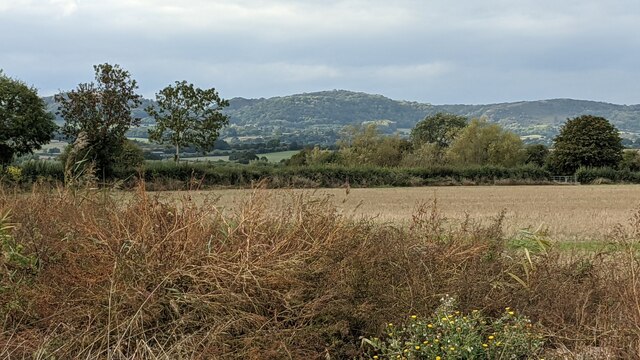
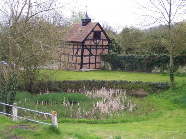
Eldersfield, the larger of the two villages, is known for its charming rural character and beautiful landscape. The village is surrounded by lush green fields, rolling hills, and woodlands, providing a tranquil and idyllic setting for residents and visitors alike. The area is dotted with traditional cottages, many of which date back to the 17th and 18th centuries, adding to the village's charm and historical appeal.

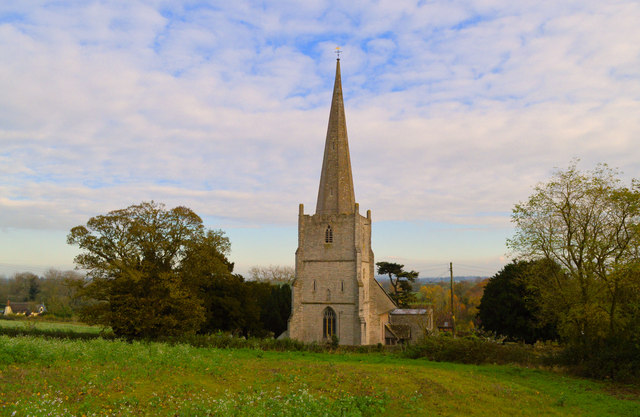
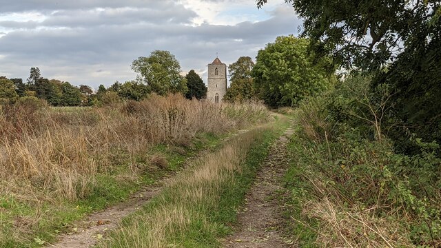
Pendock, the smaller village in the parish, is situated to the east of Eldersfield. It is characterized by its close-knit community and quiet atmosphere. The village is primarily residential, with a mix of old and new housing. Pendock is also home to a historic church, St. Mary's, which dates back to the 12th century and attracts visitors interested in its architectural and historical significance.

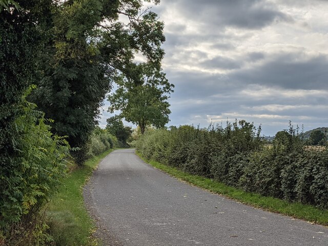
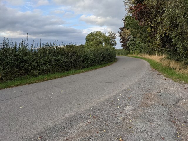
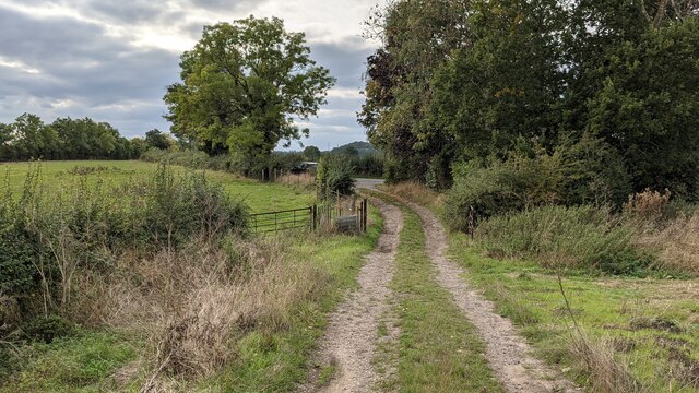
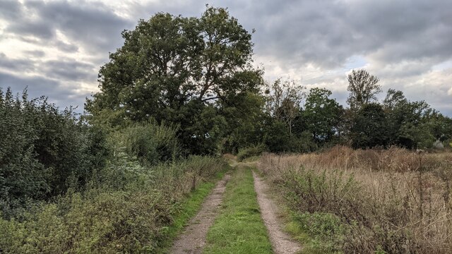
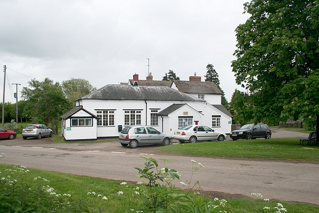
Both Eldersfield and Pendock offer a range of amenities and services to their residents, including a primary school, a village hall, and a local pub. The surrounding area provides ample opportunities for outdoor activities such as hiking, cycling, and horse riding, with numerous footpaths and bridleways crisscrossing the countryside.

Overall, Eldersfield and Pendock in Worcestershire offer a peaceful and scenic retreat, combining natural beauty with a strong sense of community.

If you have any feedback on the listing, please let us know in the comments section below.

Eldersfield Images

Images are sourced within 2km of 51.984907/-2.271599 or Grid Reference SO8131. Thanks to Geograph Open Source API. All images are credited.

St. John the Baptist's church, Eldersfield Viewed from the laburnum-clad lychgate.
The gridline intersects the east wall of the chancel.
St. John the Baptist's church, Eldersfield
Viewed from the laburnum-clad lychgate. The gridline intersects the east wall of the chancel.
St John the Baptist, Eldersfield
Eldersfield Court Seen from the churchyard
Eldersfield Court
Seen from the churchyard
St John the Baptist, Eldersfield Unless I am mistaken, there is a slight suggestion of Chesterfield in that spire.
St John the Baptist, Eldersfield
Unless I am mistaken, there is a slight suggestion of Chesterfield in that spire.
Remains of late Norman doorway, Eldersfield A Late Norman doorway of some quality on the South side of the nave, protected by a porch of 1925 by Healing and Overbury. The stonework of the Victorian replacement dates from the restoration of the nave by F.S. Waller in 1876.
Remains of late Norman doorway, Eldersfield
A Late Norman doorway of some quality on the South side of the nave, protected by a porch of 1925 by Healing and Overbury. The stonework of the Victorian replacement dates from the restoration of the nave by F.S. Waller in 1876.
Ordnance Survey Cut Mark This OS cut mark can be found on the south angle of St John the Baptist's Church. It marks a point 24.485m above mean sea level.
Ordnance Survey Cut Mark
This OS cut mark can be found on the south angle of St John the Baptist's Church. It marks a point 24.485m above mean sea level.
Footpath to Pillows Green Malvern Hills in the distance.
Footpath to Pillows Green
Malvern Hills in the distance.
Lane at Pendock This country lane passes through the second southernmost village in Worcestershire, and that is Pendock. This was taken at a layby by the old village church.
Lane at Pendock
This country lane passes through the second southernmost village in Worcestershire, and that is Pendock. This was taken at a layby by the old village church.
Track to Pendock Old Church This track leads walkers to the old church at Pendock, adjacent to the M50 road.
Track to Pendock Old Church
This track leads walkers to the old church at Pendock, adjacent to the M50 road.
Pendock Old Church Built in the mid 12th century, this was altered in the 14th and 15th centuries, and additions took place during those centuries. The bell tower with the pyramidal roof dates from the 15th century, and the church can be seen from the adjacent M50 road. The church appears to be in a peaceful location, but the thunderous noise from the motorway adds sorrow to this place. The church is owned by the Churches Conservation Trust, and the building is open daily.
Pendock Old Church
Built in the mid 12th century, this was altered in the 14th and 15th centuries, and additions took place during those centuries. The bell tower with the pyramidal roof dates from the 15th century, and the church can be seen from the adjacent M50 road. The church appears to be in a peaceful location, but the thunderous noise from the motorway adds sorrow to this place. The church is owned by the Churches Conservation Trust, and the building is open daily.
Track to Pendock Old Church This track leads walkers to the old church at Pendock, adjacent to the M50 road.
Track to Pendock Old Church
This track leads walkers to the old church at Pendock, adjacent to the M50 road.
The Malvern Hills (Viewed from Pendock) Here are the Malvern Hills from the track leading to Pendock Old Church from the west.
The Malvern Hills (Viewed from Pendock)
Here are the Malvern Hills from the track leading to Pendock Old Church from the west.
Track to Pendock Old Church This track leads walkers to the old church at Pendock, adjacent to the M50 road.
Track to Pendock Old Church
This track leads walkers to the old church at Pendock, adjacent to the M50 road.
The Malvern Hills (Viewed from Pendock) Here are the Malvern Hills from the track leading to Pendock Old Church from the west. From left to right, the hills seen in this view are Ragged Stone Hill, Midsummer Hill, Swinyard Hill, Millennium Hill and the Herefordshire Beacon.
The Malvern Hills (Viewed from Pendock)
Here are the Malvern Hills from the track leading to Pendock Old Church from the west. From left to right, the hills seen in this view are Ragged Stone Hill, Midsummer Hill, Swinyard Hill, Millennium Hill and the Herefordshire Beacon.
Midsummer Hill (Viewed from Pendock) Here is the 932 feet (284 m) tall Midsummer Hill in the Malvern Hills range, which has a concrete shelter on the summit and was an Iron Age hill fort from c.390 BC to 48 AD. This picture was taken from the track leading to the old church at Pendock.
Midsummer Hill (Viewed from Pendock)
Here is the 932 feet (284 m) tall Midsummer Hill in the Malvern Hills range, which has a concrete shelter on the summit and was an Iron Age hill fort from c.390 BC to 48 AD. This picture was taken from the track leading to the old church at Pendock.
Show me another place!

Eldersfield is located at Grid Ref: SO8131 (Lat: 51.984907, Lng: -2.271599)

Administrative County: Worcestershire

District: Malvern Hills

Police Authority: West Mercia

What 3 Words

///tulip.suits.cutlets. Near Corse, Gloucestershire

Nearby Locations

Eldersfield Tuts Hill

Related Wikis

Eldersfield

Eldersfield is a village and civil parish in the Malvern Hills district of Worcestershire, England. It had a population of 584 in 2021.It stands exactly...
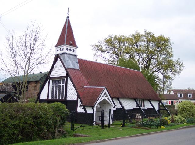
Pendock Church

Pendock Church is a redundant Anglican church standing to the southeast of the hamlet of Sledge Green in the parish of Pendock, Worcestershire, England...

RAF Berrow

Royal Air Force Berrow or more simply RAF Berrow is a former Royal Air Force Satellite Landing Ground located near Berrow, Worcestershire, England. �...

South Wales Gas Pipeline

The South Wales Gas Pipeline (also known as the Milford Haven pipeline) is the UK's largest high-pressure gas pipeline. The 197-mile (317 km) pipeline...
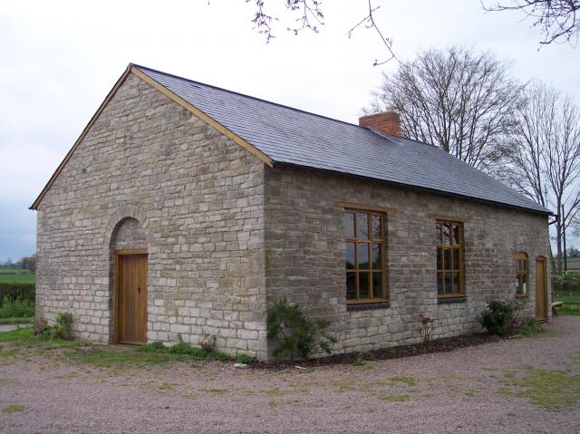
Gadfield Elm Chapel

The Gadfield Elm Chapel near the village of Pendock in Worcestershire, England, is the oldest extant chapel of the Church of Jesus Christ of Latter-day...

Pendock

Pendock is a village and civil parish in the Malvern Hills district in the county of Worcestershire, England, situated about halfway between the towns...

Berrow, Worcestershire

Berrow is a village and civil parish in the Malvern Hills district of Worcestershire, England, about seven miles east of Ledbury. According to the 2021...

Staunton (near Gloucester)

Staunton is a village that lies close to the village of Corse. Staunton is eight miles north of the city of Gloucester. To the south-west of Staunton is...

Related Videos

Day 1 of the Cheltenham Festival complete

Last flight of the day returning back to Gloucester Airport having completed all our flying for the 1st day of the Cheltenham Festival ...

Pick up from Corse Lawn Hotel, to Cheltenham Festival 2023!

Cheltenham Festival, pick up from a private site. #helicopter #helicoptervideo #jetengine.

NIKKITA - Postcard Lover

Listen here: https://song.link/Nikkitamusic Follow NIKKITA: Facebook: https://www.facebook.com/nikkitamusic Instagram: ...

Driving Along The B4208 From Birtsmorton To Welland, Worcestershire, England 9th March 2012

Driving along the B4208 from Birtsmorton to Welland, Worcestershire, England Videoed on Friday, 9th March 2012 To watch all of ...

Nearby Amenities

Located within 500m of 51.984907,-2.271599
Berrowdine Cottage
Power: pole
Transformer: distribution
Voltage Primary: 11000
Lat/Long: 51.9833472/-2.2689074
Power: pole
Lat/Long: 51.9836932/-2.2700346
Power: pole
Lat/Long: 51.9844647/-2.2712684
Power: pole
Lat/Long: 51.9847666/-2.2725298
Power: pole
Lat/Long: 51.9850391/-2.2736583
Power: pole
Lat/Long: 51.9853427/-2.2748318
Power: pole
Lat/Long: 51.9852221/-2.2762232
Bramble Cottage
Power: pole
Transformer: distribution
Voltage Primary: 11000
Lat/Long: 51.9850974/-2.2775019
Power: pole
Lat/Long: 51.9844948/-2.2782375
The data included in this document is from www.openstreetmap.org. The data is made available under ODbL.

Have you been to Eldersfield?

Leave your review of Eldersfield below (or comments, questions and feedback).