Eggington

Civil Parish in Bedfordshire

England

Eggington

Leighton Buzzard: Narrow gauge railway The railway was originally built in 1919 to carry sand from nearby quarries to the now dismantled Leighton Buzzard to Dunstable standard gauge railway line close to Page's Park. It closed as an industrial line in 1969, but was taken over by volunteers to be run as a heritage railway. The railway has a very informative website here <span class="nowrap"><a title="http://www.buzzrail.co.uk/" rel="nofollow ugc noopener" href="http://www.buzzrail.co.uk/">Link</a><img style="margin-left:2px;" alt="External link" title="External link - shift click to open in new window" src="https://s1.geograph.org.uk/img/external.png" width="10" height="10"/></span> A light dusting of snow covers the ground in this view, taken looking north westwards where the railway runs parallel to the road called Meadway on the left. The brick walls are the parapets of the railway bridge over Clipstone Brook, a tributary of the River Ouzel.
Leighton Buzzard: Narrow gauge railway Credit: Nigel Cox

Eggington is a small civil parish located in the county of Bedfordshire, England. Situated approximately 3 miles south of the town of Leighton Buzzard, Eggington covers an area of around 1.5 square miles.

The parish is primarily rural in nature, characterized by open fields, farmland, and a scattering of residential properties. It is known for its picturesque countryside, with rolling hills and scenic views. The area has a tranquil and peaceful atmosphere, making it a popular destination for those seeking a break from the hustle and bustle of city life.

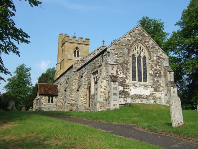
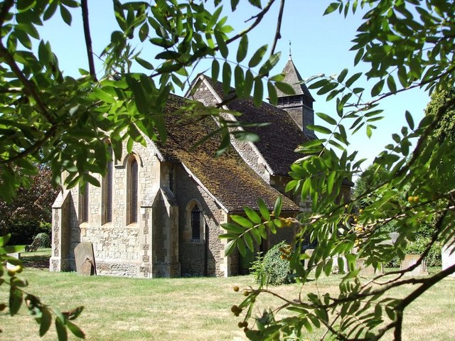
Eggington is home to a tight-knit community, with a population of around 200 residents. The parish has a small church, St. Michael and All Angels, which dates back to the 13th century. The church is a prominent feature in the local landscape and contributes to the historical charm of the area.

Despite its small size, Eggington benefits from its proximity to nearby amenities and attractions. The town of Leighton Buzzard offers a range of shops, restaurants, and leisure facilities, while the larger cities of Milton Keynes and Luton are easily accessible by car or public transportation.

In conclusion, Eggington is a peaceful and picturesque civil parish in Bedfordshire, known for its rural beauty and close-knit community. It offers a serene retreat for those looking to escape the city, while still providing easy access to nearby towns and cities.

If you have any feedback on the listing, please let us know in the comments section below.
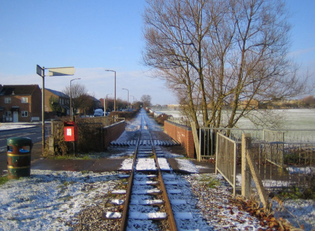
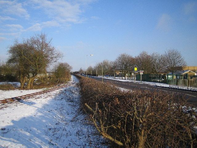
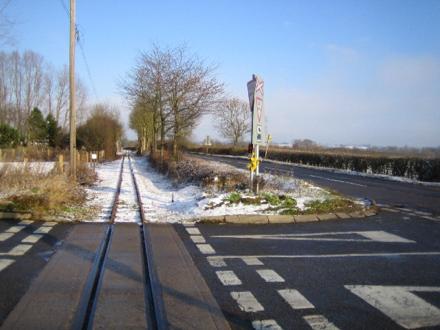
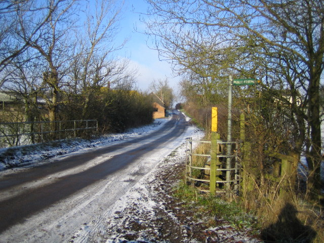
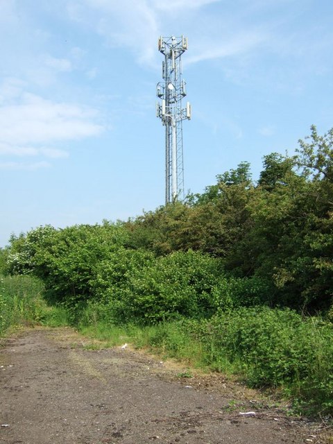
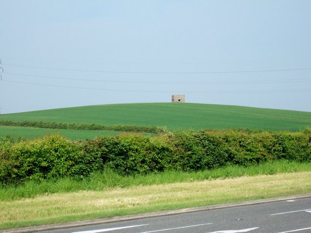
Eggington Images

Images are sourced within 2km of 51.923551/-0.618989 or Grid Reference SP9525. Thanks to Geograph Open Source API. All images are credited.

Leighton Buzzard: Narrow gauge railway The railway was originally built in 1919 to carry sand from nearby quarries to the now dismantled Leighton Buzzard to Dunstable standard gauge railway line close to Page's Park. It closed as an industrial line in 1969, but was taken over by volunteers to be run as a heritage railway. The railway has a very informative website here <span class="nowrap"><a title="http://www.buzzrail.co.uk/" rel="nofollow ugc noopener" href="http://www.buzzrail.co.uk/">Link</a><img style="margin-left:2px;" alt="External link" title="External link - shift click to open in new window" src="https://s1.geograph.org.uk/img/external.png" width="10" height="10"/></span> A light dusting of snow covers the ground in this view, taken looking north westwards where the railway runs parallel to the road called Meadway on the left. The brick walls are the parapets of the railway bridge over Clipstone Brook, a tributary of the River Ouzel.
Leighton Buzzard: Narrow gauge railway
The railway was originally built in 1919 to carry sand from nearby quarries to the now dismantled Leighton Buzzard to Dunstable standard gauge railway line close to Page's Park. It closed as an industrial line in 1969, but was taken over by volunteers to be run as a heritage railway. The railway has a very informative website here LinkExternal link A light dusting of snow covers the ground in this view, taken looking north westwards where the railway runs parallel to the road called Meadway on the left. The brick walls are the parapets of the railway bridge over Clipstone Brook, a tributary of the River Ouzel.
Leighton Buzzard: Narrow gauge railway The railway was originally built in 1919 to carry sand from nearby quarries to the now dismantled Leighton Buzzard to Dunstable standard gauge railway line close to Page's Park. It closed as an industrial line in 1969, but was taken over by volunteers to be run as a heritage railway. The railway has a very informative website here <span class="nowrap"><a title="http://www.buzzrail.co.uk/" rel="nofollow ugc noopener" href="http://www.buzzrail.co.uk/">Link</a><img style="margin-left:2px;" alt="External link" title="External link - shift click to open in new window" src="https://s1.geograph.org.uk/img/external.png" width="10" height="10"/></span> Viewed looking north eastwards, the railway runs parallel to Vandyke Road here. The buildings of Vandyke Upper School are visible on the right of the road. The School's website is here <span class="nowrap"><a title="http://www.vandyke.beds.sch.uk/" rel="nofollow ugc noopener" href="http://www.vandyke.beds.sch.uk/">Link</a><img style="margin-left:2px;" alt="External link" title="External link - shift click to open in new window" src="https://s1.geograph.org.uk/img/external.png" width="10" height="10"/></span>
Leighton Buzzard: Narrow gauge railway
The railway was originally built in 1919 to carry sand from nearby quarries to the now dismantled Leighton Buzzard to Dunstable standard gauge railway line close to Page's Park. It closed as an industrial line in 1969, but was taken over by volunteers to be run as a heritage railway. The railway has a very informative website here LinkExternal link Viewed looking north eastwards, the railway runs parallel to Vandyke Road here. The buildings of Vandyke Upper School are visible on the right of the road. The School's website is here LinkExternal link
Leighton Buzzard: Narrow gauge railway The railway was originally built in 1919 to carry sand from nearby quarries to the now dismantled Leighton Buzzard to Dunstable standard gauge railway line close to Page's Park. It closed as an industrial line in 1969, but was taken over by volunteers to be run as a heritage railway. The railway has a very informative website here <span class="nowrap"><a title="http://www.buzzrail.co.uk/" rel="nofollow ugc noopener" href="http://www.buzzrail.co.uk/">Link</a><img style="margin-left:2px;" alt="External link" title="External link - shift click to open in new window" src="https://s1.geograph.org.uk/img/external.png" width="10" height="10"/></span> This view was taken, with a light dusting of snow on the ground, looking north eastwards across the Shenley Hill Road level crossing, with Mile Tree Road running parallel to the railway to the right.
Leighton Buzzard: Narrow gauge railway
The railway was originally built in 1919 to carry sand from nearby quarries to the now dismantled Leighton Buzzard to Dunstable standard gauge railway line close to Page's Park. It closed as an industrial line in 1969, but was taken over by volunteers to be run as a heritage railway. The railway has a very informative website here LinkExternal link This view was taken, with a light dusting of snow on the ground, looking north eastwards across the Shenley Hill Road level crossing, with Mile Tree Road running parallel to the railway to the right.
Leighton Buzzard: Clipstone Viewed looking north from the bridge over Clipstone Brook towards Clipstone.
Leighton Buzzard: Clipstone
Viewed looking north from the bridge over Clipstone Brook towards Clipstone.
Leighton Buzzard: Narrow gauge railway Stonehenge Works on the railway viewed looking southwards with Mile Tree Road on the left. This is the current northern terminus of the railway although the track does continue for about another 500 metres northwards. The railway was originally built in 1919 to carry sand from nearby quarries to the now dismantled Leighton Buzzard to Dunstable standard gauge railway line close to Page's Park. It closed as an industrial line in 1969, but was taken over by volunteers to be run as a heritage railway. The railway has a very informative website here <span class="nowrap"><a title="http://www.buzzrail.co.uk/" rel="nofollow ugc noopener" href="http://www.buzzrail.co.uk/">Link</a><img style="margin-left:2px;" alt="External link" title="External link - shift click to open in new window" src="https://s1.geograph.org.uk/img/external.png" width="10" height="10"/></span>
Leighton Buzzard: Narrow gauge railway
Stonehenge Works on the railway viewed looking southwards with Mile Tree Road on the left. This is the current northern terminus of the railway although the track does continue for about another 500 metres northwards. The railway was originally built in 1919 to carry sand from nearby quarries to the now dismantled Leighton Buzzard to Dunstable standard gauge railway line close to Page's Park. It closed as an industrial line in 1969, but was taken over by volunteers to be run as a heritage railway. The railway has a very informative website here LinkExternal link
Telecoms mast, Leighton Road A common sight these days, a mobile phone mast. This one on the Leighton Road near Stanbridge.
In the foreground can be seen the remnants of the old road that has now been diverted. (Cf. <a href="https://www.geograph.org.uk/photo/182692">SP9523 : The End of the Road</a>)
Telecoms mast, Leighton Road
A common sight these days, a mobile phone mast. This one on the Leighton Road near Stanbridge. In the foreground can be seen the remnants of the old road that has now been diverted. (Cf. SP9523 : The End of the Road)
"The Look-out" Pill Box near Stanbridge This little structure is called "The Look-out" and I am assuming that it's a WWII pill box. Cross-checking with the 1:5000 map on <span class="nowrap"><a title="http://magic.defra.gov.uk/website/magic/viewer.htm?startTopic=maggb&xygridref=495000,224100&startScale=5000" rel="nofollow ugc noopener" href="http://magic.defra.gov.uk/website/magic/viewer.htm?startTopic=maggb&xygridref=495000,224100&startScale=5000">Link</a><img style="margin-left:2px;" alt="External link" title="External link - shift click to open in new window" src="https://s1.geograph.org.uk/img/external.png" width="10" height="10"/></span> its map reference is SP9500624157 placing it just six metres inside this gridsquare!
"The Look-out" Pill Box near Stanbridge
This little structure is called "The Look-out" and I am assuming that it's a WWII pill box. Cross-checking with the 1:5000 map on LinkExternal link its map reference is SP9500624157 placing it just six metres inside this gridsquare!
A new top ! I just happened to be passing at this rather historic moment as the old windmill at Stanbridge had a new top lowered on to it ! It's excellent to see old buildings such as this being refurbished - and I'm particularly sentimental about windmills since discovering that my great-grandfather was a journeyman millwright !
Google street view as it is now <span class="nowrap"><a title="http://maps.google.co.uk/maps?q=http:%2F%2Fwww.geograph.org.uk%2Fphoto%2F182704.kml&ll=51.910995,-0.601569&spn=0.000003,0.003473&t=m&z=19&layer=c&cbll=51.911096,-0.601662&panoid=-WvrUOU5O_f75Jt5F9_zKw&cbp=12,238.95,,0,7.64" rel="nofollow ugc noopener" href="http://maps.google.co.uk/maps?q=http:%2F%2Fwww.geograph.org.uk%2Fphoto%2F182704.kml&ll=51.910995,-0.601569&spn=0.000003,0.003473&t=m&z=19&layer=c&cbll=51.911096,-0.601662&panoid=-WvrUOU5O_f75Jt5F9_zKw&cbp=12,238.95,,0,7.64">Link</a><img style="margin-left:2px;" alt="External link" title="External link - shift click to open in new window" src="https://s1.geograph.org.uk/img/external.png" width="10" height="10"/></span>
A new top !
I just happened to be passing at this rather historic moment as the old windmill at Stanbridge had a new top lowered on to it ! It's excellent to see old buildings such as this being refurbished - and I'm particularly sentimental about windmills since discovering that my great-grandfather was a journeyman millwright ! Google street view as it is now LinkExternal link
St. Nicholas, Church End, Hockliffe Church End is a lovely quiet backwater of Hockliffe. Most of the village sprawls along the very busy A5 Watling Street, but this part of the village seems miles from hectic activity.
St. Nicholas, Church End, Hockliffe
Church End is a lovely quiet backwater of Hockliffe. Most of the village sprawls along the very busy A5 Watling Street, but this part of the village seems miles from hectic activity.
Hockliffe Grange Peeping over the trees which surround it, this is about the best view you can get of Hockliffe Grange, taken from the lane that approaches it from the church.
Hockliffe Grange
Peeping over the trees which surround it, this is about the best view you can get of Hockliffe Grange, taken from the lane that approaches it from the church.
Gates to Hockliffe Rectory Rather wonderfully overgrown gates and fencing to The Rectory, Church End, Hockliffe. This is almost opposite the church but in the adjacent square.
Gates to Hockliffe Rectory
Rather wonderfully overgrown gates and fencing to The Rectory, Church End, Hockliffe. This is almost opposite the church but in the adjacent square.
Ground Farm, Hockliffe The road from the church out to this farm gradually deteriorates until it becomes a muddy track with grass in the middle. It then improves a little just before you reach this farm. The area the farm is in is called "Hockliffe Grounds" hence the name of the farm.
Ground Farm, Hockliffe
The road from the church out to this farm gradually deteriorates until it becomes a muddy track with grass in the middle. It then improves a little just before you reach this farm. The area the farm is in is called "Hockliffe Grounds" hence the name of the farm.
Chicken coops - probably I'm not sure at all what these wooden structures are - sheds, coops or barns ? Neither do I know if they're still in use. I think they belong to Corner Farm so I'm going for chicken coops ... probably.
Chicken coops - probably
I'm not sure at all what these wooden structures are - sheds, coops or barns ? Neither do I know if they're still in use. I think they belong to Corner Farm so I'm going for chicken coops ... probably.
Church End, Hockliffe As it says on the sign. The eponymous church is <a href="https://www.geograph.org.uk/photo/182708">SP9626 : St. Nicholas, Church End, Hockliffe</a>
Church End, Hockliffe
As it says on the sign. The eponymous church is SP9626 : St. Nicholas, Church End, Hockliffe
Church Lane, Church End, Hockliffe This is the view back roughly southwards down Church Lane from near the lane junction at Church End. Note: The map shows this lane as Goose Green, but I'm pretty sure its street nameplate said Church Lane.
Church Lane, Church End, Hockliffe
This is the view back roughly southwards down Church Lane from near the lane junction at Church End. Note: The map shows this lane as Goose Green, but I'm pretty sure its street nameplate said Church Lane.
Steps & churchyard Steps illuminated with dappled light lead into the churchyard of <a href="https://www.geograph.org.uk/photo/182708">SP9626 : St. Nicholas, Church End, Hockliffe</a>
Steps & churchyard
Steps illuminated with dappled light lead into the churchyard of SP9626 : St. Nicholas, Church End, Hockliffe
Hockliffe Grounds Looking back down the track to Grounds Farm, Hockliffe. Just beyond this bend was a quite deep, very muddy puddle straddling the whole track.
Hockliffe Grounds
Looking back down the track to Grounds Farm, Hockliffe. Just beyond this bend was a quite deep, very muddy puddle straddling the whole track.
Hill Farm, Hockliffe Looking along the long straight track to the farm. This track is effectively a continuation of Woodcock Lane (also known as Little Lane).
Hill Farm, Hockliffe
Looking along the long straight track to the farm. This track is effectively a continuation of Woodcock Lane (also known as Little Lane).
Show me another place!

Eggington is located at Grid Ref: SP9525 (Lat: 51.923551, Lng: -0.618989)

Unitary Authority: Central Bedfordshire

Police Authority: Bedfordshire

What 3 Words

///relief.pursuit.select. Near Stanbridge, Bedfordshire

Nearby Locations

Eggington Eggington

Related Wikis

Clipstone, Bedfordshire

Clipstone is a small hamlet in Bedfordshire, England. It lies within the parish of Eggington that borders with Leighton Buzzard, Heath and Reach and Hockliffe...
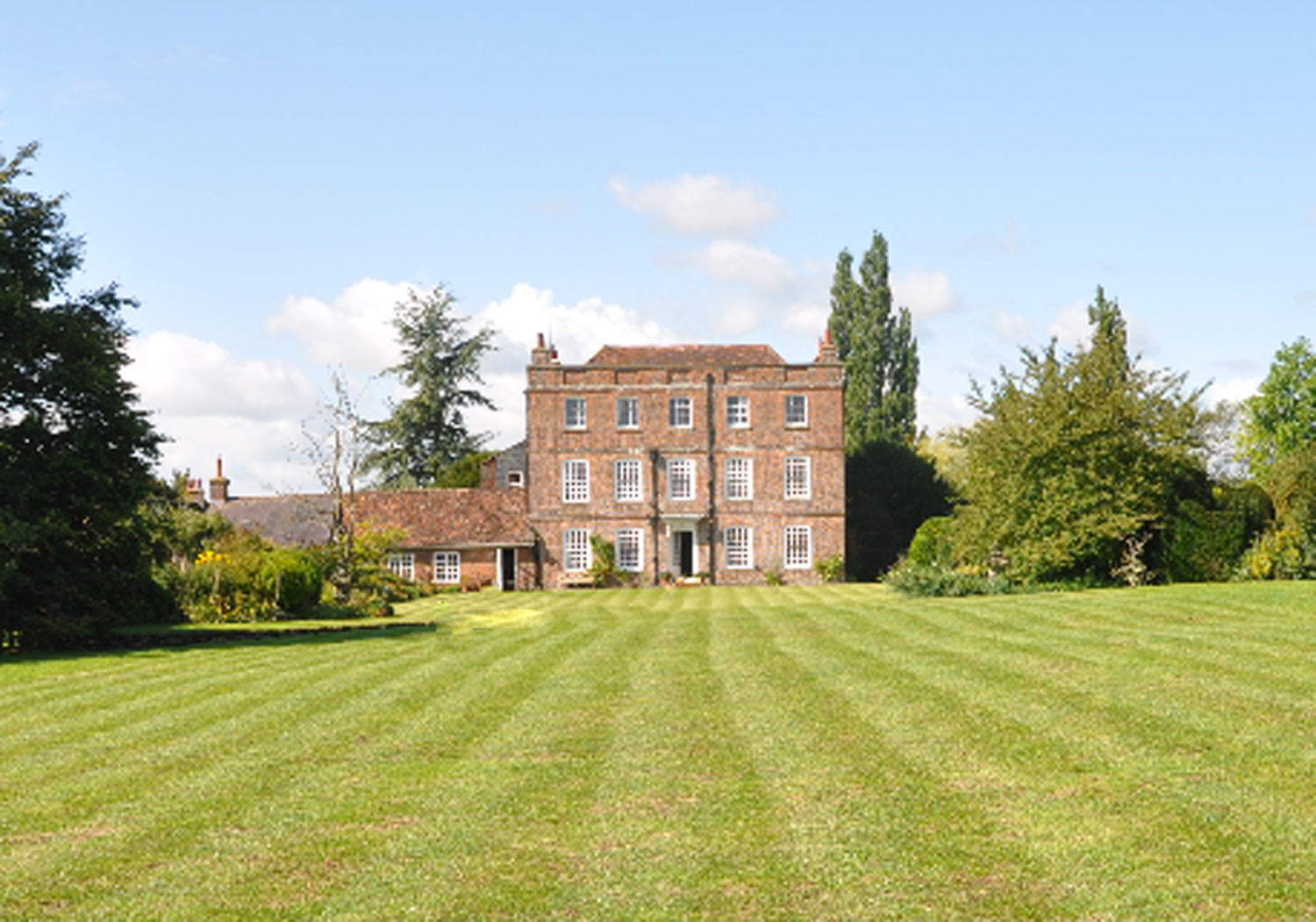
Eggington House

Eggington House is the manor house of the village of Eggington situated near Leighton Buzzard, Bedfordshire, England. The house is regarded as a very...

Eggington

Egginton – or Eggington as it is now known – is a village and civil parish in the Central Bedfordshire district of Bedfordshire, England, about three miles...

RAF Stanbridge

RAF Stanbridge (originally RAF Leighton Buzzard) was a non-flying RAF station situated on the outskirts of Leighton Buzzard, Bedfordshire, England and...

Nearby Amenities

Located within 500m of 51.923551,-0.618989
Peck's Farm Shop
Addr City: Eggington
Addr Country: GB
Addr Housename: Stockwell Farm
Addr Postcode: LU7 9PA
Addr Street: Leighton Road
Fhrs Authority: Central Bedfordshire
Fhrs Id: 450355
Fhrs Local Authority Id: 18481
Shop: farm
Source: GPS waypoint
Upload Tag: ojw_notM1
Lat/Long: 51.9202589/-0.6160632
Note: footpath left
Source: GPS waypoint
Upload Tag: ojw_notM1
Lat/Long: 51.9210983/-0.614475
Clipstone
Place: hamlet
Wikidata: Q1521901
Lat/Long: 51.9269172/-0.6224106
Place: farm
Lat/Long: 51.9199376/-0.6161599
The data included in this document is from www.openstreetmap.org. The data is made available under ODbL.

Have you been to Eggington?

Leave your review of Eggington below (or comments, questions and feedback).