Ecclesfield
Civil Parish in Yorkshire Sheffield
England
Ecclesfield

Ecclesfield is a civil parish located in the metropolitan borough of Sheffield, Yorkshire, England. It is situated about 5 miles north of the city center and covers an area of approximately 6 square miles. The parish is surrounded by picturesque countryside, with rolling hills and open fields.
Ecclesfield has a rich history, dating back to the Anglo-Saxon era. It was mentioned in the Domesday Book of 1086, and the parish church, St. Mary's, is believed to have been founded in the 12th century. The church is a notable landmark in the area and is known for its impressive architecture and historical significance.
The parish is primarily residential, with a mix of housing types ranging from traditional stone cottages to modern developments. It is a close-knit community with a population of around 10,000 people. Ecclesfield has a range of amenities, including shops, pubs, and schools, making it a convenient place to live.
The area is well-served by public transport, with regular bus services connecting Ecclesfield to Sheffield city center and surrounding areas. The M1 motorway is also easily accessible, providing convenient links to other parts of Yorkshire and beyond.
Ecclesfield offers a range of recreational opportunities, with several parks and green spaces in the vicinity. The area is popular for outdoor activities such as walking, cycling, and horse riding. Overall, Ecclesfield is a charming and historic parish that offers a peaceful and convenient place to live within close proximity to Sheffield.
If you have any feedback on the listing, please let us know in the comments section below.
Ecclesfield Images
Images are sourced within 2km of 53.455847/-1.481336 or Grid Reference SK3495. Thanks to Geograph Open Source API. All images are credited.


Ecclesfield is located at Grid Ref: SK3495 (Lat: 53.455847, Lng: -1.481336)
Division: West Riding
Administrative County: South Yorkshire
District: Sheffield
Police Authority: South Yorkshire
What 3 Words
///wooden.cars.courier. Near Chapeltown, South Yorkshire
Nearby Locations
Related Wikis
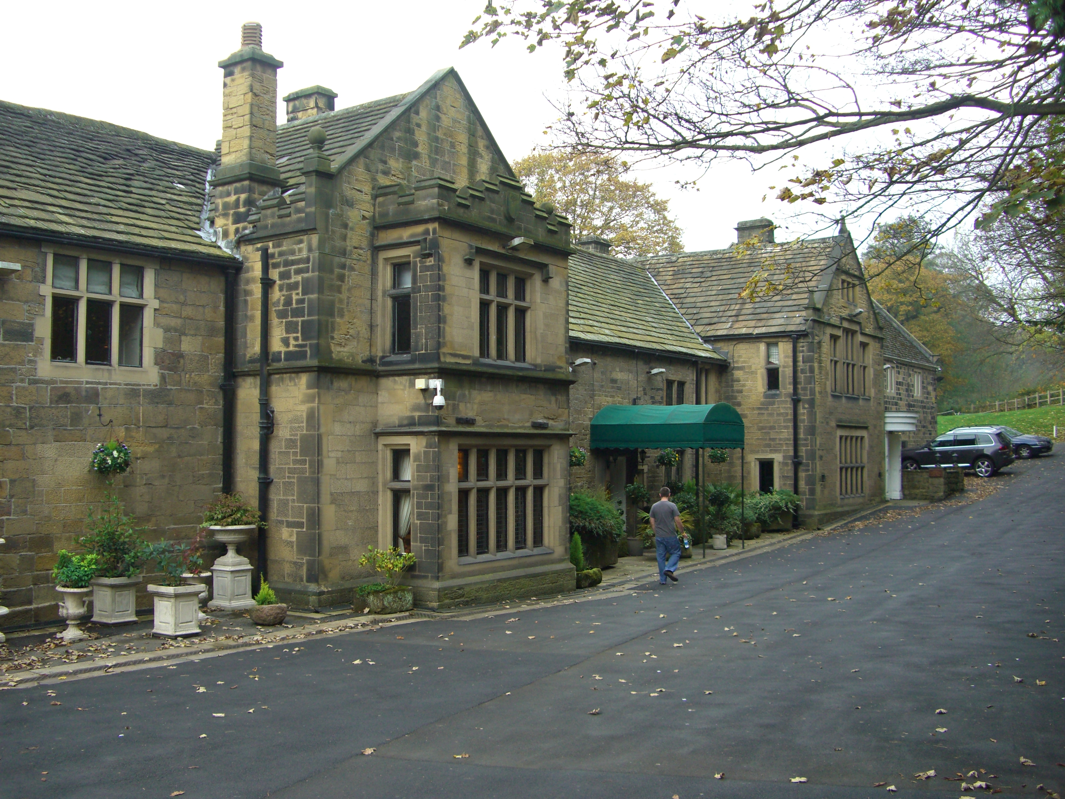
Whitley Hall
Whitley Hall is a 16th-century mansion which since 1969 has been converted into a restaurant and then a hotel. It is situated in the northern rural district...

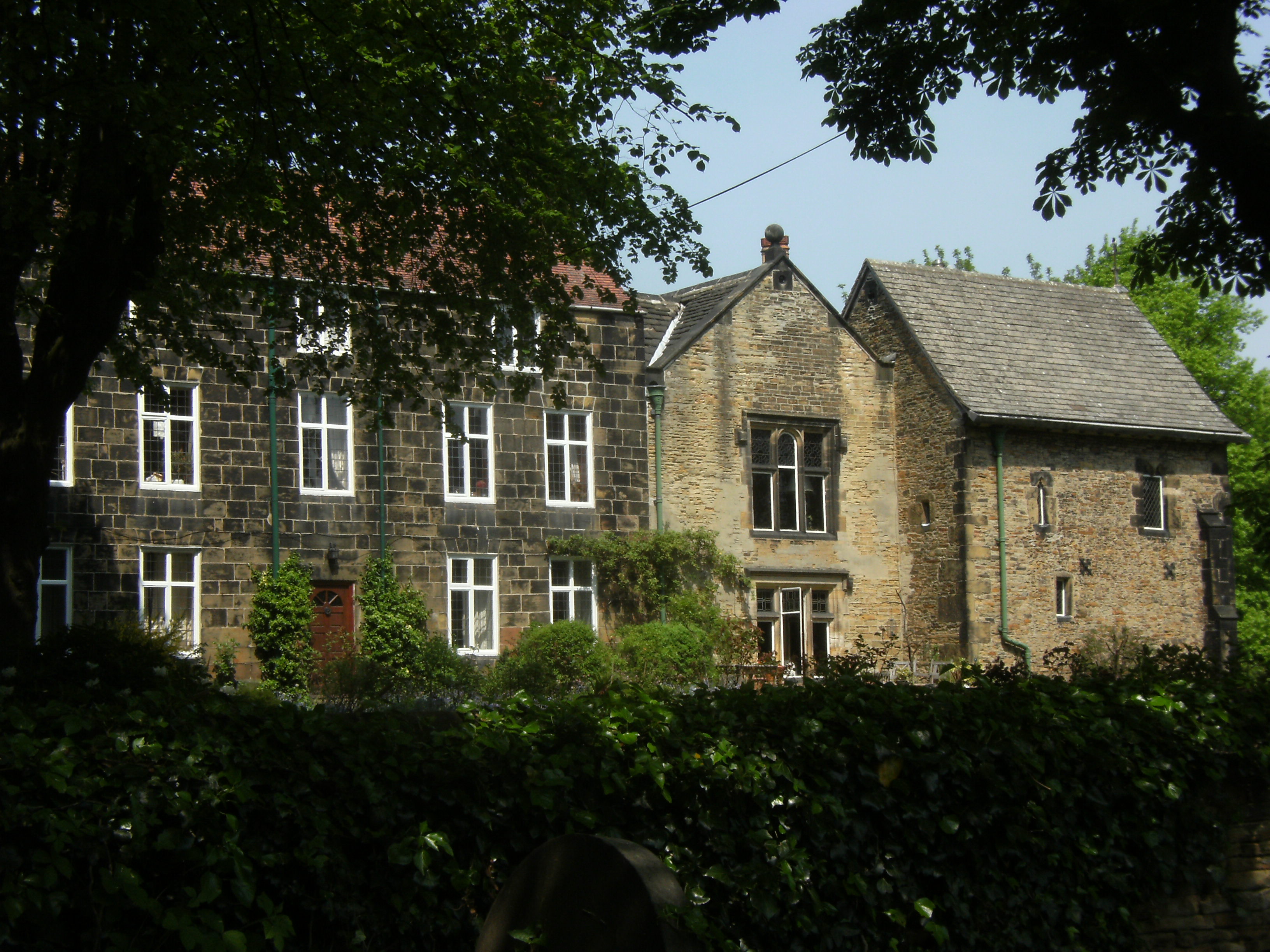
Barnes Hall, South Yorkshire
Barnes Hall is an English country house near Burncross within the City of Sheffield in England. The estate includes the buildings of the adjacent Barnes...

Ecclesfield School
Ecclesfield School is a coeducational secondary school with academy status situated on Chapeltown Road (A6135) between Chapeltown and Ecclesfield, South...

Chapeltown, South Yorkshire
Chapeltown is a suburb of Sheffield in South Yorkshire, England. It is part of the Parish of Ecclesfield. It is historically within the West Riding of...

Chapeltown railway station
Chapeltown railway station, originally known as Chapeltown South, is a railway station serves the Sheffield suburb of Chapeltown in South Yorkshire, England...
Ecclesfield Priory
Ecclesfield Priory was a religious house of Benedictine monks, lying in the village of Ecclesfield, north of Sheffield in Yorkshire, England. == History... ==

Church of St Mary, Ecclesfield
The Church of St Mary, Ecclesfield, is situated on Church Street in the village of Ecclesfield, Sheffield, South Yorkshire, England. It is situated 4.3...
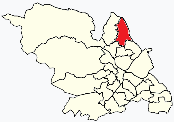
East Ecclesfield
East Ecclesfield ward—which includes the districts of Chapeltown and Ecclesfield—is one of the 28 electoral wards in City of Sheffield, England. It is...
Nearby Amenities
Located within 500m of 53.455847,-1.481336Have you been to Ecclesfield?
Leave your review of Ecclesfield below (or comments, questions and feedback).