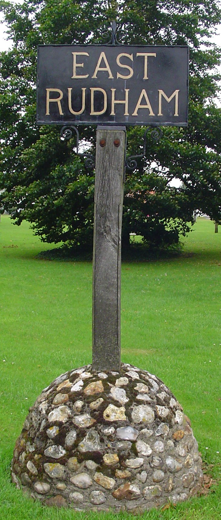
East Rudham

Civil Parish in Norfolk King's Lynn and West Norfolk

England

East Rudham

East and West Rudham: aerial 2015
East and West Rudham: aerial 2015 Credit: Chris

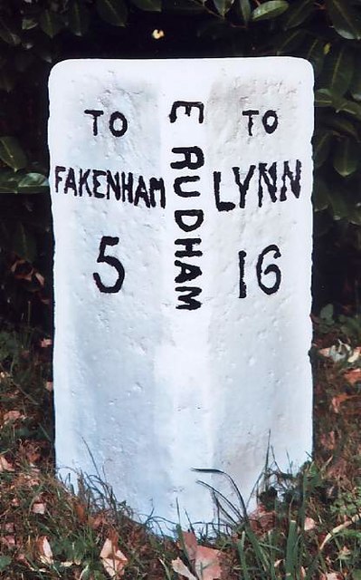
East Rudham is a civil parish located in the county of Norfolk, England. It is situated approximately 16 miles east of the town of King's Lynn and 8 miles west of Fakenham. The parish covers an area of around 8.6 square miles.

The village of East Rudham, which serves as the main settlement in the parish, has a population of around 600 people. It is a traditional English village with a charming mix of historic buildings and modern amenities. The center of the village is dominated by the medieval parish church of St. Mary, which dates back to the 14th century.

East Rudham is surrounded by picturesque countryside, offering residents and visitors plenty of opportunities for outdoor activities. The village is located on the edge of the Wensum Valley, providing beautiful landscapes for walking, cycling, and birdwatching. The local area is also known for its numerous nature reserves and wildlife.

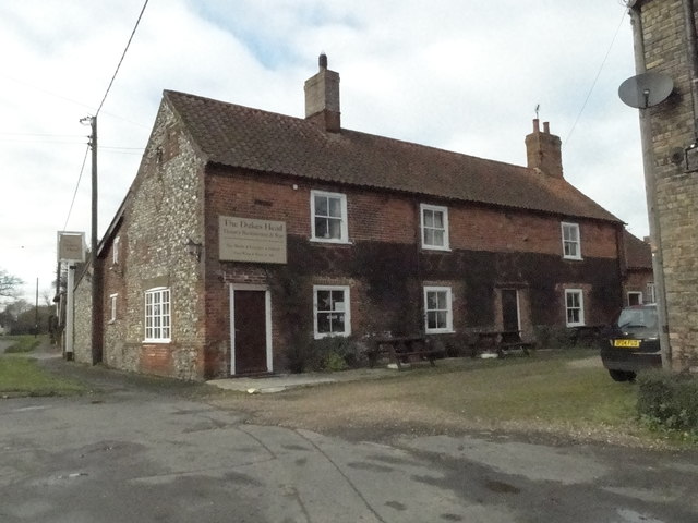
In terms of amenities, East Rudham boasts a primary school, a village hall, a post office, and a local pub. The village is well-connected by road, with the A148 running through it, providing easy access to nearby towns and cities.

Overall, East Rudham is a peaceful and scenic civil parish, offering a pleasant rural lifestyle while still being within reach of larger towns and cities.

If you have any feedback on the listing, please let us know in the comments section below.

East Rudham Images

Images are sourced within 2km of 52.830702/0.712097 or Grid Reference TF8229. Thanks to Geograph Open Source API. All images are credited.

East and West Rudham: aerial 2015
East and West Rudham War Memorial The brass memorial hangs in East Rudham church but has the names of 29 men who were lost from both villages in WW1. 
A further ten names relate to WW2 encompassing both parishes.
East and West Rudham War Memorial
The brass memorial hangs in East Rudham church but has the names of 29 men who were lost from both villages in WW1. A further ten names relate to WW2 encompassing both parishes.
Back Lane, West Rudham An old part of the village, the road is still little more than a rough track.
Back Lane, West Rudham
An old part of the village, the road is still little more than a rough track.
West Rudham: aerial 2017 View to Houghton Park and the Wash.
West Rudham: aerial 2017
View to Houghton Park and the Wash.
East Rudham Village Sign East Rudham is a village on the A148, King's Lynn to Cromer road, about 6 miles west of Fakenham.
The village sign is located at the western end of the village green.
East Rudham Village Sign
East Rudham is a village on the A148, King's Lynn to Cromer road, about 6 miles west of Fakenham. The village sign is located at the western end of the village green.
East Rudham Village Green Looking east along the village green with the A148, King's Lynn to Cromer road, to the left of the village green.
East Rudham Village Green
Looking east along the village green with the A148, King's Lynn to Cromer road, to the left of the village green.
West Rudham Village Sign and Village Green Looking east along the village green with the A148, King's Lynn to Cromer road, to the left of the green.
West Rudham Village Sign and Village Green
Looking east along the village green with the A148, King's Lynn to Cromer road, to the left of the green.
The Duke's Head West Rudham Built in 1663 and still serving pints.
<a title="https://www.geograph.org.uk/photo/5616155" href="https://www.geograph.org.uk/photo/5616155">Link</a>
The Duke's Head West Rudham
Built in 1663 and still serving pints. Link
Hanging sign for 'The Duke's Head' West Rudham <a title="https://www.geograph.org.uk/photo/5616152" href="https://www.geograph.org.uk/photo/5616152">Link</a>
Hanging sign for 'The Duke's Head' West Rudham
Lynn Road, West Rudham
Hall Farm Barn on School Road, West Rudham
East Rudham cemetery On the outskirts of the village.
East Rudham cemetery
On the outskirts of the village.
Old Milestone by the former A148, Coxford, East Rudham Parish The milestone is located 30yds east of the gate to Coxford Nurseries, opposite cottages, on the verge on the north side of road. Parish of East Rudham (Kings Lynn and West Norfolk District). Carved stone post, Wells stone design, erected by the Wells to Fakenham turnpike trust in the 20th century. 

Inscription reads:-
: TO / FAKENHAM / 5 : : E. RUDHAM : : TO / LYNN / 16 :  

Milestone Society National ID: NO_FKL05
Old Milestone by the former A148, Coxford, East Rudham Parish
The milestone is located 30yds east of the gate to Coxford Nurseries, opposite cottages, on the verge on the north side of road. Parish of East Rudham (Kings Lynn and West Norfolk District). Carved stone post, Wells stone design, erected by the Wells to Fakenham turnpike trust in the 20th century. Inscription reads:- : TO / FAKENHAM / 5 : : E. RUDHAM : : TO / LYNN / 16 : Milestone Society National ID: NO_FKL05
Old Milestone by the A148, East Rudham Carved stone post by the A148, in parish of EAST RUDHAM (KINGS LYNN AND WEST NORFOLK District), 80yds East of junction with Eye Lane, at rear of wide verge, on South side of road. Wells stone, erected by the Wells to Fakenham turnpike trust in the 20th century. 

Inscription reads:-
: TO / LYNN / 15 : : E. RUDHAM : : TO / FAKENHAM / 6 :

Norfolk HER listed.  
NHER Number: 56750 <span class="nowrap"><a title="https://www.heritagegateway.org.uk/Gateway/Results_Single.aspx?uid=MNF63161&resourceID=1002" rel="nofollow ugc noopener" href="https://www.heritagegateway.org.uk/Gateway/Results_Single.aspx?uid=MNF63161&resourceID=1002">Link</a><img style="margin-left:2px;" alt="External link" title="External link - shift click to open in new window" src="https://s1.geograph.org.uk/img/external.png" width="10" height="10"/></span>

Milestone Society National ID: NO_FKL06.
Old Milestone by the A148, East Rudham
Carved stone post by the A148, in parish of EAST RUDHAM (KINGS LYNN AND WEST NORFOLK District), 80yds East of junction with Eye Lane, at rear of wide verge, on South side of road. Wells stone, erected by the Wells to Fakenham turnpike trust in the 20th century. Inscription reads:- : TO / LYNN / 15 : : E. RUDHAM : : TO / FAKENHAM / 6 : Norfolk HER listed. NHER Number: 56750 LinkExternal link Milestone Society National ID: NO_FKL06.
Old Milestone by the A148, West Rudham Carved stone post by the A148, in parish of West Rudham (Kings Lynn and West Norfolk District), opposite drive between "Rosedean" and "Albion House", at edge of village green about 1ft from edge of road, on South side of road. Wells stone, erected by the Wells to Fakenham turnpike trust in the 20th century. 

Inscription reads:-
: TO / LYNN / 14 : : W RUDHAM : : TO / FAKENHAM / 7 :

Norfolk HER.
NHER Number: 56751 <span class="nowrap"><a title="https://www.heritagegateway.org.uk/Gateway/Results_Single.aspx?uid=MNF63162&resourceID=1002" rel="nofollow ugc noopener" href="https://www.heritagegateway.org.uk/Gateway/Results_Single.aspx?uid=MNF63162&resourceID=1002">Link</a><img style="margin-left:2px;" alt="External link" title="External link - shift click to open in new window" src="https://s1.geograph.org.uk/img/external.png" width="10" height="10"/></span>  

Milestone Society National ID: NO_FKL07
Old Milestone by the A148, West Rudham
Carved stone post by the A148, in parish of West Rudham (Kings Lynn and West Norfolk District), opposite drive between "Rosedean" and "Albion House", at edge of village green about 1ft from edge of road, on South side of road. Wells stone, erected by the Wells to Fakenham turnpike trust in the 20th century. Inscription reads:- : TO / LYNN / 14 : : W RUDHAM : : TO / FAKENHAM / 7 : Norfolk HER. NHER Number: 56751 LinkExternal link Milestone Society National ID: NO_FKL07
Approaching  East  Rudham  on  the  A148 Westbound toward Kings Lynn
Approaching East Rudham on the A148
Westbound toward Kings Lynn
Entering  East  Rudham  on  the  A148 Toward Kings Lynn
Entering East Rudham on the A148
Toward Kings Lynn
Road  junction  in  village  street  East  Rudham The main road through is the A148. Up to the junction it is Fakenham Road after the junction it is Lynn Road. The minor road going left is Station Road to West Raynham
Road junction in village street East Rudham
The main road through is the A148. Up to the junction it is Fakenham Road after the junction it is Lynn Road. The minor road going left is Station Road to West Raynham
Show me another place!

East Rudham is located at Grid Ref: TF8229 (Lat: 52.830702, Lng: 0.712097)

Administrative County: Norfolk

District: King's Lynn and West Norfolk

Police Authority: Norfolk

What 3 Words

///images.farmed.digesting. Near Fakenham, Norfolk

Nearby Locations

East Rudham

Related Wikis

East Rudham

East Rudham is a village and civil parish in the English county of Norfolk. The village is located 14 miles (23 km) north-east of King's Lynn and 28 miles...

West Rudham

West Rudham is a civil parish in the English county of Norfolk. The village straddles the A148 King's Lynn to Cromer road. It covers an area of 11.81 km2...

Coxford, Norfolk

Coxford is a village in the English county of Norfolk. The village is on the south side of the A 148 King's Lynn to Cromer road. The River Tat, which...

Tattersett

Tattersett is a village and civil parish in the English county of Norfolk. It covers an area of 11.38 square kilometres (4.39 square miles), and had a...

Have you been to East Rudham?

Leave your review of East Rudham below (or comments, questions and feedback).