East Rounton

Civil Parish in Yorkshire Hambleton

England

East Rounton

View To Thrush Nest Farm From the Eaglescliffe - Northallerton Railway.
View To Thrush Nest Farm Credit: David Robinson

East Rounton is a small civil parish located in the county of North Yorkshire in England. Situated approximately 8 miles north-west of the market town of Northallerton, it covers an area of around 1.5 square miles.

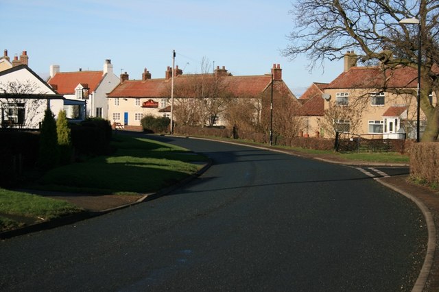
The village of East Rounton itself is home to a population of around 100 people, according to the latest census data. It is characterized by its picturesque rural setting, with rolling hills, open fields, and scattered woodland surrounding the village.

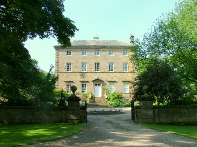
The parish is predominantly residential, with a handful of historic properties and farmhouses. The architecture in East Rounton is largely traditional, with many buildings boasting beautiful stone facades that are typical of the region.

Despite its small size, East Rounton has a strong sense of community, with residents actively involved in village life. The local parish council organizes various events and initiatives throughout the year, fostering a close-knit atmosphere.

The village is well-connected to the surrounding areas, with good road links to nearby towns and cities. It enjoys a peaceful and tranquil atmosphere, making it an attractive place to live for those seeking a quiet countryside lifestyle.

Overall, East Rounton is a charming and idyllic civil parish that offers a quintessential English countryside experience. Its natural beauty and strong community spirit make it a desirable place to call home.

If you have any feedback on the listing, please let us know in the comments section below.
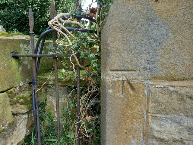
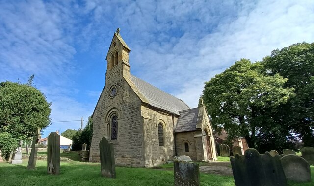
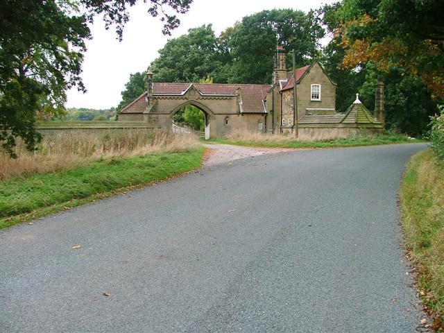
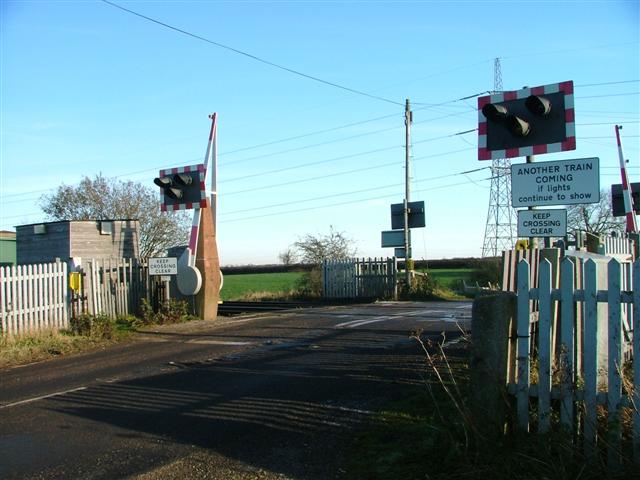
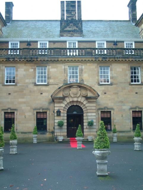
East Rounton Images

Images are sourced within 2km of 54.429368/-1.339386 or Grid Reference NZ4203. Thanks to Geograph Open Source API. All images are credited.

View To Thrush Nest Farm From the Eaglescliffe - Northallerton Railway.
View To Thrush Nest Farm
From the Eaglescliffe - Northallerton Railway.
West Rounton, St Oswald's This is the extreme left of the west facing wall of the church. There is a benchmark cut into 2 cornerstones.
West Rounton, St Oswald's
This is the extreme left of the west facing wall of the church. There is a benchmark cut into 2 cornerstones.
West Rounton, St Oswald's A wider angle showing the west facing wall of the church with the tower. On the extreme left of this wall, there is a benchmark cut into 2 cornerstones.
West Rounton, St Oswald's
A wider angle showing the west facing wall of the church with the tower. On the extreme left of this wall, there is a benchmark cut into 2 cornerstones.
Ingleby Arncliffe Services on the A19
Cut Bench Mark East Rounton Bridge This Ordnance survey mark was used as part of the levelling process for the OS map of 1911. The height recorded was 188.8ft above the mean sea level at Liverpool.
Cut Bench Mark East Rounton Bridge
This Ordnance survey mark was used as part of the levelling process for the OS map of 1911. The height recorded was 188.8ft above the mean sea level at Liverpool.
Ordnance Survey Cut Bench Mark This Ordnance Survey mark was used as part of the levelling process for the OS map of 1911. The height recorded was 237.5ft above the mean sea level at Liverpool.
Ordnance Survey Cut Bench Mark
This Ordnance Survey mark was used as part of the levelling process for the OS map of 1911. The height recorded was 237.5ft above the mean sea level at Liverpool.
Ordnance Survey Cut Bench Mark This Ordnance Survey mark was used as part of the levelling process for the OS map of 1891. The height recorded was 238.6ft above the mean sea level at Liverpool.
Ordnance Survey Cut Bench Mark
This Ordnance Survey mark was used as part of the levelling process for the OS map of 1891. The height recorded was 238.6ft above the mean sea level at Liverpool.
A19 lay-by
A19 lay-by
Lane to East Rounton This road leads directly off the A19 northbound.
Lane to East Rounton
This road leads directly off the A19 northbound.
Field south of Old Lane  Looking east towards the A19 and Hambleton Hills.
Field south of Old Lane
Looking east towards the A19 and Hambleton Hills.
View towards the Hambleton Hills from near East Rounton The line of trees marks the route of a stream that is crossed by the A19 at Trenholme Bridge - one lorry can be seen on the main road approaching the bridge.
View towards the Hambleton Hills from near East Rounton
The line of trees marks the route of a stream that is crossed by the A19 at Trenholme Bridge - one lorry can be seen on the main road approaching the bridge.
Road junction approaching the A19 Old Lane used to connect to the A19 in both directions at the junction in the distance, but when the trunk road became dual carriageway, a bridge was built to divert this cross route over it. Traffic wanting to head south has to turn left here, cross the bridge and rejoin the main road on the other side.
Road junction approaching the A19
Old Lane used to connect to the A19 in both directions at the junction in the distance, but when the trunk road became dual carriageway, a bridge was built to divert this cross route over it. Traffic wanting to head south has to turn left here, cross the bridge and rejoin the main road on the other side.
Black Swan junction  Old Lane used to connect to the A19 in both directions at this junction, but when the trunk road became dual carriageway, a bridge was built to divert this cross route over it. Traffic wanting to head south has to cross the bridge and rejoin the main road on the other side.

Swan House on the other side of the main road was formerly the Black Swan pub but now a B&B establishment.
Black Swan junction
Old Lane used to connect to the A19 in both directions at this junction, but when the trunk road became dual carriageway, a bridge was built to divert this cross route over it. Traffic wanting to head south has to cross the bridge and rejoin the main road on the other side. Swan House on the other side of the main road was formerly the Black Swan pub but now a B&B establishment.
Bridge over the A19 at Black Swan junction  This bridge carrying a minor road over the A19 has been here for at least 6 years, see <a href="https://www.geograph.org.uk/photo/3278716">NZ4403 : Bridge over the A19</a>, although oddly Google Maps showed it as still under construction in an aerial view dated 2018.
Bridge over the A19 at Black Swan junction
This bridge carrying a minor road over the A19 has been here for at least 6 years, see NZ4403 : Bridge over the A19, although oddly Google Maps showed it as still under construction in an aerial view dated 2018.
Reed bed at Black Swan junction  Shown as a "reservoir" on large scale maps, this is probably intended as primary treatment for polluted storm runoff from the A19 nearby. The bulrushes were quite magnificent.
Reed bed at Black Swan junction
Shown as a "reservoir" on large scale maps, this is probably intended as primary treatment for polluted storm runoff from the A19 nearby. The bulrushes were quite magnificent.
Field north of Old Lane Between the road and the field is a patch of waste land overtaken by bindweed.
Field north of Old Lane
Between the road and the field is a patch of waste land overtaken by bindweed.
View towards the hills Arable land in East Rounton parish with a view towards the Cleveland Hills and the edge of the North York Moors National Park.
View towards the hills
Arable land in East Rounton parish with a view towards the Cleveland Hills and the edge of the North York Moors National Park.
Level crossing at Carr Bridge The road to Appleton Wiske crosses the Northallerton to Middlesbrough railway line at this point.
Level crossing at Carr Bridge
The road to Appleton Wiske crosses the Northallerton to Middlesbrough railway line at this point.
Show me another place!

East Rounton is located at Grid Ref: NZ4203 (Lat: 54.429368, Lng: -1.339386)

Division: North Riding

Administrative County: North Yorkshire

District: Hambleton

Police Authority: North Yorkshire

What 3 Words

///responses.taxpayers.strays. Near Yarm, Co. Durham

Related Wikis

East Rounton

East Rounton is a village and civil parish in the Hambleton District of North Yorkshire, England. It is about 1 mile (1.6 km) west of the A19 and 8 miles...

Trenholme Bar railway station

Trenholme Bar railway station was a railway station built to serve the hamlet of Trenholme Bar in North Yorkshire, England. The station was on the North...

West Rounton

West Rounton is a village and civil parish in North Yorkshire, England. It is 8 miles (13 km) north of Northallerton. East Rounton is about 1-mile (1.6...

West Rounton Gates railway station

West Rounton Gates railway station, was a railway station between Welbury and Picton railway stations on the Leeds Northern Railway in the Hambleton District...

Crathorne, North Yorkshire

Crathorne is a village and civil parish in North Yorkshire, England. The parish population was 172 at the 2011 census. The River Leven flows through the...

Welbury

Welbury is a village and civil parish in the Hambleton district of North Yorkshire, England. It is about 1 mile (1.6 km) south of Appleton Wiske and 8...

Ingleby Arncliffe

Ingleby Arncliffe is a village and civil parish in North Yorkshire, England. It is situated between the A172 and A19 roads, 6.5 miles (10.5 km) north-east...

Welbury railway station

Welbury railway station was a railway station serving the village of Welbury in North Yorkshire, England. Located on the Northallerton to Eaglescliffe...

Nearby Amenities

Located within 500m of 54.429368,-1.339386
Power: tower
Lat/Long: 54.4304866/-1.3335698
Power: tower
Lat/Long: 54.4330514/-1.3357574
The data included in this document is from www.openstreetmap.org. The data is made available under ODbL.

Have you been to East Rounton?

Leave your review of East Rounton below (or comments, questions and feedback).