East Barkwith

Civil Parish in Lincolnshire East Lindsey

England

East Barkwith

Fields near Low Farm, Benniworth: aerial 2022
Fields near Low Farm, Benniworth: aerial 2022 Credit: Simon Tomson

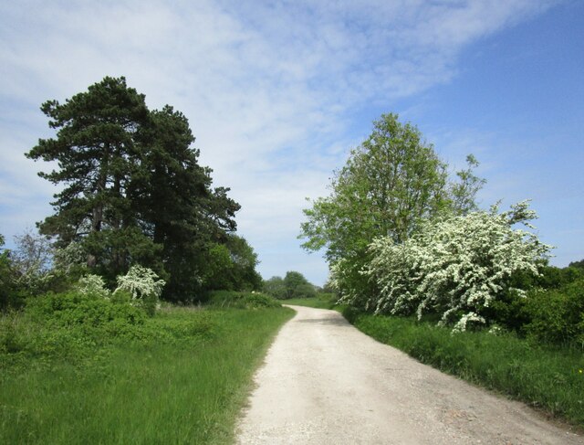
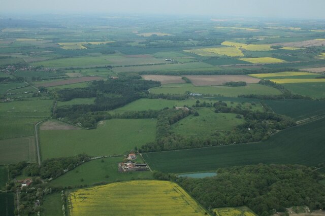
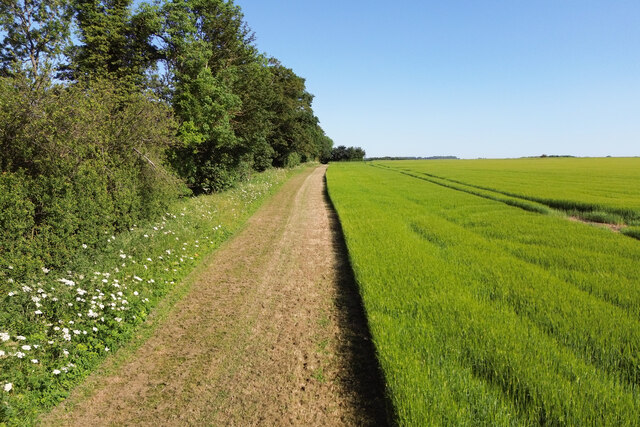
East Barkwith is a civil parish located in the East Lindsey district of Lincolnshire, England. Situated approximately 16 miles northeast of the city of Lincoln, it covers an area of about 2.7 square miles. The village is surrounded by picturesque farmland and countryside, offering a peaceful and rural setting.

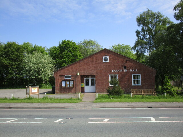
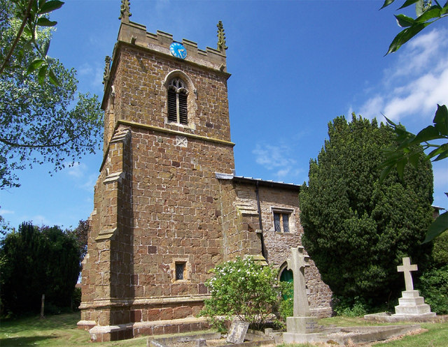
East Barkwith is a small settlement with a population of around 300 residents. It has a long history, with evidence of occupation dating back to Roman times. Today, the village retains its traditional charm, featuring a mix of old and new houses, as well as a few historic buildings, such as the St. Mary's Church, which dates back to the 13th century.

The village is well-connected by road, with the A157 passing through the parish, providing easy access to nearby towns and cities. However, East Barkwith is primarily a residential area, lacking extensive amenities. Neighboring villages offer a wider range of services, including schools, shops, and healthcare facilities.

The surrounding countryside offers opportunities for outdoor activities, such as walking, cycling, and horse riding. The parish is also known for its agricultural heritage, with farming playing a significant role in the local economy.

Overall, East Barkwith offers a tranquil and close-knit community, making it an attractive place for those seeking a peaceful countryside lifestyle.

If you have any feedback on the listing, please let us know in the comments section below.

East Barkwith Images

Images are sourced within 2km of 53.306576/-0.225899 or Grid Reference TF1880. Thanks to Geograph Open Source API. All images are credited.

Fields near Low Farm, Benniworth: aerial 2022
Stable block at site of Panton Hall: aerial 2022 (1) It dates from 1777 and was probably built by William Legg. It underwent alterations in the 20th century. 

See: <span class="nowrap"><a title="https://www.heritagegateway.org.uk/Gateway/Results_Single.aspx?uid=MLI93551&resourceID=1006" rel="nofollow ugc noopener" href="https://www.heritagegateway.org.uk/Gateway/Results_Single.aspx?uid=MLI93551&resourceID=1006">Link</a><img style="margin-left:2px;" alt="External link" title="External link - shift click to open in new window" src="https://s1.geograph.org.uk/img/external.png" width="10" height="10"/></span>
Stable block at site of Panton Hall: aerial 2022 (1)
It dates from 1777 and was probably built by William Legg. It underwent alterations in the 20th century. See: LinkExternal link
Stable block at site of Panton Hall: aerial 2022 (2) It dates from 1777 and was probably built by William Legg. It underwent alterations in the 20th century. 

See: <span class="nowrap"><a title="https://www.heritagegateway.org.uk/Gateway/Results_Single.aspx?uid=MLI93551&resourceID=1006" rel="nofollow ugc noopener" href="https://www.heritagegateway.org.uk/Gateway/Results_Single.aspx?uid=MLI93551&resourceID=1006">Link</a><img style="margin-left:2px;" alt="External link" title="External link - shift click to open in new window" src="https://s1.geograph.org.uk/img/external.png" width="10" height="10"/></span>
Stable block at site of Panton Hall: aerial 2022 (2)
It dates from 1777 and was probably built by William Legg. It underwent alterations in the 20th century. See: LinkExternal link
Stable block at site of Panton Hall: aerial 2022 (3) It dates from 1777 and was probably built by William Legg. It underwent alterations in the 20th century. 

See: <span class="nowrap"><a title="https://www.heritagegateway.org.uk/Gateway/Results_Single.aspx?uid=MLI93551&resourceID=1006" rel="nofollow ugc noopener" href="https://www.heritagegateway.org.uk/Gateway/Results_Single.aspx?uid=MLI93551&resourceID=1006">Link</a><img style="margin-left:2px;" alt="External link" title="External link - shift click to open in new window" src="https://s1.geograph.org.uk/img/external.png" width="10" height="10"/></span>
Stable block at site of Panton Hall: aerial 2022 (3)
It dates from 1777 and was probably built by William Legg. It underwent alterations in the 20th century. See: LinkExternal link
Ridge and furrow fields, Back o' Frank's Hill, near Panton : aerial 2022 See: <span class="nowrap"><a title="https://www.heritagegateway.org.uk/Gateway/Results_Single.aspx?uid=MLI88912&resourceID=1006" rel="nofollow ugc noopener" href="https://www.heritagegateway.org.uk/Gateway/Results_Single.aspx?uid=MLI88912&resourceID=1006">Link</a><img style="margin-left:2px;" alt="External link" title="External link - shift click to open in new window" src="https://s1.geograph.org.uk/img/external.png" width="10" height="10"/></span>
Ridge and furrow fields, Back o' Frank's Hill, near Panton : aerial 2022
See: LinkExternal link
Panton: aerial 2023 (1)  Park and stable block, which is a listed building dating from 1777. 

Panton Hall itself was demolished in 1964.

See <a href="https://www.geograph.org.uk/photo/3595000">TF1880 : Stable Block at site of Panton Hall: aerial</a>, <span class="nowrap"><a title="http://www.britishlistedbuildings.co.uk/en-195409-stable-block-at-site-of-panton-hall-east#.VZEDdRurQsY" rel="nofollow ugc noopener" href="http://www.britishlistedbuildings.co.uk/en-195409-stable-block-at-site-of-panton-hall-east#.VZEDdRurQsY">Link</a><img style="margin-left:2px;" alt="External link" title="External link - shift click to open in new window" src="https://s1.geograph.org.uk/img/external.png" width="10" height="10"/></span>.
Panton: aerial 2023 (1)
Park and stable block, which is a listed building dating from 1777. Panton Hall itself was demolished in 1964. See TF1880 : Stable Block at site of Panton Hall: aerial, LinkExternal link.
Panton: aerial 2023 (2) Park and stable block, which is a listed building dating from 1777. 

Panton Hall itself was demolished in 1964.

See <a href="https://www.geograph.org.uk/photo/3595000">TF1880 : Stable Block at site of Panton Hall: aerial</a>, <span class="nowrap"><a title="http://www.britishlistedbuildings.co.uk/en-195409-stable-block-at-site-of-panton-hall-east#.VZEDdRurQsY" rel="nofollow ugc noopener" href="http://www.britishlistedbuildings.co.uk/en-195409-stable-block-at-site-of-panton-hall-east#.VZEDdRurQsY">Link</a><img style="margin-left:2px;" alt="External link" title="External link - shift click to open in new window" src="https://s1.geograph.org.uk/img/external.png" width="10" height="10"/></span>.
Panton: aerial 2023 (2)
Park and stable block, which is a listed building dating from 1777. Panton Hall itself was demolished in 1964. See TF1880 : Stable Block at site of Panton Hall: aerial, LinkExternal link.
Panton: aerial 2023 (3) Park, walled garden and stable block. The latter is a listed building dating from 1777. 

Panton Hall itself was demolished in 1964.

See <a href="https://www.geograph.org.uk/photo/3595000">TF1880 : Stable Block at site of Panton Hall: aerial</a>, <span class="nowrap"><a title="http://www.britishlistedbuildings.co.uk/en-195409-stable-block-at-site-of-panton-hall-east#.VZEDdRurQsY" rel="nofollow ugc noopener" href="http://www.britishlistedbuildings.co.uk/en-195409-stable-block-at-site-of-panton-hall-east#.VZEDdRurQsY">Link</a><img style="margin-left:2px;" alt="External link" title="External link - shift click to open in new window" src="https://s1.geograph.org.uk/img/external.png" width="10" height="10"/></span>.
Panton: aerial 2023 (3)
Park, walled garden and stable block. The latter is a listed building dating from 1777. Panton Hall itself was demolished in 1964. See TF1880 : Stable Block at site of Panton Hall: aerial, LinkExternal link.
Track to Panton Stables
The former East Barkwith Station This was opened in 1874 by the Louth and Lincoln Railway on its line from Bardney to Louth. It closed to passengers in 1951 and to all traffic in 1958.
The former East Barkwith Station
This was opened in 1874 by the Louth and Lincoln Railway on its line from Bardney to Louth. It closed to passengers in 1951 and to all traffic in 1958.
Barkwith Hall Comuunity building serving East and West Barkwith.
Barkwith Hall
Comuunity building serving East and West Barkwith.
War Memorial, East Barkwith Unusually, not listed.
War Memorial, East Barkwith
Unusually, not listed.
Grassland near Lodge Farm
Course of the former railway at East Barkwith The line ran from Bardney to Louth and closed to passengers in 1951 and to freight in 1958. Facilities at East Barkwith were minimal. There was a single platform (situated on the extreme left of the picture) with a loop line serving a siding and cattle dock.
Course of the former railway at East Barkwith
The line ran from Bardney to Louth and closed to passengers in 1951 and to freight in 1958. Facilities at East Barkwith were minimal. There was a single platform (situated on the extreme left of the picture) with a loop line serving a siding and cattle dock.
Grassland with buttercups, East Barkwith
Panton Park and Stables, and Warren Farm: aerial 2023
Panton Park and Stables: aerial 2023
Track along Whitepits Plantation A similar view to <a href="https://www.geograph.org.uk/photo/812585">TF1881 : Field edge</a>
Track along Whitepits Plantation
A similar view to TF1881 : Field edge
Show me another place!

East Barkwith is located at Grid Ref: TF1880 (Lat: 53.306576, Lng: -0.225899)

Administrative County: Lincolnshire

District: East Lindsey

Police Authority: Lincolnshire

What 3 Words

///refills.clasping.soft. Near Wragby, Lincolnshire

Related Wikis

East Barkwith railway station

East Barkwith railway station was a railway station that served the village of East Barkwith, Lincolnshire, England between 1874 and 1958, on the Louth...

Panton, Lincolnshire

Panton is a village in the civil parish of East Barkwith, in the East Lindsey of district, Lincolnshire, England. It is situated approximately 13 miles...

East Barkwith

East Barkwith is a village and civil parish in the East Lindsey district of Lincolnshire, England. It is situated on the A157, and approximately 13 miles...

West Barkwith

West Barkwith is a village and civil parish in the East Lindsey district of Lincolnshire, England. It is situated on the A157 road and about 2.5 miles...

Sotby

Sotby is a village and civil parish in the East Lindsey district of Lincolnshire, England. It is situated 15 miles (24 km) north-east from the city and...

Benniworth

Benniworth is a village and civil parish in the East Lindsey district of Lincolnshire, England. The village is situated just west of the B1225 road, and...

South Willingham and Hainton railway station

South Willingham and Hainton railway station was a railway station that served the village of South Willingham, Lincolnshire, England between 1874 and...

South Willingham

South Willingham is a village and civil parish in the East Lindsey district of Lincolnshire, England, and partly within the Lincolnshire Wolds Area of...

Nearby Amenities

Located within 500m of 53.306576,-0.225899
Panton Park
Place: locality
Source: Bing
Lat/Long: 53.306257/-0.2253759
Panton Hall
Place: isolated_dwelling
Source: Bing
Lat/Long: 53.3080737/-0.2277055
The Beeches
Place: isolated_dwelling
Lat/Long: 53.3052986/-0.2234769
The data included in this document is from www.openstreetmap.org. The data is made available under ODbL.

Have you been to East Barkwith?

Leave your review of East Barkwith below (or comments, questions and feedback).