East and West Buckland

Civil Parish in Devon North Devon

England

East and West Buckland

Huxtable Lane
Huxtable Lane Credit: Roger Cornfoot

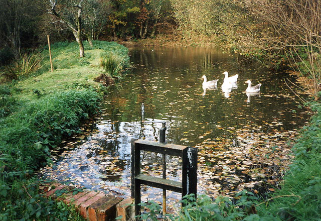
East and West Buckland is a civil parish located in the county of Devon, England. Situated approximately 9 miles southwest of the town of South Molton, it covers an area of around 2,000 acres. The parish is divided into two distinct villages, East Buckland and West Buckland, which are separated by the River Yeo.

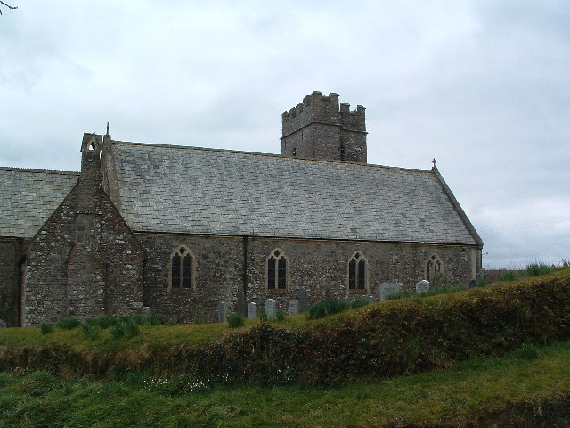
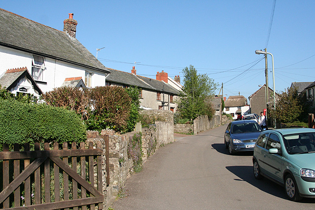
East Buckland is a small rural village with a population of around 200 residents. It is characterized by its picturesque countryside, rolling hills, and charming thatched cottages. The village is home to a historic church, St. Michael and All Angels, which dates back to the 13th century. The church features beautiful stained glass windows and a notable Norman font.

West Buckland, on the other hand, is a slightly larger village with a population of approximately 400 residents. It is known for its primary school, West Buckland Church of England Primary School, which has been serving the community since 1876. The school is highly regarded for its academic achievements and strong community spirit.

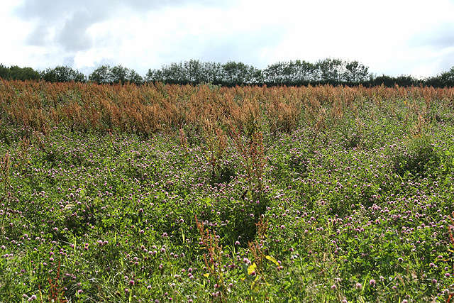
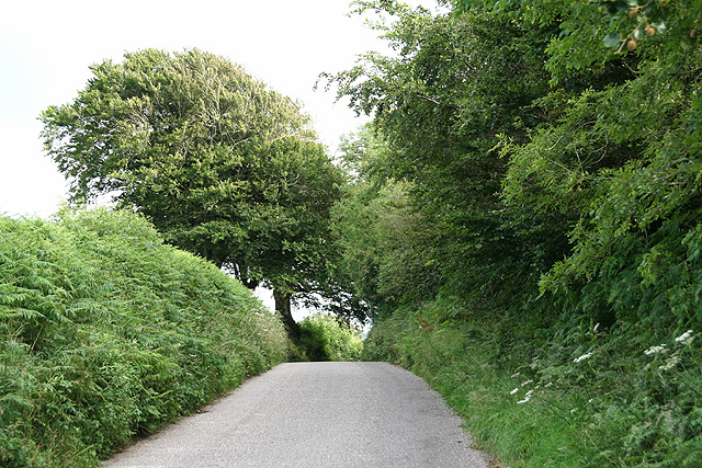
Both villages offer a peaceful and tranquil environment, surrounded by stunning natural beauty. The area is popular with outdoor enthusiasts, offering plenty of opportunities for walking, cycling, and horse riding. The nearby Exmoor National Park provides further opportunities for outdoor activities and exploration.

Overall, East and West Buckland, Devon, is a quintessential English countryside parish, with its traditional villages, rich history, and idyllic rural setting.

If you have any feedback on the listing, please let us know in the comments section below.

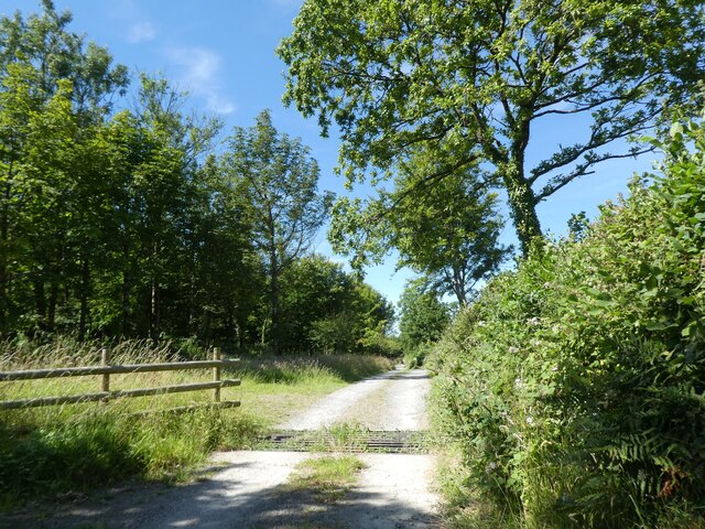
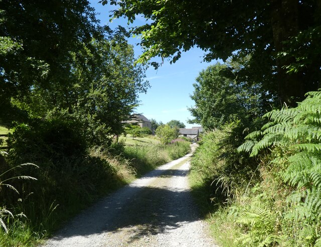
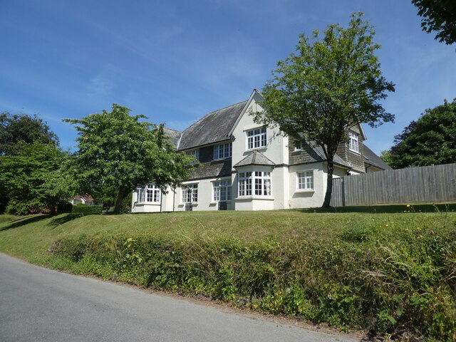
East and West Buckland Images

Images are sourced within 2km of 51.067281/-3.910554 or Grid Reference SS6631. Thanks to Geograph Open Source API. All images are credited.

Huxtable Lane
Huxtable Lane
Huxtable Farm
Huxtable Farm
Huxtable Lane
Huxtable Lane
West Buckland School
A view towards West Buckland and surrounding hills Codden Hill lies just in view to the right of this image with Codden Farm in the valley next to it.
A view towards West Buckland and surrounding hills
Codden Hill lies just in view to the right of this image with Codden Farm in the valley next to it.
West Buckland: Buckingham’s Leary A farm with 250 Friesians in December 2003. In 1890 there was water-power here; one pier of an aqueduct is all that remains of this installation, by the lane beyond the farmhouse. The cottage to the right of the original farm carries an 1858 datestone
West Buckland: Buckingham’s Leary
A farm with 250 Friesians in December 2003. In 1890 there was water-power here; one pier of an aqueduct is all that remains of this installation, by the lane beyond the farmhouse. The cottage to the right of the original farm carries an 1858 datestone
St Michael's Church, East Buckland Taken for the North side
St Michael's Church, East Buckland
Taken for the North side
St Peter's Church, West Buckland Taken from the West end.
St Peter's Church, West Buckland
Taken from the West end.
Brayford: millpond at Hudley Mill Hudley Mill stands beside a back lane between Walland Cross, Charles, and Wistford Cross. An overshot waterwheel survives here
Brayford: millpond at Hudley Mill
Hudley Mill stands beside a back lane between Walland Cross, Charles, and Wistford Cross. An overshot waterwheel survives here
West Buckland: Whitsford Entrance to the farm, looking south. A barn here at one time had machinery powered by a waterwheel
West Buckland: Whitsford
Entrance to the farm, looking south. A barn here at one time had machinery powered by a waterwheel
West Buckland: South Stoodleigh The entrance gateposts seem slightly elaborate for the location but once served West Buckland School. Looking south-south-east
West Buckland: South Stoodleigh
The entrance gateposts seem slightly elaborate for the location but once served West Buckland School. Looking south-south-east
West Buckland: Stoodleigh Barton Plantation Looking south
West Buckland: Stoodleigh Barton Plantation
Looking south
West Buckland: village street Near the church, looking east
West Buckland: village street
Near the church, looking east
West Buckland: St Peter’s church Looking east to the west tower, the only part of the church to escape the 19th century rebuilding. Note the raised churchyard, just possibly an indication of a pre-Christian site
West Buckland: St Peter’s church
Looking east to the west tower, the only part of the church to escape the 19th century rebuilding. Note the raised churchyard, just possibly an indication of a pre-Christian site
West Buckland: near Upcott Farm
West Buckland: towards Catriage Hill Near the summit and the parish boundary with East Buckland
West Buckland: towards Catriage Hill
Near the summit and the parish boundary with East Buckland
West Buckland School The main School buildings, on left and in centre date from 4 October 1860 when Earl Fortsecue (from nearby Castle Hill House <a title="https://www.geograph.org.uk/photo/3364399" href="https://www.geograph.org.uk/photo/3364399">Link</a> <a href="https://www.geograph.org.uk/gridref/SS6728">SS6728</a>) laid the foundation stone.
West Buckland School
The main School buildings, on left and in centre date from 4 October 1860 when Earl Fortsecue (from nearby Castle Hill House Link SS6728) laid the foundation stone.
Valley below Crossbury Looking up the deep little valley of a stream that finds its way into the River Bray near Filleigh. On the right, running along the valley side, is the lane from Filleigh to East Buckland, heading towards Crossbury Wood in the centre of the photo. On the left side of the valley is Westacott Wood.
Valley below Crossbury
Looking up the deep little valley of a stream that finds its way into the River Bray near Filleigh. On the right, running along the valley side, is the lane from Filleigh to East Buckland, heading towards Crossbury Wood in the centre of the photo. On the left side of the valley is Westacott Wood.
Show me another place!

East and West Buckland is located at Grid Ref: SS6631 (Lat: 51.067281, Lng: -3.910554)

Administrative County: Devon

District: North Devon

Police Authority: Devon & Cornwall

What 3 Words

///roughest.woodstove.managed. Near South Molton, Devon

Related Wikis

West Buckland, Devon

West Buckland is a small village and former manor, now in the parish of East and West Buckland, in the North Devon district, in the county of Devon, England...

East and West Buckland

East and West Buckland is a civil parish in the English county of Devon. Forming part of the district of North Devon its main settlements are West Buckland...

East Buckland

East Buckland is a small village and former civil parish, now in the parish of East and West Buckland, in the North Devon district of Devon, England, next...

Accott

Accott is an historic estate, now a small settlement, in the parish of Bishop's Tawton in the county of Devon, England == History == The place-name Accott...

Nearby Amenities

Located within 500m of 51.067281,-3.910554
Generator Method: photovoltaic
Generator Output Electricity: yes
Generator Source: solar
Generator Type: solar_photovoltaic_panel
Location: roof
Power: generator
Lat/Long: 51.0688565/-3.9097139
Generator Method: photovoltaic
Generator Output Electricity: yes
Generator Solar Modules: 2
Generator Source: solar
Generator Type: solar_photovoltaic_panel
Location: roof
Power: generator
Lat/Long: 51.0673034/-3.9051542
Generator Method: photovoltaic
Generator Output Electricity: yes
Generator Source: solar
Generator Type: solar_photovoltaic_panel
Location: roof
Power: generator
Lat/Long: 51.0673076/-3.9052548
Generator Method: photovoltaic
Generator Output Electricity: yes
Generator Source: solar
Generator Type: solar_photovoltaic_panel
Location: roof
Power: generator
Lat/Long: 51.06842/-3.9037085
Generator Method: photovoltaic
Generator Output Electricity: yes
Generator Source: solar
Generator Type: solar_photovoltaic_panel
Location: roof
Power: generator
Lat/Long: 51.0682481/-3.9035958
Generator Method: photovoltaic
Generator Output Electricity: yes
Generator Source: solar
Generator Type: solar_photovoltaic_panel
Location: roof
Power: generator
Lat/Long: 51.0683661/-3.9054036
Generator Method: photovoltaic
Generator Output Electricity: yes
Generator Source: solar
Generator Type: solar_photovoltaic_panel
Location: roof
Power: generator
Lat/Long: 51.0676759/-3.9054613
Generator Method: photovoltaic
Generator Output Electricity: yes
Generator Source: solar
Generator Type: solar_photovoltaic_panel
Location: roof
Power: generator
Lat/Long: 51.0676413/-3.9040934
Generator Method: photovoltaic
Generator Output Electricity: yes
Generator Source: solar
Generator Type: solar_photovoltaic_panel
Location: roof
Power: generator
Lat/Long: 51.0676632/-3.9052387
Generator Method: photovoltaic
Generator Output Electricity: yes
Generator Source: solar
Generator Type: solar_photovoltaic_panel
Location: roof
Power: generator
Lat/Long: 51.0676733/-3.904202
The data included in this document is from www.openstreetmap.org. The data is made available under ODbL.

Have you been to East and West Buckland?

Leave your review of East and West Buckland below (or comments, questions and feedback).