Durston

Civil Parish in Somerset Somerset West and Taunton

England

Durston

Canoeing on Bridgwater and Taunton Canal Unusually, this canoeist was exercising his dog on the towpath!
Canoeing on Bridgwater and Taunton Canal Credit: David Smith

Durston is a civil parish located in the county of Somerset, England. It is situated approximately 4 miles north of the town of Taunton, which is the administrative center for the region. The parish covers an area of around 1,200 acres and has a population of approximately 250 residents.

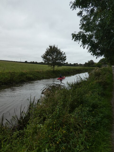
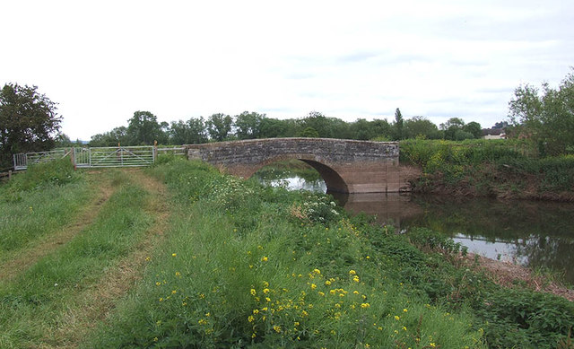
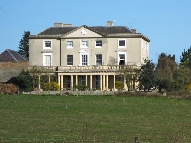
The village of Durston itself is quite small, with a scattering of houses and a few amenities. Its rural location offers beautiful views of the surrounding countryside, with rolling hills and fields stretching as far as the eye can see. The River Tone meanders through the parish, adding to its natural charm.

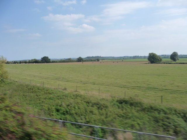
Historically, Durston has been an agricultural community, with farming being the main occupation for many of its residents. The fertile land in the area has been used for centuries for the cultivation of crops and the rearing of livestock. However, like many rural communities, Durston has seen a decline in its agricultural sector in recent years, with many residents now commuting to nearby towns for work.

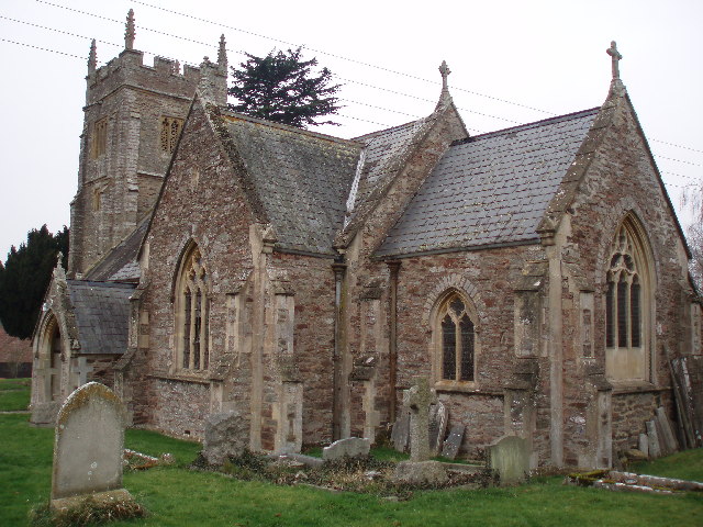
Despite its small size, Durston has a strong sense of community, with various social events and activities taking place throughout the year. The parish church, St. John the Baptist, serves as a focal point for the community, hosting regular services and providing a gathering place for residents.

Overall, Durston is a picturesque and close-knit rural community that offers a peaceful and idyllic way of life for its residents.

If you have any feedback on the listing, please let us know in the comments section below.

Durston Images

Images are sourced within 2km of 51.045542/-3.007533 or Grid Reference ST2927. Thanks to Geograph Open Source API. All images are credited.

Canoeing on Bridgwater and Taunton Canal Unusually, this canoeist was exercising his dog on the towpath!
Canoeing on Bridgwater and Taunton Canal
Unusually, this canoeist was exercising his dog on the towpath!
Bridge 21 on the Taunton and Bridgwater canal, looking north
Primmore Corner
Primmore Corner
Taunton Deane : Grassy Field A grassy field as seen from a train on the railway.
Taunton Deane : Grassy Field
A grassy field as seen from a train on the railway.
Outwood: Bridgwater and Taunton Canal
Cogload Junction
Cogload Junction
Outwood Farm The fabric of an earlier building can be seen in the gable end of the farmhouse.
Outwood Farm
The fabric of an earlier building can be seen in the gable end of the farmhouse.
Knapp bridge Old stone bridge over the River Tone at Knapp. Notice the recent "tide" mark on the bridge abutments due to the recent floods (this is upstream of the tidal limits).
Knapp bridge
Old stone bridge over the River Tone at Knapp. Notice the recent "tide" mark on the bridge abutments due to the recent floods (this is upstream of the tidal limits).
Ancient fish ponds at Lower Durston
Hedging near Durston
Flooding in the Tone valley
Cottages at Outwood
Cottages at Outwood
Taunton to Paddington railway line
Rosedale, West Lyng
Rosedale, West Lyng
Lift bridge at Outwood on the Bridgwater and Taunton Canal
The railway line from Paddington towards Taunton
Bridgwater & Taunton Canal Above Higher Maunsell Lock. A lot of vegetation has drifted down.
Bridgwater & Taunton Canal
Above Higher Maunsell Lock. A lot of vegetation has drifted down.
Farmland near Outwood House
Show me another place!

Durston is located at Grid Ref: ST2927 (Lat: 51.045542, Lng: -3.007533)

Administrative County: Somerset

District: Somerset West and Taunton

Police Authority: Avon and Somerset

What 3 Words

///similar.harmlessly.users. Near Creech St Michael, Somerset

Nearby Locations

Durston

Related Wikis

Durston

Durston is a village and civil parish in Somerset, England, situated on the A361 road 5 miles (8.0 km) north east of Taunton and 6 miles (9.7 km) south...

Cogload Junction

Cogload Junction is a railway junction in Durston, Somerset, England. It is where the 1906-opened London to Penzance Line via Castle Cary joins the original...

Buckland Priory

Buckland Priory (also known as Minchin Buckland Preceptory or Buckland Sororum (Latin: "Buckland of the Sisters")) was established around 1167 in Lower...

Walford, Somerset

Walford is a small village 3 miles (5 km) north east of Taunton in Somerset, England. Most of the village, including Walford Cross at the junction of...

Nearby Amenities

Located within 500m of 51.045542,-3.007533
Durston
Is In: Somerset, England, UK
Place: hamlet
Wikidata: Q5316777
Wikipedia: en:Durston
Lat/Long: 51.0476963/-3.0120689
Give Way
Lat/Long: 51.0475412/-3.0134947
Give Way
Lat/Long: 51.0475949/-3.0133133
Power: pole
Lat/Long: 51.045397/-3.0008032
Power: pole
Lat/Long: 51.0452207/-3.0027342
Power: pole
Lat/Long: 51.0452343/-3.0040127
Power: pole
Lat/Long: 51.0452595/-3.0060516
Brand: National Grid
Brand Wikidata: Q1465461
Line Attachment: anchor
Material: wood
Operator: National Grid Electricity Distribution Plc
Operator Old: Western Power Distribution
Operator Wikidata: Q7988183
Owner: National Grid Electricity Distribution (South West) Plc
Owner Wikidata: Q114397866
Power: pole
Lat/Long: 51.0460016/-3.0076371
Brand: National Grid
Brand Wikidata: Q1465461
Line Attachment: anchor
Material: wood
Operator: National Grid Electricity Distribution Plc
Operator Old: Western Power Distribution
Operator Wikidata: Q7988183
Owner: National Grid Electricity Distribution (South West) Plc
Owner Wikidata: Q114397866
Power: pole
Lat/Long: 51.0419933/-3.0091708
Brand: National Grid
Brand Wikidata: Q1465461
Line Attachment: anchor
Material: wood
Operator: National Grid Electricity Distribution Plc
Operator Old: Western Power Distribution
Operator Wikidata: Q7988183
Owner: National Grid Electricity Distribution (South West) Plc
Owner Wikidata: Q114397866
Power: pole
Lat/Long: 51.0430386/-3.0090871
Brand: National Grid
Brand Wikidata: Q1465461
Guyed: yes
Line Attachment: anchor
Material: wood
Operator: National Grid Electricity Distribution Plc
Operator Old: Western Power Distribution
Operator Wikidata: Q7988183
Owner: National Grid Electricity Distribution (South West) Plc
Owner Wikidata: Q114397866
Power: pole
Lat/Long: 51.0441398/-3.0090093
Brand: National Grid
Brand Wikidata: Q1465461
Line Attachment: anchor
Material: wood
Operator: National Grid Electricity Distribution Plc
Operator Old: Western Power Distribution
Operator Wikidata: Q7988183
Owner: National Grid Electricity Distribution (South West) Plc
Owner Wikidata: Q114397866
Power: pole
Lat/Long: 51.045289/-3.0081616
Brand: National Grid
Brand Wikidata: Q1465461
Line Attachment: anchor
Material: wood
Operator: National Grid Electricity Distribution Plc
Operator Old: Western Power Distribution
Operator Wikidata: Q7988183
Owner: National Grid Electricity Distribution (South West) Plc
Owner Wikidata: Q114397866
Power: pole
Lat/Long: 51.0466357/-3.0071845
Brand: National Grid
Brand Wikidata: Q1465461
Line Attachment: anchor
Material: wood
Operator: National Grid Electricity Distribution Plc
Operator Old: Western Power Distribution
Operator Wikidata: Q7988183
Owner: National Grid Electricity Distribution (South West) Plc
Owner Wikidata: Q114397866
Power: pole
Lat/Long: 51.0476997/-3.0064062
Public Bookcase
Booth: K6
Disused Amenity: telephone
Man Made: telephone_box
Public Bookcase Type: phone_box
Lat/Long: 51.0477706/-3.0132979
The data included in this document is from www.openstreetmap.org. The data is made available under ODbL.

Have you been to Durston?

Leave your review of Durston below (or comments, questions and feedback).