Dunsfold
Civil Parish in Surrey Waverley
England
Dunsfold

Dunsfold is a civil parish located in the county of Surrey, England. Situated approximately 8 miles south of Guildford and 30 miles southwest of London, it covers an area of around 9.5 square miles. The parish is part of the borough of Waverley and falls within the South East England region.
Dunsfold is a predominantly rural area characterized by its picturesque countryside and charming village setting. The parish is home to a population of approximately 1,000 residents, who enjoy a peaceful and close-knit community atmosphere.
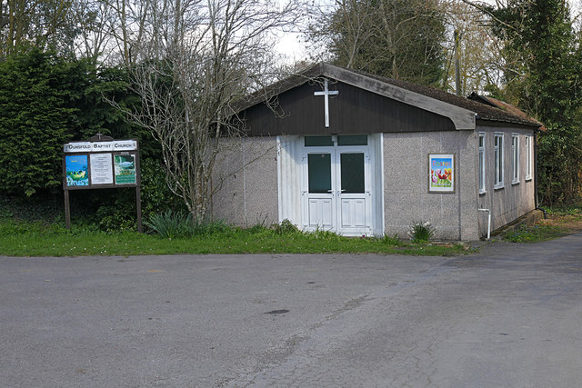
The village of Dunsfold itself is centered around the historic St. Mary and All Saints Church, which dates back to the 13th century and serves as a focal point for the local community. Other notable landmarks in the area include Dunsfold Park, a former Royal Canadian Air Force base that now serves as a popular business park and event venue.
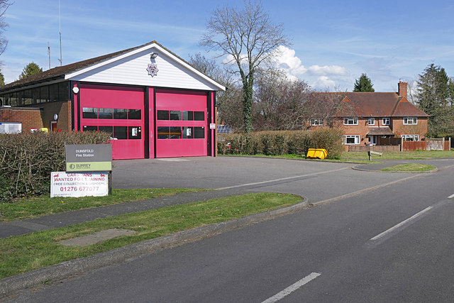
The parish boasts a range of amenities, including a primary school, a village hall, and a local pub. It also benefits from excellent transport links, with the nearby A281 providing easy access to the neighboring towns of Guildford and Horsham, as well as the major motorway networks.
Dunsfold offers a tranquil and scenic setting, making it a desirable location for those seeking a rural retreat while still being within commuting distance of London and other major cities. With its rich history, natural beauty, and strong sense of community, Dunsfold is a delightful place to live and visit.
If you have any feedback on the listing, please let us know in the comments section below.
Dunsfold Images
Images are sourced within 2km of 51.107772/-0.567677 or Grid Reference TQ0035. Thanks to Geograph Open Source API. All images are credited.


Dunsfold is located at Grid Ref: TQ0035 (Lat: 51.107772, Lng: -0.567677)
Administrative County: Surrey
District: Waverley
Police Authority: Surrey
What 3 Words
///delighted.emptied.thinking. Near Chiddingfold, Surrey
Nearby Locations
Related Wikis

Dunsfold
Dunsfold is a village in the borough of Waverley, Surrey, England, 8.7 miles (14.0 kilometres) south of Guildford. It lies in the Weald and reaches in...

Fir Tree Copse
Fir Tree Copse is a 6-hectare (15-acre) nature reserve south-east of Dunsfold in Surrey. It is managed by the Surrey Wildlife Trust and is part of the...

Top Gear test track
The Top Gear test track is used by the BBC automotive television programme Top Gear. It is located at Dunsfold Aerodrome in Surrey, United Kingdom. The...

Chiddingfold Forest
Chiddingfold Forest is a 542.5-hectare (1,341-acre) biological Site of Special Scientific Interest in Chiddingfold in Surrey and West Sussex. One part...

Dunsfold Aerodrome
Dunsfold Aerodrome (former ICAO code EGTD) is an unlicensed airfield in Surrey, England, near the village of Cranleigh. It extends across land in the villages...

Hascombe Hill
Hascombe Hill or Hascombe Camp is the site of an Iron Age multivallate hill fort close to the village of Hascombe in Surrey, England. == History == The...

Wey and Arun Canal
The Wey and Arun Canal is a partially open, 23-mile-long (37 km) canal in the southeast of England. It runs southwards from the River Wey at Gunsmouth...

London to Portsmouth canal
The London to Portsmouth canal was a concept for the construction of a secure inland canal route from the British capital of London to the headquarters...
Nearby Amenities
Located within 500m of 51.107772,-0.567677Have you been to Dunsfold?
Leave your review of Dunsfold below (or comments, questions and feedback).