Dunsby

Civil Parish in Lincolnshire South Kesteven

England

Dunsby

A vacant plot
A vacant plot Credit: Bob Harvey

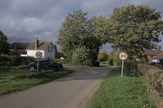
Dunsby is a small civil parish located in the county of Lincolnshire, England. Situated in the South Kesteven district, it covers an area of approximately 5.5 square kilometers. The village is located about 9 miles south-east of the town of Sleaford and is surrounded by picturesque countryside.

Dunsby is home to a relatively small population, with around 150 residents living within the parish. The village itself dates back to medieval times, with evidence of settlement in the area as early as the 12th century.

The parish is primarily rural, with a landscape characterized by rolling hills, farmland, and small woodlands. It offers a tranquil setting, ideal for those seeking a peaceful and idyllic location. The village is surrounded by beautiful countryside, providing opportunities for outdoor activities such as walking, cycling, and horse riding.

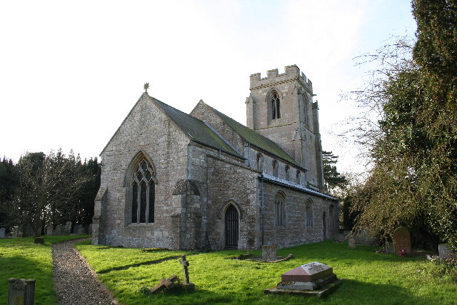
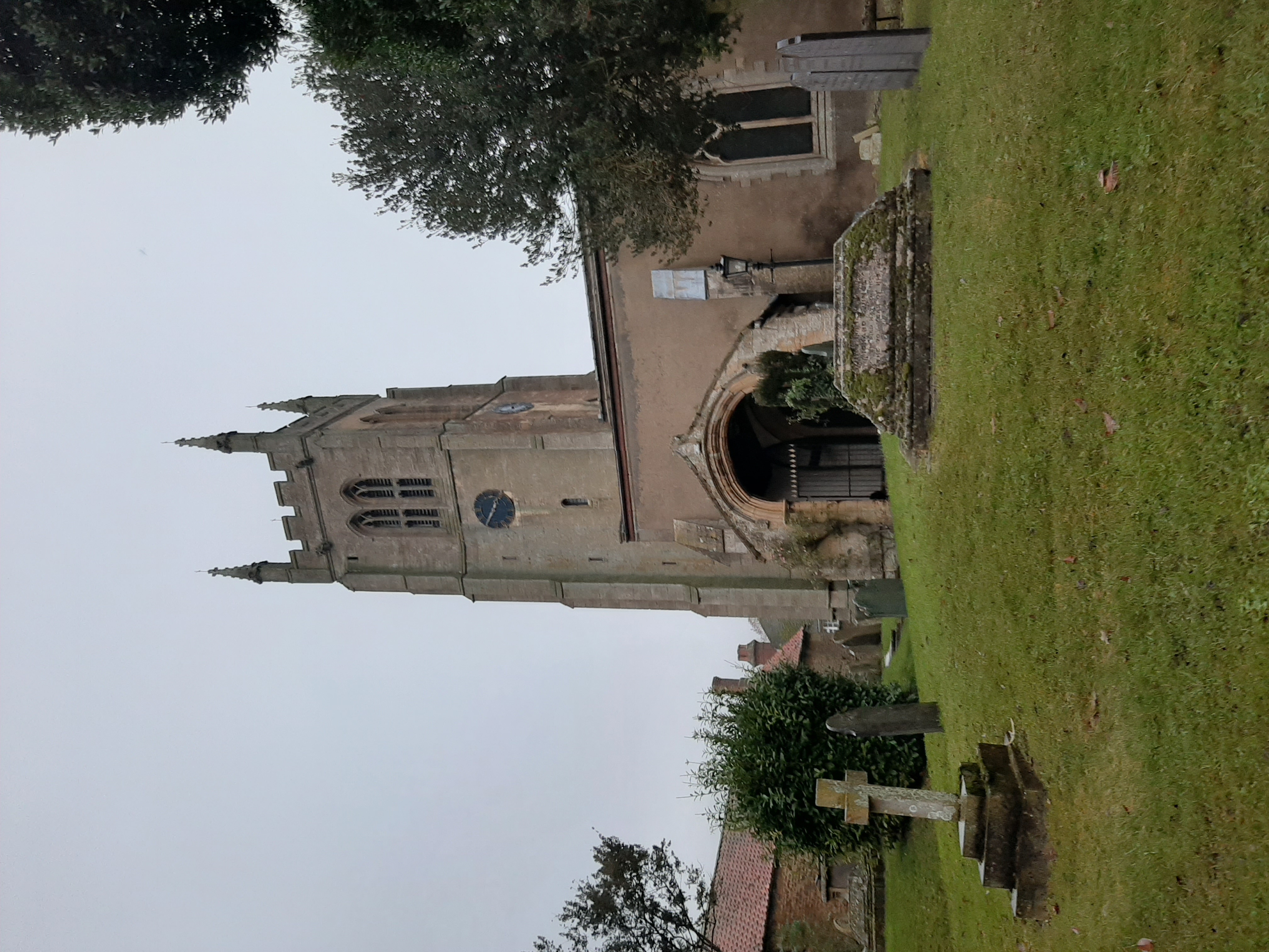
Although small, Dunsby has a strong sense of community, with the local residents actively involved in various initiatives and events. The village has a local pub, serving as a social hub for both residents and visitors alike. Additionally, there is a church, St. Mary's, which dates back to the 13th century, adding historical and architectural interest to the area.

Overall, Dunsby is a charming and quiet village, offering a peaceful retreat from the hustle and bustle of larger towns and cities. Its picturesque surroundings, sense of community, and historical charm make it an attractive place to reside or visit for those seeking a rural escape in Lincolnshire.

If you have any feedback on the listing, please let us know in the comments section below.

Dunsby Images

Images are sourced within 2km of 52.825256/-0.334613 or Grid Reference TF1226. Thanks to Geograph Open Source API. All images are credited.

A vacant plot
A vacant plot
Former level crossing The white house is the former crossing-keeper's house, and the raised section of road, with the gravel track to the left, marks where the rails once ran between Bourne and Sleaford
Former level crossing
The white house is the former crossing-keeper's house, and the raised section of road, with the gravel track to the left, marks where the rails once ran between Bourne and Sleaford
The Up direction The former railway trackbed, looking toward Bourne, and hence London, and so the Up direction.
The Up direction
The former railway trackbed, looking toward Bourne, and hence London, and so the Up direction.
Former trackbed The course of the GN line to Sleaford.
Former trackbed
The course of the GN line to Sleaford.
Cover belt A small stand of Maize as a cover belt for game birds.
Cover belt
A small stand of Maize as a cover belt for game birds.
Trimmed hedge Flailed, perhaps, within an inch of its life.  

This is the very edge of the fen, just outside Haconby - the land you see is sloping down, below five metres in the distance.
Trimmed hedge
Flailed, perhaps, within an inch of its life. This is the very edge of the fen, just outside Haconby - the land you see is sloping down, below five metres in the distance.
Trees on Haconby Fen Three oaks and one Ash on the verge of Haconby Fen Drove
Trees on Haconby Fen
Three oaks and one Ash on the verge of Haconby Fen Drove
Elizabeth II postbox on Station Street, Rippingale Postbox No. PE10 227.

See <a href="https://www.geograph.org.uk/photo/7011618">TF1128 : Close up, Elizabeth II postbox on Station Street, Rippingale</a> for close up.
See <a href="https://www.geograph.org.uk/photo/7011620">TF1128 : Station Street, Rippingale</a> for context.
Elizabeth II postbox on Station Street, Rippingale
Close up, Elizabeth II postbox on Station Street, Rippingale Postbox No. PE10 227.

See <a href="https://www.geograph.org.uk/photo/7011616">TF1128 : Elizabeth II postbox on Station Street, Rippingale</a> for wider view.
Close up, Elizabeth II postbox on Station Street, Rippingale
Postbox No. PE10 227. See TF1128 : Elizabeth II postbox on Station Street, Rippingale for wider view.
Station Street, Rippingale Showing position of Postbox No. PE10 227.

See <a href="https://www.geograph.org.uk/photo/7011616">TF1128 : Elizabeth II postbox on Station Street, Rippingale</a> for postbox.
Station Street, Rippingale
Showing position of Postbox No. PE10 227. See TF1128 : Elizabeth II postbox on Station Street, Rippingale for postbox.
Elizabeth II postbox on the B1177, Dunsby Postbox No. PE10 238.

See <a href="https://www.geograph.org.uk/photo/7011629">TF1026 : Brick built agricultural building on B1177, Dunsby</a> for context.
Elizabeth II postbox on the B1177, Dunsby
Postbox No. PE10 238. See TF1026 : Brick built agricultural building on B1177, Dunsby for context.
Brick built agricultural building on B1177, Dunsby Showing position of Postbox No. PE10 238.

See <a href="https://www.geograph.org.uk/photo/7011628">TF1026 : Elizabeth II postbox on the B1177, Dunsby</a> for postbox.
Brick built agricultural building on B1177, Dunsby
Showing position of Postbox No. PE10 238. See TF1026 : Elizabeth II postbox on the B1177, Dunsby for postbox.
Drain beside Main Road (B1177)
Main Road (B1177) Towards Dunsby.
Main Road (B1177)
Towards Dunsby.
House on Main Road (B1177)
Old railway station, Rippingale Built in 1871 and closed to passengers in 1930.
Old railway station, Rippingale
Built in 1871 and closed to passengers in 1930.
Station House The old railway station, Rippingale was built in 1871 and closed to passengers in 1930.
Station House
The old railway station, Rippingale was built in 1871 and closed to passengers in 1930.
Long Drove Site of a former level crossing near Rippingale Railway Station - <a href="https://www.geograph.org.uk/photo/7012527">TF1128 : Old railway station, Rippingale</a>
Long Drove
Site of a former level crossing near Rippingale Railway Station - TF1128 : Old railway station, Rippingale
Show me another place!

Dunsby is located at Grid Ref: TF1226 (Lat: 52.825256, Lng: -0.334613)

Administrative County: Lincolnshire

District: South Kesteven

Police Authority: Lincolnshire

What 3 Words

///wealth.conquest.hushed. Near Bourne, Lincolnshire

Nearby Locations

Dunsby

Related Wikis

Dunsby

Dunsby is a small village and civil parish in the South Kesteven district of in Lincolnshire, England. It is 4 miles (6.4 km) north from Bourne, just east...

Rippingale railway station

Rippingale railway station was a station serving the villages of Rippingale, Dowsby and Dunsby, Lincolnshire on the Great Northern Railway Bourne and Sleaford...

Haconby

Haconby is a village and civil parish in the South Kesteven district of Lincolnshire, England. The population of the civil parish at the 2001 census was...

Rippingale

Rippingale is a village and civil parish in the South Kesteven district of Lincolnshire, England. The population of the civil parish was 929 at the 2011...

St Andrew's Church, Rippingale

The Church of St Andrew in Rippingale, Lincolnshire, England, is a Grade Iā€“listed Anglican church. The earliest phase of the church dates back to the mid...

Dowsby Hall

Dowsby Hall is an early 17th-century house situated in Dowsby, Lincolnshire, England, and 6 miles (10 km) to the north of Bourne. Originally a much grander...

Dowsby

Dowsby is a village and civil parish in the South Kesteven district of Lincolnshire, England. It is situated on the western edge of The Fens at the junction...

Morton Road railway station

Morton Road railway station was a station serving the village of Morton, Lincolnshire on the Great Northern Railway Bourne and Sleaford railway. It opened...

Have you been to Dunsby?

Leave your review of Dunsby below (or comments, questions and feedback).