Drigg and Carleton
Civil Parish in Cumberland Copeland
England
Drigg and Carleton

Drigg and Carleton is a civil parish located in Cumberland, a historic county in the northwest region of England. Situated in the borough of Copeland, the parish covers an area of approximately 9 square miles.
The parish is predominantly rural, encompassing the villages of Drigg and Carleton, as well as surrounding farmland and countryside. It is bordered by the Irish Sea to the west, providing stunning coastal views and access to beautiful sandy beaches.
Drigg and Carleton have a combined population of around 1,200 residents. The area is known for its peaceful and picturesque surroundings, attracting visitors seeking a tranquil escape from urban life.
Historically, the parish has played a significant role in agriculture, with farming being a major industry. However, in recent years, tourism has also become an important economic contributor due to the area's natural beauty and proximity to the Lake District National Park.
Key landmarks in the parish include St. Peter's Church, a Grade II listed building dating back to the 12th century, and the Drigg Sand Dunes, a designated Site of Special Scientific Interest known for its unique flora and fauna.
Overall, Drigg and Carleton offer a charming rural retreat with a rich history and idyllic coastal scenery, making it an attractive destination for nature enthusiasts, walkers, and those seeking a peaceful getaway.
If you have any feedback on the listing, please let us know in the comments section below.
Drigg and Carleton Images
Images are sourced within 2km of 54.35882/-3.449024 or Grid Reference SD0596. Thanks to Geograph Open Source API. All images are credited.


Drigg and Carleton is located at Grid Ref: SD0596 (Lat: 54.35882, Lng: -3.449024)
Administrative County: Cumbria
District: Copeland
Police Authority: Cumbria
What 3 Words
///centrally.panning.trucks. Near Seascale, Cumbria
Nearby Locations
Related Wikis
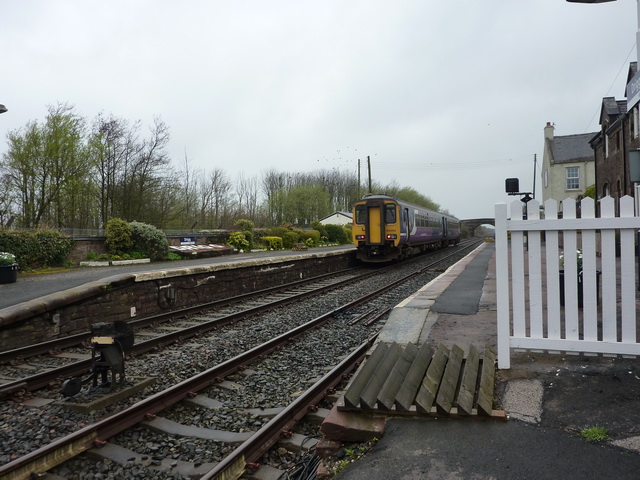
Drigg railway station
Drigg is a railway station on the Cumbrian Coast Line, which runs between Carlisle and Barrow-in-Furness. The station, situated 31 miles (50 km) north...
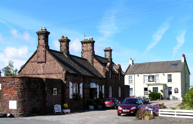
Drigg
Drigg is a village situated in the civil parish of Drigg and Carleton on the West Cumbria coast of the Irish Sea and on the boundary of the Lake District...

River Irt
The River Irt is a river in the county of Cumbria in northern England. It flows for 14 miles (22 km) from the south-western end of Wast Water, the deepest...
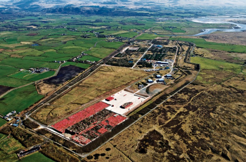
Low Level Waste Repository
The Low Level Waste Repository is the UK's central long-term store for low-level radioactive waste located on the West Cumbrian coast near Drigg village...
Nearby Amenities
Located within 500m of 54.35882,-3.449024Have you been to Drigg and Carleton?
Leave your review of Drigg and Carleton below (or comments, questions and feedback).