Down Ampney

Civil Parish in Gloucestershire Cotswold

England

Down Ampney

Farmland on the Down Ampney Estate Farmland on the Down Ampney Estate near Marston Meysey.
Farmland on the Down Ampney Estate Credit: Philip Halling

Down Ampney is a civil parish located in the county of Gloucestershire, England. It covers an area of approximately 8.5 square kilometers and has a population of around 750 people. The parish is situated about 8 miles east of the town of Cirencester and is part of the Cotswold district.

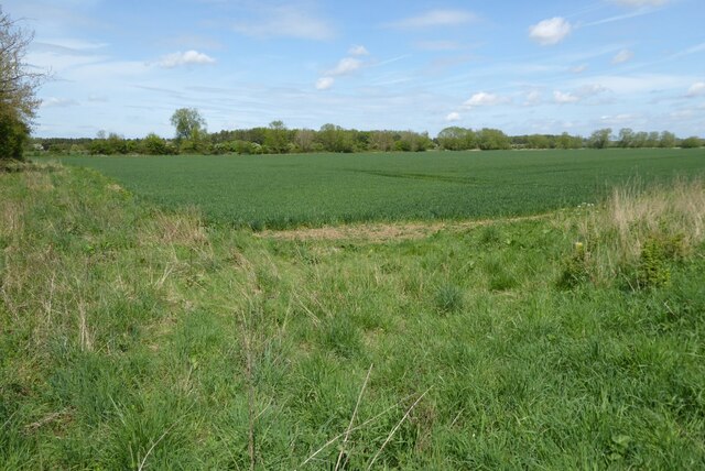
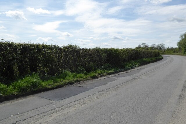
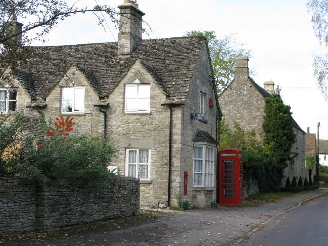
The village of Down Ampney is known for its picturesque countryside and charming rural setting. It is surrounded by rolling hills, open fields, and meandering streams, making it an ideal location for outdoor activities such as hiking and cycling. The village itself is characterized by a mix of traditional stone cottages and more modern houses.

The parish boasts a rich history dating back to Roman times, and there are several notable landmarks and historical sites in the area. One of the most prominent is Down Ampney House, a Grade II listed Georgian mansion that was once the home of composer Ralph Vaughan Williams. The village also has a beautiful parish church, St. Michael and All Angels, which dates back to the 12th century.

In terms of amenities, Down Ampney has a primary school, a village hall, and a local pub. The nearby town of Cirencester provides additional services and amenities, including shops, supermarkets, and healthcare facilities.

Overall, Down Ampney offers a peaceful and idyllic countryside setting with a strong sense of community. It is a popular destination for those seeking a rural lifestyle while still being within reach of larger towns and cities.

If you have any feedback on the listing, please let us know in the comments section below.

Down Ampney Images

Images are sourced within 2km of 51.675465/-1.846266 or Grid Reference SU1097. Thanks to Geograph Open Source API. All images are credited.

Farmland on the Down Ampney Estate Farmland on the Down Ampney Estate near Marston Meysey.
Farmland on the Down Ampney Estate
Farmland on the Down Ampney Estate near Marston Meysey.
Country road near Marston Meysey Country road from Cricklade to Marston Meysey.
Country road near Marston Meysey
Country road from Cricklade to Marston Meysey.
Stone Stile, Down Ampney On Gloucestershire footpath BDA8 looking West from the road. The view from the field is <a href="https://www.geograph.org.uk/photo/7296971">SU1097 : Stone Stile, Down Ampney</a>.
Stone Stile, Down Ampney
On Gloucestershire footpath BDA8 looking West from the road. The view from the field is SU1097 : Stone Stile, Down Ampney.
Stone Stile, Down Ampney On Gloucestershire footpath BDA8 looking West to the road. The view to the field is <a href="https://www.geograph.org.uk/photo/7296970">SU1097 : Stone Stile, Down Ampney</a>.
Stone Stile, Down Ampney
On Gloucestershire footpath BDA8 looking West to the road. The view to the field is SU1097 : Stone Stile, Down Ampney.
Field to the north of Down Ampney Difficult to identify the crop growing in this field to the north of the village of Down Ampney.  Possibly turnips or swedes.
Field to the north of Down Ampney
Difficult to identify the crop growing in this field to the north of the village of Down Ampney. Possibly turnips or swedes.
County road approaching Down Ampney
Public footpath and stream north of Castle Hill Farm, Down Ampney The stream, for which I can discover no name, forms the parish boundary between Down Ampney (the photographer's side) and Meysey Hampton parishes. It flows into the Thames just south of Marston Meysey. The stile leads into a recently fenced sheep pasture field.
Public footpath and stream north of Castle Hill Farm, Down Ampney
The stream, for which I can discover no name, forms the parish boundary between Down Ampney (the photographer's side) and Meysey Hampton parishes. It flows into the Thames just south of Marston Meysey. The stile leads into a recently fenced sheep pasture field.
Derelict farm cottages, nos. 66 & 67 Castle Hill Farm A semi-detached pair of derelict, uninhabited stone-tiled Cotswold stone cottages. These 19th century cottages are Grade II Listed buildings. <span class="nowrap"><a title="http://www.britishlistedbuildings.co.uk/en-129839-castle-hill-farm-down-ampney-gloucesters#.VvGLdv_cuUk" rel="nofollow ugc noopener" href="http://www.britishlistedbuildings.co.uk/en-129839-castle-hill-farm-down-ampney-gloucesters#.VvGLdv_cuUk">Link</a><img style="margin-left:2px;" alt="External link" title="External link - shift click to open in new window" src="https://s1.geograph.org.uk/img/external.png" width="10" height="10"/></span>
Derelict farm cottages, nos. 66 & 67 Castle Hill Farm
A semi-detached pair of derelict, uninhabited stone-tiled Cotswold stone cottages. These 19th century cottages are Grade II Listed buildings. LinkExternal link
Former horse engine house, adjoining stable and barn, Castle Hill Farm Grade II Listed Cotswold stone former horse engine house and adjoining small stable block. The horse engine house is circular with a conical stone slate roof and opens at the rear into the barn. The stable is a single storey building of four bays with a bellcote on west end and three plank doors on north side. <span class="nowrap"><a title="http://www.britishlistedbuildings.co.uk/en-129840-former-horse-engine-house-and-adjoining-#.VvGMX__cuUk" rel="nofollow ugc noopener" href="http://www.britishlistedbuildings.co.uk/en-129840-former-horse-engine-house-and-adjoining-#.VvGMX__cuUk">Link</a><img style="margin-left:2px;" alt="External link" title="External link - shift click to open in new window" src="https://s1.geograph.org.uk/img/external.png" width="10" height="10"/></span> See also <a href="https://www.geograph.org.uk/photo/4874235">SU1197 : Former horse engine house, stable and barn, Castle Hill Farm</a>, <a href="https://www.geograph.org.uk/photo/4874251">SU1197 : Former horse engine house and barn, Castle Hill Farm</a>, <a href="https://www.geograph.org.uk/photo/4874257">SU1197 : Former horse engine house, Castle Hill Farm</a> and <a href="https://www.geograph.org.uk/photo/4874244">SU1197 : Stable block and barn, Castle Hill Farm</a>.
Former horse engine house, adjoining stable and barn, Castle Hill Farm
Grade II Listed Cotswold stone former horse engine house and adjoining small stable block. The horse engine house is circular with a conical stone slate roof and opens at the rear into the barn. The stable is a single storey building of four bays with a bellcote on west end and three plank doors on north side. LinkExternal link See also SU1197 : Former horse engine house, stable and barn, Castle Hill Farm, SU1197 : Former horse engine house and barn, Castle Hill Farm, SU1197 : Former horse engine house, Castle Hill Farm and SU1197 : Stable block and barn, Castle Hill Farm.
Former horse engine house, stable and barn, Castle Hill Farm Grade II Listed Cotswold stone former horse engine house and adjoining small stable block. The horse engine house is circular with a conical stone slate roof. It has a wide opening to west with window to the left of it. At the rear it opens into the barn. Its roof overlaps that of stable and the circular wall ceases at this point. The stable is a single storey building with a bellcote on west end with saddlestone and cross and former clock space below. It has three plank doors on north side. <span class="nowrap"><a title="http://www.britishlistedbuildings.co.uk/en-129840-former-horse-engine-house-and-adjoining-#.VvGMX__cuUk" rel="nofollow ugc noopener" href="http://www.britishlistedbuildings.co.uk/en-129840-former-horse-engine-house-and-adjoining-#.VvGMX__cuUk">Link</a><img style="margin-left:2px;" alt="External link" title="External link - shift click to open in new window" src="https://s1.geograph.org.uk/img/external.png" width="10" height="10"/></span> See also <a href="https://www.geograph.org.uk/photo/4874184">SU1197 : Former horse engine house, adjoining stable and barn, Castle Hill Farm</a>, <a href="https://www.geograph.org.uk/photo/4874251">SU1197 : Former horse engine house and barn, Castle Hill Farm</a>, <a href="https://www.geograph.org.uk/photo/4874257">SU1197 : Former horse engine house, Castle Hill Farm</a> and <a href="https://www.geograph.org.uk/photo/4874244">SU1197 : Stable block and barn, Castle Hill Farm</a>.
Former horse engine house, stable and barn, Castle Hill Farm
Grade II Listed Cotswold stone former horse engine house and adjoining small stable block. The horse engine house is circular with a conical stone slate roof. It has a wide opening to west with window to the left of it. At the rear it opens into the barn. Its roof overlaps that of stable and the circular wall ceases at this point. The stable is a single storey building with a bellcote on west end with saddlestone and cross and former clock space below. It has three plank doors on north side. LinkExternal link See also SU1197 : Former horse engine house, adjoining stable and barn, Castle Hill Farm, SU1197 : Former horse engine house and barn, Castle Hill Farm, SU1197 : Former horse engine house, Castle Hill Farm and SU1197 : Stable block and barn, Castle Hill Farm.
Stable block and barn, Castle Hill Farm Grade II Listed Cotswold stone stable block and barn. The stable is a single storey building of four bays with stable doors to south; it has a bellcote on west end with a cross and a former clock space below. The conical roof of a former horse engine house shows behind the stable block. <span class="nowrap"><a title="http://www.britishlistedbuildings.co.uk/en-129840-former-horse-engine-house-and-adjoining-#.VvGMX__cuUk" rel="nofollow ugc noopener" href="http://www.britishlistedbuildings.co.uk/en-129840-former-horse-engine-house-and-adjoining-#.VvGMX__cuUk">Link</a><img style="margin-left:2px;" alt="External link" title="External link - shift click to open in new window" src="https://s1.geograph.org.uk/img/external.png" width="10" height="10"/></span> See also <a href="https://www.geograph.org.uk/photo/4874235">SU1197 : Former horse engine house, stable and barn, Castle Hill Farm</a>, <a href="https://www.geograph.org.uk/photo/4874251">SU1197 : Former horse engine house and barn, Castle Hill Farm</a>, <a href="https://www.geograph.org.uk/photo/4874257">SU1197 : Former horse engine house, Castle Hill Farm</a> and <a href="https://www.geograph.org.uk/photo/4874184">SU1197 : Former horse engine house, adjoining stable and barn, Castle Hill Farm</a>.
Stable block and barn, Castle Hill Farm
Grade II Listed Cotswold stone stable block and barn. The stable is a single storey building of four bays with stable doors to south; it has a bellcote on west end with a cross and a former clock space below. The conical roof of a former horse engine house shows behind the stable block. LinkExternal link See also SU1197 : Former horse engine house, stable and barn, Castle Hill Farm, SU1197 : Former horse engine house and barn, Castle Hill Farm, SU1197 : Former horse engine house, Castle Hill Farm and SU1197 : Former horse engine house, adjoining stable and barn, Castle Hill Farm.
Former horse engine house and barn, Castle Hill Farm Grade II Listed former horse engine house adjoining Cotswold stone barn. The horse engine house is circular with a conical stone slate roof. It has a wide opening to west with window to the left and opens at the rear into the barn. Its roof overlaps that of a stable block to the right of the picture. <span class="nowrap"><a title="http://www.britishlistedbuildings.co.uk/en-129840-former-horse-engine-house-and-adjoining-#.VvGMX__cuUk" rel="nofollow ugc noopener" href="http://www.britishlistedbuildings.co.uk/en-129840-former-horse-engine-house-and-adjoining-#.VvGMX__cuUk">Link</a><img style="margin-left:2px;" alt="External link" title="External link - shift click to open in new window" src="https://s1.geograph.org.uk/img/external.png" width="10" height="10"/></span> See also <a href="https://www.geograph.org.uk/photo/4874235">SU1197 : Former horse engine house, stable and barn, Castle Hill Farm</a>, <a href="https://www.geograph.org.uk/photo/4874184">SU1197 : Former horse engine house, adjoining stable and barn, Castle Hill Farm</a>, <a href="https://www.geograph.org.uk/photo/4874257">SU1197 : Former horse engine house, Castle Hill Farm</a> and <a href="https://www.geograph.org.uk/photo/4874244">SU1197 : Stable block and barn, Castle Hill Farm</a>.
Former horse engine house and barn, Castle Hill Farm
Grade II Listed former horse engine house adjoining Cotswold stone barn. The horse engine house is circular with a conical stone slate roof. It has a wide opening to west with window to the left and opens at the rear into the barn. Its roof overlaps that of a stable block to the right of the picture. LinkExternal link See also SU1197 : Former horse engine house, stable and barn, Castle Hill Farm, SU1197 : Former horse engine house, adjoining stable and barn, Castle Hill Farm, SU1197 : Former horse engine house, Castle Hill Farm and SU1197 : Stable block and barn, Castle Hill Farm.
Former horse engine house, Castle Hill Farm Grade II Listed former horse engine house and adjoining small stable block. The Cotswold stone horse engine house is circular with a conical stone slate roof. It has a wide opening to west with window to the left. It opens at the rear into the barn. Its roof overlaps that of stable and circular wall ceases at this point. <span class="nowrap"><a title="http://www.britishlistedbuildings.co.uk/en-129840-former-horse-engine-house-and-adjoining-#.VvGMX__cuUk" rel="nofollow ugc noopener" href="http://www.britishlistedbuildings.co.uk/en-129840-former-horse-engine-house-and-adjoining-#.VvGMX__cuUk">Link</a><img style="margin-left:2px;" alt="External link" title="External link - shift click to open in new window" src="https://s1.geograph.org.uk/img/external.png" width="10" height="10"/></span> See also <a href="https://www.geograph.org.uk/photo/4874235">SU1197 : Former horse engine house, stable and barn, Castle Hill Farm</a>, <a href="https://www.geograph.org.uk/photo/4874184">SU1197 : Former horse engine house, adjoining stable and barn, Castle Hill Farm</a>, <a href="https://www.geograph.org.uk/photo/4874251">SU1197 : Former horse engine house and barn, Castle Hill Farm</a> and <a href="https://www.geograph.org.uk/photo/4874244">SU1197 : Stable block and barn, Castle Hill Farm</a>.
Former horse engine house, Castle Hill Farm
Grade II Listed former horse engine house and adjoining small stable block. The Cotswold stone horse engine house is circular with a conical stone slate roof. It has a wide opening to west with window to the left. It opens at the rear into the barn. Its roof overlaps that of stable and circular wall ceases at this point. LinkExternal link See also SU1197 : Former horse engine house, stable and barn, Castle Hill Farm, SU1197 : Former horse engine house, adjoining stable and barn, Castle Hill Farm, SU1197 : Former horse engine house and barn, Castle Hill Farm and SU1197 : Stable block and barn, Castle Hill Farm.
Sharp bend, minor road between Down Ampney and Marston Meysey
Village Shop, Down Ampney The Village Shop, which adjoins the Village Hall, is run by volunteers. As well as selling a wide range of goods, the shop also houses a café and Post Office. There is also seating and a picnic table outside and toilets inside for use by passing travellers as well as locals.
Village Shop, Down Ampney
The Village Shop, which adjoins the Village Hall, is run by volunteers. As well as selling a wide range of goods, the shop also houses a café and Post Office. There is also seating and a picnic table outside and toilets inside for use by passing travellers as well as locals.
Road from Down Ampney to Poulton Country lane.
Road from Down Ampney to Poulton
Country lane.
Arable land, Down Ampney
Down Ampney primary school A grade II listed building, 1853, enlarged in 1880s.
Down Ampney primary school
A grade II listed building, 1853, enlarged in 1880s.
Show me another place!

Down Ampney is located at Grid Ref: SU1097 (Lat: 51.675465, Lng: -1.846266)

Administrative County: Gloucestershire

District: Cotswold

Police Authority: Gloucestershire

What 3 Words

///respected.transcribes.mental. Near Cricklade, Wiltshire

Nearby Locations

Down Ampney Down Ampney

Related Wikis

Down Ampney

Down Ampney (pronounced Amney) is a medium-sized village located in Cotswold district in Gloucestershire, in England. The population taken at the 2011...
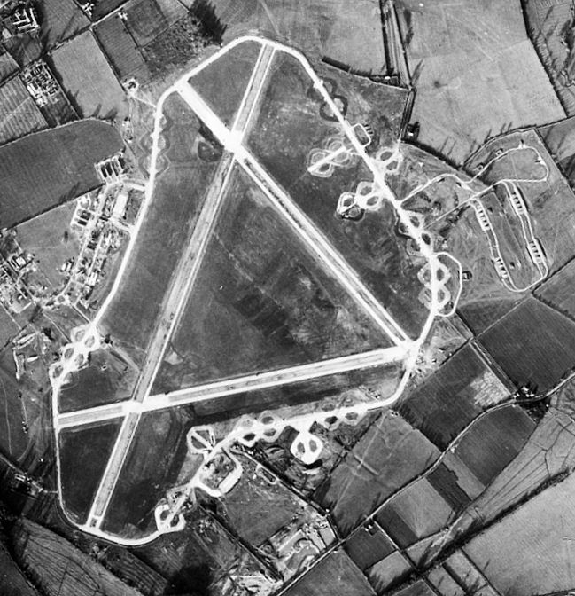
RAF Down Ampney

Royal Air Force Down Ampney or more simply RAF Down Ampney is a former Royal Air Force station located 1.8 miles (2.9 km) north east of Cricklade, Wiltshire...

Marston Meysey

Marston Meysey, pronounced and sometimes also spelt Marston Maisey, is a village and civil parish in Wiltshire, England, lying 3 miles (5 km) northeast...

Latton, Wiltshire

Latton is a village and civil parish in Wiltshire, England, 1.5 miles (2.4 km) north of Cricklade, on the county border with Gloucestershire. The village...

Nearby Amenities

Located within 500m of 51.675465,-1.846266
The data included in this document is from www.openstreetmap.org. The data is made available under ODbL.

Have you been to Down Ampney?

Leave your review of Down Ampney below (or comments, questions and feedback).