Dowlish Wake

Civil Parish in Somerset South Somerset

England

Dowlish Wake

Ilminster This market town takes its name from the River Ile and the Minster church, St Mary's.
Ilminster Credit: Liz Martin

Dowlish Wake is a small civil parish located in the county of Somerset, England. It is situated approximately 6 miles southwest of the town of Ilminster and 5 miles northeast of the town of Chard. The parish covers an area of about 1.5 square miles and has a population of around 300 people.

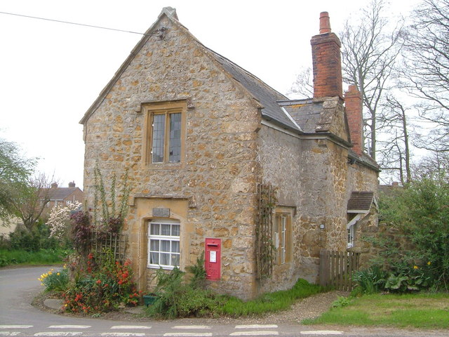
The village of Dowlish Wake is known for its picturesque countryside and traditional English charm. It is surrounded by rolling hills and farmland, making it an ideal location for nature enthusiasts and those seeking a peaceful retreat. The River Isle runs through the village, adding to its scenic beauty.

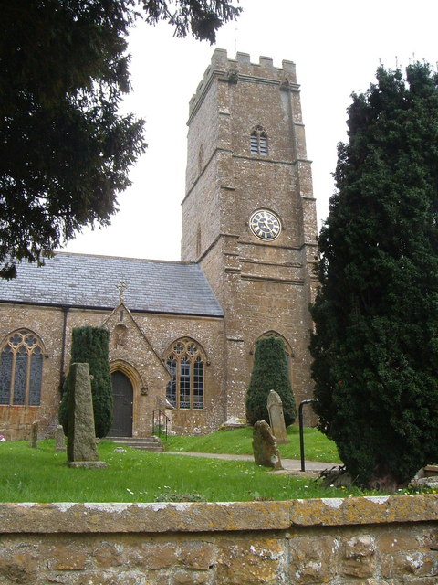
The village itself is small but has a rich history dating back centuries. It features a number of historic buildings, including the Grade II listed Church of St. Andrew, which dates back to the 12th century. The church is a prominent landmark in the area and attracts visitors interested in its architectural and historical significance.

In terms of amenities, Dowlish Wake has a community hall that serves as a hub for local events and gatherings. Additionally, there is a pub that offers a warm and welcoming atmosphere for locals and visitors alike.

Overall, Dowlish Wake is a charming and tranquil village that offers a glimpse into the rural beauty of Somerset. Its rich history, stunning landscapes, and friendly community make it a delightful place to visit or call home.

If you have any feedback on the listing, please let us know in the comments section below.

Dowlish Wake Images

Images are sourced within 2km of 50.910381/-2.896182 or Grid Reference ST3712. Thanks to Geograph Open Source API. All images are credited.

Ilminster This market town takes its name from the River Ile and the Minster church, St Mary's.
Ilminster
This market town takes its name from the River Ile and the Minster church, St Mary's.
Track in Autumn
Track in Autumn
Pretwood Hill Trees newly in leaf on the permissive path along the crest of Pretwood Hill, overlooking Ilminster.
Pretwood Hill
Trees newly in leaf on the permissive path along the crest of Pretwood Hill, overlooking Ilminster.
St John and All Saints church, Kingstone The medieval church <span class="nowrap"><a title="http://webapp1.somerset.gov.uk/her/details.asp?prn=56710" rel="nofollow ugc noopener" href="http://webapp1.somerset.gov.uk/her/details.asp?prn=56710">Link</a><img style="margin-left:2px;" alt="External link" title="External link - shift click to open in new window" src="https://s1.geograph.org.uk/img/external.png" width="10" height="10"/></span> from the south.
St John and All Saints church, Kingstone
The medieval church LinkExternal link from the south.
Dowlish Wake from the churchyard Looking SSW from the churchyard down the village street. A reverse view of <a href="https://www.geograph.org.uk/photo/3715773">ST3712 : Entrance to churchyard, Dowlish Wake</a>; on the right is the scene in <a href="https://www.geograph.org.uk/photo/3715820">ST3712 : Lane at Dowlish Wake</a>.
Dowlish Wake from the churchyard
Looking SSW from the churchyard down the village street. A reverse view of ST3712 : Entrance to churchyard, Dowlish Wake; on the right is the scene in ST3712 : Lane at Dowlish Wake.
Oxenford House Attractive buildings in Ham stone near Dowlish Wake, the main C17-C18 house and cottage described at <span class="nowrap"><a title="http://webapp1.somerset.gov.uk/her/details.asp?prn=57238" rel="nofollow ugc noopener" href="http://webapp1.somerset.gov.uk/her/details.asp?prn=57238">Link</a><img style="margin-left:2px;" alt="External link" title="External link - shift click to open in new window" src="https://s1.geograph.org.uk/img/external.png" width="10" height="10"/></span>
Oxenford House
Attractive buildings in Ham stone near Dowlish Wake, the main C17-C18 house and cottage described at LinkExternal link
Remains of Chard Canal near Dowlish Ford The wooded line of the canal has here been made into a nature reserve.
Remains of Chard Canal near Dowlish Ford
The wooded line of the canal has here been made into a nature reserve.
Ilminster Library On Ditton Road, south of the town centre. The tablet in the gable reads "The Reading Room, 1889".
Ilminster Library
On Ditton Road, south of the town centre. The tablet in the gable reads "The Reading Room, 1889".
Townsend Farm, Ilminster Seen from the slopes of Pretwood Hill.
Townsend Farm, Ilminster
Seen from the slopes of Pretwood Hill.
Cottages at Knott Oak Seen from the slopes of Pretwood Hill, looking northeast.
Cottages at Knott Oak
Seen from the slopes of Pretwood Hill, looking northeast.
Wake Hill, Kingstone Early C19 house - "in a later form of 'cottage ornee' (<span class="nowrap"><a title="http://webapp1.somerset.gov.uk/her/details.asp?prn=57246" rel="nofollow ugc noopener" href="http://webapp1.somerset.gov.uk/her/details.asp?prn=57246">Link</a><img style="margin-left:2px;" alt="External link" title="External link - shift click to open in new window" src="https://s1.geograph.org.uk/img/external.png" width="10" height="10"/></span> )
Wake Hill, Kingstone
Early C19 house - "in a later form of 'cottage ornee' (LinkExternal link )
Old Toll House, Kingstone <span class="nowrap"><a title="http://webapp1.somerset.gov.uk/her/details.asp?prn=57243" rel="nofollow ugc noopener" href="http://webapp1.somerset.gov.uk/her/details.asp?prn=57243">Link</a><img style="margin-left:2px;" alt="External link" title="External link - shift click to open in new window" src="https://s1.geograph.org.uk/img/external.png" width="10" height="10"/></span> . George V postbox TA19 19 is on the wall. See also <a href="https://www.geograph.org.uk/photo/3715963">ST3713 : Old Toll House, Kingstone</a>.
Old Toll House, Kingstone
LinkExternal link . George V postbox TA19 19 is on the wall. See also ST3713 : Old Toll House, Kingstone.
Barn conversion, Kingstone Farmhouse The pre-conversion photo, taken in 1986, at <span class="nowrap"><a title="http://webapp1.somerset.gov.uk/her/details.asp?prn=56718" rel="nofollow ugc noopener" href="http://webapp1.somerset.gov.uk/her/details.asp?prn=56718">Link</a><img style="margin-left:2px;" alt="External link" title="External link - shift click to open in new window" src="https://s1.geograph.org.uk/img/external.png" width="10" height="10"/></span> makes an interesting comparison. Listed and described at <span class="nowrap"><a title="https://historicengland.org.uk/listing/the-list/list-entry/1056989" rel="nofollow ugc noopener" href="https://historicengland.org.uk/listing/the-list/list-entry/1056989">Link</a><img style="margin-left:2px;" alt="External link" title="External link - shift click to open in new window" src="https://s1.geograph.org.uk/img/external.png" width="10" height="10"/></span>  .
Barn conversion, Kingstone Farmhouse
The pre-conversion photo, taken in 1986, at LinkExternal link makes an interesting comparison. Listed and described at LinkExternal link .
Kingstone church from the south Looking across a field of brassica, past a little stand of trees in its midst, from the footpath to Dowlish Wake.
Kingstone church from the south
Looking across a field of brassica, past a little stand of trees in its midst, from the footpath to Dowlish Wake.
St Andrew's church, Dowlish Wake <span class="nowrap"><a title="http://webapp1.somerset.gov.uk/her/details.asp?prn=57228" rel="nofollow ugc noopener" href="http://webapp1.somerset.gov.uk/her/details.asp?prn=57228">Link</a><img style="margin-left:2px;" alt="External link" title="External link - shift click to open in new window" src="https://s1.geograph.org.uk/img/external.png" width="10" height="10"/></span>
St Andrew's church, Dowlish Wake
Dower House , Dowlish Wake Fine 1664 house in Ham stone, with a five-light mullioned window, at the centre of the charming village. Details at <span class="nowrap"><a title="http://webapp1.somerset.gov.uk/her/details.asp?prn=57233" rel="nofollow ugc noopener" href="http://webapp1.somerset.gov.uk/her/details.asp?prn=57233">Link</a><img style="margin-left:2px;" alt="External link" title="External link - shift click to open in new window" src="https://s1.geograph.org.uk/img/external.png" width="10" height="10"/></span> .
Dower House , Dowlish Wake
Fine 1664 house in Ham stone, with a five-light mullioned window, at the centre of the charming village. Details at LinkExternal link .
Packhorse Bridge, Dowlish Wake The 2-arch bridge was widened in the 1990s as part of flood relief work - quite cleverly (can you see the joins?). <span class="nowrap"><a title="http://webapp1.somerset.gov.uk/her/details.asp?prn=17080" rel="nofollow ugc noopener" href="http://webapp1.somerset.gov.uk/her/details.asp?prn=17080">Link</a><img style="margin-left:2px;" alt="External link" title="External link - shift click to open in new window" src="https://s1.geograph.org.uk/img/external.png" width="10" height="10"/></span>
Packhorse Bridge, Dowlish Wake
The 2-arch bridge was widened in the 1990s as part of flood relief work - quite cleverly (can you see the joins?). LinkExternal link
Not St George's Day In Dowlish Wake village on St George's Eve. Hope it won whatever competition it was in for.
Not St George's Day
In Dowlish Wake village on St George's Eve. Hope it won whatever competition it was in for.
Show me another place!

Dowlish Wake is located at Grid Ref: ST3712 (Lat: 50.910381, Lng: -2.896182)

Administrative County: Somerset

District: South Somerset

Police Authority: Avon and Somerset

What 3 Words

///firming.amended.removals. Near Ilminster, Somerset

Related Wikis

Dowlish Wake

Dowlish Wake is a small village and civil parish in Somerset, England, 2 miles (3 km) south of Ilminster and 5 miles (8 km) northeast of Chard in the South...

Church of St Andrew, Dowlish Wake

The Anglican Church of St Andrew in Dowlish Wake, Somerset, England, was built in the 14th century. It is a Grade II* listed building. == History == The...

Kingstone, Somerset

Kingstone is a village and civil parish in Somerset, England, situated near Ilminster, 5 miles (8.0 km) north east of Chard in the South Somerset district...

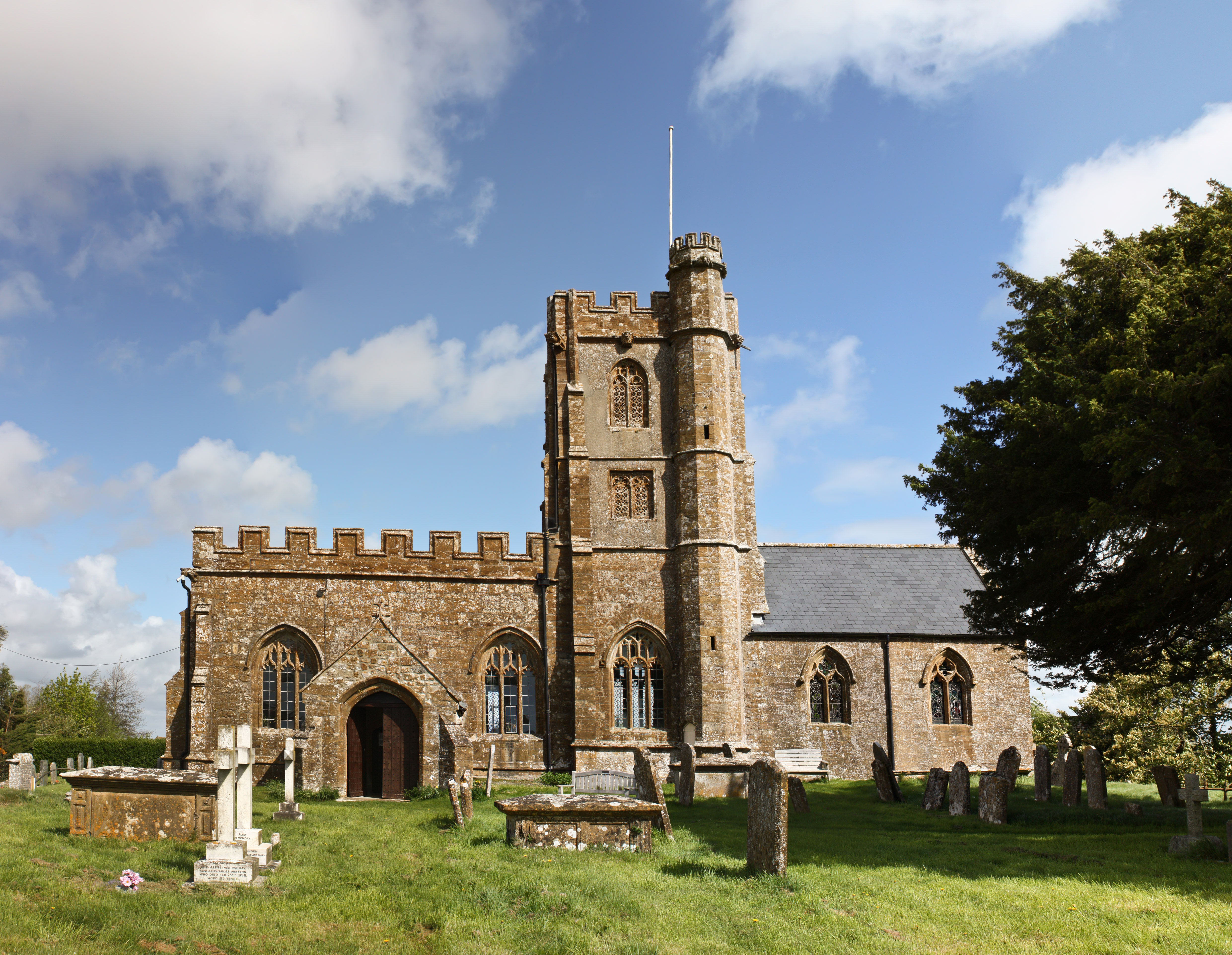
Church of St John the Evangelist and All Saints, Kingstone

The Anglican Church of St John the Evangelist and All Saints in Kingstone, Somerset, England was built in the 14th century. It is a Grade II* listed building...

Church of St Mary Magdalene, Cricket Malherbie

The Anglican Church of St Mary Magdalene in Cricket Malherbie, Somerset, England was built in the 12th century and rebuilt in 1855. It is a Grade II* listed...

Church of St Michael, Cudworth

The Anglican Church of St Michael in Cudworth, Somerset, England was built in the 12th century. It is a Grade II* listed building. == History == The church...

Ilminster

Ilminster is a minster town and civil parish in the South Somerset district of Somerset, England, with a population of 5,808. Bypassed in 1988, the town...

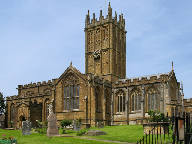
St Mary's Church, Ilminster

The Church of St Mary in Ilminster, Somerset, England, dates from the 15th century and has been designated as a Grade I listed building. == History... ==

Nearby Amenities

Located within 500m of 50.910381,-2.896182
Dowlish Wake
Place: village
Wikidata: Q2616263
Wikipedia: en:Dowlish Wake
Lat/Long: 50.9094125/-2.889848
Power: pole
Lat/Long: 50.9061366/-2.8962707
Power: pole
Lat/Long: 50.906852/-2.8978426
Power: pole
Lat/Long: 50.907417/-2.8990093
Power: pole
Lat/Long: 50.908003/-2.9002539
Power: pole
Lat/Long: 50.908699/-2.9017478
Power: pole
Lat/Long: 50.9092977/-2.9030125
Power: pole
Lat/Long: 50.913458/-2.8927705
Power: pole
Lat/Long: 50.9129406/-2.890614
Stop
Direction: forward
Stop: minor
Lat/Long: 50.9084408/-2.8900405
The data included in this document is from www.openstreetmap.org. The data is made available under ODbL.

Have you been to Dowlish Wake?

Leave your review of Dowlish Wake below (or comments, questions and feedback).