Broadmoor Common

Settlement in Herefordshire

England

Broadmoor Common

Croose Farm
Croose Farm Credit: Julian P Guffogg

Broadmoor Common is a picturesque village located in the county of Herefordshire, England. Situated amidst the stunning countryside, the village offers a serene and tranquil environment, making it an ideal destination for those seeking a peaceful retreat.

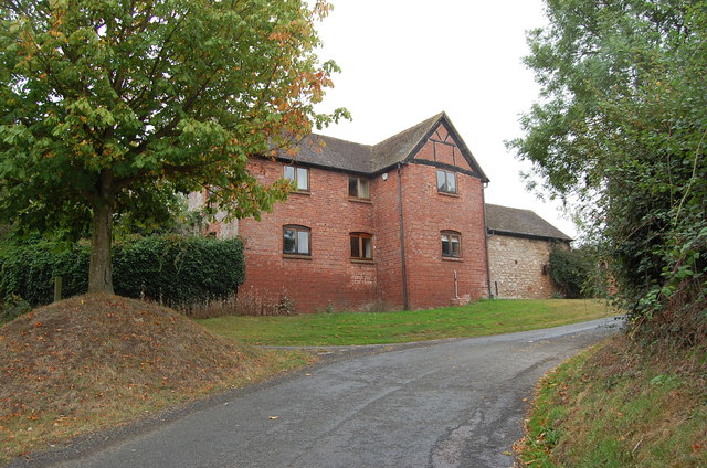
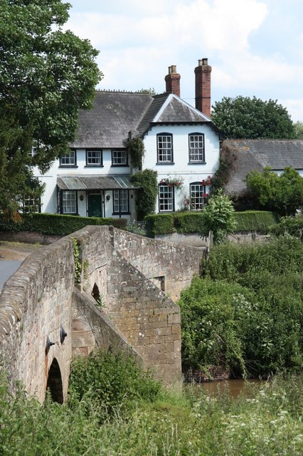
With a population of approximately 500 residents, Broadmoor Common retains a strong sense of community spirit. The village is characterized by its charming cottages, which add to the overall rustic appeal. The architecture reflects a mix of traditional and contemporary styles, blending seamlessly with the natural surroundings.

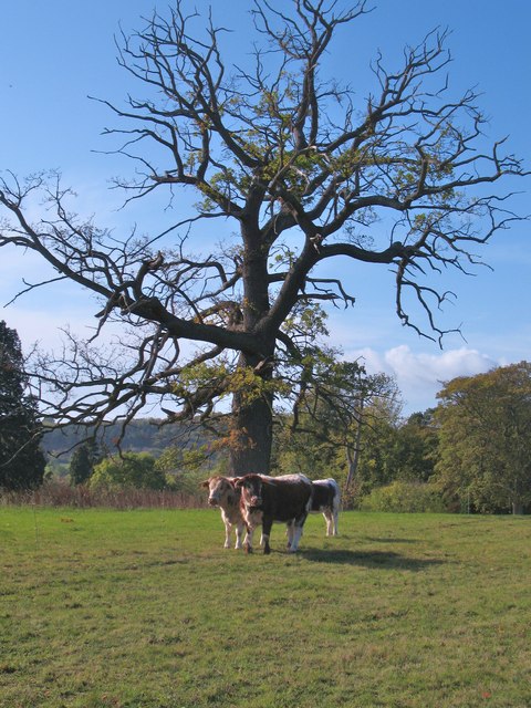
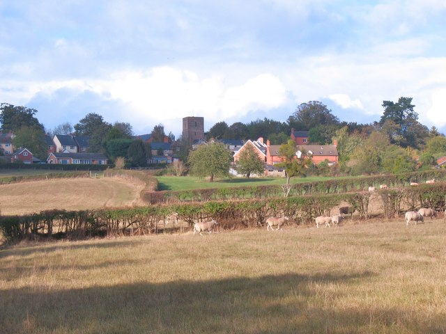
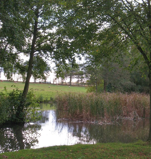
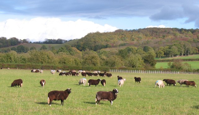
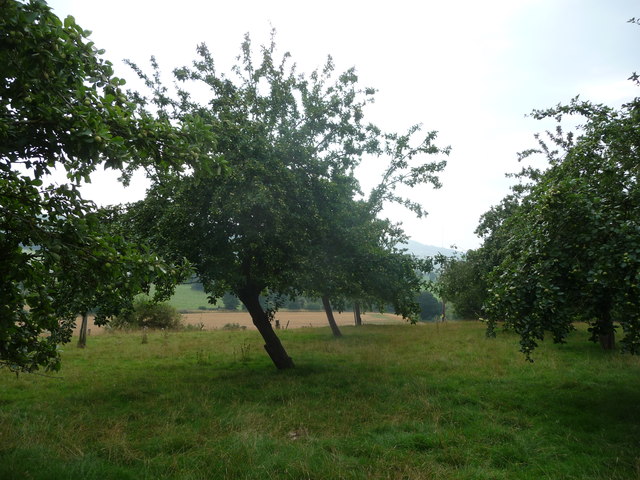
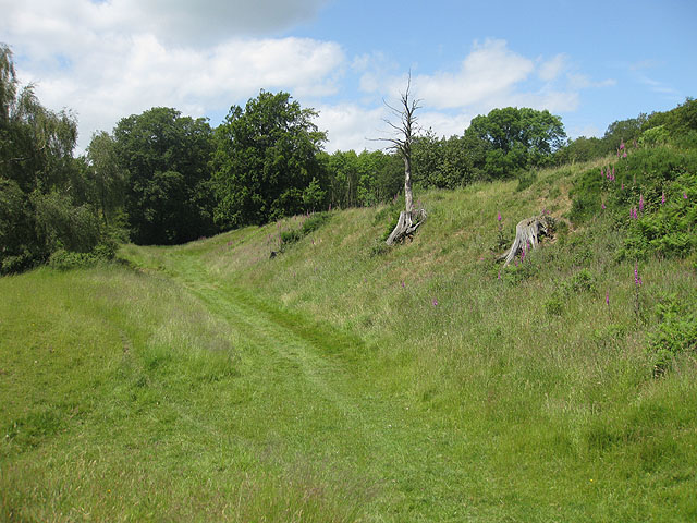
Nature enthusiasts will find themselves in paradise in Broadmoor Common. The village is surrounded by lush greenery, rolling hills, and meandering streams. Walking and cycling trails are abundant, allowing residents and visitors to explore the stunning landscape at their leisure. The nearby River Wye provides ample opportunities for fishing and boating, while the dense woodlands offer the perfect setting for wildlife spotting.

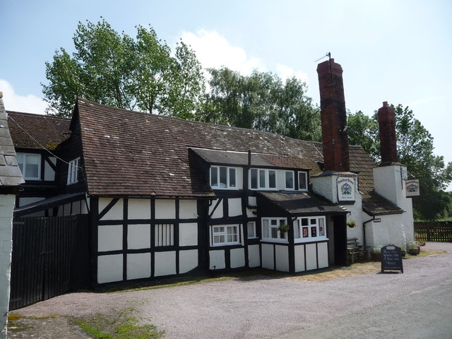
In terms of amenities, Broadmoor Common has a well-equipped village hall that serves as a hub for various community activities and events. The village also boasts a quaint, local pub, where residents and visitors can enjoy a refreshing drink or indulge in traditional British cuisine.

Overall, Broadmoor Common offers a peaceful and idyllic lifestyle, combining the beauty of nature with a strong sense of community. It is the perfect destination for those seeking a harmonious balance between rural charm and modern amenities.

If you have any feedback on the listing, please let us know in the comments section below.

Broadmoor Common Images

Images are sourced within 2km of 52.020968/-2.58433 or Grid Reference SO6036. Thanks to Geograph Open Source API. All images are credited.

Croose Farm
Croose Farm
Cattle at Woolhope These appear to be English Longhorn cattle, standing by an old oak at Woolhope.
Cattle at Woolhope
These appear to be English Longhorn cattle, standing by an old oak at Woolhope.
Approaching Woolhope Nearing the end of a circular walk at the village of Woolhope.
Approaching Woolhope
Nearing the end of a circular walk at the village of Woolhope.
Pond near Woolhope A corner of a pond and wetland area to the south of Woolhope village.
Pond near Woolhope
A corner of a pond and wetland area to the south of Woolhope village.
Sheep pasture at Woolhope Some rather unusually marked sheep at Woolhope. Maybe another contributor can recognise the breed.
Sheep pasture at Woolhope
Some rather unusually marked sheep at Woolhope. Maybe another contributor can recognise the breed.
The Butcher's Arms public house, Woolhope A proper little country pub with good food, excellent service and good value - it's good to see a pub being run to advantage; the owners, the customers, the village.
The Butcher's Arms public house, Woolhope
A proper little country pub with good food, excellent service and good value - it's good to see a pub being run to advantage; the owners, the customers, the village.
Crown Inn, Woolhope Taken on a day my girlfriend did a charity 8 mile cross country run around Woolhope, a tiny village in Herefordshire. While she was doing that, I sensibly decamped to the nearest pub, which was this one. I can recommend the Butty Bach bitter!
Crown Inn, Woolhope
Taken on a day my girlfriend did a charity 8 mile cross country run around Woolhope, a tiny village in Herefordshire. While she was doing that, I sensibly decamped to the nearest pub, which was this one. I can recommend the Butty Bach bitter!
St George, Woolhope The North side, seen from the East end. The church was mostly rebuilt 1882-83 by Henry Woodyer, but still has notable medieval elements.
St George, Woolhope
The North side, seen from the East end. The church was mostly rebuilt 1882-83 by Henry Woodyer, but still has notable medieval elements.
St George, Woolhope The church was mostly rebuilt 1882-83 by Henry Woodyer, who added the South aisle, but it still has notable medieval elements. Set in an enormous churchyard in this magical Herefordshire village.
St George, Woolhope
The church was mostly rebuilt 1882-83 by Henry Woodyer, who added the South aisle, but it still has notable medieval elements. Set in an enormous churchyard in this magical Herefordshire village.
In fields near Woolhope A herd of young cattle are excited by a group of walkers crossing their fields.
In fields near Woolhope
A herd of young cattle are excited by a group of walkers crossing their fields.
In an orchard near Woolhope A large if slightly neglected orchard.
In an orchard near Woolhope
A large if slightly neglected orchard.
Apple orchard near Woolhope A large old orchard and a bit confusing to cross as at certain points your outlook is restricted and all directions look identical.
Apple orchard near Woolhope
A large old orchard and a bit confusing to cross as at certain points your outlook is restricted and all directions look identical.
Rural lane in Herefordshire Walking the lane from the mill towards Woolhope. The church is just visible in the distance.
Rural lane in Herefordshire
Walking the lane from the mill towards Woolhope. The church is just visible in the distance.
Property in Woolhope, Herefordshire Elegant property with a substantial wall.
Property in Woolhope, Herefordshire
Elegant property with a substantial wall.
The Butcher's Arms pub at Woolhope Rural pub serving food and drinks.
The Butcher's Arms pub at Woolhope
Rural pub serving food and drinks.
Farmland at Terrace Farm
Buckenhill Wood
Buckenhill Wood
Crown Inn at Woolhope Taken as dusk fell, using a high ISO setting and black and white mode to give it atmosphere. Whether it makes a good Geograph is another matter, but I like it as a photograph. The Crown Inn, incidentally is a fine pub which serves excellent food (beef dripping chips ... mmmmm) and is well worth a visit.
Crown Inn at Woolhope
Taken as dusk fell, using a high ISO setting and black and white mode to give it atmosphere. Whether it makes a good Geograph is another matter, but I like it as a photograph. The Crown Inn, incidentally is a fine pub which serves excellent food (beef dripping chips ... mmmmm) and is well worth a visit.
Show me another place!

Broadmoor Common is located at Grid Ref: SO6036 (Lat: 52.020968, Lng: -2.58433)

Unitary Authority: County of Herefordshire

Police Authority: West Mercia

What 3 Words

///binder.adults.rags. Near Brockhampton, Herefordshire

Related Wikis

Woolhope

Woolhope is a village and civil parish in the English county of Herefordshire. The population of the civil parish was 486 at the 2011 census. The civil...

Fiddler's Green, Herefordshire

Fiddler's Green is a hamlet in the English county of Herefordshire. It is located near the River Wye on the B4224 road that connects Hereford and Ross...

Sollers Hope

Sollers Hope or Sollershope is a village and civil parish 8 miles (13 km) south east of Hereford, in the county of Herefordshire, England. In 2001 the...

Capler Camp

Capler Camp is an Iron Age hill fort located 2.5 km south of Fownhope, Herefordshire. The Camp is on a hill top above the River Wye. It has a double layer...

Mordiford

Mordiford is a village and civil parish in Herefordshire, England on the B4224 Hereford to Mitcheldean road 4 miles (6 km) east-southeast of the city of...

St Cuthbert's Church, Holme Lacy

St Cuthbert's Church is a redundant Anglican church about 1 mile (1.6 km) to the southeast of the village of Holme Lacy, Herefordshire, England. It stands...

River Lugg

The River Lugg (Welsh: Afon Llugwy) rises near Llangynllo in Radnorshire, Wales. It flows through the border town of Presteigne and then through Herefordshire...

All Saints' Church, Brockhampton

The Church of All Saints is a Church of England parish church at Brockhampton in the English county of Herefordshire. The church was commissioned by Alice...

Nearby Amenities

Located within 500m of 52.020968,-2.58433
Post Box
Collection Times: Mo-Fr 10:15; Sa 10:15
Post Box Type: lamp
Ref: HR1 195
Royal Cypher: EIIR
Royal Cypher Wikidata: Q33102113
Lat/Long: 52.0239662/-2.5852376
Barrier: kissing_gate
Lat/Long: 52.0194924/-2.5779143
Barrier: cattle_grid
Lat/Long: 52.020286/-2.5811846
Generator Method: photovoltaic
Generator Output Electricity: yes
Generator Source: solar
Generator Type: solar_photovoltaic_panel
Location: roof
Power: generator
Lat/Long: 52.0210518/-2.5826454
Generator Method: photovoltaic
Generator Output Electricity: yes
Generator Source: solar
Generator Type: solar_photovoltaic_panel
Location: roof
Power: generator
Lat/Long: 52.0245806/-2.5819185
Crossing
Lat/Long: 52.0228688/-2.5812955
Crossing
Lat/Long: 52.0226832/-2.581729
Haughwood Gate
Place: hamlet
Lat/Long: 52.0241221/-2.588173
Haugh Wood Gate
Power: pole
Transformer: distribution
Voltage Primary: 11000
Lat/Long: 52.0240553/-2.5843627
Power: pole
Lat/Long: 52.0235037/-2.5841823
Power: pole
Lat/Long: 52.0227366/-2.5839356
Power: pole
Lat/Long: 52.0222056/-2.5837518
Broadmoor Common South
Power: pole
Transformer: distribution
Voltage Primary: 11000
Lat/Long: 52.0212796/-2.5833964
Power: pole
Lat/Long: 52.0204032/-2.5831094
Power: pole
Lat/Long: 52.0171266/-2.5830303
Power: pole
Lat/Long: 52.0177696/-2.5828157
Power: pole
Lat/Long: 52.0186463/-2.582545
The Leys Broiler House
Power: pole
Transformer: distribution
Voltage Primary: 11000
Lat/Long: 52.019478/-2.5823396
Power: pole
Lat/Long: 52.0202992/-2.5820848
Power: pole
Lat/Long: 52.0201935/-2.5811166
Power: pole
Lat/Long: 52.020097/-2.5801604
Power: pole
Lat/Long: 52.0199707/-2.5789654
Power: pole
Lat/Long: 52.019818/-2.5774138
The data included in this document is from www.openstreetmap.org. The data is made available under ODbL.

Have you been to Broadmoor Common?

Leave your review of Broadmoor Common below (or comments, questions and feedback).