Broadmeadows

Settlement in Selkirkshire

Scotland

Broadmeadows

The Mill at Lewenshope The Mill is a beautifully converted former water mill and now available for holiday rent (I'm a happy customer - not the owner!).
The Mill at Lewenshope Credit: Gordon Brown

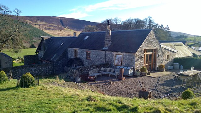
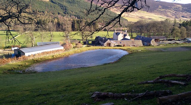
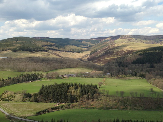
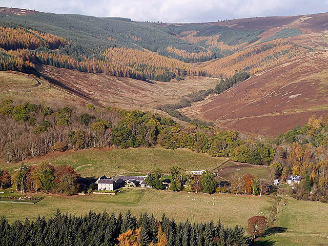
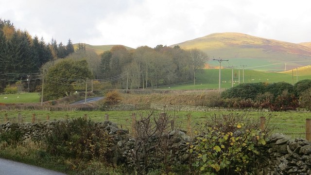
Broadmeadows is a small village situated in the picturesque region of Selkirkshire, Scotland. Nestled amidst rolling hills and lush green landscapes, this tranquil village offers a serene retreat for both residents and visitors alike. With a population of approximately 300 people, Broadmeadows enjoys a close-knit community atmosphere.

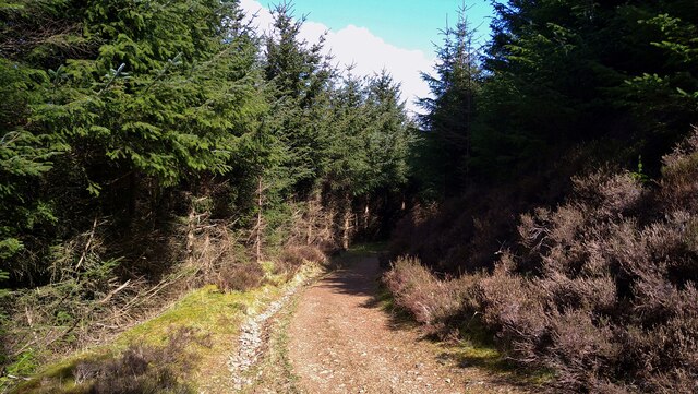
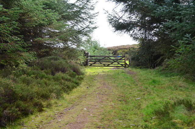
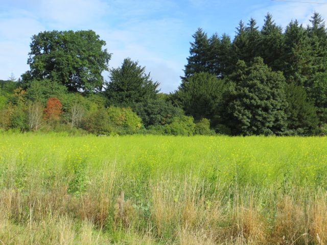
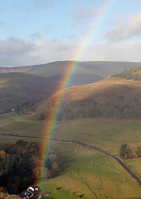
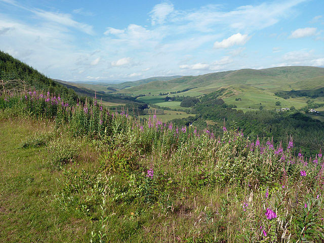
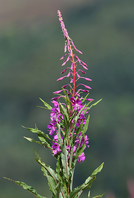
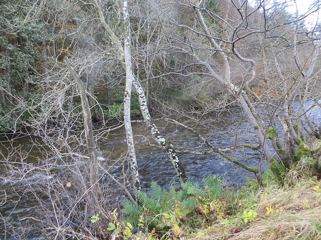
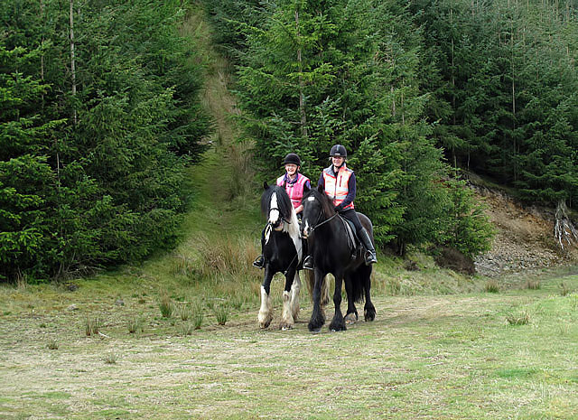
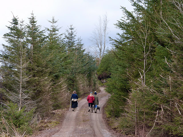
The village is renowned for its stunning natural beauty, with the River Tweed flowing nearby, providing breathtaking views and opportunities for outdoor activities such as fishing and hiking. The surrounding countryside is rich in wildlife, making it a haven for nature lovers and birdwatchers.

Broadmeadows boasts a rich historical background, with evidence of settlements dating back to ancient times. The area is home to several archaeological sites, including an Iron Age fort and remnants of Roman settlements. The village's history can be explored at the local museum, which showcases artifacts and documents from different eras.

Despite its small size, Broadmeadows offers a range of amenities and services to its residents. The village has a primary school, a village hall that hosts community events, and a local shop where essential goods can be purchased. For more extensive shopping and entertainment options, the nearby town of Selkirk is easily accessible.

Overall, Broadmeadows is an idyllic Scottish village that captivates visitors with its natural beauty and rich history. Whether one seeks peaceful walks in the countryside or a glimpse into the past, this charming village has something to offer for everyone.

If you have any feedback on the listing, please let us know in the comments section below.
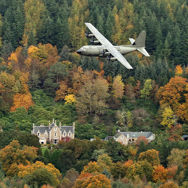
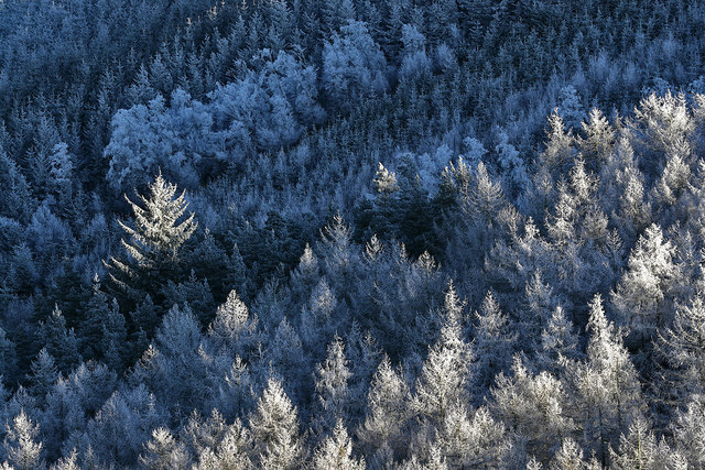
Broadmeadows Images

Images are sourced within 2km of 55.560096/-2.9369493 or Grid Reference NT4130. Thanks to Geograph Open Source API. All images are credited.

The Mill at Lewenshope The Mill is a beautifully converted former water mill and now available for holiday rent (I'm a happy customer - not the owner!).
The Mill at Lewenshope
The Mill is a beautifully converted former water mill and now available for holiday rent (I'm a happy customer - not the owner!).
Buildings at Lewenshope This includes the former mill, now converted as a holiday let.
Buildings at Lewenshope
This includes the former mill, now converted as a holiday let.
On the Duchess's Drive, in Black Andrew Wood This pleasant 7.5 mile walk follows the route of a Victorian carriage drive. Underfoot conditions are excellent, on good tracks and paths.
On the Duchess's Drive, in Black Andrew Wood
This pleasant 7.5 mile walk follows the route of a Victorian carriage drive. Underfoot conditions are excellent, on good tracks and paths.
Gate at the top of Black Andrew Wood Here the Duchess's Drive emerges on to the moorland of Newark Hill for a high-level route around Fastheugh Hill before descending to Bowhill.
Gate at the top of Black Andrew Wood
Here the Duchess's Drive emerges on to the moorland of Newark Hill for a high-level route around Fastheugh Hill before descending to Bowhill.
Across the Yarrow Valley from Black Andrew It's been a slow, cold spring but today the temperature was above 20 deg. C and now the grass is beginning to show, but even in early May the farmers are still having to feed their stock.  Minchmoor can be seen in the background.
Across the Yarrow Valley from Black Andrew
It's been a slow, cold spring but today the temperature was above 20 deg. C and now the grass is beginning to show, but even in early May the farmers are still having to feed their stock. Minchmoor can be seen in the background.
Game crop near Lewenshope Just off the A708, looks like cover and winter food for pheasants.
Game crop near Lewenshope
Just off the A708, looks like cover and winter food for pheasants.
An RAF Tucano at Yarrowford The Tucano is powered by a turboprop engine and is used for training fast jet students. This was viewed from a forestry track in Black Andrew Wood.
An RAF Tucano at Yarrowford
The Tucano is powered by a turboprop engine and is used for training fast jet students. This was viewed from a forestry track in Black Andrew Wood.
A rainbow in the Yarrow Valley The A708 and the east end of Tinnis Stiel Wood are in the foreground in this view from Black Andrew Wood.
A rainbow in the Yarrow Valley
The A708 and the east end of Tinnis Stiel Wood are in the foreground in this view from Black Andrew Wood.
Lewenshope Farm This view of the farm with Lewenshope Rig on the left and Hangingshaw Brae on the right was taken from a forestry road in Black Andrew Wood.
Lewenshope Farm
This view of the farm with Lewenshope Rig on the left and Hangingshaw Brae on the right was taken from a forestry road in Black Andrew Wood.
Rosebay willowherb at Black Andrew Wood This was viewed at a forestry track clearing in the Yarrow Valley.
Rosebay willowherb at Black Andrew Wood
This was viewed at a forestry track clearing in the Yarrow Valley.
Rosebay willowherb at Black Andrew Wood For a wider view of the scene by a forestry track, see <a href="https://www.geograph.org.uk/photo/4081800">NT3929 : Rosebay willowherb at Black Andrew Wood</a>.
Rosebay willowherb at Black Andrew Wood
For a wider view of the scene by a forestry track, see NT3929 : Rosebay willowherb at Black Andrew Wood.
A708, Lewenshope Looking upstream along the Yarrow.
A708, Lewenshope
Looking upstream along the Yarrow.
Yarrow Water Flowing near the A708 with  a steep wooded hill to the south.
Yarrow Water
Flowing near the A708 with a steep wooded hill to the south.
Horse riders at Black Andrew Wood This scene was taken on one of the many forestry roads in the plantation.
Horse riders at Black Andrew Wood
This scene was taken on one of the many forestry roads in the plantation.
Logging operations at Black Andrew Wood
Walkers in Black Andrew Wood This area of the wood is open to the public again after several months of forestry clear fell operations.
Walkers in Black Andrew Wood
This area of the wood is open to the public again after several months of forestry clear fell operations.
A Hercules at Hangingshaw The RAF Hercules was on a low level sortie in the Yarrow Valley. This was viewed from Black Andrew Wood at Yarrowford with the autumnal trees in Hangingshaw Wood providing a colourful background.
A Hercules at Hangingshaw
The RAF Hercules was on a low level sortie in the Yarrow Valley. This was viewed from Black Andrew Wood at Yarrowford with the autumnal trees in Hangingshaw Wood providing a colourful background.
Frosted trees at Black Andrew Wood
Show me another place!

Broadmeadows is located at Grid Ref: NT4130 (Lat: 55.560096, Lng: -2.9369493)

Unitary Authority: The Scottish Borders

Police Authority: The Lothians and Scottish Borders

What 3 Words

///blazing.sometimes.fatigued. Near Selkirk, Scottish Borders

Related Wikis

Yarrowford

Yarrowford is a village on the A708, in the Scottish Borders area of Scotland, 4 miles north-west of Selkirk, in the Ettrick Forest. The Yarrow Water flows...

Broadmeadows, Scottish Borders

Broadmeadows is a village in the Scottish Borders area of Scotland, on the A708 near Selkirk. Places nearby include Boleside, Bowhill, Caddonfoot, Ettrickbridge...

Newark Castle, Selkirkshire

Newark Tower is a large, ruined tower house standing in the grounds of Bowhill House, in the valley of the Yarrow Water three miles west of Selkirk in...

Yarrow Water

The Yarrow Water is a river in the Borders in the south east of Scotland. It is a tributary of the Ettrick Water (itself a tributary of the Tweed) and...

Bowhill House

Bowhill House is a historic house near Bowhill at Selkirk in the Scottish Borders area of Scotland. It is a member of the Historic Houses Association,...

Bowhill, Scottish Borders

Bowhill is a village off the A708, in the Scottish Borders area of Scotland, near Selkirk, by the Yarrow Water Other places nearby include Bowhill House...

Battle of Philiphaugh

The Battle of Philiphaugh was fought on 13 September 1645 during the Wars of the Three Kingdoms near Selkirk in the Scottish Borders. The Royalist army...

Philiphaugh

Philiphaugh is a village by the Yarrow Water, on the outskirts of Selkirk, in the Scottish Borders. Places nearby include Bowhill, Broadmeadows, the Ettrick...

Nearby Amenities

Located within 500m of 55.560096,-2.9369493
Broadmeadows Farm
Naptan AtcoCode: 69001415
Naptan Bearing: E
Naptan BusStopType: CUS
Naptan CommonName: Broadmeadows Farm
Naptan Indicator: Road End
Naptan Landmark: Road End
Naptan NaptanCode: 72725439
Naptan Street: A708
Naptan Verified: no
Source: naptan_import
Lat/Long: 55.559752/-2.9386666
Telephone Box
Naptan AtcoCode: 69001416
Naptan Bearing: W
Naptan BusStopType: CUS
Naptan CommonName: Telephone Box
Naptan Indicator: layby
Naptan Landmark: Telephone Box
Naptan NaptanCode: 72725342
Naptan Street: A708
Naptan Verified: no
Source: naptan_import
Lat/Long: 55.5596308/-2.9393067
Parking
Lat/Long: 55.560671/-2.9419596
Telephone
Booth: K6
Colour: red
Covered: booth
Source: survey
Lat/Long: 55.5596405/-2.9392764
Yarrowford
Place: village
Lat/Long: 55.5602012/-2.9407487
Broadmeadows
Place: village
Lat/Long: 55.5617393/-2.9328613
Turning Circle
Lat/Long: 55.5617751/-2.932513
Post Box
Operator: Royal Mail
Post Box Mounting: pier
Post Box Type: lamp
Ref: TD7 135
Royal Cypher: scottish_crown
Lat/Long: 55.5597508/-2.9398513
Defibrillator
Defibrillator Location: outside Yarrowford Village Hall
Emergency: defibrillator
Indoor: no
Lat/Long: 55.5602712/-2.9412302
Power: pole
Lat/Long: 55.5606258/-2.9440635
Power: pole
Lat/Long: 55.5611079/-2.9428091
Power: pole
Lat/Long: 55.5611773/-2.9417599
Power: pole
Lat/Long: 55.5607478/-2.9407023
Power: pole
Lat/Long: 55.5603136/-2.9396467
Power: pole
Lat/Long: 55.5603662/-2.9381258
Power: pole
Lat/Long: 55.5604165/-2.9368989
Power: pole
Lat/Long: 55.5604799/-2.9353061
Power: pole
Lat/Long: 55.5605229/-2.9340961
Power: pole
Lat/Long: 55.5607574/-2.9380496
Power: pole
Lat/Long: 55.5611881/-2.937946
Power: pole
Lat/Long: 55.564003/-2.9356709
Power: pole
Lat/Long: 55.563613/-2.9351117
Power: pole
Lat/Long: 55.5633194/-2.9342118
Power: pole
Lat/Long: 55.5630198/-2.93327
Power: pole
Lat/Long: 55.5627213/-2.9323491
Power: pole
Lat/Long: 55.5625252/-2.9310961
Power: pole
Lat/Long: 55.562392/-2.9302278
Power: pole
Lat/Long: 55.5592769/-2.9303771
The data included in this document is from www.openstreetmap.org. The data is made available under ODbL.

Have you been to Broadmeadows?

Leave your review of Broadmeadows below (or comments, questions and feedback).