Didcot

Civil Parish in Berkshire South Oxfordshire

England

Didcot

Line up at Didcot A line up of BR blue liveried locomotives.  Left to right: GWR 6023 'King Edward II'; LNER A4 60007 'Sir Nigel Gresley'; LNER A1 60163 'Tornado'.
Line up at Didcot Credit: Bob Walters

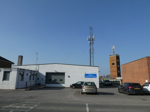
Didcot is a civil parish located in the county of Berkshire, England. Situated about 10 miles south of Oxford, it has a population of around 26,000 people. The town is mainly known for its railway junction, which has been an important transportation hub since the 19th century.

Didcot is home to the Didcot Railway Centre, a popular tourist attraction that showcases the history of the Great Western Railway. The centre features a collection of vintage steam engines, coaches, and other railway artifacts, providing visitors with a glimpse into the golden age of rail travel.

The town has a mix of modern and traditional architecture, with a range of housing options available. The Didcot Parkway railway station offers excellent transport links to London, Reading, and other major cities in the region.

In recent years, Didcot has seen significant development and expansion, with the creation of the Great Western Park housing development. This large-scale project has brought new amenities, such as shops, schools, and recreational facilities to the area, making it an attractive place to live for families and professionals alike.

Didcot also benefits from its proximity to the beautiful countryside of the Berkshire Downs and the North Wessex Downs, providing ample opportunities for outdoor activities such as hiking, cycling, and horse riding.

Overall, Didcot is a vibrant and growing town with a rich railway heritage and a range of amenities, making it an appealing place to live and visit.

If you have any feedback on the listing, please let us know in the comments section below.

Didcot Images

Images are sourced within 2km of 51.610821/-1.24255 or Grid Reference SU5290. Thanks to Geograph Open Source API. All images are credited.

Line up at Didcot A line up of BR blue liveried locomotives.  Left to right: GWR 6023 'King Edward II'; LNER A4 60007 'Sir Nigel Gresley'; LNER A1 60163 'Tornado'.
Line up at Didcot
A line up of BR blue liveried locomotives. Left to right: GWR 6023 'King Edward II'; LNER A4 60007 'Sir Nigel Gresley'; LNER A1 60163 'Tornado'.
Oxford Road at Didcot Railway Centre
Looking from the War Memorial Gardens towards Blenheim Close
Didcot Fire Station: late March 2022
Didcot Ambulance Resource Centre: late March 2022
Looking eastwards along The Broadway
Didcot Bowls Club: late March 2022
Didcot War Memorial Gardens: late March 2022
Car park at Didcot Civic Centre: late March 2022
Jubilee postbox Postbox along Haydon Road in Didcot with a decoration in celebration of The Queen's Platinum Jubilee
Jubilee postbox
Postbox along Haydon Road in Didcot with a decoration in celebration of The Queen's Platinum Jubilee
Queen's Jubilee Post box decoration in celebration of the Queen's Platinum Jubilee along Haydon Road in Didcot
Queen's Jubilee
Post box decoration in celebration of the Queen's Platinum Jubilee along Haydon Road in Didcot
Smoky Towers Postbox decoration outside the old post office along Broadway Didcot
Smoky Towers
Postbox decoration outside the old post office along Broadway Didcot
Grandad's Smoky Towers Postbox decoration called Grandad's Smoky Towers along Broadway, Didcot.
Grandad's Smoky Towers
Postbox decoration called Grandad's Smoky Towers along Broadway, Didcot.
Track and field north of Didcot
Grassland towards Moor Ditch North of Didcot
Grassland towards Moor Ditch
North of Didcot
Milk Tanker at the Railway Centre One of Didcot Railway Centre's collection of preserved freight wagons.
Milk Tanker at the Railway Centre
One of Didcot Railway Centre's collection of preserved freight wagons.
Thame, Taplow, Toilet Didcot Railway Centre. Old station name boards by the gent's.
Thame, Taplow, Toilet
Didcot Railway Centre. Old station name boards by the gent's.
Didcot Railway Centre Tracks at the northern end of this working museum complex that features God's Wonderful Railway.
Didcot Railway Centre
Tracks at the northern end of this working museum complex that features God's Wonderful Railway.
Show me another place!

Didcot is located at Grid Ref: SU5290 (Lat: 51.610821, Lng: -1.24255)

Administrative County: Oxfordshire

District: South Oxfordshire

Police Authority: Thames Valley

What 3 Words

///pins.spoiled.emotional. Near Didcot, Oxfordshire

Nearby Locations

Didcot Loop Meadow

Related Wikis

Didcot Parkway railway station

Didcot Parkway is a railway station serving the town of Didcot in Oxfordshire, England. The station was opened as Didcot on 12 June 1844 and was renamed...

Didcot Railway Centre

Didcot Railway Centre is a railway museum and preservation engineering site in Didcot, Oxfordshire, England. The site was formerly a Great Western Railway...

Vauxhall Barracks

Vauxhall Barracks is a British Army installation in Didcot, Oxfordshire. It is set to close in 2034. == History == The barracks were established during...

Didcot Town F.C.

Didcot Town Football Club are a football club based in Didcot in Oxfordshire, England. The club is affiliated to the Berks & Bucks Football Association...

Didcot

Didcot ( DID-kot, -⁠kət) is a railway town and civil parish in the ceremonial county of Oxfordshire and the historic county of Berkshire. Didcot is 15...

British Airways Flight 5390

British Airways Flight 5390 was a flight from Birmingham Airport in England for Málaga Airport in Spain. On 10 June 1990, the BAC One-Eleven 528FL suffered...

Didcot Girls' School

Didcot Girls' School (also known as DGS) is a secondary school with academy status for students in Didcot, Oxfordshire and the surrounding rural area....

St Birinus School

St Birinus School, previously known as Didcot Boy's County Modern and Didcot Senior Boys, is a boys' academy in Didcot, Oxfordshire, England. St Birinus...

Nearby Amenities

Located within 500m of 51.610821,-1.24255
Crossing
Bicycle: yes
Crossing: uncontrolled
Kerb: lowered
Tactile Paving: yes
Traffic Calming: table
Lat/Long: 51.610803/-1.2388082
Traffic Calming: choker
Lat/Long: 51.6110032/-1.2366996
Didcot Parkway
Public Transport: stop_position
Railway: stop
Ref: 1
Train: yes
Uic Ref: 7000651
Lat/Long: 51.6110586/-1.2425883
Operator: Network Rail
Railway: switch
Lat/Long: 51.612458/-1.2457754
Operator: Network Rail
Railway: switch
Source: bing
Lat/Long: 51.6129625/-1.2463509
Spar
Brand: Spar
Brand Wikidata: Q610492
Brand Wikipedia: en:Spar (retailer)
Opening Hours: Mo-Sa 06:00-20:00; Su 09:00-16:00
Payment Apple Pay: yes
Payment Cash: yes
Payment Coins: yes
Payment Credit Cards: yes
Payment Debit Cards: yes
Payment Notes: yes
Shop: convenience
Website: https://www.spar.co.uk/store-locator/afb15180-spar-didcot/
Lat/Long: 51.6108874/-1.2427136
Mini Roundabout
Direction: clockwise
Lat/Long: 51.606374/-1.242012
Telephone
Booth: KX100
Covered: booth
Lat/Long: 51.6063884/-1.2414846
Barrier: cycle_barrier
Lat/Long: 51.6109623/-1.2398572
Access: no
Barrier: bollard
Bicycle: yes
Bollard: rising
Bus: designated
Foot: yes
Horse: yes
Motor Vehicle: yes
Lat/Long: 51.6068579/-1.2401643
Entrance: yes
Lat/Long: 51.6066273/-1.2401347
Railway: buffer_stop
Source: Bing
Lat/Long: 51.6115092/-1.2415406
Operator: Great Western Society
Railway: switch
Source: bing
Lat/Long: 51.6132452/-1.2435051
Traffic Calming: cushion
Lat/Long: 51.6095374/-1.2448898
Traffic Calming: cushion
Lat/Long: 51.6080789/-1.2445202
Post Box
Lat/Long: 51.6100833/-1.2447656
Crossing
Crossing: unmarked
Kerb: lowered
Lat/Long: 51.6098408/-1.2406296
Crossing
Bicycle: yes
Crossing: traffic_signals
Crossing Ref: toucan
Kerb: lowered
Lat/Long: 51.6095973/-1.2398115
Crossing
Crossing: unmarked
Kerb: lowered
Source: Bing
Tactile Paving: yes
Lat/Long: 51.6096447/-1.2428807
Entrance: main
Lat/Long: 51.6098829/-1.2489258
Barrier: cycle_barrier
Lat/Long: 51.6105269/-1.2473496
Barrier: cycle_barrier
Lat/Long: 51.6101008/-1.2483692
Turning Circle
Turning Circle: hammer
Lat/Long: 51.6089246/-1.2469965
Turning Circle
Turning Circle: square
Lat/Long: 51.6082921/-1.2462958
Turning Circle
Turning Circle: square
Lat/Long: 51.6089743/-1.2462181
Barrier: bollard
Bollard: fixed
Lat/Long: 51.6071967/-1.2415825
Crossing
Crossing: unmarked
Kerb: lowered
Source: Bing
Tactile Paving: yes
Lat/Long: 51.6072731/-1.2446395
Turning Circle
Turning Circle: knuckle
Lat/Long: 51.6106673/-1.2484017
Market Place Shopping Centre
Landuse: retail
Lat/Long: 51.6068191/-1.2407714
Bus Stop
Didcot Parkway Station stop R1
Bus: yes
Local Ref: R1
Naptan AtcoCode: 340000176ST
Naptan Bearing: E
Naptan CommonName: Didcot Parkway Station
Naptan NaptanCode: oxfampgd
Naptan Street: Station Road
Naptan Verified: no
Public Transport: platform
Shelter: yes
Source: naptan_import
Lat/Long: 51.6108515/-1.2428203
Bus Stop
Haydon Road
Bus: yes
Local Ref: H2
Naptan AtcoCode: 340001385NOR
Naptan Bearing: N
Naptan CommonName: Haydon Road
Naptan Indicator: Stop H2
Naptan Landmark: Haydon Road
Naptan NaptanCode: oxfagmtw
Naptan Street: Haydon Road
Naptan Verified: no
Public Transport: platform
Source: naptan_import
Lat/Long: 51.606777/-1.2447659
Bus Stop
Haydon Road
Bus: yes
Local Ref: H1
Naptan AtcoCode: 340001385SOU
Naptan Bearing: S
Naptan CommonName: Haydon Road
Naptan Indicator: Stop H1
Naptan Landmark: Haydon Road
Naptan NaptanCode: oxfagmtp
Naptan Street: Haydon Road
Naptan Verified: no
Public Transport: platform
Source: naptan_import
Lat/Long: 51.6066324/-1.2446527
Bus Stop
Orchard Centre
Bench: yes
Bin: yes
Lit: yes
Local Ref: S1
Naptan AtcoCode: 340003232OUT
Naptan Bearing: N
Naptan CommonName: The Orchard Centre
Naptan Indicator: Stop S1
Naptan Landmark: Outside
Naptan NaptanCode: oxfawpaj
Naptan Street: Orchard Centre
Naptan Verified: no
Public Transport: platform
Shelter: yes
Source: naptan_import
Tactile Paving: no
Lat/Long: 51.6073651/-1.2400955
Crossing
Bicycle: yes
Crossing: traffic_signals
Crossing Ref: toucan
Kerb: lowered
Lat/Long: 51.6097137/-1.2394242
Turning Circle
Turning Circle: knucklew
Lat/Long: 51.6119191/-1.2362297
Turning Circle
Turning Circle: hammer
Lat/Long: 51.6101791/-1.2365939
Operator: Network Rail
Railway: switch
Source: bing
Lat/Long: 51.6118733/-1.2438639
Operator: Network Rail
Railway: switch
Source: bing
Lat/Long: 51.6124896/-1.2447215
Operator: Network Rail
Railway: switch
Source: bing
Lat/Long: 51.6136131/-1.2469717
Operator: Network Rail
Railway: switch
Source: bing
Lat/Long: 51.6135131/-1.2468738
Railway: buffer_stop
Source: Bing
Lat/Long: 51.6123909/-1.2458438
Operator: Network Rail
Railway: switch
Lat/Long: 51.6114975/-1.2433783
Operator: Network Rail
Railway: switch
Source: bing
Lat/Long: 51.6098321/-1.2385109
Operator: Great Western Society
Railway: switch
Source: bing
Lat/Long: 51.6122292/-1.2426449
Operator: Great Western Society
Railway: switch
Source: bing
Lat/Long: 51.6123828/-1.2428138
Railway: buffer_stop
Source: Bing
Lat/Long: 51.6145713/-1.2448849
Operator: Great Western Society
Railway: switch
Source: bing
Lat/Long: 51.6147367/-1.2458209
Railway: buffer_stop
Lat/Long: 51.6128259/-1.244117
Operator: Great Western Society
Railway: switch
Source: bing
Lat/Long: 51.6114222/-1.2415772
Operator: Great Western Society
Railway: switch
Source: bing
Lat/Long: 51.6126315/-1.2433439
Operator: Network Rail
Railway: switch
Lat/Long: 51.6094319/-1.2368445
Layer: 1
Lat/Long: 51.6111408/-1.2425171
Layer: 1
Lat/Long: 51.611284/-1.2423756
Elevator
Lat/Long: 51.6113792/-1.2426969
Elevator
Lat/Long: 51.6112289/-1.242811
Addr Housenumber: 27
Addr Street: King Alfred Drive
Fixme: position
Lat/Long: 51.6088115/-1.2434443
Addr Housenumber: 36
Addr Street: King Alfred Drive
Fixme: position
Lat/Long: 51.6088693/-1.2433143
Addr Housenumber: 124
Addr Street: Lydalls Road
Fixme: position
Lat/Long: 51.6106482/-1.2497695
Addr Housenumber: 136
Addr Street: Lydalls Road
Fixme: position
Lat/Long: 51.6106232/-1.2496602
Operator: Great Western Society
Railway: switch
Lat/Long: 51.6143366/-1.2451698
Operator: Network Rail
Railway: switch
Lat/Long: 51.6119704/-1.2450063
Traffic Calming: cushion
Lat/Long: 51.6114997/-1.2373243
Traffic Calming: cushion
Lat/Long: 51.6118687/-1.236757
Operator: Network Rail
Railway: switch
Source: bing
Lat/Long: 51.6099165/-1.2383877
Operator: Network Rail
Railway: switch
Lat/Long: 51.6101443/-1.2389868
Operator: Network Rail
Railway: switch
Source: bing
Lat/Long: 51.6105208/-1.2399242
Operator: Network Rail
Railway: switch
Source: bing
Lat/Long: 51.6107169/-1.2404141
Operator: Network Rail
Railway: switch
Source: bing
Lat/Long: 51.6108751/-1.2407341
Didcot Parkway
Public Transport: stop_position
Railway: stop
Ref: 2
Train: yes
Uic Ref: 7000651
Lat/Long: 51.6110603/-1.2424817
Railway: crossing
Lat/Long: 51.6110936/-1.2410228
Railway: crossing
Lat/Long: 51.6114376/-1.2412737
Operator: Network Rail
Railway: switch
Source: bing
Lat/Long: 51.6113976/-1.2420686
Operator: Network Rail
Railway: switch
Lat/Long: 51.6114525/-1.2433245
Operator: Network Rail
Railway: switch
Source: bing
Lat/Long: 51.6115073/-1.2425794
Railway: crossing
Lat/Long: 51.6114587/-1.2412385
Operator: Network Rail
Railway: switch
Source: bing
Lat/Long: 51.6115894/-1.2428674
Operator: Network Rail
Railway: switch
Lat/Long: 51.6117059/-1.2440415
Operator: Network Rail
Railway: switch
Source: bing
Lat/Long: 51.6117768/-1.2439949
Operator: Network Rail
Railway: switch
Source: bing
Lat/Long: 51.6117599/-1.2434947
Operator: Network Rail
Railway: switch
Lat/Long: 51.6118882/-1.2444291
Operator: Network Rail
Railway: switch
Lat/Long: 51.6117913/-1.2443509
Operator: Network Rail
Railway: switch
Source: bing
Lat/Long: 51.6119998/-1.2438717
Crossing Barrier: no
Railway: crossing
Lat/Long: 51.6117803/-1.24212
Operator: Network Rail
Railway: switch
Source: bing
Lat/Long: 51.6119804/-1.2441631
Operator: Network Rail
Railway: switch
Lat/Long: 51.6120045/-1.2447542
Operator: Network Rail
Railway: switch
Lat/Long: 51.6122531/-1.2461503
Operator: Great Western Society
Railway: switch
Source: bing
Lat/Long: 51.612505/-1.2431156
Operator: Great Western Society
Railway: switch
Source: Bing
Lat/Long: 51.612577/-1.243113
Operator: Great Western Society
Railway: switch
Source: bing
Lat/Long: 51.6129313/-1.2439
Operator: Great Western Society
Railway: switch
Source: bing
Lat/Long: 51.6127249/-1.2434215
Operator: Great Western Society
Railway: switch
Lat/Long: 51.6130711/-1.2442473
Railway: buffer_stop
Source: Bing
Lat/Long: 51.613125/-1.2462072
Crossing Barrier: no
Railway: crossing
Source: bing
Lat/Long: 51.6131861/-1.2443027
Crossing Barrier: no
Railway: crossing
Source: bing
Lat/Long: 51.6131625/-1.2443512
Operator: Great Western Society
Railway: switch
Lat/Long: 51.6133453/-1.2445099
Operator: Network Rail
Railway: switch
Source: bing
Lat/Long: 51.6135624/-1.2462981
Operator: Network Rail
Railway: switch
Source: bing
Lat/Long: 51.6138125/-1.24647
Crossing Barrier: no
Railway: crossing
Source: Bing
Lat/Long: 51.6137359/-1.2447732
Operator: Great Western Society
Railway: switch
Source: bing
Lat/Long: 51.6137421/-1.2448391
Operator: Network Rail
Railway: switch
Source: bing
Lat/Long: 51.6139674/-1.2474263
Railway: buffer_stop
Source: Bing
Lat/Long: 51.6140008/-1.2443608
Railway: buffer_stop
Source: Bing
Lat/Long: 51.6142359/-1.2464368
Operator: Great Western Society
Railway: switch
Lat/Long: 51.6143858/-1.2454747
Traffic Calming: cushion
Lat/Long: 51.6087373/-1.244691
Traffic Calming: cushion
Lat/Long: 51.6065792/-1.2447182
Traffic Calming: cushion
Lat/Long: 51.6075771/-1.2444598
Traffic Calming: cushion
Lat/Long: 51.6070705/-1.2445899
Crossing
Bicycle: yes
Crossing: traffic_signals
Crossing Ref: toucan
Kerb: lowered
Kerb Height: 1
Wheelchair: yes
Lat/Long: 51.6098395/-1.2395288
Entrance: yes
Lat/Long: 51.6109404/-1.242988
Bicycle Parking
Bicycle Parking: shed
Capacity: 100
Covered: yes
Lat/Long: 51.6115109/-1.2443769
Operator: Great Western Society
Railway: switch
Lat/Long: 51.6146066/-1.2460105
Crossing Barrier: no
Railway: crossing
Lat/Long: 51.6142953/-1.2453956
Crossing Barrier: no
Railway: crossing
Lat/Long: 51.6147528/-1.2453054
Crossing Barrier: no
Railway: crossing
Lat/Long: 51.6147607/-1.2452547
Entrance: yes
Lat/Long: 51.6132635/-1.2442566
Operator: Great Western Society
Railway: switch
Source: Bing
Lat/Long: 51.6146784/-1.2451928
Bus Stop
Didcot Parkway Station stop R2
Bus: yes
Local Ref: R2
Naptan AtcoCode: 340000176ST2
Naptan NaptanCode: oxfgtdaj
Public Transport: platform
Shelter: yes
Lat/Long: 51.6107849/-1.2425789
Bus Stop
Didcot Parkway Station stop R3
Bus: yes
Local Ref: R3
Naptan AtcoCode: 340000176ST3
Naptan NaptanCode: oxfgtdam
Public Transport: platform
Shelter: yes
Lat/Long: 51.6107101/-1.2423614
Bus Stop
Didcot Parkway Station stop R4
Bus: yes
Local Ref: R4
Naptan AtcoCode: 340000176ST4
Naptan NaptanCode: oxfgtdap
Public Transport: platform
Shelter: yes
Lat/Long: 51.6106402/-1.2421226
Cafe
Starbucks
Brand: Starbucks
Brand Wikidata: Q27825961
Cuisine: coffee_shop
Layer: 1
Official Name: Starbucks Coffee
Opening Hours: Mo-Fr 06:00-18:00; Sa-Su 08:00-15:30
Takeaway: yes
Lat/Long: 51.6111116/-1.2424126
Cafe
Coffee Hut
Layer: 1
Lat/Long: 51.6112615/-1.2423402
Entrance: main
Lat/Long: 51.6072429/-1.2403055
Bench
Backrest: yes
Lat/Long: 51.6097024/-1.236519
Leisure: picnic_table
Lat/Long: 51.6105119/-1.2381196
Bench
Backrest: yes
Lat/Long: 51.6116148/-1.2410519
Toilets
Female: yes
Lat/Long: 51.6131832/-1.2446209
Traveling Post Office Mail Exchange
Note: This is part of an active demonstration of the early 20th centry traveling postoffice system. Post bags are collected and left as the tain passes with out needing to slow down and waste time.
Railway: postal_pickup/leave_tower
Lat/Long: 51.6127002/-1.2430712
Entrance: main
Lat/Long: 51.6145019/-1.2417183
Crossing
Crossing: unmarked
Kerb: lowered
Source: Bing
Tactile Paving: yes
Lat/Long: 51.609734/-1.2447384
Traffic Calming: cushion
Lat/Long: 51.6111525/-1.2380803
Entrance: main
Level: 0
Lat/Long: 51.6071147/-1.2385135
Entrance: main
Level: 0
Lat/Long: 51.6071338/-1.2386573
Entrance: main
Level: 0
Lat/Long: 51.6071558/-1.2388234
Level: 2
Lat/Long: 51.6072976/-1.2381696
Level: 1
Lat/Long: 51.6072945/-1.2381461
Entrance: emergency
Level: -1
Lat/Long: 51.6073009/-1.2381193
Entrance: emergency
Level: -1
Lat/Long: 51.6072717/-1.2381293
Entrance: main
Level: 0
Lat/Long: 51.6072758/-1.2399205
Entrance: main
Level: 0
Lat/Long: 51.6072453/-1.2396052
Entrance: main
Lat/Long: 51.6072508/-1.2395399
Fixme: the easern wall of this waiting area was unsurved from the closed outside place seen from to the south. needs a site visit
Lat/Long: 51.6074229/-1.2392023
Door: yes
Entrance: yes
Indoor: door
Lat/Long: 51.6074092/-1.2392087
Atm
Halifax
Atm Facility Pinmanagement: Yes
Brand: Halifax
Brand Wikidata: Q3310164
Fee: no
Network: Link
Operator: Halifax
Operator Wikidata: Q3310164
Source: site survey (outside only), http://www.link.co.uk/ATMLocator/Pages/ATMLocator.aspx
Lat/Long: 51.6072149/-1.2392689
Atm
Lat/Long: 51.6072166/-1.2392816
Atm
Lat/Long: 51.6072554/-1.2392816
Manual Cash Deposit
Key Needed: yes
Note: A special depsit hatch door
Lat/Long: 51.6072627/-1.2392791
Atm
Cash In: yes
Type: deposit envelope
Lat/Long: 51.6072698/-1.2392767
Telephone
Access: private
Lat/Long: 51.6072679/-1.2394007
Telephone
Access: customers
Lat/Long: 51.6072863/-1.2393928
Computer
Access: customers
Type: online banking
Lat/Long: 51.6072943/-1.2393908
Crossing
Bicycle: yes
Crossing: unmarked
Kerb: lowered
Source: Bing
Tactile Paving: yes
Lat/Long: 51.6109466/-1.2436316
Barrier: kerb
Kerb: lowered
Tactile Paving: yes
Lat/Long: 51.6109184/-1.2435354
Barrier: kerb
Kerb: lowered
Tactile Paving: yes
Lat/Long: 51.6109731/-1.2437221
Crossing
Bicycle: yes
Crossing: unmarked
Kerb: lowered
Source: Bing
Lat/Long: 51.6112814/-1.2446247
Barrier: bollard
Bollard: fixed
Lat/Long: 51.6111756/-1.2434106
Traffic Signals
Source: Mapbox
Traffic Signals Direction: backward
Lat/Long: 51.6108304/-1.2433937
Crossing
Crossing: traffic_signals
Crossing Ref: pelican
Kerb: lowered
Lat/Long: 51.6108456/-1.2434455
Traffic Signals
Source: Mapbox
Traffic Signals Direction: forward
Lat/Long: 51.6108568/-1.2434835
Crossing
Bicycle: yes
Crossing: unmarked
Kerb: lowered
Source: survey
Lat/Long: 51.6108267/-1.2432178
Crossing
Bicycle: yes
Crossing: unmarked
Kerb: lowered
Source: Mapbox
Lat/Long: 51.6104705/-1.2420392
Barrier: bollard
Bollard: fixed
Lat/Long: 51.6108985/-1.243408
Traffic Signals
Source: Bing
Traffic Signals Direction: forward
Lat/Long: 51.6088421/-1.2363051
Crossing
Crossing: uncontrolled
Crossing Ref: zebra
Kerb: lowered
Source: Bing
Traffic Calming: table
Lat/Long: 51.6086009/-1.2375334
Traffic Signals
Source: Bing
Traffic Signals Direction: forward
Lat/Long: 51.6098089/-1.2399713
Traffic Signals
Source: Bing
Traffic Signals Direction: backward
Lat/Long: 51.609557/-1.2398353
Traffic Signals
Source: Bing
Traffic Signals Direction: forward
Lat/Long: 51.6097042/-1.2393699
Traffic Signals
Source: Bing
Traffic Signals Direction: forward
Lat/Long: 51.609872/-1.2395032
Crossing
Crossing: traffic_signals
Crossing Ref: pelican
Kerb: lowered
Lat/Long: 51.6098004/-1.2399194
Crossing
Bicycle: yes
Crossing: unmarked
Kerb: lowered
Tactile Paving: yes
Lat/Long: 51.6099894/-1.2405288
Crossing
Bicycle: yes
Crossing: unmarked
Kerb: lowered
Tactile Paving: yes
Lat/Long: 51.6102005/-1.2412693
Crossing
Crossing: unmarked
Kerb: lowered
Lat/Long: 51.6112347/-1.2447861
Barrier: cycle_barrier
Lat/Long: 51.6094779/-1.2389244
Crossing
Crossing: unmarked
Kerb: lowered
Lat/Long: 51.6095057/-1.2399359
Access: no
Barrier: bollard
Bicycle: yes
Bollard: rising
Bus: designated
Foot: yes
Horse: yes
Motor Vehicle: yes
Lat/Long: 51.6074135/-1.2399899
Crossing
Crossing: uncontrolled
Crossing Ref: zebra
Kerb: lowered
Source: Bing
Traffic Calming: table
Lat/Long: 51.6079049/-1.2376492
Crossing
Crossing: unmarked
Lat/Long: 51.6064444/-1.2419863
Crossing
Crossing: traffic_signals
Crossing Ref: pelican
Lat/Long: 51.6063809/-1.2423117
Crossing Barrier: no
Railway: crossing
Lat/Long: 51.6120868/-1.2424794
Crossing Barrier: no
Railway: crossing
Source: bing
Lat/Long: 51.6132025/-1.2442666
Operator: Great Western Society
Railway: switch
Source: bing
Lat/Long: 51.6115491/-1.2418406
Crossing Barrier: no
Railway: crossing
Lat/Long: 51.6117244/-1.2421678
Crossing Barrier: no
Railway: crossing
Lat/Long: 51.6117431/-1.2421401
Toilets
Access: yes
Fee: no
Layer: 1
Wheelchair: no
Lat/Long: 51.611074/-1.2423335
Information: telephone
Layer: 1
Tourism: information
Lat/Long: 51.6111683/-1.2426348
Layer: 1
Lat/Long: 51.6110325/-1.2427051
Crossing
Crossing: uncontrolled
Crossing Ref: zebra
Lat/Long: 51.6111938/-1.2435193
Bicycle Parking
Access: yes
Bicycle Parking: shed
Covered: yes
Fee: no
Lat/Long: 51.6113482/-1.2438391
Crossing
Crossing: uncontrolled
Crossing Ref: zebra
Lat/Long: 51.6113087/-1.243885
Crossing
Crossing: uncontrolled
Crossing Ref: zebra
Tactile Paving: yes
Lat/Long: 51.6112667/-1.2439339
Taxi
Lat/Long: 51.6112811/-1.2437482
Crossing
Crossing: uncontrolled
Crossing Ref: zebra
Tactile Paving: yes
Lat/Long: 51.6111408/-1.2435682
Crossing
Crossing: uncontrolled
Crossing Ref: zebra
Kerb: lowered
Source: Bing
Traffic Calming: table
Lat/Long: 51.6084744/-1.2376225
Crossing
Crossing: uncontrolled
Crossing Ref: zebra
Kerb: lowered
Source: Bing
Traffic Calming: table
Lat/Long: 51.6080374/-1.2379167
Entrance: yes
Lat/Long: 51.6111331/-1.2431405
Operator: Network Rail
Railway: switch
Source: bing
Lat/Long: 51.6116842/-1.2432166
Operator: Network Rail
Railway: switch
Source: bing
Lat/Long: 51.6121013/-1.2444501
Operator: Network Rail
Railway: switch
Source: bing
Lat/Long: 51.61185/-1.2435325
Operator: Network Rail
Railway: switch
Source: bing
Lat/Long: 51.6116801/-1.243401
Crossing Barrier: no
Railway: crossing
Source: Bing
Lat/Long: 51.6138259/-1.2446068
Crossing Barrier: no
Railway: crossing
Source: Bing
Lat/Long: 51.6138441/-1.2445487
Railway: buffer_stop
Source: Bing
Lat/Long: 51.6144064/-1.2450757
Railway: buffer_stop
Source: Bing
Lat/Long: 51.6144746/-1.2449123
Operator: Great Western Society
Railway: switch
Source: bing
Lat/Long: 51.6128034/-1.2436575
Crossing Barrier: no
Railway: crossing
Source: Bing
Lat/Long: 51.6137204/-1.2448183
Operator: Great Western Society
Railway: switch
Source: Bing
Lat/Long: 51.6118549/-1.2426119
Railway: buffer_stop
Lat/Long: 51.6125679/-1.2445074
Crossing Barrier: no
Railway: crossing
Lat/Long: 51.6142758/-1.2455296
Entrance: yes
Lat/Long: 51.6109763/-1.2430592
Barrier: bollard
Bollard: fixed
Lat/Long: 51.6109313/-1.2431211
Crossing
Crossing: unmarked
Kerb: lowered
Source: Bing
Tactile Paving: yes
Lat/Long: 51.6097366/-1.2450236
Crossing
Crossing: unmarked
Kerb: lowered
Source: Bing
Lat/Long: 51.6109931/-1.2441737
Give Way
Direction: forward
Lat/Long: 51.6097655/-1.2448561
Give Way
Direction: backward
Lat/Long: 51.6097083/-1.2449134
Barrier: bollard
Lat/Long: 51.6109001/-1.243012
Main Line Platform
Naptan AtcoCode: 910GDIDCOTP
Operator: Didcot Railway Centre
Public Transport: station
Railway: station
Railway Preserved: yes
Usage: tourism
Wheelchair: yes
Lat/Long: 51.6118363/-1.2419808
Didcot Halt
Operator: Didcot Railway Centre
Public Transport: station
Railway: station
Service: preserved
Usage: tourism
Wheelchair: limited
Lat/Long: 51.6143946/-1.2458686
Barrier: kerb
Lat/Long: 51.607701/-1.2397874
Access: no
Barrier: bollard
Bicycle: yes
Bollard: fixed
Foot: yes
Horse: yes
Lat/Long: 51.6088887/-1.2488467
Didcot Parkway
Addr City: Didcot
Addr Postcode: OX11 7NR
Addr Street: Station Road
Naptan AtcoCode: 9100DIDCOTP
Network: National Rail
Network Website: https://www.nationalrail.co.uk/stations/did/
Network Wikidata: Q26334
Operator: Great Western Railway
Operator Website: https://www.gwr.com/stations-and-destinations/stations/didcot-parkway
Operator Wikidata: Q1419438
Public Transport: station
Railway: station
Ref Crs: DID
Uic Ref: 7000651
Wikidata: Q1929166
Wikipedia: en:Didcot Parkway railway station
Lat/Long: 51.6109222/-1.24295
Turning Circle
Turning Circle: knuckle
Lat/Long: 51.6130339/-1.2380427
Entrance: main
Lat/Long: 51.6072242/-1.2393389
Access: yes
Drinking Water: no
Man Made: water_tap
Lat/Long: 51.608757/-1.2373624
Compressed Air
Covered: no
Fee: no
Lat/Long: 51.6087534/-1.2373496
Door: automatic
Entrance: main
Wheelchair: yes
Lat/Long: 51.6073667/-1.2379954
Door: automatic
Entrance: main
Wheelchair: yes
Lat/Long: 51.6073322/-1.2380073
Entrance: main
Lat/Long: 51.6071642/-1.2399372
Barrier: turnstile
Bicycle: customers
Foot: customers
Lat/Long: 51.611027/-1.2429313
Vending Machine
Payment Contactless: yes
Payment Credit Cards: yes
Payment Debit Cards: yes
Vending: public_transport_tickets
Lat/Long: 51.6110225/-1.2428813
Vending Machine
Payment Contactless: yes
Payment Credit Cards: yes
Payment Debit Cards: yes
Vending: public_transport_tickets
Lat/Long: 51.6110175/-1.2428515
Didcot East Junction
Railway: junction
Lat/Long: 51.61184/-1.2443921
Toilets
Changing Table: no
Fee: no
Male: yes
Wheelchair: yes
Lat/Long: 51.6129663/-1.2444238
Toilets
Changing Table: yes
Fee: no
Unisex: yes
Wheelchair: yes
Lat/Long: 51.6130261/-1.2444322
Parking
Lat/Long: 51.6130497/-1.2391965
Noexit: yes
Lat/Long: 51.6099903/-1.2490732
Old Didcot
Place: neighbourhood
Lat/Long: 51.6100919/-1.2486649
Traffic Calming: rumble_strip
Lat/Long: 51.6084058/-1.2392712
Crossing
Crossing: unmarked
Kerb: lowered
Source: Bing
Tactile Paving: yes
Lat/Long: 51.6096814/-1.2434815
Crossing
Crossing: unmarked
Kerb: lowered
Source: Bing
Tactile Paving: yes
Lat/Long: 51.6090791/-1.2448851
Crossing
Crossing: unmarked
Kerb: lowered
Source: Bing
Tactile Paving: yes
Lat/Long: 51.6083944/-1.244488
Crossing
Crossing: unmarked
Kerb: lowered
Source: Bing
Tactile Paving: no
Lat/Long: 51.6083988/-1.2446992
Crossing
Crossing: uncontrolled
Kerb: flush
Tactile Paving: yes
Lat/Long: 51.6080885/-1.2388926
Crossing
Crossing: uncontrolled
Kerb: flush
Tactile Paving: yes
Lat/Long: 51.608172/-1.2391867
Bus Stop
Sainsbury's
Bus: yes
Local Ref: S3
Naptan AtcoCode: 340003334STO
Naptan NaptanCode: oxfgtwma
Public Transport: platform
Shelter: no
Lat/Long: 51.6082064/-1.2395426
Crossing
Crossing: unmarked
Lat/Long: 51.6140072/-1.237522
Barrier: bollard
Lat/Long: 51.6139774/-1.2375586
Traffic Calming: cushion
Lat/Long: 51.6125769/-1.2362583
Post Box
Brand: Royal Mail
Brand Wikidata: Q638098
Collection Plate: not visible
Collection Times: Mo-Fr 09:00; Sa 07:00
Indoor: yes
Last Checked: 2021-08-20
Operator: Royal Mail
Operator Wikidata: Q638098
Post Box Type: pillar
Source: survey
Lat/Long: 51.6109078/-1.2427612
Entrance: main
Lat/Long: 51.6064698/-1.2423506
Entrance: main
Lat/Long: 51.6064596/-1.2420931
Entrance: main
Lat/Long: 51.6072186/-1.2424038
Entrance: main
Lat/Long: 51.6071226/-1.2408826
Chester Line Junction
Railway: junction
Lat/Long: 51.6099171/-1.2382371
Toilets
Access: customers
Changing Table: yes
Layer: 1
Wheelchair: yes
Lat/Long: 51.6110978/-1.2423095
Speed Camera
Direction: 120
Maxspeed: 30 mph
Lat/Long: 51.612003/-1.2464518
Parcel Locker
Amazon Hub Locker
Brand: Amazon Hub
Brand Wikidata: Q16974764
Opening Hours: 24/7
Operator: Amazon
Parcel Mail In: yes
Parcel Pickup: yes
Lat/Long: 51.6108718/-1.2426332
Parcel Locker
Amazon Hub Locker
Brand: Amazon Hub
Brand Wikidata: Q16974764
Description: Located inside Co-Op
Opening Hours: Mo-Su 07:00-20:00
Operator: Amazon
Parcel Mail In: yes
Parcel Pickup: yes
Lat/Long: 51.6066937/-1.2440615
Noexit: yes
Lat/Long: 51.6111361/-1.23837
Turning Circle
Turning Circle: knuckle
Lat/Long: 51.6117897/-1.2371548
Direction: 170
Generator Method: photovoltaic
Generator Output Electricity: yes
Generator Solar Modules: 12
Generator Source: solar
Generator Type: solar_photovoltaic_panel
Location: roof
Power: generator
Lat/Long: 51.6111688/-1.2374138
Direction: 150
Generator Method: photovoltaic
Generator Output Electricity: yes
Generator Solar Modules: 7
Generator Source: solar
Generator Type: solar_photovoltaic_panel
Location: roof
Power: generator
Lat/Long: 51.6114961/-1.236604
Direction: 165
Generator Method: photovoltaic
Generator Output Electricity: yes
Generator Solar Modules: 11
Generator Source: solar
Generator Type: solar_photovoltaic_panel
Location: roof
Power: generator
Lat/Long: 51.6106093/-1.2359905
Direction: 225
Generator Method: photovoltaic
Generator Output Electricity: yes
Generator Solar Modules: 16
Generator Source: solar
Generator Type: solar_photovoltaic_panel
Location: roof
Power: generator
Lat/Long: 51.6142779/-1.2425752
Direction: 245
Generator Method: photovoltaic
Generator Output Electricity: yes
Generator Solar Modules: 12
Generator Source: solar
Generator Type: solar_photovoltaic_panel
Location: roof
Power: generator
Lat/Long: 51.6113659/-1.2478211
Direction: 200
Generator Method: photovoltaic
Generator Output Electricity: yes
Generator Solar Modules: 12
Generator Source: solar
Generator Type: solar_photovoltaic_panel
Location: roof
Power: generator
Lat/Long: 51.6107359/-1.2497684
Direction: 180
Generator Method: photovoltaic
Generator Output Electricity: yes
Generator Solar Modules: 10
Generator Source: solar
Generator Type: solar_photovoltaic_panel
Location: roof
Power: generator
Lat/Long: 51.6087747/-1.2463783
Fixme: solar panels?
Lat/Long: 51.6071369/-1.2448801
Direction: 195
Generator Method: photovoltaic
Generator Output Electricity: yes
Generator Solar Modules: 4
Generator Source: solar
Generator Type: solar_photovoltaic_panel
Location: roof
Power: generator
Lat/Long: 51.6075056/-1.2447187
Direction: 285
Generator Method: photovoltaic
Generator Output Electricity: yes
Generator Solar Modules: 19
Generator Source: solar
Generator Type: solar_photovoltaic_panel
Location: roof
Power: generator
Lat/Long: 51.6075431/-1.2447215
Direction: 165
Generator Method: photovoltaic
Generator Output Electricity: yes
Generator Solar Modules: 6
Generator Source: solar
Generator Type: solar_photovoltaic_panel
Location: roof
Power: generator
Lat/Long: 51.6088753/-1.2453714
Direction: 75
Generator Method: photovoltaic
Generator Output Electricity: yes
Generator Solar Modules: 6
Generator Source: solar
Generator Type: solar_photovoltaic_panel
Location: roof
Power: generator
Lat/Long: 51.6089088/-1.2453514
Direction: 165
Generator Method: photovoltaic
Generator Output Electricity: yes
Generator Solar Modules: 14
Generator Source: solar
Generator Type: solar_photovoltaic_panel
Location: roof
Power: generator
Lat/Long: 51.6095615/-1.2455034
Direction: 185
Generator Method: photovoltaic
Generator Output Electricity: yes
Generator Solar Modules: 14
Generator Source: solar
Generator Type: solar_photovoltaic_panel
Location: roof
Power: generator
Lat/Long: 51.6098866/-1.2457044
Direction: 170
Generator Method: photovoltaic
Generator Output Electricity: yes
Generator Solar Modules: 5
Generator Source: solar
Generator Type: solar_photovoltaic_panel
Location: roof
Power: generator
Lat/Long: 51.6094729/-1.2460679
Direction: 165
Generator Method: photovoltaic
Generator Output Electricity: yes
Generator Solar Modules: 18
Generator Source: solar
Generator Type: solar_photovoltaic_panel
Location: roof
Power: generator
Lat/Long: 51.6098662/-1.2463212
Direction: 165
Generator Method: photovoltaic
Generator Output Electricity: yes
Generator Solar Modules: 14
Generator Source: solar
Generator Type: solar_photovoltaic_panel
Location: roof
Power: generator
Lat/Long: 51.6096948/-1.2471118
Direction: 175
Generator Method: photovoltaic
Generator Output Electricity: yes
Generator Solar Modules: 5
Generator Source: solar
Generator Type: solar_photovoltaic_panel
Location: roof
Power: generator
Lat/Long: 51.6087007/-1.2476139
Direction: 85
Generator Method: photovoltaic
Generator Output Electricity: yes
Generator Solar Modules: 11
Generator Source: solar
Generator Type: solar_photovoltaic_panel
Location: roof
Power: generator
Lat/Long: 51.6087578/-1.247576
Direction: 140
Generator Method: photovoltaic
Generator Output Electricity: yes
Generator Solar Modules: 11
Generator Source: solar
Generator Type: solar_photovoltaic_panel
Location: roof
Power: generator
Lat/Long: 51.6095133/-1.2490734
Fixme: solar panels?
Lat/Long: 51.6119292/-1.2470813
Direction: 165
Generator Method: photovoltaic
Generator Output Electricity: yes
Generator Solar Modules: 14
Generator Source: solar
Generator Type: solar_photovoltaic_panel
Location: roof
Power: generator
Lat/Long: 51.6088044/-1.2413077
Direction: 145
Generator Method: photovoltaic
Generator Output Electricity: yes
Generator Solar Modules: 10
Generator Source: solar
Generator Type: solar_photovoltaic_panel
Location: roof
Power: generator
Lat/Long: 51.6086552/-1.243451
Direction: 235
Generator Method: photovoltaic
Generator Output Electricity: yes
Generator Solar Modules: 6
Generator Source: solar
Generator Type: solar_photovoltaic_panel
Location: roof
Power: generator
Lat/Long: 51.6086459/-1.2435257
Direction: 265
Generator Method: photovoltaic
Generator Output Electricity: yes
Generator Solar Modules: 8
Generator Source: solar
Generator Type: solar_photovoltaic_panel
Location: roof
Power: generator
Lat/Long: 51.6082259/-1.2443139
Direction: 175
Generator Method: photovoltaic
Generator Output Electricity: yes
Generator Solar Modules: 5
Generator Source: solar
Generator Type: solar_photovoltaic_panel
Location: roof
Power: generator
Lat/Long: 51.6081962/-1.244273
Direction: 165
Generator Method: photovoltaic
Generator Output Electricity: yes
Generator Solar Modules: 12
Generator Source: solar
Generator Type: solar_photovoltaic_panel
Location: roof
Power: generator
Lat/Long: 51.6082218/-1.2431151
Fixme: solar panels?
Lat/Long: 51.6079422/-1.2424642
Direction: 90
Fixme: survey for panel counthttps://www.youtube.com/watch?v=G2oY6sNUxNc
Generator Method: photovoltaic
Generator Output Electricity: yes
Generator Solar Modules: 6
Generator Source: solar
Generator Type: solar_photovoltaic_panel
Location: roof
Power: generator
Lat/Long: 51.6077921/-1.2432238
Direction: 270
Fixme: survey for panel counthttps://www.youtube.com/watch?v=G2oY6sNUxNc
Generator Method: photovoltaic
Generator Output Electricity: yes
Generator Solar Modules: 6
Generator Source: solar
Generator Type: solar_photovoltaic_panel
Location: roof
Power: generator
Lat/Long: 51.6077912/-1.2432571
Direction: 110
Fixme: survey for panel counthttps://www.youtube.com/watch?v=G2oY6sNUxNc
Generator Method: photovoltaic
Generator Output Electricity: yes
Generator Solar Modules: 8
Generator Source: solar
Generator Type: solar_photovoltaic_panel
Location: roof
Power: generator
Lat/Long: 51.6080473/-1.2413067
Direction: 290
Fixme: survey for panel counthttps://www.youtube.com/watch?v=G2oY6sNUxNc
Generator Method: photovoltaic
Generator Output Electricity: yes
Generator Solar Modules: 8
Generator Source: solar
Generator Type: solar_photovoltaic_panel
Location: roof
Power: generator
Lat/Long: 51.6080576/-1.2413564
Direction: 110
Fixme: survey for panel counthttps://www.youtube.com/watch?v=G2oY6sNUxNc
Generator Method: photovoltaic
Generator Output Electricity: yes
Generator Solar Modules: 16
Generator Source: solar
Generator Type: solar_photovoltaic_panel
Location: roof
Power: generator
Lat/Long: 51.6081136/-1.2412658
Direction: 110
Fixme: survey for panel counthttps://www.youtube.com/watch?v=G2oY6sNUxNc
Generator Method: photovoltaic
Generator Output Electricity: yes
Generator Solar Modules: 16
Generator Source: solar
Generator Type: solar_photovoltaic_panel
Location: roof
Power: generator
Lat/Long: 51.6082027/-1.2412131
Direction: 205
Generator Method: photovoltaic
Generator Output Electricity: yes
Generator Solar Modules: 9
Generator Source: solar
Generator Type: solar_photovoltaic_panel
Location: roof
Power: generator
Lat/Long: 51.6090522/-1.2384646
Entrance: main
Lat/Long: 51.6066162/-1.2451234
Bicycle Parking
Access: yes
Bicycle Parking: anchors
Capacity: 8
Covered: no
Surface: asphalt
Lat/Long: 51.6073811/-1.2401198
Addr City: Didcot
Addr Housenumber: 8
Addr Postcode: OX11 7JW
Addr Street: Blagrave Close
Entrance: yes
Lat/Long: 51.6079197/-1.2477409
Addr City: Didcot
Addr Housenumber: 6
Addr Postcode: OX11 7JW
Addr Street: Blagrave Close
Entrance: yes
Lat/Long: 51.6078985/-1.2479581
Addr City: Didcot
Addr Housenumber: 4
Addr Postcode: OX11 7JW
Addr Street: Blagrave Close
Entrance: yes
Lat/Long: 51.6078948/-1.2479967
Addr City: Didcot
Addr Housenumber: 10
Addr Postcode: OX11 7JW
Addr Street: Blagrave Close
Entrance: yes
Lat/Long: 51.6077932/-1.2475919
Addr City: Didcot
Addr Housenumber: 12
Addr Postcode: OX11 7JW
Addr Street: Blagrave Close
Entrance: yes
Lat/Long: 51.6076583/-1.2475579
Addr City: Didcot
Addr Housenumber: 11
Addr Postcode: OX11 7JW
Addr Street: Blagrave Close
Entrance: yes
Lat/Long: 51.6076551/-1.2475906
Addr City: Didcot
Addr Housenumber: 9
Addr Postcode: OX11 7JW
Addr Street: Blagrave Close
Entrance: yes
Lat/Long: 51.60779/-1.2476247
Addr City: Didcot
Addr Housenumber: 7
Addr Postcode: OX11 7JW
Addr Street: Blagrave Close
Entrance: yes
Lat/Long: 51.6078993/-1.2477358
Addr City: Didcot
Addr Housenumber: 5
Addr Postcode: OX11 7JW
Addr Street: Blagrave Close
Entrance: yes
Lat/Long: 51.6078782/-1.247953
Addr City: Didcot
Addr Housenumber: 3
Addr Postcode: OX11 7JW
Addr Street: Blagrave Close
Entrance: yes
Lat/Long: 51.6078744/-1.2479916
Grit Bin
Lat/Long: 51.6107359/-1.2416587
Entrance: shop
Operator: True Mobility
Lat/Long: 51.6066138/-1.2414973
Iceland
Brand: Iceland
Brand Wikidata: Q721810
Contact Website: https://www.iceland.co.uk/store-finder/store?StoreID=1485&StoreName=DIDCOT
Shop: frozen_food
Lat/Long: 51.6067072/-1.2412613
Entrance: shop
Operator: True Mobility
Lat/Long: 51.606586/-1.2411849
True Mobility
Addr City: Didcot
Addr Housenumber: 2
Addr Postcode: OX11 7LE
Addr Street: Market Place
Opening Hours: Mo-Fr 09:00-16:30; Sa 09:00-15:45
Shop: mobility_scooter
Website: https://truemobility.co.uk/
Lat/Long: 51.6066014/-1.2412444
Barrier: bollard
Lat/Long: 51.6107516/-1.2386423
Barrier: bollard
Lat/Long: 51.6107382/-1.2386784
Barrier: bollard
Lat/Long: 51.6107315/-1.2386964
Barrier: bollard
Lat/Long: 51.6107449/-1.2386604
Barrier: bollard
Lat/Long: 51.6107248/-1.2387145
Barrier: bollard
Lat/Long: 51.6107963/-1.2389335
Barrier: bollard
Lat/Long: 51.6107907/-1.238953
Barrier: bollard
Lat/Long: 51.6107851/-1.2389725
Barrier: bollard
Lat/Long: 51.6108019/-1.238914
Leisure: picnic_table
Lat/Long: 51.6104026/-1.2380125
Leisure: picnic_table
Lat/Long: 51.6105025/-1.2379421
Liberty Taxis
Office: yes
Phone: +44 1235 376030
Website: http://www.libertytaxis.co.uk/home
Lat/Long: 51.6115147/-1.2445939
Bench
Backrest: yes
Lat/Long: 51.6112556/-1.2433579
Millennium Milepost Didcot Station
Description: 1) Oxford 14 2) London 89 3) Town Centre 0.5
Image: https://www.cyclestreets.net/location/202955/cyclestreets202955-size640.jpg
Information: guidepost
Ncn Milepost: rowe
Sustrans Ref: MP 228
Tourism: information
Lat/Long: 51.6107635/-1.2428952
Bench
Backrest: yes
Lat/Long: 51.6113076/-1.2434978
The data included in this document is from www.openstreetmap.org. The data is made available under ODbL.

Have you been to Didcot?

Leave your review of Didcot below (or comments, questions and feedback).