Dallinghoo

Civil Parish in Suffolk East Suffolk

England

Dallinghoo

Fields northeast of Bredfield
Fields northeast of Bredfield Credit: Christopher Hilton

Dallinghoo is a civil parish located in the county of Suffolk, England. Situated approximately 8 miles north-west of the town of Woodbridge, Dallinghoo covers an area of around 3.5 square miles.

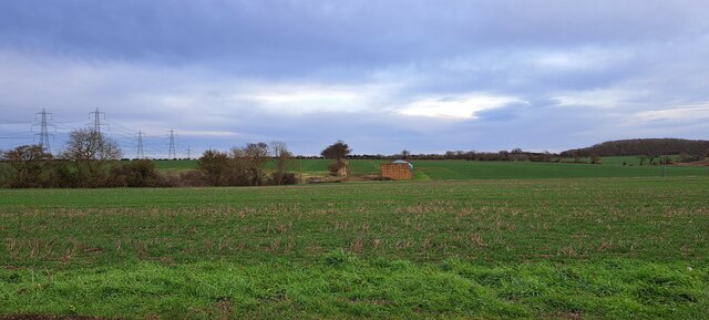
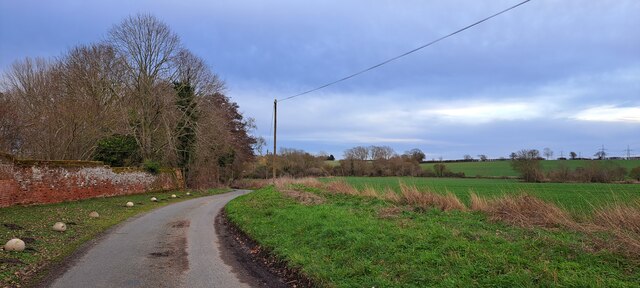
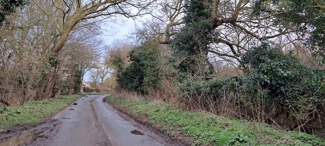
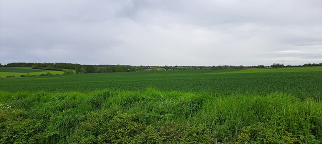
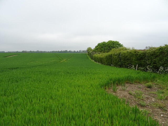
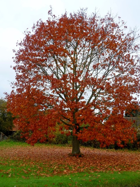
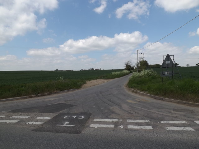
The parish is primarily rural, consisting of a small number of scattered settlements and open farmland. The landscape is characterized by gently rolling hills and meandering streams, providing a picturesque and tranquil setting. The River Deben flows to the east of the parish, adding to the natural beauty of the area.

Historically, Dallinghoo was an agricultural community, with farming playing a significant role in the local economy. Today, while agriculture remains important, the parish has also seen some diversification in terms of its economic activities, including small businesses and tourism.

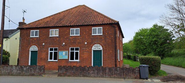
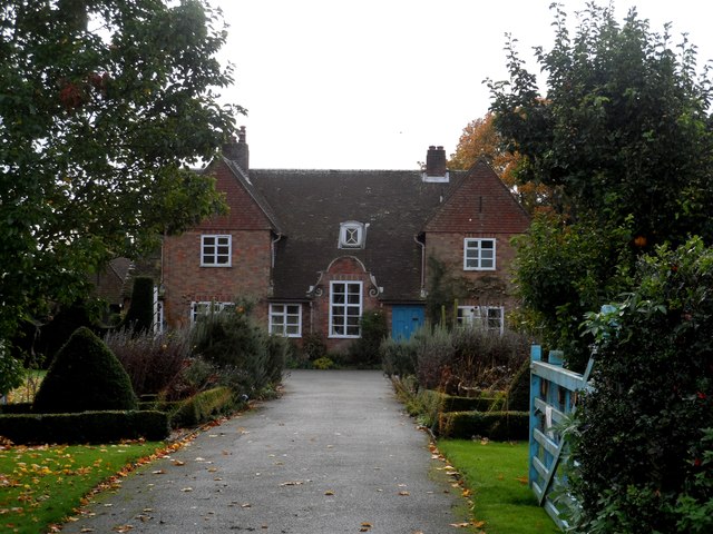
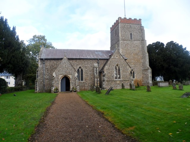
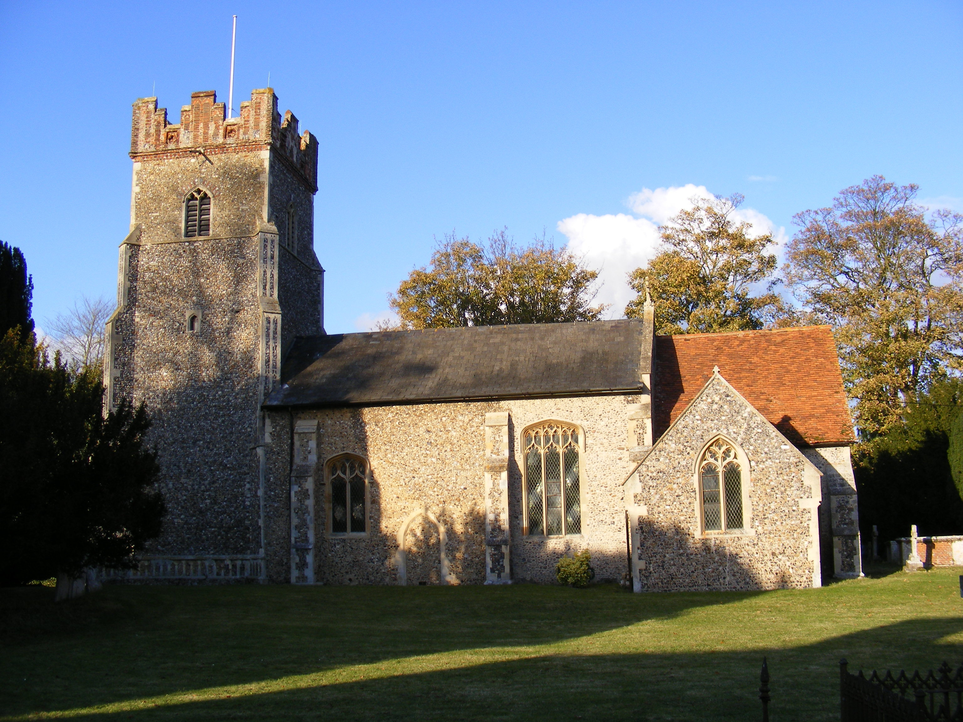
The parish is home to a population of around 200 people, residing in a mix of traditional cottages, farmhouses, and newer housing developments. The village itself is centered around a small church, St. Mary's, which dates back to the 12th century and is a Grade II listed building.

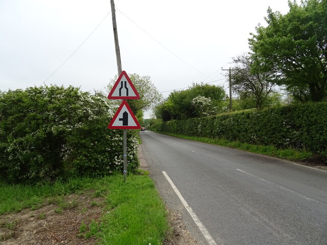
Dallinghoo benefits from its proximity to the larger towns of Woodbridge and Ipswich, which provide residents with access to a wider range of amenities and services. The area is also well-connected, with good road links to nearby towns and cities, making it an attractive location for commuters.

Overall, Dallinghoo offers a peaceful and idyllic rural lifestyle, with a close-knit community and stunning natural surroundings.

If you have any feedback on the listing, please let us know in the comments section below.

Dallinghoo Images

Images are sourced within 2km of 52.147182/1.313625 or Grid Reference TM2655. Thanks to Geograph Open Source API. All images are credited.

Fields northeast of Bredfield
Lane south of Dallinghoo
Dallinghoo Docks, lane running along the Byng Brook valley
View west towards Charsfield along the valley side
Looking down Park Road
Charsfield chapel
Charsfield chapel
Cereal crop and hedgerow Off Ipswich Road.
Cereal crop and hedgerow
Off Ipswich Road.
Ipswich Road (A1078) Towards Wickham Market.
Ipswich Road (A1078)
Towards Wickham Market.
Gated track off Ipswich Road
B1078 dropping towards Charsfield
Bredfield, village sign
Tree at crossroads near Bredfield Seems to be an ornamental species.
Tree at crossroads near Bredfield
Seems to be an ornamental species.
The Old Rectory, Dallinghoo
St Mary's church, Dallinghoo It dates from the late C11/early C12 with C14 and C15 additions.
St Mary's church, Dallinghoo
It dates from the late C11/early C12 with C14 and C15 additions.
Dallinghoo village sign Obviiously erected in 1977 for the Queen's silver jubilee. Unusually it is made from shapes cut from plastic.
Dallinghoo village sign
Obviiously erected in 1977 for the Queen's silver jubilee. Unusually it is made from shapes cut from plastic.
Roadsign on the B1078 at Letheringham At the junction with Park Road at Park Corner
Roadsign on the B1078 at Letheringham
At the junction with Park Road at Park Corner
Park Road, Letheringham At the junction with the B1078 and Park Corner
Park Road, Letheringham
At the junction with the B1078 and Park Corner
B1078 at Charsfield Looking towards Bridge Garage
B1078 at Charsfield
Looking towards Bridge Garage
Show me another place!

Dallinghoo is located at Grid Ref: TM2655 (Lat: 52.147182, Lng: 1.313625)

Administrative County: Suffolk

District: East Suffolk

Police Authority: Suffolk

What 3 Words

///grabs.usages.crackling. Near Wickham Market, Suffolk

Nearby Locations

Page's Covert Dallinghoo

Related Wikis

Dallinghoo

Dallinghoo is a village and civil parish about three miles (5 km) north of Woodbridge, East Suffolk, Suffolk, England. In 2011 the parish had a population...

Charsfield

Charsfield is a small Suffolk village of 342 residents, 3 miles (4.8 km) from Wickham Market, 7 miles (11 km) from Woodbridge and 12 miles (19 km) from...
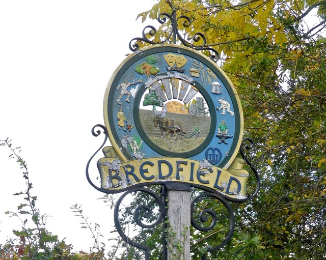
Bredfield

Bredfield is a small village and civil parish in the English county of Suffolk. It is situated just off the A12, two miles north of Woodbridge. Another...

Dallinghoo Wield

Dallinghoo Wield is a former civil parish 1 mile (1.6 km) from Dallinghoo village, now in the parish of Dallinghoo, in the East Suffolk district, in the...

Nearby Amenities

Located within 500m of 52.147182,1.313625
Dallinghoo
Place: hamlet
Wikidata: Q1900203
Wikipedia: en:Dallinghoo
Lat/Long: 52.1462625/1.3129511
Bus Stop
Jubilee Hall
Naptan AtcoCode: 390060306
Naptan Bearing: NE
Naptan CommonName: Jubilee Hall
Naptan Indicator: adj
Naptan Landmark: Jubilee Hall
Naptan NaptanCode: sufgpdwt
Naptan Street: Pound Hill
Naptan Verified: no
Source: naptan_import
Lat/Long: 52.1462599/1.3122626
Bus Stop
Jubilee Hall
Naptan AtcoCode: 390060307
Naptan Bearing: SW
Naptan BusStopType: CUS
Naptan CommonName: Jubilee Hall
Naptan Indicator: opp
Naptan Landmark: Jubilee Hall
Naptan NaptanCode: sufgpgad
Naptan Street: Pound Hill
Naptan Verified: no
Public Transport: platform
Source: naptan_import
Lat/Long: 52.1463246/1.3124927
Post Box
Collection Times: Mo-Fr 09:00; Sa 10:00
Post Box Type: wall
Ref: IP13 6276
Royal Cypher: EIIR
Royal Cypher Wikidata: Q33102113
Lat/Long: 52.1466853/1.3129319
Recycling
Recycling Type: container
Lat/Long: 52.1463239/1.3122116
Man Made: village_sign
Lat/Long: 52.1464227/1.3123994
Advertising: board
Lat/Long: 52.1463675/1.3123457
Defibrillator
Booth: K6
Covered: booth
Defibrillator Location: In the disused telephone kiosk, adjacent to the village hall.
Emergency: defibrillator
Indoor: no
Man Made: telephone_box
Operator: Community Heartbeat
Ref: AM53
Lat/Long: 52.1462968/1.3122411
Bench
Lat/Long: 52.1462342/1.3121258
Information: guidepost
Tourism: information
Lat/Long: 52.1461947/1.3121137
Crossing
Lat/Long: 52.1507731/1.3137785
The data included in this document is from www.openstreetmap.org. The data is made available under ODbL.

Have you been to Dallinghoo?

Leave your review of Dallinghoo below (or comments, questions and feedback).