Culham

Civil Parish in Oxfordshire South Oxfordshire

England

Culham

Church Street, The Green and All Saints Church
Church Street, The Green and All Saints Church Credit: Colin Pyle

Culham is a civil parish located in Oxfordshire, England. Situated on the southern bank of the River Thames, it lies approximately 10 miles south of Oxford. The parish covers an area of about 4 square miles and is home to a population of around 900 people.

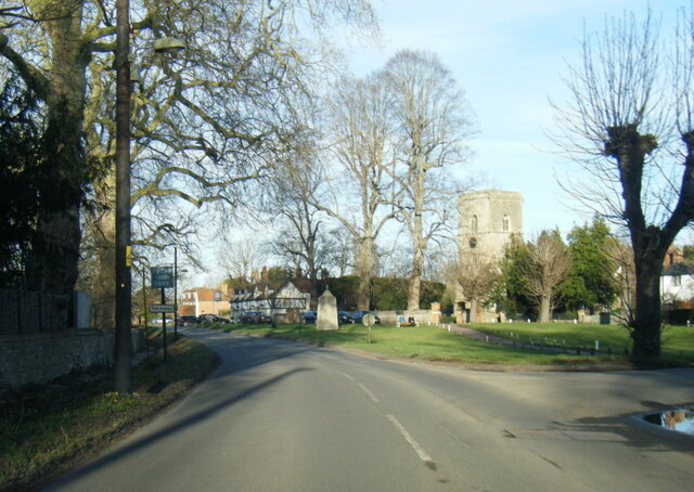
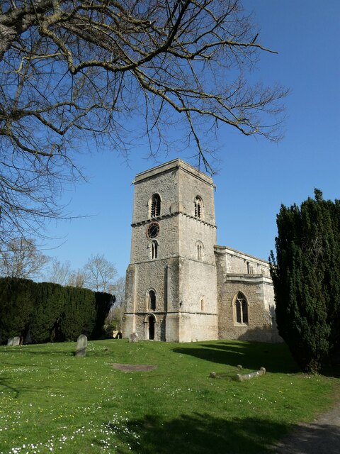
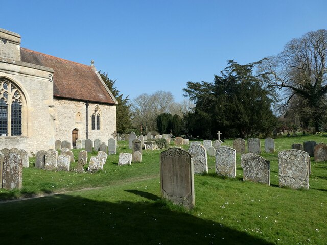
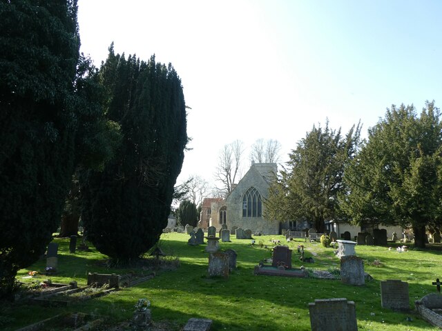
The village of Culham is known for its picturesque setting and historical significance. It boasts a number of well-preserved thatched cottages, some of which date back to the 17th century. The centerpiece of the village is the Church of All Saints, a beautiful medieval building that has stood for over 900 years.

Culham is also home to Culham Science Centre, which is a renowned research facility focused on nuclear energy. The center employs a large number of scientists and engineers and contributes significantly to the local economy.

The village has a strong sense of community and offers a range of amenities to its residents. These include a primary school, a village hall, a pub, and a post office. There are also several scenic walking trails in the surrounding countryside, providing opportunities for outdoor activities.

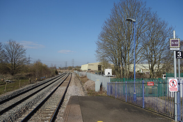
Transport links to Culham are convenient, with regular bus services connecting the village to nearby towns and cities. The closest train station is Culham railway station, which offers direct services to Oxford and London.

Overall, Culham is a charming and historic village, combining natural beauty with modern scientific advancements. It offers a peaceful and idyllic rural lifestyle while still being easily accessible to larger urban areas.

If you have any feedback on the listing, please let us know in the comments section below.
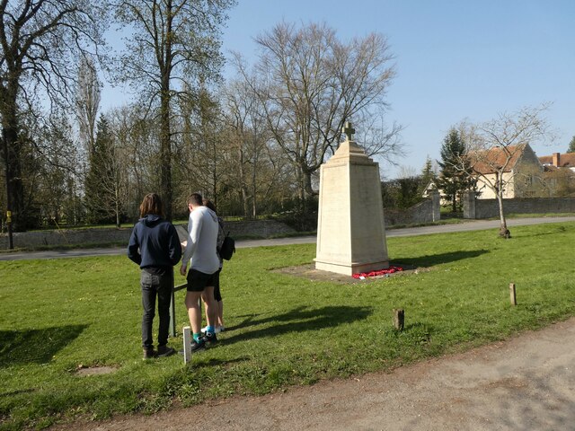
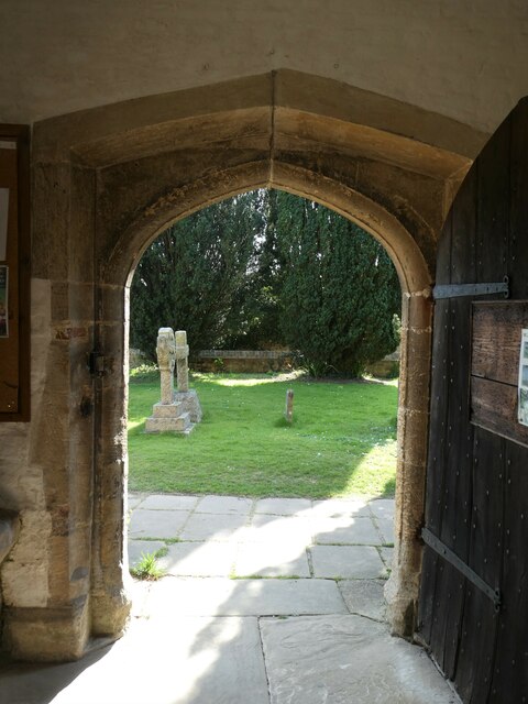
Culham Images

Images are sourced within 2km of 51.658256/-1.258775 or Grid Reference SU5195. Thanks to Geograph Open Source API. All images are credited.

Church Street, The Green and All Saints Church
B4016 Appleford Road nearing power lines
B4016 Appleford Road
End of the platform, Culham Station Looking northwards along the railway towards Oxford. On the right you can see one of the old WW2 aircraft hangars on the old Culham Airfield site. Now a business estate, a fair number of the original wartime buildings are still being used.
End of the platform, Culham Station
Looking northwards along the railway towards Oxford. On the right you can see one of the old WW2 aircraft hangars on the old Culham Airfield site. Now a business estate, a fair number of the original wartime buildings are still being used.
Sutton Courtenay War Memorial: late March 2022
All Saints, Sutton Courtenay: late March 2022
All Saints, Sutton Courtenay: churchyard (a)
All Saints, Sutton Courtenay: churchyard (b)
All Saints, Sutton Courtenay: churchyard (c)
All Saints, Sutton Courtenay: churchyard (d) For more about Sir Reginald see <span class="nowrap"><a title="https://en.wikipedia.org/wiki/Reginald_Kennedy-Cox" rel="nofollow ugc noopener" href="https://en.wikipedia.org/wiki/Reginald_Kennedy-Cox">Link</a><img style="margin-left:2px;" alt="External link" title="External link - shift click to open in new window" src="https://s1.geograph.org.uk/img/external.png" width="10" height="10"/></span>
All Saints, Sutton Courtenay: churchyard (d)
For more about Sir Reginald see LinkExternal link
All Saints, Sutton Courtenay: churchyard (e) The tomb memorial for Sir Reginald Kennedy Cox and his adopted son: for his son's service record see <span class="nowrap"><a title="https://www.cwgc.org/find-records/find-war-dead/casualty-details/2437292/rising,-john-james/" rel="nofollow ugc noopener" href="https://www.cwgc.org/find-records/find-war-dead/casualty-details/2437292/rising,-john-james/">Link</a><img style="margin-left:2px;" alt="External link" title="External link - shift click to open in new window" src="https://s1.geograph.org.uk/img/external.png" width="10" height="10"/></span>
All Saints, Sutton Courtenay: churchyard (e)
The tomb memorial for Sir Reginald Kennedy Cox and his adopted son: for his son's service record see LinkExternal link
All Saints, Sutton Courtenay: churchyard (f) Also see <span class="nowrap"><a title="https://en.wikipedia.org/wiki/Thomas_FitzGerald,_Earl_of_Offaly" rel="nofollow ugc noopener" href="https://en.wikipedia.org/wiki/Thomas_FitzGerald,_Earl_of_Offaly">Link</a><img style="margin-left:2px;" alt="External link" title="External link - shift click to open in new window" src="https://s1.geograph.org.uk/img/external.png" width="10" height="10"/></span>
All Saints, Sutton Courtenay: churchyard (f)
Also see LinkExternal link
All Saints, Sutton Courtenay: churchyard (g) Better known as George Orwell <span class="nowrap"><a title="https://en.wikipedia.org/wiki/George_Orwell" rel="nofollow ugc noopener" href="https://en.wikipedia.org/wiki/George_Orwell">Link</a><img style="margin-left:2px;" alt="External link" title="External link - shift click to open in new window" src="https://s1.geograph.org.uk/img/external.png" width="10" height="10"/></span>
All Saints, Sutton Courtenay: churchyard (g)
Better known as George Orwell LinkExternal link
All Saints, Sutton Courtenay: churchyard (h) The tomb of Herbert Asquith <span class="nowrap"><a title="https://en.wikipedia.org/wiki/H._H._Asquith" rel="nofollow ugc noopener" href="https://en.wikipedia.org/wiki/H._H._Asquith">Link</a><img style="margin-left:2px;" alt="External link" title="External link - shift click to open in new window" src="https://s1.geograph.org.uk/img/external.png" width="10" height="10"/></span>
All Saints, Sutton Courtenay: churchyard (h)
The tomb of Herbert Asquith LinkExternal link
Inside All Saints, Sutton Courtenay (A) For more about Orwell see <span class="nowrap"><a title="https://en.wikipedia.org/wiki/George_Orwell" rel="nofollow ugc noopener" href="https://en.wikipedia.org/wiki/George_Orwell">Link</a><img style="margin-left:2px;" alt="External link" title="External link - shift click to open in new window" src="https://s1.geograph.org.uk/img/external.png" width="10" height="10"/></span>
Inside All Saints, Sutton Courtenay (A)
For more about Orwell see LinkExternal link
Inside All Saints, Sutton Courtenay (B)
Inside All Saints, Sutton Courtenay (C)
Inside All Saints, Sutton Courtenay (D)
Show me another place!

Culham is located at Grid Ref: SU5195 (Lat: 51.658256, Lng: -1.258775)

Administrative County: Oxfordshire

District: South Oxfordshire

Police Authority: Thames Valley

What 3 Words

///table.garage.dinner. Near Abingdon, Oxfordshire

Nearby Locations

Culham Sloven Copse

Related Wikis

European School, Culham

The European School, Culham (ESC) was one of the fourteen European Schools and the only one in the United Kingdom. Located in Culham near Abingdon in Oxfordshire...

Europa School UK

The Europa School UK is an all-through, free school and IB world school located in Culham near Abingdon in Oxfordshire. It was founded in 2012 by stakeholders...

Culham

Culham is a village and civil parish in a bend of the River Thames, 1 mile (1.6 km) south of Abingdon in Oxfordshire. The parish includes Culham Science...

Culham Court, Oxfordshire

Culham Court is a Grade II listed house in Culham, Oxfordshire, England. == History == It was built in the mid-18th century, the south front in about 1816...

Nearby Amenities

Located within 500m of 51.658256,-1.258775
Bus Stop
European School
Bus: yes
Covered: yes
Naptan AtcoCode: 340000245OPP
Naptan Bearing: W
Naptan CommonName: European School
Naptan Indicator: Opposite
Naptan Landmark: Bus Shelters
Naptan NaptanCode: oxfajtmg
Naptan Street: Abingdon Road
Naptan Verified: no
Public Transport: platform
Shelter: no
Source: naptan_import
Lat/Long: 51.6548065/-1.2582358
Bus Stop
European School
Naptan AtcoCode: 340000245OUT
Naptan Bearing: E
Naptan CommonName: European School
Naptan Indicator: Outside
Naptan Landmark: Bus Shelters
Naptan NaptanCode: oxfajptg
Naptan Street: Abingdon Road
Naptan Verified: no
Public Transport: platform
Source: naptan_import
Lat/Long: 51.6548808/-1.2586104
Power: tower
Lat/Long: 51.6577884/-1.2609924
Power: tower
Lat/Long: 51.6569831/-1.2655843
Power: tower
Lat/Long: 51.6587269/-1.2554778
Crossing
Lat/Long: 51.6548999/-1.2587083
The data included in this document is from www.openstreetmap.org. The data is made available under ODbL.

Have you been to Culham?

Leave your review of Culham below (or comments, questions and feedback).