Cuckmere Valley

Civil Parish in Sussex Wealden

England

Cuckmere Valley

Buildings at the Long Man Brewery The brewery has expanded its operation to this east side of the lane more recently. In addition to these buildings there is a shop and a cafe nearby. This is a cross-grid shot. The camera was in TQ5202.
Buildings at the Long Man Brewery Credit: Ian Cunliffe

Cuckmere Valley is a picturesque civil parish located in the county of Sussex, in the southern region of England. Situated near the stunning Seven Sisters cliffs along the English Channel, the valley is renowned for its natural beauty and scenic landscapes.

The parish covers an area of approximately 8 square kilometers and is home to a small population of around 150 residents. The tranquil and idyllic surroundings make it a popular destination for tourists and nature enthusiasts.

The focal point of the area is the meandering Cuckmere River, which flows through the valley and eventually meets the sea. The river's gentle curves and meadows create a serene atmosphere that is perfect for leisurely walks and picnics. The surrounding hills and farmland further enhance the area's charm, providing breathtaking views of the countryside.

Cuckmere Valley is also known for its rich biodiversity and is designated as a Site of Special Scientific Interest (SSSI). The diverse habitats, including salt marshes, reed beds, and wet meadows, support a wide variety of flora and fauna. Birdwatchers flock to the area to catch glimpses of rare species such as bitterns and marsh harriers.

The valley is easily accessible by road, with nearby towns such as Seaford and Eastbourne providing amenities and services to both residents and visitors. The area's natural beauty and tranquility make Cuckmere Valley a hidden gem in Sussex, offering a peaceful retreat from the hustle and bustle of everyday life.

If you have any feedback on the listing, please let us know in the comments section below.

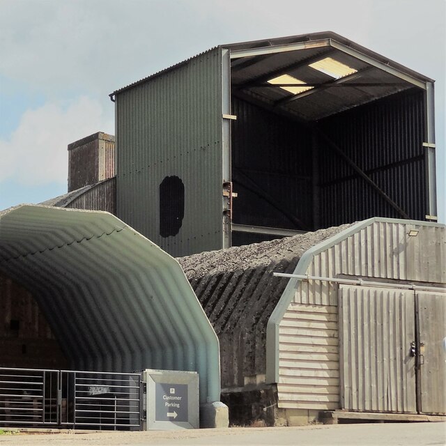
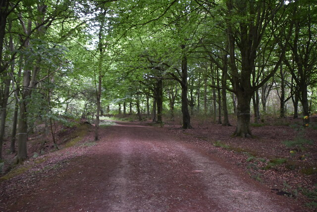
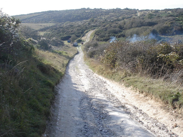
Cuckmere Valley Images

Images are sourced within 2km of 50.782483/0.161833 or Grid Reference TQ5200. Thanks to Geograph Open Source API. All images are credited.

Buildings at the Long Man Brewery The brewery has expanded its operation to this east side of the lane more recently. In addition to these buildings there is a shop and a cafe nearby. This is a cross-grid shot. The camera was in TQ5202.
Buildings at the Long Man Brewery
The brewery has expanded its operation to this east side of the lane more recently. In addition to these buildings there is a shop and a cafe nearby. This is a cross-grid shot. The camera was in TQ5202.
Stack of plastic trays near the Long Man Brewery I assume these have something to do with the brewery. They were nearby anyway.
Stack of plastic trays near the Long Man Brewery
I assume these have something to do with the brewery. They were nearby anyway.
Waymarker, Friston Forest An open access forest managed by the Forestry Commission.

Forestry website <span class="nowrap"><a title="http://www.forestry.gov.uk/website/recreation.nsf/LUWebDocsByKey/EnglandEastSussexNoForestFristonForest" rel="nofollow ugc noopener" href="http://www.forestry.gov.uk/website/recreation.nsf/LUWebDocsByKey/EnglandEastSussexNoForestFristonForest">Link</a><img style="margin-left:2px;" alt="External link" title="External link - shift click to open in new window" src="https://s1.geograph.org.uk/img/external.png" width="10" height="10"/></span>
Waymarker, Friston Forest
An open access forest managed by the Forestry Commission. Forestry website LinkExternal link
Track, Friston Forest An open access forest managed by the Forestry Commission.

Forestry website <span class="nowrap"><a title="http://www.forestry.gov.uk/website/recreation.nsf/LUWebDocsByKey/EnglandEastSussexNoForestFristonForest" rel="nofollow ugc noopener" href="http://www.forestry.gov.uk/website/recreation.nsf/LUWebDocsByKey/EnglandEastSussexNoForestFristonForest">Link</a><img style="margin-left:2px;" alt="External link" title="External link - shift click to open in new window" src="https://s1.geograph.org.uk/img/external.png" width="10" height="10"/></span>
Track, Friston Forest
An open access forest managed by the Forestry Commission. Forestry website LinkExternal link
Fate at edge of Friston Forest An open access forest managed by the Forestry Commission.

Forestry website <span class="nowrap"><a title="http://www.forestry.gov.uk/website/recreation.nsf/LUWebDocsByKey/EnglandEastSussexNoForestFristonForest" rel="nofollow ugc noopener" href="http://www.forestry.gov.uk/website/recreation.nsf/LUWebDocsByKey/EnglandEastSussexNoForestFristonForest">Link</a><img style="margin-left:2px;" alt="External link" title="External link - shift click to open in new window" src="https://s1.geograph.org.uk/img/external.png" width="10" height="10"/></span>
Fate at edge of Friston Forest
An open access forest managed by the Forestry Commission. Forestry website LinkExternal link
Chalk grassland
Chalk grassland
Chalk downland The South Downs is one of the four areas of chalk downland in southern England. They extend from the eastern side of Hampshire through Sussex, culminating in the cliffs at Beachy Head.
The South Downs is England's newest National Park, its designation taking effect on March 31, 2010. There are many Sites of Special Scientific Interest within the park.
The area is relatively unpopulated, although along its southern periphery there is an almost uninterrupted ribbon of seaside towns. It is extremely popular with walkers, having one principal long distance footpath, the South Downs Way, and many interconnecting ones. There are three principal gaps in the upland through which rivers flow; and there are also many dry valleys along its length.
The South Downs have a long history; there are archaeological remains from Neolithic times. Until the middle of the 20th century, sheep-rearing was the main occupation of those living on the Downs.

At 886ft, Butser Hill is the highest point of the South Downs.

Extract from Wikipedia <span class="nowrap"><a title="http://en.wikipedia.org/wiki/South_Downs" rel="nofollow ugc noopener" href="http://en.wikipedia.org/wiki/South_Downs">Link</a><img style="margin-left:2px;" alt="External link" title="External link - shift click to open in new window" src="https://s1.geograph.org.uk/img/external.png" width="10" height="10"/></span>
Chalk downland
The South Downs is one of the four areas of chalk downland in southern England. They extend from the eastern side of Hampshire through Sussex, culminating in the cliffs at Beachy Head. The South Downs is England's newest National Park, its designation taking effect on March 31, 2010. There are many Sites of Special Scientific Interest within the park. The area is relatively unpopulated, although along its southern periphery there is an almost uninterrupted ribbon of seaside towns. It is extremely popular with walkers, having one principal long distance footpath, the South Downs Way, and many interconnecting ones. There are three principal gaps in the upland through which rivers flow; and there are also many dry valleys along its length. The South Downs have a long history; there are archaeological remains from Neolithic times. Until the middle of the 20th century, sheep-rearing was the main occupation of those living on the Downs. At 886ft, Butser Hill is the highest point of the South Downs. Extract from Wikipedia LinkExternal link
Edge of Friston Forest An open access forest managed by the Forestry Commission.

Forestry website <span class="nowrap"><a title="http://www.forestry.gov.uk/website/recreation.nsf/LUWebDocsByKey/EnglandEastSussexNoForestFristonForest" rel="nofollow ugc noopener" href="http://www.forestry.gov.uk/website/recreation.nsf/LUWebDocsByKey/EnglandEastSussexNoForestFristonForest">Link</a><img style="margin-left:2px;" alt="External link" title="External link - shift click to open in new window" src="https://s1.geograph.org.uk/img/external.png" width="10" height="10"/></span>
Edge of Friston Forest
An open access forest managed by the Forestry Commission. Forestry website LinkExternal link
Edge of Friston Forest
Friston Forest An open access forest managed by the Forestry Commission.

Forestry website <span class="nowrap"><a title="http://www.forestry.gov.uk/website/recreation.nsf/LUWebDocsByKey/EnglandEastSussexNoForestFristonForest" rel="nofollow ugc noopener" href="http://www.forestry.gov.uk/website/recreation.nsf/LUWebDocsByKey/EnglandEastSussexNoForestFristonForest">Link</a><img style="margin-left:2px;" alt="External link" title="External link - shift click to open in new window" src="https://s1.geograph.org.uk/img/external.png" width="10" height="10"/></span>
Friston Forest
An open access forest managed by the Forestry Commission. Forestry website LinkExternal link
Bridleway, Friston Forest An open access forest managed by the Forestry Commission.

Forestry website <span class="nowrap"><a title="http://www.forestry.gov.uk/website/recreation.nsf/LUWebDocsByKey/EnglandEastSussexNoForestFristonForest" rel="nofollow ugc noopener" href="http://www.forestry.gov.uk/website/recreation.nsf/LUWebDocsByKey/EnglandEastSussexNoForestFristonForest">Link</a><img style="margin-left:2px;" alt="External link" title="External link - shift click to open in new window" src="https://s1.geograph.org.uk/img/external.png" width="10" height="10"/></span>
Bridleway, Friston Forest
An open access forest managed by the Forestry Commission. Forestry website LinkExternal link
Friston Forest
Friston Forest
Bridleway, Friston Forest An open access forest managed by the Forestry Commission.

Forestry website <span class="nowrap"><a title="http://www.forestry.gov.uk/website/recreation.nsf/LUWebDocsByKey/EnglandEastSussexNoForestFristonForest" rel="nofollow ugc noopener" href="http://www.forestry.gov.uk/website/recreation.nsf/LUWebDocsByKey/EnglandEastSussexNoForestFristonForest">Link</a><img style="margin-left:2px;" alt="External link" title="External link - shift click to open in new window" src="https://s1.geograph.org.uk/img/external.png" width="10" height="10"/></span>
Bridleway, Friston Forest
An open access forest managed by the Forestry Commission. Forestry website LinkExternal link
Friston Forest An open access forest managed by the Forestry Commission.

Forestry website <span class="nowrap"><a title="http://www.forestry.gov.uk/website/recreation.nsf/LUWebDocsByKey/EnglandEastSussexNoForestFristonForest" rel="nofollow ugc noopener" href="http://www.forestry.gov.uk/website/recreation.nsf/LUWebDocsByKey/EnglandEastSussexNoForestFristonForest">Link</a><img style="margin-left:2px;" alt="External link" title="External link - shift click to open in new window" src="https://s1.geograph.org.uk/img/external.png" width="10" height="10"/></span>
Friston Forest
An open access forest managed by the Forestry Commission. Forestry website LinkExternal link
Bridleway, Friston Forest An open access forest managed by the Forestry Commission.

Forestry website <span class="nowrap"><a title="http://www.forestry.gov.uk/website/recreation.nsf/LUWebDocsByKey/EnglandEastSussexNoForestFristonForest" rel="nofollow ugc noopener" href="http://www.forestry.gov.uk/website/recreation.nsf/LUWebDocsByKey/EnglandEastSussexNoForestFristonForest">Link</a><img style="margin-left:2px;" alt="External link" title="External link - shift click to open in new window" src="https://s1.geograph.org.uk/img/external.png" width="10" height="10"/></span>
Bridleway, Friston Forest
An open access forest managed by the Forestry Commission. Forestry website LinkExternal link
Friston Forest An open access forest managed by the Forestry Commission.

Forestry website <span class="nowrap"><a title="http://www.forestry.gov.uk/website/recreation.nsf/LUWebDocsByKey/EnglandEastSussexNoForestFristonForest" rel="nofollow ugc noopener" href="http://www.forestry.gov.uk/website/recreation.nsf/LUWebDocsByKey/EnglandEastSussexNoForestFristonForest">Link</a><img style="margin-left:2px;" alt="External link" title="External link - shift click to open in new window" src="https://s1.geograph.org.uk/img/external.png" width="10" height="10"/></span>
Friston Forest
An open access forest managed by the Forestry Commission. Forestry website LinkExternal link
Show me another place!

Cuckmere Valley is located at Grid Ref: TQ5200 (Lat: 50.782483, Lng: 0.161833)

Administrative County: East Sussex

District: Wealden

Police Authority: Sussex

What 3 Words

///fatigued.blacken.kiosk. Near Friston, East Sussex

Related Wikis

Friston Forest

Friston Forest is a forest, located between Seaford and Eastbourne in East Sussex. It is part of the South Downs National Park area. The forest is managed...

Litlington, East Sussex

Litlington is a village and former civil parish, now in the parish of Cuckmere Valley, in the Wealden district, in the county of East Sussex, England....

Litlington White Horse

The Litlington White Horse is a chalk hill figure depicting a horse, situated on Hindover Hill (known locally as High-and-Over) in the South Downs, looking...

Lullington Heath

Lullington Heath is a 72.7-hectare (180-acre) biological Site of Special Scientific Interest west of Eastbourne in East Sussex. It is a national nature...

Cuckmere Valley

Cuckmere Valley is a civil parish in the Wealden District of East Sussex, England. As its name suggests, the parish consists of a number of small settlements...

RAF Friston

Royal Air Force Friston or more simply RAF Friston is a former Royal Air Force satellite station and Emergency Landing Ground located in East Sussex, England...

Ladycross School

Ladycross was a Catholic preparatory school in Seaford, East Sussex. It was founded in 1891 in Briely Road, Bournemouth, and moved to a purpose-built school...

Lullington, East Sussex

Lullington is a village and former civil parish, now in the parish of Cuckmere Valley, in the Wealden district, in the county of East Sussex, England....

Nearby Amenities

Located within 500m of 50.782483,0.161833
Foot: yes
Lat/Long: 50.7856224/0.1575184
Barrier: stile
Foot: yes
Material: wood
Stile: stepover
Lat/Long: 50.7856334/0.1575259
Charlston Bottom
Place: locality
Lat/Long: 50.7817501/0.1664688
The data included in this document is from www.openstreetmap.org. The data is made available under ODbL.

Have you been to Cuckmere Valley?

Leave your review of Cuckmere Valley below (or comments, questions and feedback).