Cubert

Civil Parish in Cornwall

England

Cubert

Cornwall A3075 Turning For West Pentire & Crantock
Cornwall A3075 Turning For West Pentire & Crantock Credit: Roy Hughes

Cubert is a civil parish located in the county of Cornwall, England. It is situated on the north coast of the county, about 3 miles south of Newquay. The parish covers an area of approximately 15 square kilometers and is home to a population of around 1,200 residents.

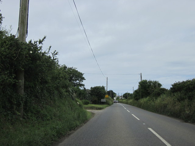
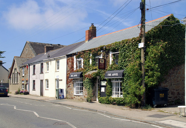
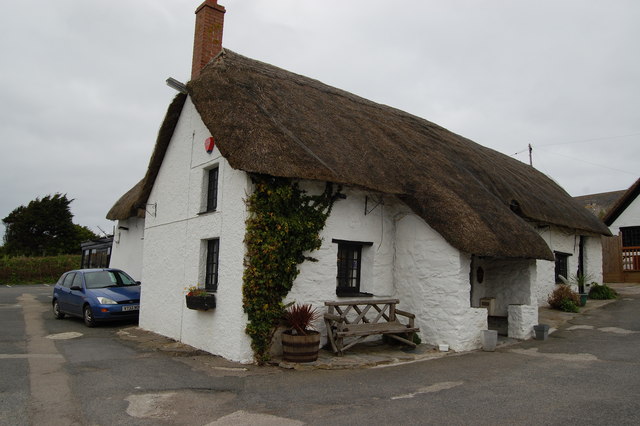
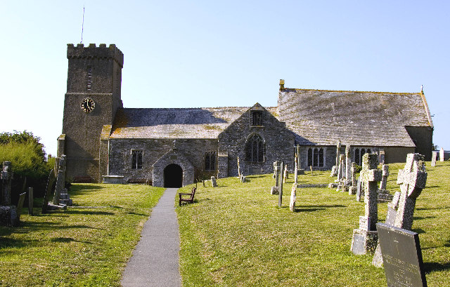
The village of Cubert itself is small and picturesque, with a mix of old stone cottages and more modern houses. It has a charming village green, a local pub, and a small church dating back to the 13th century. The surrounding countryside is characterized by rolling hills, farmland, and beautiful coastal scenery.

Cubert is well-known for its sandy beaches, with Holywell Bay being the most popular among locals and tourists alike. The beach is known for its impressive sand dunes and is a popular spot for surfing, swimming, and sunbathing. The nearby Crantock Beach is also worth a visit, offering stunning views of the Atlantic Ocean.

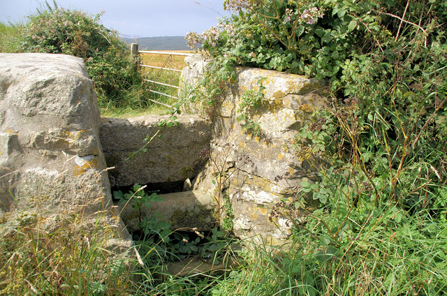
The area is rich in history, with evidence of human habitation dating back to the Bronze Age. There are several ancient sites in the parish, including a hillfort and a prehistoric burial chamber known as a barrow.

Cubert is a peaceful and idyllic place to live, offering a relaxed and friendly community atmosphere. It is well-served by local amenities, including a post office, a primary school, and a village hall that hosts various community events throughout the year. Overall, Cubert is a delightful rural parish with a strong sense of history and natural beauty.

If you have any feedback on the listing, please let us know in the comments section below.

Cubert Images

Images are sourced within 2km of 50.381693/-5.107708 or Grid Reference SW7958. Thanks to Geograph Open Source API. All images are credited.

Cornwall A3075 Turning For West Pentire & Crantock
A wealth of information Road signs and posters on the A3075.
A wealth of information
Road signs and posters on the A3075.
On the A30 Heading north with what looks to me like a field of solar panels on the hillside. They grow strange crops in Cornwall!
On the A30
Heading north with what looks to me like a field of solar panels on the hillside. They grow strange crops in Cornwall!
High Lane Near Cubert Cornwall
Approaching Cubert Village Cornwall
Outskirts of Cubert Village
Leaving Cubert Village
Entrance to Trevornick Fun Park Holywell
Approaching Holywell
Hedge lined road near Treworthen Farm Looking north-westward.
Hedge lined road near Treworthen Farm
Looking north-westward.
St Cubert's Church, Cubert
The common, Cubert
The common, Cubert
Farmland, Cubert
Farmland, Cubert
Farmland, Cubert
Farmland, Cubert
Farmland, Cubert
Farmland, Cubert
Farmland, Cubert A footpath heading east from the road south of Treworgans.
Farmland, Cubert
A footpath heading east from the road south of Treworgans.
Old Guide Stone at Holywell Road junction in Cubert Guide Stone at the junction of Holywell Road with UC lane. In front of gate to 'Glenburn' cottage.

Inscription reads:-
HOLYWELL

Grade II listed.
List Entry Number: 1328651 <span class="nowrap"><a title="https://historicengland.org.uk/listing/the-list/list-entry/1328651" rel="nofollow ugc noopener" href="https://historicengland.org.uk/listing/the-list/list-entry/1328651">Link</a><img style="margin-left:2px;" alt="External link" title="External link - shift click to open in new window" src="https://s1.geograph.org.uk/img/external.png" width="10" height="10"/></span>
Old Guide Stone at Holywell Road junction in Cubert
Guide Stone at the junction of Holywell Road with UC lane. In front of gate to 'Glenburn' cottage. Inscription reads:- HOLYWELL Grade II listed. List Entry Number: 1328651 LinkExternal link
Old Wayside Cross Ellenglaze Cross, a wayside cross - moved, with an old head & neck. Set in Cubert churchyard. Cubert parish. Langdon MC No. 27. Grade II Listed <span class="nowrap"><a title="https://historicengland.org.uk/listing/the-list/list-entry/1141574" rel="nofollow ugc noopener" href="https://historicengland.org.uk/listing/the-list/list-entry/1141574">Link</a><img style="margin-left:2px;" alt="External link" title="External link - shift click to open in new window" src="https://s1.geograph.org.uk/img/external.png" width="10" height="10"/></span>. See also <span class="nowrap"><a title="http://www.flickr.com/photos/ocifant/2836660583" rel="nofollow ugc noopener" href="http://www.flickr.com/photos/ocifant/2836660583">Link</a><img style="margin-left:2px;" alt="External link" title="External link - shift click to open in new window" src="https://s1.geograph.org.uk/img/external.png" width="10" height="10"/></span>.

Milestone Society National ID: CWCA_CUB
Old Wayside Cross
Ellenglaze Cross, a wayside cross - moved, with an old head & neck. Set in Cubert churchyard. Cubert parish. Langdon MC No. 27. Grade II Listed LinkExternal link. See also LinkExternal link. Milestone Society National ID: CWCA_CUB
Show me another place!

Cubert is located at Grid Ref: SW7958 (Lat: 50.381693, Lng: -5.107708)

Unitary Authority: Cornwall

Police Authority: Devon & Cornwall

What 3 Words

///ocean.scribbled.storage. Near Newquay, Cornwall

Nearby Locations

Cubert

Related Wikis

Cubert

Cubert (Cornish: Egloskubert) is a village in Cornwall, England, United Kingdom. It is three miles (5 km) south-southwest of Newquay and is in the civil...

Ellenglaze

Ellenglaze (Cornish: Elynglas) is a hamlet near the village of Cubert north of Perranporth in Cornwall, England. It lies close to the edge of Penhale...

Holywell, Cornwall

Holywell (Cornish: Tregew) is a coastal village in the civil parish of Cubert (Cornish: Lannowyn), in north Cornwall, England, United Kingdom. It is at...

Crantock

Crantock (Cornish: Lanngorrow) is a coastal civil parish and village in Cornwall, England, two miles (3 km) southwest of Newquay.In 460, a group of Irish...

Nearby Amenities

Located within 500m of 50.381693,-5.107708
Bus Stop
Cubert School
Bus: yes
Naptan AtcoCode: 0800FWV38485
Naptan Bearing: NE
Naptan CommonName: Cubert School
Naptan Crossing: Wesley Road
Naptan NaptanCode: coratgdt
Naptan Street: Chynowen Lane
Naptan Verified: no
Public Transport: platform
Source: naptan_import
Lat/Long: 50.3811826/-5.1132153
Bus Stop
Cubert Infants School
Bus: yes
Naptan AtcoCode: 0800FWX38487
Naptan Bearing: N
Naptan CommonName: Cubert Infants School
Naptan NaptanCode: coratgdj
Naptan Street: Wesley Road
Naptan Verified: no
Public Transport: platform
Source: naptan_import
Lat/Long: 50.3805311/-5.1133555
Bus Stop
Cubert School
Bus: yes
Naptan AtcoCode: 0800FWZ38471
Naptan Bearing: S
Naptan CommonName: Cubert School
Naptan Indicator: Opp
Naptan NaptanCode: coratgdp
Naptan Street: Wesley Road
Naptan Verified: no
Public Transport: platform
Source: naptan_import
Lat/Long: 50.3805974/-5.1132332
Power: pole
Lat/Long: 50.3808762/-5.1062138
Power: pole
Lat/Long: 50.378751/-5.1105738
Power: pole
Lat/Long: 50.3783918/-5.1113637
Power: pole
Lat/Long: 50.3794027/-5.1092608
Power: pole
Lat/Long: 50.3800783/-5.1078433
Power: pole
Lat/Long: 50.3816775/-5.1044691
Power: pole
Lat/Long: 50.3823394/-5.1030904
Power: pole
Lat/Long: 50.3829278/-5.1018941
The data included in this document is from www.openstreetmap.org. The data is made available under ODbL.

Have you been to Cubert?

Leave your review of Cubert below (or comments, questions and feedback).