Cressage

Civil Parish in Shropshire

England

Cressage

Bridge over the Severn - Cressage
Bridge over the Severn - Cressage Credit: Roy Hughes

Cressage is a civil parish located in Shropshire, England. It is situated approximately 8 miles southeast of the town of Shrewsbury and is part of the Much Wenlock electoral division. The parish covers an area of approximately 1,087 hectares and has a population of around 1,000 residents.

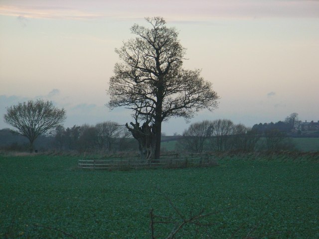
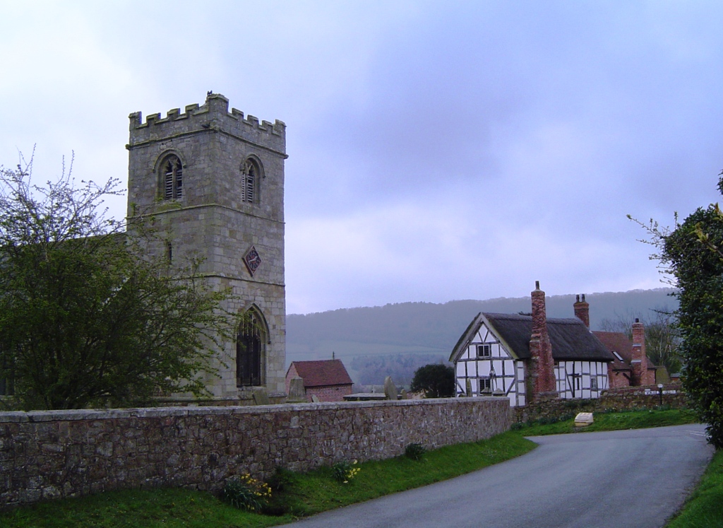
Cressage is a picturesque village with a mix of historic buildings and modern amenities. The parish is surrounded by beautiful countryside, including the River Severn to the west and the Wenlock Edge to the east. The village has a primary school, a church, a village hall, and a local pub, providing essential services for its residents.

The economy of Cressage is primarily based on agriculture, with many residents working in farming and related industries. The village also benefits from its proximity to larger towns like Shrewsbury, which provide additional employment opportunities and services.

Overall, Cressage is a charming rural community with a strong sense of community spirit and a peaceful way of life. It offers residents a tranquil setting to live in while still being within easy reach of larger towns and cities for amenities and services.

If you have any feedback on the listing, please let us know in the comments section below.

Cressage Images

Images are sourced within 2km of 52.62683/-2.607034 or Grid Reference SJ5903. Thanks to Geograph Open Source API. All images are credited.

Bridge over the Severn - Cressage
The Eagles, Cressage
Looking back along the lane towards Harley
A458 at the junction for Wigwig and Homer
A458 approaching the northern junction for Harley
Northbound layby on the A458
Southbound layby on the A458
Entering Cressage from the south
A458 in Cressage
A458 in Cressage
The Eagles pub, Cressage
Cressage - main crossroads and war memorial The street light intrudes into an otherwise elegant setting for the village's memorial.
Cressage - main crossroads and war memorial
The street light intrudes into an otherwise elegant setting for the village's memorial.
Heading west from Cressage
A458 leaving Cressage for Shrewsbury
Dead straight west of Cressage
The southern side of Cressage Taken from the main track to New Buildings Farm
The southern side of Cressage
Taken from the main track to New Buildings Farm
Barns and paraphernalia at New Buildings Farm The items lying around included several pallets of reclaimed bricks - it's not clear whether these represent the forerunners of the New Buildings at the farm, or whether they're for making new buildings.
There were a number of free-range chickens running around the yard, and Daft Dog was VERY interested in those.
Barns and paraphernalia at New Buildings Farm
The items lying around included several pallets of reclaimed bricks - it's not clear whether these represent the forerunners of the New Buildings at the farm, or whether they're for making new buildings. There were a number of free-range chickens running around the yard, and Daft Dog was VERY interested in those.
New Buildings Farm The large barn on the right houses a good flock of free-range chickens, which were enjoying the adjacent field on this particular morning.
New Buildings Farm
The large barn on the right houses a good flock of free-range chickens, which were enjoying the adjacent field on this particular morning.
Bridleway from Belswardyne to Harley Now mostly a farm track, but technically a bridleway.
Bridleway from Belswardyne to Harley
Now mostly a farm track, but technically a bridleway.
Show me another place!

Cressage is located at Grid Ref: SJ5903 (Lat: 52.62683, Lng: -2.607034)

Unitary Authority: Shropshire

Police Authority: West Mercia

What 3 Words

///claw.bikers.messed. Near Harley, Shropshire

Nearby Locations

Fellear Coppice Cressage

Related Wikis

Cressage

Cressage is a village and civil parish in Shropshire, England. It lies on the junction of the A458 and B4380 roads and the River Severn flows around its...

Cressage railway station

Cressage railway station was a railway station on the Severn Valley Railway. It opened on 1 February 1862 with a single platform and a siding. By 1898...

Harley, Shropshire

Harley is a village and civil parish in the English county of Shropshire. The population of the civil parish at the 2011 census was 163. == Location... ==

Sheinton

Sheinton is a small rural village and civil parish just outside Telford, and within Shropshire.It is situated on the south bank of the River Severn opposite...

Nearby Amenities

Located within 500m of 52.62683,-2.607034
Give Way
Lat/Long: 52.6300537/-2.6037504
Give Way
Lat/Long: 52.625176/-2.603752
The Vicarage
Addr City: Cressage
Addr Housename: The Vicarage
Addr Postcode: SY5 6DF
Addr Street: Harley Road
Building: house
Building Levels: 2
Lat/Long: 52.6302417/-2.6044154
Give Way
Lat/Long: 52.6290038/-2.6033126
Give Way
Lat/Long: 52.6262604/-2.6036589
Ford: yes
Lat/Long: 52.6260762/-2.6130313
The data included in this document is from www.openstreetmap.org. The data is made available under ODbL.

Have you been to Cressage?

Leave your review of Cressage below (or comments, questions and feedback).