Cowden

Civil Parish in Kent Sevenoaks

England

Cowden

House adjacent Golf Club
House adjacent Golf Club Credit: Oast House Archive

Cowden is a civil parish located in the county of Kent, in the southeastern part of England. It is situated approximately 6 miles southwest of the town of Edenbridge and covers an area of around 6 square miles. The civil parish is part of the Sevenoaks district.

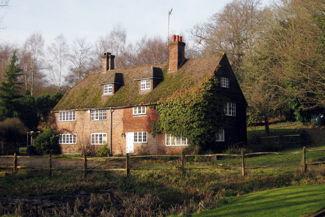
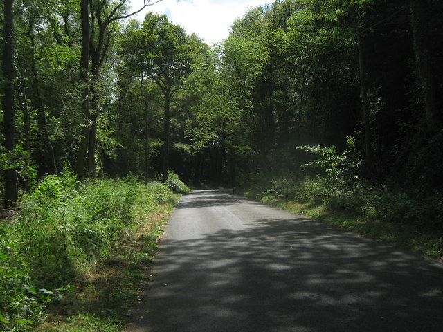
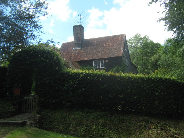
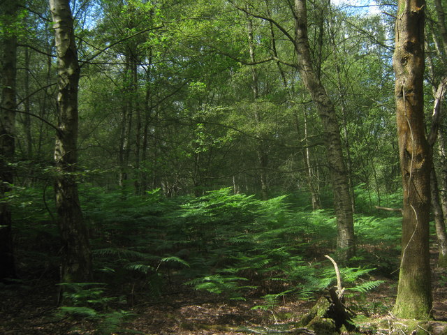
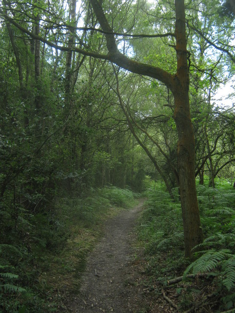
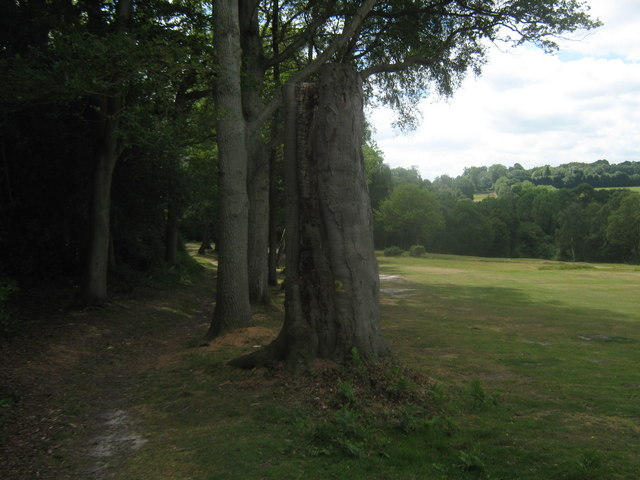
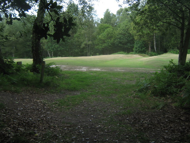
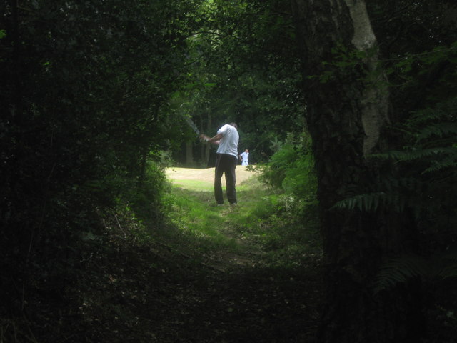
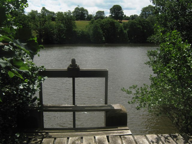
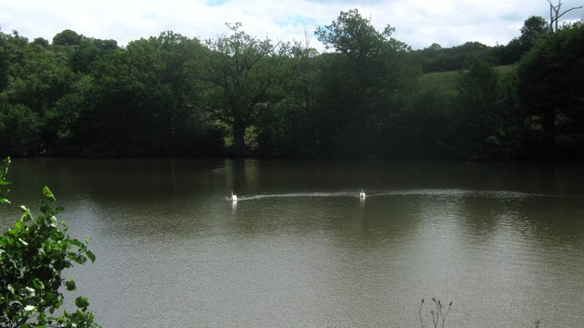
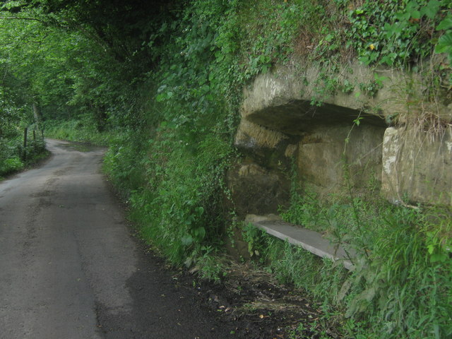
Cowden is a predominantly rural area with a population of around 800 residents. The village itself is small and picturesque, featuring a number of historic buildings and charming cottages. The parish is surrounded by beautiful countryside, including woodlands, fields, and rolling hills, making it a popular destination for outdoor activities such as hiking and cycling.

The village is centered around St. Mary Magdalene Church, a Grade I listed building dating back to the 14th century. The church is known for its distinctive architecture and stained glass windows. Other notable landmarks in Cowden include the Cowden railway station, which provides connections to London and other nearby towns, and the Cowden Castle, a 19th-century mansion.

The local economy in Cowden is primarily based on agriculture, with farming and livestock rearing being the main industries. There are also a few small businesses and shops in the village, catering to the needs of the local community.

Overall, Cowden offers a peaceful and idyllic setting for residents and visitors alike, with its scenic landscapes and rich history.

If you have any feedback on the listing, please let us know in the comments section below.

Cowden Images

Images are sourced within 2km of 51.152903/0.091543 or Grid Reference TQ4641. Thanks to Geograph Open Source API. All images are credited.

House adjacent Golf Club
Holtye Lane This lane leads from Cowden, down the Kitford Bridge over the Kent Water (stream on the Kent / Sussex county boundary), then up towards Hartfield Road.
Holtye Lane
This lane leads from Cowden, down the Kitford Bridge over the Kent Water (stream on the Kent / Sussex county boundary), then up towards Hartfield Road.
House on Holtye Lane Close to Furnace Lane junction.
House on Holtye Lane
Close to Furnace Lane junction.
Holtye Common Wood As seen from a bridleway from Furnace Lane towards the A264 Holtye Road.
Holtye Common Wood
As seen from a bridleway from Furnace Lane towards the A264 Holtye Road.
Bridleway in Holtye Common Wood This track leads from Furnace Lane towards the A264 Holtye Road.
Bridleway in Holtye Common Wood
This track leads from Furnace Lane towards the A264 Holtye Road.
Bridleway in Sweetwoods Park Golf Course A bridleway leads from Furnace Lane through Holtye Common wood and then the golf course towards the A264 Holtye Road.
Bridleway in Sweetwoods Park Golf Course
A bridleway leads from Furnace Lane through Holtye Common wood and then the golf course towards the A264 Holtye Road.
Bridleway junction in Sweetwoods Park Golf Course A bridleway from the A264 Holtye Road leads straight on towards Furnace Lane near Kitford Bridge. Another bridleway heads left towards Furnace Lane near Furnace Pond. Also a footpath heads right to Holtye Lane. In the background is Holtye Golf Club.
Bridleway junction in Sweetwoods Park Golf Course
A bridleway from the A264 Holtye Road leads straight on towards Furnace Lane near Kitford Bridge. Another bridleway heads left towards Furnace Lane near Furnace Pond. Also a footpath heads right to Holtye Lane. In the background is Holtye Golf Club.
Golfer on the bridleway This golfer is on Holtye Golf Course. Seen from a bridleway from Furnace Lane to Holtye Hill.

I was at <a href="https://www.geograph.org.uk/photo/1950151">TQ4539 : Bridleway junction in Sweetwoods Park Golf Course</a>, after coming along <a href="https://www.geograph.org.uk/photo/1950028">TQ4539 : Bridleway in Sweetwoods Park Golf Course</a>.
Saw that the golfers went ready so crosses the course. On my way I spotted a ball. The golfer taking the shot was looking in another area and was about to throw a new ball down. Claiming lost ball -1 shot. He was very pleased when I told him about the ball. His golfing partner (in the background) was on the cut grass and played already.
Golfer on the bridleway
This golfer is on Holtye Golf Course. Seen from a bridleway from Furnace Lane to Holtye Hill. I was at TQ4539 : Bridleway junction in Sweetwoods Park Golf Course, after coming along TQ4539 : Bridleway in Sweetwoods Park Golf Course. Saw that the golfers went ready so crosses the course. On my way I spotted a ball. The golfer taking the shot was looking in another area and was about to throw a new ball down. Claiming lost ball -1 shot. He was very pleased when I told him about the ball. His golfing partner (in the background) was on the cut grass and played already.
Furnace Pond As seen from Furnace lane over the weir on the Kent Water. (Stream on the Kent / Sussex boundary).
This large lake belongs to <a href="https://www.geograph.org.uk/photo/42065">TQ4539 : Cottage near Holtye, Kent/Sussex border</a>. It was a large pond dammed by the lane, to create power.
Furnace Pond
As seen from Furnace lane over the weir on the Kent Water. (Stream on the Kent / Sussex boundary). This large lake belongs to TQ4539 : Cottage near Holtye, Kent/Sussex border. It was a large pond dammed by the lane, to create power.
Swans on Furnace Pond Pair of gliding swans on the large pond on Kent Water (stream on the Kent / Sussex Boundary). As seen from Furnace Lane.
Swans on Furnace Pond
Pair of gliding swans on the large pond on Kent Water (stream on the Kent / Sussex Boundary). As seen from Furnace Lane.
Bench in the rocks on Furnace Lane This lane leads from Holtye Hill heading towards Dormansland. 

Why ??
Bench in the rocks on Furnace Lane
This lane leads from Holtye Hill heading towards Dormansland. Why ??
Cowden New Burial Ground A triangular plot entered through the apex. It is separated from another similarly shaped graveyard, presumably the old burial ground, by the public footpath on the right. The gates are dated 1989, but look older and are in poor shape. Their lower panels are decorated with relief carvings of pious folk in mediaeval garb. It is hard to see their relevance to a modern graveyard.
Cowden New Burial Ground
A triangular plot entered through the apex. It is separated from another similarly shaped graveyard, presumably the old burial ground, by the public footpath on the right. The gates are dated 1989, but look older and are in poor shape. Their lower panels are decorated with relief carvings of pious folk in mediaeval garb. It is hard to see their relevance to a modern graveyard.
Bridge on footpath SR680 This looks like a standard prefabricated bridge with a bespoke approach boardwalk.
Bridge on footpath SR680
This looks like a standard prefabricated bridge with a bespoke approach boardwalk.
Curds This pair of cottages are labelled 'Curds' on the larger scale maps. A rather secluded spot, but footpath SR534 does pass them by. In principle this footpath should head straight across the field towards them from the viewpoint.
Curds
This pair of cottages are labelled 'Curds' on the larger scale maps. A rather secluded spot, but footpath SR534 does pass them by. In principle this footpath should head straight across the field towards them from the viewpoint.
View towards Horseshoe Green The large barn is part of Horseshoe Green Farm, and seems to be a milking barn, judging by the number of cows in the yard and the loud humming noise radiating from it when passed at about 16:45.
View towards Horseshoe Green
The large barn is part of Horseshoe Green Farm, and seems to be a milking barn, judging by the number of cows in the yard and the loud humming noise radiating from it when passed at about 16:45.
Mark Beech Tunnel, southern portal Although the tunnel passes under the village of Markbeech, the railways have chosen a two word version of the name for the tunnel, unless their sign writer got it wrong. It is 1342 yards long - with the same proviso! It appears to be fitted with an antenna relay to enable radio reception within the tunnel. The faint white patch on the brickwork to the left of the portal must have been a sighting aid for a semaphore signal close to the tunnel mouth. The tunnel and line as a whole were built for double track, but it is now single over much of its length. This has enabled a comfortably wide inspection walkway fenced off from the track to be made through the tunnel - the end of the blue fence may be seen.
Mark Beech Tunnel, southern portal
Although the tunnel passes under the village of Markbeech, the railways have chosen a two word version of the name for the tunnel, unless their sign writer got it wrong. It is 1342 yards long - with the same proviso! It appears to be fitted with an antenna relay to enable radio reception within the tunnel. The faint white patch on the brickwork to the left of the portal must have been a sighting aid for a semaphore signal close to the tunnel mouth. The tunnel and line as a whole were built for double track, but it is now single over much of its length. This has enabled a comfortably wide inspection walkway fenced off from the track to be made through the tunnel - the end of the blue fence may be seen.
Track components by the track, Cowden Cowden station may just be glimpsed around the bend.
Track components by the track, Cowden
Cowden station may just be glimpsed around the bend.
The Paddocks A fairly modern small close off Hartfield Road.
The Paddocks
A fairly modern small close off Hartfield Road.
Show me another place!

Cowden is located at Grid Ref: TQ4641 (Lat: 51.152903, Lng: 0.091543)

Administrative County: Kent

District: Sevenoaks

Police Authority: Kent

What 3 Words

///healers.backup.shiny. Near Edenbridge, Kent

Nearby Locations

Jones's Wood Cowden

Related Wikis

London to Lewes Way

The London to Lewes Way is a 71 kilometres (44 mi) long Roman road between Watling Street at Peckham and Lewes in Sussex. The road passes through Beckenham...

Cowden

Cowden () is a small village and civil parish in the Sevenoaks District of Kent, England. The parish is located on the northern slopes of the Weald, south...

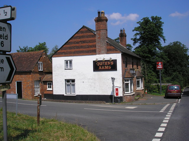
Queen's Arms, Cowden Pound

The Queens Arms is a Grade II listed public house at Hartfield Road, Cowden in Kent. It is on the Campaign for Real Ale's National Inventory of Historic...

Cowden railway station

Cowden railway station is on the Uckfield branch of the Oxted line in southern England and serves Cowden in Kent. It is 29 miles 26 chains (29.33 miles...

Cowden rail crash

The Cowden rail crash occurred on 15 October 1994, near Cowden Station in Kent (UK), when two trains collided head-on, killing five and injuring thirteen...

Cowden Meadow

Cowden Meadow is a 1.1-hectare (2.7-acre) biological Site of Special Scientific Interest east of Cowden in Kent.This site has flora which are found on...

Sundridge with Ide Hill

Sundridge and Ide Hill is a civil parish in the Sevenoaks District of Kent, England. It is located in the Darenth valley and lies between Sevenoaks and...

Markbeech

Markbeech (sometimes styled Mark Beech) is a village in the civil parish of Hever in the Sevenoaks district of Kent, England. The village is located on...

Nearby Amenities

Located within 500m of 51.152903,0.091543
Barrier: stile
Foot: yes
Source: survey
Lat/Long: 51.1503697/0.0930562
Barrier: stile
Foot: yes
Source: survey
Lat/Long: 51.1532054/0.0913362
Barrier: stile
Foot: yes
Source: survey
Lat/Long: 51.1558567/0.089735
The data included in this document is from www.openstreetmap.org. The data is made available under ODbL.

Have you been to Cowden?

Leave your review of Cowden below (or comments, questions and feedback).