Cornforth

Civil Parish in Durham

England

Cornforth

Road to West House Farm
Road to West House Farm Credit: David Robinson

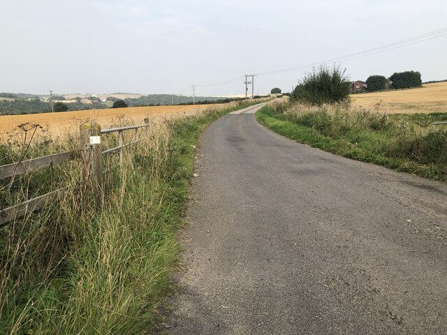
Cornforth is a civil parish located in the County Durham, North East England. Situated approximately 9 miles south of the city of Durham, it lies along the A177 road, providing good connectivity to nearby towns and cities. The village is nestled in a rural setting, surrounded by picturesque countryside and farmland.

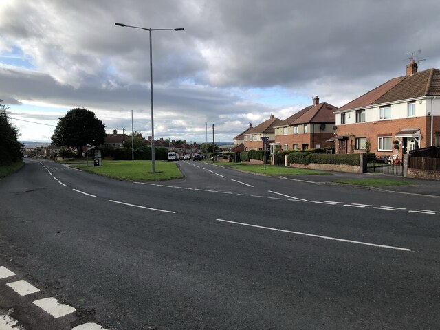
With a population of around 2,500, Cornforth maintains a close-knit community atmosphere. The parish consists of several residential areas, including Cornforth Village, East Cornforth, and the newer developments of The Village and The Green. These areas offer a range of housing options, from traditional terraced houses to modern family homes.

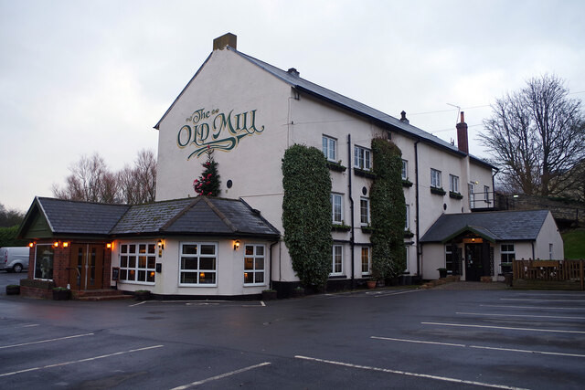
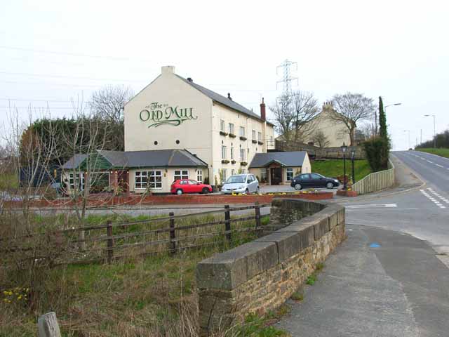
Cornforth boasts a variety of amenities and services for its residents. The village center features a handful of local shops, including convenience stores, a post office, and a pharmacy. There are also a few pubs and restaurants that serve as popular gathering spots for locals and visitors alike.

Education is well catered for in Cornforth, with a primary school providing education for children aged 3 to 11. Older students have access to secondary schools in nearby towns such as Spennymoor and Durham.

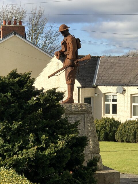
The village benefits from a rich history, with notable landmarks including St. John the Baptist Church, a Grade II listed building dating back to the 13th century. The church's architecture and historical significance make it a popular attraction for visitors.

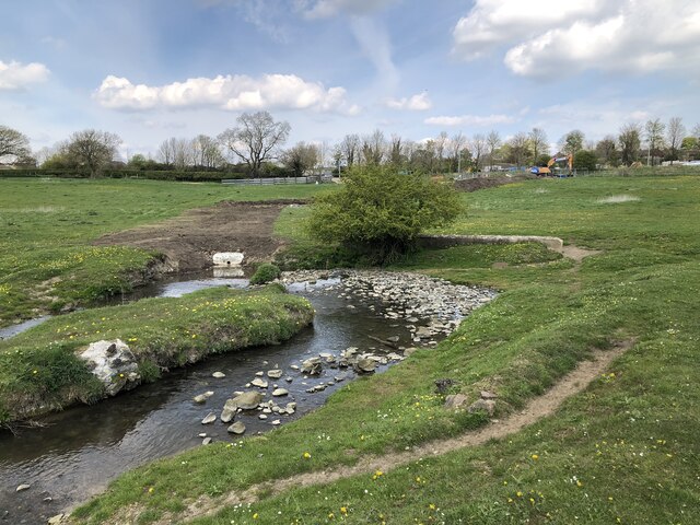
Cornforth offers a range of recreational opportunities, including several parks, playgrounds, and sports facilities. The nearby River Wear also provides opportunities for fishing and scenic walks.

Overall, Cornforth provides a charming countryside setting with a strong sense of community, making it an attractive place to live for those seeking a peaceful village lifestyle.

If you have any feedback on the listing, please let us know in the comments section below.
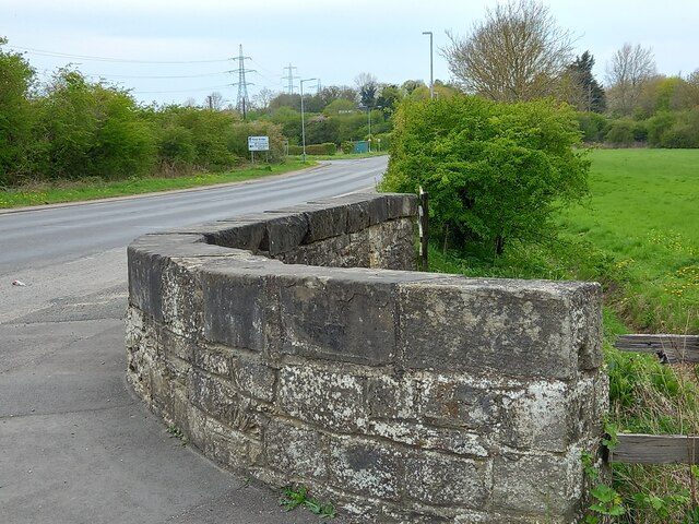
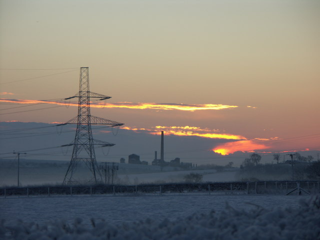
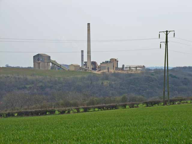
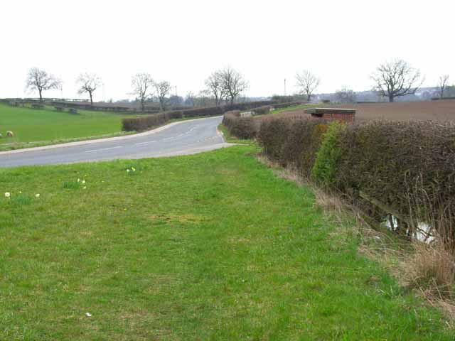
Cornforth Images

Images are sourced within 2km of 54.699368/-1.513933 or Grid Reference NZ3133. Thanks to Geograph Open Source API. All images are credited.

Road to West House Farm
Linden Road, West Cornforth
Metal Bridge, old mill bridge The rivet benchmark is cut into the top of the parapet on the north side of Thinford Road.
Metal Bridge, old mill bridge
The rivet benchmark is cut into the top of the parapet on the north side of Thinford Road.
Metal Bridge, old mill bridge There is a rivet benchmark is cut into the top of the parapet on the north side of Thinford Road. It is on the second stone from the right.
Metal Bridge, old mill bridge
There is a rivet benchmark is cut into the top of the parapet on the north side of Thinford Road. It is on the second stone from the right.
New drainage into Coxhoe Beck A new drainage channel crossing fields to an outflow into Coxhoe beck, constructed in association with new housing on the southern edge of the village.
New drainage into Coxhoe Beck
A new drainage channel crossing fields to an outflow into Coxhoe beck, constructed in association with new housing on the southern edge of the village.
Intermodal train at site of former Coxhoe Junction Coxhoe junction formerly had several lines including a flyover across the lines in the image. These former lines included early railways such as the Clarence Railway's branches to Coxhoe & collieries in the Spennymoor area, and the splendidly named Great North of England, Clarence & Hartlepool Junction Railway (GNEC&HJR) which linked the Clarence Railway to Hartlepool Docks. In addition local collieries, quarries, and ironworks at Cornforth, Mainsforth, and Ferryhill were also connected here or close by.

The two remaining tracks on the left are the East Coast Main line, while the two nearest tracks serve as a passing loop, with onward running to Stockton via Stillington in the southerly direction, and formerly running to Gateshead via Leamside in the northerly direction.
Intermodal train at site of former Coxhoe Junction
Coxhoe junction formerly had several lines including a flyover across the lines in the image. These former lines included early railways such as the Clarence Railway's branches to Coxhoe & collieries in the Spennymoor area, and the splendidly named Great North of England, Clarence & Hartlepool Junction Railway (GNEC&HJR) which linked the Clarence Railway to Hartlepool Docks. In addition local collieries, quarries, and ironworks at Cornforth, Mainsforth, and Ferryhill were also connected here or close by. The two remaining tracks on the left are the East Coast Main line, while the two nearest tracks serve as a passing loop, with onward running to Stockton via Stillington in the southerly direction, and formerly running to Gateshead via Leamside in the northerly direction.
The Old Mill, near Tursdale This building dates from 1813 when it opened as a paper mill; it was later also used as a corn mill. That business ceased in 1890 after which it had a variety of uses including as a pub. It is now an up-market inn with 12 en-suite rooms. In this view taken on a dismal December day the external lights are still on even though it is about 9-30am.
The Old Mill, near Tursdale
This building dates from 1813 when it opened as a paper mill; it was later also used as a corn mill. That business ceased in 1890 after which it had a variety of uses including as a pub. It is now an up-market inn with 12 en-suite rooms. In this view taken on a dismal December day the external lights are still on even though it is about 9-30am.
Cornforth Lane, Coxhoe This row of houses is called Cooperative Terrace and although each dwelling is similar they all have detailed differences. Those with plain brickwork arguably look better than the ones with rendered walls.
Cornforth Lane, Coxhoe
This row of houses is called Cooperative Terrace and although each dwelling is similar they all have detailed differences. Those with plain brickwork arguably look better than the ones with rendered walls.
Front Street East, Coxhoe Street names in Coxhoe are confusing. In this view the houses are on Front Street East, but the dental practice gives its address as Blackgate East. Presumably their 'west' equivalents are on the opposite side but those names don't seem to be used. In any case this is a stretch of the B6291. Modern Coxhoe is a product of the development of the Durham coalfield in the late 18th and early 19th centuries and has an unremittingly workaday feel about it.
Front Street East, Coxhoe
Street names in Coxhoe are confusing. In this view the houses are on Front Street East, but the dental practice gives its address as Blackgate East. Presumably their 'west' equivalents are on the opposite side but those names don't seem to be used. In any case this is a stretch of the B6291. Modern Coxhoe is a product of the development of the Durham coalfield in the late 18th and early 19th centuries and has an unremittingly workaday feel about it.
Fire damaged farm machinery Burned out farm equipment
Fire damaged farm machinery
Burned out farm equipment
Tursdale War Memorial Sculpture Sculpture 'Not Much To Ask' by Ray Lonsdale. The sculpture replaced an earlier stone figure that was removed in the 1970s due to damage. The new sculpture was erected and the memorial re-dedicated in 2018.

The artist's work can be found throughout the northeast, often portraying people involved in the regions historic industries.
Tursdale War Memorial Sculpture
Sculpture 'Not Much To Ask' by Ray Lonsdale. The sculpture replaced an earlier stone figure that was removed in the 1970s due to damage. The new sculpture was erected and the memorial re-dedicated in 2018. The artist's work can be found throughout the northeast, often portraying people involved in the regions historic industries.
Multiple lines
Multiple lines
Multiple lines
Multiple lines
Mixed land use
Mixed land use
Chimney at Thrislington Works, Ferryhill Taken from Thinford, just by the nursery on the A688.
An early morning stop on my way to work.
Chimney at Thrislington Works, Ferryhill
Taken from Thinford, just by the nursery on the A688. An early morning stop on my way to work.
Thrislington Works These works process the output from nearby quarries which are the best deposits of pure dolomite in the country. See <span class="nowrap"><a title="http://www.cornforth.org.uk/thrislington.htm#QUARRIES" rel="nofollow ugc noopener" href="http://www.cornforth.org.uk/thrislington.htm#QUARRIES">Link</a><img style="margin-left:2px;" alt="External link" title="External link - shift click to open in new window" src="https://s1.geograph.org.uk/img/external.png" width="10" height="10"/></span>
Thrislington Works
These works process the output from nearby quarries which are the best deposits of pure dolomite in the country. See LinkExternal link
Cornforth Road, Metal Bridge
The Old Mill, Tursdale See <span class="nowrap"><a title="http://www.theoldmill.uk.com" rel="nofollow ugc noopener" href="http://www.theoldmill.uk.com">Link</a><img style="margin-left:2px;" alt="External link" title="External link - shift click to open in new window" src="https://s1.geograph.org.uk/img/external.png" width="10" height="10"/></span>
The Old Mill, Tursdale
See LinkExternal link
Show me another place!

Cornforth is located at Grid Ref: NZ3133 (Lat: 54.699368, Lng: -1.513933)

Unitary Authority: County Durham

Police Authority: Durham

What 3 Words

///sundial.rates.affirming. Near West Cornforth, Co. Durham

Related Wikis

West Cornforth

West Cornforth is a village in County Durham, in England. It is situated to the south of Cornforth, near the A1(M) motorway, Coxhoe, Ferryhill and Spennymoor...

Cornforth

Cornforth is a village in County Durham, England. It is adjacent to the village of West Cornforth, situated a short distance to the north-east of Ferryhill...

West Cornforth railway station

West Cornforth railway station served the village of West Cornforth, County Durham, England, from 1866 to 1952 on the Great North of England, Clarence...

Thrislington Plantation

Thrislington Plantation is a Site of Special Scientific Interest and a national nature reserve in the Sedgefield district of County Durham, England. It...

Coxhoe Bridge railway station

Coxhoe Bridge railway station served the village of Coxhoe, County Durham, England, from 1846 to 1984 on the Hartlepool–Ferryhill Line. == History == The...

The Carrs

The Carrs is a Site of Special Scientific Interest in the Sedgefield district of County Durham, England. It is situated on the eastern outskirts of Ferryhill...

Coxhoe

Coxhoe is a village in County Durham, England. It is situated about 5 miles (8 km) south of Durham City centre. The civil parish also includes nearby Quarrington...

Metal Bridge, County Durham

Metal Bridge is a hamlet in County Durham, England, situated a few miles south of Durham. The East Coast Main Line runs directly through Metal Bridge but...

Nearby Amenities

Located within 500m of 54.699368,-1.513933
Cornforth
Place: village
Wikidata: Q2294753
Wikipedia: en:Cornforth
Lat/Long: 54.7032738/-1.5142852
Barrier: Gendpavtr
Ele: 138.31
Lat/Long: 54.6974511/-1.5136071
Bus Stop
Middleham Road
Naptan AtcoCode: 13006013A
Naptan Bearing: SE
Naptan CommonName: Middleham Road
Naptan Indicator: south east bound
Naptan Landmark: Landmark not known
Naptan NaptanCode: durgamdw
Naptan Street: Middleham Road
Naptan Verified: no
Source: naptan_import
Lat/Long: 54.7022679/-1.5145183
Bus Stop
Middleham Road
Naptan AtcoCode: 13006013E
Naptan Bearing: NW
Naptan CommonName: Middleham Road
Naptan Indicator: north west bound
Naptan Landmark: Landmark not known
Naptan NaptanCode: durgamga
Naptan Street: Middleham Road
Naptan Verified: no
Source: naptan_import
Lat/Long: 54.7022764/-1.5143941
Bus Stop
Stobb Cross Road (1)
Naptan AtcoCode: 13006401D
Naptan Bearing: SE
Naptan CommonName: Stobb Cross Road (1)
Naptan Indicator: south east bound
Naptan Landmark: Landmark not known
Naptan NaptanCode: durdmtgj
Naptan Notes: between 26-27 stobb cross road- ferryhill- dl179ha
Naptan Street: Street not known
Naptan Verified: no
Source: naptan_import
Lat/Long: 54.697472/-1.5130705
Bus Stop
Laburnum Road
Naptan AtcoCode: 13006402G
Naptan Bearing: W
Naptan CommonName: Laburnum Road
Naptan Indicator: west bound
Naptan Landmark: Landmark not known
Naptan NaptanCode: durdmtgm
Naptan Notes: outside 16 laburnum road- ferryhill- dl179nj
Naptan Street: Street not known
Naptan Verified: no
Source: naptan_import
Lat/Long: 54.6992823/-1.5162764
Bus Stop
17 Linden Rd
Naptan AtcoCode: 13006431A
Naptan Bearing: N
Naptan CommonName: 17 Linden Rd
Naptan Indicator: north bound
Naptan Landmark: Landmark not known
Naptan NaptanCode: durdmwgp
Naptan Notes: between 17-19 linden road- ferryhill- dl179nr
Naptan Street: Street not known
Naptan Verified: no
Source: naptan_import
Lat/Long: 54.6988933/-1.5132848
Bus Stop
56 Lichfield Road
Naptan AtcoCode: 13006703H
Naptan Bearing: NW
Naptan CommonName: 56 Lichfield Road
Naptan Indicator: north west bound
Naptan Landmark: Landmark not known
Naptan NaptanCode: durdpmwd
Naptan Notes: outside numbers 52 and 54 lichfield road- ferryhill- dl179pa
Naptan Street: Lichfield Road
Naptan Verified: no
Source: naptan_import
Lat/Long: 54.6987685/-1.5092068
Bus Stop
4 Lichfield Road
Naptan AtcoCode: 13006704G
Naptan Bearing: W
Naptan CommonName: 4 Lichfield Road
Naptan Indicator: west bound
Naptan Landmark: Landmark not known
Naptan NaptanCode: durdpmwg
Naptan Notes: outside numbers 4-6 lichfield road- ferryhill- dl179pb
Naptan Street: Lichfield Road
Naptan Verified: no
Source: naptan_import
Lat/Long: 54.6992952/-1.5127849
Bus Stop
Stobb Cross Road
Naptan AtcoCode: 13006705D
Naptan Bearing: SE
Naptan CommonName: Stobb Cross Road
Naptan Indicator: south east bound
Naptan Landmark: Landmark not known
Naptan NaptanCode: durdpmwj
Naptan Notes: opposite rear boundary of numbers 58-60 linden road- strobly cross road- ferryhill- dl179nr
Naptan Street: Stobb Cross Road
Naptan Verified: no
Shelter: yes
Source: naptan_import
Lat/Long: 54.6971359/-1.5121746
Bus Stop
Stobb Cross Road
Naptan AtcoCode: 13006705H
Naptan Bearing: NW
Naptan CommonName: Stobb Cross Road
Naptan Indicator: north west bound
Naptan Landmark: Landmark not known
Naptan NaptanCode: durdpmwm
Naptan Notes: opposite number 27 stobb cross road- ferryhill- dl179ha
Naptan Street: Stobb Cross Road
Naptan Verified: no
Source: naptan_import
Lat/Long: 54.6974367/-1.5132261
Bus Stop
Villas
Naptan AtcoCode: 13006706B
Naptan Bearing: NE
Naptan CommonName: Villas
Naptan Indicator: north east bound
Naptan Landmark: Landmark not known
Naptan NaptanCode: durdpmwp
Naptan Notes: in front of kier works on unmarked road- thrislington industrial estate- ferryhill- dl179eu
Naptan Street: Unclassified Road Cornforth to Bypass
Naptan Verified: no
Source: naptan_import
Lat/Long: 54.6986646/-1.5191388
Bus Stop
Villas
Naptan AtcoCode: 13006706D
Naptan Bearing: SE
Naptan CommonName: Villas
Naptan Indicator: south east bound
Naptan Landmark: Landmark not known
Naptan NaptanCode: durdpmwt
Naptan Notes: between 30-31 poplar terrace- ferryhill- dl179el
Naptan Street: Station Road
Naptan Verified: no
Source: naptan_import
Lat/Long: 54.699376/-1.5195028
Bus Stop
Villas
Naptan AtcoCode: 13006706F
Naptan Bearing: SW
Naptan CommonName: Villas
Naptan Indicator: south west bound
Naptan Landmark: Landmark not known
Naptan NaptanCode: durdptad
Naptan Notes: opposite kier northern works- thrislington industrial estate- ferryhill- dl179eu
Naptan Street: Unclassifed Road Cornforth to Bypass
Naptan Verified: no
Source: naptan_import
Lat/Long: 54.6984586/-1.5193275
Bus Stop
Villas
Naptan AtcoCode: 13006706H
Naptan Bearing: NW
Naptan CommonName: Villas
Naptan Indicator: north west bound
Naptan Landmark: Landmark not known
Naptan NaptanCode: durdptag
Naptan Notes: outside number 1 stobbcross villas- ferryhill- dl179ez
Naptan Street: Stobb Cross Road
Naptan Verified: no
Source: naptan_import
Lat/Long: 54.6987588/-1.5179895
Bus Stop
Market Place
Naptan AtcoCode: 13006709C
Naptan Bearing: N
Naptan CommonName: Market Place
Naptan Indicator: north bound
Naptan Landmark: Landmark not known
Naptan NaptanCode: durgamgd
Naptan Notes: infront on boundary no. 31-32 beech parade- ferryhill- dl179ph
Naptan Street: Street not known
Naptan Verified: no
Source: naptan_import
Lat/Long: 54.7029731/-1.5155652
Bus Stop
Market Place
Naptan AtcoCode: 13006709G
Naptan Bearing: S
Naptan CommonName: Market Place
Naptan Indicator: south bound
Naptan Landmark: Landmark not known
Naptan NaptanCode: durgamgj
Naptan Notes: opposite boundary between no. 31-32 beech parade- ferryhill- dl179ph
Naptan Street: Street not known
Naptan Verified: no
Source: naptan_import
Lat/Long: 54.7029214/-1.51614
Bus Stop
Garmondsway Road
Naptan AtcoCode: 13006950C
Naptan Bearing: E
Naptan CommonName: Garmondsway Road
Naptan Indicator: east bound
Naptan Landmark: Landmark not known
Naptan NaptanCode: durgampg
Naptan Notes: opposite number 28 garmondsway road- ferryhill- dl179hd
Naptan Street: Garmondsway Road
Naptan Verified: no
Source: naptan_import
Lat/Long: 54.6971913/-1.5080932
Post Box
Lat/Long: 54.6977407/-1.5090329
Noexit: yes
Lat/Long: 54.6972203/-1.5080339
Barrier: stile
Lat/Long: 54.6984626/-1.5192199
Power: pole
Lat/Long: 54.7001836/-1.5132098
Power: pole
Lat/Long: 54.700272/-1.5118003
Power: pole
Lat/Long: 54.7003634/-1.5103975
Power: pole
Lat/Long: 54.6998225/-1.5091261
Power: pole
Lat/Long: 54.6992769/-1.5078414
Power: pole
Lat/Long: 54.6987856/-1.5066612
West Cornforth War Memorial
Historic: memorial
Image: https://www.geograph.org.uk/photo/6381029
Memorial: war_memorial
Wikidata: Q26671318
Lat/Long: 54.7030904/-1.5162595
The data included in this document is from www.openstreetmap.org. The data is made available under ODbL.

Have you been to Cornforth?

Leave your review of Cornforth below (or comments, questions and feedback).