Comberton

Civil Parish in Cambridgeshire South Cambridgeshire

England

Comberton

Comberton, St Mary <span class="nowrap"><a title="http://www.druidic.org/camchurch/churches/comberton.htm" rel="nofollow ugc noopener" href="http://www.druidic.org/camchurch/churches/comberton.htm">Link</a><img style="margin-left:2px;" alt="External link" title="External link - shift click to open in new window" src="https://s1.geograph.org.uk/img/external.png" width="10" height="10"/></span>
Comberton, St Mary Credit: mym

Comberton is a civil parish located in the county of Cambridgeshire, England. Situated approximately 8 miles southwest of Cambridge, it covers an area of about 4.9 square miles. Comberton is bordered by the parishes of Toft, Barton, and Harlton.

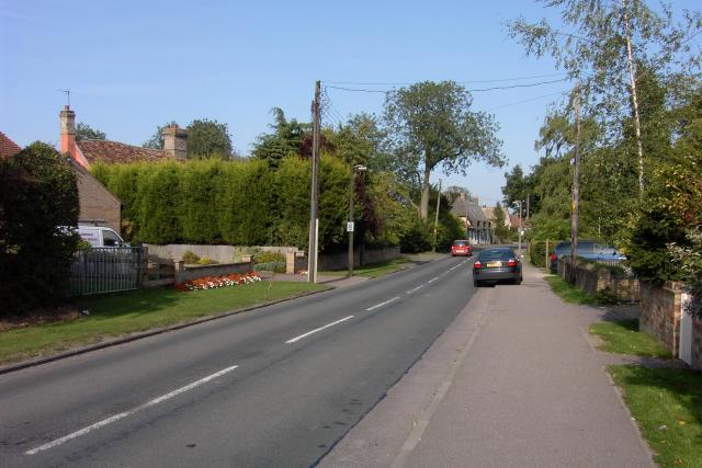
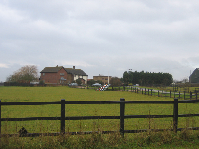
The village of Comberton is nestled in a rural setting, surrounded by picturesque countryside and farmland. It has a population of around 2,200 residents, according to the latest available data. The parish is served by a primary school, which has a good reputation and caters to local children.

Comberton is known for its strong community spirit and active involvement in various local initiatives. The village hosts a range of social events and clubs, including sports clubs, gardening clubs, and a historical society. There are also several public houses and restaurants, providing residents with options for dining and socializing.

The village benefits from good transportation links, with regular bus services connecting it to nearby towns and cities. Additionally, the A428 road, which runs through the parish, provides convenient access to Cambridge and other major routes.

Comberton offers a range of amenities to its residents, including a post office, a convenience store, and a village hall. It also boasts a beautiful church, St. Mary's, which dates back to the 13th century and is a notable historical landmark in the area.

Overall, Comberton is a vibrant and picturesque village, offering a peaceful and close-knit community lifestyle, while still providing easy access to nearby urban centers.

If you have any feedback on the listing, please let us know in the comments section below.
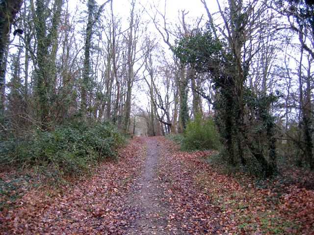
Comberton Images

Images are sourced within 2km of 52.191183/0.027557 or Grid Reference TL3856. Thanks to Geograph Open Source API. All images are credited.

Comberton, St Mary <span class="nowrap"><a title="http://www.druidic.org/camchurch/churches/comberton.htm" rel="nofollow ugc noopener" href="http://www.druidic.org/camchurch/churches/comberton.htm">Link</a><img style="margin-left:2px;" alt="External link" title="External link - shift click to open in new window" src="https://s1.geograph.org.uk/img/external.png" width="10" height="10"/></span>
Comberton, St Mary
Comberton Looking roughly ENE at the crossroads in the centre of Comberton.
Comberton
Looking roughly ENE at the crossroads in the centre of Comberton.
Fields south-east of Comberton View roughly SE from TL384555. The row of white objects just visible in the centre of the image are radio telescopes.
Fields south-east of Comberton
View roughly SE from TL384555. The row of white objects just visible in the centre of the image are radio telescopes.
Comberton Looking ENE along the B1046 coming into Comberton from Toft. There is a great mix of ages of housing within the SE corner of this square - some houses look to be hundreds of years old (such as the pink one with the somewhat bent roof visible over the hedge on the left) while others must have been built within the last few decades.
Comberton
Looking ENE along the B1046 coming into Comberton from Toft. There is a great mix of ages of housing within the SE corner of this square - some houses look to be hundreds of years old (such as the pink one with the somewhat bent roof visible over the hedge on the left) while others must have been built within the last few decades.
Barton Glebe Woodland Burial Site and Memorial Lodge, Comberton Road, Cambs The Arbory Trust site at Barton is the first of its kind and will eventually cover some 38 acres.
Barton Glebe Woodland Burial Site and Memorial Lodge, Comberton Road, Cambs
The Arbory Trust site at Barton is the first of its kind and will eventually cover some 38 acres.
Woodland burial site This is the Memorial Lodge of the Arbory Trust's burial site outside Barton. The area has been planted with trees which will grow into a respectable wood in 50 years or so.
Woodland burial site
This is the Memorial Lodge of the Arbory Trust's burial site outside Barton. The area has been planted with trees which will grow into a respectable wood in 50 years or so.
Jaggard's Farm, Comberton, Cambs – view SE across Bin Brook valley from the Whitwell Way bridleway.
Jaggard's Farm, Comberton, Cambs
– view SE across Bin Brook valley from the Whitwell Way bridleway.
Whitwell Way, Coton, Cambs  – view to the N from near the centre of the square; with an oilseed rape crop sown into cereal stubble.
Whitwell Way, Coton, Cambs
– view to the N from near the centre of the square; with an oilseed rape crop sown into cereal stubble.
Whitwell Way, Coton, Cambs  – view to the E from near the centre of the square.
Whitwell Way, Coton, Cambs
– view to the E from near the centre of the square.
Whitwell Way, Coton, Cambs  – view to the S across the Bin Brook valley from near the centre of the square.
Whitwell Way, Coton, Cambs
– view to the S across the Bin Brook valley from near the centre of the square.
Whitwell Way, Coton, Cambs  – view to the W from near the centre of the square.
Whitwell Way, Coton, Cambs
– view to the W from near the centre of the square.
Common Farm, Comberton, Cambs – the only buildings in an agricultural square north of the village; view W from Long Road.
Common Farm, Comberton, Cambs
– the only buildings in an agricultural square north of the village; view W from Long Road.
Long Road, Comberton, Cambs – view S across the eastern side of the square towards the village.
Long Road, Comberton, Cambs
– view S across the eastern side of the square towards the village.
Long Road plantation, Comberton, Cambs View E along the Whitwell Way bridleway between Long Road and Coton village.
Long Road plantation, Comberton, Cambs
View E along the Whitwell Way bridleway between Long Road and Coton village.
Port Way bridleway, from Long Road, Comberton, Cambs View W across the southern part of the square towards Starve Goose Plantation, Hardwick.
Port Way bridleway, from Long Road, Comberton, Cambs
View W across the southern part of the square towards Starve Goose Plantation, Hardwick.
Farmland, Comberton, Cambs View NW of winter wheat fields from Branch Road.
Farmland, Comberton, Cambs
View NW of winter wheat fields from Branch Road.
Farmland S of Hardwick, Cambs View N along the eastern edge of the square.
Farmland S of Hardwick, Cambs
View N along the eastern edge of the square.
Farmland S of Hardwick, Cambs View W over a broad south-facing Chalky Boulder Clay ridge towards the centre of the square.
Farmland S of Hardwick, Cambs
View W over a broad south-facing Chalky Boulder Clay ridge towards the centre of the square.
Show me another place!

Comberton is located at Grid Ref: TL3856 (Lat: 52.191183, Lng: 0.027557)

Administrative County: Cambridgeshire

District: South Cambridgeshire

Police Authority: Cambridgeshire

What 3 Words

///ejects.demotion.bother. Near Comberton, Cambridgeshire

Related Wikis

Comberton

Comberton is a village and civil parish in South Cambridgeshire, England, just east of the Prime Meridian. == History == Archaeological finds, including...

Comberton Village College

Comberton Village College is an 11–18 mixed secondary school and sixth form with academy status on the edge of Comberton village in Cambridge, Cambridgeshire...

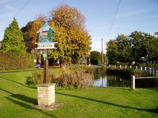
Barton, Cambridgeshire

Barton is a village and civil parish in the South Cambridgeshire district of Cambridgeshire, England. It is about 4 miles (6.4 km) south-west of Cambridge...

Lord's Bridge railway station

Lord's Bridge was a railway station on the Varsity Line which ran between Oxford and Cambridge. Situated in the north of the parish of Harlton on the western...

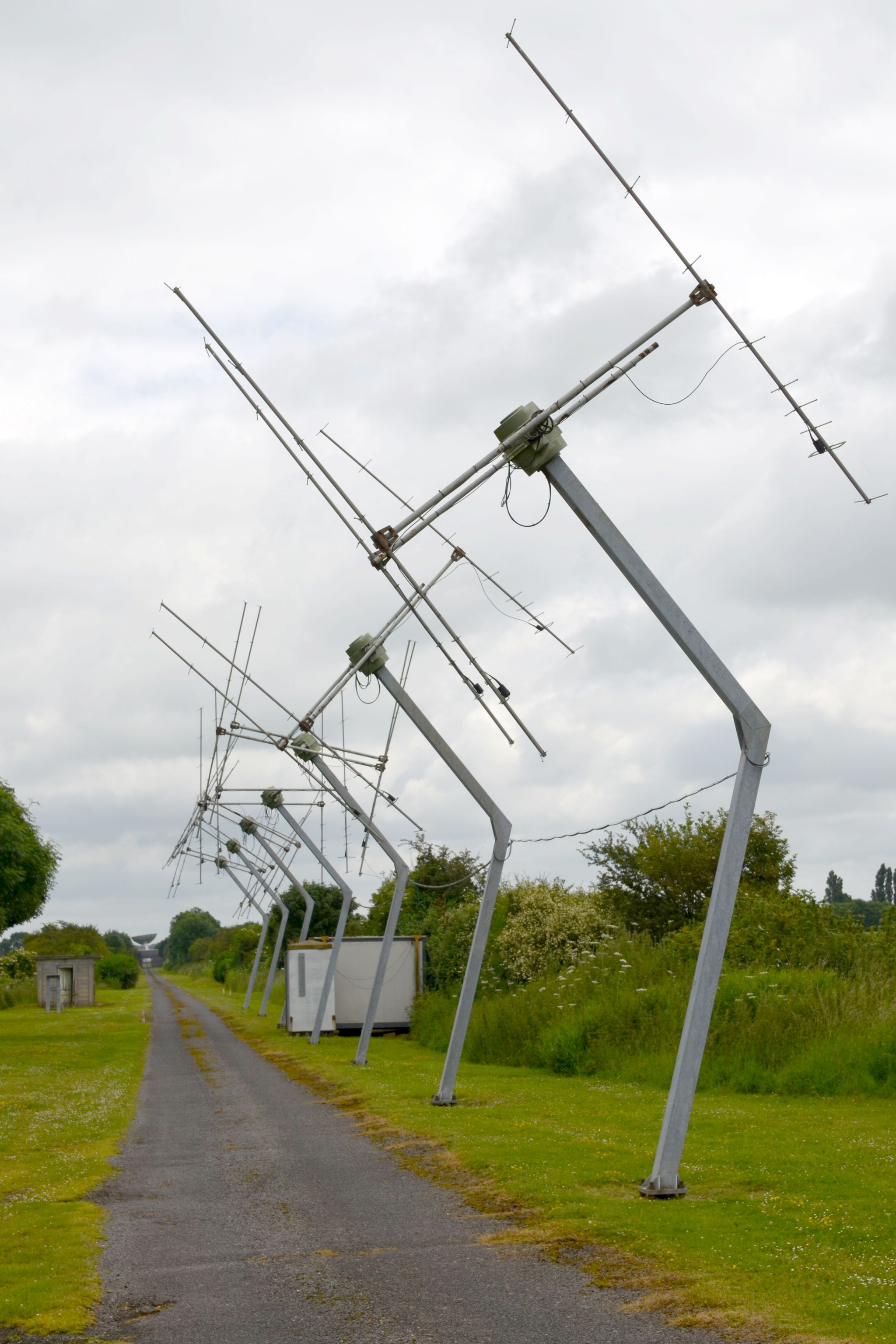
Cambridge Low Frequency Synthesis Telescope

The Cambridge Low-Frequency Synthesis Telescope (CLFST) is an east-west aperture synthesis radio telescope currently operating at 151 MHz. It consists...

Mullard Radio Astronomy Observatory

The Mullard Radio Astronomy Observatory (MRAO) is located near Cambridge, UK and is home to a number of the largest and most advanced aperture synthesis...

Hardwick, Cambridgeshire

Hardwick is a village and civil parish in the county of Cambridgeshire, England with a large housing estate located about 6 miles (9.7 km) west of the...

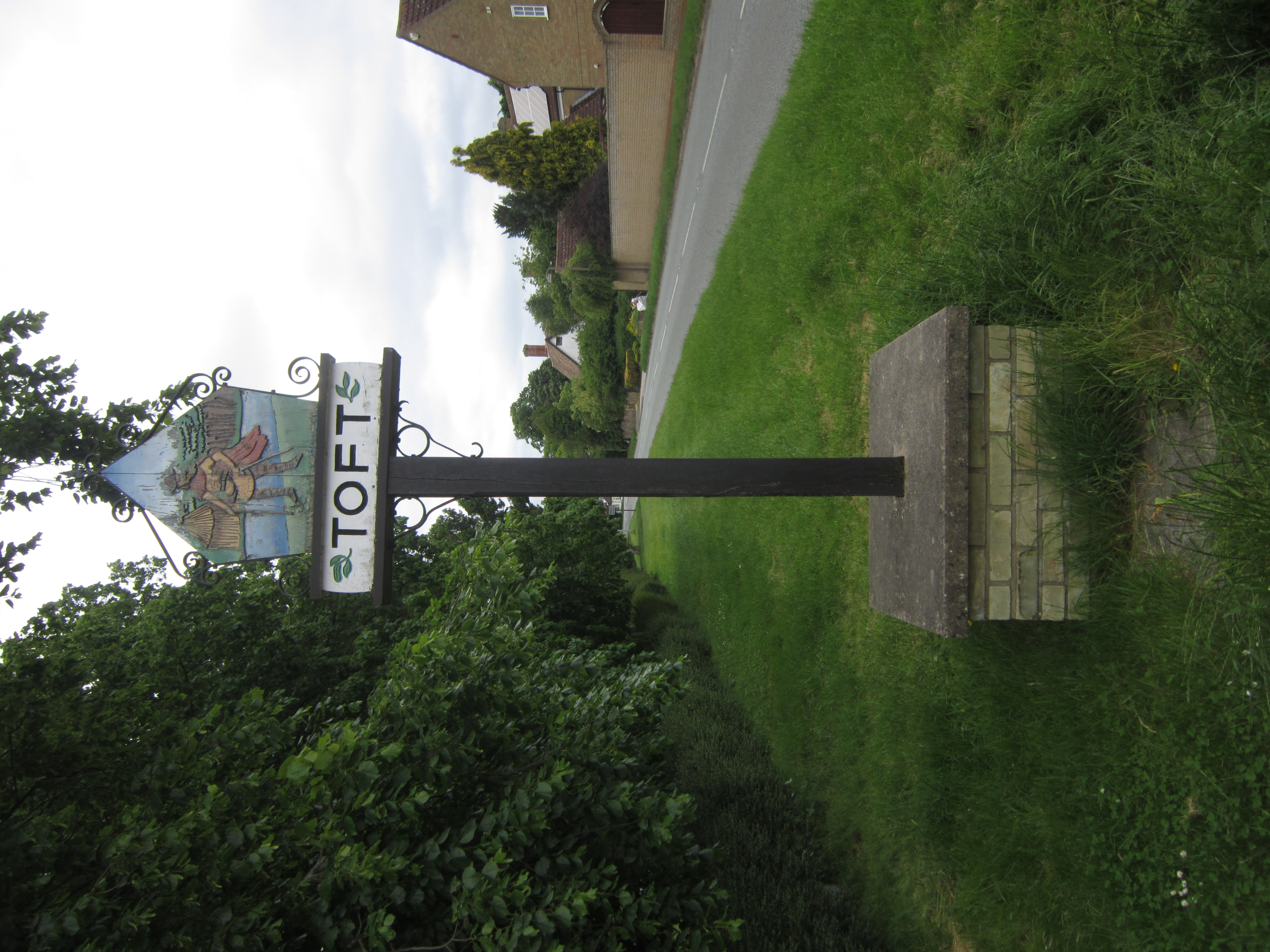
Toft, Cambridgeshire

Toft is a village situated in Cambridgeshire, England. It is approximately six miles to the west of Cambridge, and is situated within four miles of the...

Nearby Amenities

Located within 500m of 52.191183,0.027557
Mini Roundabout
Direction: clockwise
Lat/Long: 52.1882441/0.0296507
Post Box
Brand: Royal Mail
Brand Wikidata: Q638098
Brand Wikipedia: en:Royal Mail
Collection Times: Mo-Fr 09:00; Sa 07:00
Operator: Royal Mail
Operator Wikidata: Q638098
Post Box Type: lamp
Ref: CB23 270D
Royal Cypher: EIIR
Royal Cypher Wikidata: Q33102113
Source: survey
Lat/Long: 52.1909935/0.0282189
Post Box
Brand: Royal Mail
Brand Wikidata: Q638098
Brand Wikipedia: en:Royal Mail
Collection Times: Mo-Fr 09:00, Sa 07:00
Operator: Royal Mail
Operator Wikidata: Q638098
Post Box Type: wall
Ref: CB23 267D
Royal Cypher: GVIR
Royal Cypher Wikidata: Q33102169
Source: survey
Lat/Long: 52.1879893/0.0266536
Bus Stop
Swayne Lane
Bench: yes
Bin: yes
Naptan AtcoCode: 0500SCOMB001
Naptan Bearing: E
Naptan BusStopType: MKD
Naptan CommonName: Swayne Lane
Naptan Indicator: opp
Naptan Landmark: Swayne Lane
Naptan NaptanCode: cmbdtwtg
Naptan PlusbusZoneRef: CAMBDGE
Naptan Street: Barton Road
Route Ref: 18;18A
Shelter: yes
Source: naptan_import
Tactile Paving: no
Lat/Long: 52.1881946/0.0275223
Bus Stop
Swayne Lane
Bench: no
Bin: no
Naptan AtcoCode: 0500SCOMB006
Naptan Bearing: W
Naptan BusStopType: CUS
Naptan CommonName: Swayne Lane
Naptan Indicator: near
Naptan Landmark: Swayne Lane
Naptan NaptanCode: cmbdwada
Naptan PlusbusZoneRef: CAMBDGE
Naptan Street: Barton Road
Route Ref: 18;18A
Shelter: no
Source: naptan_import
Tactile Paving: no
Lat/Long: 52.1881126/0.0275357
Barrier: cycle_barrier
Lat/Long: 52.1879858/0.0255832
Shelter
Lat/Long: 52.189014/0.0223821
Historic: yes
Man Made: water_well
Pump: manual
Lat/Long: 52.1877581/0.0237893
Bench
Backrest: yes
Material: wood
Lat/Long: 52.1888656/0.0216588
Bench
Backrest: yes
Material: wood
Lat/Long: 52.1891206/0.0229526
Bench
Backrest: yes
Check Date: 2021-09-11
Material: wood
Lat/Long: 52.1894235/0.0227793
Access: private
Barrier: swing_gate
Lat/Long: 52.1939397/0.0300058
Entrance: main
Lat/Long: 52.1887906/0.0243227
Bench
Backrest: no
Lat/Long: 52.190023/0.0230842
Bench
Lat/Long: 52.1903936/0.0236909
Bench
Lat/Long: 52.1911138/0.0226232
Entrance: main
Lat/Long: 52.187066/0.0250307
Entrance: main
Lat/Long: 52.1872606/0.0253575
Entrance: main
Lat/Long: 52.1874013/0.0252474
Addr Flats: 4
Entrance: yes
Lat/Long: 52.1892003/0.0275393
Addr Flats: 1
Entrance: yes
Lat/Long: 52.1892154/0.027712
Addr Flats: 3
Entrance: yes
Lat/Long: 52.1892345/0.0276056
Addr Flats: 2
Entrance: yes
Lat/Long: 52.1892365/0.0276274
Waste Basket
Lat/Long: 52.1900598/0.0268789
Power: transformer
Lat/Long: 52.1928667/0.0277169
Waste Basket
Lat/Long: 52.1879701/0.0269963
Bench
Backrest: yes
Lat/Long: 52.1879772/0.0266931
Artist Name: Mel Fraser
Artwork Type: sculpture
Inscription: The strength of our village lies in its people Commissioned by Comberton Parish Council & South Cambridgeshire District Council
Material: stone
Start Date: 2003
Tourism: artwork
Lat/Long: 52.1879734/0.0267791
Waste Basket
Lat/Long: 52.1911226/0.0297001
Grit Bin
Lat/Long: 52.1883034/0.0298
Grit Bin
Lat/Long: 52.1884551/0.0252691
Waste Basket
Lat/Long: 52.1884765/0.0252952
Grit Bin
Lat/Long: 52.1908431/0.0276951
Bench
Backrest: no
Lat/Long: 52.1897052/0.0218506
Board Type: notice
Information: board
Tourism: information
Lat/Long: 52.1900793/0.0268972
Information: map
Tourism: information
Lat/Long: 52.1879782/0.0250867
Barrier: swing_gate
Lat/Long: 52.1917792/0.0302258
Bench
Backrest: yes
Lat/Long: 52.1890419/0.0225851
Waste Basket
Lat/Long: 52.1891089/0.0229084
Waste Basket
Lat/Long: 52.189015/0.0224118
Waste Basket
Lat/Long: 52.1888579/0.0216306
Waste Basket
Lat/Long: 52.1894323/0.0228343
Bench
Backrest: yes
Lat/Long: 52.1879877/0.0253529
Power: pole
Lat/Long: 52.1948496/0.0300575
Power: pole
Lat/Long: 52.1940096/0.0299234
Power: pole
Lat/Long: 52.19402/0.0286487
Power: pole
Lat/Long: 52.194009/0.0299898
Power: pole
Lat/Long: 52.1940308/0.0273243
Power: pole
Lat/Long: 52.1940608/0.0261341
Power: pole
Lat/Long: 52.1933234/0.0252315
Power: pole
Lat/Long: 52.1925893/0.0243303
Power: pole
Lat/Long: 52.1918527/0.0234546
Line Management: transition
Location Transition: yes
Power: pole
Lat/Long: 52.1911489/0.0225869
Traffic Calming: chicane
Lat/Long: 52.1909865/0.0298416
Traffic Calming: chicane
Lat/Long: 52.193392/0.0300547
Board Type: notice
Information: board
Tourism: information
Lat/Long: 52.1879846/0.0266709
Bench
Lat/Long: 52.1900941/0.027099
Waste Basket
Lat/Long: 52.1892545/0.0233682
Leisure: picnic_table
Lat/Long: 52.1892393/0.0233577
Entrance: yes
Lat/Long: 52.1895013/0.0253166
Entrance: yes
Lat/Long: 52.1894812/0.0252332
Entrance: yes
Lat/Long: 52.1894612/0.0251499
Entrance: yes
Lat/Long: 52.1894412/0.0250665
Entrance: yes
Lat/Long: 52.1894212/0.0249831
Entrance: yes
Lat/Long: 52.1894012/0.0248998
Entrance: yes
Lat/Long: 52.1893812/0.0248164
Entrance: yes
Lat/Long: 52.1897537/0.0246033
Entrance: yes
Lat/Long: 52.1897735/0.024685
Entrance: yes
Lat/Long: 52.1897932/0.0247667
Entrance: yes
Lat/Long: 52.1898129/0.0248485
Entrance: yes
Lat/Long: 52.1898326/0.0249302
Entrance: yes
Lat/Long: 52.1898523/0.0250119
Entrance: yes
Lat/Long: 52.189872/0.0250937
Addr City: Cambridge
Addr Housenumber: 29
Addr Postcode: CB23 7DB
Addr Street: Hillfield Road
Addr Village: Comberton
Entrance: yes
Lat/Long: 52.1899172/0.0242643
Addr City: Cambridge
Addr Housenumber: 30
Addr Postcode: CB23 7DB
Addr Street: Hillfield Road
Addr Village: Comberton
Entrance: yes
Lat/Long: 52.1899211/0.0242813
Addr City: Cambridge
Addr Housenumber: 31
Addr Postcode: CB23 7DB
Addr Street: Hillfield Road
Addr Village: Comberton
Entrance: yes
Lat/Long: 52.1899521/0.0244171
Addr City: Cambridge
Addr Housenumber: 32
Addr Postcode: CB23 7DB
Addr Street: Hillfield Road
Addr Village: Comberton
Entrance: yes
Lat/Long: 52.189956/0.0244341
Addr City: Cambridge
Addr Housenumber: 33
Addr Postcode: CB23 7DB
Addr Street: Hillfield Road
Addr Village: Comberton
Entrance: yes
Lat/Long: 52.1899641/0.02451
Addr City: Cambridge
Addr Housenumber: 34
Addr Postcode: CB23 7DB
Addr Street: Hillfield Road
Addr Village: Comberton
Entrance: yes
Lat/Long: 52.1899676/0.0245271
Addr City: Cambridge
Addr Housenumber: 36
Addr Postcode: CB23 7DB
Addr Street: Hillfield Road
Addr Village: Comberton
Entrance: yes
Lat/Long: 52.1899989/0.0246806
Addr City: Cambridge
Addr Housenumber: 35
Addr Postcode: CB23 7DB
Addr Street: Hillfield Road
Addr Village: Comberton
Entrance: yes
Lat/Long: 52.1899954/0.0246635
Addr City: Cambridge
Addr Housenumber: 37
Addr Postcode: CB23 7DB
Addr Street: Hillfield Road
Addr Village: Comberton
Entrance: yes
Lat/Long: 52.1900082/0.0247594
Addr City: Cambridge
Addr Housenumber: 38
Addr Postcode: CB23 7DB
Addr Street: Hillfield Road
Addr Village: Comberton
Entrance: yes
Lat/Long: 52.1900116/0.0247758
Addr City: Cambridge
Addr Housenumber: 39
Addr Postcode: CB23 7DB
Addr Street: Hillfield Road
Addr Village: Comberton
Entrance: yes
Lat/Long: 52.1900392/0.0249076
Addr City: Cambridge
Addr Housenumber: 40
Addr Postcode: CB23 7DB
Addr Street: Hillfield Road
Addr Village: Comberton
Entrance: yes
Lat/Long: 52.1900427/0.024924
Addr City: Cambridge
Addr Housenumber: 42
Addr Postcode: CB23 7DB
Addr Street: Hillfield Road
Addr Village: Comberton
Entrance: yes
Lat/Long: 52.1900603/0.0250081
Addr City: Cambridge
Addr Housenumber: 41
Addr Postcode: CB23 7DB
Addr Street: Hillfield Road
Addr Village: Comberton
Entrance: yes
Lat/Long: 52.1900573/0.0249909
Addr City: Cambridge
Addr Housenumber: 43
Addr Postcode: CB23 7DB
Addr Street: Hillfield Road
Addr Village: Comberton
Entrance: yes
Lat/Long: 52.1900841/0.0251459
Addr City: Cambridge
Addr Housenumber: 44
Addr Postcode: CB23 7DB
Addr Street: Hillfield Road
Addr Village: Comberton
Entrance: yes
Lat/Long: 52.1900871/0.0251631
Addr City: Cambridge
Addr Housenumber: 27
Addr Postcode: CB23 7DA
Addr Street: Woottens Close
Addr Village: Comberton
Lat/Long: 52.1869839/0.0251688
Addr City: Cambridge
Addr Housenumber: 35
Addr Postcode: CB23 7DA
Addr Street: Woottens Close
Addr Village: Comberton
Lat/Long: 52.1871339/0.0250467
Addr City: Cambridge
Addr Housenumber: 29
Addr Postcode: CB23 7DA
Addr Street: Woottens Close
Addr Village: Comberton
Lat/Long: 52.1870413/0.0251227
Addr City: Cambridge
Addr Housenumber: 19
Addr Postcode: CB23 7DA
Addr Street: Woottens Close
Addr Village: Comberton
Lat/Long: 52.1872321/0.0254528
Addr City: Cambridge
Addr Housenumber: 13
Addr Postcode: CB23 7DA
Addr Street: Woottens Close
Addr Village: Comberton
Lat/Long: 52.187325/0.0253777
Addr City: Cambridge
Addr Housenumber: 11
Addr Postcode: CB23 7DA
Addr Street: Woottens Close
Addr Village: Comberton
Lat/Long: 52.1873825/0.0253321
Addr City: Cambridge
Addr Housenumber: 5
Addr Postcode: CB23 7DA
Addr Street: Woottens Close
Addr Village: Comberton
Lat/Long: 52.1874598/0.0252704
Information: guidepost
Tourism: information
Lat/Long: 52.1881883/0.0297745
Information: guidepost
Tourism: information
Lat/Long: 52.1877554/0.0237949
Bicycle Parking
Capacity: 10
Lat/Long: 52.1884091/0.0247159
Information: guidepost
Tourism: information
Lat/Long: 52.1867786/0.0272445
Bench
Backrest: yes
Lat/Long: 52.189942/0.022046
Bench
Backrest: yes
Lat/Long: 52.190802/0.02192
Bench
Lat/Long: 52.1905886/0.0203363
Waste Basket
Lat/Long: 52.1882093/0.0274936
The data included in this document is from www.openstreetmap.org. The data is made available under ODbL.

Have you been to Comberton?

Leave your review of Comberton below (or comments, questions and feedback).