Colsterdale

Civil Parish in Yorkshire Harrogate

England

Colsterdale

The Millennium Bridge over the River Burn Installed by the Swinton Estate in 2000.
The Millennium Bridge over the River Burn Credit: Matthew Hatton

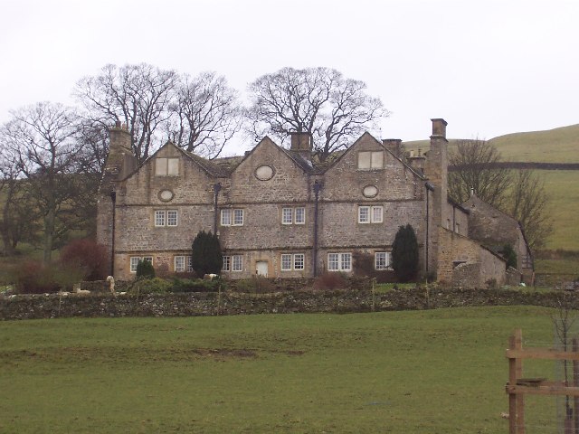
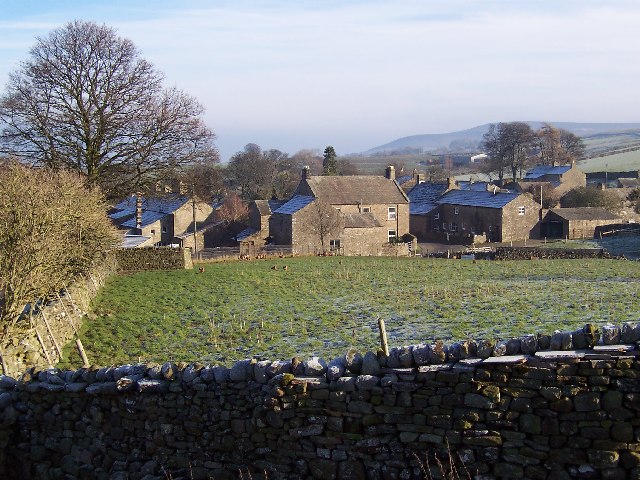
Colsterdale is a civil parish located in the Yorkshire Dales, North Yorkshire, England. Situated in the heart of the Nidderdale Area of Outstanding Natural Beauty, it covers an area of approximately 30 square kilometers. The parish is known for its picturesque landscape, characterized by rolling hills, open moorland, and scattered woodlands.

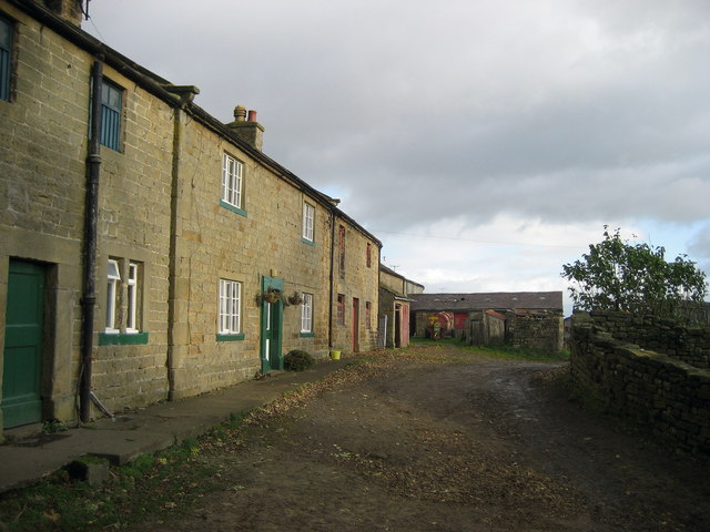
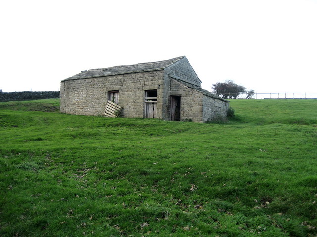
The village of Colsterdale, after which the parish is named, is small and rural, with a population of around 100 people. The village itself consists of a few scattered houses and farms, surrounded by vast stretches of untouched nature. The parish is primarily agricultural, with farming being the main occupation of its residents.

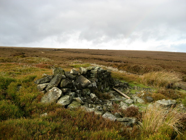
Colsterdale is a popular destination for outdoor enthusiasts, offering a variety of activities such as hiking, cycling, and birdwatching. The area is home to several species of birds, including curlews, lapwings, and red grouse. Visitors can explore the numerous footpaths and bridleways that crisscross the countryside, providing breathtaking views of the surrounding moors and valleys.

Despite its remote location, Colsterdale is within easy reach of nearby towns and amenities. The market town of Masham is approximately 10 miles away, offering a range of shops, pubs, and restaurants. The city of Ripon is also within a short driving distance, providing further amenities and attractions.

In conclusion, Colsterdale is a tranquil and unspoiled civil parish in Yorkshire, offering stunning natural beauty and a peaceful rural lifestyle. Its secluded location and abundant outdoor activities make it an idyllic destination for nature lovers and those seeking a peaceful retreat.

If you have any feedback on the listing, please let us know in the comments section below.

Colsterdale Images

Images are sourced within 2km of 54.232734/-1.826473 or Grid Reference SE1181. Thanks to Geograph Open Source API. All images are credited.

The Millennium Bridge over the River Burn Installed by the Swinton Estate in 2000.
The Millennium Bridge over the River Burn
Installed by the Swinton Estate in 2000.
Ulfers Gill The short section of bridleway that heads westwards into this grid square is soon lost on the ground.  Its purpose is unclear, but other similar paths/tracks on the moors are often 'turf roads' leading to areas where peat was once gathered for fuel.
Ulfers Gill
The short section of bridleway that heads westwards into this grid square is soon lost on the ground. Its purpose is unclear, but other similar paths/tracks on the moors are often 'turf roads' leading to areas where peat was once gathered for fuel.
Photographer's dilemma. According to the 1:50000 map I could be standing exactly at the junction of 4 squares. The 1:25000 map would confirm that I'm about 10m within the chosen square and looking at the junction of the LRT which goes left towards a shooting house, and a 'mystery status' track [possibly a county road] that heads straight on towards Colsterdale.
Photographer's dilemma.
According to the 1:50000 map I could be standing exactly at the junction of 4 squares. The 1:25000 map would confirm that I'm about 10m within the chosen square and looking at the junction of the LRT which goes left towards a shooting house, and a 'mystery status' track [possibly a county road] that heads straight on towards Colsterdale.
Animal Trap on Peat Moss On a ridge leading up to East Scafton Moor and looking back towards Caldbergh Moor the gamekeeper has set a trap on this grouse moor. Presumably for stoats or weasels the trap contained a metal spring trap inside the tunnel.
Animal Trap on Peat Moss
On a ridge leading up to East Scafton Moor and looking back towards Caldbergh Moor the gamekeeper has set a trap on this grouse moor. Presumably for stoats or weasels the trap contained a metal spring trap inside the tunnel.
Bell Heather on Red Way Just inside the square looking out. A close call.
Bell Heather on Red Way
Just inside the square looking out. A close call.
Barnley Beck Bracken infested at this altitude.
Barnley Beck
Bracken infested at this altitude.
On Foss Rakes An extensive view of moorland seen just off the "Red Way"
On Foss Rakes
An extensive view of moorland seen just off the "Red Way"
Small Waterfall on Barnley Beck The upper reaches of this particular watercourse
Small Waterfall on Barnley Beck
The upper reaches of this particular watercourse
Upper Reaches of Barnley Beck Lively watercourse flowing off Barnley Moss towards Colsterdale
Upper Reaches of Barnley Beck
Lively watercourse flowing off Barnley Moss towards Colsterdale
High House Farm, Colsterdale
High House Farm - End of the Road The road up Colsterdale ends here at the last farm up the valley.  Beyond are endless moors
High House Farm - End of the Road
The road up Colsterdale ends here at the last farm up the valley. Beyond are endless moors
Track from Colsterdale Moor This looks down the track towards High House Farm, after its descent from Colsterdale Moor.  Originally used for transportation of coal, but now adopted by the shooting fraternity
Track from Colsterdale Moor
This looks down the track towards High House Farm, after its descent from Colsterdale Moor. Originally used for transportation of coal, but now adopted by the shooting fraternity
Gin Coal Pit Very little left of the coal workings on Colsterdale Moor - the largest pit now used as a repository for spent cartridges by the shooting fraternity
Gin Coal Pit
Very little left of the coal workings on Colsterdale Moor - the largest pit now used as a repository for spent cartridges by the shooting fraternity
Stone Barn, Colsterdale One of several in the scattered community of Colsterdale
Stone Barn, Colsterdale
One of several in the scattered community of Colsterdale
Coal Road (West) Ancient track used for the transportation of coal from Colsterdale Moor
Coal Road (West)
Ancient track used for the transportation of coal from Colsterdale Moor
Slee House Gill The watercourse is hidden under autumnal bracken, however it does its function in draining excess water off Colsterdale Moor
Slee House Gill
The watercourse is hidden under autumnal bracken, however it does its function in draining excess water off Colsterdale Moor
Track from Gin Coal Pit Pleasant track on Colsterdale Moor, showing autumnal colours
Track from Gin Coal Pit
Pleasant track on Colsterdale Moor, showing autumnal colours
Shooting Party Vehicles, Colsterdale Moor Came across the green welly brigade on my return from the Gin Coal Pit.  Colsterdale Moor is now open access, and although the gamekeepers were polite the shooters were vociferous in their condemnation of my presence - something like this would never have been allowed to happen if we had a Tory Government!
Shooting Party Vehicles, Colsterdale Moor
Came across the green welly brigade on my return from the Gin Coal Pit. Colsterdale Moor is now open access, and although the gamekeepers were polite the shooters were vociferous in their condemnation of my presence - something like this would never have been allowed to happen if we had a Tory Government!
Show me another place!

Colsterdale is located at Grid Ref: SE1181 (Lat: 54.232734, Lng: -1.826473)

Division: North Riding

Administrative County: North Yorkshire

District: Harrogate

Police Authority: North Yorkshire

What 3 Words

///regular.hardening.opens. Near Leyburn, North Yorkshire

Nearby Locations

Colsterdale

Related Wikis

Colsterdale

Colsterdale is the valley of the River Burn, a tributary of the River Ure, in the Yorkshire Dales in North Yorkshire, England. It gives its name to a hamlet...

East Scrafton

East Scrafton is a hamlet in the Yorkshire Dales in the Richmondshire district of North Yorkshire, England. It is about 3 miles (5 km) south-west of Leyburn...

Braithwaite Hall

Braithwaite Hall is a 17th-century manor house in Coverdale in the Yorkshire Dales in England. It lies 1.8 miles (2.9 km) west of the village of East...

Caldbergh

Caldbergh (Caldeber in the Domesday Book) is a hamlet within the Yorkshire Dales, North Yorkshire, England. It lies about four miles south of Leyburn....

Caldbergh with East Scrafton

Caldbergh with East Scrafton is a civil parish in the Richmondshire district of North Yorkshire, England. The parish includes the settlements of Caldbergh...

Gollinglith Foot

Gollinglith Foot (GOWN-li FOOT), historically also spelt Gownley Foot, is a hamlet in the civil parish of Healey in the Harrogate district of North Yorkshire...

West Scrafton

West Scrafton is a village and civil parish in Coverdale in the Yorkshire Dales, England. It is located 4 miles (6.4 km) south west of Leyburn. It falls...

Coverham

Coverham is a village in Coverdale in the Yorkshire Dales in North Yorkshire, England. It lies 2 miles (3.2 km) west of the town of Middleham. == History... ==

Have you been to Colsterdale?

Leave your review of Colsterdale below (or comments, questions and feedback).