Coln St. Dennis

Civil Parish in Gloucestershire Cotswold

England

Coln St. Dennis

Coln St. Denis church, St. James the Great A Norman church with a c15 top stage to the Norman tower
Coln St. Denis church, St. James the Great Credit: Anonymous 4610

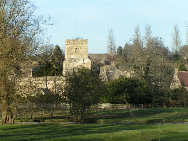
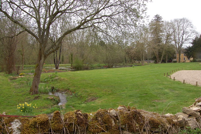
Coln St. Dennis is a civil parish located in the county of Gloucestershire, England. Situated in the picturesque Cotswolds, this small village is nestled along the banks of the River Coln. The parish is part of the Cotswold District and lies approximately 5 miles southeast of the market town of Cirencester.

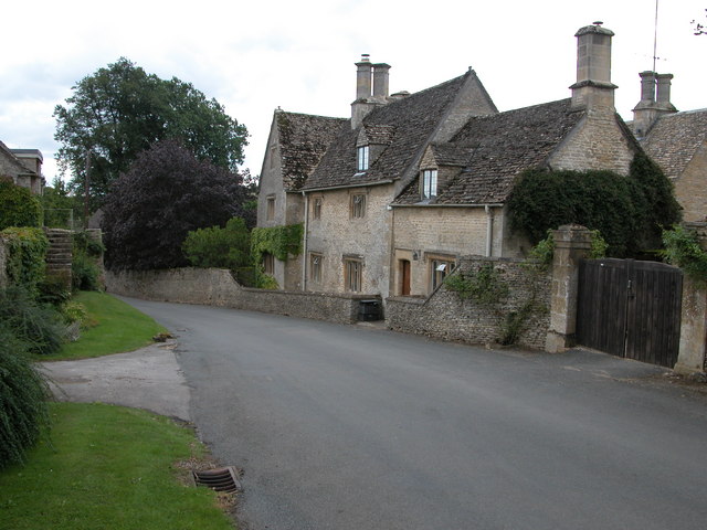
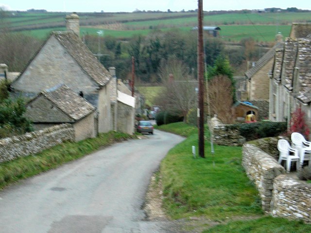
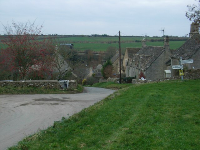
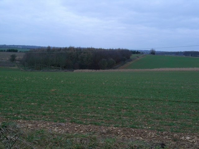
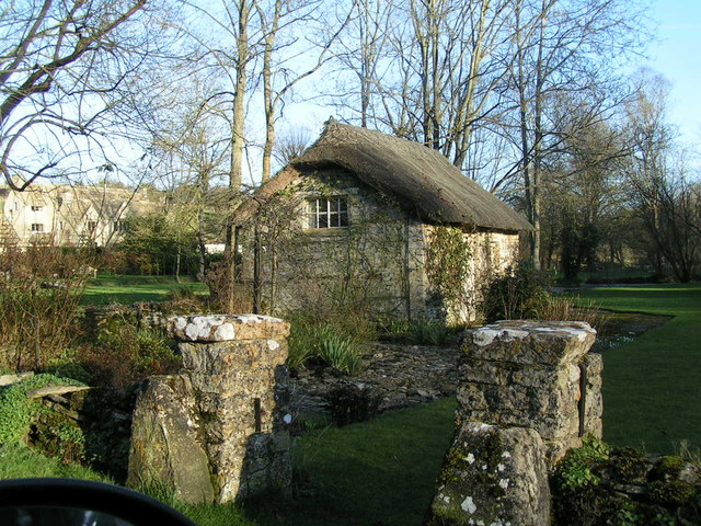
Coln St. Dennis is renowned for its natural beauty, with rolling hills and charming stone cottages dotting the landscape. The village itself is home to a tight-knit community, with a population of around 200 people. The parish also includes the hamlet of Fyfield, which adds to its rural character.

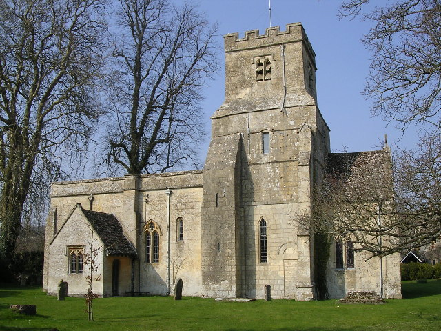
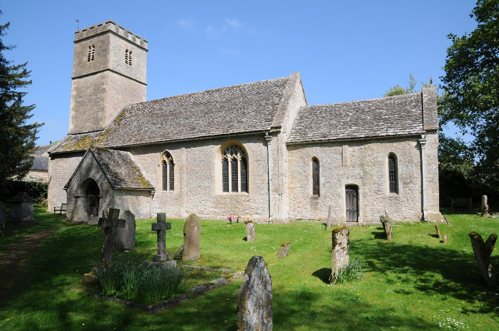
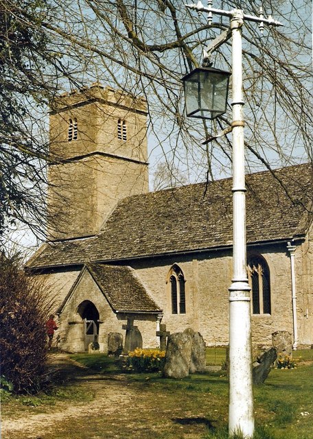
The centerpiece of Coln St. Dennis is its historic parish church, St. James the Great. Dating back to the 13th century, this Grade II listed building showcases stunning architectural features and serves as a focal point for both residents and visitors. The church hosts regular services and community events throughout the year.

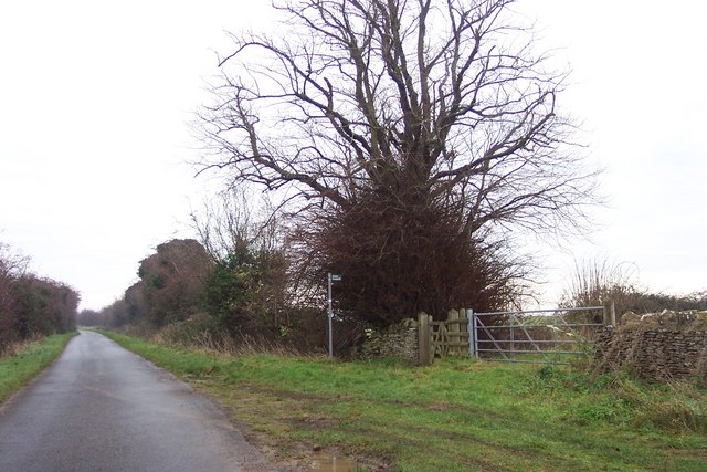
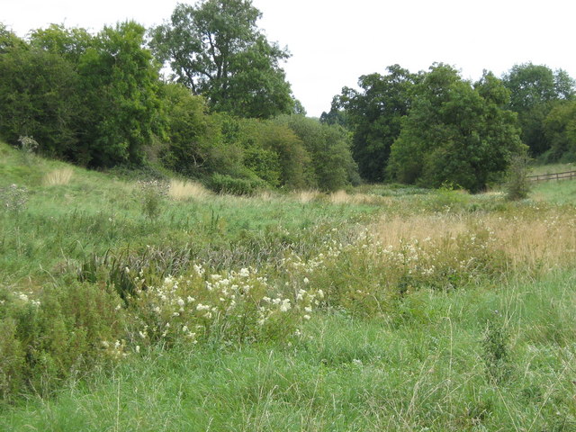
Nature lovers will find plenty to explore in Coln St. Dennis, with numerous walking trails and footpaths that wind through the surrounding countryside. The River Coln is a popular spot for fishing and attracts anglers from near and far.

Despite its small size, Coln St. Dennis offers a range of amenities for residents, including a village hall that hosts various social activities and gatherings. The village is also home to a traditional pub, providing a warm and welcoming atmosphere for locals and visitors alike.

In summary, Coln St. Dennis is a charming and idyllic civil parish in Gloucestershire's Cotswold District. Its natural beauty, historic church, and sense of community make it a truly special place to live or visit.

If you have any feedback on the listing, please let us know in the comments section below.

Coln St. Dennis Images

Images are sourced within 2km of 51.788631/-1.878618 or Grid Reference SP0810. Thanks to Geograph Open Source API. All images are credited.

Coln St. Denis church, St. James the Great A Norman church with a c15 top stage to the Norman tower
Coln St. Denis church, St. James the Great
A Norman church with a c15 top stage to the Norman tower
House in Coln St Dennis Cotswold stone house on the roadside in the village of Coln St Dennis.
House in Coln St Dennis
Cotswold stone house on the roadside in the village of Coln St Dennis.
Lower Chedworth Cottages below Pancakehill, Lower Chedworth.
Lower Chedworth
Cottages below Pancakehill, Lower Chedworth.
Field of wheat near Lower Chedworth View of farmland at SP073115 to the north east of Lower Chedworth.
Field of wheat near Lower Chedworth
View of farmland at SP073115 to the north east of Lower Chedworth.
Straw bales in stubble field, Fields Farm Field to the east of Fields Farm. Fields Farm can be seen in the background.
Straw bales in stubble field, Fields Farm
Field to the east of Fields Farm. Fields Farm can be seen in the background.
Calcot The village street.
Calcot
The village street.
Crossroads at Calcot
Tree plantation An isolated plantation, looking in the direction of Coln St Dennis.
Tree plantation
An isolated plantation, looking in the direction of Coln St Dennis.
Footpath starts here South-east towards Saltway Farm.
Footpath starts here
South-east towards Saltway Farm.
Wildflower meadow Wildflower meadows in a shallow valley near a brook.
Wildflower meadow
Wildflower meadows in a shallow valley near a brook.
Farmland near Lower Chedworth The farmland is probably part of Fields Farm and rises gently from the viewpoint at the gateway of the field.
Farmland near Lower Chedworth
The farmland is probably part of Fields Farm and rises gently from the viewpoint at the gateway of the field.
Thatched Shed
Thatched Shed
Coln St Dennis church
Ornamental lake and water features at Fossebridge
A429 at Fossebridge A 14% climb out of Fossebridge towards Cirencester.
A429 at Fossebridge
A 14% climb out of Fossebridge towards Cirencester.
A429 at Fossebridge A 14% climb out of Fossebridge towards Northleach.
A429 at Fossebridge
A 14% climb out of Fossebridge towards Northleach.
Looking down into Coln St. Dennis.
Coln St. Dennis. Around the middle of the village.
Coln St. Dennis.
Around the middle of the village.
Show me another place!

Coln St. Dennis is located at Grid Ref: SP0810 (Lat: 51.788631, Lng: -1.878618)

Administrative County: Gloucestershire

District: Cotswold

Police Authority: Gloucestershire

What 3 Words

///petrified.relieves.guardian. Near Northleach, Gloucestershire

Related Wikis

Church of St Andrew, Coln Rogers

The Anglican Church of St Andrew at Coln Rogers in the Cotswold District of Gloucestershire, England was built in the 11th century. It is a grade I listed...

Coln Rogers

Coln Rogers is a village and former civil parish, now in the parish of Coln St. Dennis, in the Cotswold district of the county of Gloucestershire, England...

Calcot, Gloucestershire

Calcot is a settlement in the English county of Gloucestershire. Calcot forms part of the civil parish of Coln St Dennis, within the Cotswold local government...

Church of St James, Coln St. Dennis

The Anglican Church of St James at Coln St. Dennis in the Cotswold District of Gloucestershire, England was built in the 12th century. It is a grade I...

Nearby Amenities

Located within 500m of 51.788631,-1.878618
Bus Stop
Upper Farm
Bus: yes
Naptan AtcoCode: 1600GL1419
Naptan Bearing: SW
Naptan CommonName: Upper Farm
Naptan NaptanCode: glogdapm
Naptan Street: Main Street
Naptan Verified: no
Public Transport: platform
Source: naptan_import
Lat/Long: 51.7848968/-1.8767889
Bus Stop
Upper Farm
Bus: yes
Naptan AtcoCode: 1600GL1420
Naptan Bearing: NE
Naptan CommonName: Upper Farm
Naptan Indicator: Opp
Naptan NaptanCode: glogdapg
Naptan Street: Main Street
Naptan Verified: no
Public Transport: platform
Source: naptan_import
Lat/Long: 51.7849239/-1.8768903
Bus Stop
Calcot Footpath
Bus: yes
Naptan AtcoCode: 1600GLC063
Naptan Bearing: S
Naptan CommonName: Calcot Footpath
Naptan NaptanCode: glogdata
Naptan Street: Coln St Dennis Road
Naptan Verified: no
Public Transport: platform
Source: naptan_import
Lat/Long: 51.7880693/-1.8754754
Bus Stop
Calcot Footpath
Bus: yes
Naptan AtcoCode: 1600GLC064
Naptan Bearing: N
Naptan CommonName: Calcot Footpath
Naptan Indicator: Opp
Naptan NaptanCode: glogdapt
Naptan Street: Coln St Dennis Road
Naptan Verified: no
Public Transport: platform
Source: naptan_import
Lat/Long: 51.7880155/-1.8755771
Telephone
Booth: K6
Covered: booth
Man Made: telephone_box
Phone: +44 01??? 720264
Lat/Long: 51.7849484/-1.8768509
Post Box
Post Box Type: lamp
Ref: GL54 304
Royal Cypher: EIIR
Royal Cypher Wikidata: Q33102113
Lat/Long: 51.789423/-1.872073
042
Ele: 117.165527
Wpt Description: G
Wpt Symbol: Trail Head
Lat/Long: 51.7887638/-1.8727667
Material: wood
Power: pole
Lat/Long: 51.7925587/-1.8820739
Material: wood
Power: pole
Lat/Long: 51.7916728/-1.8816769
Material: wood
Power: pole
Lat/Long: 51.7907893/-1.8812364
Material: wood
Power: pole
Lat/Long: 51.789901/-1.8808025
Material: wood
Power: pole
Lat/Long: 51.7891677/-1.8804646
Material: wood
Power: pole
Lat/Long: 51.7882336/-1.8800408
Material: wood
Power: pole
Lat/Long: 51.787341/-1.8796197
Material: wood
Power: pole
Lat/Long: 51.786756/-1.8829495
Material: wood
Power: pole
Lat/Long: 51.7876993/-1.8816206
Material: wood
Power: pole
Lat/Long: 51.7886368/-1.8802714
Material: wood
Power: pole
Lat/Long: 51.7890598/-1.8789142
Material: wood
Power: pole
Lat/Long: 51.7894663/-1.8775383
Material: wood
Power: pole
Lat/Long: 51.7898446/-1.8762079
Public Bookcase
Booth: K6
Colour: red
Disused Amenity: telephone
Man Made: telephone_box
Public Bookcase Type: phone_box
Lat/Long: 51.7894387/-1.87206
Material: wood
Power: pole
Lat/Long: 51.785518/-1.8787389
Material: wood
Power: pole
Lat/Long: 51.7914411/-1.8776713
Material: wood
Power: pole
Lat/Long: 51.7910118/-1.8790933
Material: wood
Power: pole
Lat/Long: 51.790677/-1.8802638
Material: wood
Power: pole
Lat/Long: 51.7862719/-1.8823166
Material: wood
Power: pole
Lat/Long: 51.7863227/-1.8812637
Material: wood
Power: pole
Lat/Long: 51.7863794/-1.8802133
Material: wood
Power: pole
Lat/Long: 51.7864319/-1.879191
The data included in this document is from www.openstreetmap.org. The data is made available under ODbL.

Have you been to Coln St. Dennis?

Leave your review of Coln St. Dennis below (or comments, questions and feedback).