Collingbourne Kingston

Civil Parish in Wiltshire

England

Collingbourne Kingston

Byway, Collingbourne Kingston A barn approached by the briefly northbound section of track.
Byway, Collingbourne Kingston Credit: Andrew Smith

Collingbourne Kingston is a civil parish located in the county of Wiltshire, England. It is situated in the picturesque countryside, approximately 9 miles southwest of Marlborough and 16 miles northeast of Salisbury.

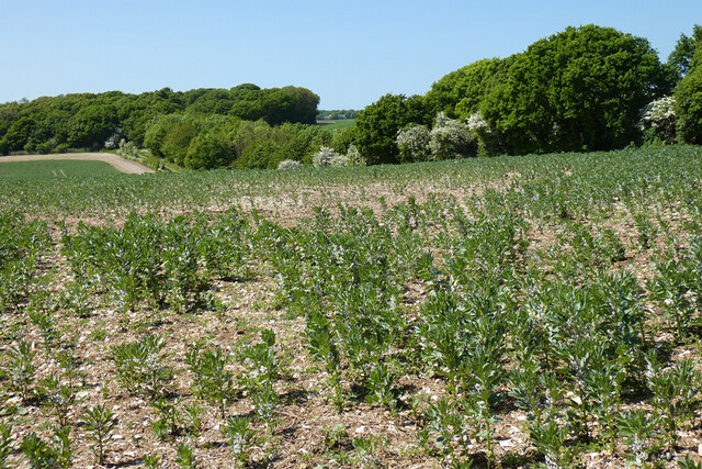
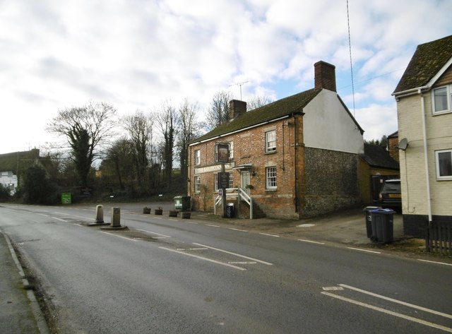
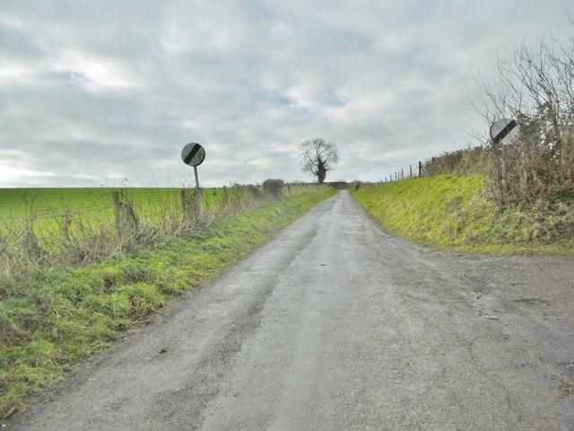
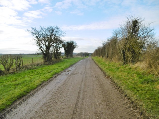
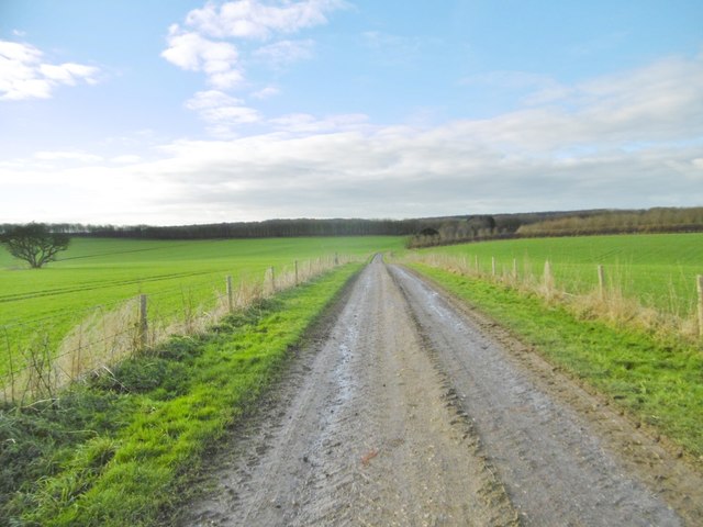
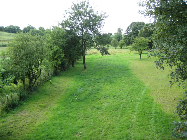
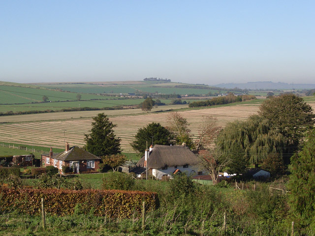
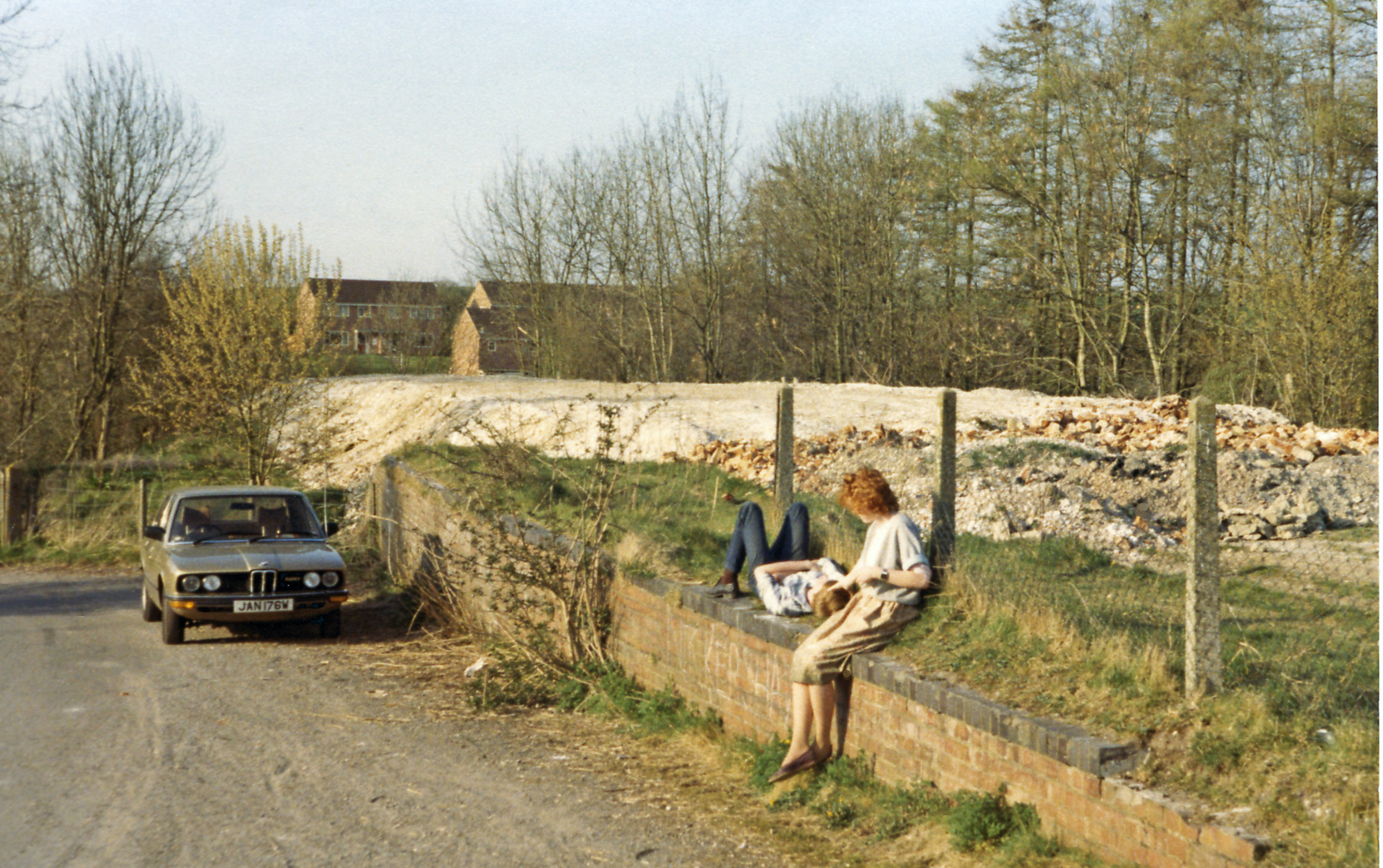
The parish is home to a small, close-knit community, with a population of around 800 residents. It is primarily a rural area, characterized by its rolling hills, green fields, and charming country lanes. The landscape is dotted with traditional, stone-built cottages, giving the village a quintessential English countryside feel.

Collingbourne Kingston is known for its rich history, with evidence of human habitation in the area dating back to the Bronze Age. The All Saints Church, a Grade I listed building, stands as a testament to the village's historic past. The church, originally built in the 12th century, underwent several renovations over the centuries and still serves as a place of worship today.

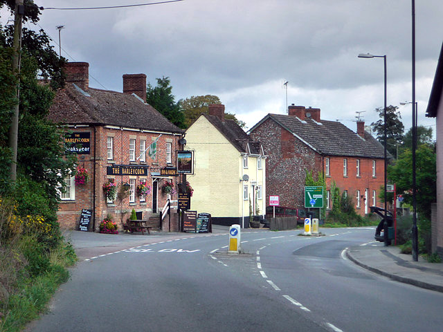
The village boasts a range of amenities and services for its residents, including a primary school, village hall, and a local pub. It is also well-connected to nearby towns and cities, with regular bus services and easy access to major road networks.

The surrounding countryside offers plenty of opportunities for outdoor activities, such as hiking, cycling, and horse riding. The nearby Collingbourne Woods also provide a tranquil spot for nature enthusiasts to explore.

Overall, Collingbourne Kingston is a charming and idyllic village, offering a peaceful and picturesque lifestyle for its residents.

If you have any feedback on the listing, please let us know in the comments section below.

Collingbourne Kingston Images

Images are sourced within 2km of 51.304074/-1.659231 or Grid Reference SU2356. Thanks to Geograph Open Source API. All images are credited.

Byway, Collingbourne Kingston A barn approached by the briefly northbound section of track.
Byway, Collingbourne Kingston
A barn approached by the briefly northbound section of track.
Pasture, Collingbourne Kingston Seen from the byway climbing onto the downs east of Brunton.
Pasture, Collingbourne Kingston
Seen from the byway climbing onto the downs east of Brunton.
Farmland, Collingbourne Kingston A crop of beans and the copse on Thornhill Down.
Farmland, Collingbourne Kingston
A crop of beans and the copse on Thornhill Down.
Collingbourne Kingston Village Hall On the lane to Brunton; complete with playground and playing field: <span class="nowrap"><a title="http://www.collingbournekingston.org.uk/VillageHallB.php" rel="nofollow ugc noopener" href="http://www.collingbournekingston.org.uk/VillageHallB.php">Link</a><img style="margin-left:2px;" alt="External link" title="External link - shift click to open in new window" src="https://s1.geograph.org.uk/img/external.png" width="10" height="10"/></span>
Collingbourne Kingston Village Hall
On the lane to Brunton; complete with playground and playing field: LinkExternal link
Collingbourne Kingston, St. Mary's Parish church overlooking Marlborough Road; dating from C13, listed by Historic England (Grade II*): <span class="nowrap"><a title="http://www.imagesofengland.org.uk/Details/Default.aspx?id=312359&mode=adv" rel="nofollow ugc noopener" href="http://www.imagesofengland.org.uk/Details/Default.aspx?id=312359&mode=adv">Link</a><img style="margin-left:2px;" alt="External link" title="External link - shift click to open in new window" src="https://s1.geograph.org.uk/img/external.png" width="10" height="10"/></span>
Collingbourne Kingston, St. Mary's
Parish church overlooking Marlborough Road; dating from C13, listed by Historic England (Grade II*): LinkExternal link
Collingbourne Kingston, Barleycorn Inn Public house with accommodation on Marlborough Road; early C19, listed by Historic England (Grade II): <span class="nowrap"><a title="http://www.imagesofengland.org.uk/Details/Default.aspx?id=312375&mode=adv" rel="nofollow ugc noopener" href="http://www.imagesofengland.org.uk/Details/Default.aspx?id=312375&mode=adv">Link</a><img style="margin-left:2px;" alt="External link" title="External link - shift click to open in new window" src="https://s1.geograph.org.uk/img/external.png" width="10" height="10"/></span> <span class="nowrap"><a title="http://www.barleycorninn.co.uk/" rel="nofollow ugc noopener" href="http://www.barleycorninn.co.uk/">Link</a><img style="margin-left:2px;" alt="External link" title="External link - shift click to open in new window" src="https://s1.geograph.org.uk/img/external.png" width="10" height="10"/></span>
Collingbourne Kingston, Barleycorn Inn
Public house with accommodation on Marlborough Road; early C19, listed by Historic England (Grade II): LinkExternal link LinkExternal link
Collingbourne Kingston, thatched cottages Norrie Cottage and Mayzells Cottage, on Marlborough Road; C17, listed by Historic England (Grade II): <span class="nowrap"><a title="http://www.imagesofengland.org.uk/Details/Default.aspx?id=312366&mode=adv" rel="nofollow ugc noopener" href="http://www.imagesofengland.org.uk/Details/Default.aspx?id=312366&mode=adv">Link</a><img style="margin-left:2px;" alt="External link" title="External link - shift click to open in new window" src="https://s1.geograph.org.uk/img/external.png" width="10" height="10"/></span>
Collingbourne Kingston, thatched cottages
Norrie Cottage and Mayzells Cottage, on Marlborough Road; C17, listed by Historic England (Grade II): LinkExternal link
Collingbourne Kingston, Mill Drove Lane from Marlborough Road to Parsonage Farm, becoming a byway towards Everleigh.
Collingbourne Kingston, Mill Drove
Lane from Marlborough Road to Parsonage Farm, becoming a byway towards Everleigh.
Collingbourne Kingston, Parsonage Farm Cattle farm on Mill Drove.
Collingbourne Kingston, Parsonage Farm
Cattle farm on Mill Drove.
Collingbourne Kingston, cattle shed At Parsonage Farm.
Collingbourne Kingston, cattle shed
At Parsonage Farm.
Collingbourne Kingston, farm road After Parsonage Farm, Mill Drove continues, to serve a barn, before becoming a byway heading towards Everleigh.
Collingbourne Kingston, farm road
After Parsonage Farm, Mill Drove continues, to serve a barn, before becoming a byway heading towards Everleigh.
Collingbourne Kingston, barn At the end of Mill Drove. Like others nearby, the barn is choc-a-bloc with straw.
Collingbourne Kingston, barn
At the end of Mill Drove. Like others nearby, the barn is choc-a-bloc with straw.
Collingbourne Kingston, byway Byway and farm road, the continuation of Mill Drove, heading towards Everleigh.
Collingbourne Kingston, byway
Byway and farm road, the continuation of Mill Drove, heading towards Everleigh.
Collingbourne Kingston, barn On the byway towards Everleigh; like others nearby, choc-a-bloc with bales.
Collingbourne Kingston, barn
On the byway towards Everleigh; like others nearby, choc-a-bloc with bales.
Collingbourne Kingston, bird feeder Next to a copse on the byway to the village. Patches of woodland in the area are rich in feeders, and pheasants and partridges often seen.
Collingbourne Kingston, bird feeder
Next to a copse on the byway to the village. Patches of woodland in the area are rich in feeders, and pheasants and partridges often seen.
Collingbourne Kingston, byway The continuation of Mill Drove, across cropland towards Everleigh.
Collingbourne Kingston, byway
The continuation of Mill Drove, across cropland towards Everleigh.
Aughton, byway From Falstone Pond to the hamlet.
Aughton, byway
From Falstone Pond to the hamlet.
Aughton, barn Full of bales for winter feeding.
Aughton, barn
Full of bales for winter feeding.
Show me another place!

Collingbourne Kingston is located at Grid Ref: SU2356 (Lat: 51.304074, Lng: -1.659231)

Unitary Authority: Wiltshire

Police Authority: Wiltshire

What 3 Words

///replayed.hazy.evolving. Near Collingbourne Kingston, Wiltshire

Related Wikis

Aughton, Wiltshire

Aughton is a hamlet adjacent to the village of Collingbourne Kingston in Wiltshire, England. Aughton took its name from Aeffe, the owner in the 10th century...

Collingbourne Kingston Halt railway station

Collingbourne Kingston Halt was a small railway station that served the village of Collingbourne Kingston in Wiltshire, England for less than 30 years...

Collingbourne Kingston

Collingbourne Kingston is a village and civil parish about 8 miles (13 km) south of the market town of Marlborough in Wiltshire, England. The village,...

Brunton House

Brunton House is a Grade II* listed house in Brunton, Wiltshire, England. It dates from the late seventeenth or early eighteenth centuries and is of brick...

Brunton, Wiltshire

Brunton is a hamlet adjacent to the village of Collingbourne Kingston in Wiltshire, England. Records of Brunton's existence date back to the 10th century...

Collingbourne railway station

Collingbourne railway station served the village of Collingbourne Ducis in Wiltshire, England. It was on the Midland and South Western Junction Railway...

Collingbourne Ducis

Collingbourne Ducis is a village and civil parish on Salisbury Plain in Wiltshire, England, about 10 miles (16 km) south of Marlborough. It is one of several...

Everleigh, Wiltshire

Everleigh, pronounced and also sometimes spelt Everley, is a village and civil parish in east Wiltshire, England, about 4+1⁄2 miles (7 km) southeast of...

Nearby Amenities

Located within 500m of 51.304074,-1.659231
Mini Roundabout
Direction: clockwise
Lat/Long: 51.3016277/-1.658402
Collingbourne Kingston
Is In: Wiltshire, England, UK
Place: village
Lat/Long: 51.3017763/-1.6577196
Maxspeed: 30 mph
Traffic Sign: maxspeed
Lat/Long: 51.306394/-1.6601164
Aughton
Place: hamlet
Source: NPE
Wikidata: Q4820386
Lat/Long: 51.3058342/-1.6576925
Post Box
Collection Times: Mo-Fr 16:00; Sa 10:00
Operator: Royal Mail
Operator Wikidata: Q638098
Post Box Type: lamp
Ref: SN8 68
Royal Cypher: EIIR
Royal Cypher Wikidata: Q33102113
Lat/Long: 51.3015002/-1.6583267
Historic: memorial
Memorial: war_memorial
Lat/Long: 51.3007875/-1.6583374
Barrier: kissing_gate
Lat/Long: 51.3002113/-1.6566222
Post Box
Collection Times: Mo-Fr 09:00; Sa 07:00
Operator: Royal Mail
Operator Wikidata: Q638098
Post Box Type: lamp
Ref: SN8 58D
Royal Cypher: EIIR
Royal Cypher Wikidata: Q33102113
Lat/Long: 51.3060969/-1.6595795
AED
Defibrillator
Defibrillator Location: On outside wall of The Barleycorn Pub on corner next to road
Emergency: defibrillator
Lat/Long: 51.3004115/-1.6592267
The data included in this document is from www.openstreetmap.org. The data is made available under ODbL.

Have you been to Collingbourne Kingston?

Leave your review of Collingbourne Kingston below (or comments, questions and feedback).