Coberley

Civil Parish in Gloucestershire Cotswold

England

Coberley

Path and fence line
Path and fence line Credit: don cload

Coberley is a civil parish located in the county of Gloucestershire, England. Situated near the Cotswold Hills, it covers an area of approximately 8 square miles. The parish consists of a small cluster of settlements, including the main village of Coberley, as well as the hamlets of Cowley, Coberley Mill, and Colesborne.

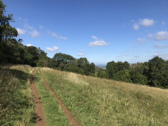
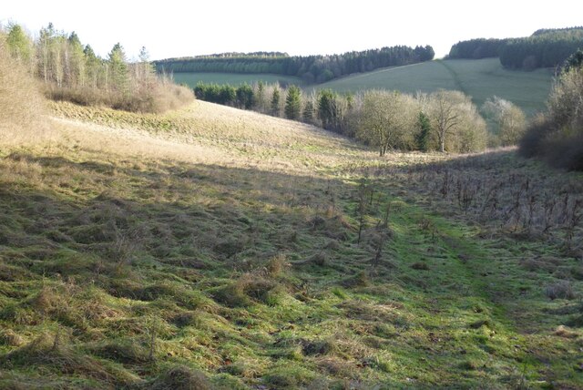
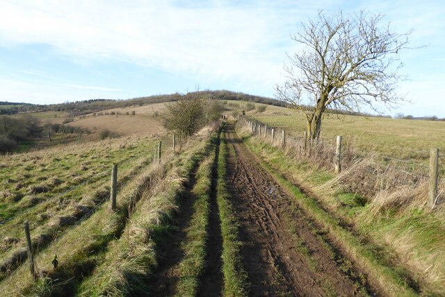
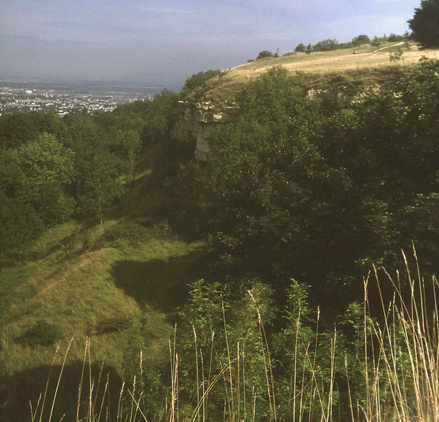
Coberley is known for its picturesque countryside and charming rural character. The landscape is dominated by rolling hills, green pastures, and dense woodlands, offering stunning views and ample opportunities for outdoor activities such as hiking, cycling, and horseback riding. The area is also home to various species of wildlife, making it a popular destination for nature enthusiasts.

The village of Coberley itself is steeped in history, with several historical landmarks and buildings. One notable feature is the parish church of St. Giles, a Grade I listed building dating back to the 12th century. The church boasts impressive architectural features, including a Norman doorway and a medieval font.

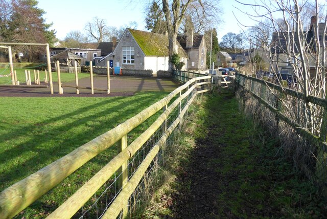
In terms of amenities, Coberley offers limited facilities, with a small primary school and a village hall serving as the community hub. Residential properties in the area mainly consist of traditional Cotswold stone cottages, adding to the overall charm and character of the village.

Overall, Coberley, Gloucestershire, is a peaceful and idyllic rural parish, offering residents and visitors alike a tranquil escape from the hustle and bustle of city life.

If you have any feedback on the listing, please let us know in the comments section below.

Coberley Images

Images are sourced within 2km of 51.846061/-2.057832 or Grid Reference SO9616. Thanks to Geograph Open Source API. All images are credited.

Path and fence line
Path and fence line
Stubble by the Cotswold Way
Open land
Open land
Disused quarry
Disused quarry
Manx Loaghtan sheep Manx Loaghtan sheep in a field at Coberley.
Manx Loaghtan sheep
Manx Loaghtan sheep in a field at Coberley.
Manx Loaghtan sheep Manx Loaghtan sheep in a field at Coberley.
Manx Loaghtan sheep
Manx Loaghtan sheep in a field at Coberley.
Manx Loaghtan sheep Manx Loaghtan sheep in a field at Coberley.
Manx Loaghtan sheep
Manx Loaghtan sheep in a field at Coberley.
The Gloucestershire Way The Gloucestershire Way crossing a field between forestry and entering the valley above Coberley known as Coldwell Bottom.
The Gloucestershire Way
The Gloucestershire Way crossing a field between forestry and entering the valley above Coberley known as Coldwell Bottom.
Coldwell Bottom The Gloucestershire Way long distance footpath follows this path above the valley on the right which is called Coldwell Bottom.
Coldwell Bottom
The Gloucestershire Way long distance footpath follows this path above the valley on the right which is called Coldwell Bottom.
Path and gate above Coldwell Bottom The Gloucestershire Way follows this right of way above Coldwell Bottom.
Path and gate above Coldwell Bottom
The Gloucestershire Way follows this right of way above Coldwell Bottom.
Coldwell Bottom View across Coldwell Bottom to the Churn valley beyond, from the Gloucestershire Way.
Coldwell Bottom
View across Coldwell Bottom to the Churn valley beyond, from the Gloucestershire Way.
Gloucestershire Way Gloucestershire Way with Coldwell Bottom below on the left.
Gloucestershire Way
Gloucestershire Way with Coldwell Bottom below on the left.
A junction of paths The right of way on the left passing through the gate is the route of the Gloucestershire Way, alternatively there is a right of way on the right which eventually rejoins the Gloucestershire Way.
A junction of paths
The right of way on the left passing through the gate is the route of the Gloucestershire Way, alternatively there is a right of way on the right which eventually rejoins the Gloucestershire Way.
A junction of rights of way Continuing along this right of way passes Cuckoopen Barn Farm.  The path on the left, out of view is the route of the Gloucestershire Way.  This is almost exactly the same view as when I was last here almost fourteen years ago to the day <a href="https://www.geograph.org.uk/photo/653006">SO9515 : Footpath junction near Coberley</a>.
A junction of rights of way
Continuing along this right of way passes Cuckoopen Barn Farm. The path on the left, out of view is the route of the Gloucestershire Way. This is almost exactly the same view as when I was last here almost fourteen years ago to the day SO9515 : Footpath junction near Coberley.
The Gloucestershire Way The Gloucestershire Way to the west of Coberley and above Coldwell Bottom which is out of view on the left.
The Gloucestershire Way
The Gloucestershire Way to the west of Coberley and above Coldwell Bottom which is out of view on the left.
Dowman's Farm Dowman's Farm in the village of Coberley.
Dowman's Farm
Dowman's Farm in the village of Coberley.
Footpath approaching Dowman's Farm Footpath crossing field approaching Dowman's Farm at Coberley.
Footpath approaching Dowman's Farm
Footpath crossing field approaching Dowman's Farm at Coberley.
Footpath passing Coberley School Footpath passing Coberley Primary School.
Footpath passing Coberley School
Footpath passing Coberley Primary School.
Show me another place!

Coberley is located at Grid Ref: SO9616 (Lat: 51.846061, Lng: -2.057832)

Administrative County: Gloucestershire

District: Cotswold

Police Authority: Gloucestershire

What 3 Words

///that.intruding.releasing. Near Charlton Kings, Gloucestershire

Related Wikis

Coberley

Coberley is a village and civil parish in the Cotswold District of Gloucestershire in England, 4 miles (6.4 km) south of Cheltenham. It lies at the confluence...

Seven Springs, Gloucestershire

Seven Springs is a hamlet in the heavily wooded parish of Coberley in the Cotswold District of Gloucestershire in England, 4 miles (6.4 km) south of Cheltenham...

Cowley, Gloucestershire

Cowley is a village and civil parish in the Cotswold District of Gloucestershire, England. It lies between the A417 and A435 roads between Cheltenham...

National Star College

The National Star College (previously known as the Star Centre) is an independent specialist further education college for people with physical disabilities...

Ullenwood

Ullenwood is a village in the Coberley civil parish, near Cheltenham in Gloucestershire. It is the site of a formerly secret civil defence bunker intended...

Devil's Chimney (Gloucestershire)

The Devil's Chimney is a limestone rock formation that stands above a disused quarry in Leckhampton, near Cheltenham, Gloucestershire, England. It is named...

Leckhampton Hill and Charlton Kings Common

Leckhampton Hill and Charlton Kings Common (grid reference SO952187) is a 63.8-hectare (158-acre) biological and geological Site of Special Scientific...

The Air Balloon, Birdlip

The Air Balloon is a road junction and former pub Birdlip, Gloucestershire, England. The junction is on the A417 at a significant congestion point. The...

Nearby Amenities

Located within 500m of 51.846061,-2.057832
Coberley
Is In: Gloucestershire, England, UK
Place: village
Source: NPE
Lat/Long: 51.843072/-2.0560231
Bus Stop
The Old Rectory
Bus: yes
Naptan AtcoCode: 1600GL1385
Naptan Bearing: W
Naptan CommonName: The Old Rectory
Naptan Indicator: Opp
Naptan NaptanCode: glodtwma
Naptan Street: Main Street
Naptan Verified: no
Public Transport: platform
Source: naptan_import
Lat/Long: 51.8426809/-2.0556967
Bus Stop
The Old Rectory
Bus: yes
Naptan AtcoCode: 1600GL1386
Naptan Bearing: SE
Naptan CommonName: The Old Rectory
Naptan NaptanCode: glodtwmp
Naptan Street: Main Street
Naptan Verified: no
Public Transport: platform
Source: naptan_import
Lat/Long: 51.842717/-2.0554645
Bus Stop
Close Farm
Bus: yes
Naptan AtcoCode: 1600GLS945
Naptan Bearing: SW
Naptan CommonName: Close Farm
Naptan NaptanCode: glodtpjt
Naptan Street: Cowley Ln
Naptan Verified: no
Public Transport: platform
Source: naptan_import
Lat/Long: 51.8420857/-2.059801
Bus Stop
Close Farm
Bus: yes
Naptan AtcoCode: 1600GLS946
Naptan Bearing: N
Naptan CommonName: Close Farm
Naptan NaptanCode: glodtpjd
Naptan Street: Cowley Ln
Naptan Verified: no
Public Transport: platform
Source: naptan_import
Lat/Long: 51.8420134/-2.060065
Post Box
Brand: Royal Mail
Brand Wikidata: Q638098
Collection Times: Mo-Fr 09:00; Sa 07:00; Su off
Drive Through: no
Note: Previously ref was mapped as GL53 40, but that's certainly not what the plate says as of 14/12/2019. GL53 40 appears to be mapped correctly in Leckhampton. https://www.openstreetmap.org/node/511081865
Operator: Royal Mail
Operator Wikidata: Q638098
Post Box Type: wall
Ref: GL53 182D
Royal Cypher: GR
Royal Cypher Wikidata: Q33102273
Source: survey
Lat/Long: 51.8427299/-2.0558967
Public Bookcase
Defibrillator
Booth: K6
Colour: red
Defibrillator Location: inside red phone box (that is now used as book exchage) in Coberley
Disused Amenity: telephone
Emergency: defibrillator
Man Made: telephone_box
Public Bookcase Type: phone_box
Lat/Long: 51.8429081/-2.0556834
Barrier: kissing_gate
Lat/Long: 51.8421076/-2.0561756
Barrier: stile
Lat/Long: 51.8478509/-2.0537106
Barrier: kissing_gate
Lat/Long: 51.8426694/-2.0559168
Fixme: incomplete
Lat/Long: 51.8436587/-2.0563392
Parking
Rest Area
Parking: layby
Source: video_survey; gps_survey
Lat/Long: 51.8486358/-2.054591
Barrier: kissing_gate
Foot: yes
Lat/Long: 51.8432344/-2.0575329
Barrier: kissing_gate
Foot: yes
Lat/Long: 51.8432642/-2.0571599
Barrier: cattle_grid
Note: Gate and Cattle Grid - access discouraged by sign saying Private Land
Lat/Long: 51.8438483/-2.0621211
HE Ref: 1152694
Description: CROSS ON THE VILLAGE GREEN
Historic: wayside_cross
Listed Status: Grade II
Lat/Long: 51.8431003/-2.0564027
Town End
Place: locality
Source Name: OS_OpenData_StreetView
Lat/Long: 51.8432219/-2.0633
Hamblins Cottages
Note: Not clear which buildings
Place: locality
Source Name: OS_OpenData_StreetView
Lat/Long: 51.8439941/-2.0569217
Barrier: kissing_gate
Lat/Long: 51.8485777/-2.0551344
Golf: pin
Lat/Long: 51.8486964/-2.0636332
Golf: pin
Lat/Long: 51.847749/-2.063593
Advertising: board
Lat/Long: 51.8428077/-2.0555824
Power: pole
Lat/Long: 51.8422433/-2.0539767
Coberley School
Power: pole
Transformer: distribution
Voltage Primary: 11000
Lat/Long: 51.8435442/-2.0560265
Power: pole
Lat/Long: 51.8431606/-2.0543012
Power: pole
Lat/Long: 51.8437513/-2.0541054
Coberley Grange
Power: pole
Transformer: distribution
Voltage Primary: 11000
Lat/Long: 51.8443537/-2.0601819
Power: pole
Lat/Long: 51.8441498/-2.0573844
Power: pole
Lat/Long: 51.8441188/-2.0558944
Power: pole
Lat/Long: 51.8448657/-2.0551032
Power: pole
Lat/Long: 51.845637/-2.0548926
Power: pole
Lat/Long: 51.8440993/-2.0552514
Power: pole
Lat/Long: 51.8464614/-2.0546526
Power: pole
Lat/Long: 51.8470969/-2.0540679
Power: pole
Lat/Long: 51.8477895/-2.0536481
Power: pole
Lat/Long: 51.8478953/-2.0522195
The data included in this document is from www.openstreetmap.org. The data is made available under ODbL.

Have you been to Coberley?

Leave your review of Coberley below (or comments, questions and feedback).