Clive

Civil Parish in Shropshire

England

Clive

Alderton A short road cutting out a crossroads.
Alderton Credit: Richard Webb

Clive is a civil parish located in the county of Shropshire, England. It is situated approximately 6 miles southeast of the town of Shrewsbury and covers an area of around 5 square miles. The parish is predominantly rural, with a population of around 400 people.

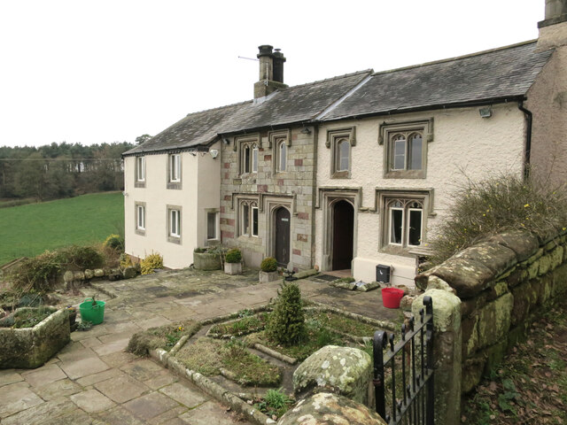
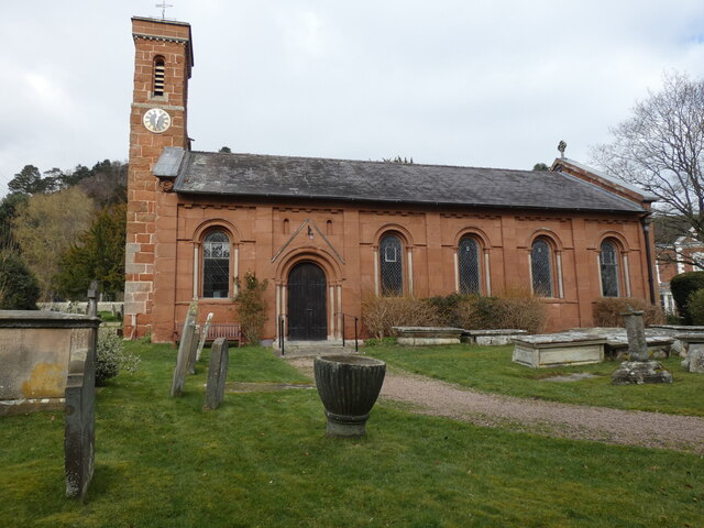
The village of Clive itself is small but picturesque, with a charming mix of traditional cottages and modern houses. The heart of the village is centered around the St. Mary's Church, a beautiful medieval church that dates back to the 12th century. The church is a notable landmark in the area and attracts visitors from both near and far.

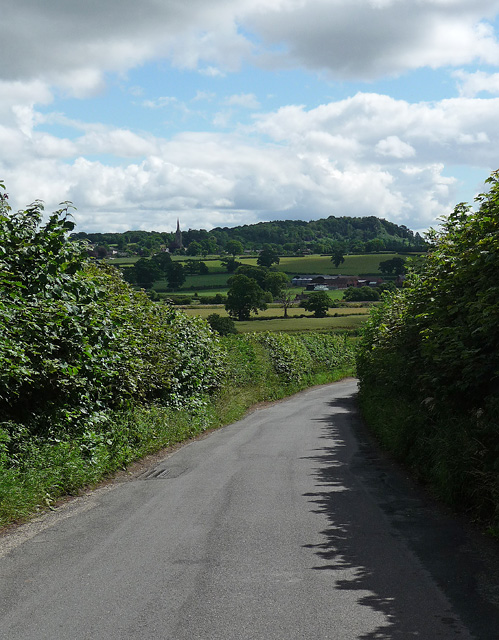
The parish is surrounded by stunning countryside, with rolling hills and fields providing breathtaking views. It is an ideal location for outdoor enthusiasts, with plenty of walking and cycling routes to explore. The nearby River Severn also offers opportunities for fishing and boating.

Despite its rural setting, Clive is well-connected to larger towns and cities. The A5 road runs nearby, providing easy access to Shrewsbury and Telford. The village also has a regular bus service, linking it to surrounding areas.

Local amenities in Clive include a village hall, a primary school, and a pub, providing a sense of community for residents. The area is known for its agricultural heritage, with farming playing a significant role in the local economy.

Overall, Clive is a peaceful and idyllic parish that offers a tranquil countryside escape while still being within easy reach of larger urban areas.

If you have any feedback on the listing, please let us know in the comments section below.

Clive Images

Images are sourced within 2km of 52.815969/-2.723992 or Grid Reference SJ5124. Thanks to Geograph Open Source API. All images are credited.

Alderton A short road cutting out a crossroads.
Alderton
A short road cutting out a crossroads.
Farmland, Alderton Arable land with most hedges partly removed.
Farmland, Alderton
Arable land with most hedges partly removed.
Broughton Farm from B5476
Crossroads at Alderton
Old Forge House, Clive
Smooth cut sandstone This wide cutting may have been for the easy removal of the quarried stone down to the road at Grinshill.

Many local buildings where made with stone from here, including the railway station at nearby Shrewsbury. <a title="https://www.geograph.org.uk/photo/5052456" href="https://www.geograph.org.uk/photo/5052456">Link</a>
Smooth cut sandstone
This wide cutting may have been for the easy removal of the quarried stone down to the road at Grinshill. Many local buildings where made with stone from here, including the railway station at nearby Shrewsbury. Link
The Railway Inn, Yorton Now closed.
The Railway Inn, Yorton
Now closed.
Land near Sansaw
Land near Sansaw
Houses between Clive and Grinshill
Stone trig pillar
Stone trig pillar
Clive, Station Road
Clive, Station Road
All Saint’s Church in the lovely village of Grinshill A well-placed bench in the churchyard provided this view of the church. An interesting tower housing a long pendulum clock, and note the tremendous gargoyles at either end of the roof!
All Saint’s Church in the lovely village of Grinshill
A well-placed bench in the churchyard provided this view of the church. An interesting tower housing a long pendulum clock, and note the tremendous gargoyles at either end of the roof!
Sheep grazing near Bilmarsh The woodland beyond is Broughton Gorse.
Sheep grazing near Bilmarsh
The woodland beyond is Broughton Gorse.
Too muddy to walk along today
Farm buildings at Alderton
Track into Alderton
Track into Alderton
Country road near Yorton The church spire is in Clive.
The wooded hill beyond is The Cliff at Grinshill.
Though not really discernible the railway between Shrewsbury and Wem runs a little way in front of the silos.
Country road near Yorton
The church spire is in Clive. The wooded hill beyond is The Cliff at Grinshill. Though not really discernible the railway between Shrewsbury and Wem runs a little way in front of the silos.
Beacon & Trig Point at Grinshill
Show me another place!

Clive is located at Grid Ref: SJ5124 (Lat: 52.815969, Lng: -2.723992)

Unitary Authority: Shropshire

Police Authority: West Mercia

What 3 Words

///date.spoon.hires. Near Clive, Shropshire

Nearby Locations

Clive Clive

Related Wikis

Clive, Shropshire

Clive is a village and civil parish in Shropshire, England, United Kingdom. Clive is situated around the west side of Grinshill Hill. Grinshill sandstone...

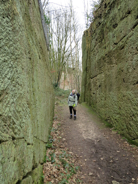
Corbet Wood and Grinshill

Corbet Wood Countryside Heritage Site and Grinshill Site is a mixture of a woodland and quarrying site in Shropshire. It has been designated a SSSI due...

Yorton

Yorton is a small village in Shropshire, England, north of the county town of Shrewsbury and south of the town of Wem. == Governance == Yorton is represented...

Yorton railway station

Yorton railway station serves the villages of Yorton and Clive in Shropshire, England. It is 7¼ miles (11.5 km) north of Shrewsbury on the Welsh Marches...

Nearby Amenities

Located within 500m of 52.815969,-2.723992
Clive
Place: village
Wikidata: Q2254403
Lat/Long: 52.8136122/-2.721145
Post Box
Post Box Mounting: brick_pillar
Post Box Type: wall
Lat/Long: 52.8136202/-2.7247504
Defibrillator
Defibrillator Location: inside front porch of Clive Village Hall
Emergency: defibrillator
Lat/Long: 52.8121918/-2.7223048
Addr Housename: Cornerstone
Addr Street: High Street
Lat/Long: 52.8137088/-2.7224375
The data included in this document is from www.openstreetmap.org. The data is made available under ODbL.

Have you been to Clive?

Leave your review of Clive below (or comments, questions and feedback).