Clifford Chambers and Milcote

Civil Parish in Gloucestershire Stratford-on-Avon

England

Clifford Chambers and Milcote

The B4632 passing Willicote Farm
The B4632 passing Willicote Farm Credit: Philip Halling

Clifford Chambers and Milcote are two neighboring villages located in the county of Gloucestershire, England. They form a civil parish within the Stratford-on-Avon district. The villages are situated on the banks of the River Stour, just a few miles south-west of the historic town of Stratford-upon-Avon.

Clifford Chambers is the larger of the two villages and is known for its picturesque countryside and charming cottages. The village dates back to medieval times, and its architecture reflects this rich history. There are several notable landmarks in Clifford Chambers, including the 12th-century St. Helen's Church and Clifford Manor, a historic manor house that dates back to the 15th century.

Milcote, on the other hand, is a smaller village that lies adjacent to Clifford Chambers. It is primarily a residential area and is known for its quiet and serene atmosphere. The village is home to a mix of old and new houses, with some dating back to the 17th century. Milcote is also famous for its connection to the renowned playwright William Shakespeare. The village is believed to be the birthplace of Shakespeare's mother, Mary Arden.

Both Clifford Chambers and Milcote offer a peaceful and idyllic setting, surrounded by rolling hills and lush green fields. The villages provide a close-knit community feel and are popular with residents who enjoy a rural lifestyle. With their close proximity to Stratford-upon-Avon, residents have easy access to a range of amenities, including shops, schools, and cultural attractions. The area is also well-connected by road and public transport, making it an attractive location for commuters.

If you have any feedback on the listing, please let us know in the comments section below.

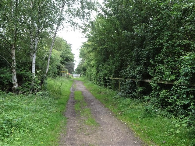
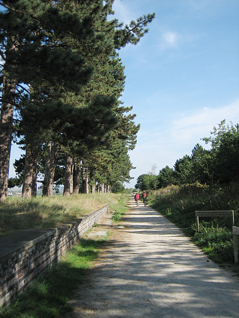
Clifford Chambers and Milcote Images

Images are sourced within 2km of 52.162856/-1.726013 or Grid Reference SP1851. Thanks to Geograph Open Source API. All images are credited.

The B4632 passing Willicote Farm
Shakespeare's Way Shakespeare's Way following Clifford Lane towards Clifford Mill
Shakespeare's Way
Shakespeare's Way following Clifford Lane towards Clifford Mill
Shakespeare's Way Shakespeare's Way heading away from Forge Farm cuts left after the gate towards Clifford Chambers
Shakespeare's Way
Shakespeare's Way heading away from Forge Farm cuts left after the gate towards Clifford Chambers
Shakespeare's Way Shakespeare's Way heading to Atherstone on Stour
Shakespeare's Way
Shakespeare's Way heading to Atherstone on Stour
Former railway bridge carries cycle route 5 and the Monarch's Way across the River Avon
Farmland below Clifford Hill Farm Farmland below Clifford Hill Farm which can be seen on the left on the rising ground.  Broad beans are being grown in the field in the foreground.
Farmland below Clifford Hill Farm
Farmland below Clifford Hill Farm which can be seen on the left on the rising ground. Broad beans are being grown in the field in the foreground.
Farmland at Clifford Chambers Farmland at Clifford Chambers beside the B4632.  The crop being grown here is broad beans.
Farmland at Clifford Chambers
Farmland at Clifford Chambers beside the B4632. The crop being grown here is broad beans.
Road to Preston-on-Stour Unfenced country road to Preston-on-Stour, a crop of broad beans is growing in the field on the right.
Road to Preston-on-Stour
Unfenced country road to Preston-on-Stour, a crop of broad beans is growing in the field on the right.
View south from Atherstone Hill The Cotswold Hills can be seen on the horizon, Ilmington Down on the left and Meon Hill on the right.
View south from Atherstone Hill
The Cotswold Hills can be seen on the horizon, Ilmington Down on the left and Meon Hill on the right.
Disused railway line from Stratford-upon-Avon to Honeybourne Aerial photograph. River Avon to right of line in this image. Railway was the ex-GWR route from Stratford-upon-Avon to Cheltenham via Honeybourne.
Disused railway line from Stratford-upon-Avon to Honeybourne
Aerial photograph. River Avon to right of line in this image. Railway was the ex-GWR route from Stratford-upon-Avon to Cheltenham via Honeybourne.
The Greenway One of the many benches along the Greenway to stop and rest.
Stood by the bench is my new bicycle, a GT Traffic 1.0 hybrid, with 24 gears and hydraulic disc brakes, on its first Geograph outing.
Note the GPS60 on its handlebar mount.
The Greenway
One of the many benches along the Greenway to stop and rest. Stood by the bench is my new bicycle, a GT Traffic 1.0 hybrid, with 24 gears and hydraulic disc brakes, on its first Geograph outing. Note the GPS60 on its handlebar mount.
Clifford Chambers Village Cottage by the church.
Clifford Chambers Village
Cottage by the church.
Atherstone Hill Farmland From near Atherstone Farm.
Atherstone Hill Farmland
From near Atherstone Farm.
Clifford Chambers Farmland Looking south west.
Clifford Chambers Farmland
Looking south west.
Disused Railway Bridge The derelict half of the former railway bridge that took the Stratford-Upon-Avon - Honeybourne line across the River Avon. The adjacent half of the bridge has concrete decking and is in use as part of the footpath using the former trackbed.
Disused Railway Bridge
The derelict half of the former railway bridge that took the Stratford-Upon-Avon - Honeybourne line across the River Avon. The adjacent half of the bridge has concrete decking and is in use as part of the footpath using the former trackbed.
Steel Girder Bridge Former Railway bridge crossing the River Avon south of the racecourse. The railway was closed in 1976 between Stratford-Upon-Avon Long Marston where a spur from Honeybourne survived serving the military complex at Long Marston airfield. The trackbed is now a foot / cycle route.
Steel Girder Bridge
Former Railway bridge crossing the River Avon south of the racecourse. The railway was closed in 1976 between Stratford-Upon-Avon Long Marston where a spur from Honeybourne survived serving the military complex at Long Marston airfield. The trackbed is now a foot / cycle route.
Milcote 1st railway station (site), Warwickshire Opened in 1859 by the Oxford Worcester and Wolverhampton Railway, later part of the Great Western Railway, on what became the line from Cheltenham to Stratford-upon-Avon, this station closed in 1966.
View north towards the later station, also Chambers Crossing Halt and Stratford-upon-Avon. The single 1859 platform and station building would have been to the right of the image, the 1908 platforms were on the far side of the level crossing, beyond the gate. The track-bed is now a path and bridleway.
Milcote 1st railway station (site), Warwickshire
Opened in 1859 by the Oxford Worcester and Wolverhampton Railway, later part of the Great Western Railway, on what became the line from Cheltenham to Stratford-upon-Avon, this station closed in 1966. View north towards the later station, also Chambers Crossing Halt and Stratford-upon-Avon. The single 1859 platform and station building would have been to the right of the image, the 1908 platforms were on the far side of the level crossing, beyond the gate. The track-bed is now a path and bridleway.
Milcote 2nd railway station (site), Warwickshire Opened in 1908 by the Great Western Railway, on the line from Cheltenham to Stratford-upon-Avon, this station replaced an earlier one situated immediately behind the camera position. In turn, this station closed in 1966.
View north from the former level crossing towards Chambers Crossing Halt and Stratford-upon-Avon. The northbound platform was still in situ, just beyond the fencing, when this image was taken. The track-bed is now a path and bridleway.
Milcote 2nd railway station (site), Warwickshire
Opened in 1908 by the Great Western Railway, on the line from Cheltenham to Stratford-upon-Avon, this station replaced an earlier one situated immediately behind the camera position. In turn, this station closed in 1966. View north from the former level crossing towards Chambers Crossing Halt and Stratford-upon-Avon. The northbound platform was still in situ, just beyond the fencing, when this image was taken. The track-bed is now a path and bridleway.
Show me another place!

Clifford Chambers and Milcote is located at Grid Ref: SP1851 (Lat: 52.162856, Lng: -1.726013)

Administrative County: Warwickshire

District: Stratford-on-Avon

Police Authority: Warwickshire

What 3 Words

///tanks.routines.inflamed. Near Stratford-upon-Avon, Warwickshire

Related Wikis

Clifford Chambers and Milcote

Clifford Chambers and Milcote is a civil parish in the Stratford-on-Avon District, in the county of Warwickshire, England, formed on 1 April 2004. It is...

Clifford Chambers

Clifford Chambers is a village and former civil parish two miles south of Stratford-upon-Avon town centre, in Warwickshire, England. It is on the B4632...

Milcote

Milcote is a village and former civil parish, now in the parish of Clifford Chambers and Milcote, in the Stratford-on-Avon district, in Warwickshire, England...

Stratford on Avon and Broadway Railway

The Stratford on Avon and Broadway Railway project (SBR) was an English railway project whose aim was to re-open the closed railway line from Stratford...

Chambers Crossing Halt railway station

Chambers Crossing Halt railway station was a timber-framed railway halt on the Stratford-upon-Avon to Cheltenham section of the Honeybourne Line. The station...

River Stour, Warwickshire

The River Stour is an English river that rises in the county of Oxfordshire but largely flows through Warwickshire. It is a tributary of the Avon, which...

Atherstone on Stour

Atherstone on Stour is a small village and civil parish about 3 miles (5 km) south of Stratford-upon-Avon in Warwickshire, England. The 2011 Census recorded...

Milcote railway station

Milcote railway station was a station on the Great Western Railway line between Stratford-upon-Avon and Honeybourne, which in 1908 became part of the Great...

Nearby Amenities

Located within 500m of 52.162856,-1.726013
Bus Stop
Garden Centre
Bus: yes
Naptan AtcoCode: 4200F152241
Naptan Bearing: NE
Naptan CommonName: Garden Centre
Naptan Indicator: Adj
Naptan NaptanCode: wardjpdg
Naptan Street: Campden Road
Naptan Verified: no
Public Transport: platform
Shelter: no
Source: naptan_import
Lat/Long: 52.1642669/-1.7220995
Bus Stop
Garden Centre
Bus: yes
Naptan AtcoCode: 4200F152242
Naptan Bearing: SW
Naptan CommonName: Garden Centre
Naptan Indicator: Opp
Naptan NaptanCode: wardjpdj
Naptan Street: Campden Road
Naptan Verified: no
Public Transport: platform
Shelter: no
Source: naptan_import
Lat/Long: 52.1641702/-1.721941
Material: wood
Power: pole
Lat/Long: 52.1608067/-1.7320096
Material: wood
Power: pole
Lat/Long: 52.1597084/-1.7308964
Clifford Hill
Place: locality
Source: OS_OpenData_StreetView
Lat/Long: 52.1659264/-1.7302491
Material: wood
Power: pole
Source: bing
Lat/Long: 52.1671953/-1.7245491
Material: wood
Power: pole
Source: bing
Lat/Long: 52.1664048/-1.724246
Material: wood
Power: pole
Source: bing
Lat/Long: 52.1657541/-1.7239925
Material: wood
Power: pole
Source: bing
Lat/Long: 52.1650713/-1.7237163
Material: wood
Power: pole
Ref: 772807
Source: bing
Transformer: distribution
Lat/Long: 52.1645284/-1.7234977
Material: wood
Power: pole
Source: bing
Lat/Long: 52.1633989/-1.7230792
Material: wood
Power: pole
Source: bing
Lat/Long: 52.1626635/-1.7226595
Material: wood
Power: pole
Source: bing
Lat/Long: 52.1619025/-1.7222343
Material: wood
Power: pole
Source: bing
Lat/Long: 52.161223/-1.7218642
Material: wood
Power: pole
Source: bing
Lat/Long: 52.1605706/-1.7214927
Material: wood
Power: pole
Source: bing
Lat/Long: 52.1597273/-1.7211641
Material: wood
Power: pole
Source: bing
Lat/Long: 52.1651914/-1.7307892
Material: wood
Power: pole
Source: bing
Lat/Long: 52.1651857/-1.7294508
Material: wood
Power: pole
Source: bing
Lat/Long: 52.165175/-1.7277946
Material: wood
Power: pole
Source: bing
Lat/Long: 52.1651429/-1.7263328
Material: wood
Power: pole
Source: bing
Lat/Long: 52.1651223/-1.7248428
Material: wood
Power: pole
Source: bing
Lat/Long: 52.1632303/-1.71884
Material: wood
Power: pole
Source: bing
Lat/Long: 52.1625639/-1.7198217
Material: wood
Power: pole
Source: bing
Lat/Long: 52.161942/-1.7207631
The data included in this document is from www.openstreetmap.org. The data is made available under ODbL.

Have you been to Clifford Chambers and Milcote?

Leave your review of Clifford Chambers and Milcote below (or comments, questions and feedback).