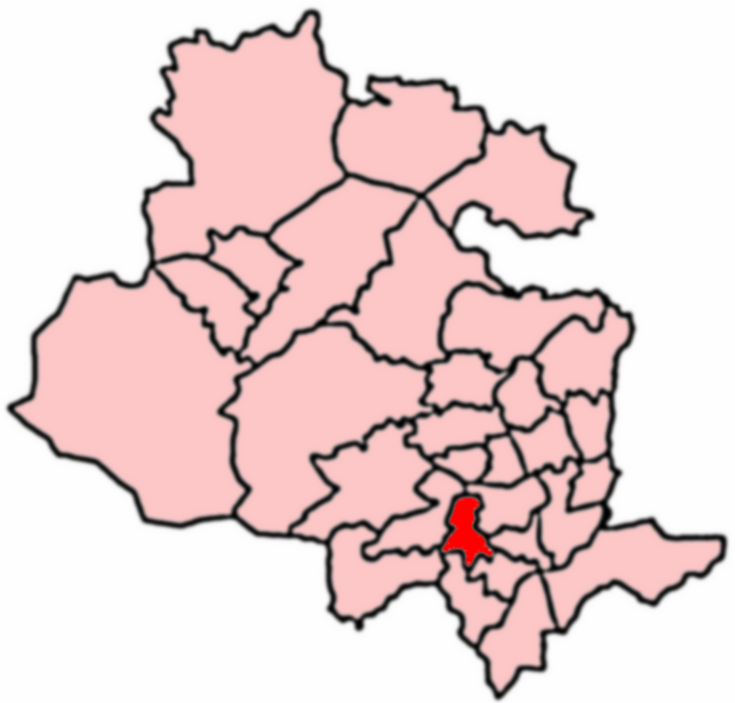
Clayton

Civil Parish in Yorkshire Bradford

England

Clayton

The Junction Inn at West Scholes A change of colour scheme since <a href="https://www.geograph.org.uk/photo/2273818">SE0931 : The Junction Inn, Yews Green, near Queensbury</a>
The Junction Inn at West Scholes Credit: John Slater

Clayton is a civil parish located in the county of Yorkshire, England. It is situated approximately 6 miles west of Bradford and lies within the metropolitan borough of Bradford. The parish covers an area of approximately 3 square miles.

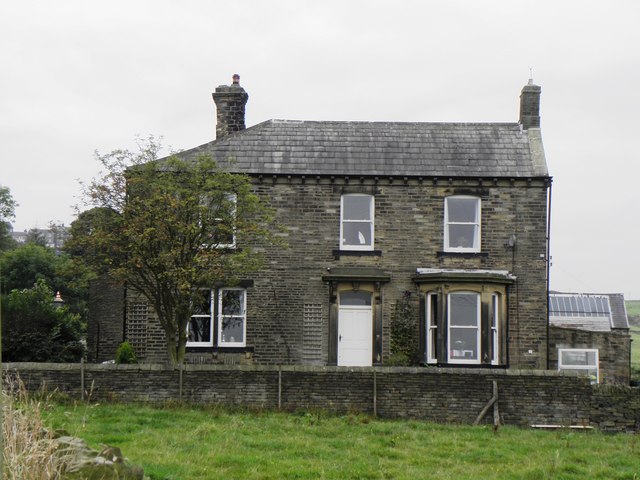
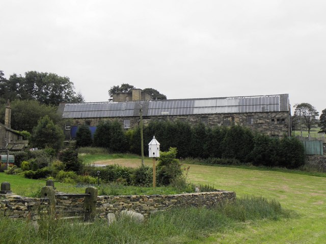
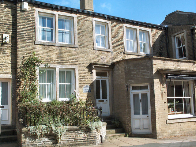
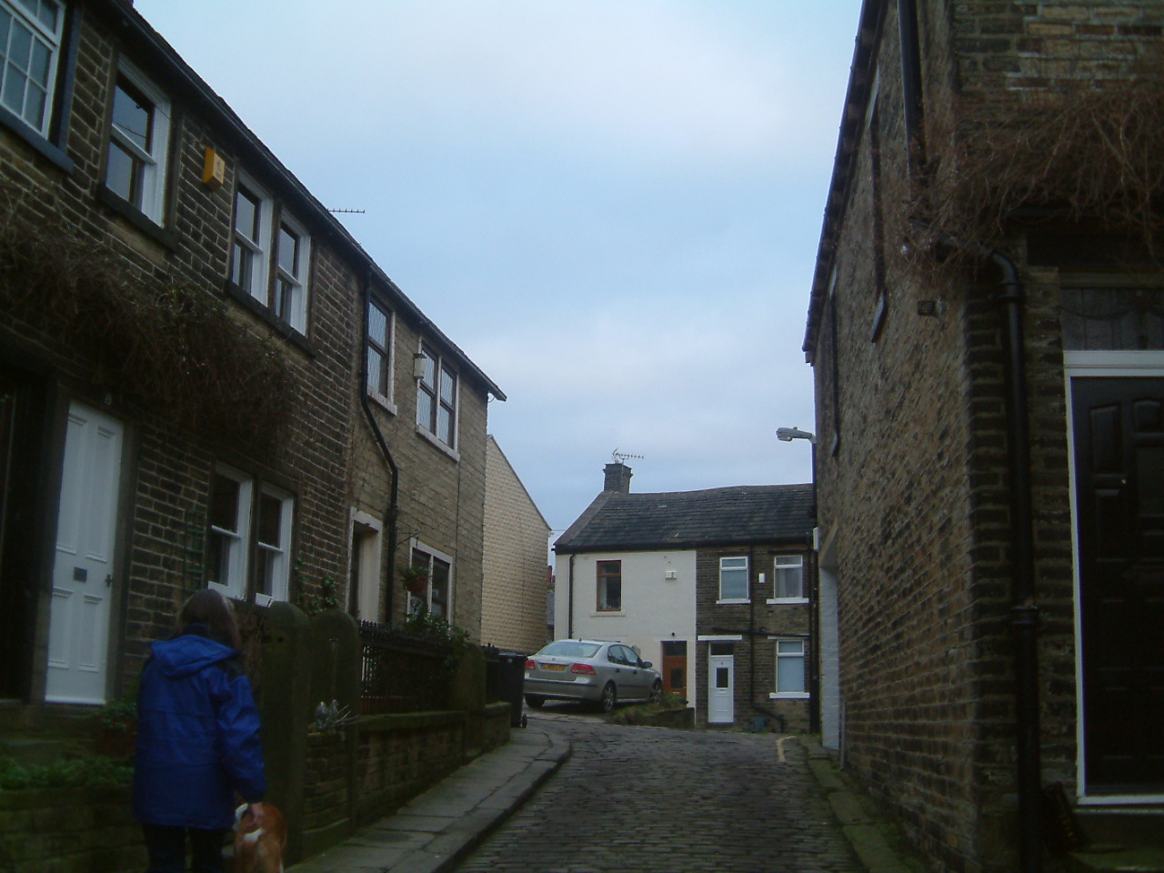
The village of Clayton is a rural settlement with a population of around 5,000 residents. It is surrounded by picturesque countryside, offering stunning views of the nearby Yorkshire Dales. The village itself has a charming and quaint atmosphere, with traditional stone-built houses and a historic church at its heart.

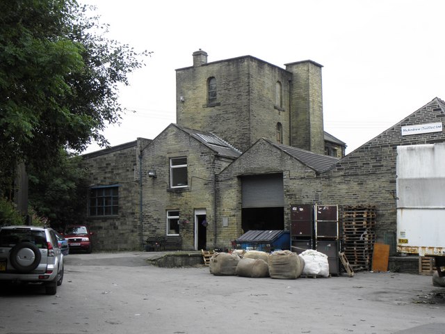
The local economy is primarily based on agriculture and farming, with many residents working in these industries. However, there are also a number of small businesses and shops that cater to the needs of the local community.

Clayton boasts several amenities and facilities for its residents. These include a primary school, a community center, a library, and a village hall. There are also several parks and green spaces, providing opportunities for outdoor activities and recreation.

Transport links in Clayton are relatively good, with regular bus services connecting the village to nearby towns and cities. The M62 motorway is also easily accessible, providing convenient access to Bradford, Leeds, and Manchester.

Overall, Clayton is a peaceful and picturesque village in Yorkshire, offering a close-knit community and a rural lifestyle. It is an idyllic place for those seeking a tranquil setting whilst still having access to essential amenities and nearby urban areas.

If you have any feedback on the listing, please let us know in the comments section below.
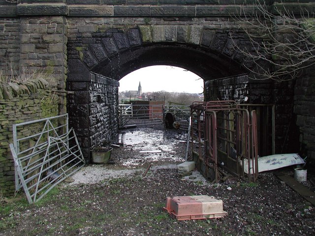
Clayton Images

Images are sourced within 2km of 53.78215/-1.822737 or Grid Reference SE1131. Thanks to Geograph Open Source API. All images are credited.

The Junction Inn at West Scholes A change of colour scheme since <a href="https://www.geograph.org.uk/photo/2273818">SE0931 : The Junction Inn, Yews Green, near Queensbury</a>
The Junction Inn at West Scholes
Remains of the mill at West Scholes Contrast with <a href="https://www.geograph.org.uk/photo/2273808">SE0931 : West Scholes Mill, Queensbury</a> take just four years earlier
Remains of the mill at West Scholes
Contrast with SE0931 : West Scholes Mill, Queensbury take just four years earlier
Footbridge over High Birks Beck, West Scholes
Great Northern trail crossing Headley Lane The old railway line ran under the bridge to the right of the photo, but the present trail crosses the lane at grade.
Great Northern trail crossing Headley Lane
The old railway line ran under the bridge to the right of the photo, but the present trail crosses the lane at grade.
Underpass at Lower Headley The access track from Lower Headley farm to its associated fields passes under the old railway line.
Underpass at Lower Headley
The access track from Lower Headley farm to its associated fields passes under the old railway line.
Brewery Lane, West Scholes Cottages by the mill on Brewery Lane in the village of West Scholes, north of Queensbury. The plaque above the door in the centre reads "VHIH 1694".
Brewery Lane, West Scholes
Cottages by the mill on Brewery Lane in the village of West Scholes, north of Queensbury. The plaque above the door in the centre reads "VHIH 1694".
High Birks Beck, Upper Headley Footbridge across High Birks Beck between Thornton and Queensbury. Beyond the trees the valley is blocked by an embankment built for the railway line, which is now disused.
High Birks Beck, Upper Headley
Footbridge across High Birks Beck between Thornton and Queensbury. Beyond the trees the valley is blocked by an embankment built for the railway line, which is now disused.
Lower Headley Farm road underpass beneath the dismantled railway line at Lower Headley, south of Thornton.
Lower Headley
Farm road underpass beneath the dismantled railway line at Lower Headley, south of Thornton.
Ashgrove, West Scholes from Cow Lane
Porch of West Scholes House
The Former Clayton Brewery, Brewery Lane, West Scholes
Gable of West Scholes House
Northlight extension to Former Clayton Brewery This extension dates from the 1920s when the premises were first used as a Textile Mill producing Moquette.
Northlight extension to Former Clayton Brewery
This extension dates from the 1920s when the premises were first used as a Textile Mill producing Moquette.
Pylon, High Birks Wood
Footbridge over High Birks Beck
Footpath from High Birks Beck towards Headley Lane
Headley Lane crossing the former Great Northern Railway The Blue sign indicates the entrance to the Great Northern Way bridle path which crosses the Thornton Viaduct to give access to Thornton.
Below it can be seen a conventional Public Footpath sign indicating the traditional footpath route to Thornton.
Headley Lane crossing the former Great Northern Railway
The Blue sign indicates the entrance to the Great Northern Way bridle path which crosses the Thornton Viaduct to give access to Thornton. Below it can be seen a conventional Public Footpath sign indicating the traditional footpath route to Thornton.
West Scholes Farm, Thornton A wide road, which seems to lead nowhere but goes to the site of the Birks Clay Works.
West Scholes Farm, Thornton
A wide road, which seems to lead nowhere but goes to the site of the Birks Clay Works.
Show me another place!

Clayton is located at Grid Ref: SE1131 (Lat: 53.78215, Lng: -1.822737)

Division: West Riding

Administrative County: West Yorkshire

District: Bradford

Police Authority: West Yorkshire

What 3 Words

///bump.prom.joins. Near Clayton, West Yorkshire

Nearby Locations

Sheep Hill Clayton

Related Wikis

Nearby Amenities

Located within 500m of 53.78215,-1.822737
Clayton
Is In: Bradford, West Yorkshire, England, UK
Place: suburb
Source: npe
Lat/Long: 53.7814093/-1.8181026
Source: www.npemap.org.uk
Uk Postcode Centroid: BD14
Lat/Long: 53.78215/-1.819408
Mini Roundabout
Direction: clockwise
Lat/Long: 53.7858966/-1.8205714
Source: bing
Lat/Long: 53.7805109/-1.8248385
Ele: 243.3
Lat/Long: 53.7788155/-1.8217446
Bus Stop
Park Lane Clayton Lane
Local Ref: 45021344
Naptan AtcoCode: 450021344
Naptan Bearing: NW
Naptan CommonName: Park Lane Clayton Lane
Naptan Crossing: Clayton Lane
Naptan Indicator: Stop 45021344
Naptan Landmark: Victoria Park
Naptan Notes: OSR taken place 310805
Naptan PlusbusZoneRef: LEEDS
Naptan ShortCommonName: School Street
Naptan Street: Park Lane
Naptan Verified: no
Source: naptan_import
Lat/Long: 53.7826381/-1.8208545
Bus Stop
The Avenue Clayton Lane
Local Ref: 45021345
Naptan AtcoCode: 450021345
Naptan Bearing: S
Naptan CommonName: The Avenue Clayton Lane
Naptan Crossing: Clayton Lane
Naptan Indicator: Stop 45021345
Naptan PlusbusZoneRef: LEEDS
Naptan ShortCommonName: Clayton Lane
Naptan Street: The Avenue
Naptan Verified: no
Source: naptan_import
Lat/Long: 53.7794748/-1.8274239
Bus Stop
The Avenue Westminster Drive
Local Ref: 45021346
Naptan AtcoCode: 450021346
Naptan Bearing: S
Naptan CommonName: The Avenue Westminster Drive
Naptan Crossing: Westminster Drive
Naptan Indicator: Stop 45021346
Naptan Landmark: Clayton Cricket Club
Naptan Notes: OSR taken place 310805
Naptan PlusbusZoneRef: LEEDS
Naptan ShortCommonName: Westminster Drive
Naptan Street: The Avenue
Naptan Verified: no
Source: naptan_import
Lat/Long: 53.7800408/-1.8271939
Bus Stop
The Avenue Westminster Drive
Local Ref: 45021347
Naptan AtcoCode: 450021347
Naptan Bearing: N
Naptan CommonName: The Avenue Westminster Drive
Naptan Crossing: Westminster Drive
Naptan Indicator: Stop 45021347
Naptan Landmark: Clayton Cricket Club
Naptan Notes: OSR taken place 310805
Naptan PlusbusZoneRef: LEEDS
Naptan ShortCommonName: Westminster Drive
Naptan Street: The Avenue
Naptan Verified: no
Source: naptan_import
Lat/Long: 53.7805441/-1.8271615
Bus Stop
The Avenue Harry Lane
Local Ref: 45021348
Naptan AtcoCode: 450021348
Naptan Bearing: SW
Naptan CommonName: The Avenue Harry Lane
Naptan Crossing: Harry Lane
Naptan Indicator: Stop 45021348
Naptan Landmark: Clayton Cricket Club
Naptan Notes: OSR taken place 310805
Naptan PlusbusZoneRef: LEEDS
Naptan ShortCommonName: Harry Lane
Naptan Street: The Avenue
Naptan Verified: no
Source: naptan_import
Lat/Long: 53.7819803/-1.8258656
Bus Stop
The Avenue Harry Lane
Local Ref: 45021349
Naptan AtcoCode: 450021349
Naptan Bearing: NE
Naptan CommonName: The Avenue Harry Lane
Naptan Crossing: Harry Lane
Naptan Indicator: Stop 45021349
Naptan Landmark: Clayton Cricket Club
Naptan Notes: OSR taken place 310805
Naptan PlusbusZoneRef: LEEDS
Naptan ShortCommonName: Harry Lane
Naptan Street: The Avenue
Naptan Verified: no
Source: naptan_import
Lat/Long: 53.7821959/-1.8257736
Bus Stop
The Avenue Druids Street
Local Ref: 45021350
Naptan AtcoCode: 450021350
Naptan Bearing: SW
Naptan CommonName: The Avenue Druids Street
Naptan Crossing: Druids Street
Naptan Indicator: Stop 45021350
Naptan PlusbusZoneRef: LEEDS
Naptan ShortCommonName: Druids Street
Naptan Street: The Avenue
Naptan Verified: no
Source: naptan_import
Lat/Long: 53.7832528/-1.8232195
Bus Stop
The Avenue Fieldway
Local Ref: 45021351
Naptan AtcoCode: 450021351
Naptan Bearing: NE
Naptan CommonName: The Avenue Fieldway
Naptan Crossing: Fieldway
Naptan Indicator: Stop 45021351
Naptan Landmark: Church
Naptan Notes: OSR taken place 310805
Naptan PlusbusZoneRef: LEEDS
Naptan ShortCommonName: Druids Street
Naptan Street: The Avenue
Naptan Verified: no
Source: naptan_import
Lat/Long: 53.7835487/-1.822763
Bus Stop
The Avenue Town End Road
Local Ref: 45021352
Naptan AtcoCode: 450021352
Naptan Bearing: NE
Naptan CommonName: The Avenue Town End Road
Naptan Crossing: Town End Road
Naptan Indicator: Stop 45021352
Naptan Landmark: Church
Naptan PlusbusZoneRef: LEEDS
Naptan ShortCommonName: Clayton Town End
Naptan Street: The Avenue
Naptan Verified: no
Source: naptan_import
Lat/Long: 53.7845064/-1.8200725
Bus Stop
Green End The Avenue
Local Ref: 45021353
Naptan AtcoCode: 450021353
Naptan Bearing: N
Naptan CommonName: Green End The Avenue
Naptan Crossing: The Avenue
Naptan Indicator: Stop 45021353
Naptan Landmark: Black Bull PH
Naptan PlusbusZoneRef: LEEDS
Naptan ShortCommonName: The Avenue Clayton
Naptan Street: Green End
Naptan Verified: no
Source: naptan_import
Lat/Long: 53.7843617/-1.8194812
Bus Stop
Bradford Road Granville Street
Local Ref: 45021354
Naptan AtcoCode: 450021354
Naptan Bearing: W
Naptan CommonName: Bradford Road Granville Street
Naptan Crossing: Granville Street
Naptan Indicator: Stop 45021354
Naptan Landmark: Unknown
Naptan PlusbusZoneRef: LEEDS
Naptan ShortCommonName: Granville Street
Naptan Street: Bradford Road
Naptan Verified: no
Source: naptan_import
Lat/Long: 53.7847288/-1.8185387
Bus Stop
Bradford Road Wolseley Street
Local Ref: 45021355
Naptan AtcoCode: 450021355
Naptan Bearing: E
Naptan CommonName: Bradford Road Wolseley Street
Naptan Crossing: Wolseley Street
Naptan Indicator: Stop 45021355
Naptan PlusbusZoneRef: LEEDS
Naptan ShortCommonName: Wesley Street
Naptan Street: Bradford Road
Naptan Verified: no
Source: naptan_import
Lat/Long: 53.784902/-1.8173476
Bus Stop
Station Road Pentland Avenue
Local Ref: 45022546
Naptan AtcoCode: 450022546
Naptan Bearing: SE
Naptan CommonName: Station Road Pentland Avenue
Naptan Crossing: Pentland Avenue
Naptan Indicator: Stop 45022546
Naptan Notes: OSR taken place 180805
Naptan PlusbusZoneRef: LEEDS
Naptan ShortCommonName: Pentland Avenue
Naptan Street: Station Road
Naptan Verified: no
Source: naptan_import
Lat/Long: 53.7804041/-1.8176164
Bus Stop
Station Road Pentland Avenue
Local Ref: 45022547
Naptan AtcoCode: 450022547
Naptan Bearing: N
Naptan CommonName: Station Road Pentland Avenue
Naptan Crossing: Pentland Avenue
Naptan Indicator: Stop 45022547
Naptan Notes: OSR taken place 140905
Naptan PlusbusZoneRef: LEEDS
Naptan ShortCommonName: Pentland Avenue
Naptan Street: Station Road
Naptan Verified: no
Source: naptan_import
Lat/Long: 53.7805754/-1.8179799
Bus Stop
Station Road John Street
Local Ref: 45022548
Naptan AtcoCode: 450022548
Naptan Bearing: NW
Naptan CommonName: Station Road John Street
Naptan Crossing: John Street
Naptan Indicator: Stop 45022548
Naptan Notes: OSR taken place 180805
Naptan PlusbusZoneRef: LEEDS
Naptan ShortCommonName: John Street
Naptan Street: Station Road
Naptan Verified: no
Source: naptan_import
Lat/Long: 53.7818801/-1.8189152
Bus Stop
Station Road John Street
Local Ref: 45022549
Naptan AtcoCode: 450022549
Naptan Bearing: SE
Naptan CommonName: Station Road John Street
Naptan Crossing: John Street
Naptan Indicator: Stop 45022549
Naptan Notes: OSR taken place 140905
Naptan PlusbusZoneRef: LEEDS
Naptan ShortCommonName: John Street
Naptan Street: Station Road
Naptan Verified: no
Source: naptan_import
Lat/Long: 53.7819248/-1.8187481
Bus Stop
Park Lane School Street
Local Ref: 45022550
Naptan AtcoCode: 450022550
Naptan Bearing: SE
Naptan CommonName: Park Lane School Street
Naptan Crossing: School Street
Naptan Indicator: Stop 45022550
Naptan Notes: OSR taken place 310805
Naptan PlusbusZoneRef: LEEDS
Naptan ShortCommonName: School Street
Naptan Street: Park Lane
Naptan Verified: no
Source: naptan_import
Lat/Long: 53.7823678/-1.8204611
Ele: 239.0
Lat/Long: 53.7798874/-1.819572
Ele: 239.8
Lat/Long: 53.7795664/-1.8203428
Ele: 243.6
Lat/Long: 53.7792087/-1.8215207
Ele: 235.8
Lat/Long: 53.7783762/-1.8194515
Ele: 234.2
Lat/Long: 53.7785421/-1.8190472
Ele: 244.8
Lat/Long: 53.778073/-1.8223585
Post Box
Operator: Royal Mail
Lat/Long: 53.7806343/-1.8175591
Parking
Co-operative Clayton Car Park
Lat/Long: 53.7849222/-1.8189974
Pub
Black Bull
Addr City: Bradford
Addr Housenumber: 7
Addr Postcode: BD14 6BA
Addr Street: Green End
Fhrs Id: 906894
Operator: Stonegate
Operator Wikidata: Q7619176
Source Addr: FHRS Open Data
Website: https://www.craftunionpubs.com/black-bull-inn-clayton
Wikidata: Q26426088
Lat/Long: 53.7843504/-1.8191948
Pharmacy
Rowlands
Addr City: Bradford
Addr Housenumber: 26
Addr Postcode: BD14 6AN
Addr Street: Station Road
Addr Village: Clayton
Lat/Long: 53.782199/-1.8189264
Ele: 227.0
Lat/Long: 53.7822897/-1.817995
Ele: 220.8
Lat/Long: 53.7841086/-1.8183932
Ele: 220.6
Lat/Long: 53.7840985/-1.8185588
Ele: 221.3
Lat/Long: 53.7838023/-1.8187896
Ele: 218.5
Lat/Long: 53.7842913/-1.8174285
Doctors
Cowgill Surgery
Lat/Long: 53.7807297/-1.8173302
Ele: 221.8
Lat/Long: 53.7808662/-1.815445
Pub
The Albion
Addr City: Bradford
Addr Housenumber: 2
Addr Postcode: BD14 6BB
Addr Street: Green End
Fhrs Id: 595950
Source Addr: FHRS Open Data
Lat/Long: 53.7838338/-1.819281
Ele: 227.0
Lat/Long: 53.7827883/-1.8213162
Ele: 228.0
Lat/Long: 53.7812476/-1.8185174
Ele: 231.3
Lat/Long: 53.7816763/-1.8199193
Ele: 254.4
Lat/Long: 53.781451/-1.8263573
Post Box
Operator: Royal Mail
Lat/Long: 53.7829849/-1.8239273
Ele: 235.8
Lat/Long: 53.7836331/-1.8224874
Ele: 231.9
Lat/Long: 53.7842653/-1.8209919
Parking
Lat/Long: 53.7807091/-1.8175957
Ele: 223.9
Lat/Long: 53.7792058/-1.8170757
Ele: 251.3
Lat/Long: 53.7779978/-1.8205984
Ele: 266.6
Lat/Long: 53.7797806/-1.827528
Ele: 263.0
Lat/Long: 53.7803368/-1.8273832
Ele: 261.8
Lat/Long: 53.7810477/-1.8297891
Ele: 251.0
Lat/Long: 53.7825643/-1.8272971
Barrier: stile
Ele: 251.2
Lat/Long: 53.7825603/-1.8273112
Ele: 253.6
Lat/Long: 53.7823998/-1.8276508
Ele: 247.0
Lat/Long: 53.7831601/-1.8262119
Ele: 226.7
Lat/Long: 53.7858077/-1.8226831
Ele: 228.7
Lat/Long: 53.7857847/-1.8231143
Pub
The Royal Hotel
Addr City: Bradford
Addr Postcode: BD14 6RF
Addr Street: Clayton Lane
Addr Village: Clayton
Fhrs Id: 328085
Source Addr: FHRS Open Data
Lat/Long: 53.7826123/-1.8217179
Post Office
Clayton Post Office
Addr City: Bradford
Addr Housenumber: 2
Addr Postcode: BD14 6RH
Addr Street: Cambridge Street
Addr Village: Clayton
Brand: Post Office
Brand Wikidata: Q1783168
Fhrs Id: 328020
Opening Hours: Mo-We 08:30-17:30; Th,Fr 09:00-17:30; Sa 09:00-13:00
Ref Pol Id: 5052
Source: OS OpenData StreetView
Website: https://www.postoffice.co.uk/branch-finder/1773062/clayton
Lat/Long: 53.7824066/-1.8220762
Ele: 221.0
Lat/Long: 53.7805326/-1.8179536
Ele: 233.5
Lat/Long: 53.7817672/-1.8202116
John R. Summers
Ele: 235.6
Shop: butcher
Lat/Long: 53.7825013/-1.8218449
Ele: 237.4
Lat/Long: 53.7831814/-1.8236457
Ele: 235.9
Lat/Long: 53.7838642/-1.8247828
Ele: 236.1
Lat/Long: 53.7838253/-1.8249191
Barrier: stile
Ele: 235.9
Lat/Long: 53.7839309/-1.8249341
Ele: 242.0
Lat/Long: 53.7835804/-1.8254747
Ele: 238.0
Lat/Long: 53.7825045/-1.8251384
Ele: 240.9
Lat/Long: 53.7829781/-1.8258026
Turning Circle
Lat/Long: 53.7825986/-1.8265189
Ele: 241.5
Lat/Long: 53.7830129/-1.8257197
Ele: 242.4
Lat/Long: 53.783472/-1.8258808
Ele: 244.2
Lat/Long: 53.782319/-1.8266875
Ele: 244.9
Lat/Long: 53.7821181/-1.8259501
Ele: 245.7
Lat/Long: 53.7817912/-1.8245865
Barrier: stile
Ele: 244.1
Lat/Long: 53.7820355/-1.8254274
Ele: 245.2
Lat/Long: 53.7812234/-1.8239839
Ele: 244.9
Lat/Long: 53.7814319/-1.8236987
Ele: 244.9
Lat/Long: 53.7814486/-1.8237134
Ele: 245.5
Lat/Long: 53.7816876/-1.8243137
Ele: 245.7
Lat/Long: 53.7817537/-1.8245166
Ele: 256.8
Lat/Long: 53.7794257/-1.8269675
Ele: 256.2
Lat/Long: 53.7795781/-1.8267119
Post Box
Operator: Royal Mail
Lat/Long: 53.7796333/-1.8266906
Ele: 260.8
Lat/Long: 53.7791468/-1.8257008
Ele: 261.3
Lat/Long: 53.7793041/-1.8270252
Ele: 243.3
Lat/Long: 53.7782753/-1.820835
Ele: 242.9
Lat/Long: 53.7784757/-1.8211348
Ele: 245.5
Lat/Long: 53.7780825/-1.8214746
Turning Circle
Lat/Long: 53.7785704/-1.8184275
Ele: 237.3
Lat/Long: 53.7795437/-1.8186878
Ele: 244.5
Lat/Long: 53.7819934/-1.825462
Town End
Is In: Clayton
Place: hamlet
Lat/Long: 53.7858191/-1.8202779
Broad Folds
Is In: Clayton
Place: hamlet
Lat/Long: 53.7830395/-1.8182287
Ele: 248.3
Lat/Long: 53.7783776/-1.8193347
Ele: 240.3
Lat/Long: 53.7790565/-1.8181639
Ele: 246.5
Lat/Long: 53.7833458/-1.8282074
Ele: 245.4
Lat/Long: 53.7832486/-1.8281367
Ele: 241.7
Lat/Long: 53.7834936/-1.8274998
Ele: 234.8
Lat/Long: 53.7838082/-1.8266199
Ele: 234.6
Lat/Long: 53.7838235/-1.8265631
Ele: 234.5
Lat/Long: 53.7838419/-1.8265276
Ele: 235.1
Lat/Long: 53.7839279/-1.8265786
Ele: 236.4
Lat/Long: 53.7839655/-1.8265405
Bench
Ele: 226.0
Lat/Long: 53.7852178/-1.8242431
Ele: 232.9
Lat/Long: 53.7843436/-1.8254318
Turning Circle
Lat/Long: 53.7793934/-1.8190257
Turning Circle
Lat/Long: 53.7813185/-1.8285283
Fast Food
Casa Pizza
Addr City: Bradford
Addr Housenumber: 2a
Addr Postcode: BD14 6JA
Addr Street: Station Road
Cuisine: pizza
Delivery: yes
Fhrs Id: 324619
Operator: Casa Piza
Phone: +44 1274 818186
Takeaway: yes
Lat/Long: 53.7809665/-1.8179131
Atm
Lat/Long: 53.7849769/-1.8186765
Turning Circle
Lat/Long: 53.778882/-1.8177932
Historic: monument
Lat/Long: 53.7819935/-1.8215266
Barrier: stile
Ele: 249.4
Lat/Long: 53.7777807/-1.8227742
Mini Roundabout
Lat/Long: 53.7791064/-1.8275534
Turning Circle
Broomcroft
Lat/Long: 53.7805026/-1.8201341
Turning Circle
Oakleigh Avenue
Lat/Long: 53.7798624/-1.8205808
The data included in this document is from www.openstreetmap.org. The data is made available under ODbL.

Have you been to Clayton?

Leave your review of Clayton below (or comments, questions and feedback).