Alderston

Settlement in East Lothian

Scotland

Alderston

Woodland, Letham Stripwoods, offset at this point. On the path between Letham Holdings and Liberty Hall. (East Lothian core path 110).
Woodland, Letham Credit: Richard Webb

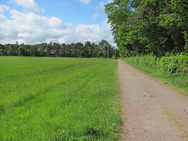
Alderston is a small village located in East Lothian, Scotland. Situated approximately 20 miles east of Edinburgh, it is nestled amidst the picturesque countryside that characterizes this region. The village is surrounded by rolling hills, lush green fields, and offers breathtaking views of the North Sea.

Despite its small size, Alderston has a rich history that dates back centuries. The area was once home to a thriving mining industry, and remnants of old coal mines can still be seen in the landscape. Today, the village has evolved into a charming residential area, known for its peaceful atmosphere and sense of community.

Alderston boasts a range of amenities, making it an ideal place to live for families and individuals seeking a quieter lifestyle. The village has a primary school, providing education for local children, and a village hall that serves as a hub for various community events and activities. Additionally, a local pub and a small convenience store cater to the daily needs of residents.

For outdoor enthusiasts, Alderston offers ample opportunities for exploration and recreation. The surrounding countryside is crisscrossed with walking and cycling trails, allowing residents to immerse themselves in nature. The nearby coastline also provides opportunities for beach walks and water activities.

Overall, Alderston presents a peaceful and idyllic lifestyle, with its stunning natural surroundings and strong sense of community. It offers a welcome retreat from the hustle and bustle of nearby urban areas, while still providing essential amenities for its residents.

If you have any feedback on the listing, please let us know in the comments section below.

Alderston Images

Images are sourced within 2km of 55.956302/-2.8183711 or Grid Reference NT4974. Thanks to Geograph Open Source API. All images are credited.

Woodland, Letham Stripwoods, offset at this point. On the path between Letham Holdings and Liberty Hall. (East Lothian core path 110).
Woodland, Letham
Stripwoods, offset at this point. On the path between Letham Holdings and Liberty Hall. (East Lothian core path 110).
Letham Holdings
Letham Holdings
East Lothian core path no.110 Singletrack through a stripwood. The path leads through woodland and along field margins to Liberty Hall.
East Lothian core path no.110
Singletrack through a stripwood. The path leads through woodland and along field margins to Liberty Hall.
Letham Holdings A large area of land west of Haddington has been used for small holdings. Nowadays there is a fair scattering of trophy homes amongst the small flocks of sheep and gardening enterprise. A house with a bit of land is very attractive to horse owners. This view is of the more traditional land use, the foreground field contains sheep.
Letham Holdings
A large area of land west of Haddington has been used for small holdings. Nowadays there is a fair scattering of trophy homes amongst the small flocks of sheep and gardening enterprise. A house with a bit of land is very attractive to horse owners. This view is of the more traditional land use, the foreground field contains sheep.
Woodland path, Letham Holdings A lovely stretch of woodland singletrack. The path runs between Haddington and Liberty Hall via Letham Holdings. East Lothian core path 109.
Woodland path, Letham Holdings
A lovely stretch of woodland singletrack. The path runs between Haddington and Liberty Hall via Letham Holdings. East Lothian core path 109.
Letham Burn At the end of a stripwood near Letham House.
Letham Burn
At the end of a stripwood near Letham House.
East Lothian core path no.109 Lovely piece of singletrack between Haddington and Letham Holdings. The track that crosses it here runs from Letham House to fields.
East Lothian core path no.109
Lovely piece of singletrack between Haddington and Letham Holdings. The track that crosses it here runs from Letham House to fields.
Estate road, Clerkington
Path, Letham Mains Path running through a stripwood. East Lothian core path no. 110.
Path, Letham Mains
Path running through a stripwood. East Lothian core path no. 110.
Old A1 Now replaced by a dual carriageway.
Old A1
Now replaced by a dual carriageway.
A long narrow field A rump field left after the A1 was rebuilt through arable land near Haddington.
A long narrow field
A rump field left after the A1 was rebuilt through arable land near Haddington.
A1 The new dual carriageway A1 looking eastwards. The strip of land between the new and old road is narrow here and is not in production.
A1
The new dual carriageway A1 looking eastwards. The strip of land between the new and old road is narrow here and is not in production.
A small wood near Merryhatton A clump of pines off a road to Huntington.
A small wood near Merryhatton
A clump of pines off a road to Huntington.
The Haddington Branch The North British Railway upset a lot of people when they chose to ignore Haddington and run some distance to the north of the town. Going north meant easier gradients and missing the high ground around Pencraig.  Haddington had to put up with a branch line.

There is no doubt that Haddington could support a service to Edinburgh now, but lack of capacity between Longniddry and Edinburgh is probably a problem. The trackbed is now a cycle path.
The Haddington Branch
The North British Railway upset a lot of people when they chose to ignore Haddington and run some distance to the north of the town. Going north meant easier gradients and missing the high ground around Pencraig. Haddington had to put up with a branch line. There is no doubt that Haddington could support a service to Edinburgh now, but lack of capacity between Longniddry and Edinburgh is probably a problem. The trackbed is now a cycle path.
Cereals, Bangly Winter crops near the quarry.
Cereals, Bangly
Winter crops near the quarry.
The A1 west of Haddington Looking east to the slip road off to the A199 and B6471 into Haddington, with Traprain Law in the distance.
The A1 west of Haddington
Looking east to the slip road off to the A199 and B6471 into Haddington, with Traprain Law in the distance.
Farmland east of Haddington Typical East Lothian farmscape, seen from the bridge over the A1 looking northeast towards Huntington.
Farmland east of Haddington
Typical East Lothian farmscape, seen from the bridge over the A1 looking northeast towards Huntington.
The A1 west of Haddington Looking west towards Tranent.
The A1 west of Haddington
Looking west towards Tranent.
Show me another place!

Alderston is located at Grid Ref: NT4974 (Lat: 55.956302, Lng: -2.8183711)

Unitary Authority: East Lothian

Police Authority: The Lothians and Scottish Borders

What 3 Words

///polices.hurry.monday. Near Haddington, East Lothian

Related Wikis

East Lothian Community Hospital

East Lothian Community Hospital is a hospital located on Station Road, Haddington, East Lothian, Scotland. The hospital is operated by NHS Lothian. �...

Haddington line

The Haddington line was a branch railway line connecting the Burgh of Haddington to the main line railway network at Longniddry. It was the first branch...

Haddington railway station

Haddington railway station served the town of Haddington, Scotland. Services were provided by trains on the Haddington line. == History == The station...

Knox Academy

Knox Academy is a co-educational state secondary school located in Haddington, East Lothian, Scotland. Originally founded in 1379 as a medieval grammar...

Nearby Amenities

Located within 500m of 55.956302,-2.8183711
Motorway Junction
Oak Tree Junction
Lat/Long: 55.9562212/-2.8113672
Speed Camera
Lat/Long: 55.9552819/-2.8159356
Bus Stop
Letham Mains Road End
Bus: yes
Naptan AtcoCode: 627009050320
Naptan Bearing: W
Naptan CommonName: Letham Mains Road End
Naptan Indicator: at Letham Mains junction
Naptan NaptanCode: 58234238
Naptan Street: A199
Naptan Verified: no
Public Transport: platform
Source: naptan_import
Lat/Long: 55.9539438/-2.8240229
Letham Mains
Naptan AtcoCode: 627009060320
Naptan Bearing: E
Naptan BusStopType: CUS
Naptan CommonName: Letham Mains
Naptan Indicator: opposite Letham Mains
Naptan NaptanCode: 58234879
Naptan Street: A199
Naptan Verified: no
Source: naptan_import
Lat/Long: 55.954064/-2.8240658
Power: pole
Lat/Long: 55.9588674/-2.8198225
Power: pole
Lat/Long: 55.9588163/-2.8184171
Power: pole
Lat/Long: 55.9586752/-2.8142972
Power: pole
Lat/Long: 55.9589783/-2.8226606
Power: pole
Lat/Long: 55.9586196/-2.8128359
Power: pole
Lat/Long: 55.9590145/-2.8239641
Power: pole
Lat/Long: 55.9587142/-2.8156276
Power: pole
Lat/Long: 55.9587683/-2.8170974
Power: pole
Lat/Long: 55.9589243/-2.8211961
Cafe
Costa
Brand: Costa
Brand Wikidata: Q608845
Brand Wikipedia: en:Costa Coffee
Cuisine: coffee_shop
Drive Through: yes
Outdoor Seating: yes
Takeaway: yes
Lat/Long: 55.9544844/-2.814159
The Food Warehouse
Brand: The Food Warehouse
Brand Wikidata: Q87263899
Shop: supermarket
Lat/Long: 55.955016/-2.8118134
Home Bargains
Brand: Home Bargains
Brand Wikidata: Q5888229
Brand Wikipedia: en:Home Bargains
Shop: variety_store
Website: https://storelocator.homebargains.co.uk/store/A815/+Haddington+Retail+Park
Lat/Long: 55.954947/-2.8113896
ALDI
Brand: ALDI
Brand Wikidata: Q41171672
Brand Wikipedia: en:Aldi
Contact Website: https://stores.aldi.co.uk/haddington/unit-1-haddington-retail-park
Shop: supermarket
Lat/Long: 55.9548839/-2.8109577
Power: pole
Lat/Long: 55.9523643/-2.8203409
Power: pole
Lat/Long: 55.9522057/-2.8190365
Power: pole
Lat/Long: 55.9520517/-2.8176946
Power: pole
Lat/Long: 55.9525615/-2.8152671
Power: pole
Lat/Long: 55.9533034/-2.8149171
Power: pole
Lat/Long: 55.954134/-2.8145378
Power: substation
Lat/Long: 55.954998/-2.8129104
Crossing
Crossing Ref: zebra
Lat/Long: 55.9548992/-2.8129448
Crossing
Crossing Ref: zebra
Lat/Long: 55.9544972/-2.8131683
Shop: convenience
Lat/Long: 55.954519/-2.814175
Fuel
Shell
Brand: Shell
Brand Wikidata: Q110716465
Website: https://find.shell.com/gb/fuel/12875605-eg-haddington-service-station
Lat/Long: 55.9545911/-2.8137794
Charging Station
Description: CCS 3x75kW CHAdeMO 3x62.5kW
Lat/Long: 55.9549547/-2.8126826
The data included in this document is from www.openstreetmap.org. The data is made available under ODbL.

Have you been to Alderston?

Leave your review of Alderston below (or comments, questions and feedback).