Church Eaton

Civil Parish in Staffordshire Stafford

England

Church Eaton

Hedgerow and field
Hedgerow and field Credit: P Gaskell

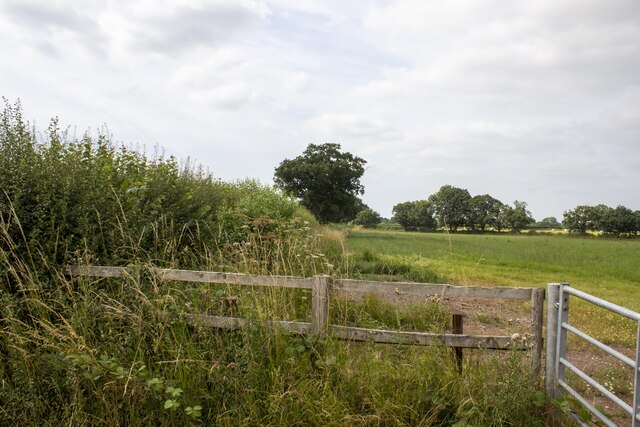
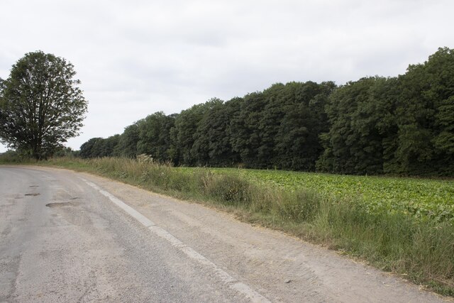
Church Eaton is a civil parish located in the county of Staffordshire, England. It is situated approximately 8 miles northeast of the town of Stafford and covers an area of about 1,100 acres. The parish is primarily rural, characterized by rolling countryside, open fields, and scattered farmsteads.

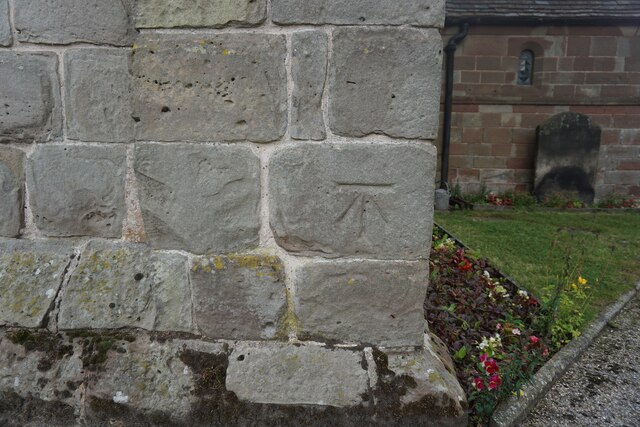
The heart of Church Eaton is its historic village, which is centered around the parish church of St. Editha. This Grade II* listed building dates back to the 12th century and features a mix of architectural styles, including Norman and Gothic elements. The church is known for its beautiful stained glass windows and intricate carvings.

The village itself is small, with a population of around 400 residents. It has a close-knit community feel and a strong sense of local pride. The village pub, The Royal Oak, is a popular gathering place for locals and visitors alike, offering traditional pub fare and a warm atmosphere.

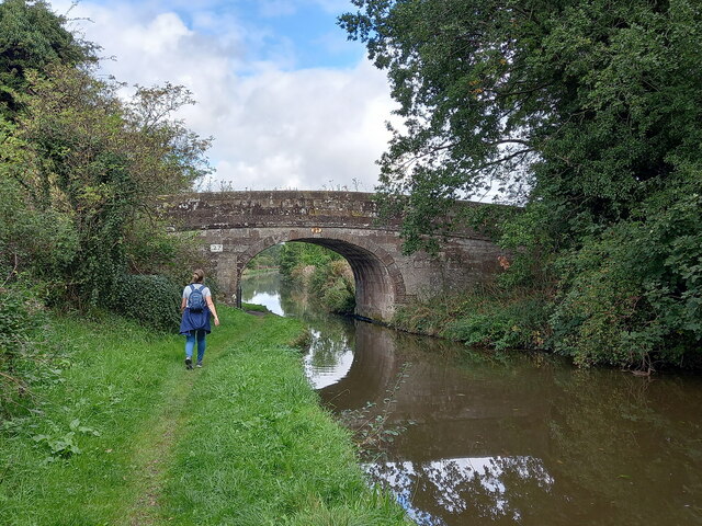
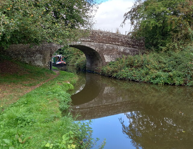
The surrounding countryside provides ample opportunities for outdoor activities, such as walking, cycling, and horse riding. The parish is crisscrossed by numerous footpaths and bridleways, offering stunning views of the Staffordshire countryside.

While Church Eaton may be small, it offers a peaceful and picturesque setting for those seeking a rural escape. Its historic church, friendly community, and beautiful countryside make it a charming place to visit or call home.

If you have any feedback on the listing, please let us know in the comments section below.
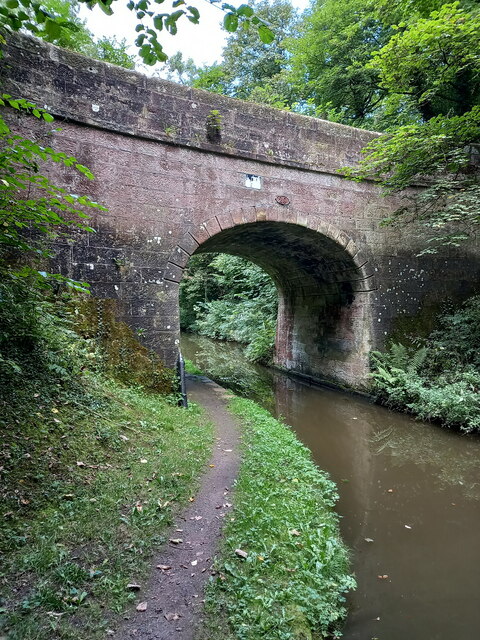
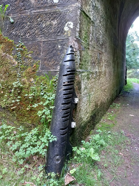
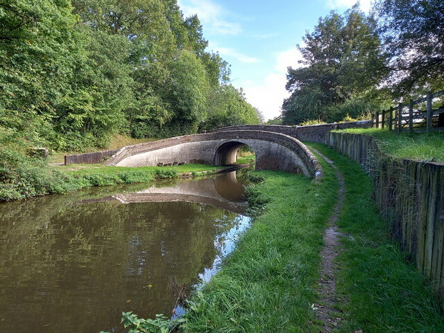
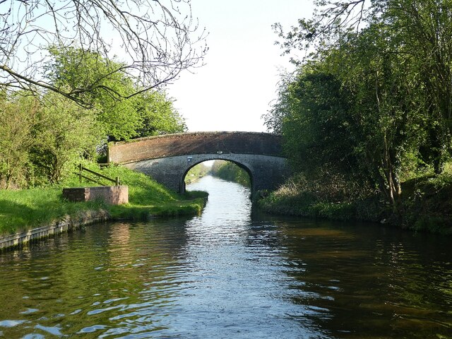
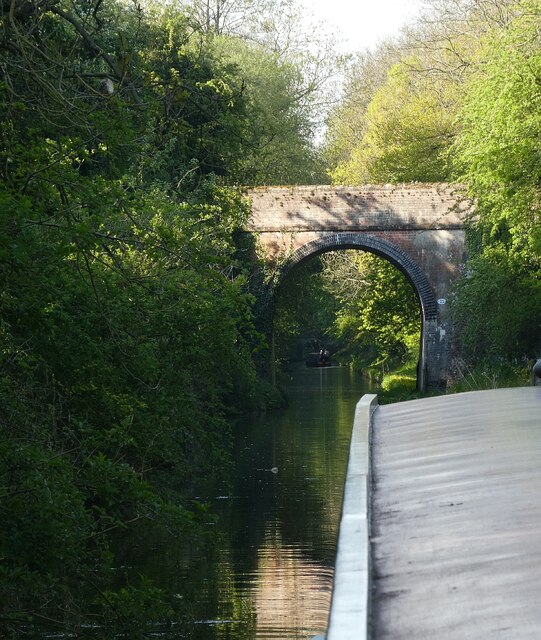
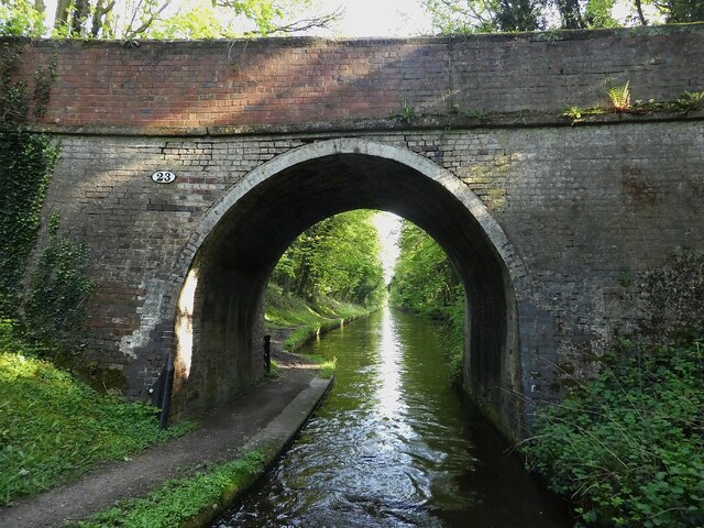
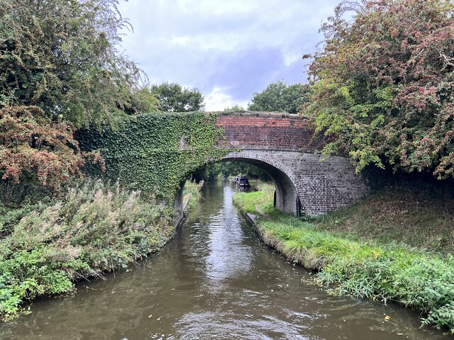
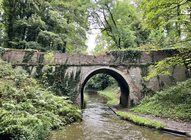
Church Eaton Images

Images are sourced within 2km of 52.744761/-2.24319 or Grid Reference SJ8316. Thanks to Geograph Open Source API. All images are credited.

Hedgerow and field
Hedgerow and field
Woodland by Shropshire Union Canal
Gate House
Gate House
Circular brick structures in field
Church of St Edith Benchmark The OS Cut Benchmark within the tower of the Church of St Edith, Church Eaton, Staffordshire. It was last levelled by the OS in 1961. What3Words = responded.sprinkle.tidy
Church of St Edith Benchmark
The OS Cut Benchmark within the tower of the Church of St Edith, Church Eaton, Staffordshire. It was last levelled by the OS in 1961. What3Words = responded.sprinkle.tidy
Cast iron canal milepost near Turnover Bridge This original cast-iron post dates from around 1835, and was Grade II listed <span class="nowrap"><a title="https://britishlistedbuildings.co.uk/101116601-milepost-shropshire-union-canal-45-miles-to-south-of-norbury-junction-church-eaton#.YVMvSLhKjIU" rel="nofollow ugc noopener" href="https://britishlistedbuildings.co.uk/101116601-milepost-shropshire-union-canal-45-miles-to-south-of-norbury-junction-church-eaton#.YVMvSLhKjIU">Link</a><img style="margin-left:2px;" alt="External link" title="External link - shift click to open in new window" src="https://s1.geograph.org.uk/img/external.png" width="10" height="10"/></span> & <span class="nowrap"><a title="https://historicengland.org.uk/listing/the-list/list-entry/1116601" rel="nofollow ugc noopener" href="https://historicengland.org.uk/listing/the-list/list-entry/1116601">Link</a><img style="margin-left:2px;" alt="External link" title="External link - shift click to open in new window" src="https://s1.geograph.org.uk/img/external.png" width="10" height="10"/></span> in 1972.
Cast iron canal milepost near Turnover Bridge
This original cast-iron post dates from around 1835, and was Grade II listed LinkExternal link & LinkExternal link in 1972.
Parks Bridge (no 27) on the Shropshire Union Canal A rural accommodation bridge dating from the early 1830s, which attracted a Grade II listing <span class="nowrap"><a title="https://britishlistedbuildings.co.uk/101273253-shropshire-union-canal-parks-bridge-number-27-at-sj-831-173-church-eaton#.YVMwN7hKjIU" rel="nofollow ugc noopener" href="https://britishlistedbuildings.co.uk/101273253-shropshire-union-canal-parks-bridge-number-27-at-sj-831-173-church-eaton#.YVMwN7hKjIU">Link</a><img style="margin-left:2px;" alt="External link" title="External link - shift click to open in new window" src="https://s1.geograph.org.uk/img/external.png" width="10" height="10"/></span> & <span class="nowrap"><a title="https://historicengland.org.uk/listing/the-list/list-entry/1273253" rel="nofollow ugc noopener" href="https://historicengland.org.uk/listing/the-list/list-entry/1273253">Link</a><img style="margin-left:2px;" alt="External link" title="External link - shift click to open in new window" src="https://s1.geograph.org.uk/img/external.png" width="10" height="10"/></span> in 1991. It carries no right of way, but is used by local walkers on a circuit of the woods to the south.
Parks Bridge (no 27) on the Shropshire Union Canal
A rural accommodation bridge dating from the early 1830s, which attracted a Grade II listing LinkExternal link & LinkExternal link in 1991. It carries no right of way, but is used by local walkers on a circuit of the woods to the south.
Cast iron rope fender on Parks Bridge One of the original 1830s installations, which shows significant signs of use, and forms part of the bridge's Grade II listing. The visible brickwork on the towpath beneath the bridge is original too.
Cast iron rope fender on Parks Bridge
One of the original 1830s installations, which shows significant signs of use, and forms part of the bridge's Grade II listing. The visible brickwork on the towpath beneath the bridge is original too.
Parks Barn Bridge (no 28) on the Shropshire Union Canal Parks Barn Bridge carries a track (now a footpath) called Oscote Lane over the canal. It dates from the early 1830s, and was Grade II listed <span class="nowrap"><a title="https://britishlistedbuildings.co.uk/101258848-shropshire-union-canal-parks-barn-bridge-number-28-at-sj-831-177-church-eaton#.YVMx57hKjIU" rel="nofollow ugc noopener" href="https://britishlistedbuildings.co.uk/101258848-shropshire-union-canal-parks-barn-bridge-number-28-at-sj-831-177-church-eaton#.YVMx57hKjIU">Link</a><img style="margin-left:2px;" alt="External link" title="External link - shift click to open in new window" src="https://s1.geograph.org.uk/img/external.png" width="10" height="10"/></span> & <span class="nowrap"><a title="https://historicengland.org.uk/listing/the-list/list-entry/1258848" rel="nofollow ugc noopener" href="https://historicengland.org.uk/listing/the-list/list-entry/1258848">Link</a><img style="margin-left:2px;" alt="External link" title="External link - shift click to open in new window" src="https://s1.geograph.org.uk/img/external.png" width="10" height="10"/></span> in 1991.
Parks Barn Bridge (no 28) on the Shropshire Union Canal
Parks Barn Bridge carries a track (now a footpath) called Oscote Lane over the canal. It dates from the early 1830s, and was Grade II listed LinkExternal link & LinkExternal link in 1991.
Cast iron rope fender on Parks Barn Bridge One of the original 1830s installations, which shows significant signs of use, and forms part of the bridge's Grade II listing. The towropes have also scarred the sandstone of the bridge just above the fender.
Cast iron rope fender on Parks Barn Bridge
One of the original 1830s installations, which shows significant signs of use, and forms part of the bridge's Grade II listing. The towropes have also scarred the sandstone of the bridge just above the fender.
Wood Eaton Bridge (no 29) on the Shropshire Union Canal Wood Eaton Bridge dates from the 1830s, and carries Broad Lane between Goosemoor and Wood Eaton over the cut. It was Grade II listed <span class="nowrap"><a title="https://britishlistedbuildings.co.uk/101259113-shropshire-union-canal-wood-eaton-bridge-number-29-at-sj-831-181-church-eaton#.YVM1X7hKjIU" rel="nofollow ugc noopener" href="https://britishlistedbuildings.co.uk/101259113-shropshire-union-canal-wood-eaton-bridge-number-29-at-sj-831-181-church-eaton#.YVM1X7hKjIU">Link</a><img style="margin-left:2px;" alt="External link" title="External link - shift click to open in new window" src="https://s1.geograph.org.uk/img/external.png" width="10" height="10"/></span> & <span class="nowrap"><a title="https://historicengland.org.uk/listing/the-list/list-entry/1259113" rel="nofollow ugc noopener" href="https://historicengland.org.uk/listing/the-list/list-entry/1259113">Link</a><img style="margin-left:2px;" alt="External link" title="External link - shift click to open in new window" src="https://s1.geograph.org.uk/img/external.png" width="10" height="10"/></span> in 1991.
Wood Eaton Bridge (no 29) on the Shropshire Union Canal
Wood Eaton Bridge dates from the 1830s, and carries Broad Lane between Goosemoor and Wood Eaton over the cut. It was Grade II listed LinkExternal link & LinkExternal link in 1991.
Cast iron rope fender on Wood Eaton Bridge One of two very similar, well-worn rope fenders on the bridge. They are included in the bridge's Grade II listing
Cast iron rope fender on Wood Eaton Bridge
One of two very similar, well-worn rope fenders on the bridge. They are included in the bridge's Grade II listing
Turnover Bridge (no 26) on the Shropshire Union canal Turnover Bridge here dates from the early 1830s when the canal was built; the name refers to the design which allowed a horse to cross the canal on the turnover without needing to be unhitched from the barge. Relatively uncommon in the countryside, but there are more numerous examples on the canals in urban areas - such as Birmingham, for instance. It was Grade II listed <span class="nowrap"><a title="https://britishlistedbuildings.co.uk/101259092-shropshire-union-canal-turnover-bridge-number-26-at-sj-832-171-church-eaton#.YVSC8prMLIU" rel="nofollow ugc noopener" href="https://britishlistedbuildings.co.uk/101259092-shropshire-union-canal-turnover-bridge-number-26-at-sj-832-171-church-eaton#.YVSC8prMLIU">Link</a><img style="margin-left:2px;" alt="External link" title="External link - shift click to open in new window" src="https://s1.geograph.org.uk/img/external.png" width="10" height="10"/></span> & <span class="nowrap"><a title="https://historicengland.org.uk/listing/the-list/list-entry/1259092" rel="nofollow ugc noopener" href="https://historicengland.org.uk/listing/the-list/list-entry/1259092">Link</a><img style="margin-left:2px;" alt="External link" title="External link - shift click to open in new window" src="https://s1.geograph.org.uk/img/external.png" width="10" height="10"/></span> in 1991.
Turnover Bridge (no 26) on the Shropshire Union canal
Turnover Bridge here dates from the early 1830s when the canal was built; the name refers to the design which allowed a horse to cross the canal on the turnover without needing to be unhitched from the barge. Relatively uncommon in the countryside, but there are more numerous examples on the canals in urban areas - such as Birmingham, for instance. It was Grade II listed LinkExternal link & LinkExternal link in 1991.
Shropshire Union Canal - Shushions Bridge (No.21) Shushions Bridge (No.21) on the Shropshire Union Canal is a little way north of Wheaton Aston. Going north it is the first bridge encountered for about a mile (since Dirty Lane Bridge (No.20) at the north end of Wheaton Aston), but <a href="https://www.geograph.org.uk/photo/7163756">SJ8414 : Shropshire Union Canal - Ryehill Bridge (No.22)</a> follows very soon after. This view is looking back southwards from the back of the boat.
The bridge is EH Grade II listed: <span class="nowrap"><a title="https://historicengland.org.uk/listing/the-list/list-entry/1243056?section=official-list-entry" rel="nofollow ugc noopener" href="https://historicengland.org.uk/listing/the-list/list-entry/1243056?section=official-list-entry">Link</a><img style="margin-left:2px;" alt="External link" title="External link - shift click to open in new window" src="https://s1.geograph.org.uk/img/external.png" width="10" height="10"/></span>
Shropshire Union Canal - Shushions Bridge (No.21)
Shushions Bridge (No.21) on the Shropshire Union Canal is a little way north of Wheaton Aston. Going north it is the first bridge encountered for about a mile (since Dirty Lane Bridge (No.20) at the north end of Wheaton Aston), but SJ8414 : Shropshire Union Canal - Ryehill Bridge (No.22) follows very soon after. This view is looking back southwards from the back of the boat. The bridge is EH Grade II listed: LinkExternal link
Shropshire Union Canal - Ryehill Bridge (No.22) This quite lofty bridge over the Shropshire Union Canal is No.22 and is named Ryehill Bridge. Going northwards it follows soon after <a href="https://www.geograph.org.uk/photo/7163750">SJ8414 : Shropshire Union Canal - Shushions Bridge (No.21)</a>
<a href="https://www.geograph.org.uk/photo/7163764">SJ8415 : Shropshire Union Canal - Ryehill Cutting Bridge (No.23)</a> can be seen in the distance beyond the next narrowboat.
Unlike most of the bridges along the canal, this one is not listed as significant by English Heritage.
Shropshire Union Canal - Ryehill Bridge (No.22)
This quite lofty bridge over the Shropshire Union Canal is No.22 and is named Ryehill Bridge. Going northwards it follows soon after SJ8414 : Shropshire Union Canal - Shushions Bridge (No.21) SJ8415 : Shropshire Union Canal - Ryehill Cutting Bridge (No.23) can be seen in the distance beyond the next narrowboat. Unlike most of the bridges along the canal, this one is not listed as significant by English Heritage.
Shropshire Union Canal - Ryehill Cutting Bridge (No.23) This is bridge number 23 on the Shropshire Union Canal and is known as Ryehill Cutting Bridge. This is the view southwards through it.
The bridge is EH Grade II listed: <span class="nowrap"><a title="https://historicengland.org.uk/listing/the-list/list-entry/1243055?section=official-list-entry" rel="nofollow ugc noopener" href="https://historicengland.org.uk/listing/the-list/list-entry/1243055?section=official-list-entry">Link</a><img style="margin-left:2px;" alt="External link" title="External link - shift click to open in new window" src="https://s1.geograph.org.uk/img/external.png" width="10" height="10"/></span>
Shropshire Union Canal - Ryehill Cutting Bridge (No.23)
This is bridge number 23 on the Shropshire Union Canal and is known as Ryehill Cutting Bridge. This is the view southwards through it. The bridge is EH Grade II listed: LinkExternal link
Sushions Bridge Grade II listed. Listing number 1243056. Accommodation bridge. c1830-33. Telford design. Partly washed brick, with stone band copings. Single elliptical arch. Slightly cambered, solid parapet and piers. Oval iron number- plate on south side. 2 iron rope fenders. Adjoining to north a single wooden stop gate, in a brick recess with stone coping.
Sushions Bridge
Grade II listed. Listing number 1243056. Accommodation bridge. c1830-33. Telford design. Partly washed brick, with stone band copings. Single elliptical arch. Slightly cambered, solid parapet and piers. Oval iron number- plate on south side. 2 iron rope fenders. Adjoining to north a single wooden stop gate, in a brick recess with stone coping.
Ryehill Cutting Bridge Grade II listed. Listing number 1243055. Accommodation bridge. c1830-33. Telford design. Brick, with stone band and copings. Single elliptical arch, solid parapet and piers. 2 iron rope fenders. Brick towpath coping.
Ryehill Cutting Bridge
Grade II listed. Listing number 1243055. Accommodation bridge. c1830-33. Telford design. Brick, with stone band and copings. Single elliptical arch, solid parapet and piers. 2 iron rope fenders. Brick towpath coping.
Show me another place!

Church Eaton is located at Grid Ref: SJ8316 (Lat: 52.744761, Lng: -2.24319)

Administrative County: Staffordshire

District: Stafford

Police Authority: Staffordshire

What 3 Words

///overpower.repaying.words. Near Wheaton Aston, Staffordshire

Related Wikis

High Onn

High Onn is a hamlet near the village of Wheaton Aston, in the English county of Staffordshire. == See also == Listed buildings in Church Eaton == References... ==

Little Onn

Little Onn is a hamlet in Staffordshire, England located in open countryside 1 mile (2 km) north of Wheaton Aston. It is the location of the former Second...

RAF Wheaton Aston

Royal Air Force Wheaton Aston, or more simply RAF Wheaton Aston, was a Royal Air Force station located just outside of the village of Wheaton Aston in...

Church Eaton

Church Eaton is a village and civil parish in Staffordshire some 6 miles (10 km) southwest of Stafford, 6 miles (10 km) northwest of Penkridge and 4 miles...

Apeton

Apeton is a hamlet in Staffordshire in the West Midlands region of England. It is located 5+1⁄2 miles (8.9 km) southwest of Stafford, in the civil parish...

Allimore Green

Allimore Green is a small hamlet in Staffordshire, England, 1 mile north-east of Church Eaton. It is the location of a Site of Special Scientific Interest...

Mottey Meadows

Mottey Meadows National Nature Reserve (NNR) consists of a series of alluvial flood meadows near the village of Wheaton Aston in Staffordshire, England...

Orslow

Orslow is an upland hamlet in Staffordshire, England, 0.75 miles (1.21 km) north-east of Great Chatwell. Its Anglo-Saxon name means 'Horsa's burial mound...

Nearby Amenities

Located within 500m of 52.744761,-2.24319
The data included in this document is from www.openstreetmap.org. The data is made available under ODbL.

Have you been to Church Eaton?

Leave your review of Church Eaton below (or comments, questions and feedback).