High Onn Wharf

Settlement in Staffordshire Stafford

England

High Onn Wharf

Woodland by Shropshire Union Canal
Woodland by Shropshire Union Canal Credit: P Gaskell

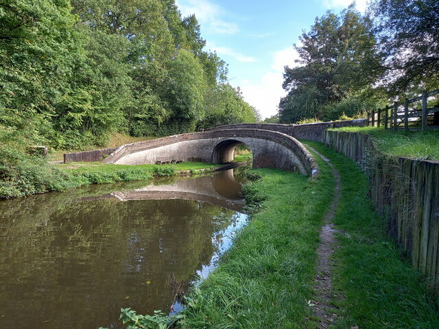
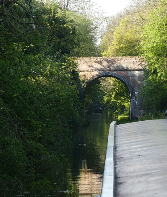
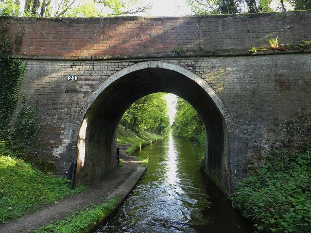
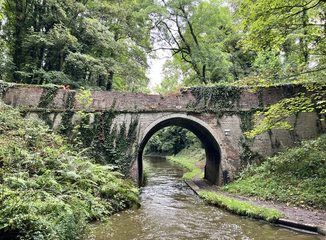
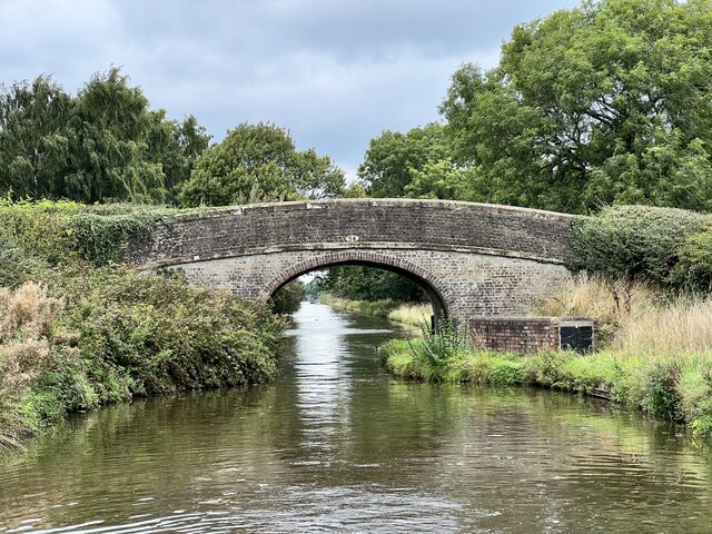
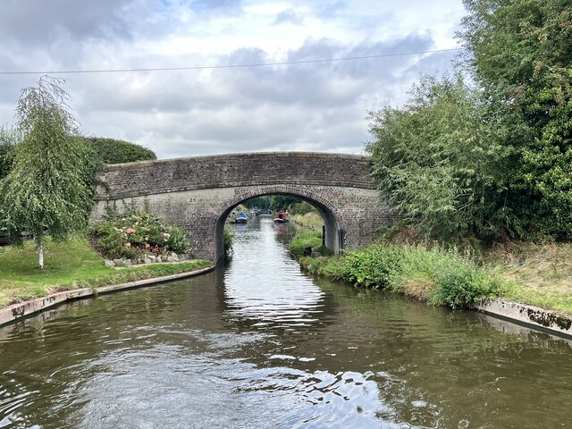
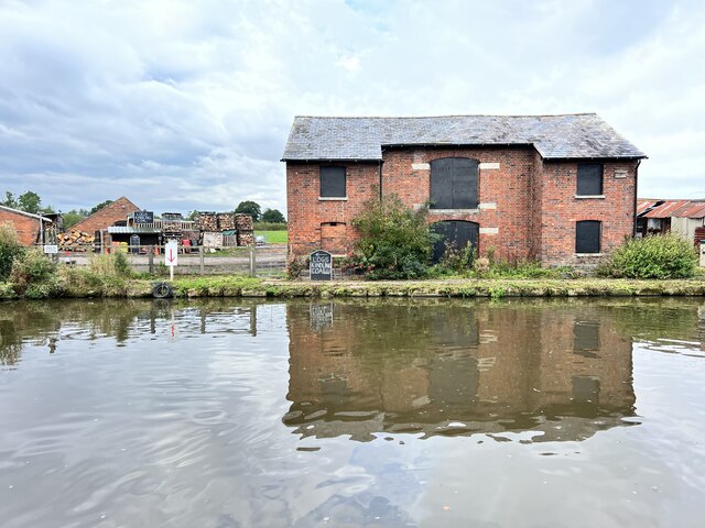
High Onn Wharf is a picturesque and historic location situated in the county of Staffordshire, England. Nestled along the Shropshire Union Canal, it is renowned for its natural beauty and tranquil surroundings. The wharf is located near the village of Church Eaton, approximately 6 miles northeast of the town of Stafford.

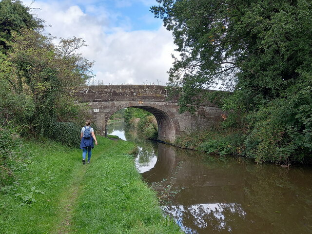
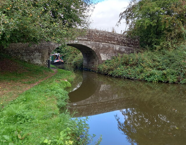
This idyllic spot offers a range of amenities and activities for visitors to enjoy. Boating enthusiasts can moor their boats at the wharf, taking advantage of the facilities and services available. The canal itself provides a serene setting for leisurely walks and bike rides, with the towpath offering stunning views of the surrounding countryside.

The wharf is also home to a charming tearoom, where visitors can indulge in delicious homemade cakes and refreshing beverages while taking in the scenic views. The tearoom's outdoor seating area provides the perfect spot to relax and soak up the peaceful atmosphere.

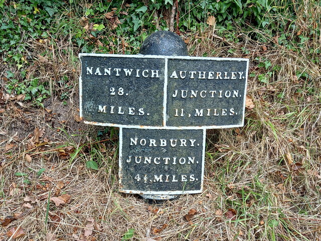
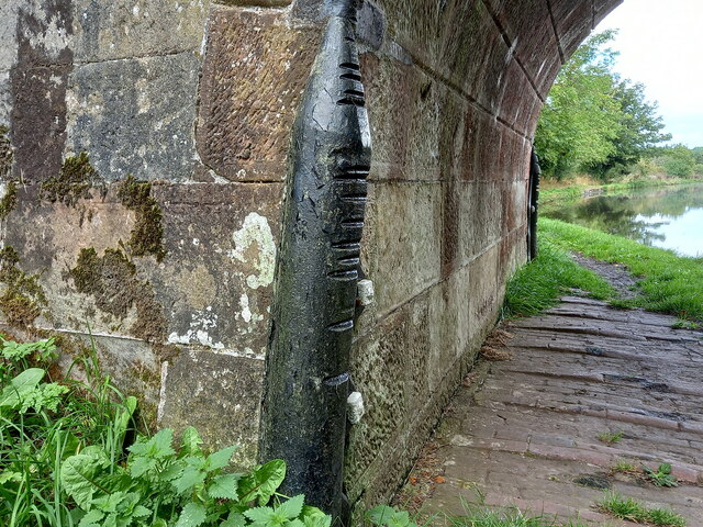
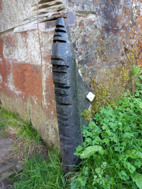
High Onn Wharf is steeped in history, with its origins dating back to the Industrial Revolution. It was once a bustling hub of activity, serving as a crucial transport link for the surrounding areas. Today, remnants of this industrial past can still be seen, adding to the wharf's unique character and charm.

Visitors to High Onn Wharf can expect a tranquil escape from the hustle and bustle of everyday life, surrounded by stunning natural beauty and a rich historical heritage. Whether it's a leisurely boat trip, a peaceful walk along the canal, or a delightful afternoon tea, this hidden gem in Staffordshire offers something for everyone.

If you have any feedback on the listing, please let us know in the comments section below.

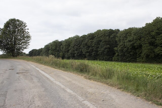
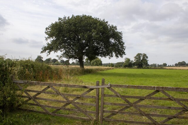
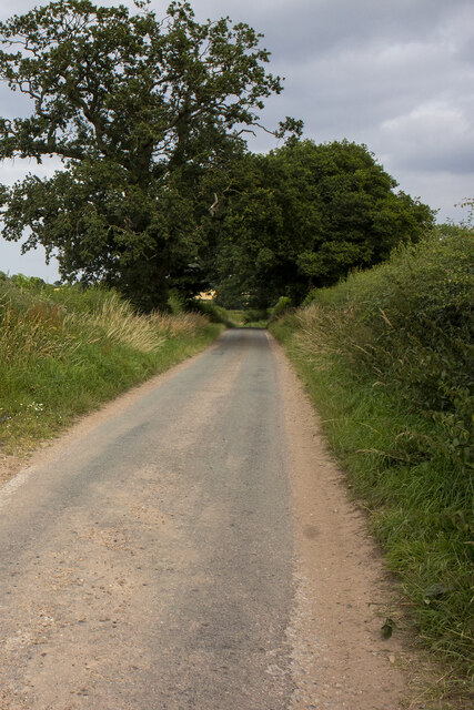
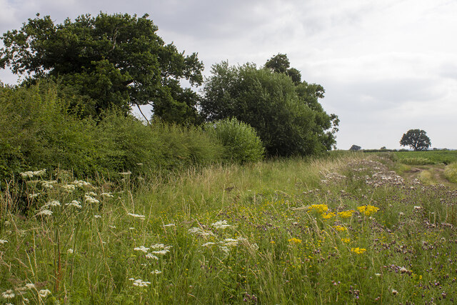
High Onn Wharf Images

Images are sourced within 2km of 52.741356/-2.2532433 or Grid Reference SJ8316. Thanks to Geograph Open Source API. All images are credited.

Woodland by Shropshire Union Canal
Gate House
Gate House
Circular brick structures in field
Hedgerow tree
Hedgerow tree
Road with hedgerows Road with hedgerows near Keeper's Cottage
Road with hedgerows
Road with hedgerows near Keeper's Cottage
Hedgerow and field
Hedgerow and field
Cast iron canal milepost near Turnover Bridge This original cast-iron post dates from around 1835, and was Grade II listed <span class="nowrap"><a title="https://britishlistedbuildings.co.uk/101116601-milepost-shropshire-union-canal-45-miles-to-south-of-norbury-junction-church-eaton#.YVMvSLhKjIU" rel="nofollow ugc noopener" href="https://britishlistedbuildings.co.uk/101116601-milepost-shropshire-union-canal-45-miles-to-south-of-norbury-junction-church-eaton#.YVMvSLhKjIU">Link</a><img style="margin-left:2px;" alt="External link" title="External link - shift click to open in new window" src="https://s1.geograph.org.uk/img/external.png" width="10" height="10"/></span> & <span class="nowrap"><a title="https://historicengland.org.uk/listing/the-list/list-entry/1116601" rel="nofollow ugc noopener" href="https://historicengland.org.uk/listing/the-list/list-entry/1116601">Link</a><img style="margin-left:2px;" alt="External link" title="External link - shift click to open in new window" src="https://s1.geograph.org.uk/img/external.png" width="10" height="10"/></span> in 1972.
Cast iron canal milepost near Turnover Bridge
This original cast-iron post dates from around 1835, and was Grade II listed LinkExternal link & LinkExternal link in 1972.
Parks Bridge (no 27) on the Shropshire Union Canal A rural accommodation bridge dating from the early 1830s, which attracted a Grade II listing <span class="nowrap"><a title="https://britishlistedbuildings.co.uk/101273253-shropshire-union-canal-parks-bridge-number-27-at-sj-831-173-church-eaton#.YVMwN7hKjIU" rel="nofollow ugc noopener" href="https://britishlistedbuildings.co.uk/101273253-shropshire-union-canal-parks-bridge-number-27-at-sj-831-173-church-eaton#.YVMwN7hKjIU">Link</a><img style="margin-left:2px;" alt="External link" title="External link - shift click to open in new window" src="https://s1.geograph.org.uk/img/external.png" width="10" height="10"/></span> & <span class="nowrap"><a title="https://historicengland.org.uk/listing/the-list/list-entry/1273253" rel="nofollow ugc noopener" href="https://historicengland.org.uk/listing/the-list/list-entry/1273253">Link</a><img style="margin-left:2px;" alt="External link" title="External link - shift click to open in new window" src="https://s1.geograph.org.uk/img/external.png" width="10" height="10"/></span> in 1991. It carries no right of way, but is used by local walkers on a circuit of the woods to the south.
Parks Bridge (no 27) on the Shropshire Union Canal
A rural accommodation bridge dating from the early 1830s, which attracted a Grade II listing LinkExternal link & LinkExternal link in 1991. It carries no right of way, but is used by local walkers on a circuit of the woods to the south.
Cast iron rope fender on Parks Bridge One of the original 1830s installations, which shows significant signs of use, and forms part of the bridge's Grade II listing. The visible brickwork on the towpath beneath the bridge is original too.
Cast iron rope fender on Parks Bridge
One of the original 1830s installations, which shows significant signs of use, and forms part of the bridge's Grade II listing. The visible brickwork on the towpath beneath the bridge is original too.
Parks Barn Bridge (no 28) on the Shropshire Union Canal Parks Barn Bridge carries a track (now a footpath) called Oscote Lane over the canal. It dates from the early 1830s, and was Grade II listed <span class="nowrap"><a title="https://britishlistedbuildings.co.uk/101258848-shropshire-union-canal-parks-barn-bridge-number-28-at-sj-831-177-church-eaton#.YVMx57hKjIU" rel="nofollow ugc noopener" href="https://britishlistedbuildings.co.uk/101258848-shropshire-union-canal-parks-barn-bridge-number-28-at-sj-831-177-church-eaton#.YVMx57hKjIU">Link</a><img style="margin-left:2px;" alt="External link" title="External link - shift click to open in new window" src="https://s1.geograph.org.uk/img/external.png" width="10" height="10"/></span> & <span class="nowrap"><a title="https://historicengland.org.uk/listing/the-list/list-entry/1258848" rel="nofollow ugc noopener" href="https://historicengland.org.uk/listing/the-list/list-entry/1258848">Link</a><img style="margin-left:2px;" alt="External link" title="External link - shift click to open in new window" src="https://s1.geograph.org.uk/img/external.png" width="10" height="10"/></span> in 1991.
Parks Barn Bridge (no 28) on the Shropshire Union Canal
Parks Barn Bridge carries a track (now a footpath) called Oscote Lane over the canal. It dates from the early 1830s, and was Grade II listed LinkExternal link & LinkExternal link in 1991.
Cast iron rope fender on Parks Barn Bridge One of the original 1830s installations, which shows significant signs of use, and forms part of the bridge's Grade II listing. The towropes have also scarred the sandstone of the bridge just above the fender.
Cast iron rope fender on Parks Barn Bridge
One of the original 1830s installations, which shows significant signs of use, and forms part of the bridge's Grade II listing. The towropes have also scarred the sandstone of the bridge just above the fender.
Turnover Bridge (no 26) on the Shropshire Union canal Turnover Bridge here dates from the early 1830s when the canal was built; the name refers to the design which allowed a horse to cross the canal on the turnover without needing to be unhitched from the barge. Relatively uncommon in the countryside, but there are more numerous examples on the canals in urban areas - such as Birmingham, for instance. It was Grade II listed <span class="nowrap"><a title="https://britishlistedbuildings.co.uk/101259092-shropshire-union-canal-turnover-bridge-number-26-at-sj-832-171-church-eaton#.YVSC8prMLIU" rel="nofollow ugc noopener" href="https://britishlistedbuildings.co.uk/101259092-shropshire-union-canal-turnover-bridge-number-26-at-sj-832-171-church-eaton#.YVSC8prMLIU">Link</a><img style="margin-left:2px;" alt="External link" title="External link - shift click to open in new window" src="https://s1.geograph.org.uk/img/external.png" width="10" height="10"/></span> & <span class="nowrap"><a title="https://historicengland.org.uk/listing/the-list/list-entry/1259092" rel="nofollow ugc noopener" href="https://historicengland.org.uk/listing/the-list/list-entry/1259092">Link</a><img style="margin-left:2px;" alt="External link" title="External link - shift click to open in new window" src="https://s1.geograph.org.uk/img/external.png" width="10" height="10"/></span> in 1991.
Turnover Bridge (no 26) on the Shropshire Union canal
Turnover Bridge here dates from the early 1830s when the canal was built; the name refers to the design which allowed a horse to cross the canal on the turnover without needing to be unhitched from the barge. Relatively uncommon in the countryside, but there are more numerous examples on the canals in urban areas - such as Birmingham, for instance. It was Grade II listed LinkExternal link & LinkExternal link in 1991.
Shropshire Union Canal - Ryehill Bridge (No.22) This quite lofty bridge over the Shropshire Union Canal is No.22 and is named Ryehill Bridge. Going northwards it follows soon after <a href="https://www.geograph.org.uk/photo/7163750">SJ8414 : Shropshire Union Canal - Shushions Bridge (No.21)</a>
<a href="https://www.geograph.org.uk/photo/7163764">SJ8415 : Shropshire Union Canal - Ryehill Cutting Bridge (No.23)</a> can be seen in the distance beyond the next narrowboat.
Unlike most of the bridges along the canal, this one is not listed as significant by English Heritage.
Shropshire Union Canal - Ryehill Bridge (No.22)
This quite lofty bridge over the Shropshire Union Canal is No.22 and is named Ryehill Bridge. Going northwards it follows soon after SJ8414 : Shropshire Union Canal - Shushions Bridge (No.21) SJ8415 : Shropshire Union Canal - Ryehill Cutting Bridge (No.23) can be seen in the distance beyond the next narrowboat. Unlike most of the bridges along the canal, this one is not listed as significant by English Heritage.
Shropshire Union Canal - Ryehill Cutting Bridge (No.23) This is bridge number 23 on the Shropshire Union Canal and is known as Ryehill Cutting Bridge. This is the view southwards through it.
The bridge is EH Grade II listed: <span class="nowrap"><a title="https://historicengland.org.uk/listing/the-list/list-entry/1243055?section=official-list-entry" rel="nofollow ugc noopener" href="https://historicengland.org.uk/listing/the-list/list-entry/1243055?section=official-list-entry">Link</a><img style="margin-left:2px;" alt="External link" title="External link - shift click to open in new window" src="https://s1.geograph.org.uk/img/external.png" width="10" height="10"/></span>
Shropshire Union Canal - Ryehill Cutting Bridge (No.23)
This is bridge number 23 on the Shropshire Union Canal and is known as Ryehill Cutting Bridge. This is the view southwards through it. The bridge is EH Grade II listed: LinkExternal link
Ryehill Cutting Bridge Grade II listed. Listing number 1243055. Accommodation bridge. c1830-33. Telford design. Brick, with stone band and copings. Single elliptical arch, solid parapet and piers. 2 iron rope fenders. Brick towpath coping.
Ryehill Cutting Bridge
Grade II listed. Listing number 1243055. Accommodation bridge. c1830-33. Telford design. Brick, with stone band and copings. Single elliptical arch, solid parapet and piers. 2 iron rope fenders. Brick towpath coping.
Little Onn Bridge Grade II listed. Listing number 1273078. Accommodation bridge. c1830-33. Telford design. Brick, with stone band and brick and stone copings. Single elliptical arch. Slightly cambered solid parapet and piers. Oval iron number- plate on south side. 2 iron rope fenders. Stone and brick towpath coping.
Little Onn Bridge
Grade II listed. Listing number 1273078. Accommodation bridge. c1830-33. Telford design. Brick, with stone band and brick and stone copings. Single elliptical arch. Slightly cambered solid parapet and piers. Oval iron number- plate on south side. 2 iron rope fenders. Stone and brick towpath coping.
High Onn Bridge Grade II listed. Listing number 1258847. Road bridge over canal. c1830-33. Telford design. Brick, with stone band and copings. Single elliptical arch. Slightly cambered, solid parapet and piers. 2 iron rope fenders.
High Onn Bridge
Grade II listed. Listing number 1258847. Road bridge over canal. c1830-33. Telford design. Brick, with stone band and copings. Single elliptical arch. Slightly cambered, solid parapet and piers. 2 iron rope fenders.
High Onn Wharf On the Shropshire Union Canal.
High Onn Wharf
On the Shropshire Union Canal.
Show me another place!

High Onn Wharf is located at Grid Ref: SJ8316 (Lat: 52.741356, Lng: -2.2532433)

Administrative County: Staffordshire

District: Stafford

Police Authority: Staffordshire

What 3 Words

///defectors.fumes.sounding. Near Wheaton Aston, Staffordshire

Related Wikis

High Onn

High Onn is a hamlet near the village of Wheaton Aston, in the English county of Staffordshire. == See also == Listed buildings in Church Eaton == References... ==

RAF Wheaton Aston

Royal Air Force Wheaton Aston, or more simply RAF Wheaton Aston, was a Royal Air Force station located just outside of the village of Wheaton Aston in...

Little Onn

Little Onn is a hamlet in Staffordshire, England located in open countryside 1 mile (2 km) north of Wheaton Aston. It is the location of the former Second...

Orslow

Orslow is an upland hamlet in Staffordshire, England, 0.75 miles (1.21 km) north-east of Great Chatwell. Its Anglo-Saxon name means 'Horsa's burial mound...

Church Eaton

Church Eaton is a village and civil parish in Staffordshire some 6 miles (10 km) southwest of Stafford, 6 miles (10 km) northwest of Penkridge and 4 miles...

Mottey Meadows

Mottey Meadows National Nature Reserve (NNR) consists of a series of alluvial flood meadows near the village of Wheaton Aston in Staffordshire, England...

Apeton

Apeton is a hamlet in Staffordshire in the West Midlands region of England. It is located 5+1⁄2 miles (8.9 km) southwest of Stafford, in the civil parish...

Allimore Green

Allimore Green is a small hamlet in Staffordshire, England, 1 mile north-east of Church Eaton. It is the location of a Site of Special Scientific Interest...

Nearby Amenities

Located within 500m of 52.741356,-2.2532433
High Onn
Place: hamlet
Wikidata: Q5755978
Lat/Long: 52.7431229/-2.2567212
The data included in this document is from www.openstreetmap.org. The data is made available under ODbL.

Have you been to High Onn Wharf?

Leave your review of High Onn Wharf below (or comments, questions and feedback).