Cholsey

Civil Parish in Berkshire South Oxfordshire

England

Cholsey

Flooding in the fields Nothing unusual with the flooding in this field at Cholsey
Flooding in the fields Credit: Bill Nicholls

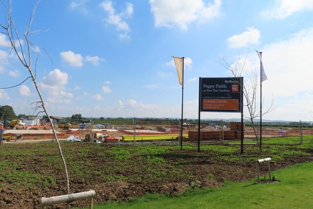
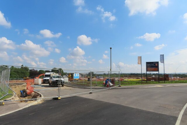
Cholsey is a civil parish located in the county of Berkshire, England. Situated on the southern bank of the River Thames, it lies approximately 3 miles southeast of the town of Wallingford. The parish covers an area of around 2,400 acres and is home to a population of approximately 3,000 residents.

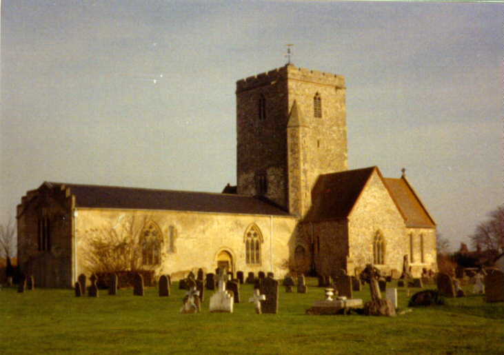
Cholsey boasts a rich history, with evidence of human habitation dating back to prehistoric times. The area was heavily influenced by the Romans, who built a road connecting Wallingford to Dorchester-on-Thames, passing through the village. During the medieval period, Cholsey was an important center for agricultural and trade activities.

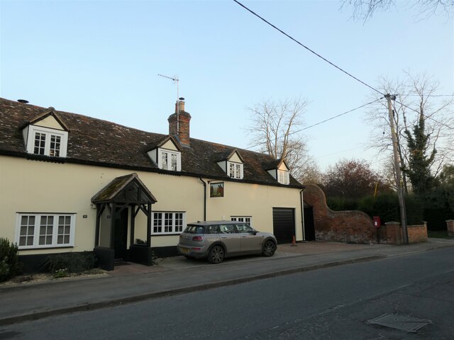
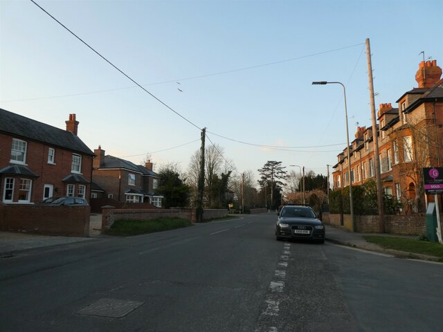
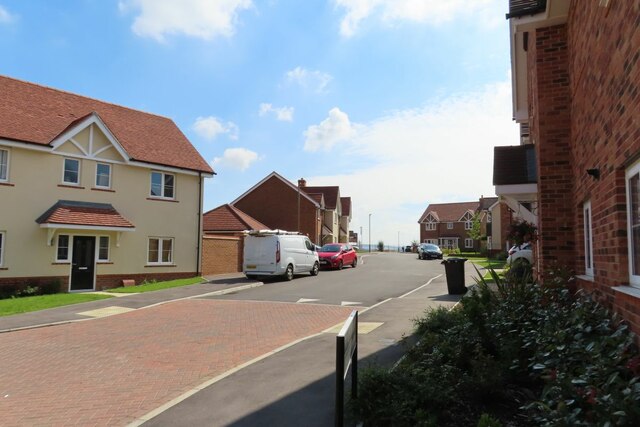
Today, Cholsey retains its quaint and picturesque charm. The village is renowned for its quintessential English countryside, featuring rolling green fields and charming thatched cottages. It has managed to preserve its rural character, despite its close proximity to major towns and cities.

The parish offers a range of amenities and facilities to cater to its residents. These include a primary school, a community center, a village hall, several local shops, and a variety of pubs and restaurants. Cholsey is also well-connected, with a railway station providing regular services to Oxford, Reading, and London.

The village is surrounded by beautiful natural landscapes, making it an ideal location for outdoor activities. There are numerous footpaths and trails that allow residents and visitors to explore the surrounding countryside, including the nearby Chiltern Hills and the Thames Path.

Overall, Cholsey offers a peaceful and idyllic setting, combining historical significance with modern amenities, making it an attractive place to live or visit for those seeking a rural retreat within easy reach of urban centers.

If you have any feedback on the listing, please let us know in the comments section below.
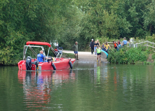
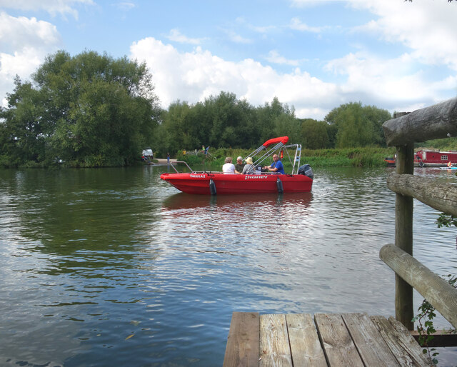
Cholsey Images

Images are sourced within 2km of 51.578468/-1.144376 or Grid Reference SU5986. Thanks to Geograph Open Source API. All images are credited.

Flooding in the fields Nothing unusual with the flooding in this field at Cholsey
Flooding in the fields
Nothing unusual with the flooding in this field at Cholsey
Flooding at the sewage works No doubt this flooding is occurring in the sewage works as well, no doubt this will give Thames Water the excuse to dump more sewage in our local watercourse
Flooding at the sewage works
No doubt this flooding is occurring in the sewage works as well, no doubt this will give Thames Water the excuse to dump more sewage in our local watercourse
Cholsey Marsh This has not really changed a lot over my lifetime: only the boathouse a little, and the cattle that grazed in the meadow are now long gone. It is now a nature reserve left to the wildlife.
Cholsey Marsh
This has not really changed a lot over my lifetime: only the boathouse a little, and the cattle that grazed in the meadow are now long gone. It is now a nature reserve left to the wildlife.
The Ferry Is Back - for a day In days gone by there used to be a ferry over the Thames between Little Stoke and Cholsey.
It hasn't run for ages, but in September 2021 for one afternoon a boat was taking passengers over the river in connection with a sponsored walk for local charities.
One of the charities was the boat itself, which is specially adapted with a landing craft style front to get chair-bound passengers on board for trips on the river.
This is looking from the Little Stoke side over to Cholsey, where the road you can see is still called Ferry Lane.
The Ferry Is Back - for a day
In days gone by there used to be a ferry over the Thames between Little Stoke and Cholsey. It hasn't run for ages, but in September 2021 for one afternoon a boat was taking passengers over the river in connection with a sponsored walk for local charities. One of the charities was the boat itself, which is specially adapted with a landing craft style front to get chair-bound passengers on board for trips on the river. This is looking from the Little Stoke side over to Cholsey, where the road you can see is still called Ferry Lane.
Ferry to Cholsey In days gone by there used to be a ferry over the Thames here between Little Stoke and Cholsey.
It hasn't run for ages, but in September 2021 for one afternoon only a boat was taking passengers over the river in connection with a sponsored walk for local charities.
One of the charities was the boat itself, which is specially adapted with a landing craft style front to get chair-bound passengers on board for trips on the river.
This is looking from the Little Stoke side over to Cholsey, where the road you can see is still called Ferry Lane.
Ferry to Cholsey
In days gone by there used to be a ferry over the Thames here between Little Stoke and Cholsey. It hasn't run for ages, but in September 2021 for one afternoon only a boat was taking passengers over the river in connection with a sponsored walk for local charities. One of the charities was the boat itself, which is specially adapted with a landing craft style front to get chair-bound passengers on board for trips on the river. This is looking from the Little Stoke side over to Cholsey, where the road you can see is still called Ferry Lane.
Gateposts in the Weeds Another picture of concrete gateposts. I hadn't realised there were quite so many of them round here, but once you've noticed them they are all over the place just in this small area.
Some wealthy estate must have had money to spend on overdesigned gateposts.
Some are still doing their original job, but these two are redundant. The Thames is just beyond the trees and the small strip of land seen here hasn't been farmed for a long time.
In the foreground a small hop vine with about a dozen hops on it climbs up a dead stalk.
Gateposts in the Weeds
Another picture of concrete gateposts. I hadn't realised there were quite so many of them round here, but once you've noticed them they are all over the place just in this small area. Some wealthy estate must have had money to spend on overdesigned gateposts. Some are still doing their original job, but these two are redundant. The Thames is just beyond the trees and the small strip of land seen here hasn't been farmed for a long time. In the foreground a small hop vine with about a dozen hops on it climbs up a dead stalk.
Constructing the escalator The new escalator being constructed for the gravel pit at Cholsey
Constructing the escalator
The new escalator being constructed for the gravel pit at Cholsey
A4130 at Winterbrook roundabout
Post box by The Nags Head
Looking north-northeast along Reading Road
River Thames, Cholsey Ferry Lane peters out here at a small slipway into the River Thames where Littlestoke Ferry once operated. In this scene a man rows downstream past two swimmers.
River Thames, Cholsey
Ferry Lane peters out here at a small slipway into the River Thames where Littlestoke Ferry once operated. In this scene a man rows downstream past two swimmers.
Reading Road entering Wallingford
Ferry Lane Cholsey This is the highest I have ever seen the flooding on Ferry Lane in Cholsey.
Ferry Lane Cholsey
This is the highest I have ever seen the flooding on Ferry Lane in Cholsey.
Road Across Looking across the construction site of Poppy Fields in Cholsey where you can see a dark line marking one of the future road. During the archaeological dig here they found an ancient driftway
Road Across
Looking across the construction site of Poppy Fields in Cholsey where you can see a dark line marking one of the future road. During the archaeological dig here they found an ancient driftway
One of the bases The footings and damp course of this house are well under way at Poppy Fields Cholsey
One of the bases
The footings and damp course of this house are well under way at Poppy Fields Cholsey
Change of view A change of view from the last time I was here, building work can now be seen in progress at Poppy Fields Cholsey <a href="https://www.geograph.org.uk/photo/6792150">SU5986 : Poppy Fields</a>
Change of view
A change of view from the last time I was here, building work can now be seen in progress at Poppy Fields Cholsey SU5986 : Poppy Fields
The Road In The estate now joined with the road into Poppy Fields at Cholsey though it is far from being open yet
The Road In
The estate now joined with the road into Poppy Fields at Cholsey though it is far from being open yet
View up Bill Money Way Last time I looked up this road you could just see the sign but in another few months you will see new houses of Poppy Field estate <a href="https://www.geograph.org.uk/photo/6700002">SU5986 : Bill Money Way, Cholsey</a>
View up Bill Money Way
Last time I looked up this road you could just see the sign but in another few months you will see new houses of Poppy Field estate SU5986 : Bill Money Way, Cholsey
Show me another place!

Cholsey is located at Grid Ref: SU5986 (Lat: 51.578468, Lng: -1.144376)

Administrative County: Oxfordshire

District: South Oxfordshire

Police Authority: Thames Valley

What 3 Words

///crouch.liquids.rules. Near Cholsey, Oxfordshire

Nearby Locations

Cholsey

Related Wikis

Cholsey

Cholsey is a village and civil parish 2 miles (3 km) south of Wallingford in South Oxfordshire. In 1974 it was transferred from Berkshire to Oxfordshire...

Winterbrook

Winterbrook is a small settlement in the English county of Oxfordshire, which adjoins the south end of Wallingford and sits on the west bank of the Thames...

Fair Mile Hospital

Fair Mile Hospital (aka Fairmile Hospital) was a Lunatic asylum built in 1870 in the village of Cholsey, 2 miles (3 kilometers) south of Wallingford and...

Cholsey Abbey

Cholsey Abbey was an Anglo-Saxon nunnery in Cholsey in the English county of Berkshire (now Oxfordshire), which was founded in 986. == History == After...

Nearby Amenities

Located within 500m of 51.578468,-1.144376
Bus Stop
Goldfinch Lane
Bus: yes
Naptan AtcoCode: 340001504CNR
Naptan Bearing: NE
Naptan CommonName: Goldfinch Lane
Naptan Indicator: Corner
Naptan Landmark: Goldfinch Lane
Naptan NaptanCode: oxfagptg
Naptan Street: Wallingford Road
Naptan Verified: no
Public Transport: platform
Shelter: no
Source: naptan_import
Lat/Long: 51.5779835/-1.1484612
Bus Stop
Goldfinch Lane
Bus: yes
Naptan AtcoCode: 340001504OPP
Naptan Bearing: SW
Naptan CommonName: Goldfinch Lane
Naptan Indicator: Opposite
Naptan Landmark: Goldfinch Lane
Naptan NaptanCode: oxfadwat
Naptan Street: Goldfinch Lane
Naptan Verified: no
Public Transport: platform
Shelter: no
Source: naptan_import
Lat/Long: 51.5777377/-1.1487582
Bus Stop
Caps Lane
Bus: yes
Naptan AtcoCode: 340002004CNR
Naptan Bearing: SW
Naptan CommonName: Caps Lane
Naptan Indicator: Corner
Naptan Landmark: Caps Lane
Naptan NaptanCode: oxfgjdwa
Naptan Street: Wallingford Road
Naptan Verified: no
Public Transport: platform
Source: naptan_import
Lat/Long: 51.58041/-1.1441384
Bus Stop
Caps Lane
Bus: yes
Naptan AtcoCode: 340002004OPP
Naptan Bearing: NE
Naptan BusStopType: CUS
Naptan CommonName: Caps Lane
Naptan Indicator: Opposite
Naptan Landmark: Caps Lane
Naptan NaptanCode: oxfgjdwd
Naptan Street: Wallingford Road
Naptan Verified: no
Public Transport: platform
Source: naptan_import
Lat/Long: 51.5804834/-1.1442242
Power: pole
Source: Bing
Lat/Long: 51.5796514/-1.1457004
Power: pole
Source: Bing
Lat/Long: 51.5820481/-1.1467787
Power: pole
Source: Bing
Lat/Long: 51.5813865/-1.1463254
Power: pole
Source: Bing
Lat/Long: 51.5799415/-1.1451935
Power: pole
Source: Bing
Lat/Long: 51.5790635/-1.1466533
Noexit: yes
Lat/Long: 51.5764823/-1.148151
Noexit: yes
Lat/Long: 51.5769103/-1.1481454
Noexit: yes
Lat/Long: 51.5758016/-1.1447644
Direction: 140
Generator Method: photovoltaic
Generator Output Electricity: yes
Generator Solar Modules: 16
Generator Source: solar
Generator Type: solar_photovoltaic_panel
Location: roof
Power: generator
Lat/Long: 51.5775305/-1.1495502
Turning Circle
Turning Circle: knuckle
Lat/Long: 51.5780383/-1.1500373
Direction: 230
Fixme: survey for panel count
Generator Method: photovoltaic
Generator Output Electricity: yes
Generator Solar Modules: 14
Generator Source: solar
Generator Type: solar_photovoltaic_panel
Location: roof
Power: generator
Lat/Long: 51.5778777/-1.1501995
Direction: 230
Generator Method: photovoltaic
Generator Output Electricity: yes
Generator Solar Modules: 12
Generator Source: solar
Generator Type: solar_photovoltaic_panel
Location: roof
Power: generator
Lat/Long: 51.5778649/-1.1494241
Direction: 210
Generator Method: photovoltaic
Generator Output Electricity: yes
Generator Solar Modules: 16
Generator Source: solar
Generator Type: solar_photovoltaic_panel
Location: roof
Power: generator
Lat/Long: 51.5792451/-1.1407931
Direction: 130
Fixme: survey for panel count
Generator Method: photovoltaic
Generator Output Electricity: yes
Generator Solar Modules: 10
Generator Source: solar
Generator Type: solar_photovoltaic_panel
Location: roof
Power: generator
Lat/Long: 51.576297/-1.1495735
Turning Loop
Lat/Long: 51.5767343/-1.1503019
Direction: 200
Generator Method: photovoltaic
Generator Output Electricity: yes
Generator Solar Modules: 10
Generator Source: solar
Generator Type: solar_photovoltaic_panel
Location: roof
Power: generator
Lat/Long: 51.5758881/-1.1483173
Direction: 200
Generator Method: photovoltaic
Generator Output Electricity: yes
Generator Solar Modules: 17
Generator Source: solar
Generator Type: solar_photovoltaic_panel
Location: roof
Power: generator
Lat/Long: 51.575808/-1.1480934
Turning Circle
Turning Circle: square
Lat/Long: 51.5759655/-1.1478118
Turning Circle
Turning Circle: hammer
Lat/Long: 51.5756825/-1.1467545
Direction: 200
Generator Method: photovoltaic
Generator Output Electricity: yes
Generator Solar Modules: 8
Generator Source: solar
Generator Type: solar_photovoltaic_panel
Location: roof
Power: generator
Lat/Long: 51.5753576/-1.149453
Direction: 210
Fixme: survey for panel count
Generator Method: photovoltaic
Generator Output Electricity: yes
Generator Solar Modules: 16
Generator Source: solar
Generator Type: solar_photovoltaic_panel
Location: roof
Power: generator
Lat/Long: 51.5747233/-1.1475332
Direction: 190
Generator Method: photovoltaic
Generator Output Electricity: yes
Generator Solar Modules: 6
Generator Source: solar
Generator Type: solar_photovoltaic_panel
Location: roof
Power: generator
Lat/Long: 51.5743369/-1.1470756
Direction: 190
Fixme: survey for panel count
Generator Method: photovoltaic
Generator Output Electricity: yes
Generator Solar Modules: 7
Generator Source: solar
Generator Type: solar_photovoltaic_panel
Location: roof
Power: generator
Lat/Long: 51.5742386/-1.1460028
Direction: 100
Generator Method: photovoltaic
Generator Output Electricity: yes
Generator Solar Modules: 8
Generator Source: solar
Generator Type: solar_photovoltaic_panel
Location: roof
Power: generator
Lat/Long: 51.5741936/-1.1460836
Direction: 210
Fixme: survey for panel count
Generator Method: photovoltaic
Generator Output Electricity: yes
Generator Solar Modules: 16
Generator Source: solar
Generator Type: solar_photovoltaic_panel
Location: roof
Power: generator
Lat/Long: 51.5744342/-1.1455535
Direction: 120
Generator Method: photovoltaic
Generator Output Electricity: yes
Generator Solar Modules: 18
Generator Source: solar
Generator Type: solar_photovoltaic_panel
Location: roof
Power: generator
Lat/Long: 51.5746643/-1.1449951
Traffic Calming: cushion
Lat/Long: 51.5780081/-1.1483556
Traffic Calming: cushion
Lat/Long: 51.5785264/-1.1474689
Traffic Calming: cushion
Lat/Long: 51.5790018/-1.1466636
Noexit: yes
Lat/Long: 51.5769604/-1.1461439
Noexit: yes
Lat/Long: 51.5757154/-1.1437157
Noexit: yes
Lat/Long: 51.5767441/-1.1448303
Waste Basket
Waste: dog_excrement
Lat/Long: 51.5742753/-1.1438077
Barrier: bollard
Bollard: foldable
Colour: #fffb00
Horse: yes
Material: metal
Motor Vehicle: no
Lat/Long: 51.5753341/-1.1430124
The data included in this document is from www.openstreetmap.org. The data is made available under ODbL.

Have you been to Cholsey?

Leave your review of Cholsey below (or comments, questions and feedback).